EstuaryWatch Data Portal
Overview
| Estuary name | Wreck Creek |
|---|---|
| CMA | West Gippsland CMA |
| Description |
Wreck Creek is a small intermittently closing and opening estuarine lagoon located on the western edge of Inverloch. From the coast the estuary follows Cape Paterson - Inverloch Road towards the Inverloch RACV resort, for approximately 800 metres, before the creek becomes fresh. The creek has two main branches, one that begins well above the RACV resort (including the resorts wetlands) and the other flows out of farmland through the residential area to the north. For the majority of the year two branches of the creek are mostly dry (apart from a few ponds and billabongs that have been sighted on private property upstream). These creeks begin to flow during wet times (winter / spring), and for the majority of the time the main habitat available to biota is the estuarine lagoon itself. |
| Estuary Values |
Plant communities / species (Ecological Vegetation Classes (EVCs) and Bioregional Conservation Significance in Victoria);
Fish identified during sampling in January 2017
Significant bird species (Conservation Status Victoria);
|
| Estuary Threats |
Threats to estuary health include;
|
| Data | Site observations |
| Status | Active |
| Monitor group | WGCMA Estuary Management Group |
| Document | Values_and_threats_content_for_EstuaryWatch_Website.pdf |
Sites
| Site details | Options |
|---|---|
Wr1 Surf Parade Bridge InverlochActive Physico-Chemical 26-05-2016 - 27-03-2024Centre culvert on the downstream (ocean) side of Surf Parade Bridge |
Observations 90 |
WrGB Wreck Creek Gauge Board SiteActive Gauge BoardThe Gauge board is located on the eastern downstream side of the Surf Parade Bridge, right alongside the bridge itself. |
|
WrMC Wreck Creek Mouth Condition SiteActive Mouth Condition 06-04-2017 - 15-04-2021Wreck Creek Mouth Condition Monitoring Site, located at the end of the Wreck Creek access path opposite 178 Surf Parade Inverloch. |
Observations 69 |
WrMC2 Wreck Creek Mouth Opening Number Two (western end)Active Mouth Condition 14-07-2020 - 27-03-2024In April 2020, following a large storm surge event, a new opening was formed at Wreck Creek. There are now two locations where the creek can flow out to sea. This site will be monitored in conjunction with the mouth condition monitoring site established several years ago (further east). |
Observations 56 |
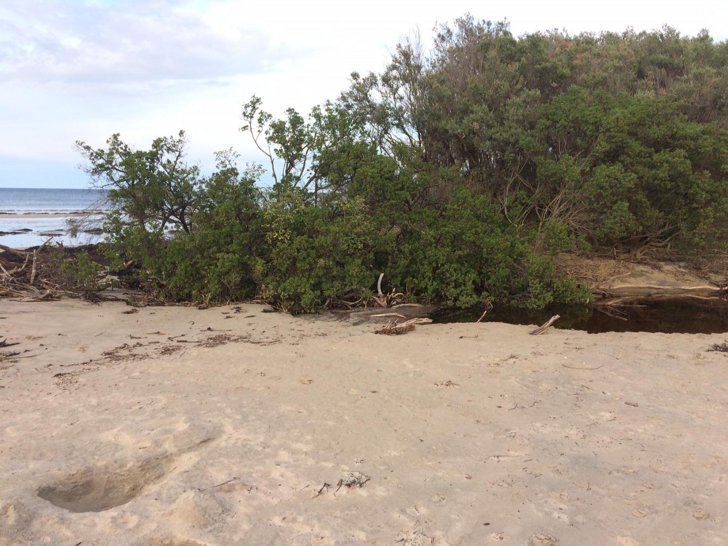
Wrp1 Wreck Creek Photopoint SiteActive Photopoint 07-04-2017 - 14-06-2022Site located at end of beach access path opposite 178 Surf Parade Inverloch. Site located on grassy mound (site of proposed Fluker Post). |
Photos 222 |
Wrp2 Wreck Creek Photopoint Site TwoActive Photopoint 01-06-2020 - 10-04-2024Wreck Creek West end Opening |
Photos 183 |
Recent Events
| Event Details |
|---|
| 27-05-2019 Estuary Entrance Opening Wreck was artificially opened at 2.0m AHD following a significant increase in water level height from 1.5m AHD on the 24th of May 2019 to 2.0m AHD @ 5:30pm on the 27th of May 2019. The water level increase was a result of rainfall (~30mm) during this period on a previously wetted down catchment. Following the opening this area experienced 70mm of rain over the next 4 days.
|
| 27-05-2019 Unusual/Extraordinary occurrence! Eel migration took place prior to the scheduled opening that occurred at 9:30pm the same night. This migration took place during a large tide and ocean swell that allowed for the crossing of the sand bar. 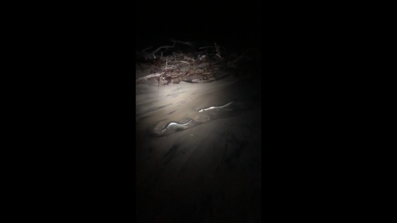
|
| 20-07-2018 Estuary Entrance Opening Estuary opened naturally as a result of freshwater inflows |
| 16-07-2018 Estuary Entrance Closure Estuary mouth closed again following low rainfall and consistent ocean swells over the past couple of weeks. 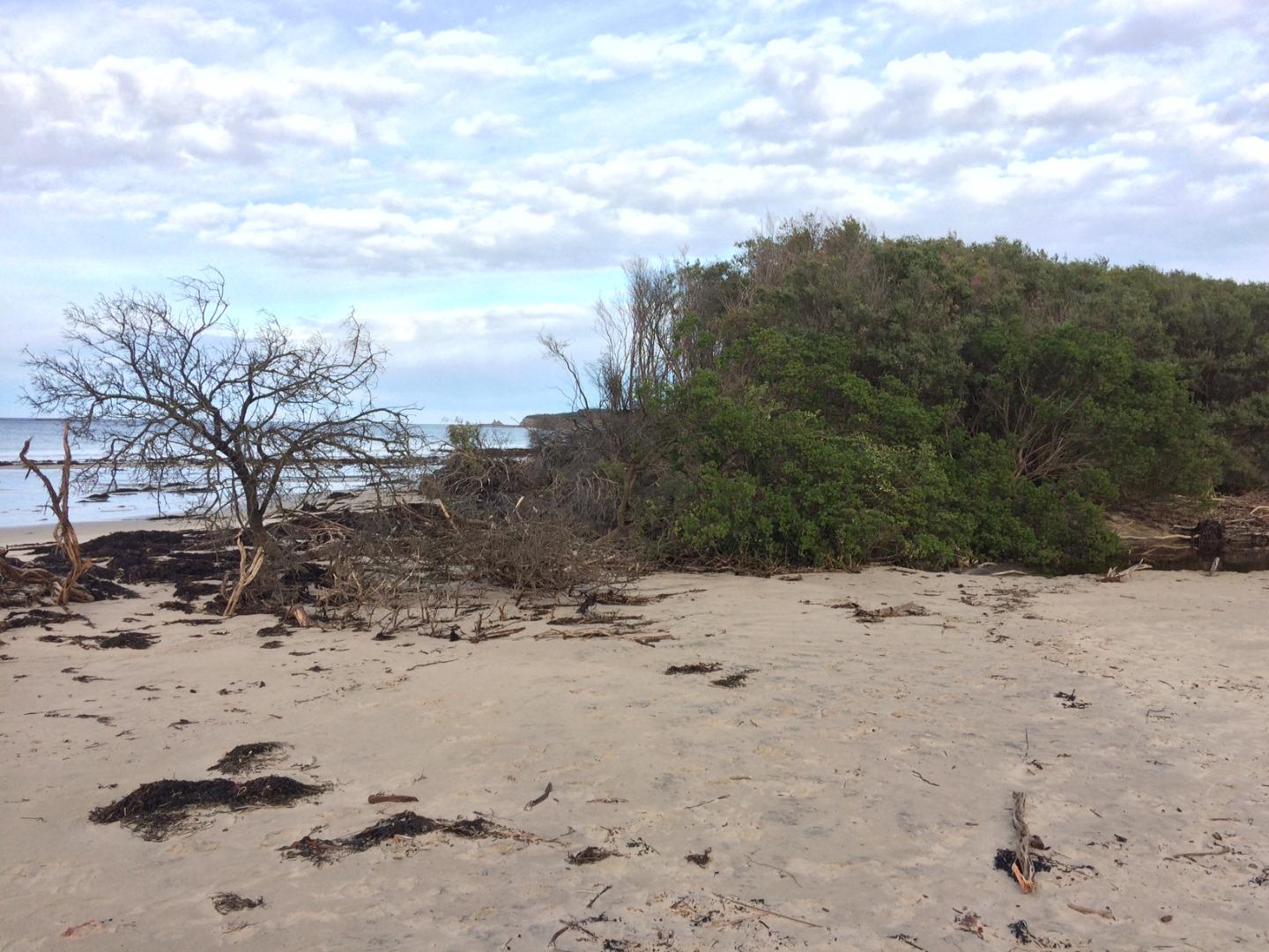
|
| 16-06-2018 Estuary Entrance Opening An artificial opening was performed @ 7:30 am to alleviate the risk of inundating surrounding houses. Water levels were above 2.10m AHD with the sand berm height approximately 30 cm above the water level height (i.e. the water levels had the potential to reach a height greater than 2.4m AHD, which would have inundated some of the lowest lying houses). Significant rainfall was also forecasted for the days following this opening. |
Estuary Snapshots
The EstuaryWatch snapshots provide a summary of estuary condition on a particular day. For all EstuaryWatch Snapshots, photopoint photos and a longitudinal water quality profile from the estuary mouth to the inland extent is displayed. Read more
Autumn 2019
Winter 2018

All content, files, data and images provided by the EstuaryWatch Data Portal and Gallery are subject to a Creative Commons Attribution License
Content is made available to be used in any way, and should always attribute EstuaryWatch and www.estuarywatch.org.au