EstuaryWatch Data Portal
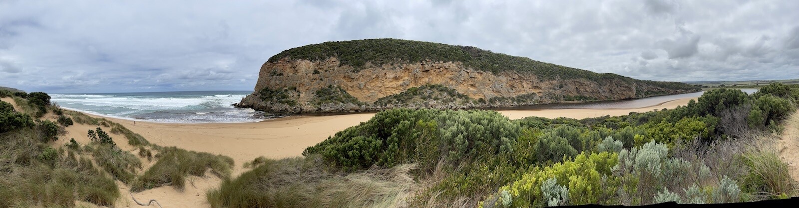
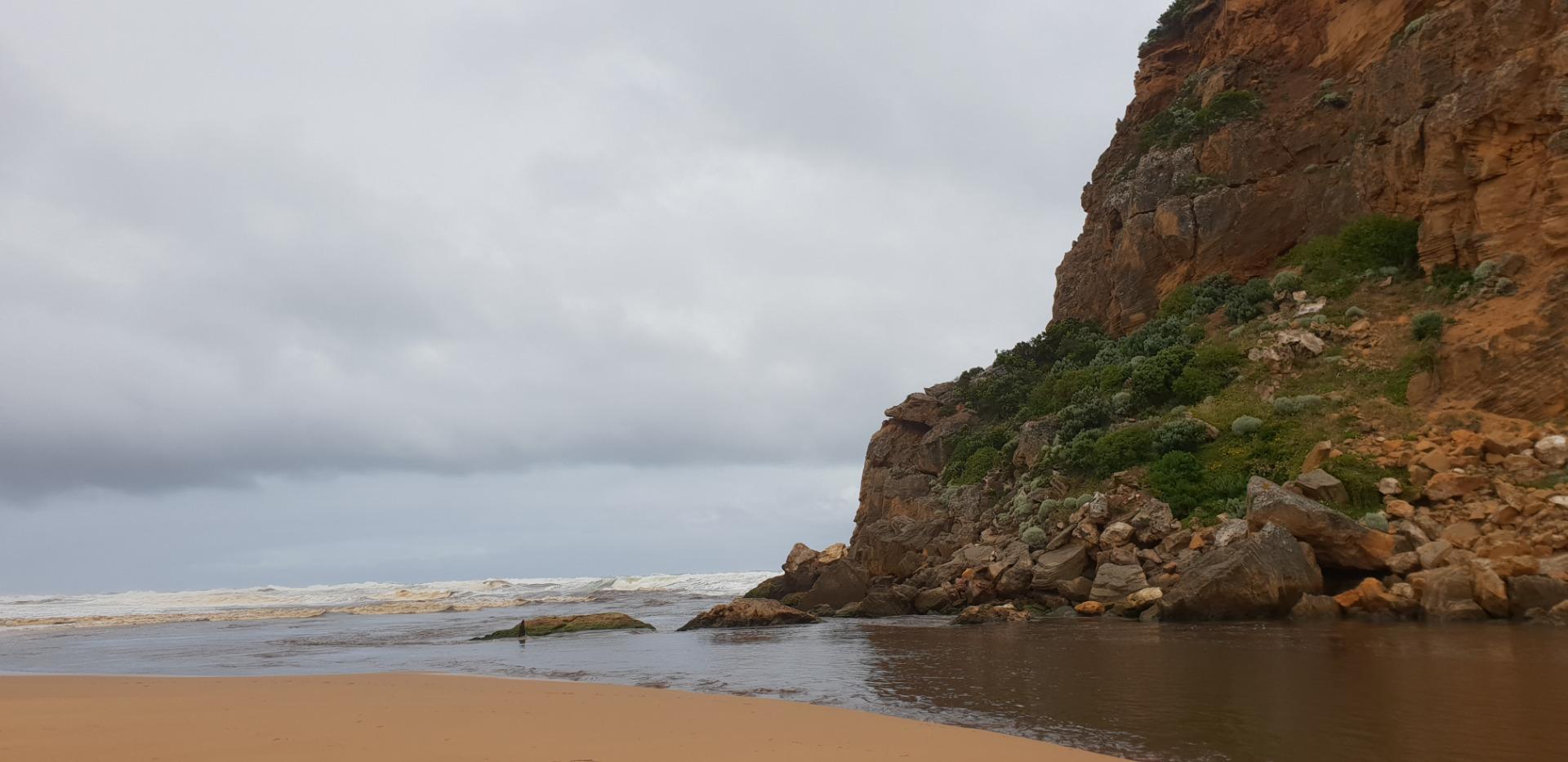
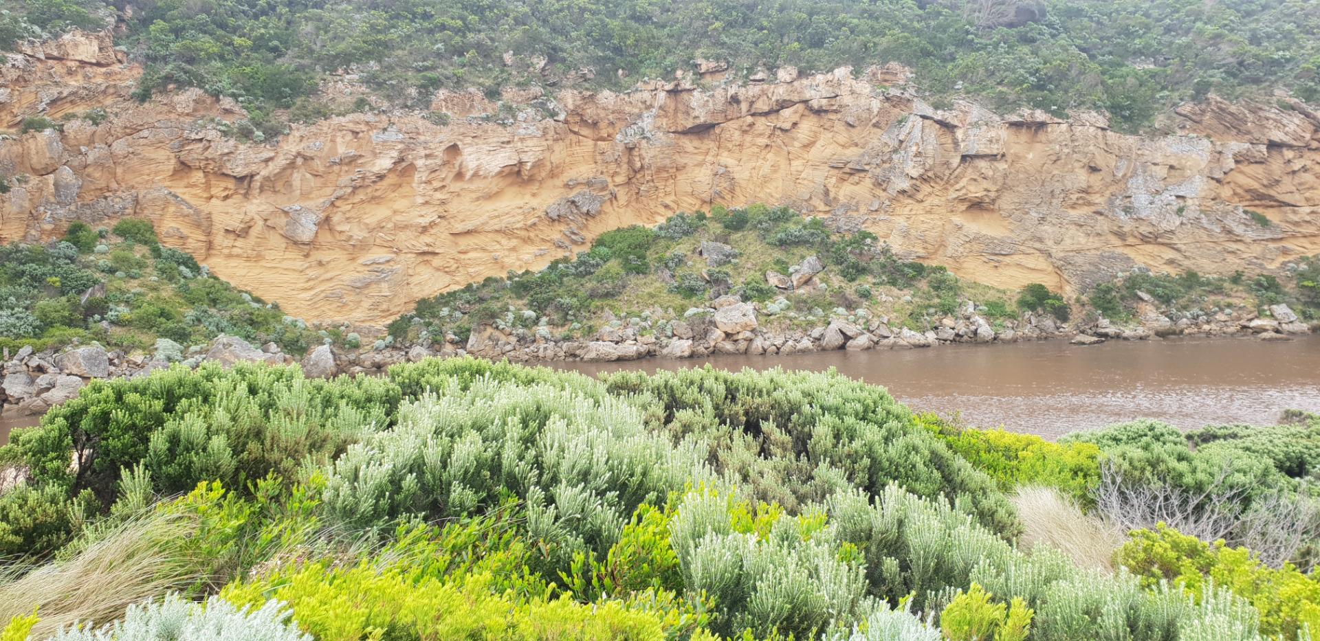
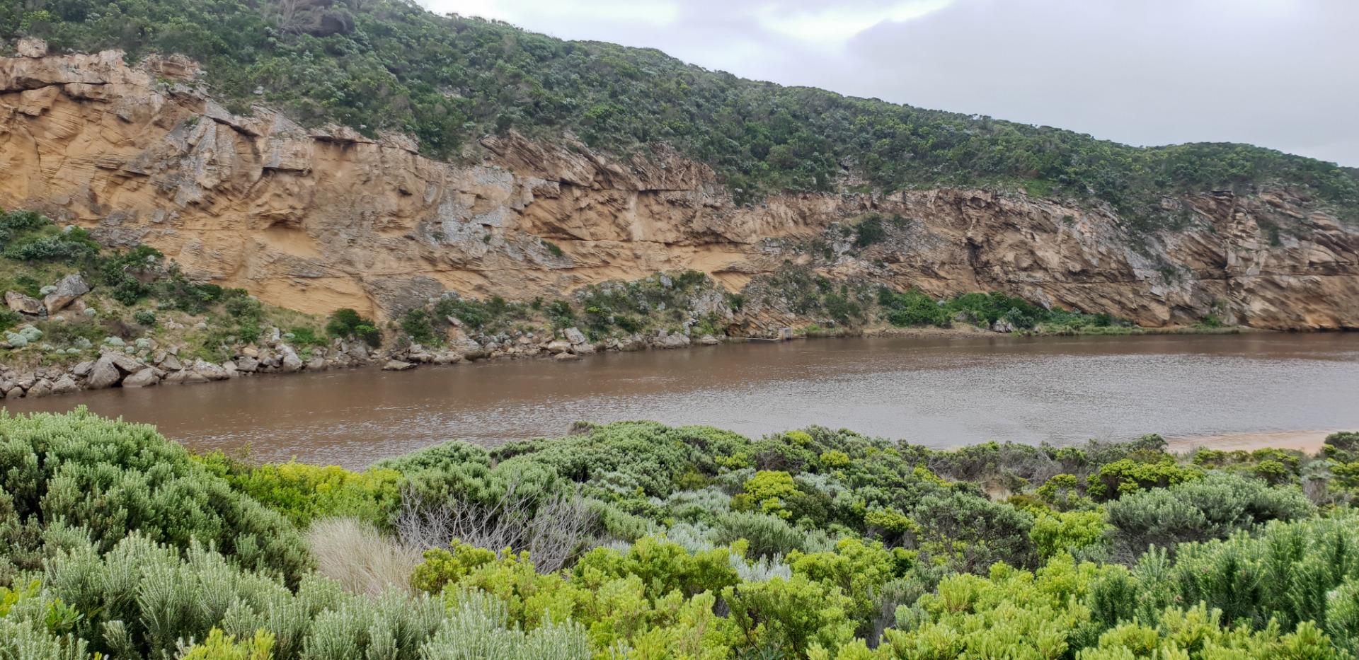
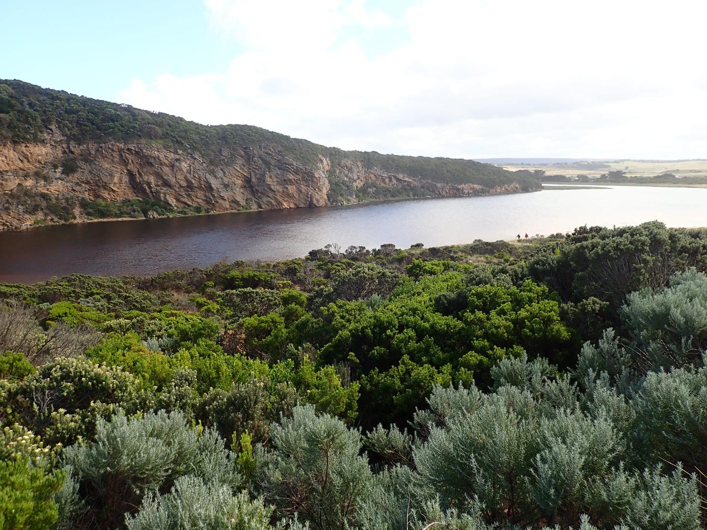
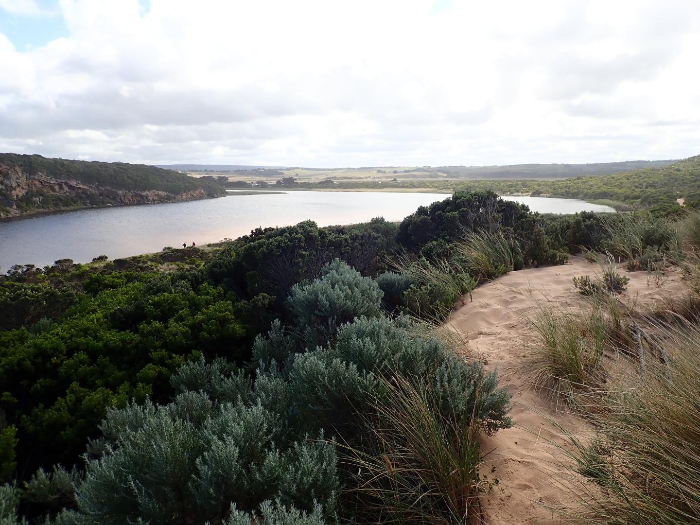
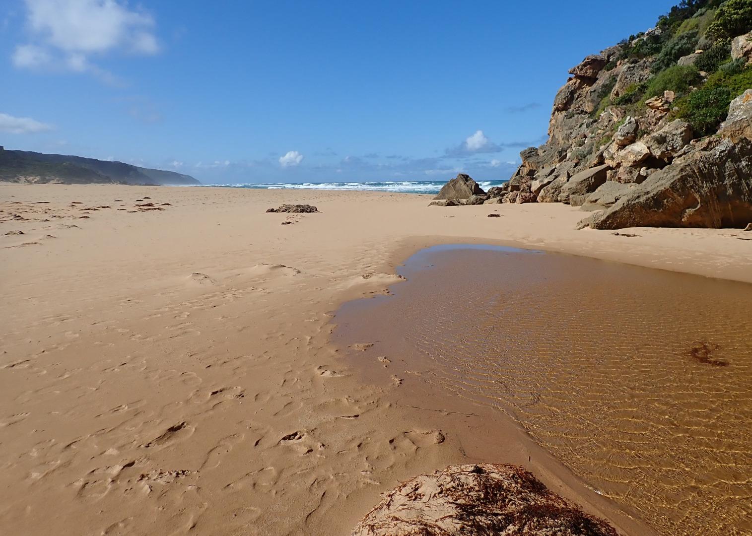
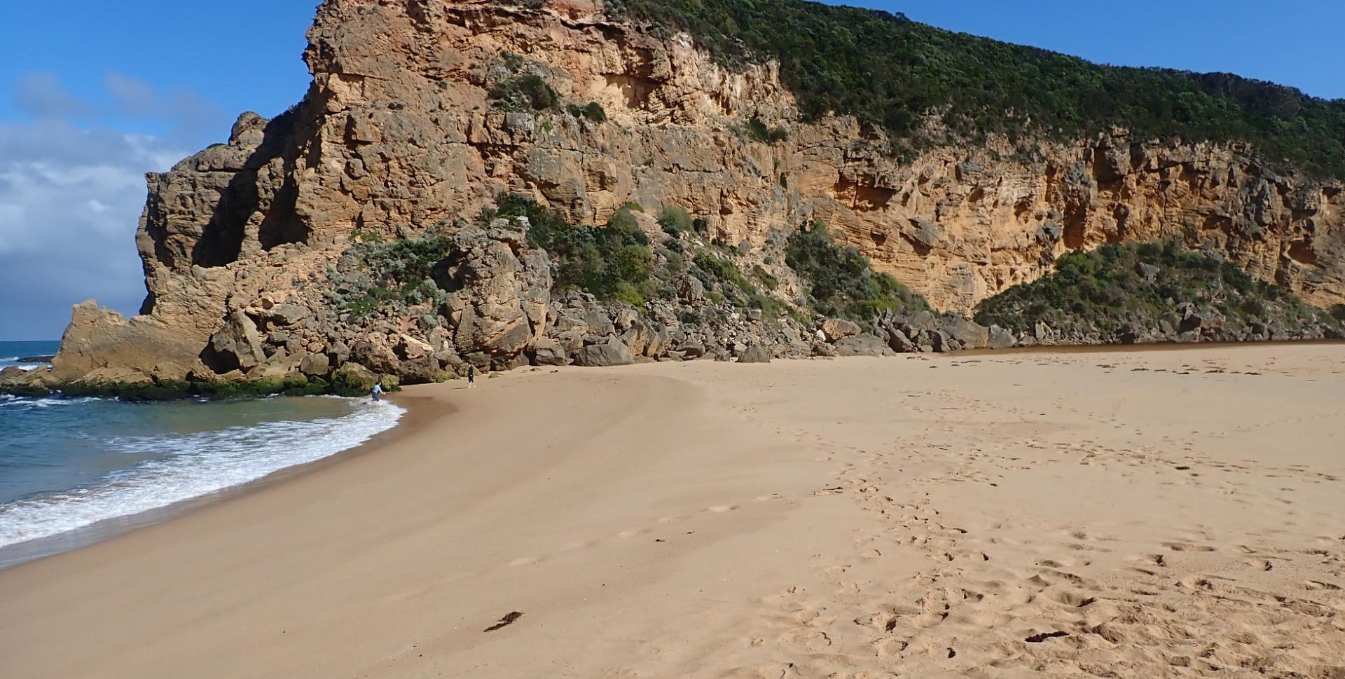
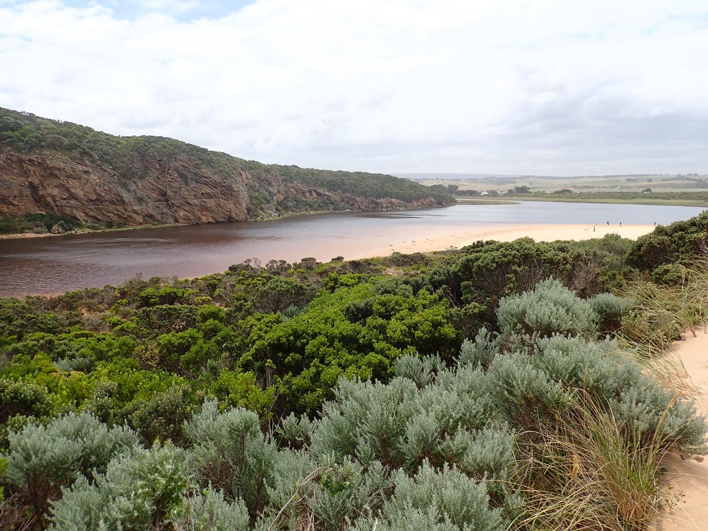
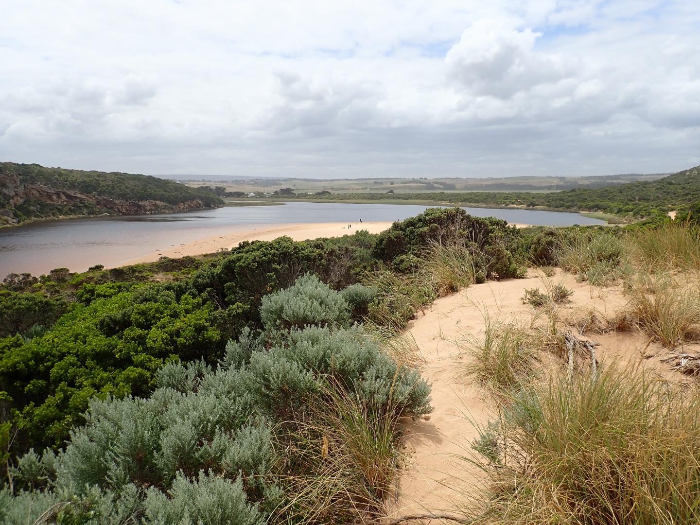
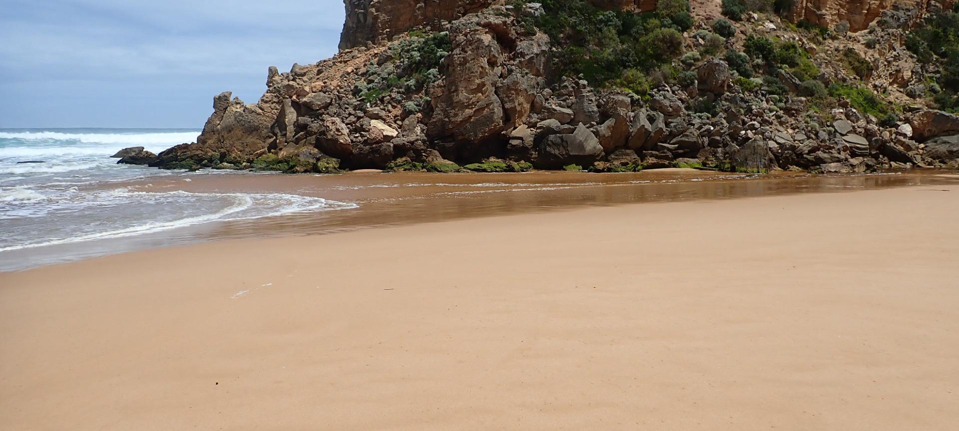
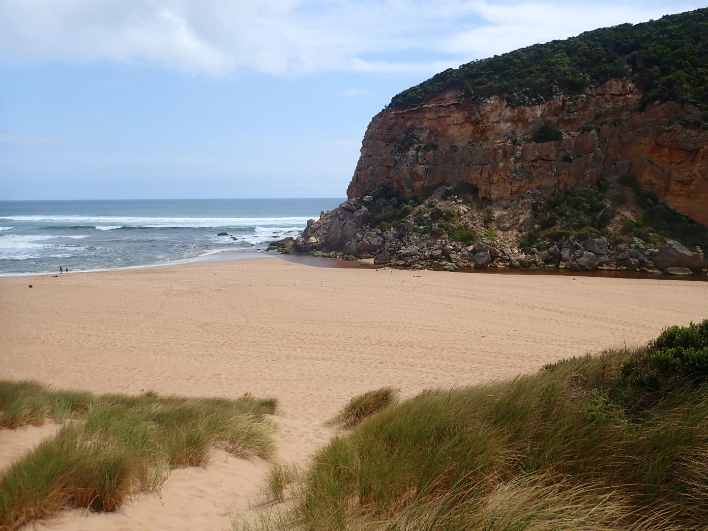
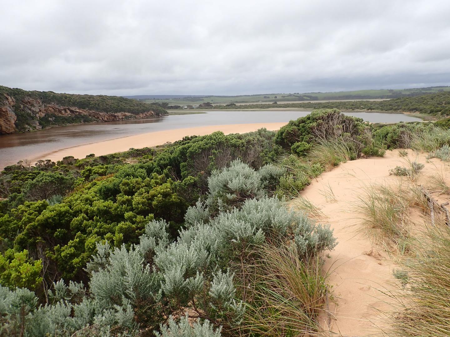
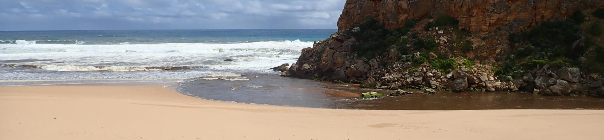
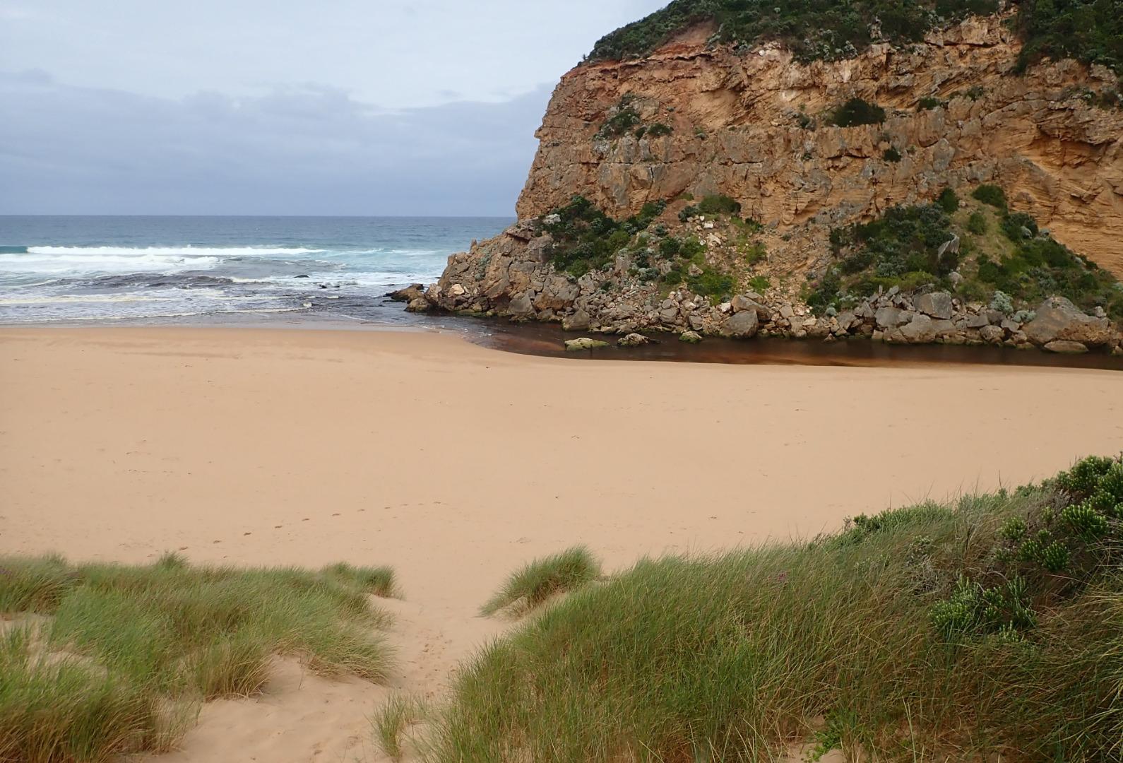
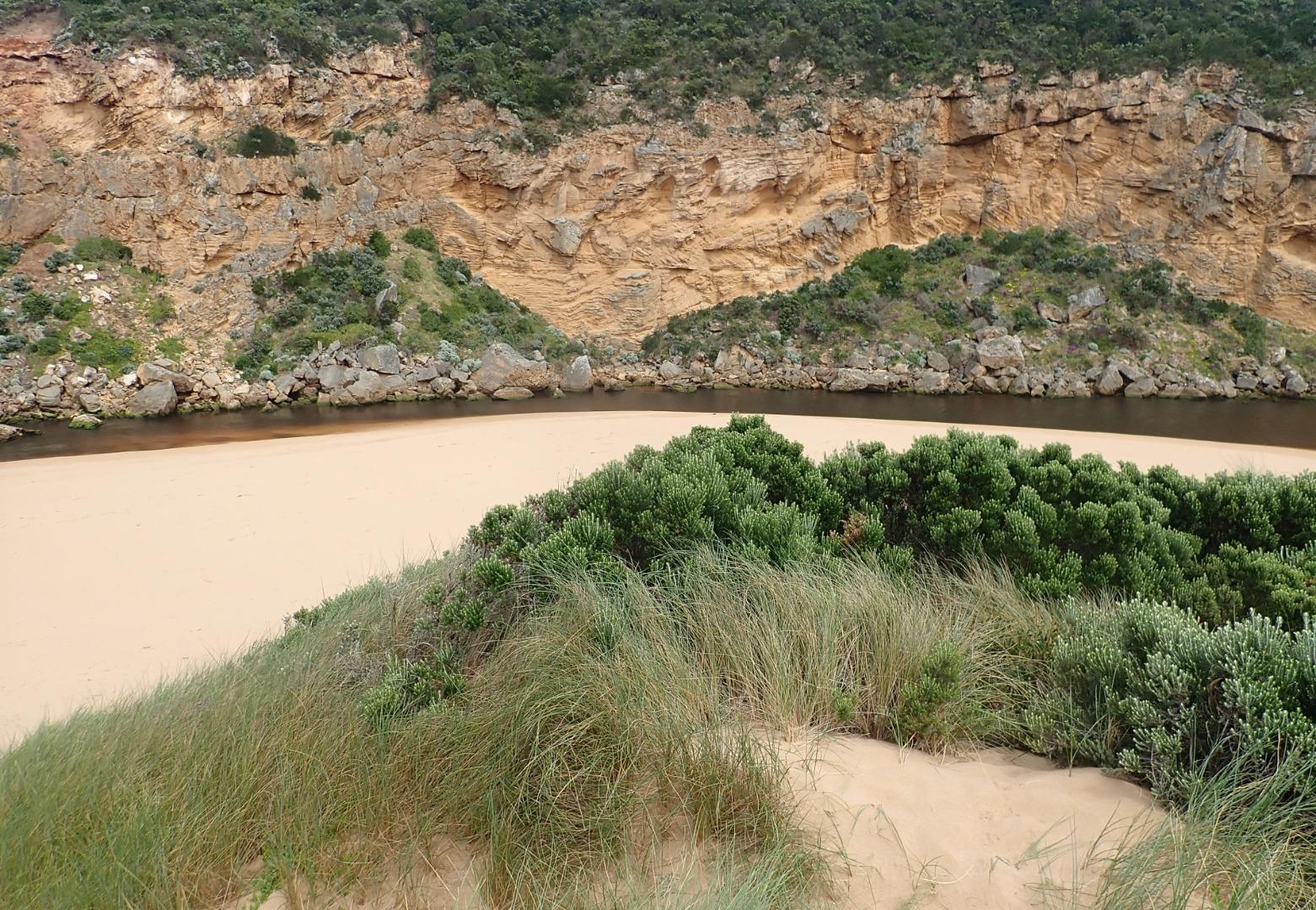
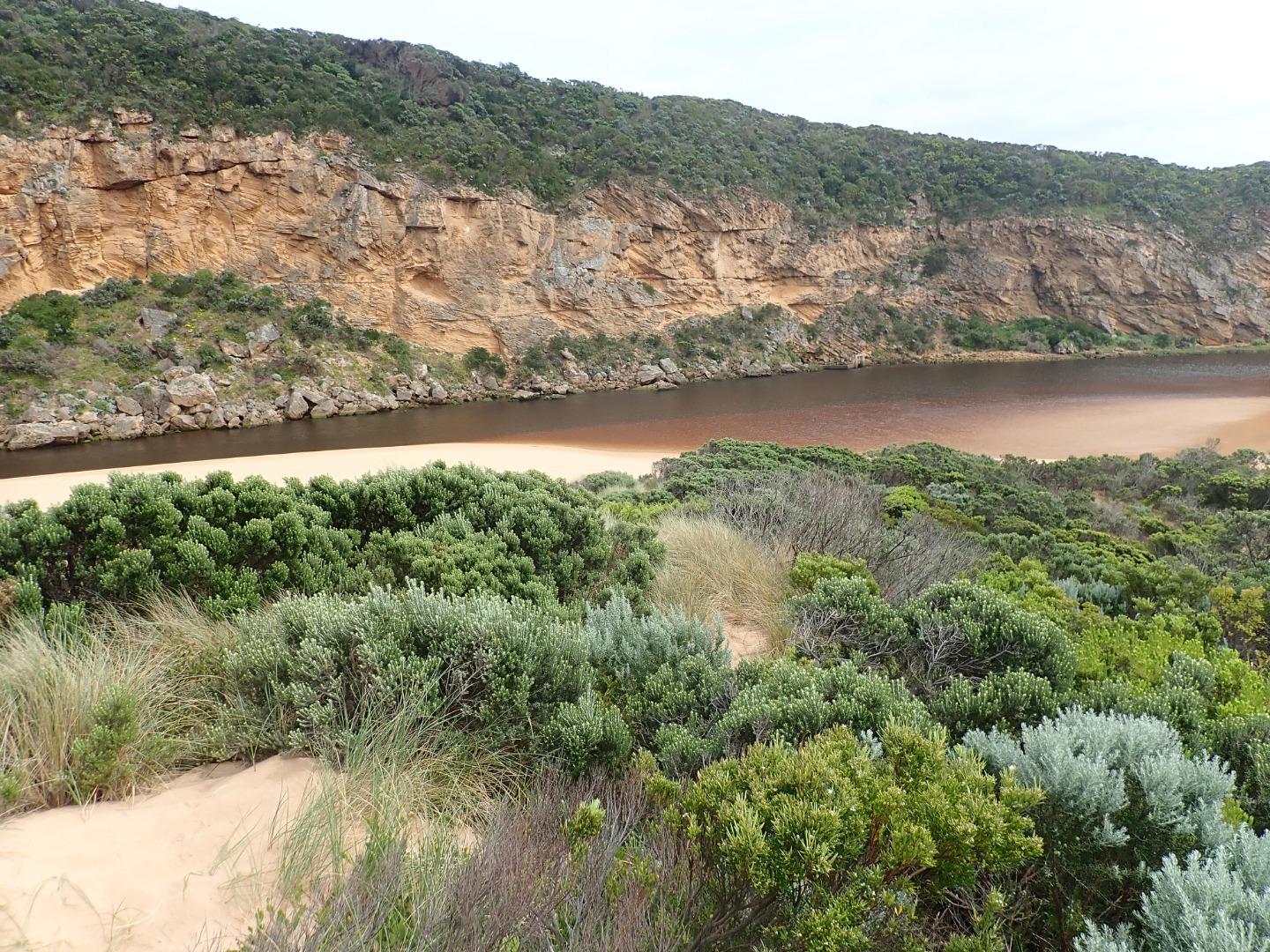
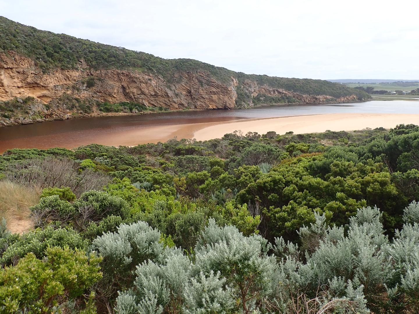
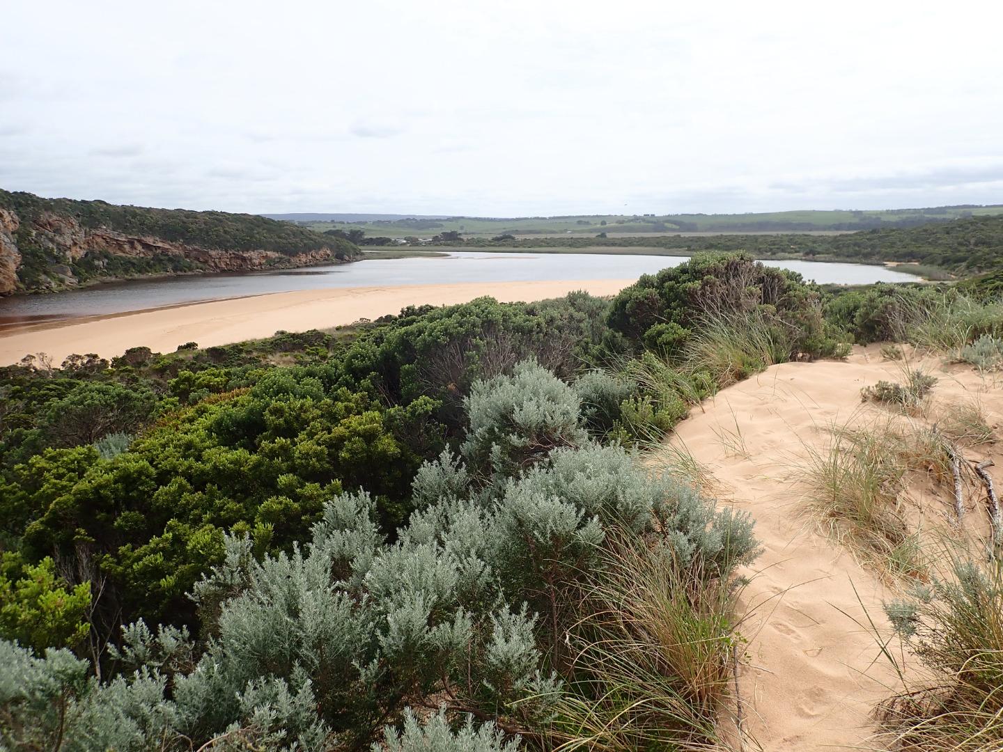
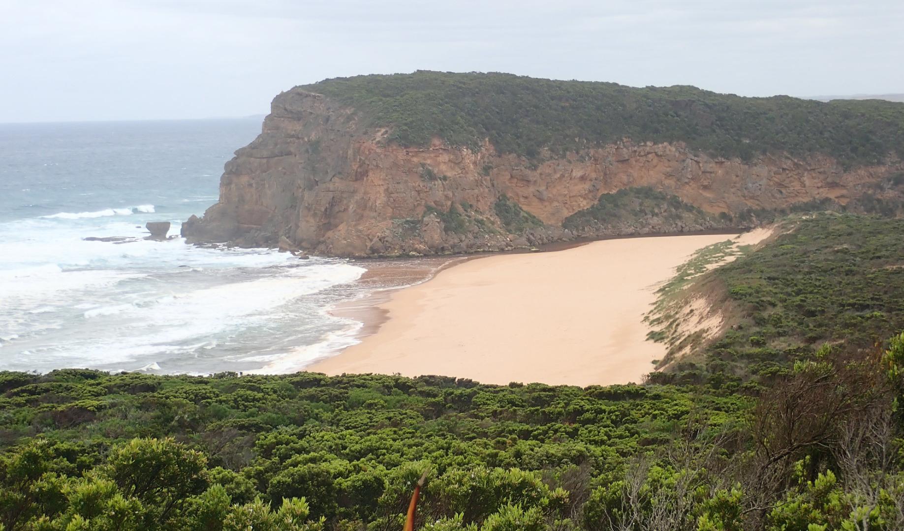
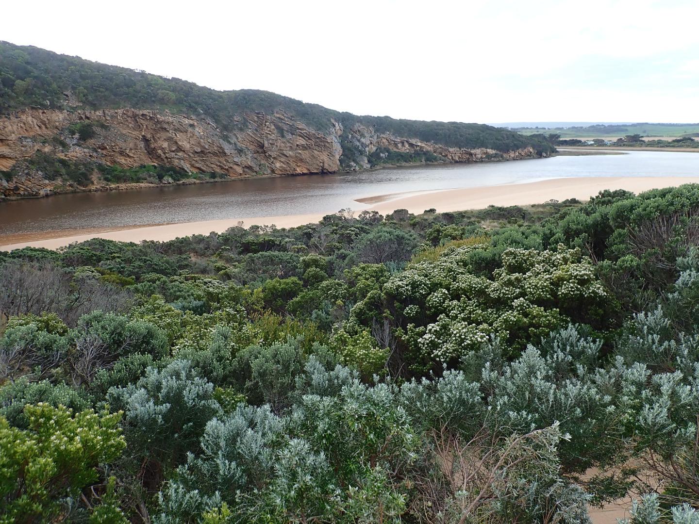
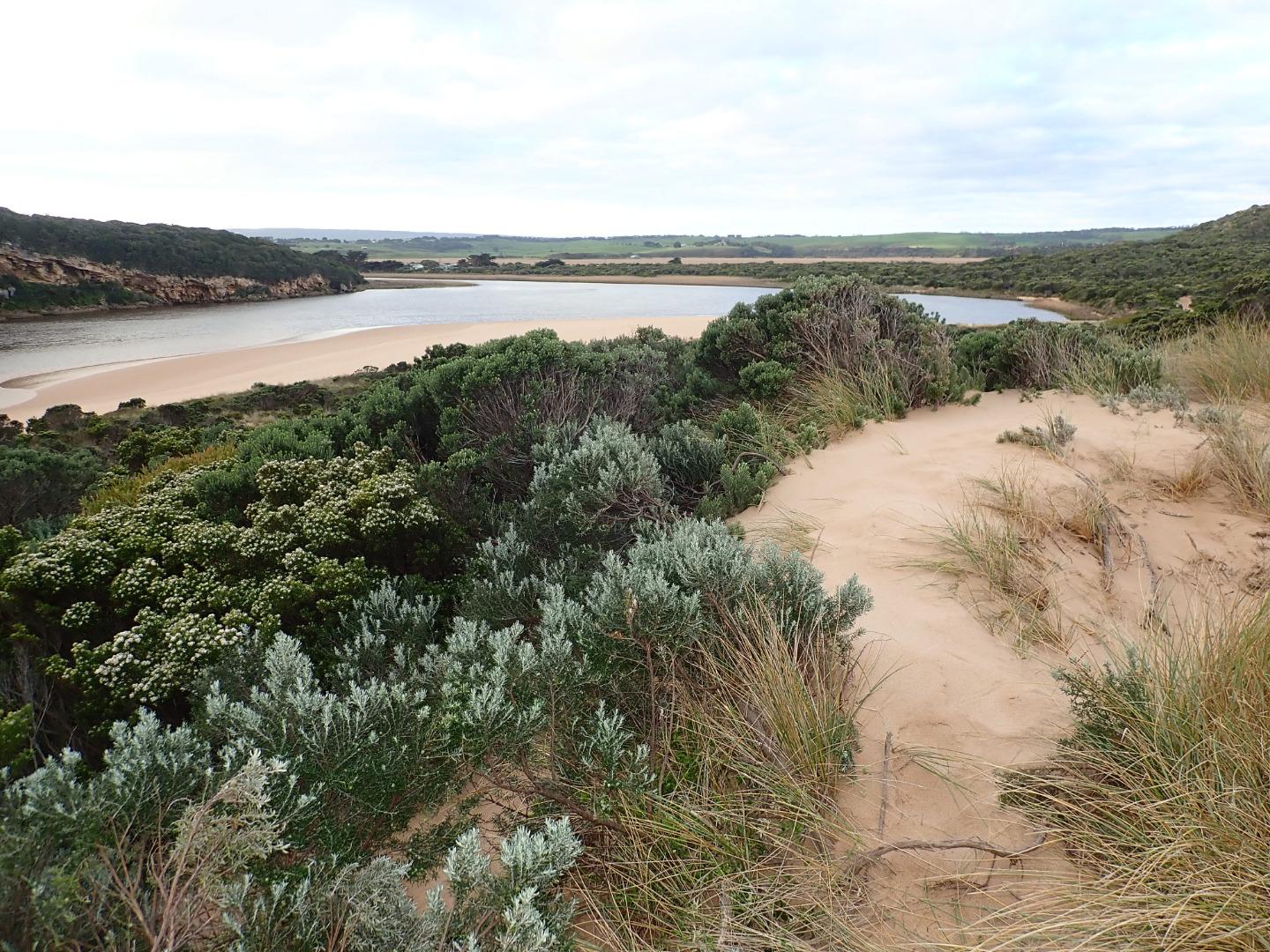
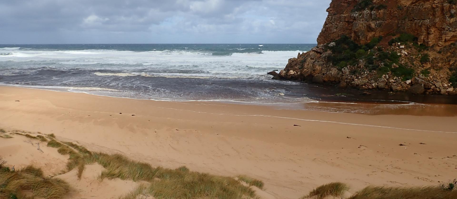
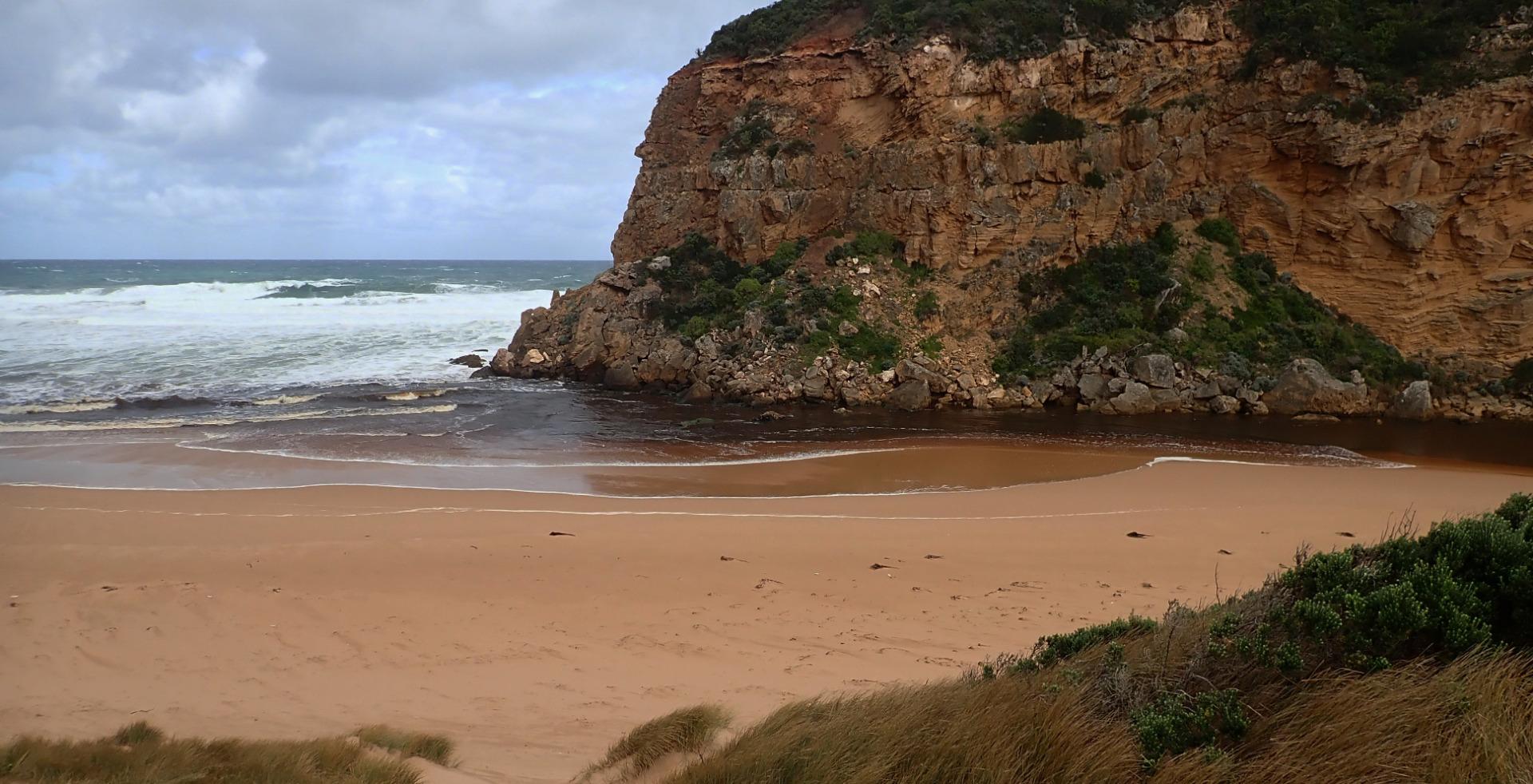
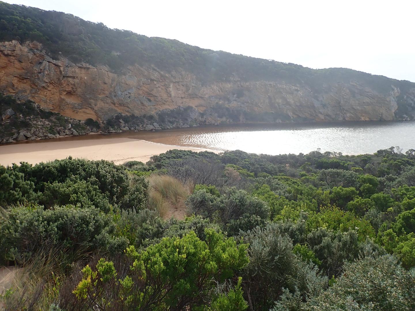
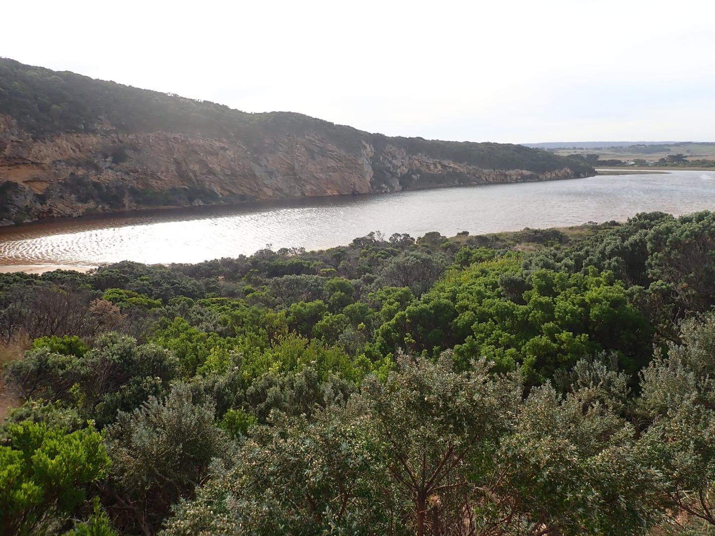
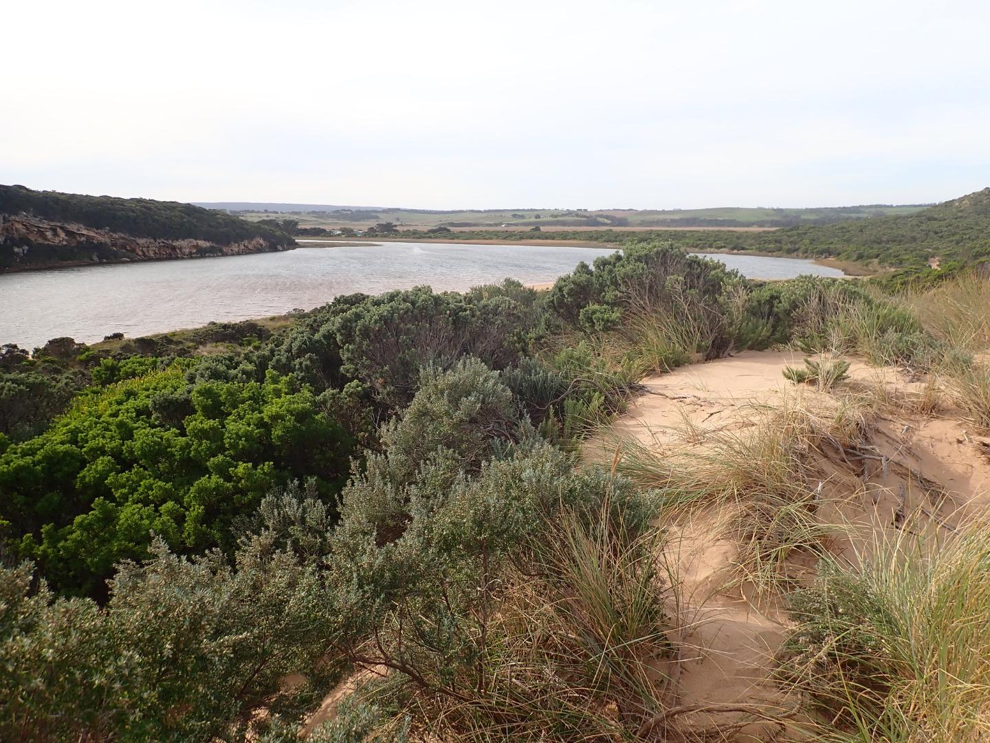
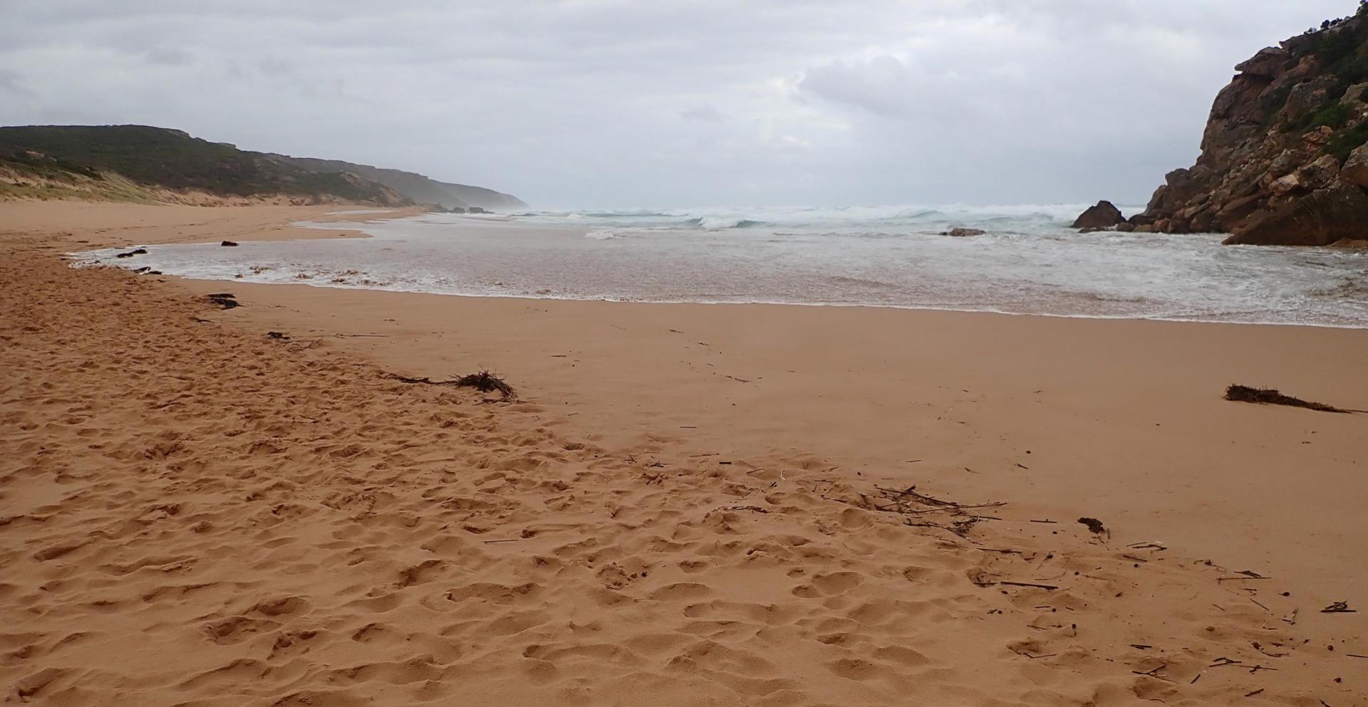
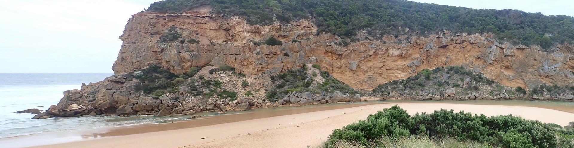
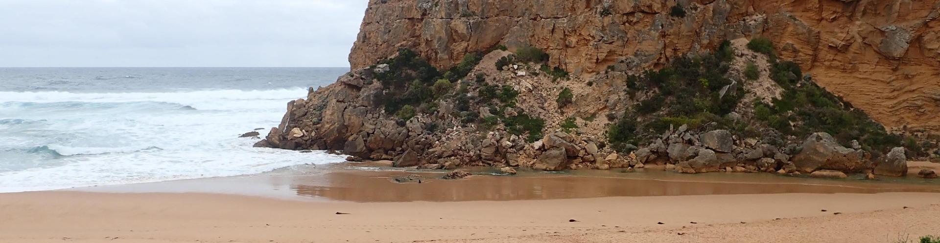
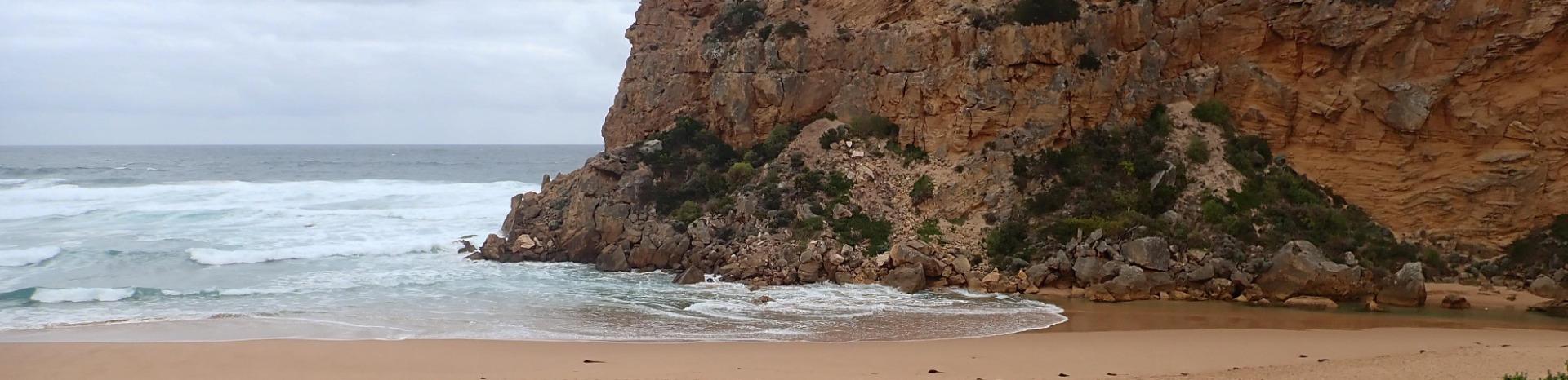
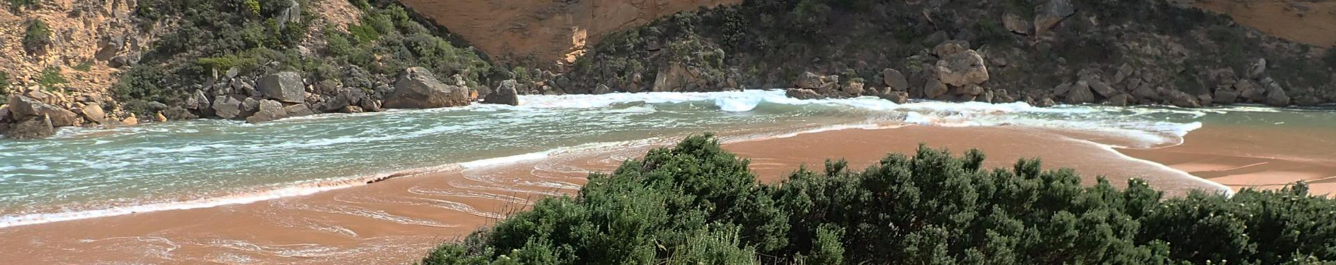
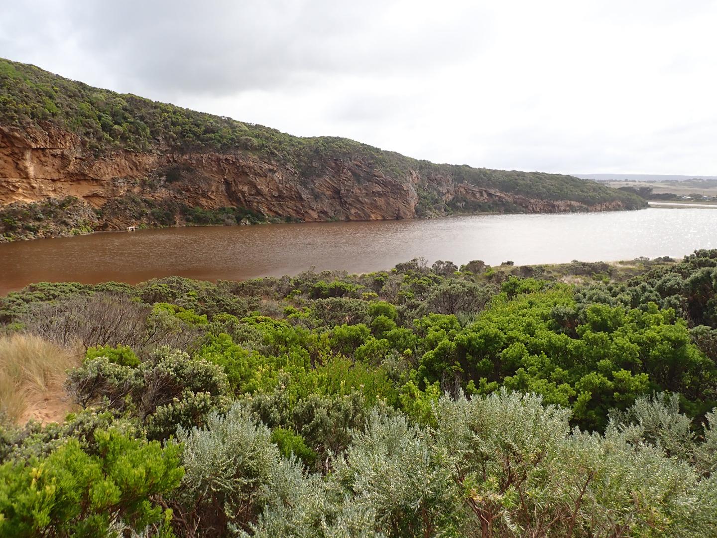
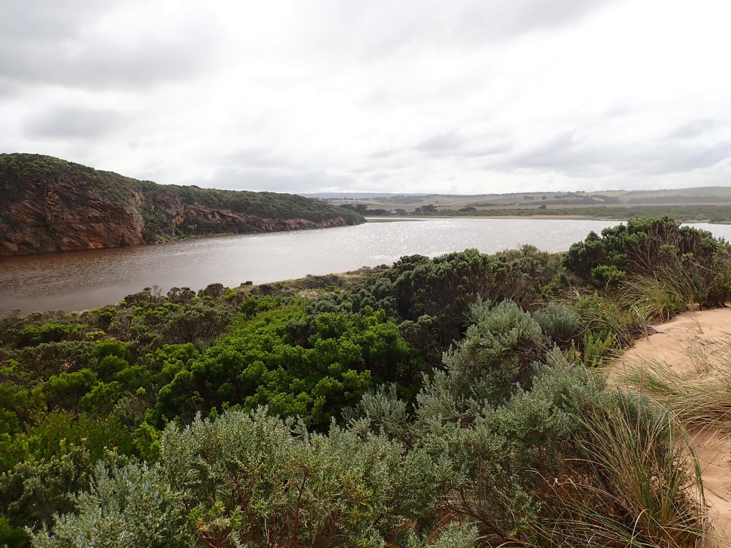
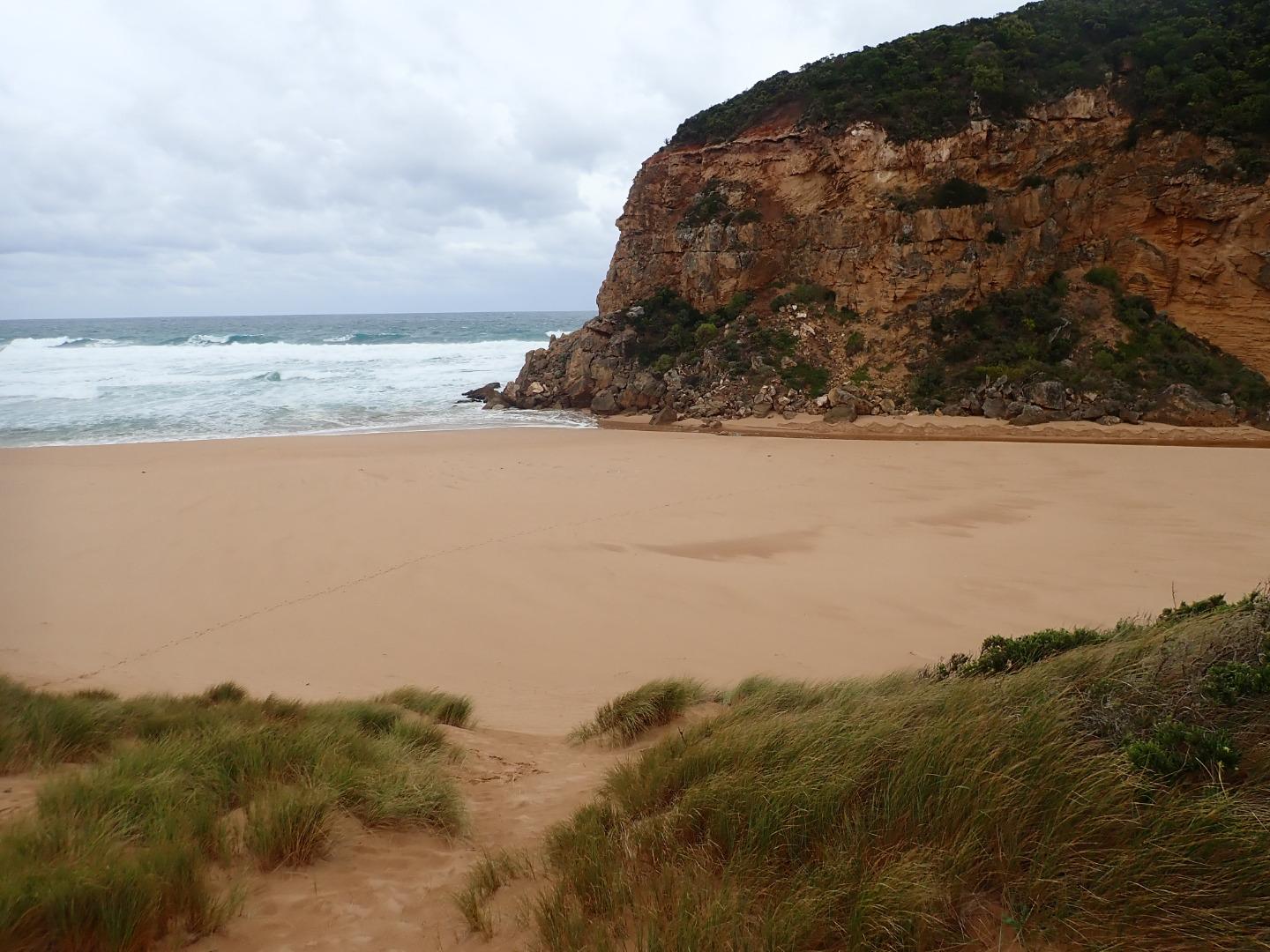
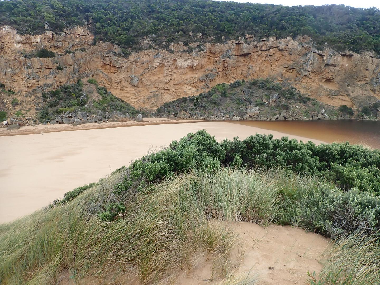
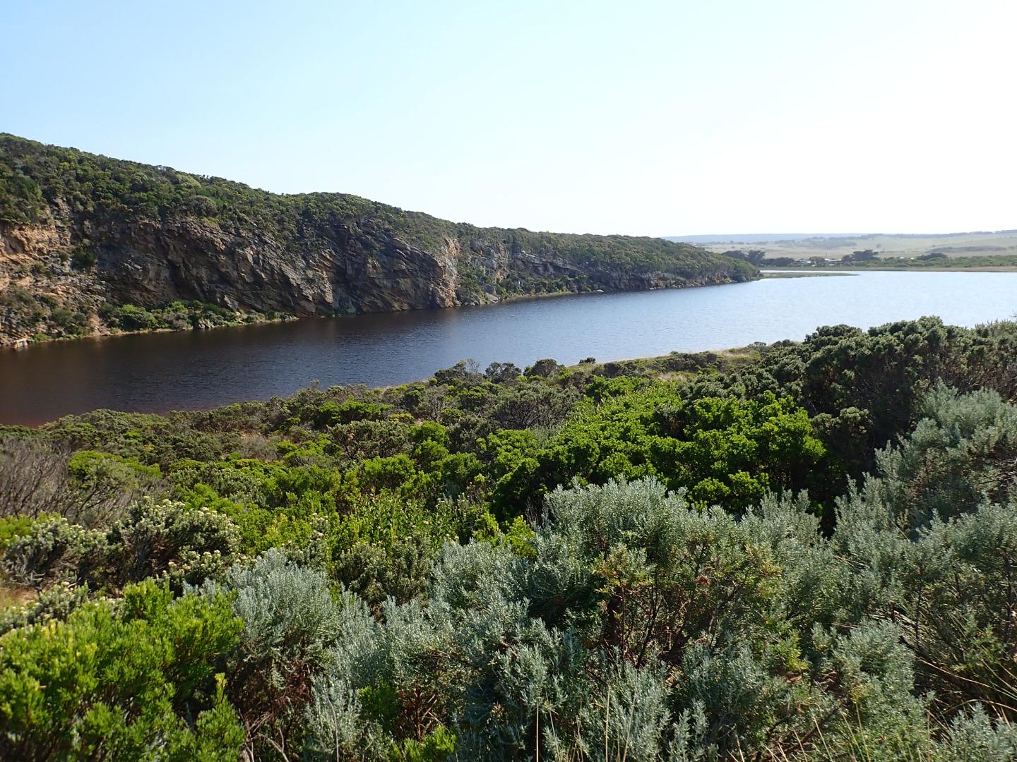
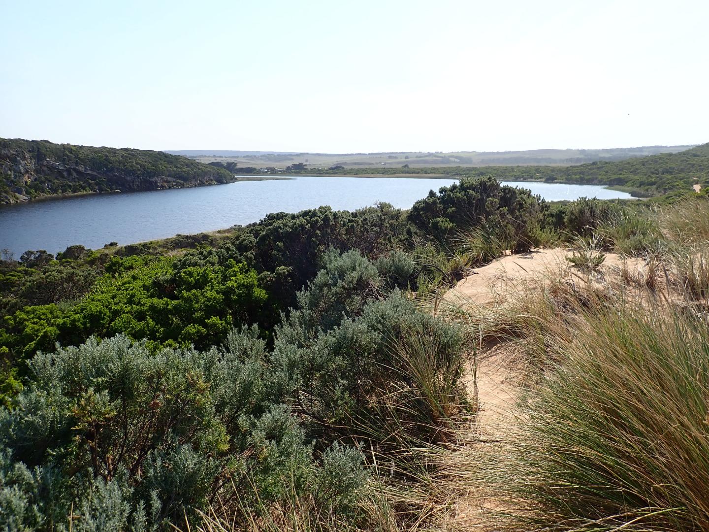
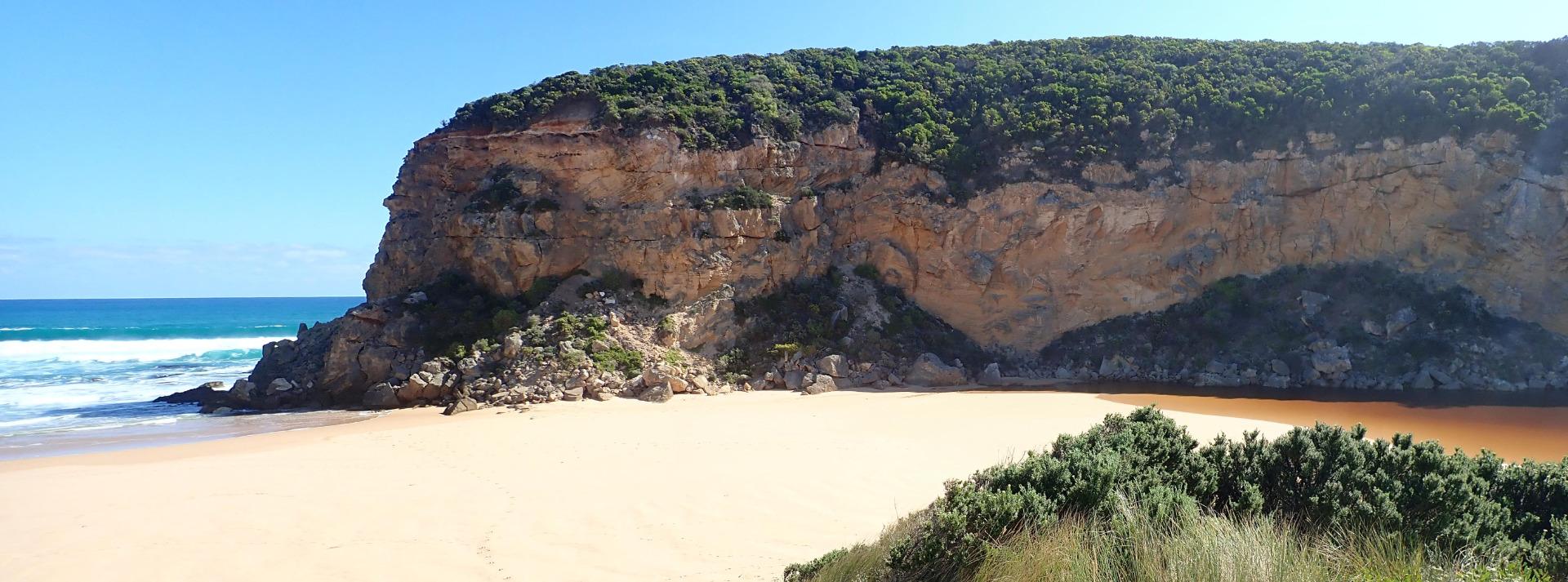
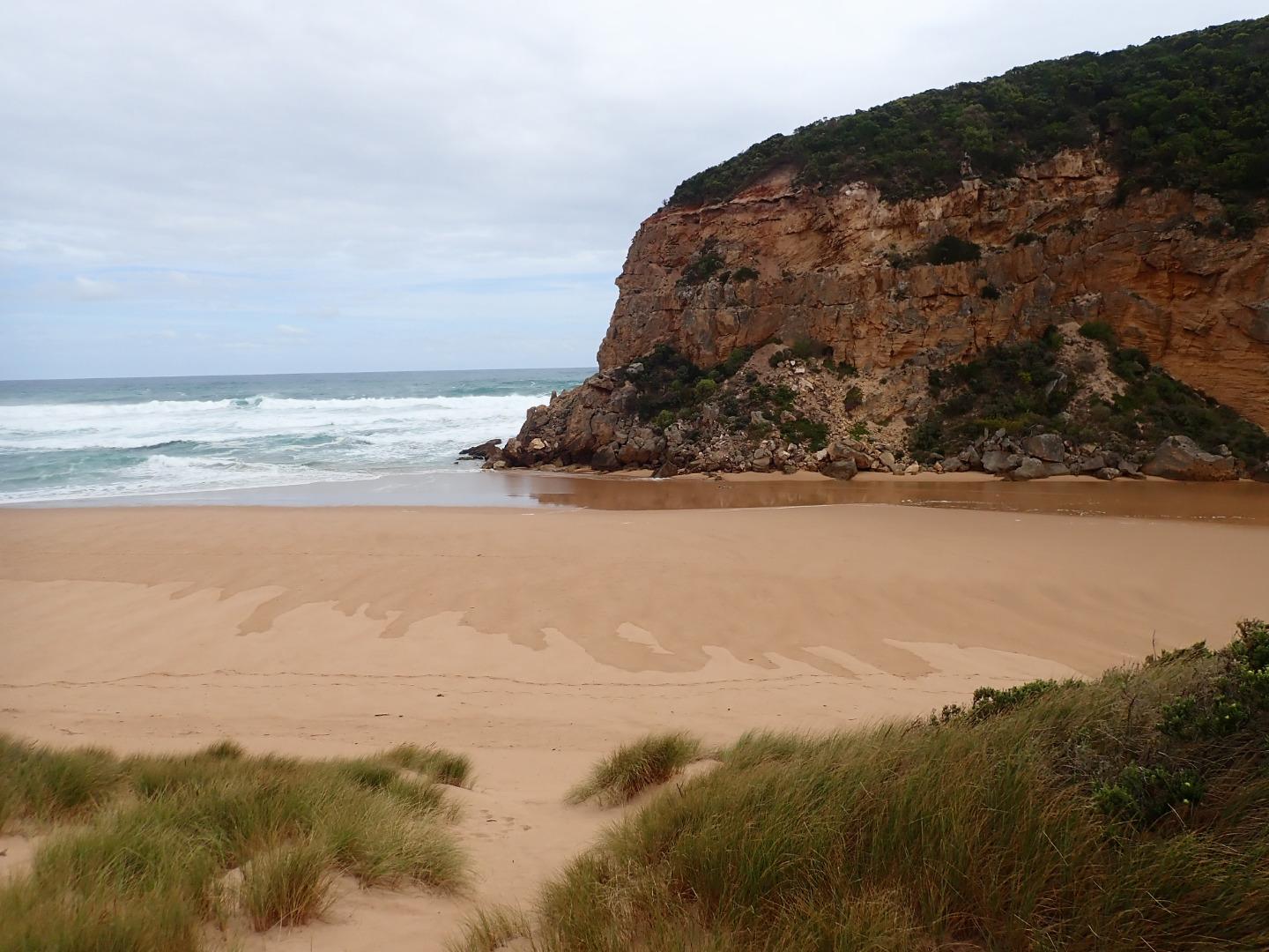
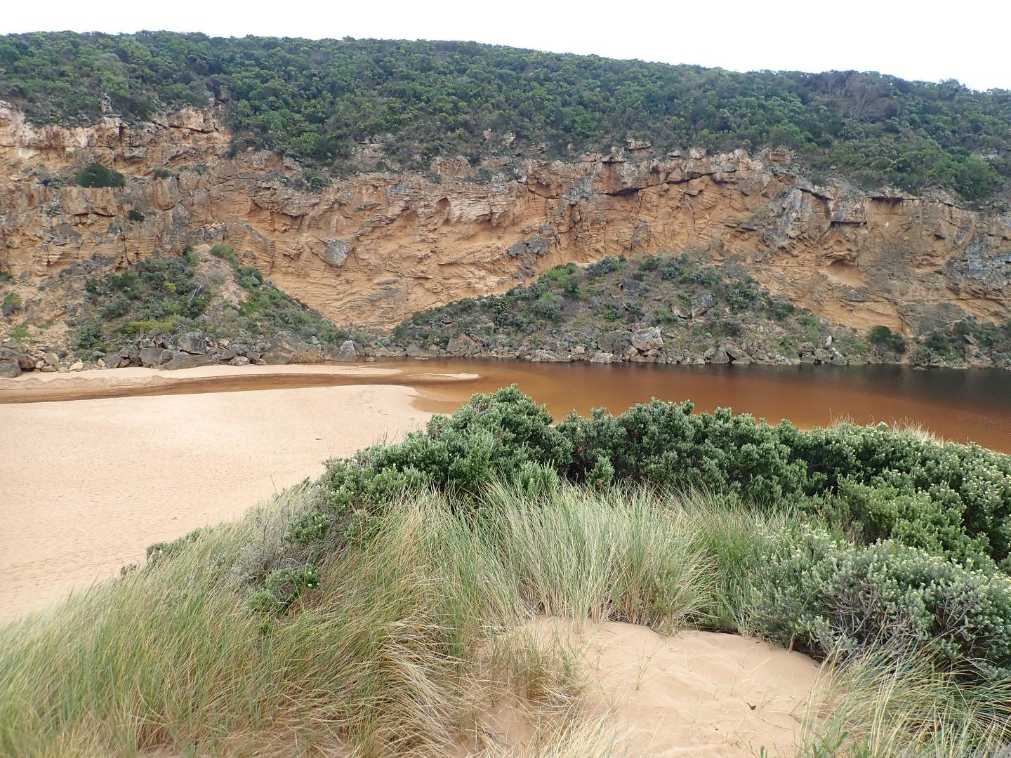
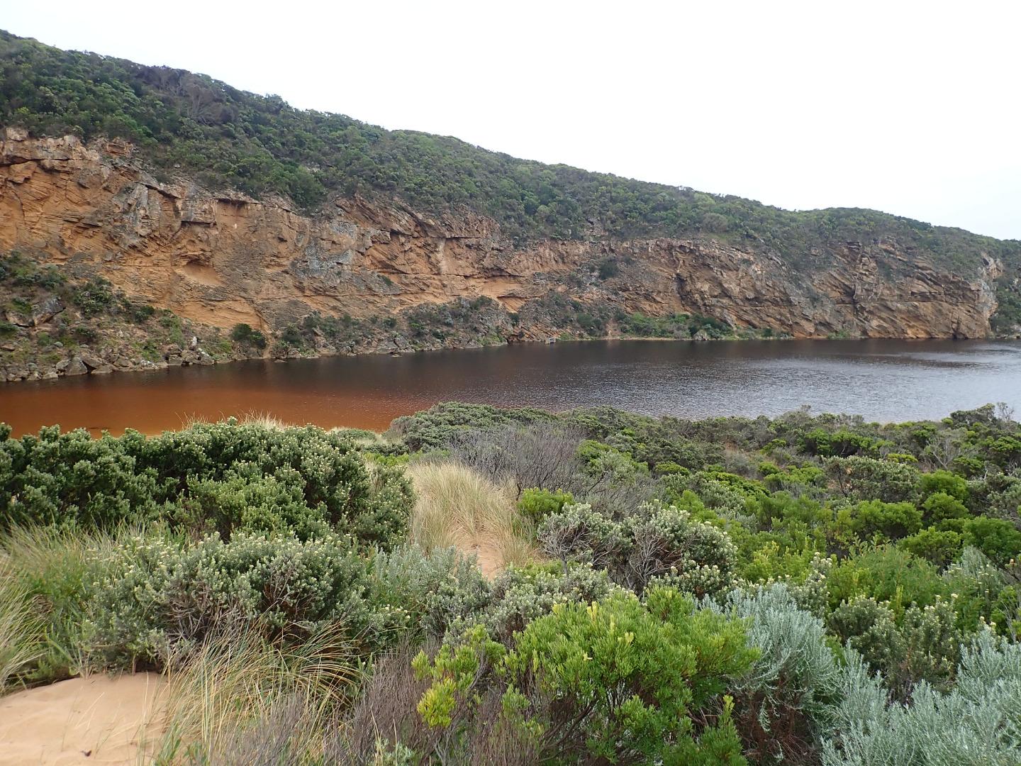
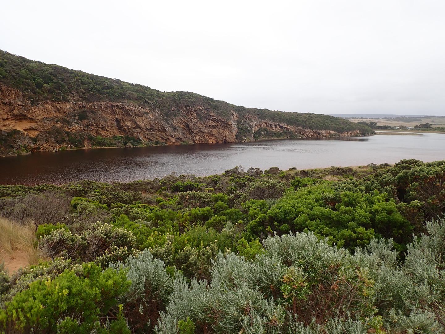
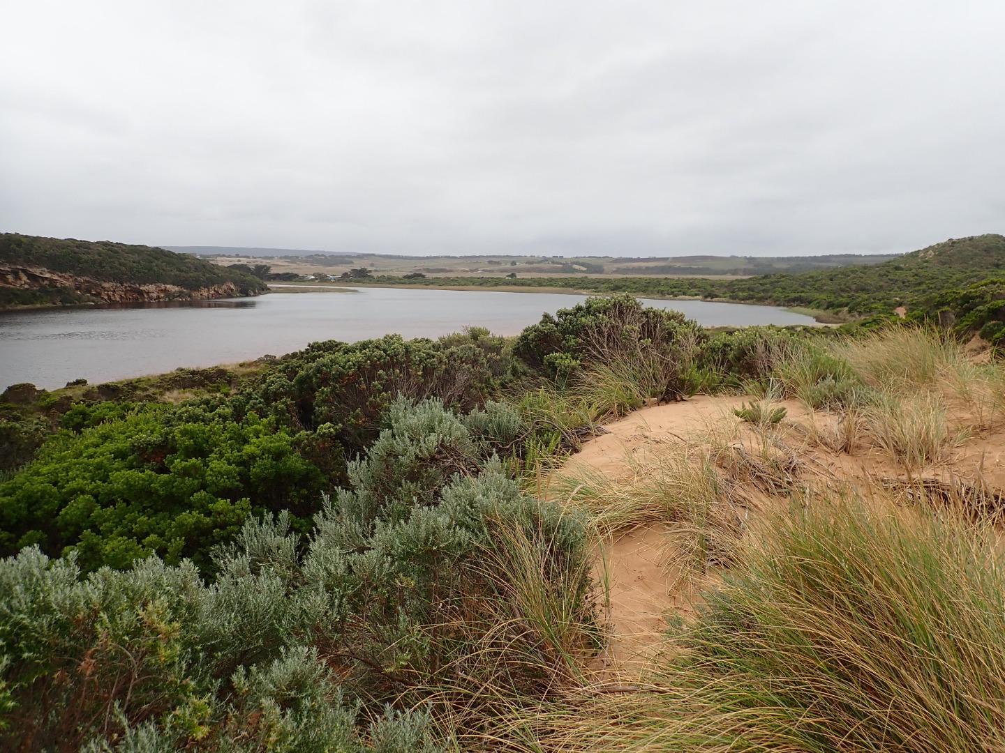
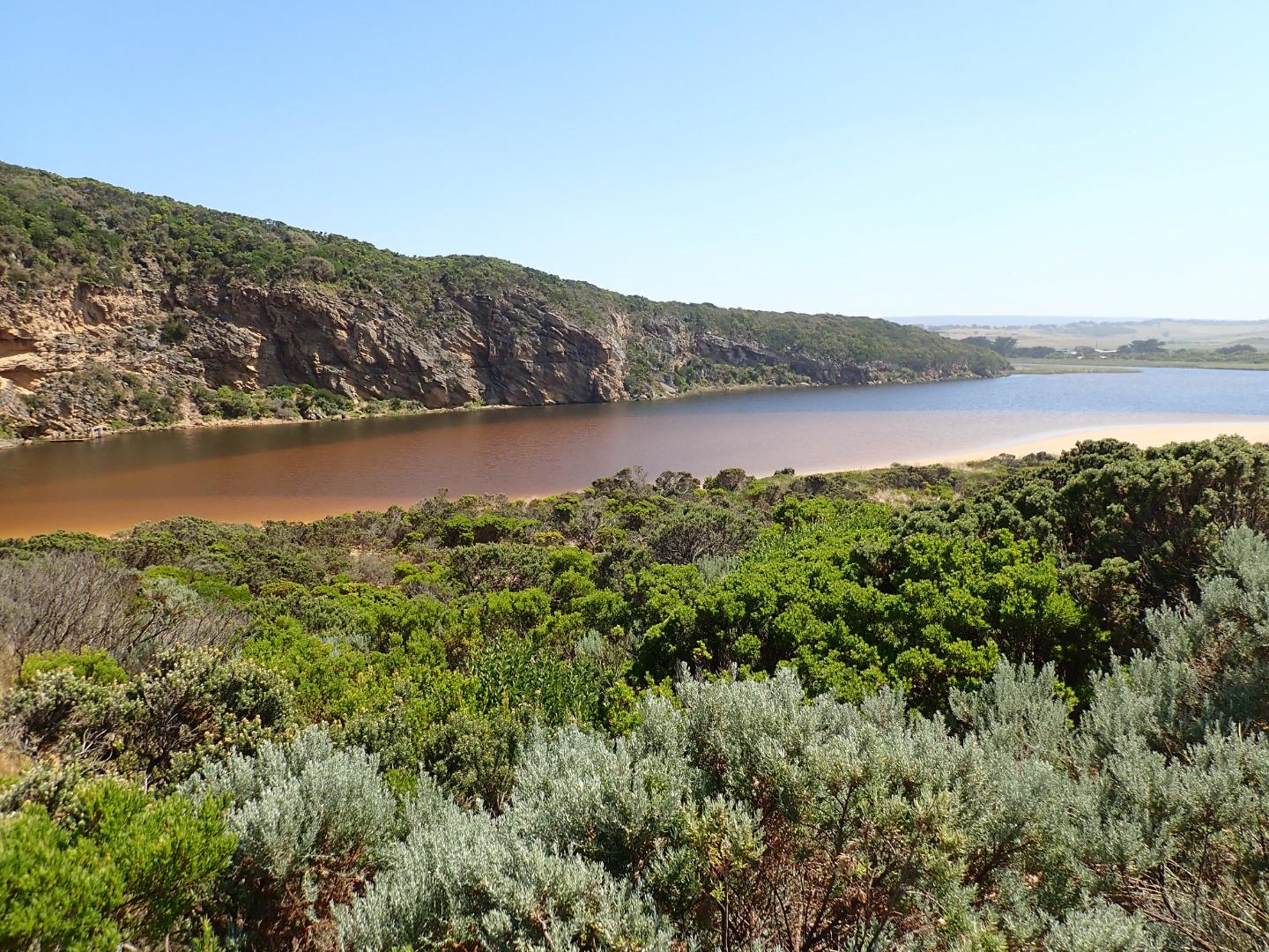
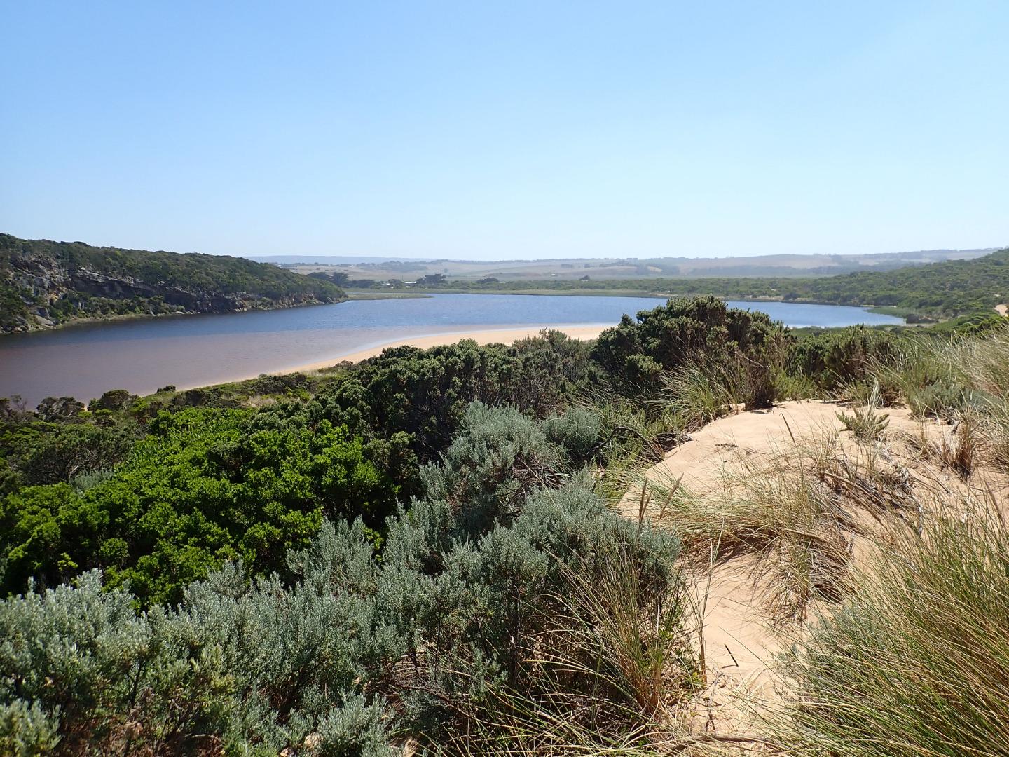
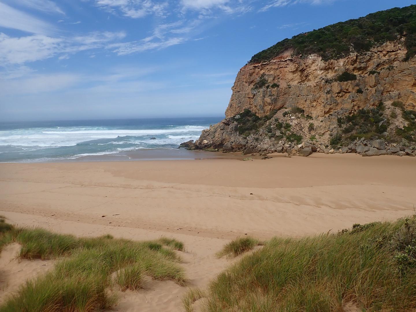
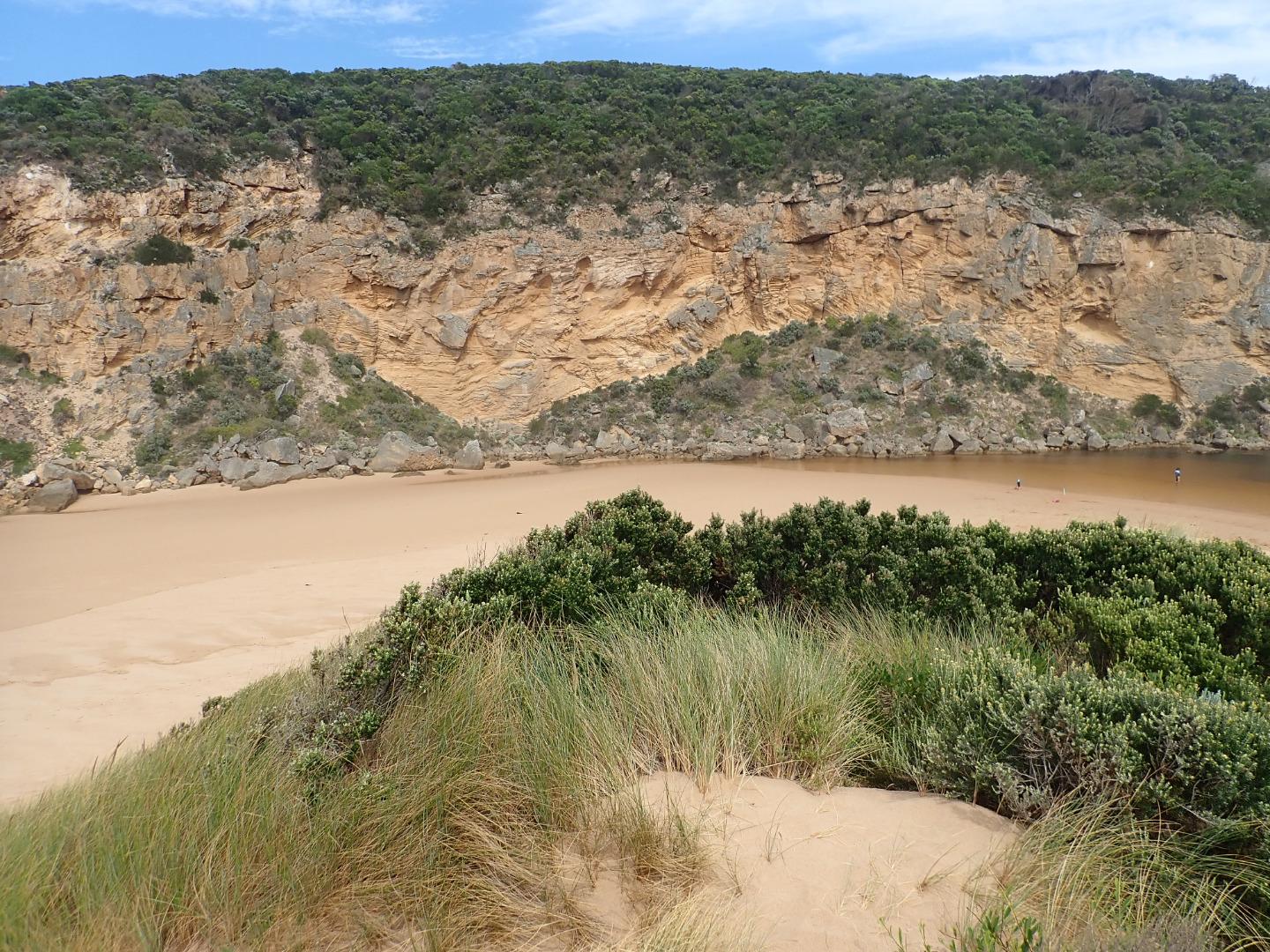
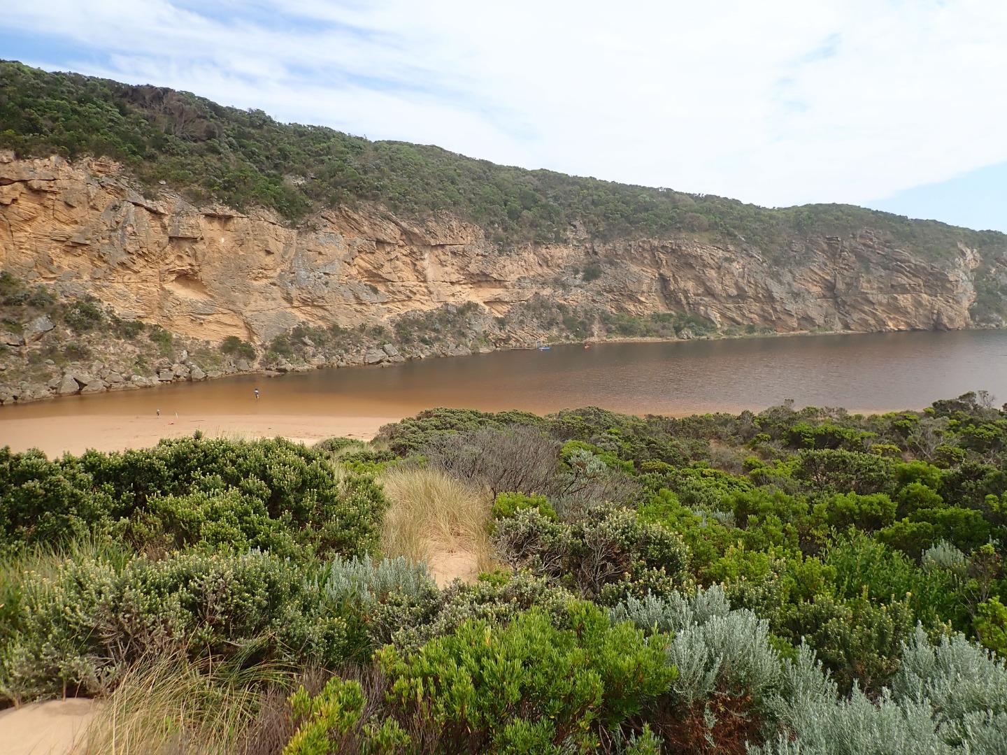
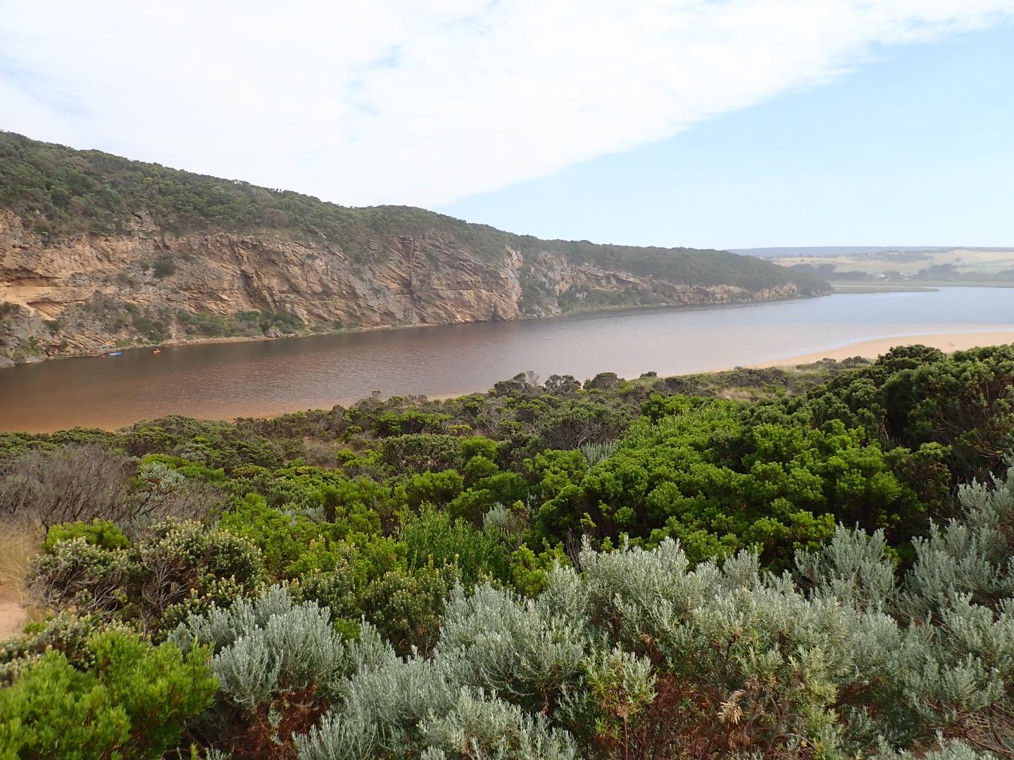
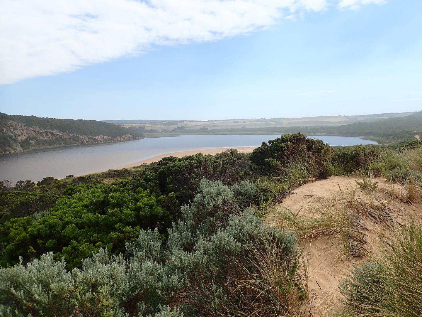
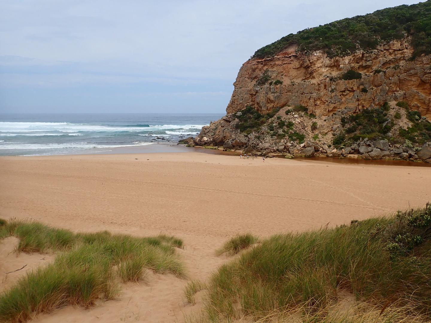
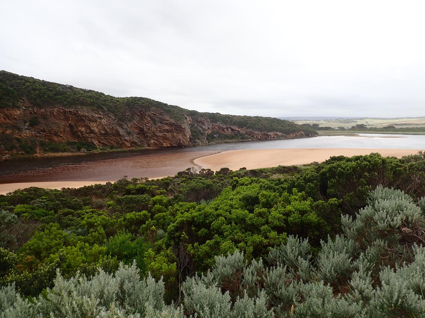
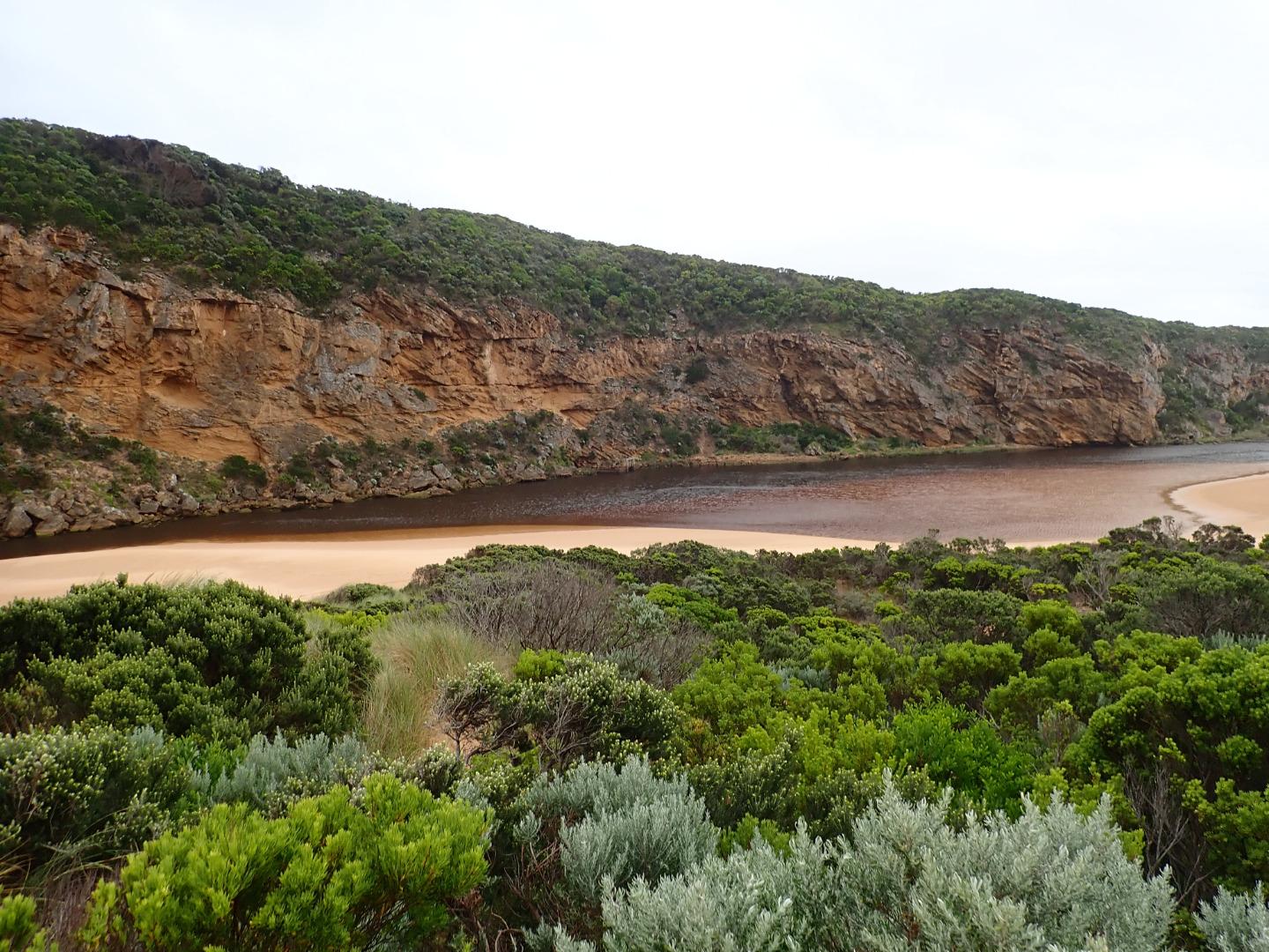
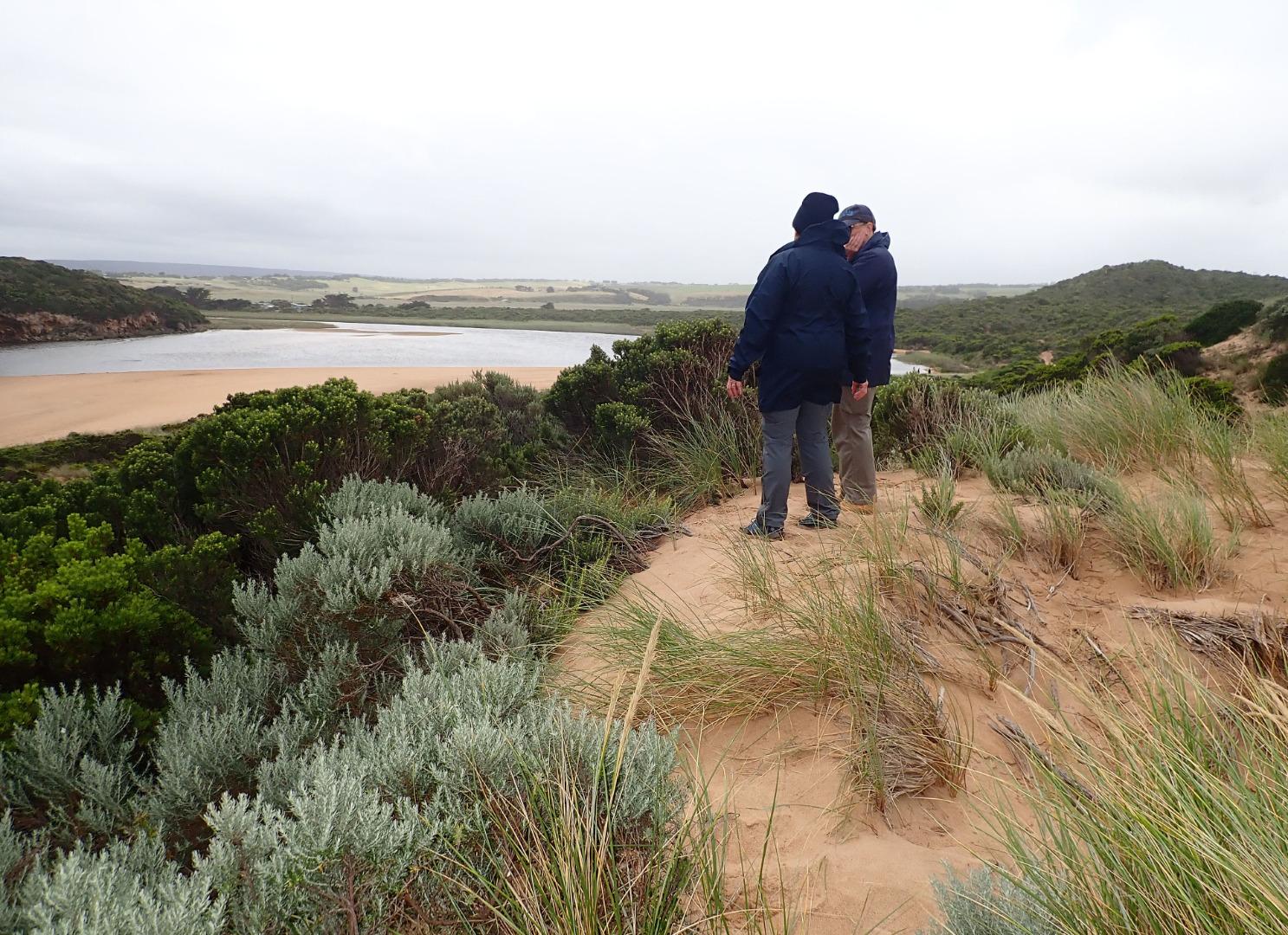
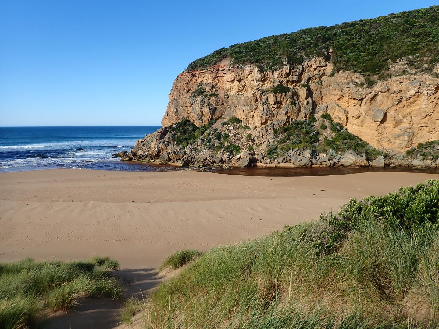
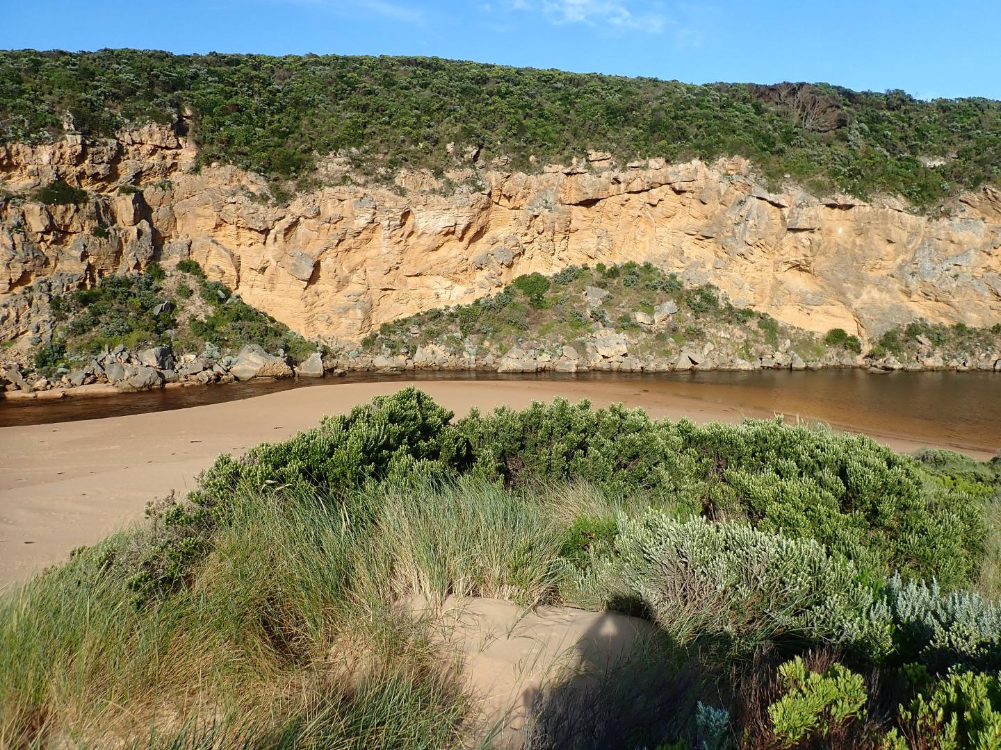
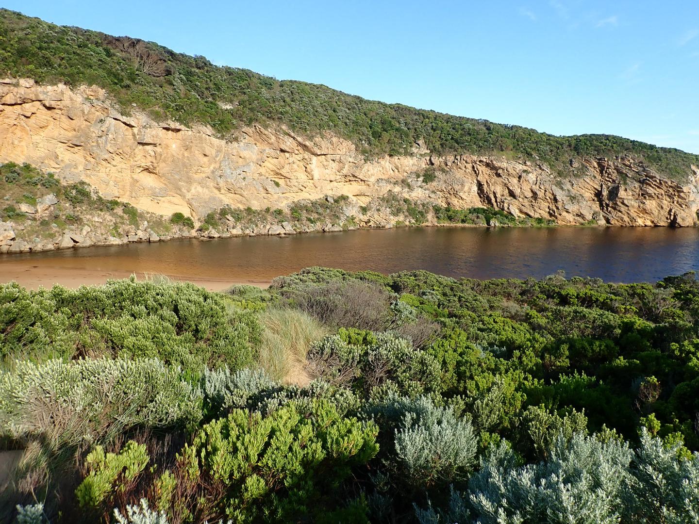
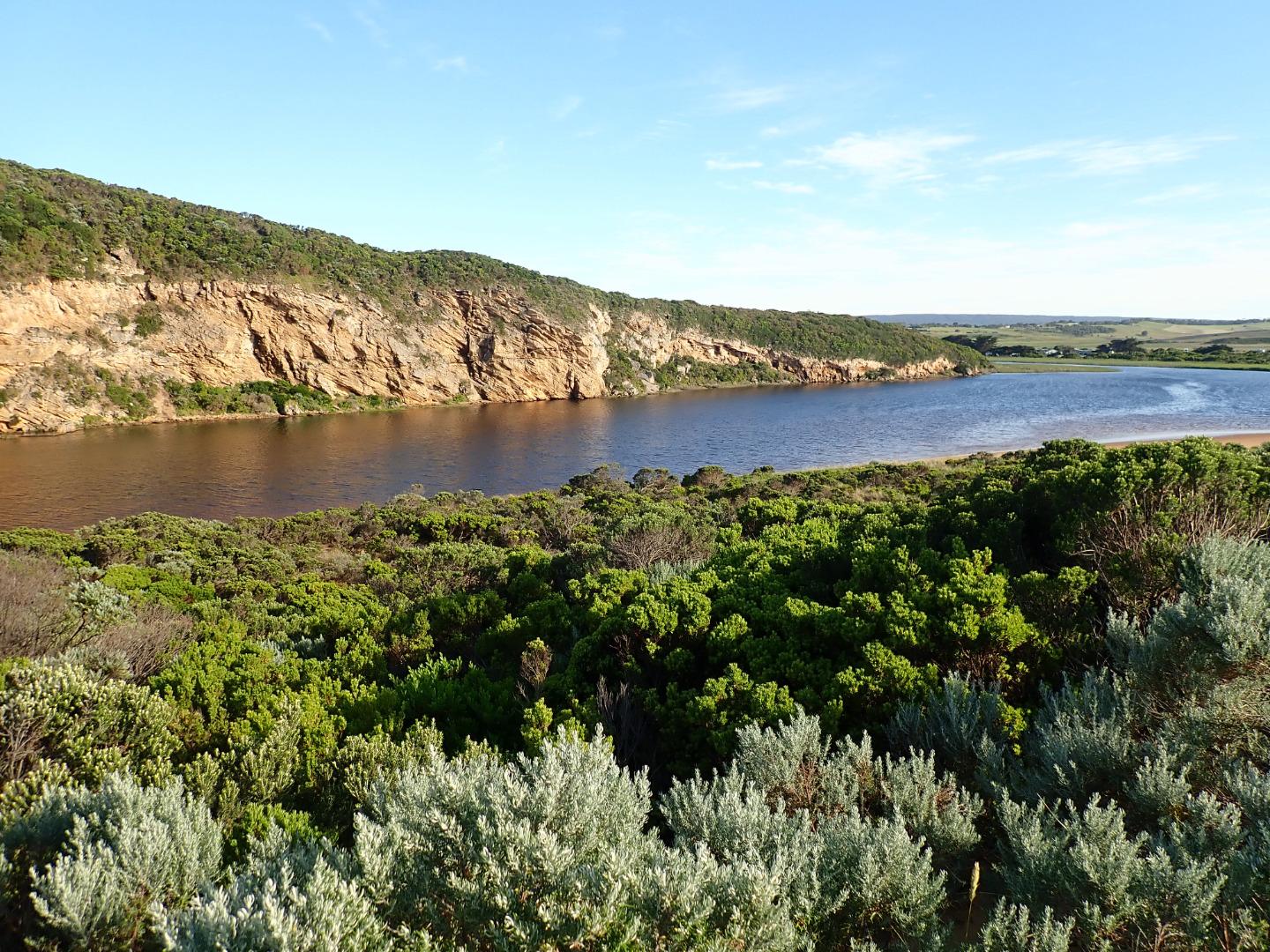
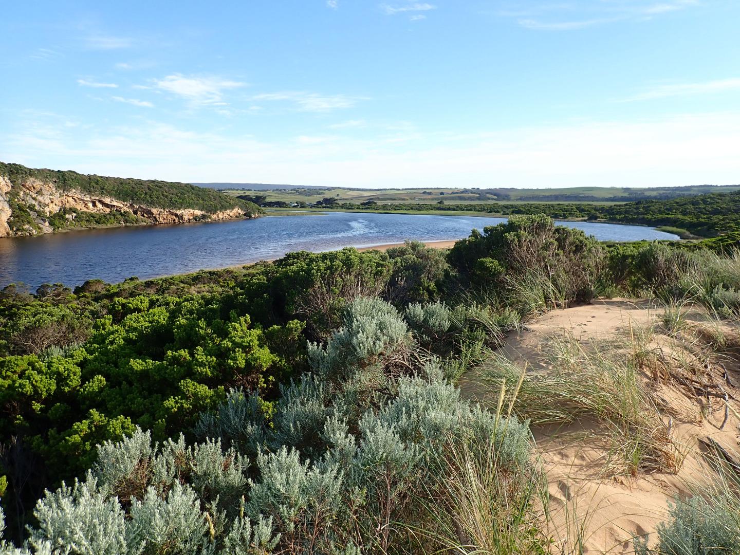
GMC Gellibrand River Estuary Mouth Observation Site
Active Mouth Condition 20-04-2007 - 16-02-2024Gellibrand River Estuary
| ID | Date | Status | Details | |
|---|---|---|---|---|
| #16040 | 16 Feb 2024 | Pending |
Notes:
Sandi Stannard also present |
|
| #16036 | 19 Jan 2024 | Pending |
Notes:
Sandi Stannard also present |
|
| #15954 | 22 Dec 2023 | Pending |
Notes:
River outflow tannin rich |
|
| #15870 | 17 Nov 2023 | Pending |
Notes:
Dead baby seal washed up beside river mouth Sandi Stannard also monitoring |
|
| #15820 | 20 Oct 2023 | Approved |
|
|
| #15750 | 15 Sep 2023 | Approved |
Notes:
Wind gusting up to 4 on Beaufort Scale |
|
| #15724 | 25 Aug 2023 | Approved |
Notes:
Thick layer of river reeds across much of track to beach Water surging back and forth at AHD meter at start 0.64-0.68 |
|
| #15674 | 21 Jul 2023 | Approved |
Notes:
Flow in and out along separate channels-river flow on west side, sea inflow on east. Brown river discolouration of sea less extensive than last month Long wave crests surging into lagoon |
|
| #15589 | 16 Jun 2023 | Approved |
Notes:
Wind gusting Extensive brown discolouration in river and sea Strong longshore drift and long small waves well up into estuary |
|
| #15536 | 19 May 2023 | Approved |
Notes:
Gentle wind gusts |
|
| #15492 | 21 Apr 2023 | Approved |
|
|
| #15381 | 24 Mar 2023 | Approved |
Notes:
Forgot to check AHD on way out-sorry! |
|
| #15288 | 10 Feb 2023 | Approved |
Notes:
AHD estimate only-scale covered with dirt |
|
| #15258 | 21 Jan 2023 | Approved |
Notes:
Unable to read actual water level as board very dirty at bottom. <0.4 at start and finish Wide beach in lagoon causing narrow shallow point in estuary inside mouth Outflow had deep segment next to rocks and shallow segment next to beach Narrow channel at mouth on far side of rock trio with fast outflow Large area of very brown sea at mouth Pronounced longshore drift
|
|
| #15184 | 16 Dec 2022 | Approved |
Notes:
Large sandy beach on lagoon Extensive brown discolouration out to sea Longshore drift Difficult to read AHD-very dirty, markings not visible |
|
| #15152 | 22 Nov 2022 | Approved |
Notes:
Strong southerly wind gusts Sea extensively+heavily coloured with dark brown matter from river
From admin: Observations likely taken on Fri 18/10/22 not 22/10/22 |
|
| #15090 | 21 Oct 2022 | Approved |
Notes:
Large clumps of reeds on beach. 4m pole with worn surface+bolt lying on beach. Also big log on beach. Sea dark brown over wide area+waves breaking have brown discolouration. Water flowing in both directions through mouth. Clumps of foam on water in estuary. Fish seen jumping in lagoon. Extensive sea mist.
|
|
| #15028 | 16 Sep 2022 | Approved |
Notes:
Fairly narrow mouth but widened out quickly at dunes. Gentle slope down to river at mouth with clumps of reeds. Large tongue of sand behind dunes. |
|
| #14960 | 19 Aug 2022 | Approved | ||
| #14911 | 22 Jul 2022 | Approved | ||
| #14696 | 19 May 2022 | Approved |
Notes:
AHD posts removed due to planned bridge replacement. Water level high, almost up to jetty. No sandbank. Wide estuary mouth, narrow river outflow channel Large clump of ?reeds ?seaweed in lagoon I forgot to record tide heights |
|
| #14634 | 22 Apr 2022 | Approved |
|
|
| #14615 | 18 Mar 2022 | Approved |
|
|
| #14831 | 14 May 2021 | Approved |
Notes:
Access track partially underwater  |
|
| #13649 | 20 Mar 2020 | Approved |
Notes:
Mouth closed but an illegal opening occurred on 19-03-20 which created some outflow out for a short period before the channel closed up again by early am 20-03-20 About .30m of last rock above water level at start of river Water over increased area of top track, low track has water up to ocean car park. Campground has no visible water but very small puddle on north side of OCR before bridge. No water visible on G.O.R. Small area of shallow water flowing from river is travelling north across OOR - vehicle access was still possible      |
|
| #13608 | 7 Mar 2020 | Approved |
Notes:
Observation taken @ low tide Sand height has increased between mid beach & mouth. Beach shape has changed, higher @ mid beach with broad projection extending slightly out to sea, while area towards mouth is higher - the area to east is lower & undulating. A sandbar is running parallel to shore about 40m. out, starting from the projection & continuing close to mouth Upstream flats up to G4 are starting to flood . No water over OOR nor in area upstream G4 apart from small area between G5& G4 |
|
| #13605 | 1 Mar 2020 | Approved |
Notes:
Observations made @ Low tide River perched-some waves going up into river with return to ocean. Waves occasionally overtopping all along beachfront. Previous very rough seas have over topped beach front & travelled down wide shallow depression behind entering river channel on both sides of rocks - action of backwash to ocean has reduced height of beach front near mouth & created a very low gradual rise up to the start of the river Seal on Princetown beach 02-03-2020   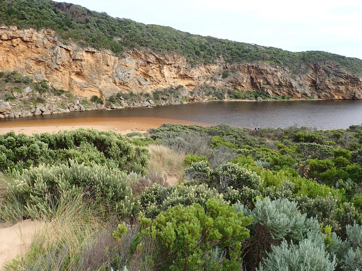 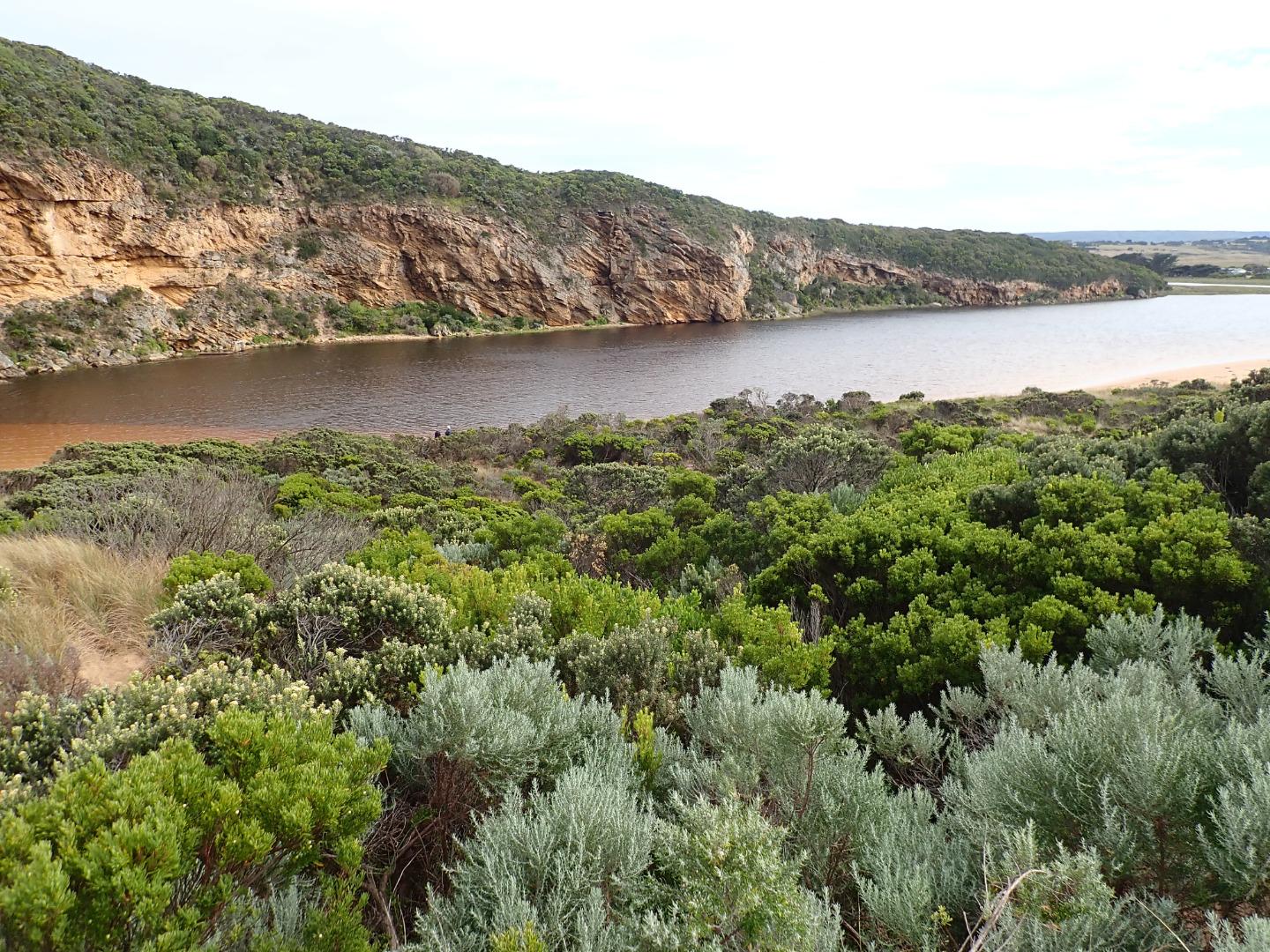 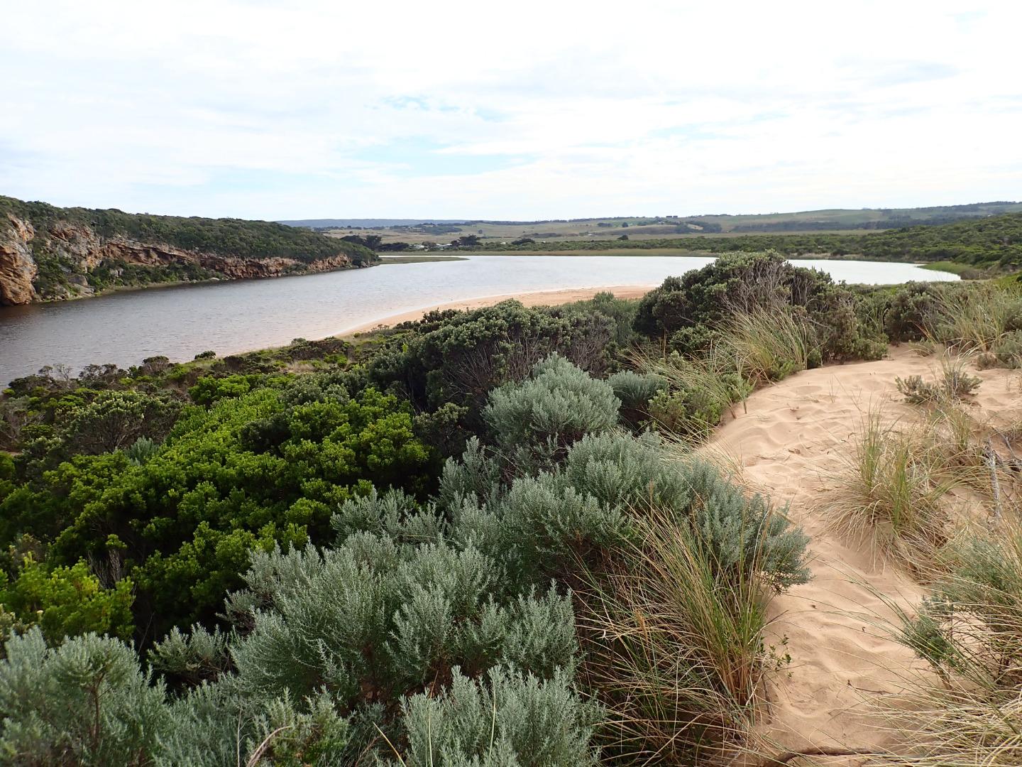 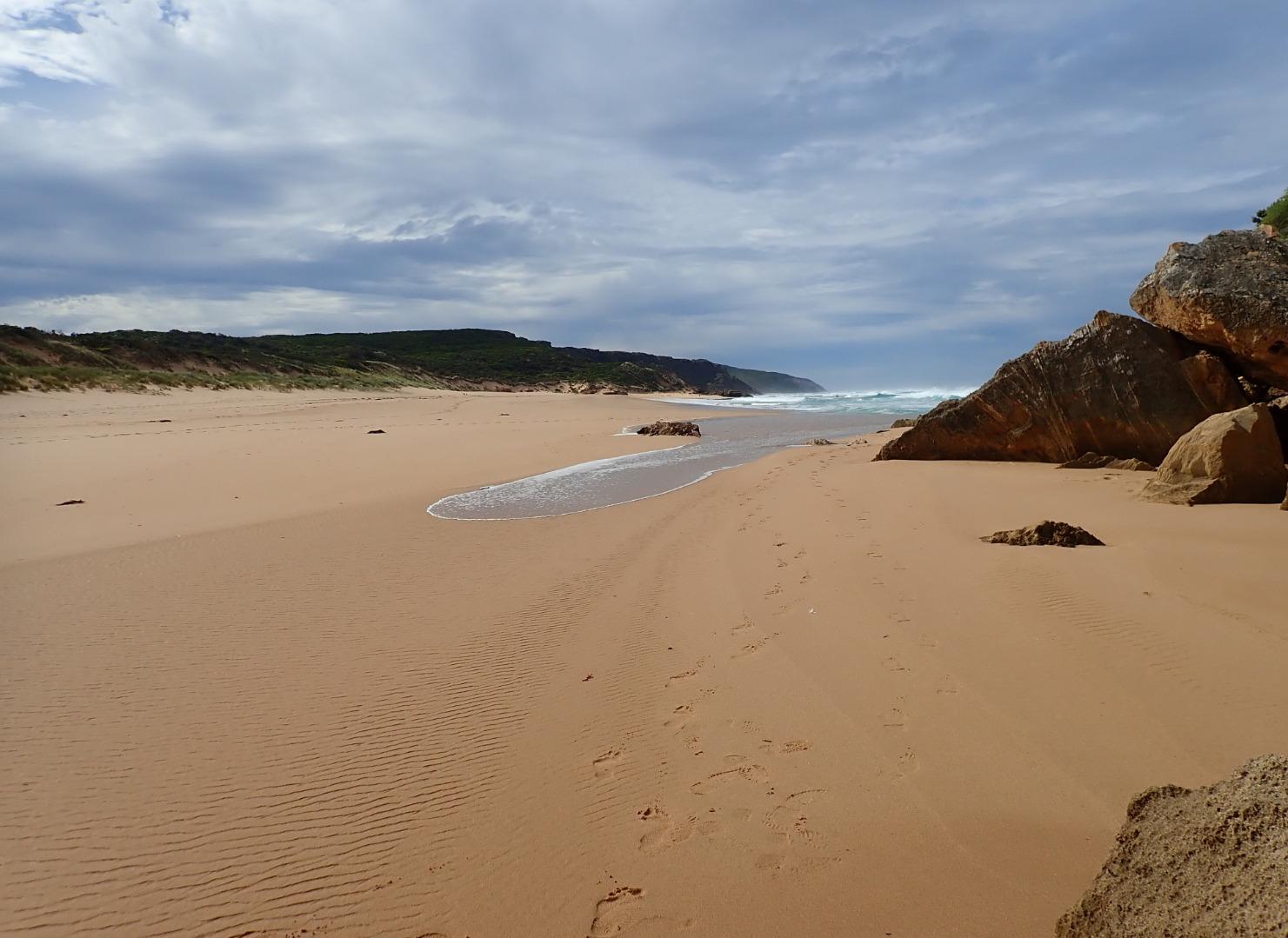   |
|
| #13586 | 21 Feb 2020 | Approved |
Notes:
Reducing outflow carrying a large amount of sand. Then travelling along foreshore to east Also lighter discharge going to west.Height of beach from mid beach to mouth has increased but from mid beach where it is highest to east the end it is much lower. Waves from last high tide have been overtopping & travelling along a wide shallow depression to enter channel around rocks. Sheer east side to channel near mouth indicates a strong flow at last change of tide      |
|
| #13606 | 11 Feb 2020 | Approved |
Notes:
Fast flow out from receding tide & reduced wave height. Slight discharge to east. Mid beach highest area -undulating to east end. Depression between beach front & dunes remains.Waves have been travelling down this area & entering river channel on both sides of rocks (confirmed by swash line) Heavy wet fog with poor visibility Large patches of seagrass & algae along SE & E side of lagoon. Large areas of algae forming in Latrobe creek wetlands 1 dead flounder near river channel -stranded         |
|
| #13552 | 27 Jan 2020 | Approved |
Notes:
Strong longshore drift meeting outflow & incoming SW swell =large waves across entrance with some covering rocks & going up channel into lagoon. Overtopping waves at east end of beach have created a wide depression between beach front & dunes. Tidal range for 27-01-2020 was between 1.13 @ 02:33 & 0.17 @ 19:57 |
|
| #13551 | 24 Jan 2020 | Approved |
Notes:
Very shallow outflow out over increased sand build up at entrance & along channel. Very rough sea with occasional very high waves creating back wash & strong longshore drift which meets incoming SW swell & slight outflow = some small waves entering along east side of channel. Beach front very high at east end of beach but over topping waves have made a very large pool in the wide lower area between it & the dunes, this wide area extends west towards entrance. Bittern was sighted near flood markers on Old Ocean Road on 19-01-20 (Mark Cuthell) |
|
| #13512 | 17 Jan 2020 | Approved |
Notes:
Very pale discharge out only around the mouth. Increased sand build up at entrance & along channel. Flow very shallow & narrow except where it becomes very wide downstream of rocks. Occasional long shore drift across entrance & some small waves entering & travelling along east side of channel into lagoon Very large no. of small 2-3 cm. fish + a few larger ones in shallow water along east side of lagoon 16-01-20- extremely thin dead Petrel washed up on ocean beach      |
|
| #13494 | 7 Jan 2020 | Approved |
Notes:
AHD board @ G6 covered with silt -unreadable Very pale narrow, shallow outflow curving to east out over high sand build up. Waves & longshore drift impacting across entrance. Large amount of sand visible moving in flow down channel. Sand bar exposed also very large sand area projecting into lagoon south side of lagoon. Edge of channel directly downstream of rocks has sheer east side Sand high & projecting out to sea @ mid beach & continuing on to east end. Waves have overtopped beach front in this area & run down shallow channel in sand towards entrance |
|
| #13468 | 19 Dec 2019 | Approved |
Notes:
AHD board @ G6 covered with thick silt -Unreadable Dark discharge flowing out over an increased height of sand buildup around mouth & to south. SW swell impacting on west side of sand projection mid beach creating backwash & longshore drift which is mixing with incoming swell causing small waves up to rocks then low against east side of channel continuing around & across front of large sand projection to SE corner of lagoon. Area east of 1st rock has been filled with sand & water only flowing through narrow gap between !st & 2nd rock with a larger area of flow against cliff. Very low tide has exposed large areas of sand on ocean beach & in lagoon where areas of algae occur along east side of lagoon. Algae is also covering areas of both west & north wetlands |
|
| #13453 | 13 Dec 2019 | Approved |
Notes:
AHD G2 0.50 AHD G6 1.00 @ 11:45 Outflow reducing - dark discharge only around entrance & south out to sea. Sand has built up in channel & at mouth. As a result of wave impact & recent short time swell times the beach has dramatically changed with very high /wide build up of sand projecting a long way out to sea from about 50m from entrance to east end.This build up has high front to sea & a large depression behind the front extending towards dunes. South west swell is impacting on start of projection & causing some longshore drift back to west across the mouth. The beach from the start of the projection to mouth is lower & has formed a bay |
|
| #13429 | 22 Nov 2019 | Approved |
Notes:
Dark discharge out mainly around the mouth -slight paler water along shoreline. SW /WSW swell = occasional longshore drift to mouth creating small waves along east side of channel into the lagoon. Mid beach has 2 high areas of sand the most easterly one projecting out to sea. Waves going over this have created a small area of retained salt water further up the beach. Beach is undulating N/S with depressions allowing waves to go further up on beach & scour out sand with backwash Sand on south side of lagoon well exposed extending far into lagoon. Separate sand bar closer to G2 is also exposed. The area on east side has a very large amount of green algae covering dying sea grass. Latrobe wetlands also has algae over most of the water    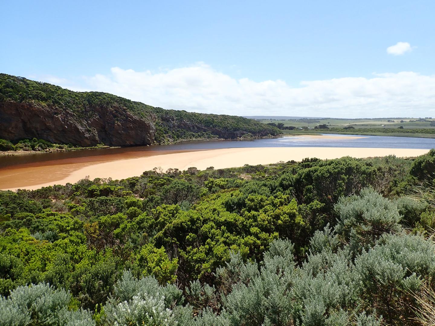 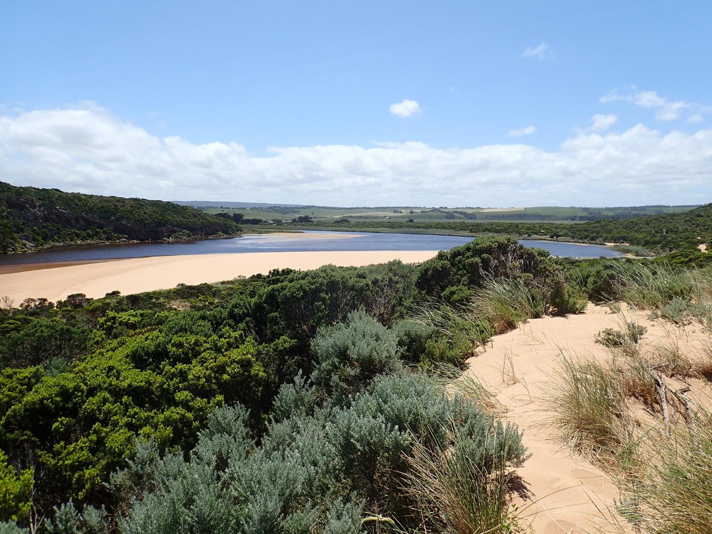 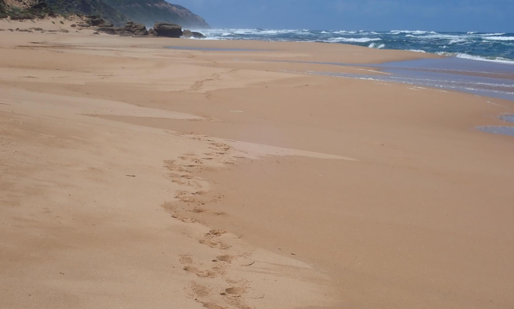 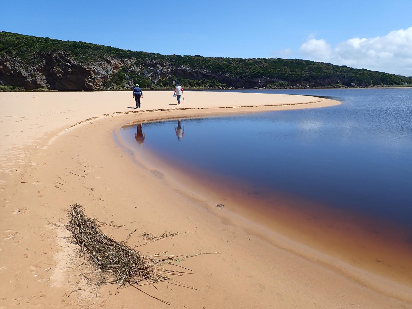 |
|
| #13408 | 13 Nov 2019 | Approved |
Notes:
AHD G6 2.64 @ 14:50 Dark discharge mainly around mouth, paler going east along foreshore.SW swell 14-13 sec impacting most of the beach except for around the mouth which is receiving the resulting longshore drift crossing & producing small waves down channel where sand being carried in outflow is visible. Beach has many wide deep north/south depressions caused by wave impact & backwash Very large area of sand extending north into lagoon but sand bar is not visible Extremely large number of Bluebottles in swash line all along beach       |
|
| #13395 | 10 Nov 2019 | Approved |
Notes:
AHD G6 3.24 @ 14:28 Very dark strong discharge out around the mouth for about 100 m. also continuing a long way to the east along the shoreline. Eastern end of beach covered with dark silt. The strong outflow has created sheer east side to channel about 1 m. high above water level (87 ml rain @ G6 over past 8 days). Beach is undulating & scouring areas especially at mid beach where backwash is taking out a lot of sand -waves in all directions at this area creating occasional longshore drift across mouth. Large amount of sand build up remains downstream of rocks but is being covered by outflow & entering waves. More erosion on east face of Pt. Ronald. Large areas of deep flood water covering large areas from G4 & G5 (also some between G5 &G6) but very little downstream G4. OOR only had slight flow across near flood markers (run off only. |
|
| #13382 | 5 Nov 2019 | Approved |
Notes:
AHD G6 1.29 @13:20 Outflow reducing but dark discharge out around mouth & along foreshore to the east. More sand visible in channel & larger build up down stream of rocks . Occasional longshore drift across mouth. Sand is wide & high at east end of beach with a slight bay forming Low tide - sandbar in lagoon slightly exposed. Large amount of rotting vegetation along waters edge east side of lagoon also remains of dead Wallaby/Kangaroo? |
|
| #13383 | 18 Oct 2019 | Approved |
Notes:
AHD G6 1.64 & 08:30 Some flow out but difficult to access Gp1 site because of near gale force gusty wind from NW. Wind coming in all directions depending on location - but mainly across lagoon to SE cr. Very strong down channel driving large amount of sand into sea. Very high & low tides during 18-10-19 with SW/WSW swell of between 12-13 secs. duration impacting mainly @ east end of beach creating longshore drift to mouth where backwash was rolling sand all along the edge of the channel Only 1 photo because of conditions  |
|
| #13361 | 12 Oct 2019 | Pending |
Notes:
AHD board unreadable unusual conditions with ESE swell 6-7 sec time duration. Very low water levels uncovering a very large sand build up in lagoon. Outflow very shallow over large wide area at entrance but channel deeper upstream rocks. Continual longshore drift across mouth. Beach front very high at mid beach |
|
| #13336 | 20 Sep 2019 | Approved |
Notes:
AHD G6 about 2.20 G2 about 0.28 AHD boards covered with silt & debris = estimate only Dark discharge out around mouth, along foreshore turning out to sea at eastern end of beach. Moderate SW swell impacting east end of beach & longshore drift across entrance -sand has built up higher at mid beach.. Low tide has exposed sand bar in lagoon also decaying vegetation scum covering sea grass along edge of low track. North wind is driving waves into SE corner of lagoon. Continuing erosion occurring on cliff face
|
|
| #13274 | 23 Aug 2019 | Approved |
Notes:
Reduced dark discharge out alongside foreshore extending far to the east. High seas earlier this week have created a high beach area at mid beach & increased sand build up at entrance. The east end of the beach has been scoured out & is lower than previously. Waves from rough sea are impacting on beach creating strong longshore drift that goes over the outflow creating small waves that travel up channel into lagoon Flood water is draining but levels remain high upstream G4 Dead Shearwater on beach near entrance |
|
| #13273 | 16 Aug 2019 | Approved |
Notes:
AHD G6 -flood level over top of pole Dark discharge out along foreshore to east. Strong & dark along channel -east side about 30-50 cm sheer face. Waves impacting high on beach causing longshore drift to cross over top of discharge & send small waves down east side of channel & enter lagoon Heavy rainfall has caused deep extensive flooding upstream of G4. but none affecting OOR down stream |
|
| #13243 | 10 Aug 2019 | Approved |
Notes:
AHD G6 2.50 @ 10:53 Dark discharge out to east along foreshore. Waves occasionally going very high up on beach. Very strong longshore drift going over top of outflow & impacting on cliff face. Wind gusts of over 7+ carrying sand off the beach into channel & lagoon. Wind much stronger along beach but more sheltered from SW near cliff 51 ml rainfall recorded @ G6 from 07-08-19 to 11-08-19  |
|
| #13242 | 7 Aug 2019 | Approved |
Notes:
AHD @ G6 1.93 @ 09:32 Dark discharge out along foreshore & continuing to east. Waves from last hi tide have been well up on beach where more sand has built up at mid beach with wide depression between there & east end. More sand has also built up along east side of entrance. Because of low water levels large areas of sand have become exposed in lagoon & inlet pipe on auto monitor at G2 is well above water level. Waves from longshore drift across entrance are crossing over outflow & combining with WSW/SW swell resulting in very small waves entering channel around rocks. Erosion continues on S & SE face of Pt Ronald. Large build up of algae or duck weed? at west side of northern wetlands below township.  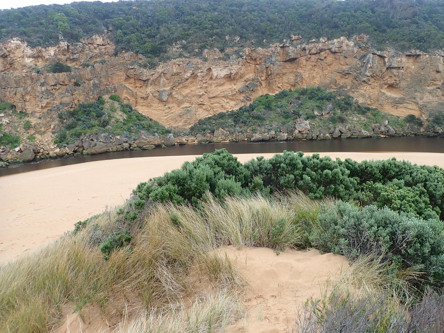 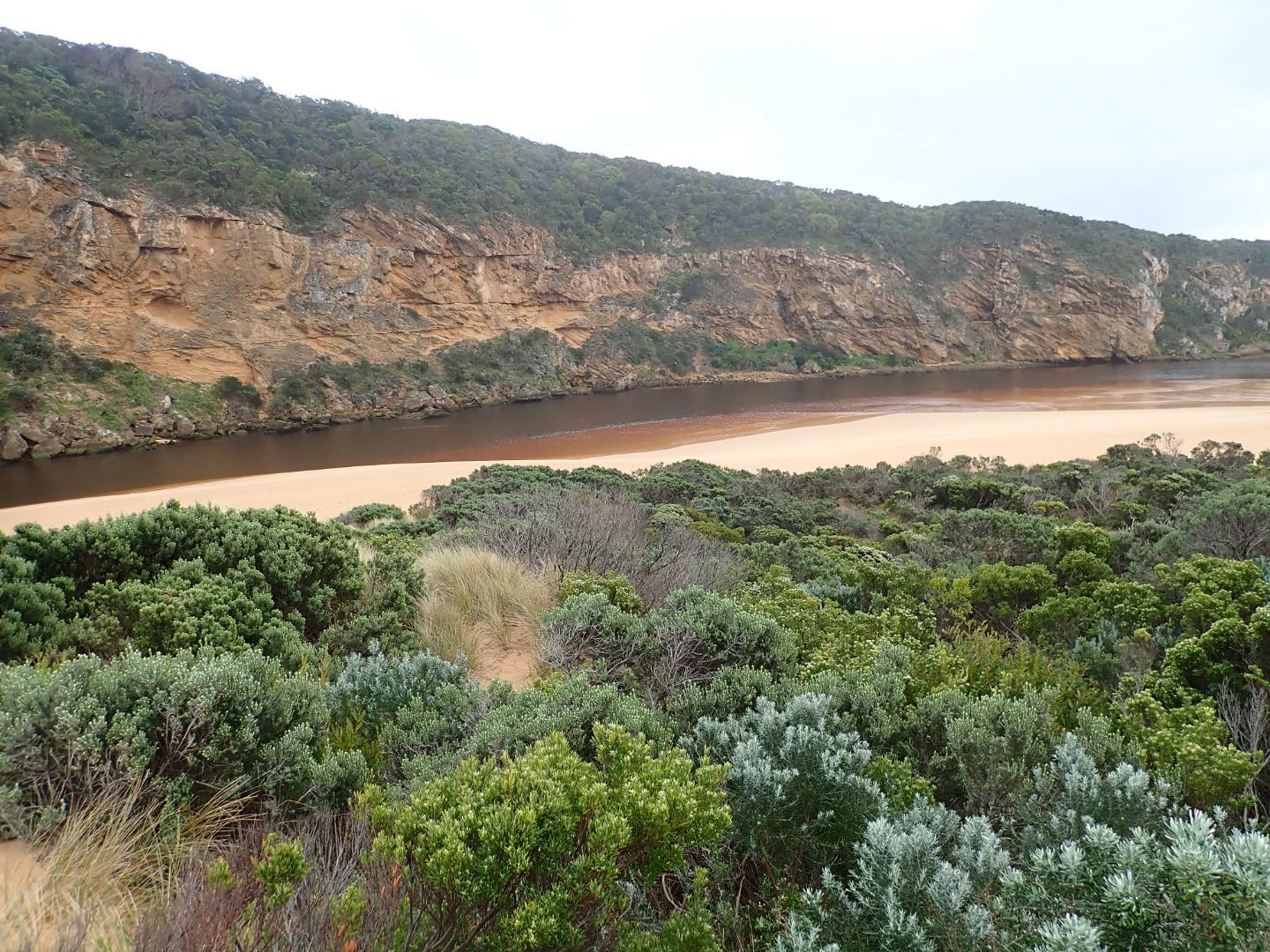 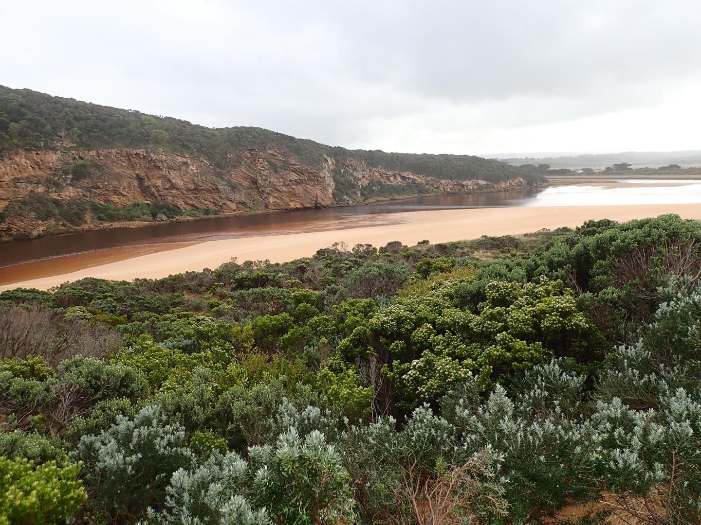 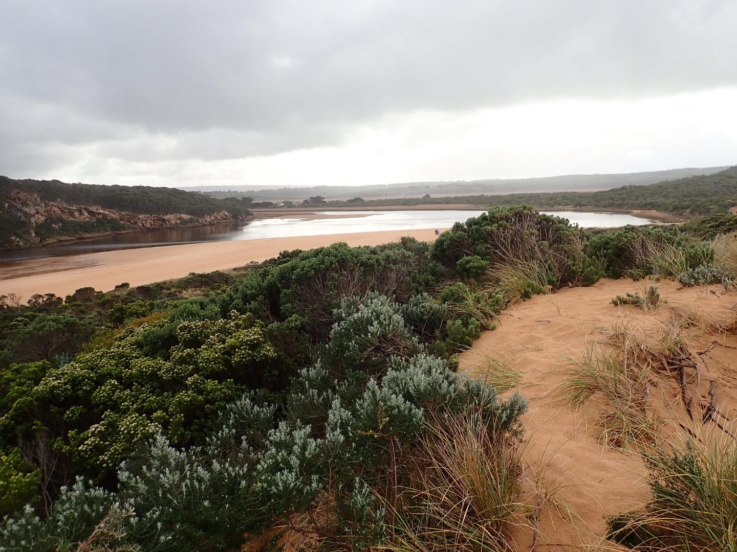 |
|
| #13227 | 28 Jul 2019 | Approved |
Notes:
AHD G6 2.73 @ 09:44 Flats upstream of G4 have deep water cover but down stream G4 flats have very little water Dark discharge out along foreshore to east, small waves entering along east side of entrance/channel into lagoon with some longshore drift occurring. Large amount of debris has been cast up on the side of low track & new scour holes have been created by backwash caused during storm surge on 23-07-19. Sand has now become higher around east side of entrance & edge of channel now slight gradual slope |
|
| #13226 | 23 Jul 2019 | Approved |
Notes:
South west swell with HIGH seas - some waves over 7m. impacting beach & entrance, travelling completely across channel into lagoon where part of surge turns to east & very strongly impacts on east side of low track rising high into vegetation. More of the surge continues to north then turns west to rise high & wash over the fishing platform at G2. Backwash from initial impact on east side of lagoon travelled directly across & impacted on western cliff face     |
|
| #13208 | 19 Jul 2019 | Approved |
Notes:
Very strong dark discharge out around mouth & to east, increased flow caused by very low tide 0.17 @ 06:31 - large amount of foam over exposed rocks & beach at east end of beach. Despite strong outflow waves are entering & travelling down sheer east side of a 25-30m. wide channel (.50-1.00m high) which is collapsing into the flow. At the start of the lagoon waves turn sharply east travelling over the increased sand build up resulting from recent very rough seas. Waves in all directions at entrance & large amount of sand moving in the flow along the channel. Area directly around mouth has been lowered & more of the old breakwater post has been exposed |
|
| #13210 | 30 Jun 2019 | Approved |
Notes:
G6 AHD 2.24 @ 10:38 Slight pale discharge around mouth & only a short distance to east but very rough sea going high up on beach & entering wide across mouth. Impact of W/WSW swell causing strong longshore drift across mouth. Wind from north @ Gp1 site but in many directions around lagoon & beach. North wind over 6 blowing sand along channel into sea 36 ml. rain on 29-06-19 but no water over any roads or tracks except low track. |
|
| #13209 | 27 Jun 2019 | Approved |
Notes:
AHD estimate only as board is covered with algae & silt Pale reducing flow out around mouth & slightly to east. Very low water level with large areas of sand exposed in the lagoon. Previous sand projection & sand bar uncovered |
|
| #13165 | 21 Jun 2019 | Approved |
Notes:
Low water level because of tide & reducing flow, dark discharge around mouth with small waves entering & going upstream across the lagoon on G2. East side of channel is sheer sided (up to about .40 high at start of channel) Remains of the previous sand projection going north into the estuary was visible because of lower water levels No water over any tracks & flood water has drained from flats around G4, but remains from midway between G5&G4 up to G6  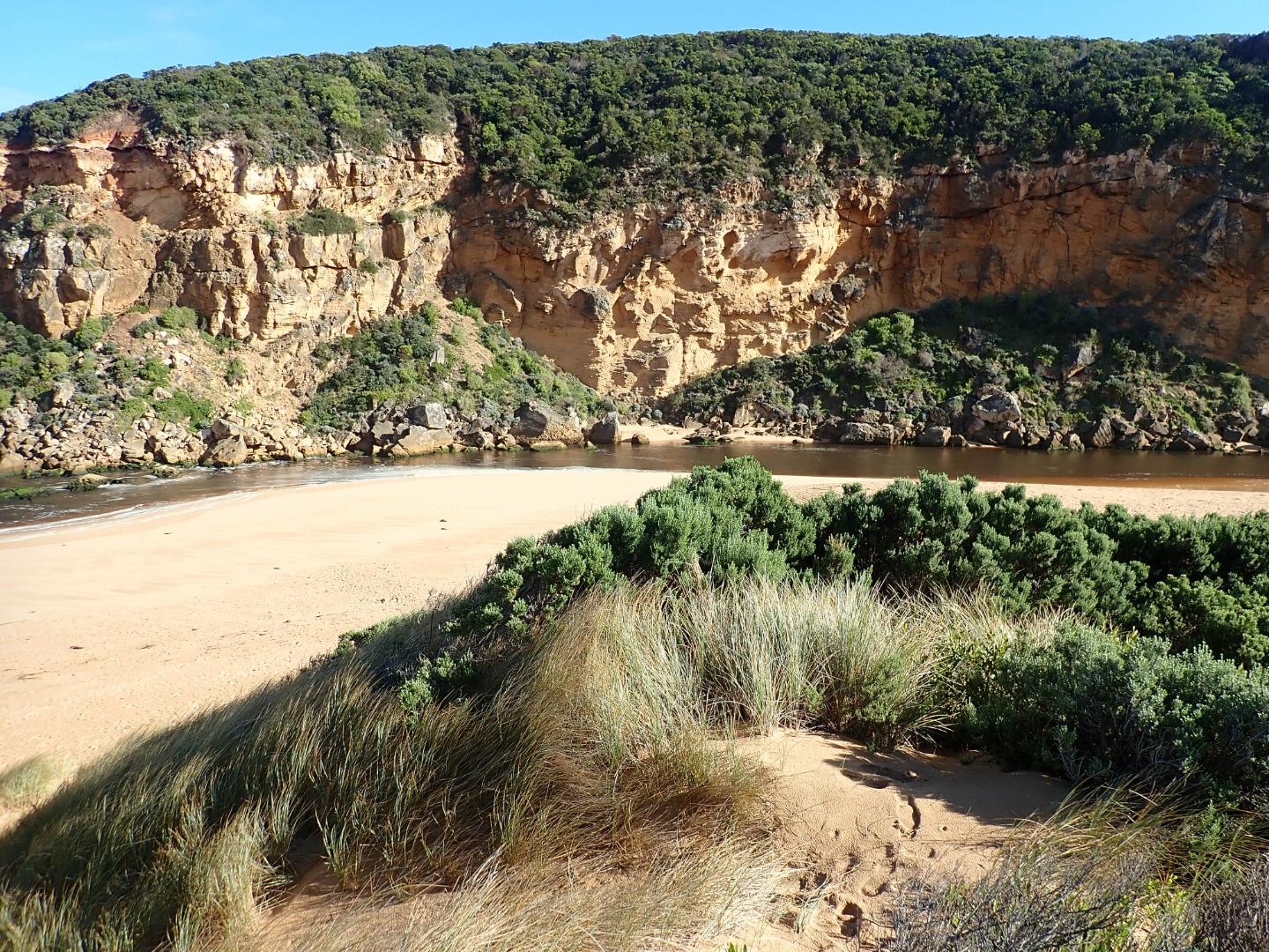 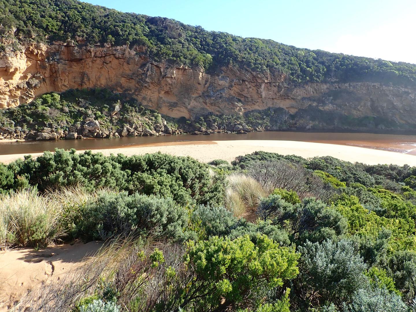 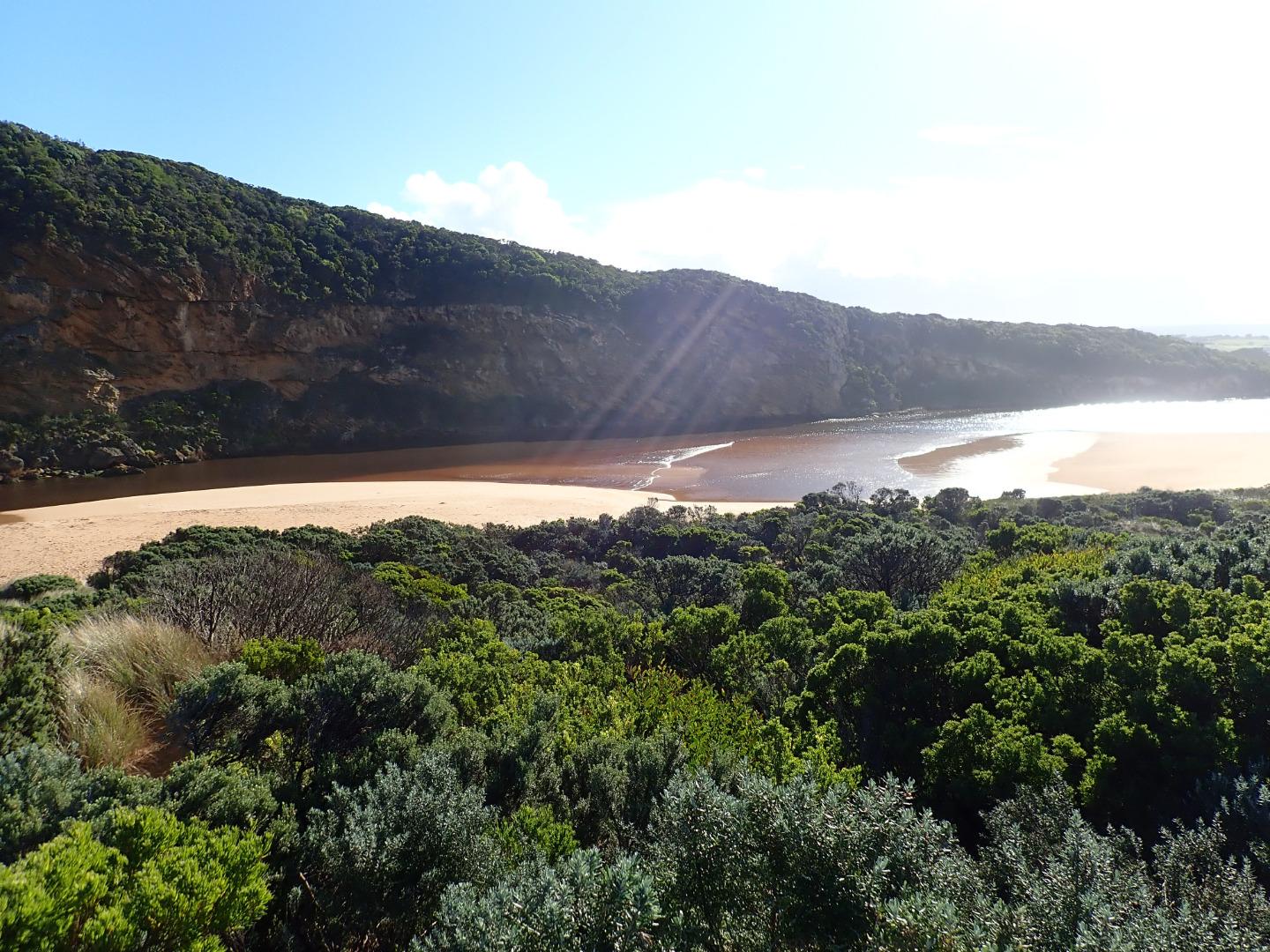 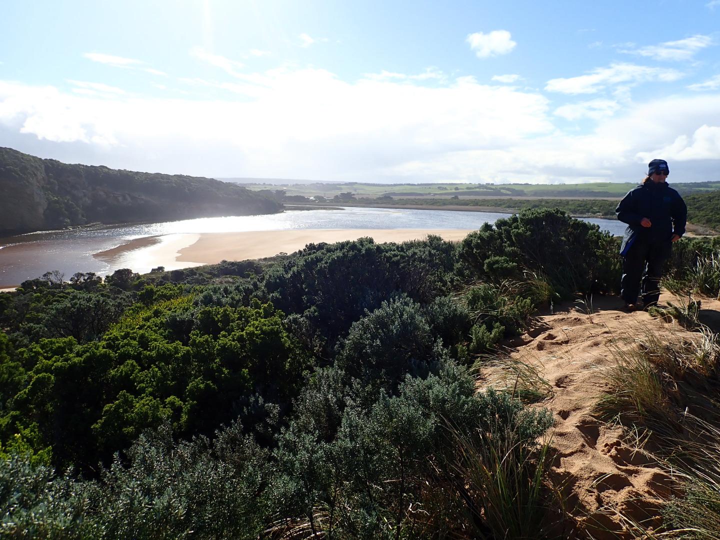 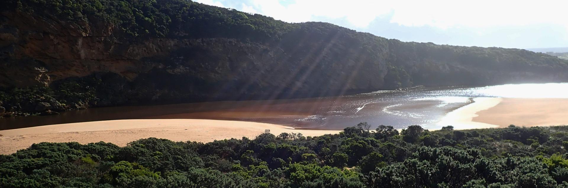 |
|
| #13135 | 14 Jun 2019 | Approved |
Notes:
Strong dark outflow from lagoon along wide channel out around mouth & to east. Rough sea sending waves high up on beach resulting in strong longshore drift which continues to scour sand from beach area around mouth which is now lower. Both ends of channel are very wide - most of previous sand projection into the lagoon has been removed but an area remains further to the east. Despite heavy rainfall the flats downstream G4 are draining but extensive flooding occurs upstream to G6. No water over roads or tracks apart from low track which has water only in very low areas |
|
| #13077 | 17 May 2019 | Approved |
Notes:
Mouth open with rocks well exposed, sea moderate but higher waves breaking on sand bar, active longshore drift across with some waves entering up channel into estuary scouring out sand at east side. Large tongues of sand projecting into lagoon -exposed areas in new formation in front of tunnel |
|
| #12901 | 3 May 2019 | Approved |
Notes:
AHD G6 1.42 @ 08:40 Shallow outflow opening wide over sand build up at entrance - very large amount of sand visible under water in estuary extending past tunnel entrance. sea moderate but some high sets breaking on sandbar about 50m. out & going very high up on beach. Occasional small waves from longshore drift & incoming sw swell going part way up channel to where it narrows down to about 2m.wide. Waves are going over top of high sand build up at mid beach (formerly a narrow projection but now extending towards east end of beach) where water then runs east along an area on top of high sand to slightly lower area where abruptly turning towards ocean it scours out narrow N/S channel - very large amount of sand visible in outflow & back wash in ocean at that area Water level in downstream of G2 is high, water over top track & nearly up to ocean car park. No water on any roads but at side of OOR between flood markers & GOR. Flats south side of G4 & downstream have visible water cover - further upstream water from runoff (about 30 ml. on 01-05-19) is only in very low areas & drains 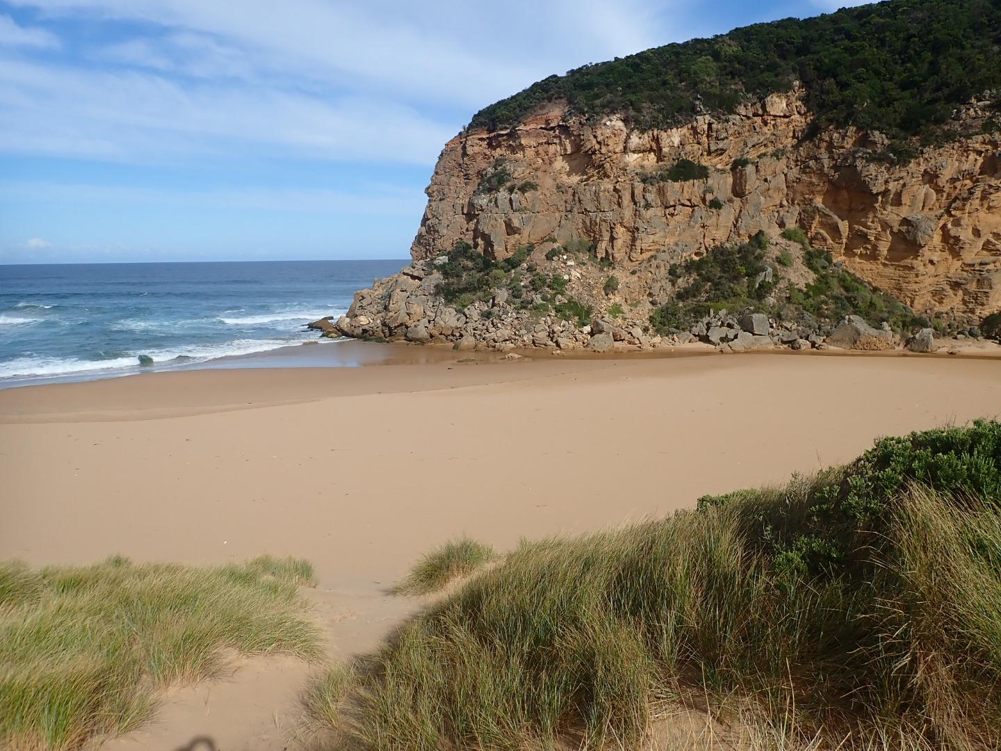 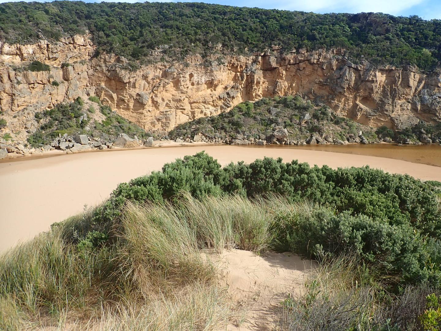 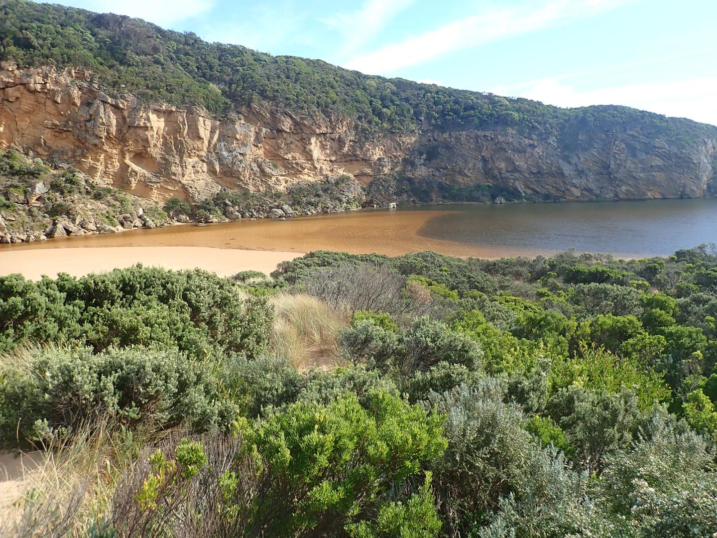 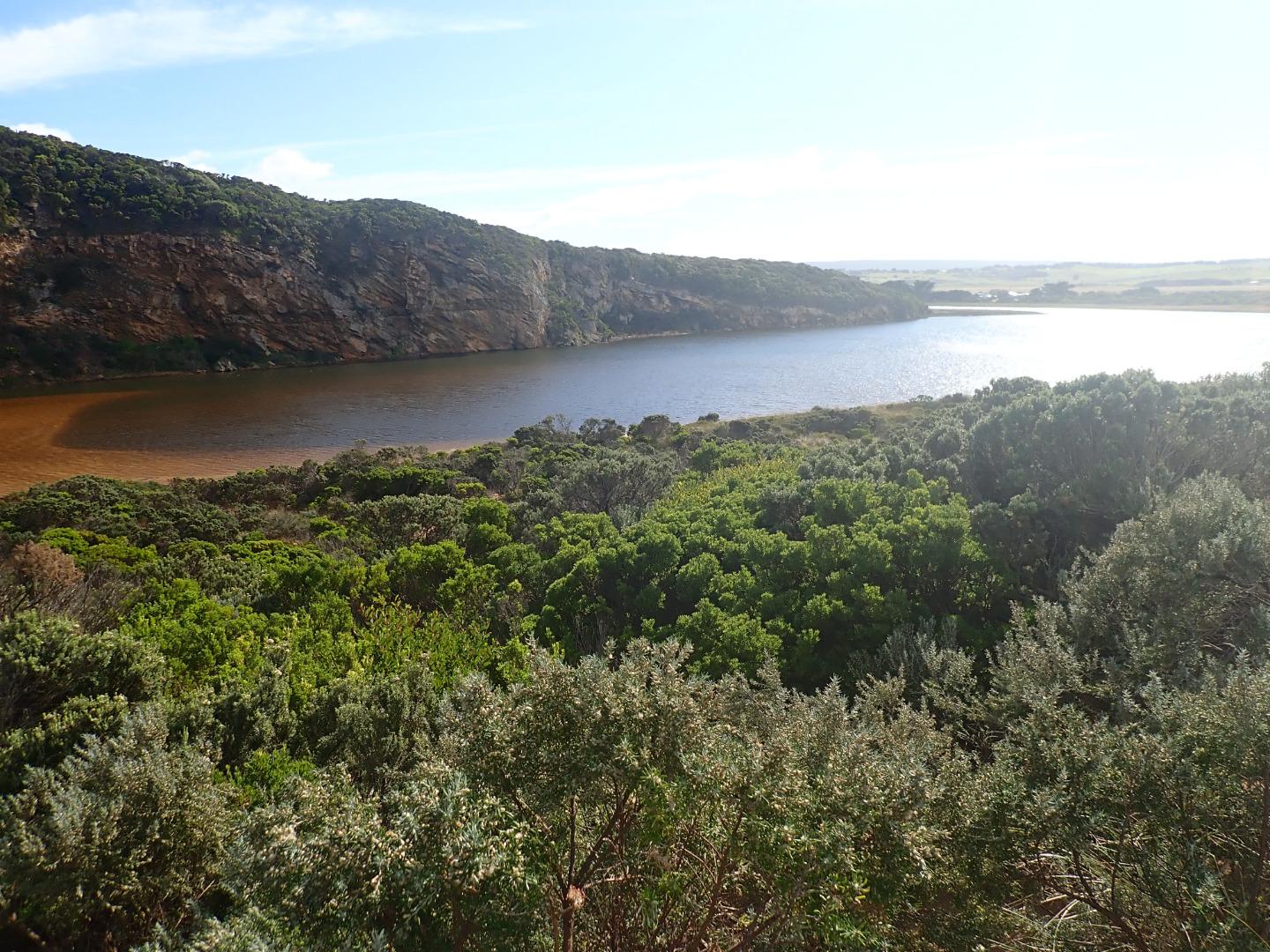 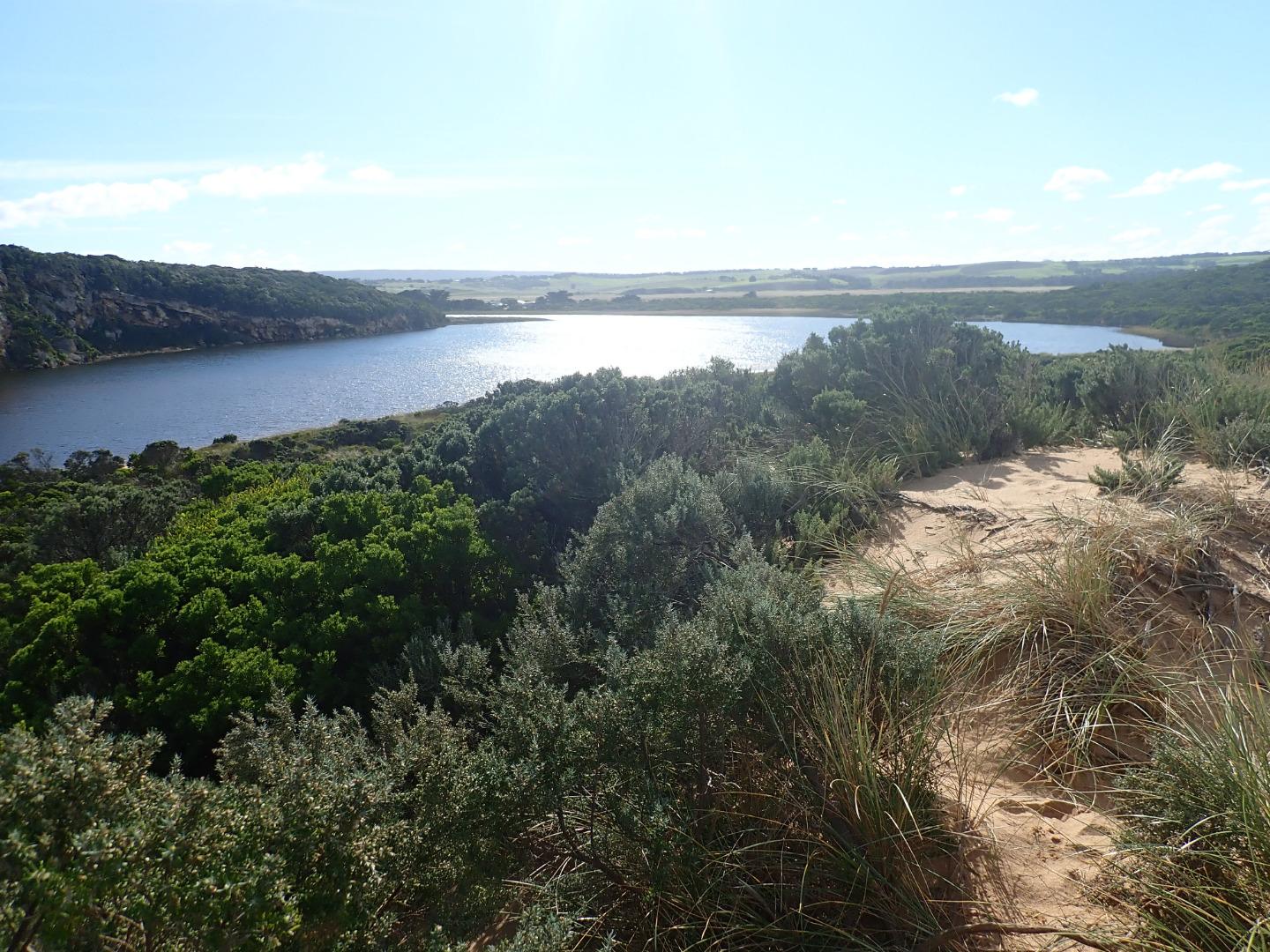 |
|
| #12894 | 30 Apr 2019 | Approved |
Notes:
AHD G6 1.28 @ 11:45 = both G6 & G2 are the same Mouth barred- the actual length of the berm without water is not great but only a very narrow very shallow projection is coming out of the estuary where an extensive sand build up is visible extending well into the estuary almost up to the tunnel entrance. Height of berm from estuary is .10 with gradual slope down to ocean. the recent storm has considerably lowered the beach around entrance & up to the sand spit at mid beach No water over any roads but flats DS G4 have water cover. G2 E.C. from 28.91 @ .10 from surface to 51.5 @ 4m down G4 E.C. 3.057 @ .10 then E.C. 48.88 @ 1.75 down & E.C. 52.3 @ 5.00 Bridge at G2 being repaired |
|
| #12891 | 26 Apr 2019 | Approved |
Notes:
AHD @ G6 about 0.96 @ 13:58 board covered with silt Observations made during hi tide & storm surge - wind from SE 8-9 along beach but even stronger turning down channel Not possible to use Gp1 site so taken from below. Waves entering from high sea combined with a very high tide. No fresh discharge only shallow salt return over high sand build up in channel. Waves going up to base of dunes all along beach & channel. Entering very wide at mouth & completely across channel. SW swell with over 8m waves strongly impacting east end of beach creating very strong longshore drift & backwash. Waves overtopping high part of beach about 50m from west cliff then turning west & around into the channel meeting incoming waves from SW swell also going down creating an extremely strong N-S backwash - also whirlpools at start of estuary, this action has left significant depressions in the sand . The wind action has also sent large amounts of sand from the beach down the channel & into the estuary 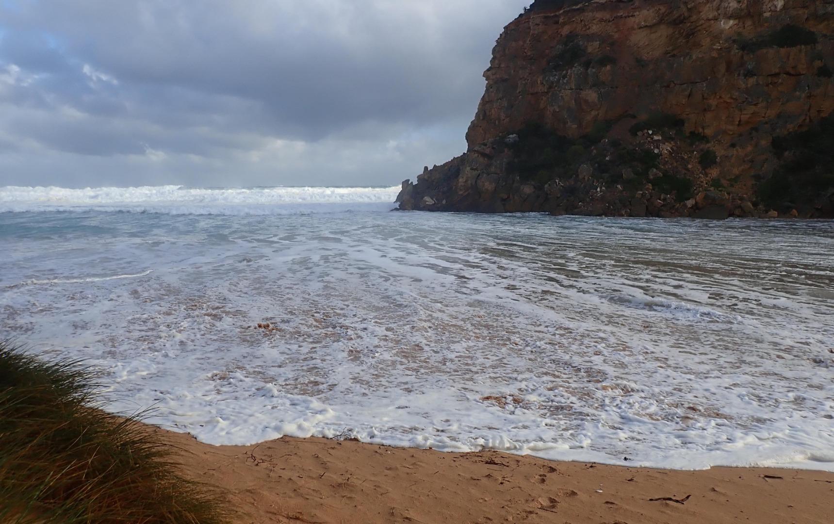 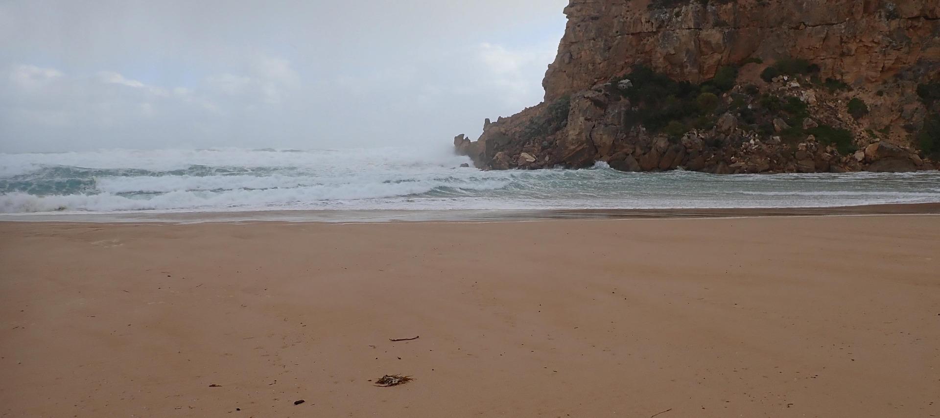     |
|
| #12890 | 25 Apr 2019 | Approved |
Notes:
AHD G6 about 0.78 - board still covered with silt Waves entering across a wide area & travelling down channel into estuary -large amount of green water is visible almost to tunnel entrance & can be seen mixing with darker fresh throughout the estuary. Only salt return occurring over high sand build up in channel. Outflow is very narrow & shallow - often no flow at all. Waves going very high up all along beach & entering very wide at mouth. At 15:50 a very strong longshore drift was visible going across entrance -impacting on west cliff & sending strong waves up channel 1 dead Gannet on beach near entrance & about 10 others feeding in area around the ocean sandbar. 2 dark grey Pacific gulls feeding in estuary |
|
| #12889 | 23 Apr 2019 | Approved |
Notes:
AHD G6 about 0.98 @ 08:40 AHD board still covered with silt Observations made close to very low tide 0.1 @ 07:12 Very pale thin discharge out to sea & along to sand projection at mid beach. Out flow very shallow - channel about 20m wide .5 to .15 deep. at start of estuary. At mid channel it narrows to about 8m.then becomes more shallow & wider around rocks.Flow spreads very wide as waves enter at mouth. East side of channel has .20m sheer face as it approaches rocks. Waves have been high up on beach at last hi tide. A large sand projection has formed at mid beach with area of beach behind scoured out. Strong longshore drift from east end travelling to spit where it meets incoming SW swell -large amount of sand visible in waves going out to sea. Only occasional longshore drift across mouth meeting small outflow & strong sw swell resulting in some waves going up the channel - large amount of sand visible in breakers around mouth. While sea is moderate there are higher wave sets are occurring      |
|
| #12860 | 19 Apr 2019 | Approved |
Notes:
Very pale discharge out (mainly salt water return). Outflow very shallow around rocks & entrance. It is wider but also shallow at start of channel from estuary, the previous high sheer east side of channel has been reduced but sand is a lot higher around rocks. Some waves entering & continuing upstream. Beach rises & falls with deep depressions (N -S direction) -2 bays have formed with a projection out to sea at mid beach. Area at east end has had full impact of previous WSW swell & rough seas extending well back towards dunes. Low water level has exposed large areas of sand on beach but sand bar in estuary is under water. Many very small fish observed in shallow water beside low track.    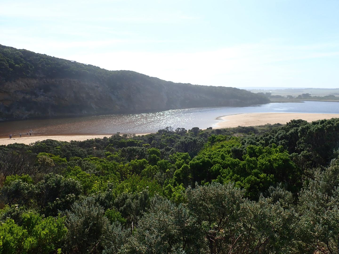 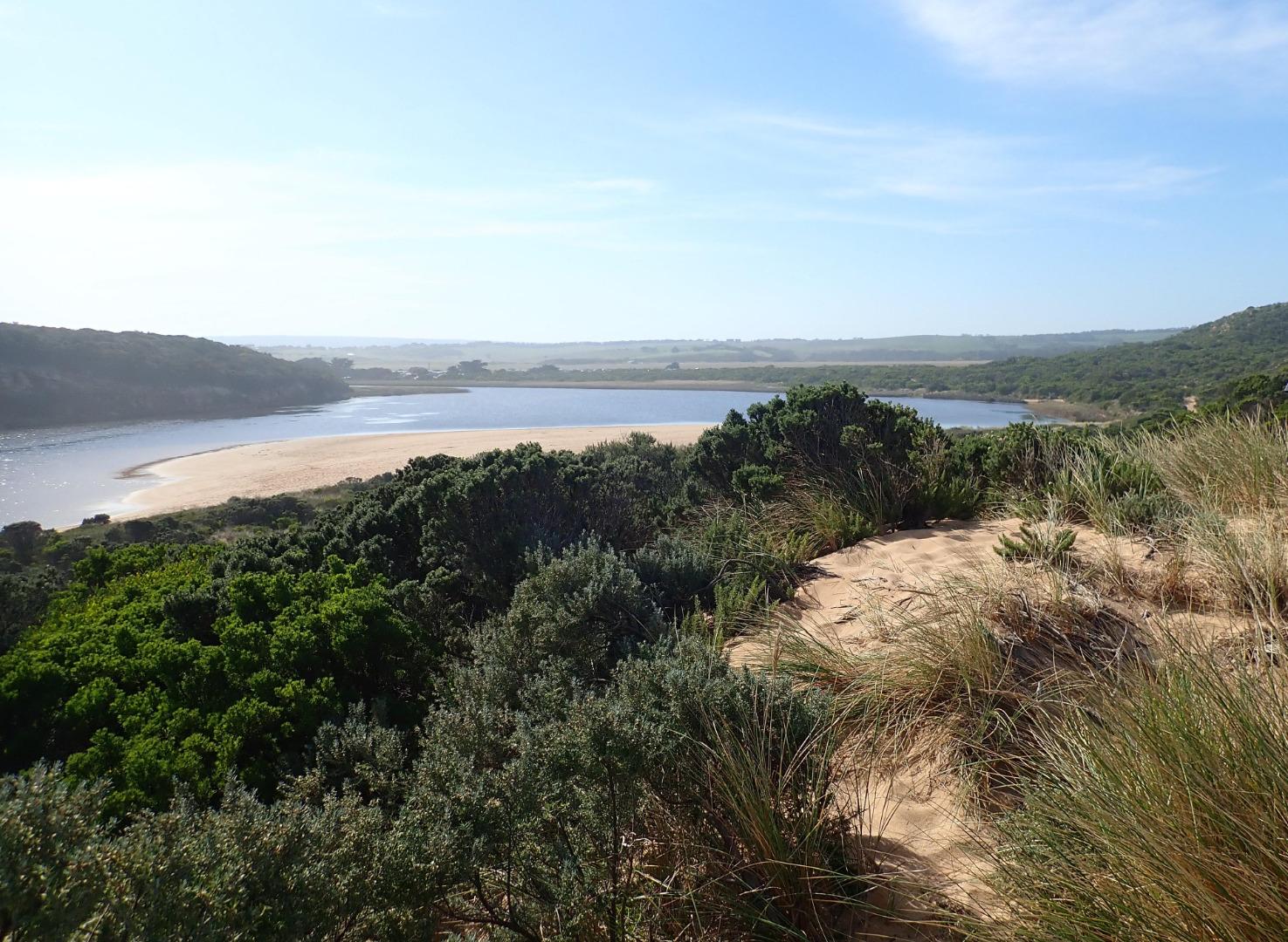 |
|
| #12842 | 9 Apr 2019 | Approved |
Notes:
AHD G6 1.18 @12:20 (estimate only as board is covered with silt) Mouth is open but high seas & SW swell (waves over 6m.) are entering completely across entrance & channel & travelling into estuary as well as going up to base of dunes all along the beach. Waves are up to base of dune at Gp1 site. Only salt water is entering & returning - green water extends into the estuary & well upstream of G2. Waves (some over 2m high) going down channel then turn east at start of estuary but an occasional wave proceeds north alongside of cliff face. Wind about 6 SE along beach but from S along channel gusts are stronger (7). Large amount of sand blowing into estuary as well as being carried in large waves down the channel . In between waves a large amount of sand is visible in channel with only a very slight flow of salt water return down below the side of cliff |
|
| #12820 | 4 Apr 2019 | Approved |
Notes:
Estimated height @ G6 0.68 - board unreadable because of silt build up Dark discharge from reducing outflow around the mouth & to west, pale discharge continuing along foreshore to east. Entrance about 50m wide with sheer sides to channel from 1-2 m. high. Sand has built up on east side of channel -also directly downstream of rock. Longshore drift across mouth over sw swell with backwash return & some waves entering up the channel into the estuary. Waves are going high up on the beach at east end of beach which rises & falls creating some deep areas. Height of beach drops as it reaches the mouth All tracks & roads are without water including low track where an extremely large number of small (1-3 cm) fish were actively swimming. Small fish were observed in all areas of estuary D.O. levels @ G2 have greatly improved with flow going upstream while monitoring |
|
| #12821 | 1 Apr 2019 | Approved |
Notes:
AHD G2 1.47 @ 09:00 1.33 @ 13:20 1.22 @ 15:50 AHD G6 1.52 @13:00 1.42 @ 17:42 On 02-04-19 AHD @ G2 was 0.54 @ 14:00 G6 0.88 @13:43 (estimate for G6 only as board was covered with silt & unreadable) Very wide strong & dark discharge @ entrance, out along foreshore to east then turning south at east end of beach -visible a long way out to sea. Water in the estuary very dark -almost black Channel from estuary over 20 m wide & about 40 m wide @ entrance. Strong & frequent longshore drift across entrance over Sw swell & very strong outflow. Waves entering & continuing along eastside of channel meeting outflow midway creating a whirlpool with a very large amount of sand visible & also building up against edge. Sand was visible in outflow travelling down whole length of channel |
|
| #12822 | 31 Mar 2019 | Approved |
Notes:
AHD G2 1.68 @ 11:45 G6 1.68 @ 11:00 Pale discharge out to east along foreshore - also south out to sea, some going west along front of cliff. East side of channel .50 -1m high, width about 15-20 m wide Very large amount of sand visible being carried out in flow. Strong wind from south blowing sand off beach down channel into estuary Some water on side of GOR & across OOR at flood markers but only at side of OCR |
|
| #12823 | 30 Mar 2019 | Approved |
Notes:
AHD G2 1.69 @ 13:17 G6 1.67 @ 13:05 Strong outflow down channel with pale discharge visible slightly to east. Rough sea = SW swell impacting E end of beach, large amount of backwash occurring at mid beach & longshore drift across entrance over outflow, small waves are going up channel into the estuary. Small areas of east side of channel are sheer sided ( above lower exposed area). These sides are currently sliding down into water as wave action in channel increases. Channel sides about .10 - .20 m.high & about .20m deep. About 8m wide Wind much stronger gusts from south down channel Water at side of GOR & OCR but across OOR at flood markers. Only at side of OOR closer to GOR |
|
| #12824 | 28 Mar 2019 | Approved |
Notes:
AHD G2 1.66 @ 09:00 1.66 @ 17:18 G6 1.64 @ 09:50 Day of Artificial Opening. Completed @ 16:50 At completion of artificial opening outflow was moving fast down channel with large outflow waves nearer entrance SSW swell sending waves far up all along beach. 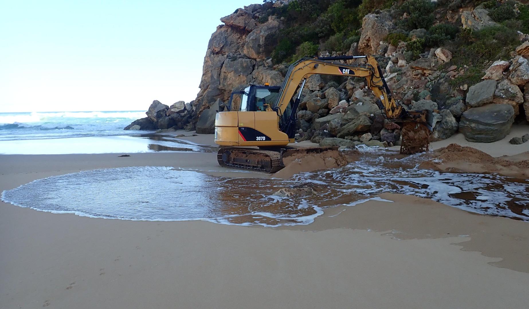 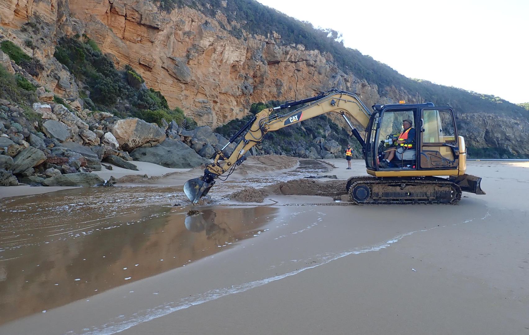  |
|
| #12825 | 27 Mar 2019 | Approved |
Notes:
AHD G2 1.65 G6 1.65 @10:35 Mouth closed but waves have been over berm & up into the estuary @ last hi tide -7 dead eels were stranded trying to cross over to sea. Strong sw/ssw swell impacting at mid beach creating strong backwash with occasional longshore drift. Wide area of beach near cliff is much lower than that towards east where sand is very high Water is up to the sides of OCR west of camp ground (which has increased water cover). Areas of OCR south & further east along return track have deep holes scoured out by vehicle traffic. Water has started to cover small area of GOR between Latrobe creek bridge & start of OCR. Water at side & over OOR at Flood markers. Water across flats DS G4 but not US G4. Flats around G5 have significant water cover that is not completely visible because of high vegetation |
|
| #12826 | 26 Mar 2019 | Approved |
Notes:
AHD G2 1.63 @ 09:32 - @11:20 between 1.63 & 1.64. G6 1.63 @ 09:13 Both G2 & G6 are level Observations taken @ low tide. Mouth closed but a few waves entering up to estuary -mostly a large expanse of sand between ocean & estuary. SW swell impacting beach - strong backwash @ mid beach carrying large amount of sand then longshore drift to west to cliff. Yesterday's high seas have lowered about 1/3rd of beach east of cliff Wind in many directions -SE along beach but turning S with much stronger gusts down channel blowing a lot of sand into estuary Increased water at side of roads & camp ground but water only just coming over OOR at flood markers. Small pool at side of GOR    |
|
| #12830 | 25 Mar 2019 | Approved |
Notes:
AHD G6 1.56 @ 09:37 1.59 @ 16:10 Mouth perched, flow both in & out. High seas & WSW swell (8-15 secs.) = waves over 6m. impacting beach sending waves all along up to the dunes & completely across the entrance & down the channel. Hi tide about 15:00 combined with strong longshore drift sent waves into the estuary - green water was visible at start of channel from estuary. Incoming waves were going over top of water returning across a wide front. A whirlpool occurred at start of estuary. Near gale force winds from many directions around estuary, channel & beach Increasing water cover at edge of roads,& on flats DS G4. Small area of water starting to cross OOR at flood markers. Fishing platform structure completely under water by 15:55      |
|
| #12831 | 24 Mar 2019 | Approved |
Notes:
AHD G2 1.57 @ 09:14 but between 1.57 & 1.58 @ 12:35 AHD G6 1.52 @ 08:40 Observations made at low tide. Mouth opened at low tide between rocks at base of cliff not through the berm sand build up which remained intact. Flow from estuary was coming down through a channel about 3-4 m across widening to 7m where it sharply curved west towards cliff - height of channel east side in that area 1m. Depth about .10-.20m . Waves had been overtopping the berm at last hi tide & running down west along the beach towards cliff along the sand behind the berm travelling down a previously formed depression. The beach rises & falls creating wide N-S depressions. High wave sets impacting on sandbar & going high up on beach = backwash & longshore drift. Very large no. small fish in shallow water around estuary & in water at edge of roads. Peregrine falcon at entrance |
|
| #12832 | 22 Mar 2019 | Approved |
Notes:
AHD @ G6 1.52 @ 08:40 Mouth was closed but a narrow very shallow flow close to cliff reached to about .30 m. from top of berm where a unsuccessful manual attempt to illegally open the mouth was being made ( small channel .10 - .15m.) Waves were occasionally overtopping berm but had been up to estuary during last hi tide        |
|
| #12833 | 19 Mar 2019 | Approved |
Notes:
AHD @ G6 1.48 Mouth closed but waves over topping berm at last hi tide. A higher 2nd. berm has risen closer to sea with a depression formed between it & the previous highest part of the original berm formation. Waves have been over berm & high up all along the beach. S wind blowing sand down channel into estuary, more sand over rock   |
|
| #12836 | 16 Mar 2019 | Approved |
Notes:
AHD G6 1.46 @ 10:18 Observations taken at low tide. Mouth closed but waves have been up to the estuary at last hi tide. Sand high all along the beach. Water is across all of low track |
|
| #12837 | 14 Mar 2019 | Approved |
Notes:
AHD G6 1.41 @ 13:50 1.43 @ 17:15 Mouth closed but waves have been over at last hi tide. Top of rock about .20 above sand. Small hand dug channel at start of estuary
|
|
| #12764 | 13 Mar 2019 | Approved |
Notes:
AHD @ G6 1.42 @ 13:35 Very rough seas over night have formed a high sand build up at entrance & along channel blocking flow. Currently some waves are over topping the berm & travelling up into the estuary where a small amount of green water is visible at time of entry. No fresh outflow but some salt return. During the night a 3m. high wave was observed travelling down the channel into estuary where it turned sharply east & travelled along south side of estuary, large mound of seaweed & many shells were deposited around SE corner. Waves in many directions at entrance with waves going high up on all along beach reaching base of sand dunes below Gp1 site, some very strong longshore drift across mouth - back wash rolling large amount of sand. Also very large amount of sand clearly visible in breakers all along beach & far out to sea Deep ridges have formed in NE/SW direction in sand below Gp1 site Depth profile @ G2 shows an increase in E.C. between 2-3 m. down |
|
| #12765 | 12 Mar 2019 | Approved |
Notes:
AHD G2 1.44 @ 06:45 1.39 @ 14:10 AHD G6 1.41 @ 10:51 1.39 @ 14:25 Strong dark discharge out along foreshore to east - turning S out to sea at east reef Strong longshore drift across entrance meeting incoming SW swell & outflow = waves in all directions with some entering channel going over rocks & up to estuary. Large amount of sand visible in breakers - also washing out in channel, Very strong gusts of wind along beach from S.E. scouring sand. The wind direction changes & turns S as it reaches the channel creating much stronger gusts that carry large amounts of sand into the channel & estuary      |
|
| #12762 | 11 Mar 2019 | Approved |
Notes:
AHD G6 1.48 @ 10:25 -remaining same @ 14:53 Dark discharge out to east along side of shoreline. Width of channel from estuary about 12 m. reducing to about 6m where it curves around rocks then increasing to about 15m wide as it flows out shallow over sand build up. The flow drops down to lower level as it passes rocks. Longshore drift across mouth travelling over incoming SW swell & outflow which is carrying a large amount of sand scoured out from start of & continuation of channel. Deeper areas occur in path of more rapid flow. Height of eastside of channel .10m at start from estuary rising to 1m. around rocks, sides continually collapsing into flow. Beach front now is in almost continuous straight line. 12:40 area of high sand removed from between 1st & 2nd rock resulting in faster flow with much scouring. 13:08 sea becoming more rough with waves entering over exposed rocks & travelling up into estuary |
|
| #12760 | 10 Mar 2019 | Approved |
Notes:
AHD G6 1.48 @ 09:55 Mouth opened 15:30 on 09-03-2019. At time of observing there was a shallow out flow with some small waves entering. Width of entrance about 6-7 m, around rock 3m. then widening again to about 7m. The width & depth continued increasing as the flow became more rapid Height of east sheer side of channel .10 cm at start of channel from estuary rising to 1m. at rocks & slightly downstream. Walls collapsing into flow |
|
| #12759 | 9 Mar 2019 | Approved |
Notes:
AHD G6 1.46 @10:00 Mouth closed but waves had been over berm & up into the estuary at last hi tide ( 0.91 @ 03:00) Sand deep & loose at entrance. Slight longshore drift across entrance mixing with incoming waves creating backwash running in a N/ S direction. Berm gradually slopes down to sea- slightly higher near location of rocks ARTIFICIAL OPENING COMPLETED 15:30 after which some fish were observed late at night swimming upstream against the current |
|
| #12758 | 6 Mar 2019 | Approved |
Notes:
AHD G2 1.49 @ 10:15 G6 1.45 @ 10:10 High tide @ 02:01 was 1.00 Some waves from 4m+ sea going high up all along beach are entering estuary with some return occurring - green water remaining around start of channel from estuary. Waves reaching base of sand dunes below Gp1 site. Top of rock has been uncovered. South wind down channel much stronger & moving quite a lot of sand
|
|
| #12841 | 28 Feb 2019 | Approved |
Notes:
AHD G6 1.40 @ 07:30 Air temp 33C. Observations made at low tide (0.17) reef at both ends of beach well exposed. Large area of sand visible on ocean side of berm. More water from rising water table on top track. No water across any roads or campground. Water is to side of OOR between flood markers & GOR. Flats downstream G4 have visible water cover, but flats upstream G4 (north side) have no water except in drains. Flats downstream G5 & immediately upstream have visible water cover Bittern sighted flying across OOR to north between flood markers & GOR |
|
| #12859 | 20 Feb 2019 | Approved |
Notes:
AHD G6 1.36 @ 11:35 Mouth closed -no waves over berm SW swell/rough sea impacting strongly at east end of beach. Large amount of sand visible in ocean all along beach with more around mouth. Berm is higher than previously observed & sand is now completely covering all of rocks. Berm slopes gradually down towards ocean with highest part near rocks area No water over any roads or tracks (apart from low track) but 2 small puddles on top track |
|
| #12717 | 15 Feb 2019 | Approved |
Notes:
AHD G6 1.30 @ 08:34 Mouth closed but some waves have been uo to estuary at last hi tide. Berm is longer but gradually slopes down from estuary to ocean with small gradual rise around rocks which are now almost entirely covered with sand Water up to start of low track but no water over any other tracks or roads or camp ground. G4 flats have water cover with water completely across dip in causeway.There is only water in drains upstream of G4 site but it has started to enter just upstream at site of mill. Northern flats at G5 have visible water in all low areas but no water entering properties further upstream      |
|
| #12716 | 11 Feb 2019 | Approved |
Notes:
AHD G6 1.17 @ 14:40 Mouth closed & short berm formed area between sea & estuary.The length has been reduced because of recent heavy local rainfall raising water level (over 40m. in some areas) . Waves over topping berm but not reaching estuary (however this had occurred during last hi tide). Entrance very dynamic & waves being driven far up on beach driven by strong SW swell. More sand over rocks, only about .30 of 2nd rock remains exposed. Large amount of sand visible in breakers all along beach. More rocks down at south face of Pt Ronald No flood water over any roads or tracks (apart from low track) nor in camp ground Many small fish observed in shallows along low track & around auto monitor      |
|
| #12679 | 2 Feb 2019 | Approved |
Notes:
AHD G6 1.30 @ 10:30 Mouth closed, more sand over & in front of rocks (closed 30-12-18) Sand higher at east end of beach & remaining high at mid beach where the spit extends further out to sea where the SW swell is impacting on the west side causing longshore drift across entrance. Waves are going in many directions all along the beach. Large area of sand stir visible in water between spit & entrance Large no.small fish in shallow water at edge of estuary also many larger 4-7 cm long fish in deeper water around bridge at G2. |
|
| #12680 | 30 Jan 2019 | Approved |
Notes:
AHD G6 1.02 @ 09:45 Entrance very dynamic with a few occasional large very shallow waves going up to reach the estuary - no return visible. Waves in many directions with longshore drift across to cliff Sand high at east end of beach also remaining high at mid beach. Large no. small fish in shallow water all around estuary & up stream |
|
| #12710 | 28 Jan 2019 | Approved |
Notes:
AHD G6 0.78 @ 11:00 Only waves entering & backwash returning (rough sea 3.5-3.8) Wind S 4 but with stronger gusts Low track is starting to become covered with water - very large no. of small fish observed in shallows around this area      |
|
| #12711 | 26 Jan 2019 | Approved |
Notes:
AHD board covered with silt = unreadable Shallow outflow out over increased sand buildup Both entrance & channel very shallow with flow only between 2nd & 3rd rock Sand now highest at mid beach where it projects out to sea dividing beach into 2 separate bays      |
|
| #12655 | 18 Jan 2019 | Approved |
Notes:
AHD G6 estimated to be about 0.69 @ 09:03 (board still covered with silt) Only very slight pale discharge out around mouth flowing across an area of high sand build up both at entrance & along channel. Flow is restricted to 2 narrow channels through rocks. Sand is high at east end & mid beach up to about 50m. from entrance where it drops down gradually. The higher mid beach area projects out to sea. The 2 separate bays recently formed remain. WSW/sw swell impacting beach causing strong backwash & longshore drift at entrance, also some waves from swell curving around at entrance. Last high tide travelled high up on beach continuing into estuary |
|
| #12649 | 15 Jan 2019 | Approved |
Notes:
AHD G6 0.72 estimate only as board covered with silt Dense sea fog drifting down channel prevented observations from being taken from actual Gp1 site Weak pale shallow out flow over increased sand build up in channel, especially around rocks & downstream across a wide area at mouth. The beach is highest at mid beach where a wide area projects out to sea dividing beach & creating 2 separate bays. Highest area is only 50m from where it slopes down entrance. Swell & rough sea impacting on west side of projection creating longshore drift across the mouth, striking cliff & going over the top of rocks resulting in occasional small waves entering down channel |
|
| #12635 | 10 Jan 2019 | Approved |
Notes:
Very slight pale discharge flowing through shallow area in channel & over sand build up downstream of rocks, then turning east along beach front. Rough sea creating backwash & longshore drift across entrance over weak outflow -some small waves entering channel & travelling up into estuary. Waves in all directions at entrance. High sand at mid beach now extending further out to sea two distinct bays are starting to form along beach. Sand slopes down to entrance Very large no. small fish in shallows along E side of estuary Many campers, & walkers around. Also many large caravans across bridge @ G2 making monitoring difficult      |
|
| #12625 | 6 Jan 2019 | Approved |
Notes:
AHD @ G6 1.02 @ 09:33 Mouth re opened sometime over 05 & 06-01-19. shallow narrow flow (area around rocks about 5-6 m.) Pale discharge out around mouth & paler along foreshore. Slight sheer edge to channel indicates a recent rapid flow. Longshore drift across mouth over outflow & curving incoming SW swell Rough sea & early hi tide (1.14) sent waves very far up on the beach which remains high from east end up to 46m. to entrance where it drops down |
|
| #12620 | 3 Jan 2019 | Approved |
Notes:
No discharge from river only salt water intermittently entering & returning from incoming rough sea. High sand build up at entrance & along channel. Longshore drift, backwash & incoming sw swell meeting returning salt water at entrance. Last hi tide well up on beach Flow reducing AHD @ G6 about 0.90 (board covered with silt) More sand has been removed from the east end of beach but area is still high from there to about 50m from entrance Large no. small fish in shallow water along S & SE side of estuary. Low track has only partial water cover & no water on top track
|
|
| #12612 | 21 Dec 2018 | Approved |
Notes:
Pale discharge out to east along foreshore, strong SW swell impacting east end of beach scouring out 1-3 m. high sheer sand cliffs. Increased sand build up at entrance & along channel, more sand being deposited in that area by very strong (7) SE wind along beach Erosion continues at S & SE face of Pt Ronald with more rock fall |
|
| #12578 | 6 Dec 2018 | Approved |
Notes:
Strong dark discharge through narrow channel cascading down to lower level through rocks & out over a wide shallow area around entrance travelling to east after a recent release after last hi tide.(High seas & gale force winds on 03-12-18 caused a high sand build up that closed the mouth). Tide mark on beach indicated extent of last hi tide. Sheer 10-50 cm sides to channel gradually collapsing into fast out flow. Waves from SW swell impacting mid beach & E end. Slight longshore drift across entrance. |
|
| #12552 | 23 Nov 2018 | Approved |
Notes:
AHD G6 1.14 @ 14:03 Rainfall 30 ml. from 20 th -23 rd Nov Pale discharge out & slightly to east. Some small waves entering channel over a high sand build up, longshore drift across entrance with waves in all directions. Very large amount of sand in breakers all along the beach Strong SW swell of short time duration strongly impacting east end of beach leaving sheer face from 1-3 m high, longshore drift from there moving west to entrance. Wind from S at entrance & from SE along the beach where it is scouring the beach & dunes depositing sand in the channel |
|
| #12714 | 16 Nov 2018 | Approved |
Notes:
AHD G6 0.88 @ 08.40 estimate only as board is covered with silt Dark discharge out over shallow opening going close to foreshore for about 40m to east. Longshore drift across entrance. Sand is building up in channel more shallow & narrow. Large amount of sand in breakers all along beach. Sand is very high at east end of beach. Sandbar is exposed in estuary Bright blue damsel fly in area of low track   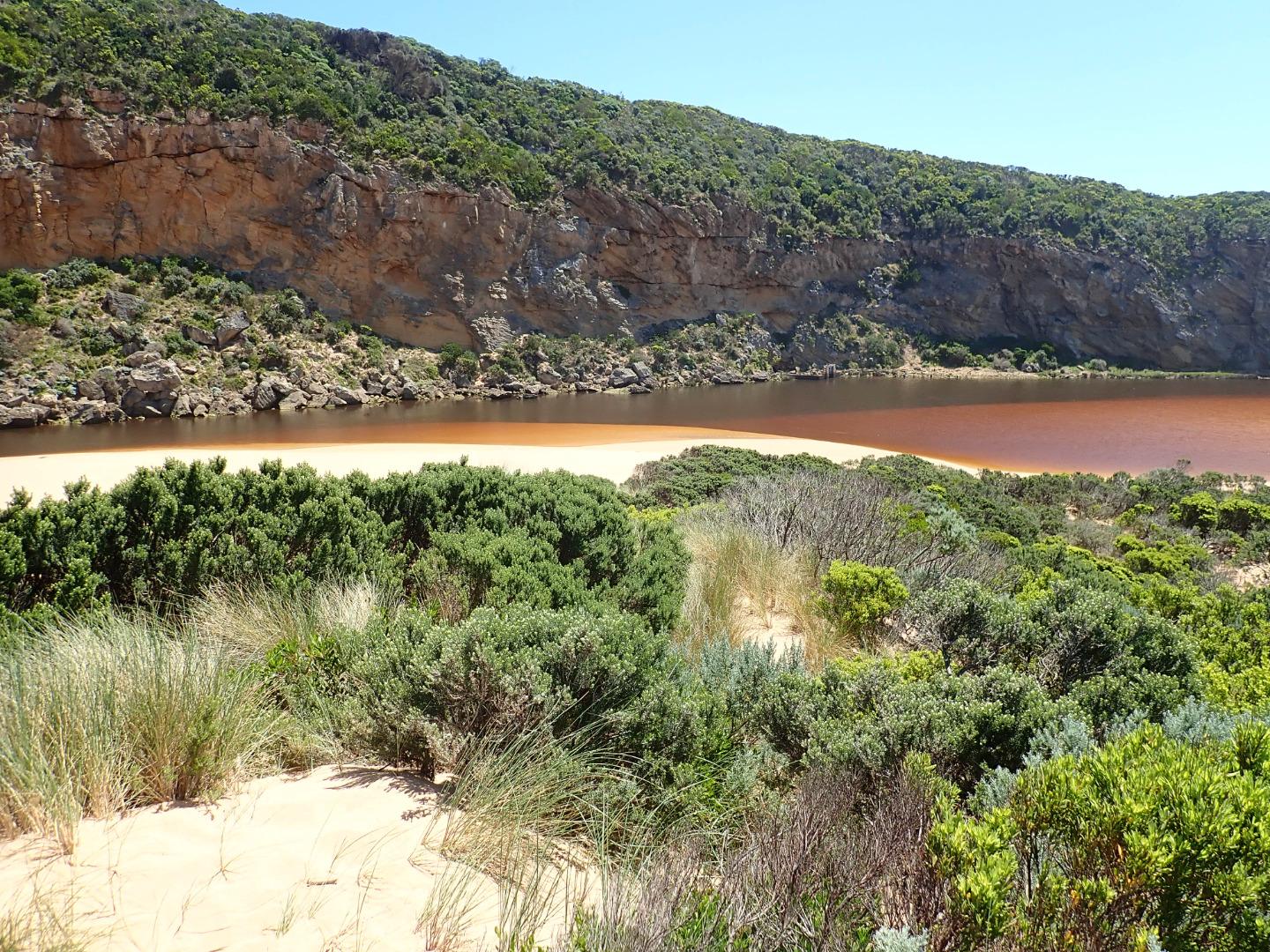 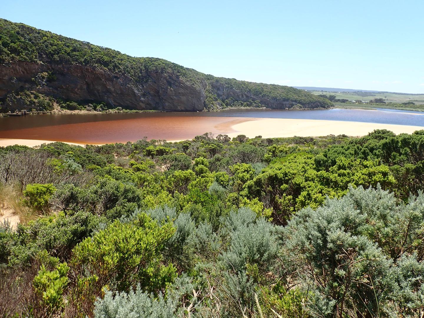 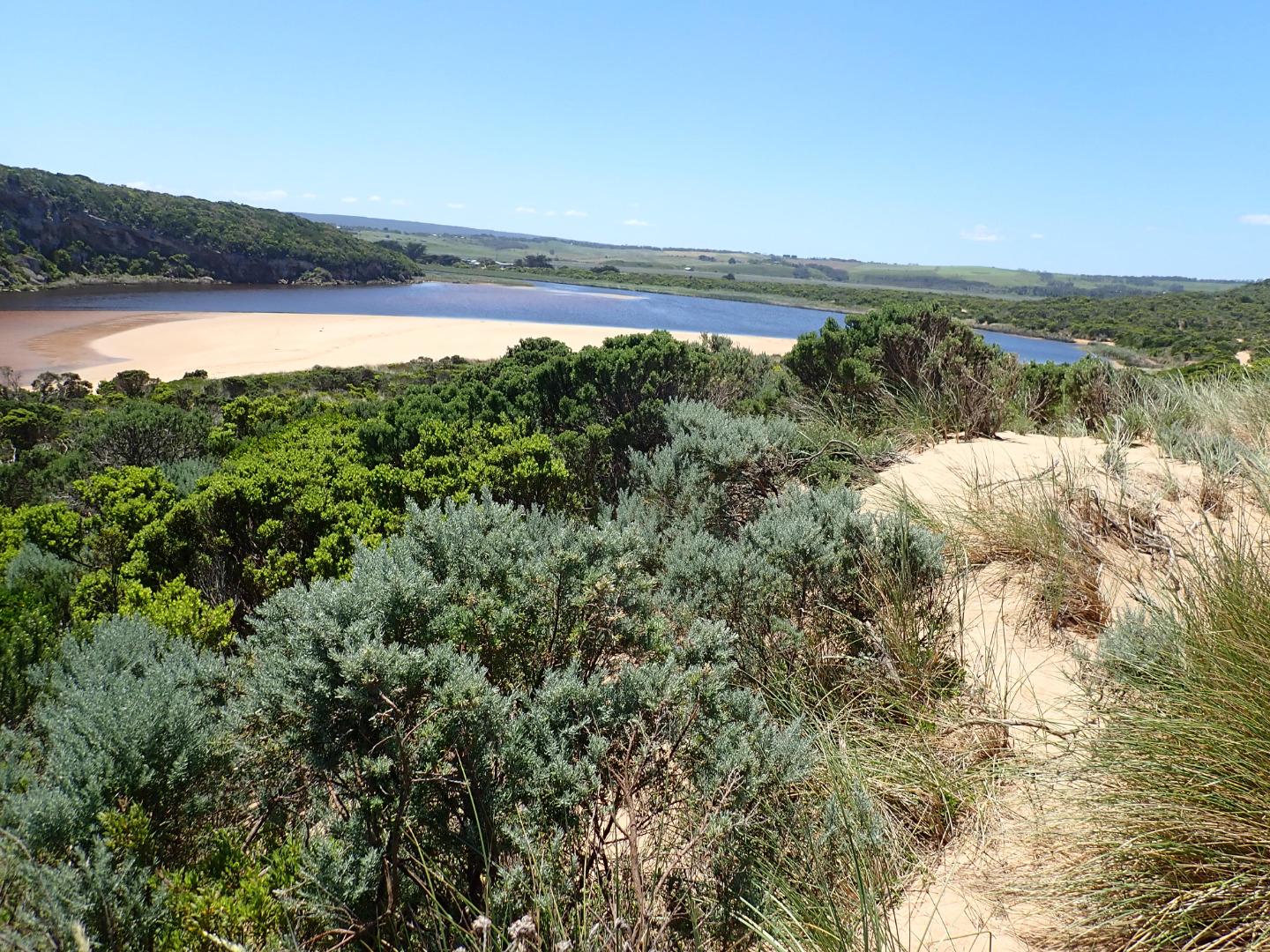 |
|
| #12514 | 9 Nov 2018 | Approved |
Notes:
Continuing rough seas & strong west winds over past days (6.3-6.1 swell height) on 03-11-18) have created a small low berm which was observed formed across mouth around 06-11-18 pm. The top of the middle rock was still uncovered. Waves had been over topping the berm at the last hi tide & entering the estuary - indicated by sand & swash line. Beach undulating with some very low areas. Sand very high at east end where sheer sided areas occur at the top of a steep decent to ocean - beach slopes down towards start of berm & entrance. Waves have been up to base of dunes in some areas - indicated by swash line which contained large dense areas of small shells, tiny crabs, shrimp, extremely small Janthina-janthina & larger 'By the wind sailors'. No water in camp ground or over any roads/tracks. Water up to the ocean car park along low track & up to the side of the recently raised OOR near flood markers (drains & sides of OOR are currently undergoing maintenance) Flood water occurs on both west & east flats @ Kangaroobie, G4 (Rivernook) flats are under water with wide flow through dip in causeway. US G4 water in drains only up to between G5&G4 . Upstream from there to G5 water covers large areas on both sides of channel. Water just starting to enter upstream of Coxon's track (G5) AHD @ G6 1.60 @ 07:15 rising to 1.61 @14:58 AHD @ G2 1.43 @ 07:15 rising to 1.46 @ 17:00 |
|
| #12453 | 19 Oct 2018 | Pending |
Notes:
Strongly flowing dark discharge around entrance & travelling south with some moving east along foreshore. Beach is undulating with waves going further in low depressions (running north south), large amount of sand in back wash from these areas. Strong longshore drift across mouth. Heavy local rainfall combined with higher falls in catchment (41 ml. recorded @ G6 -total since 15-10-2018) have greatly increased flow with river flushing strongly. Depth profile showed similar readings from top to bottom of water column at G5 & G4 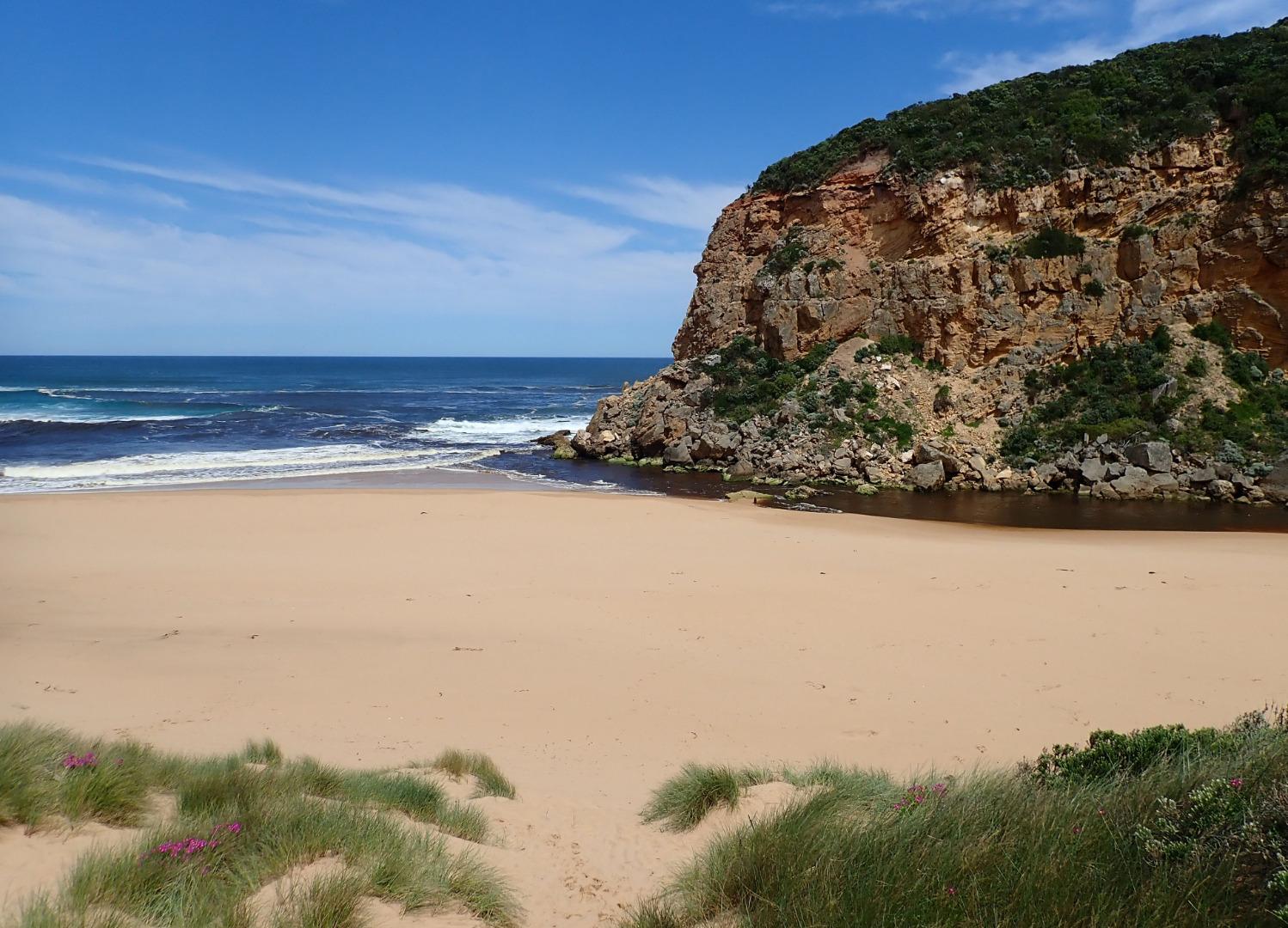     |
|
| #12447 | 15 Oct 2018 | Approved |
Notes:
AHD G6 0.95 @ 09:15 AHD board difficult to read because of silt. Observations made at low tide. Extremely pale discharge out around mouth over large sand build up - also sand building up in channel. Reduced flow only passing through very narrow gap between 1st & 2nd rock and a larger area over rapids between 2nd. & 3rd rock. Some water passing between 3rd. rock & cliff base Sand on south side of estuary extending north into estuary. North wind driven waves (gusts much stronger than 4 ) have cut sheer side to the projection. Sand bar also exposed. The east side of the channel south of rocks also has sheer side -possibly resulting from tidal action
|
|


All content, files, data and images provided by the EstuaryWatch Data Portal and Gallery are subject to a Creative Commons Attribution License
Content is made available to be used in any way, and should always attribute EstuaryWatch and www.estuarywatch.org.au