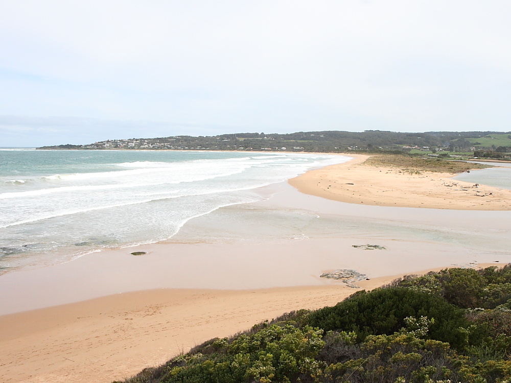
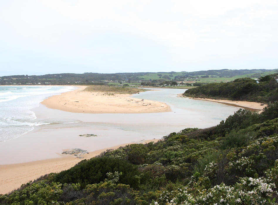
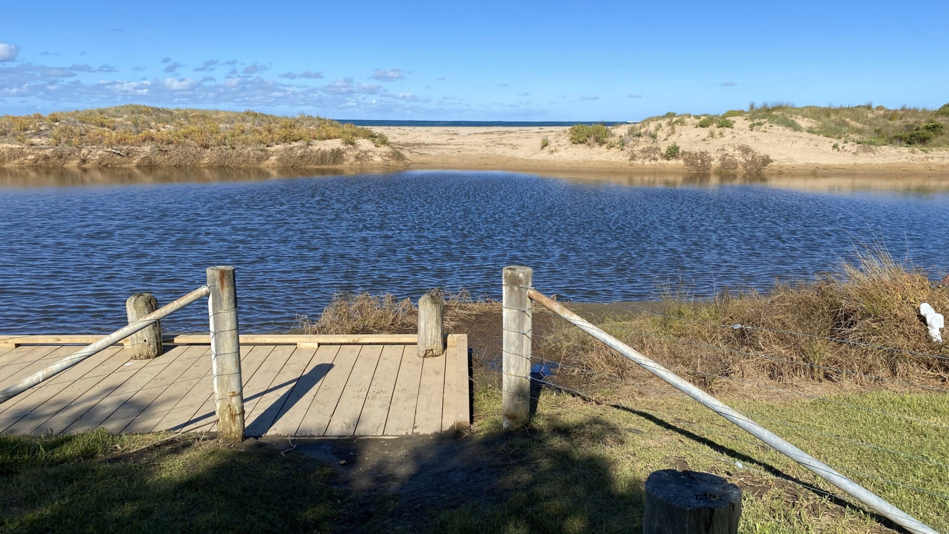
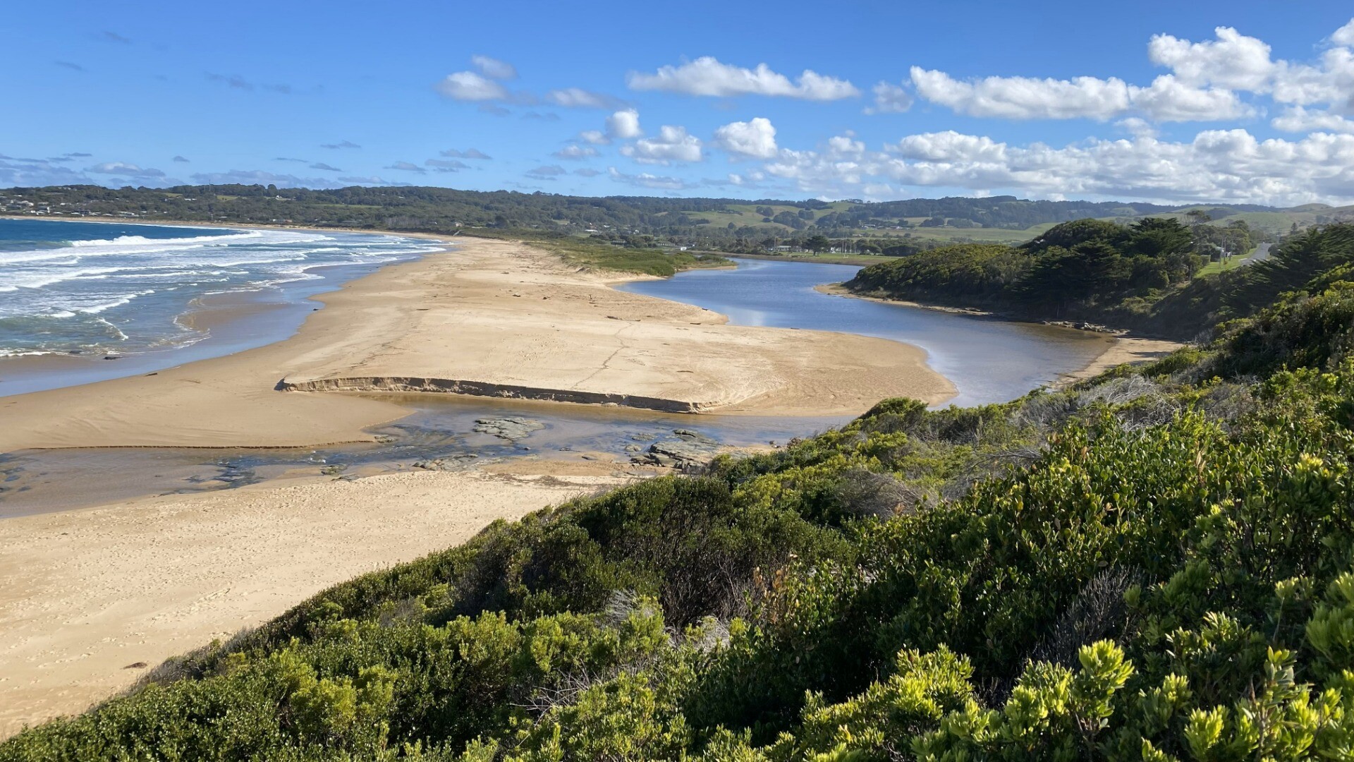
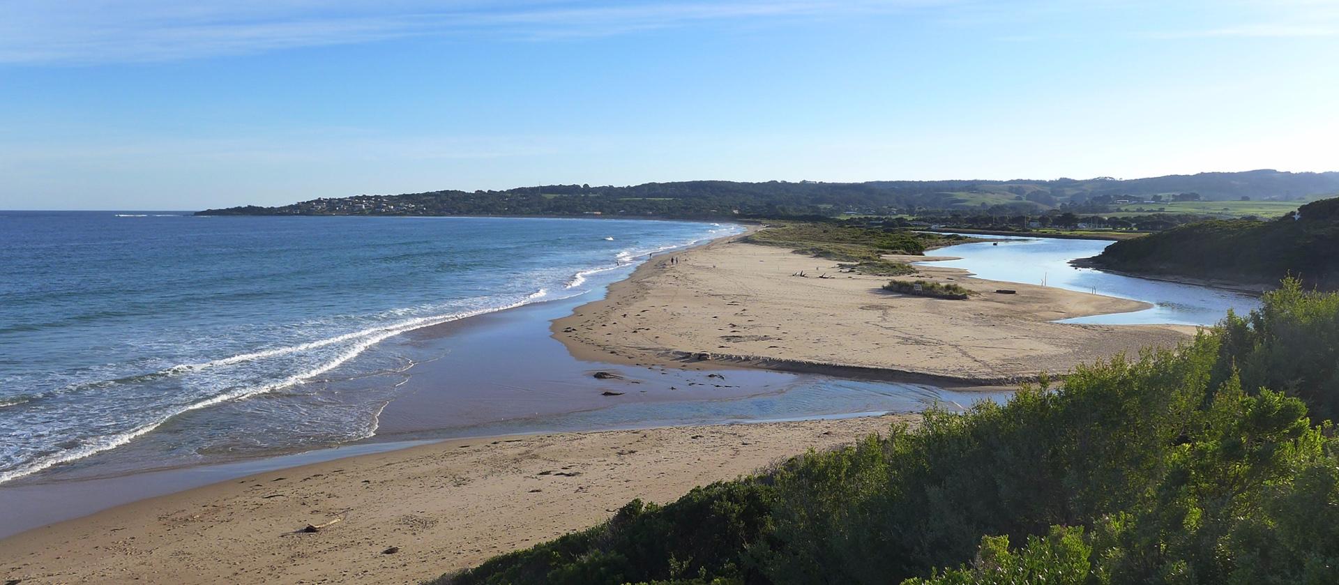
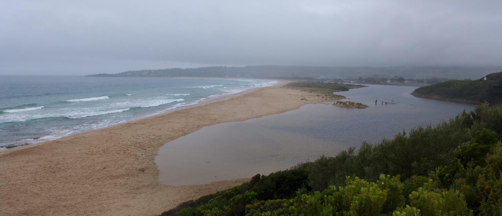
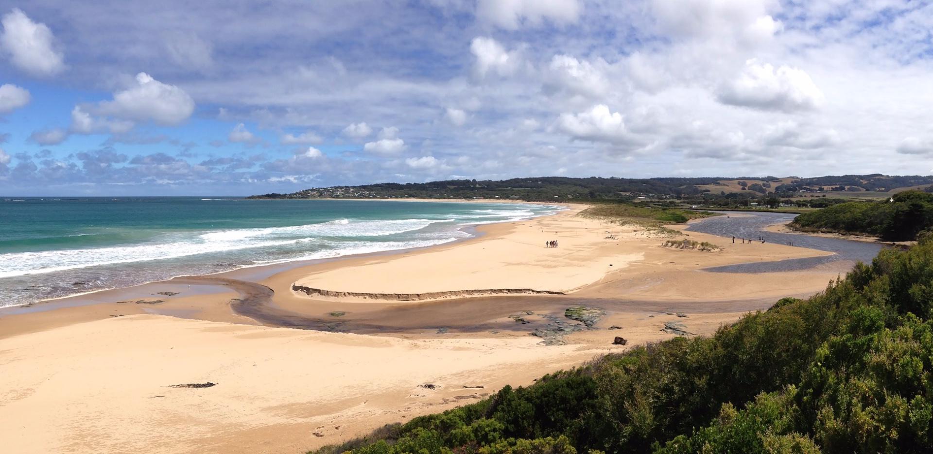
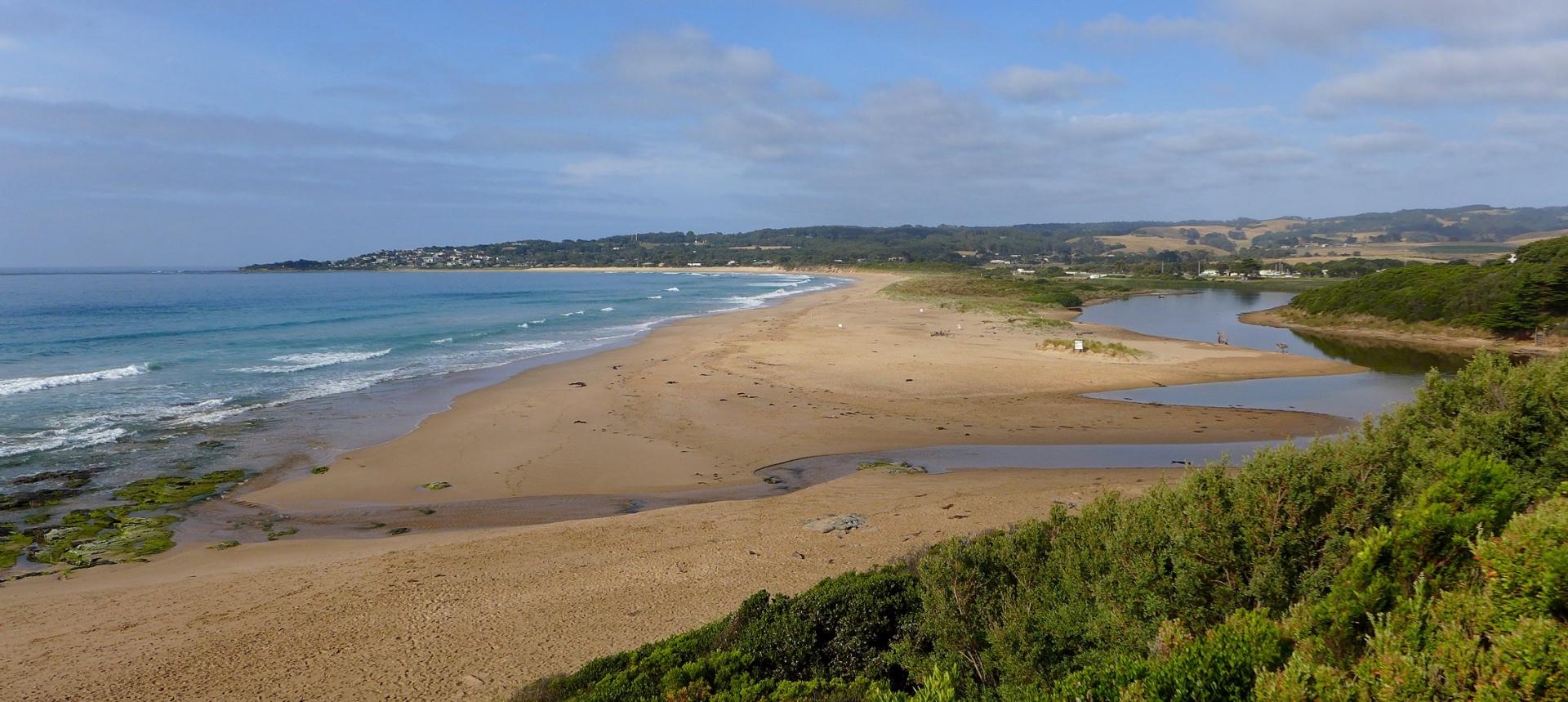
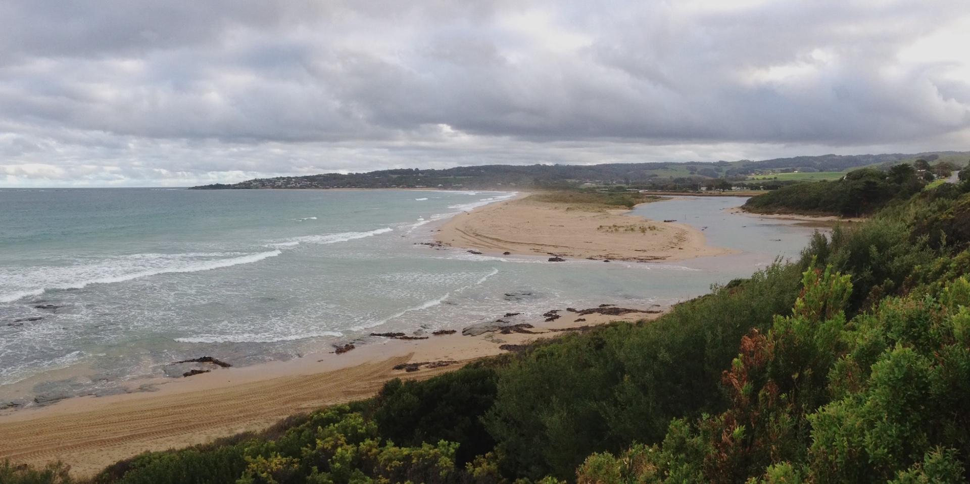
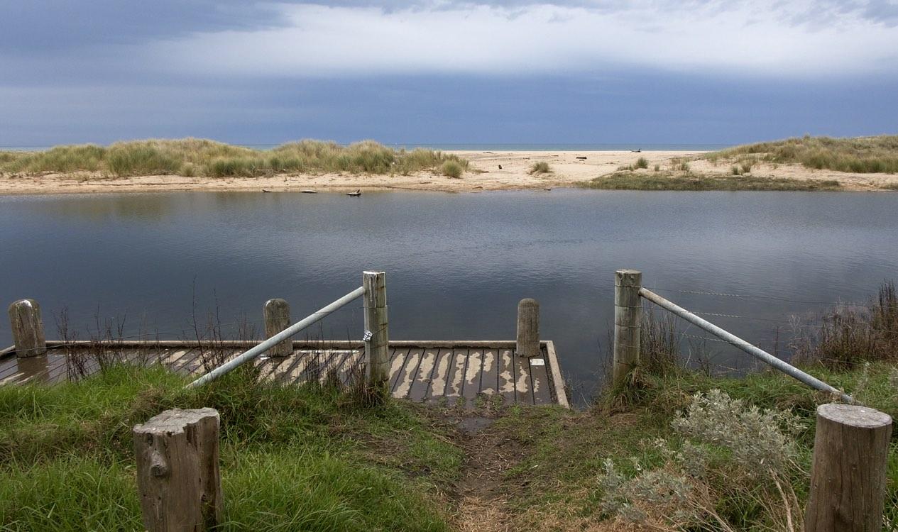
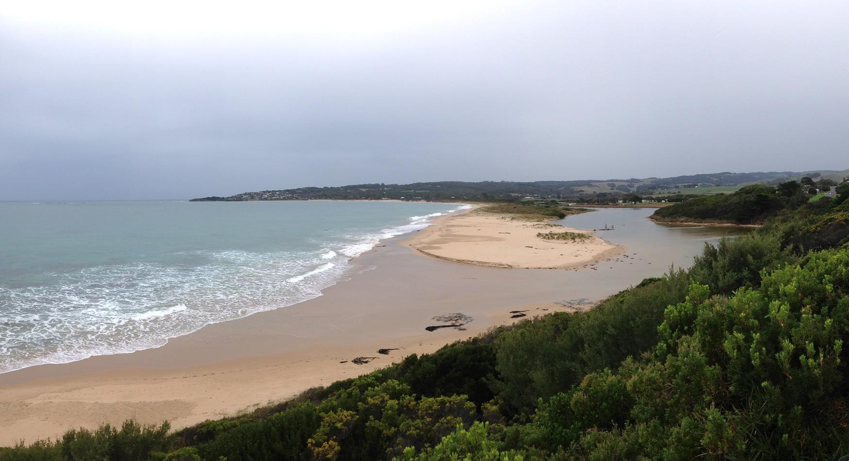
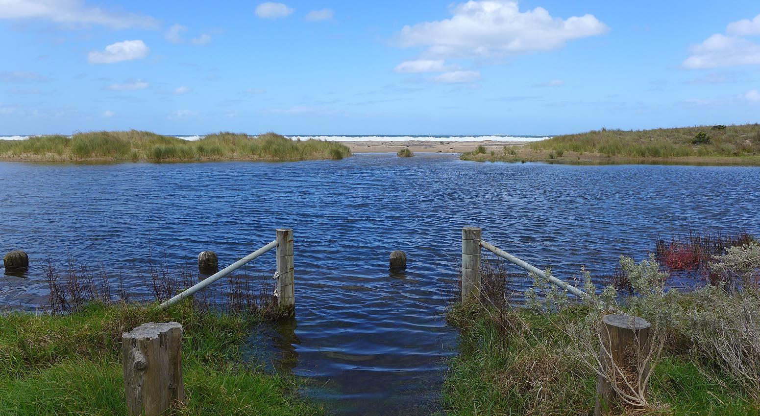
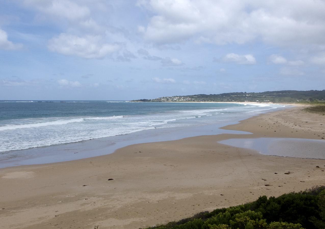
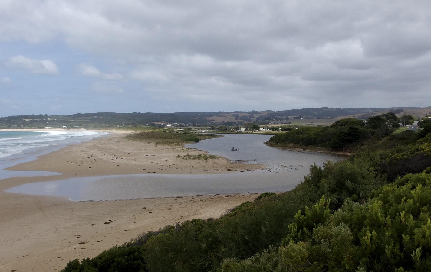
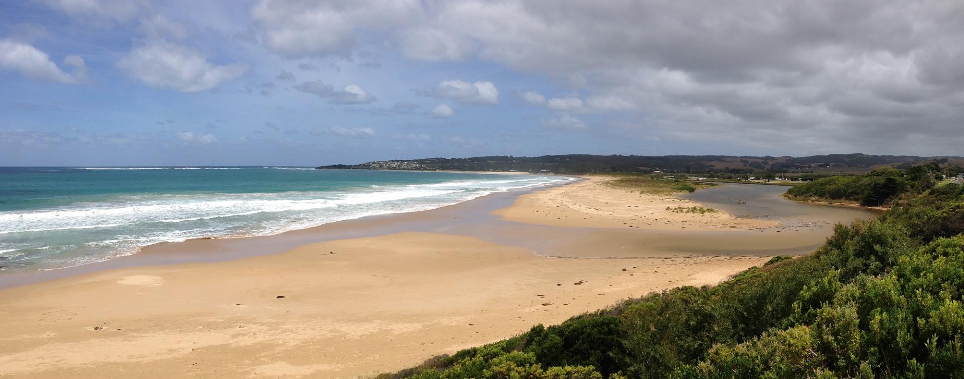
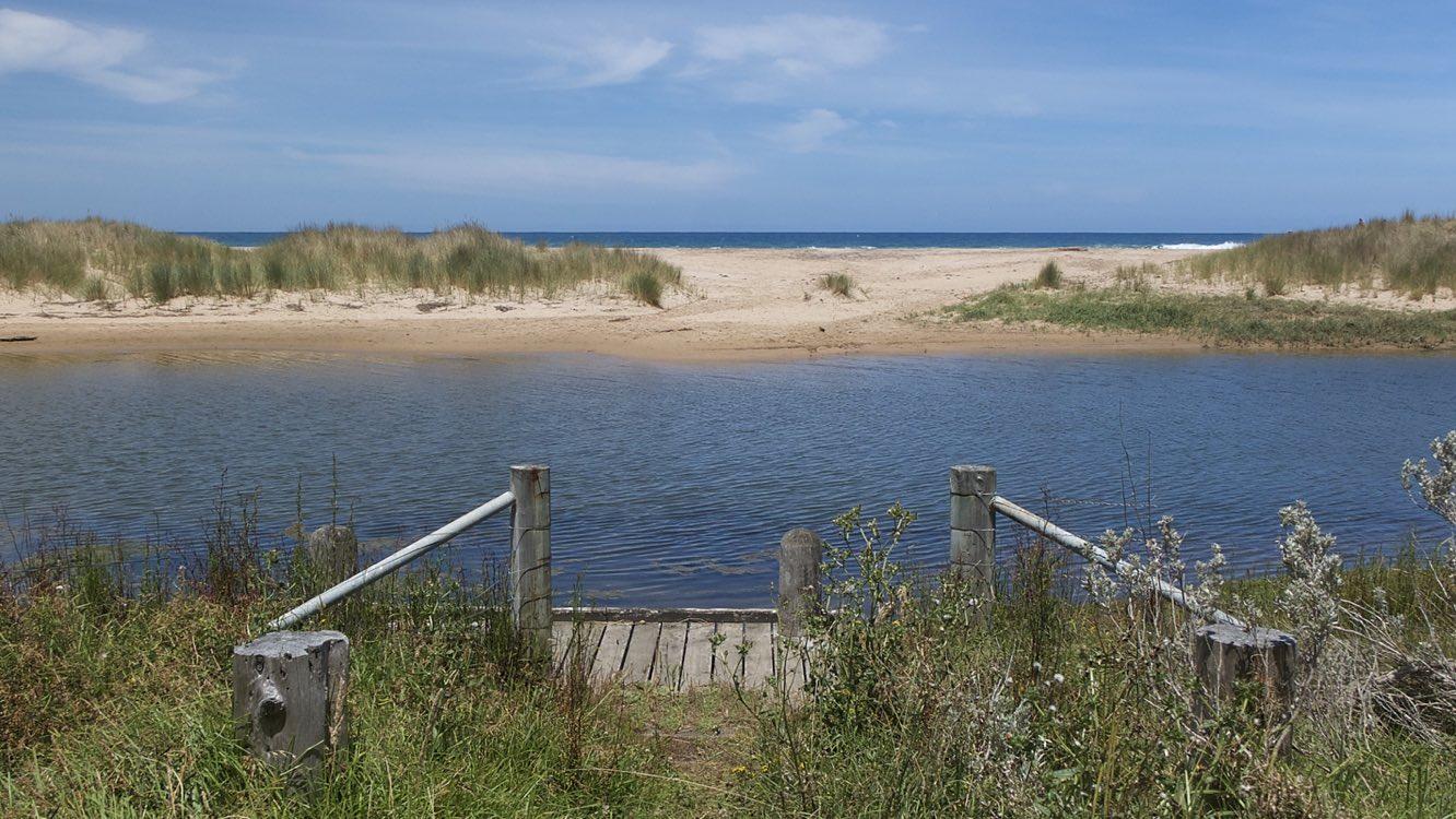
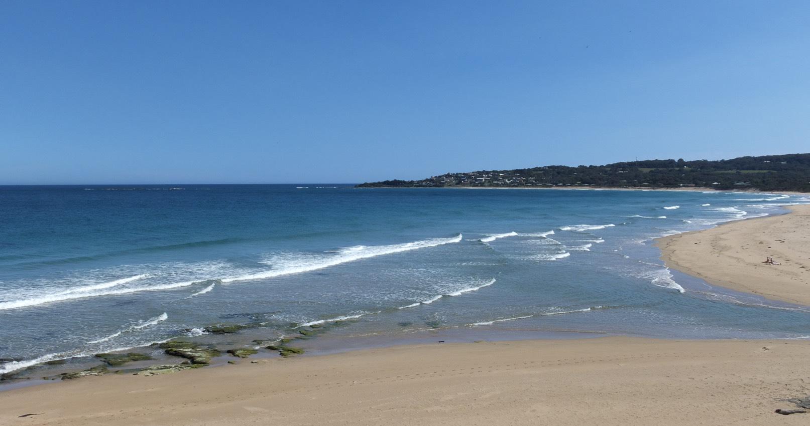
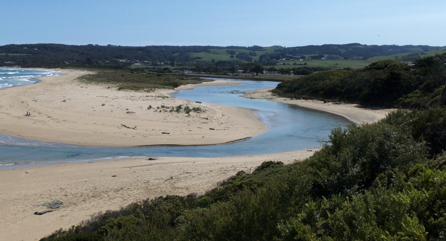
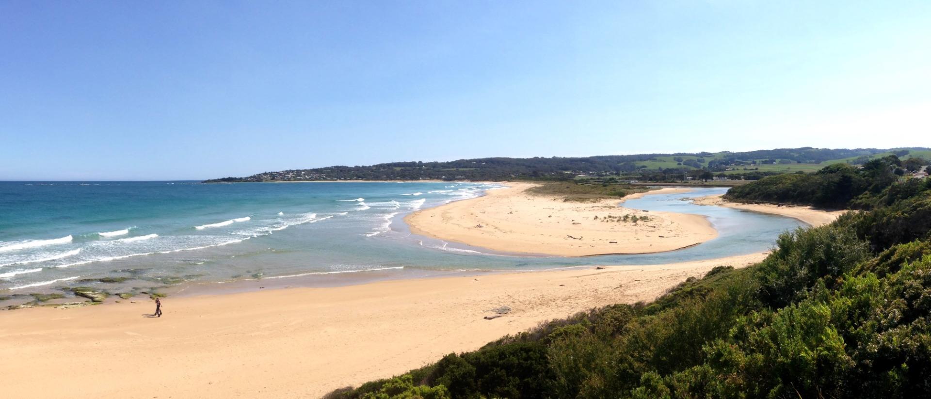
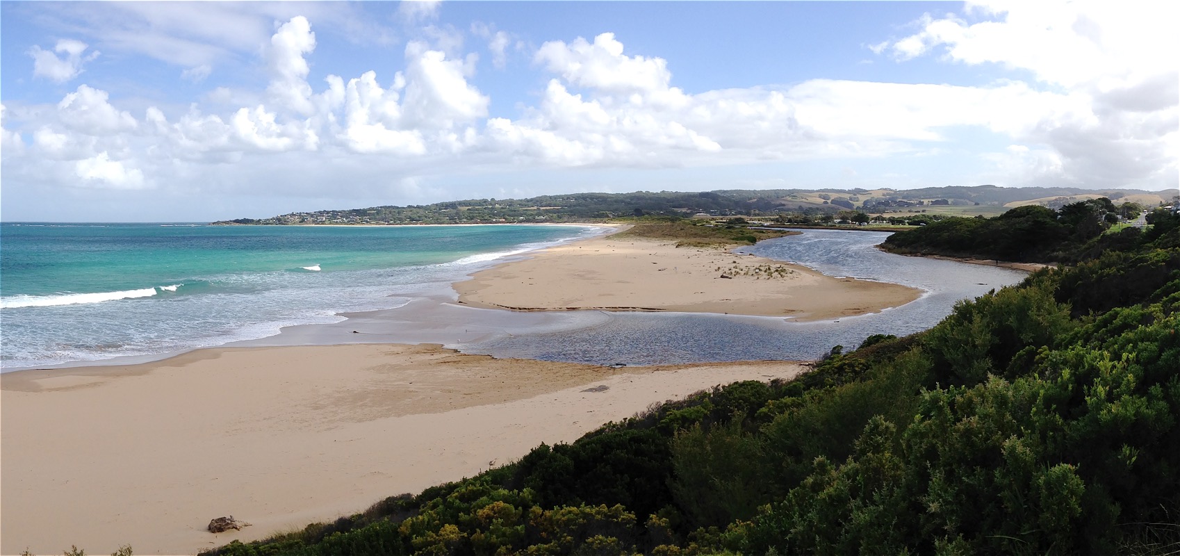
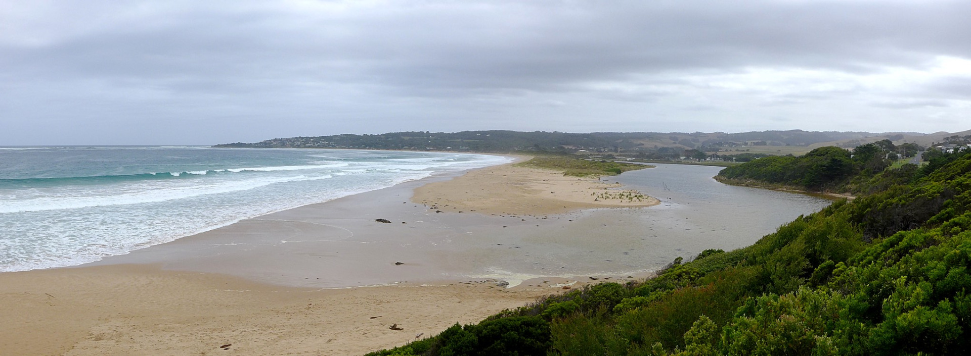
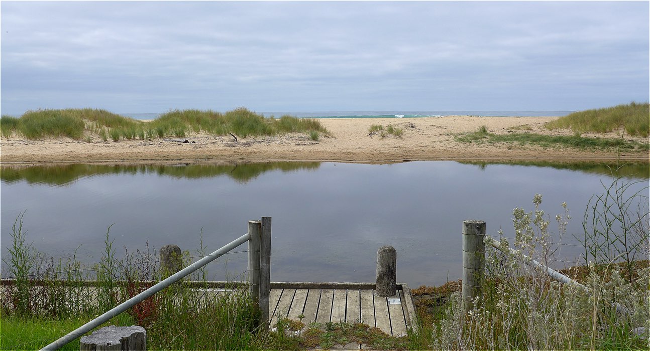
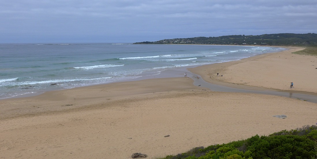
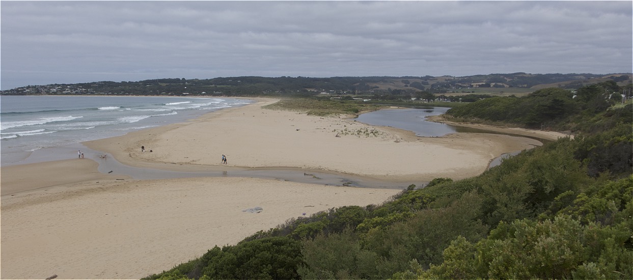
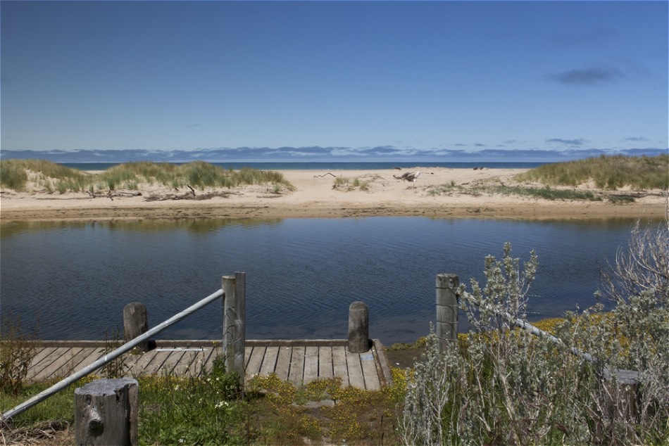
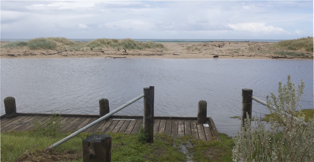
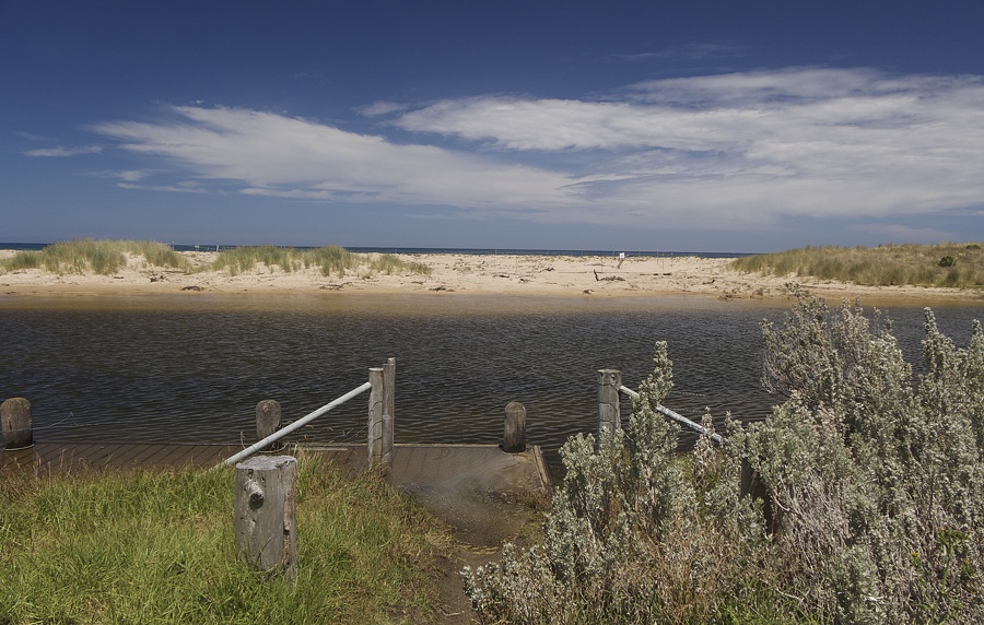
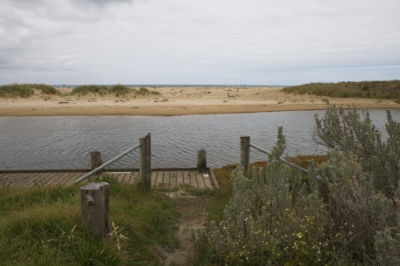
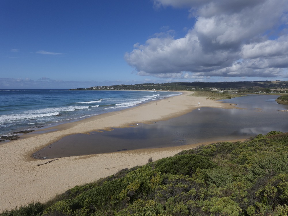
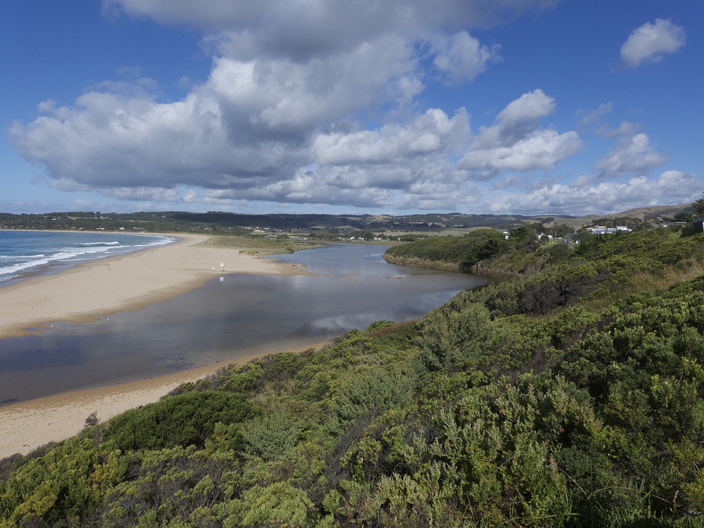
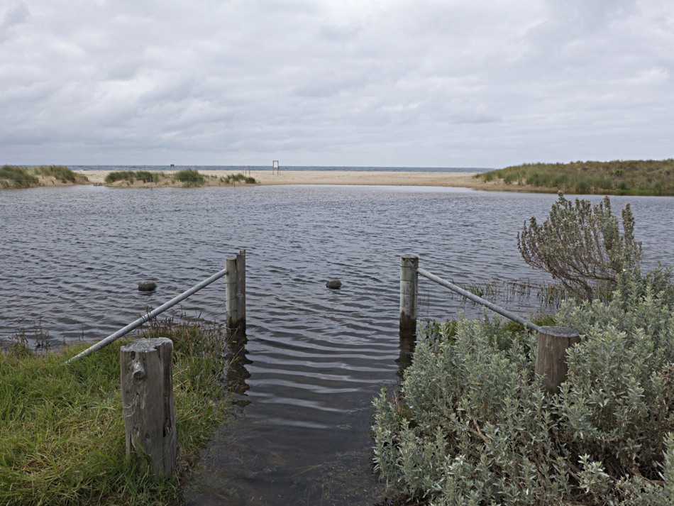
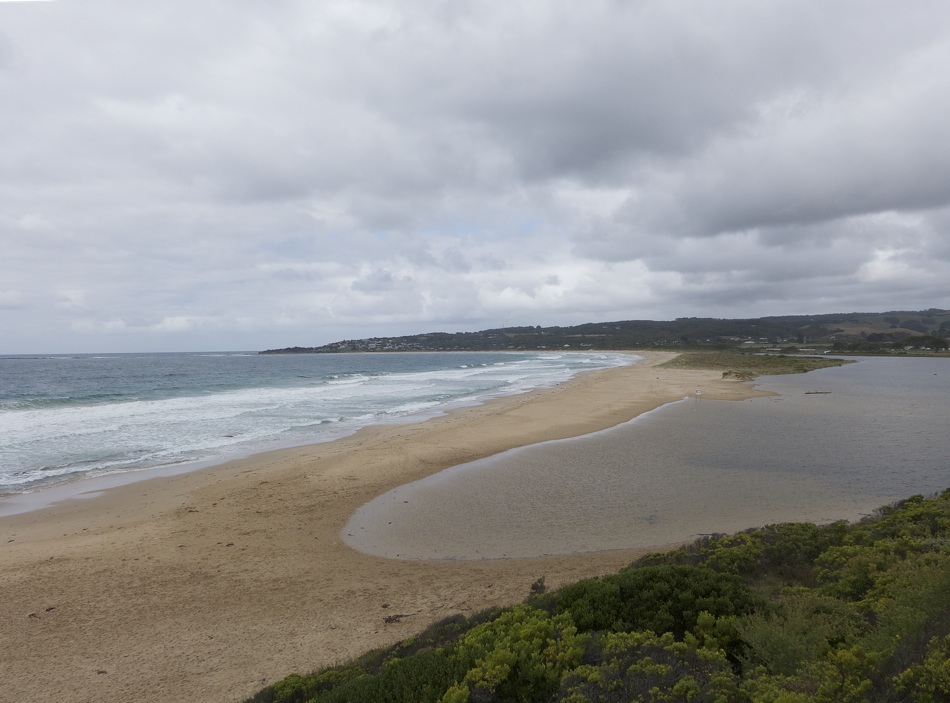
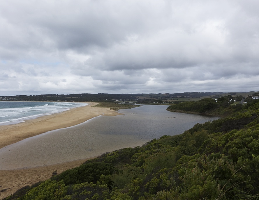
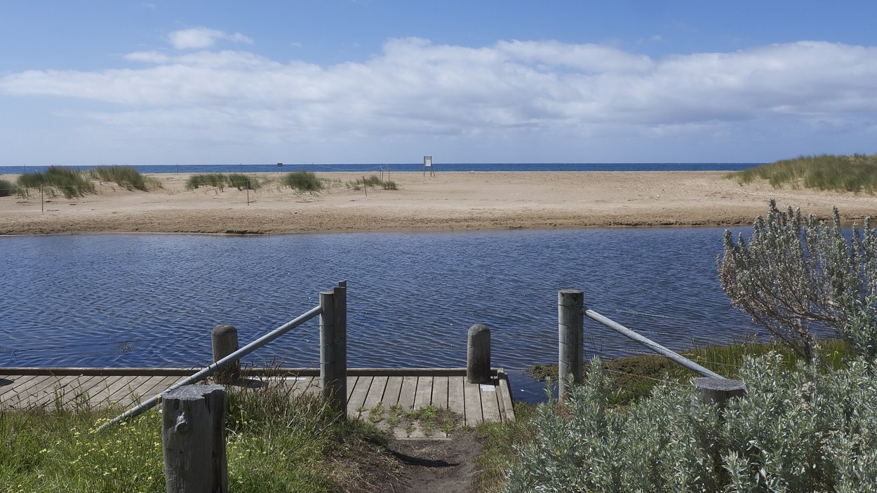
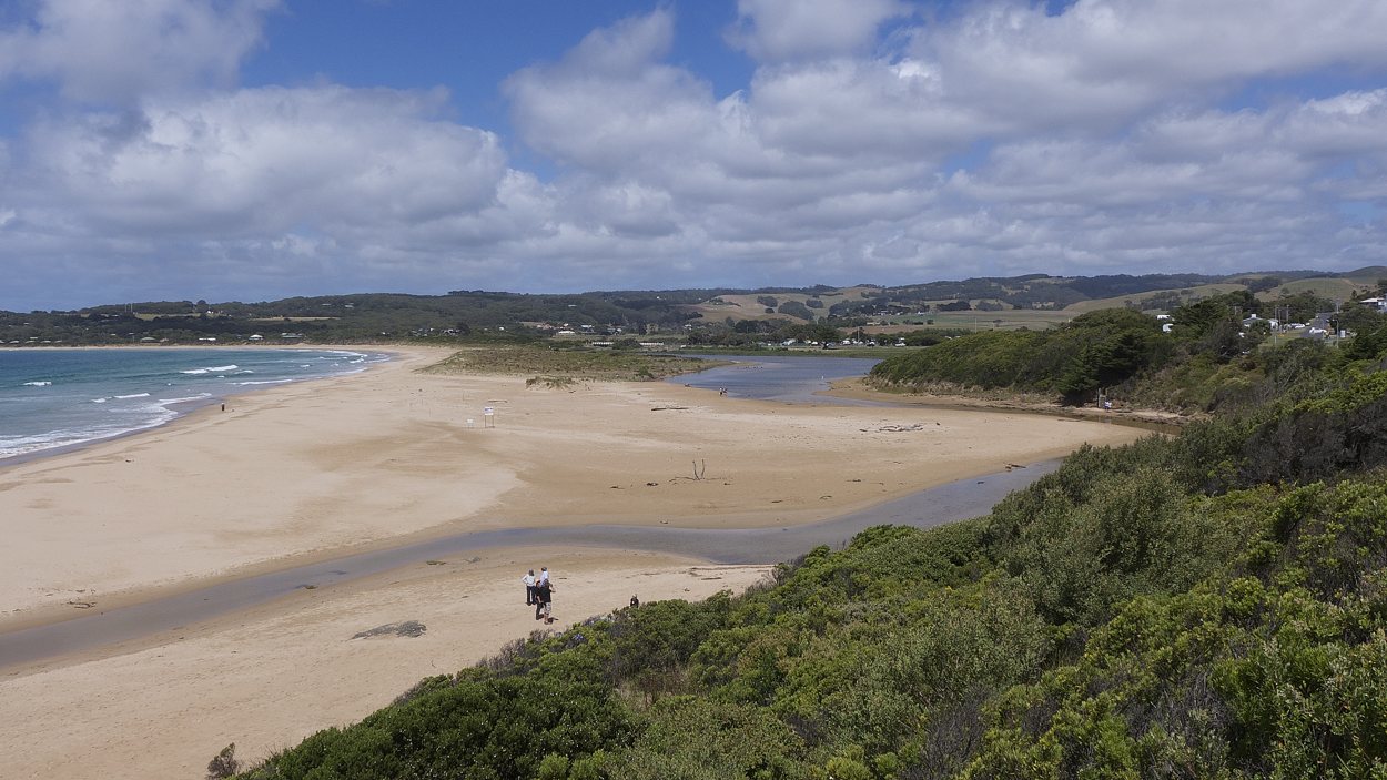
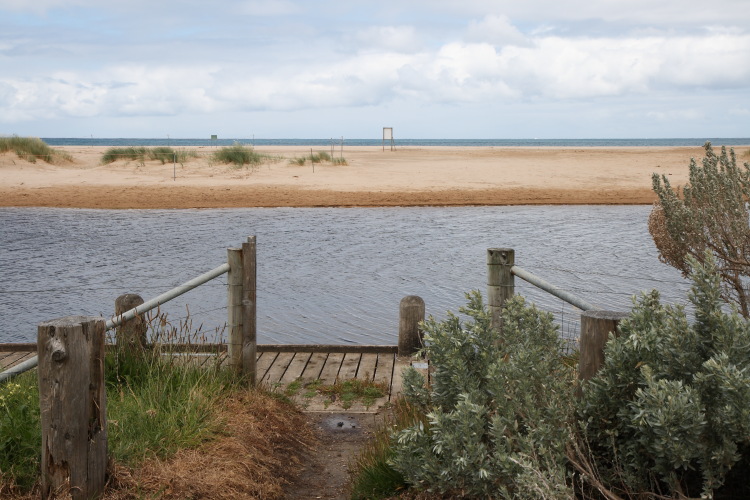
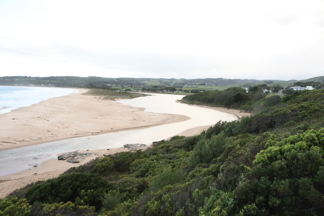
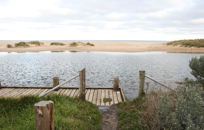
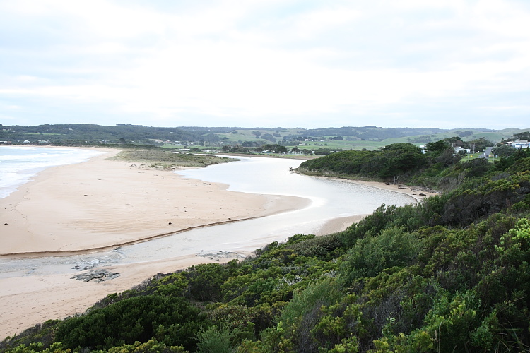
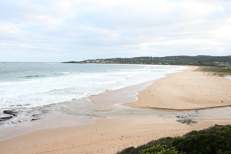
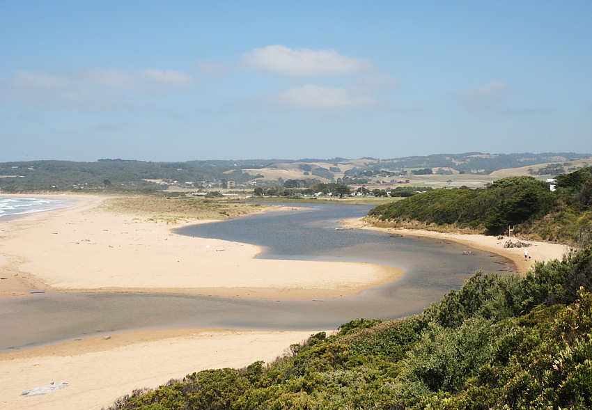
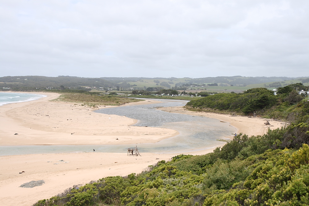
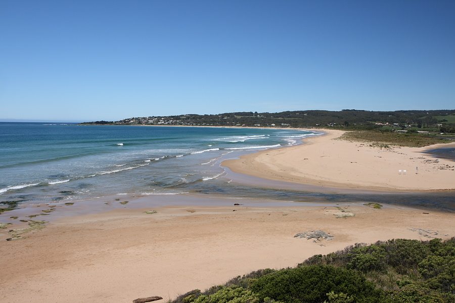
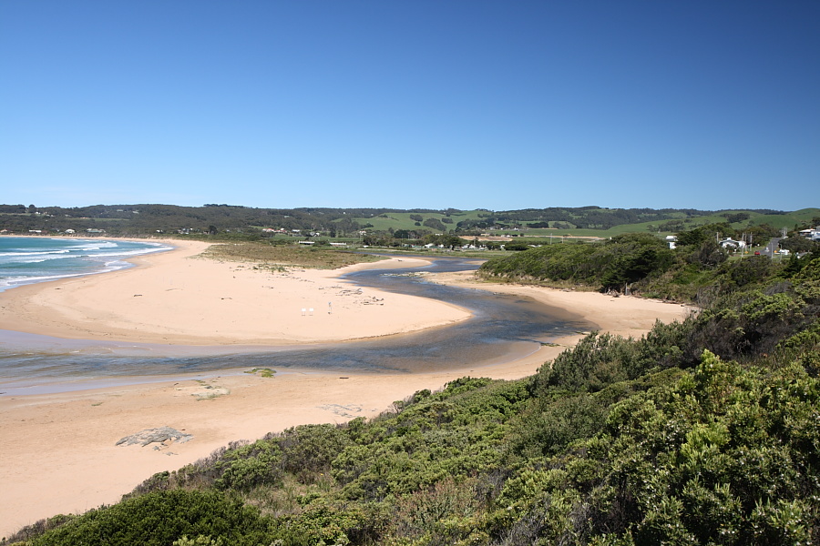
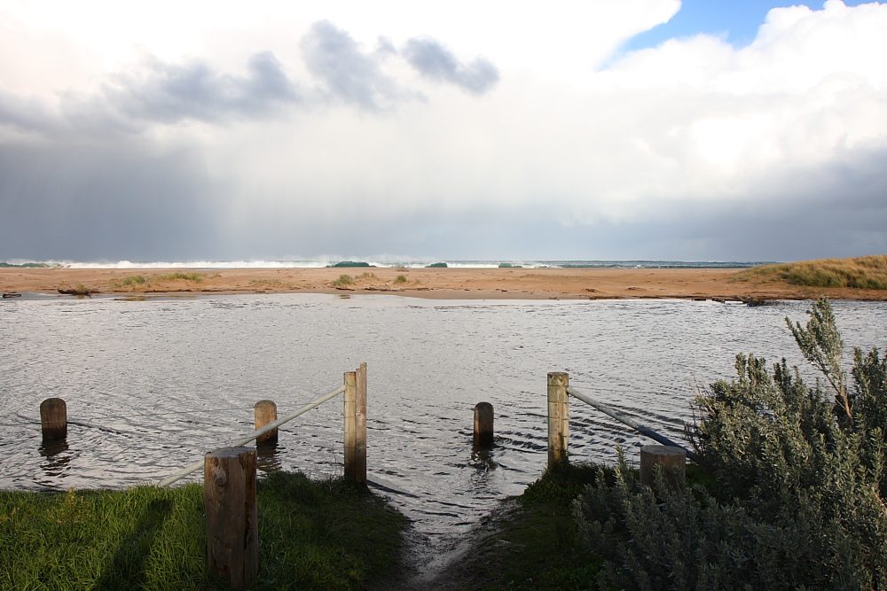
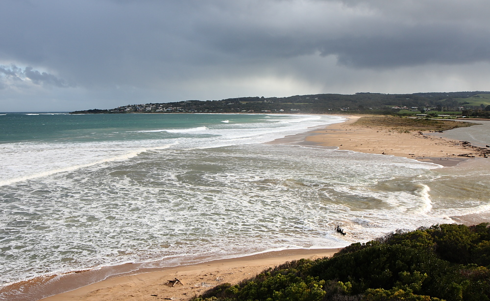
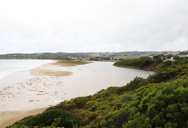
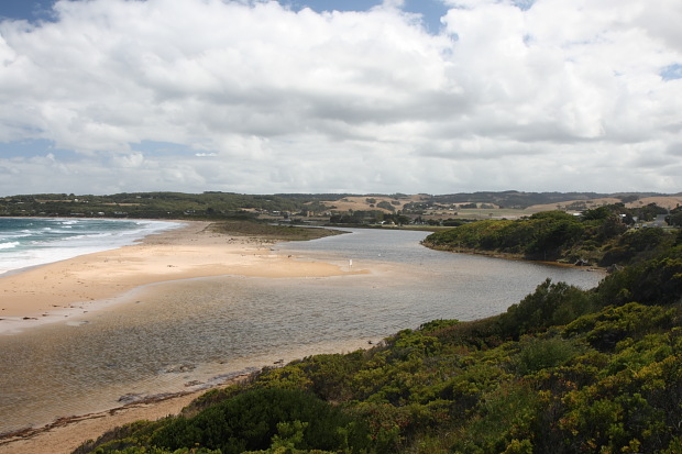
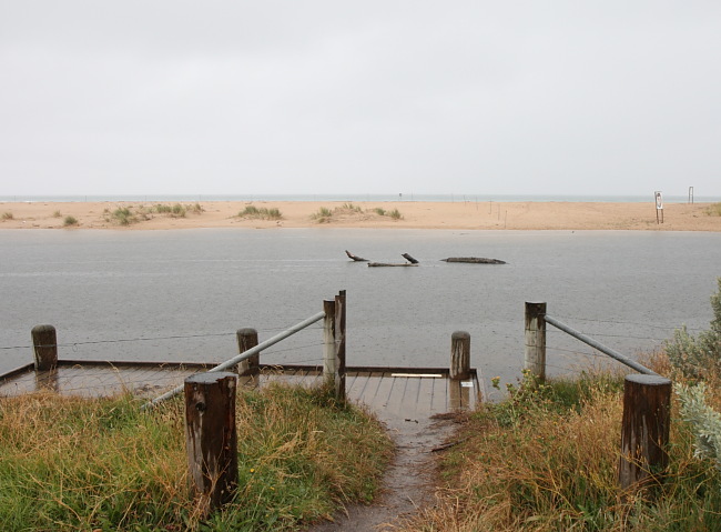
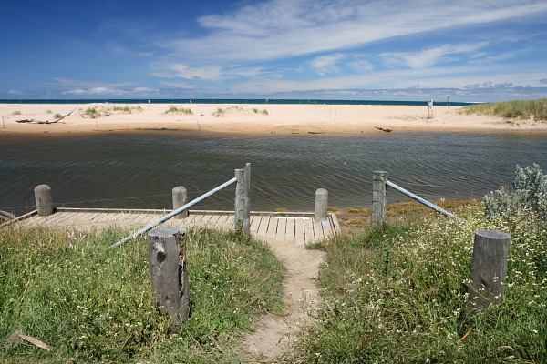
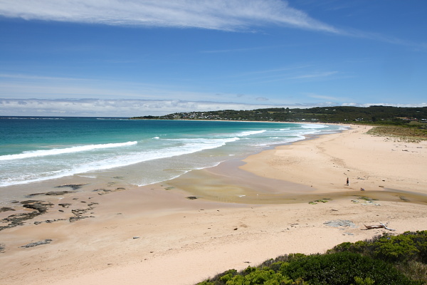
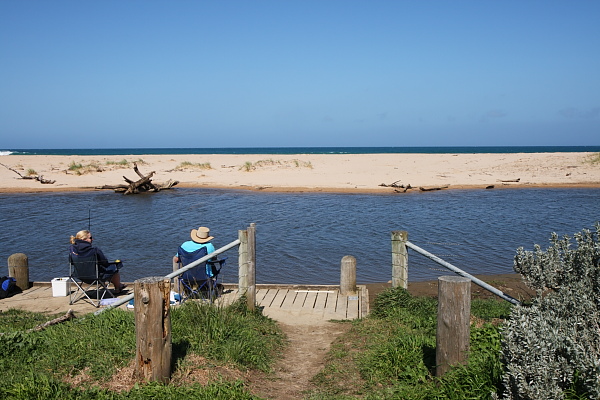
EstuaryWatch Data Portal
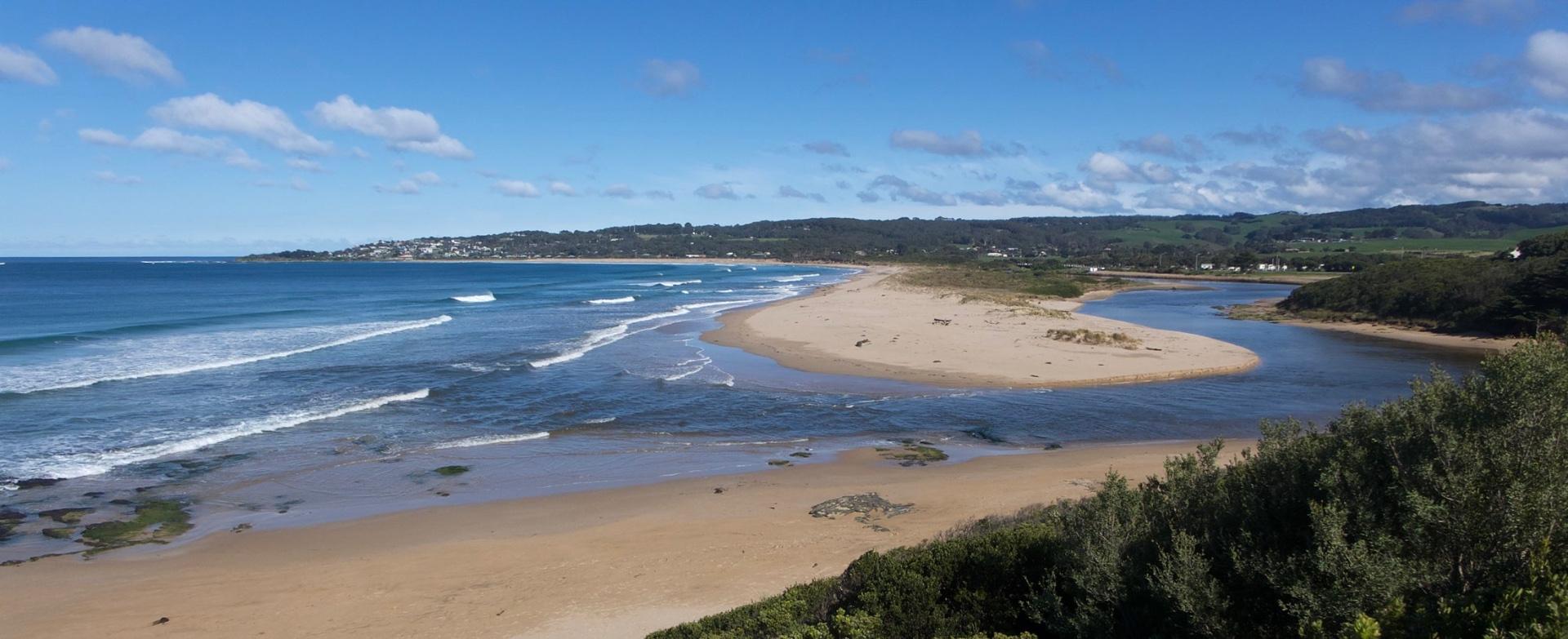
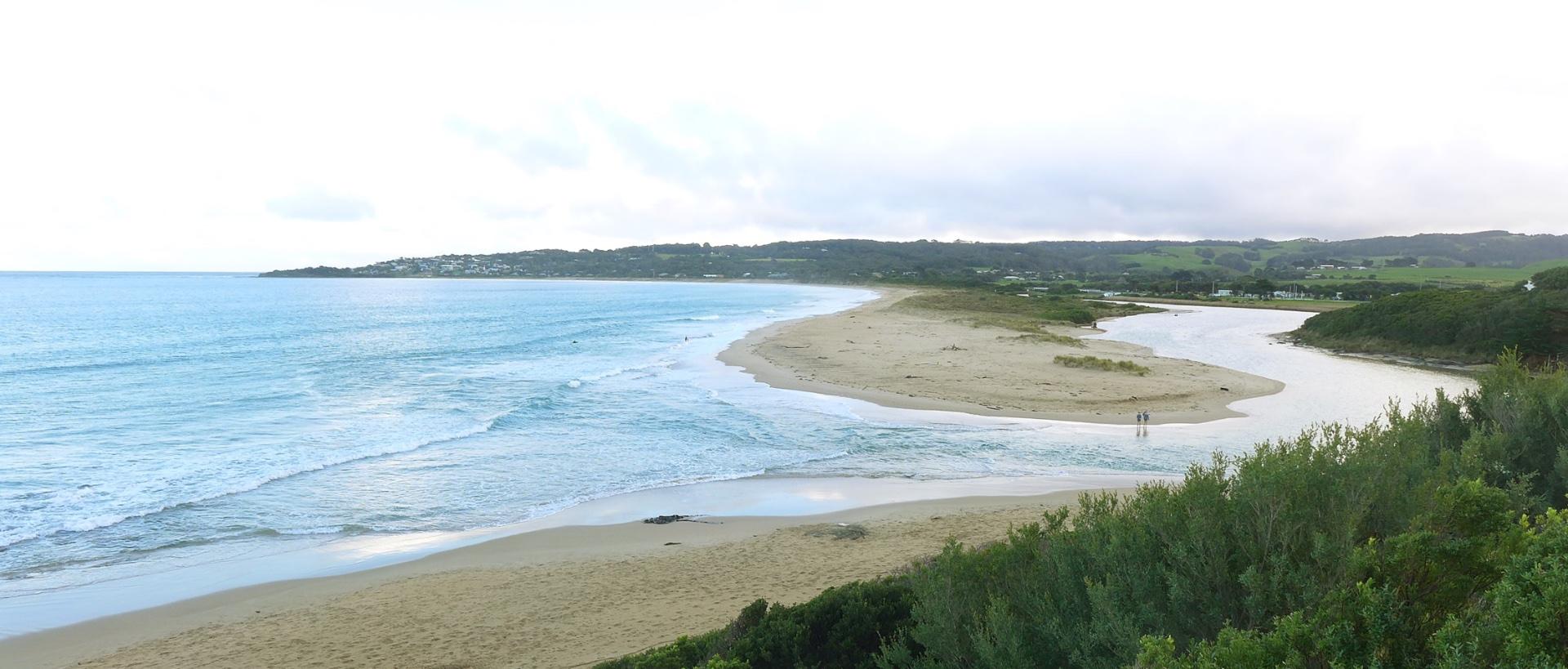
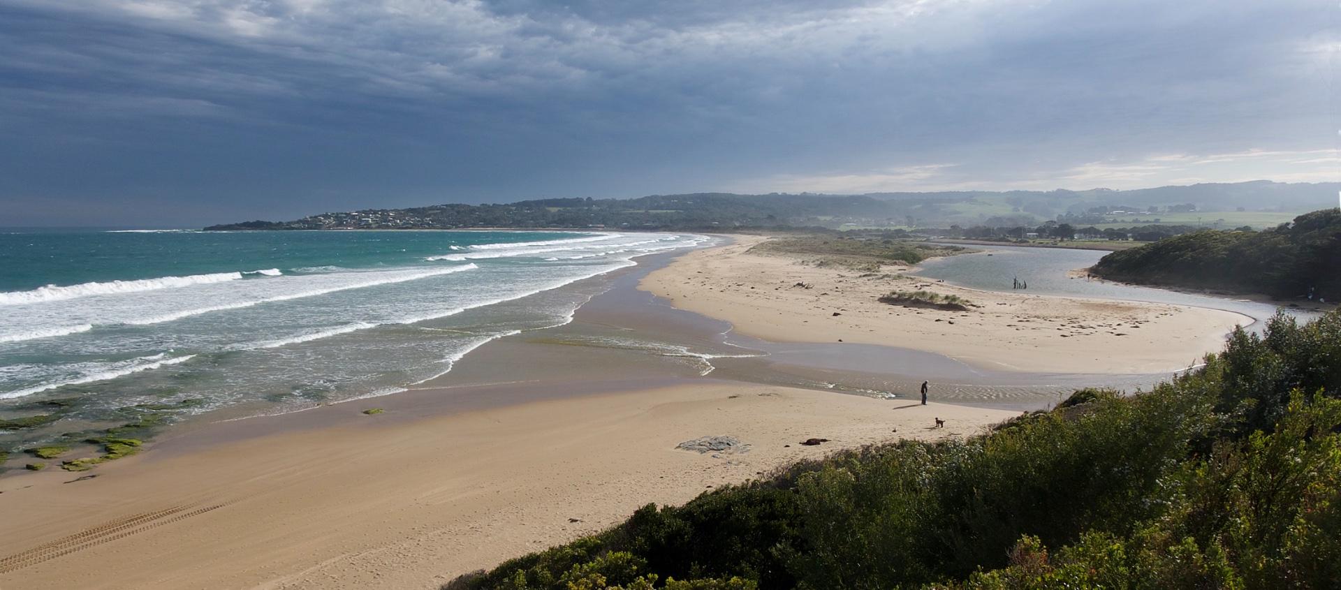
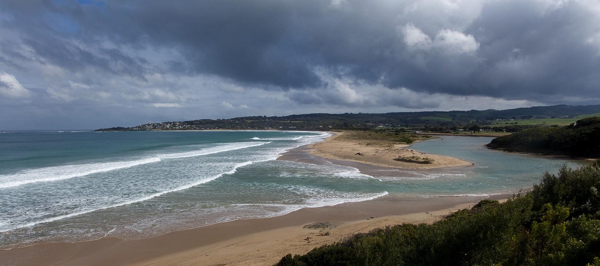
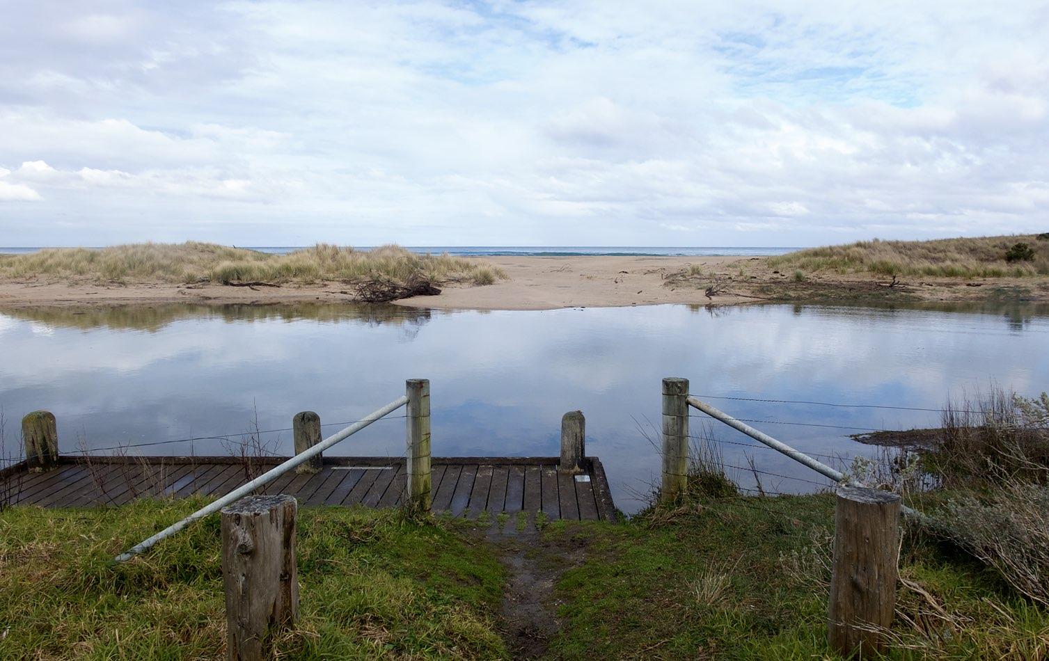
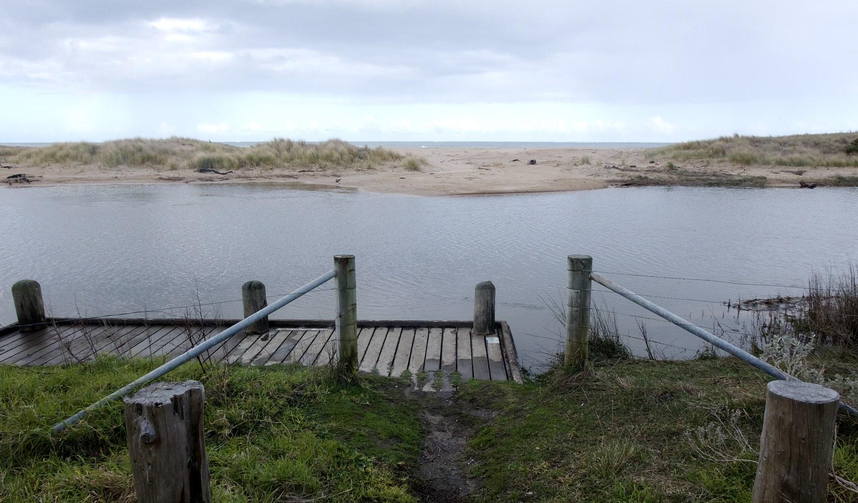
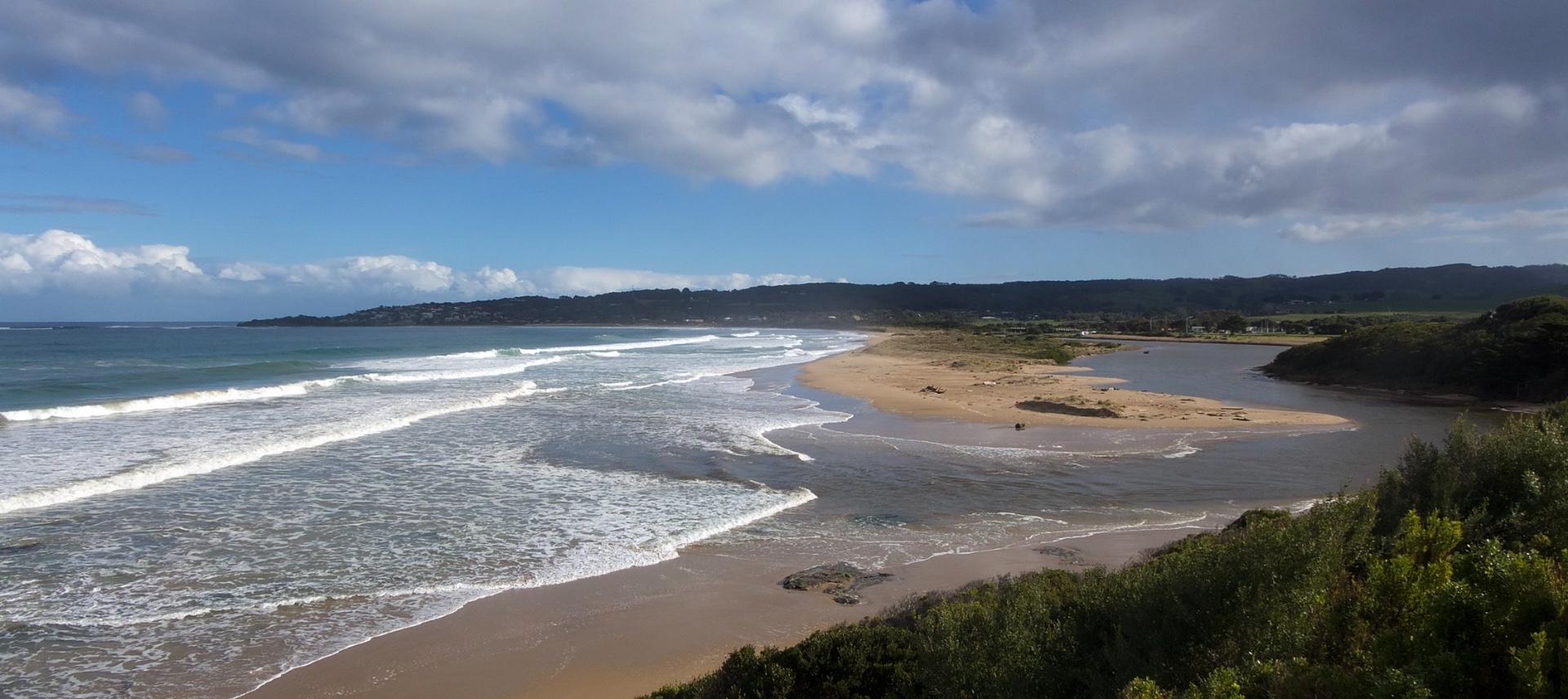
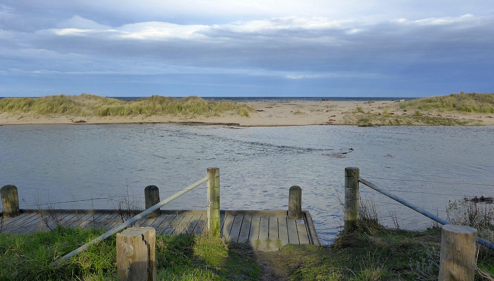
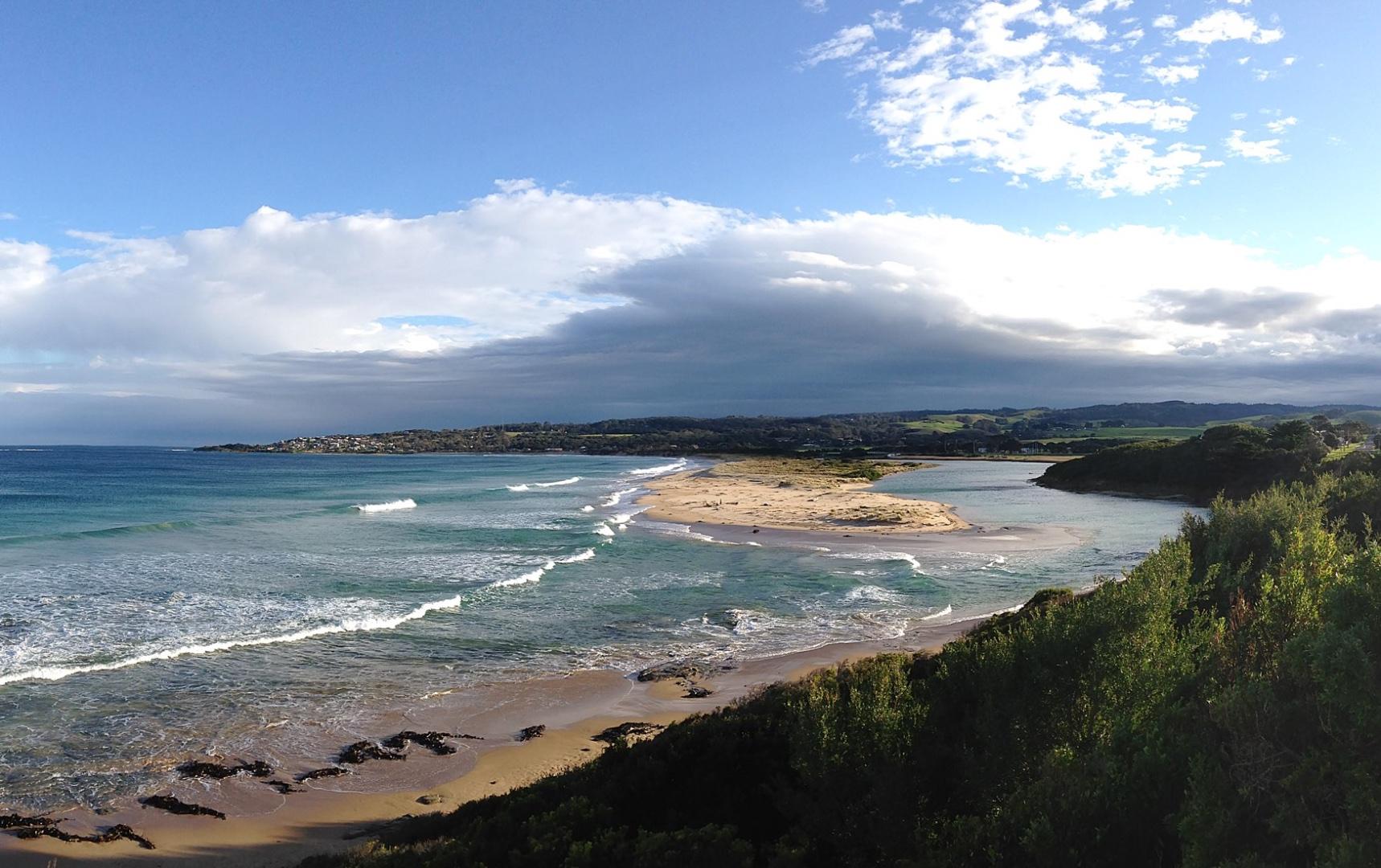
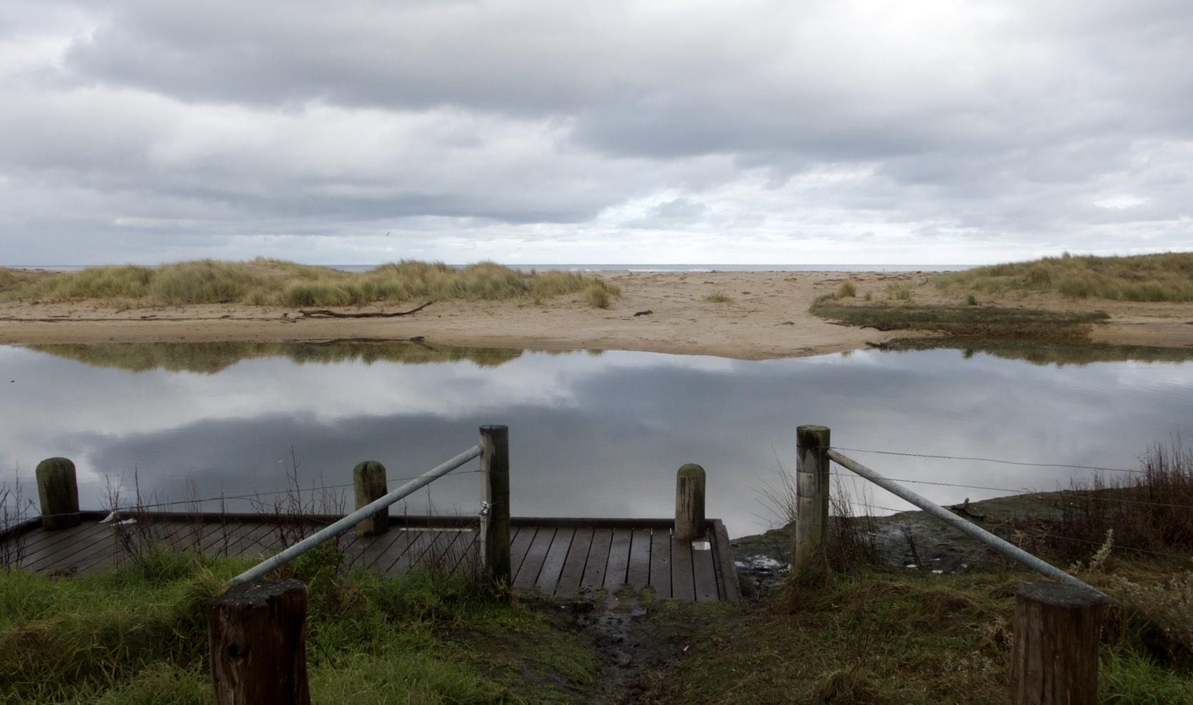
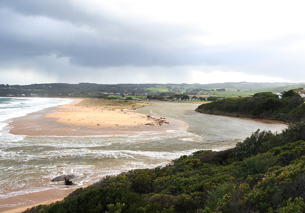
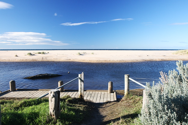
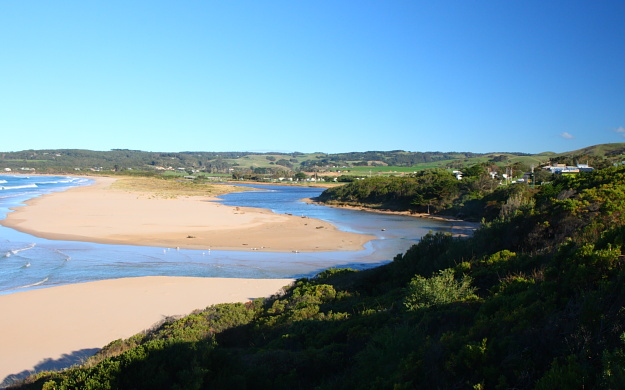
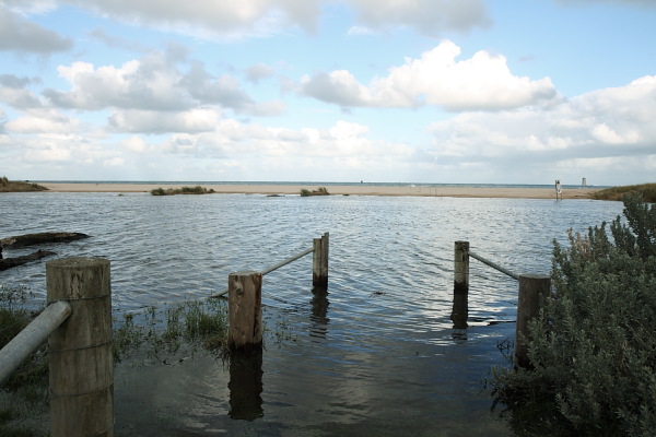
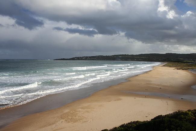
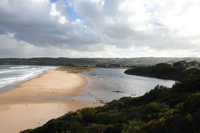
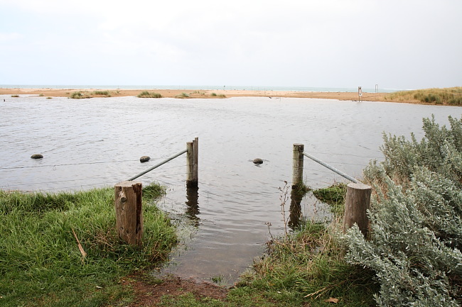
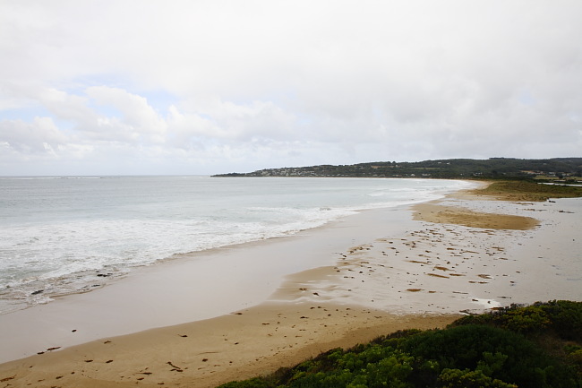
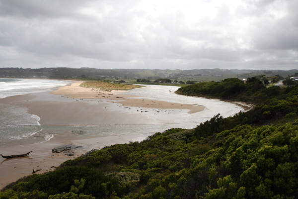
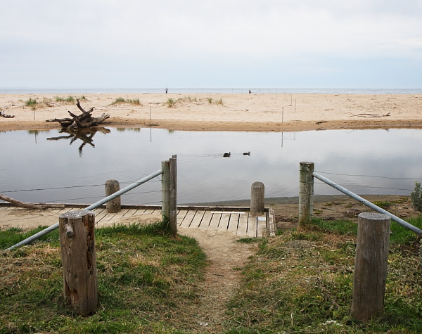
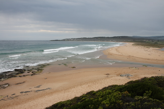
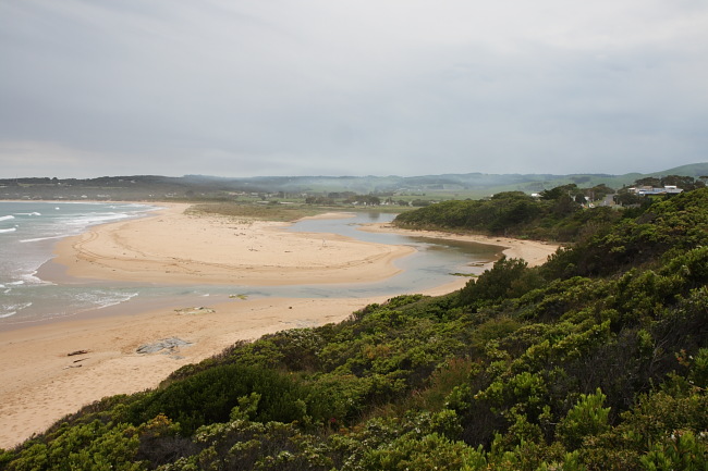
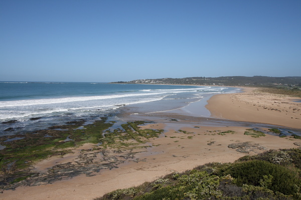
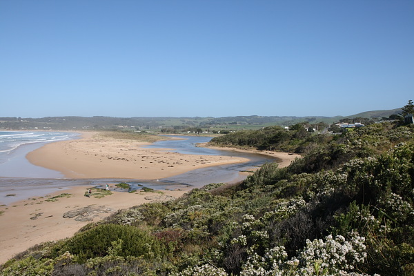
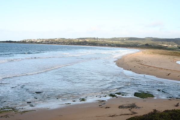
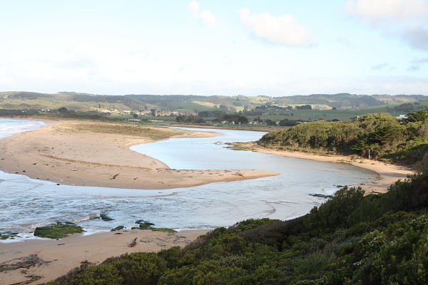
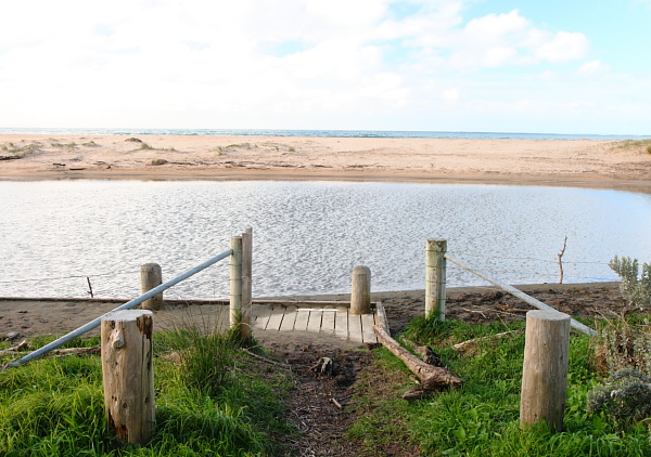
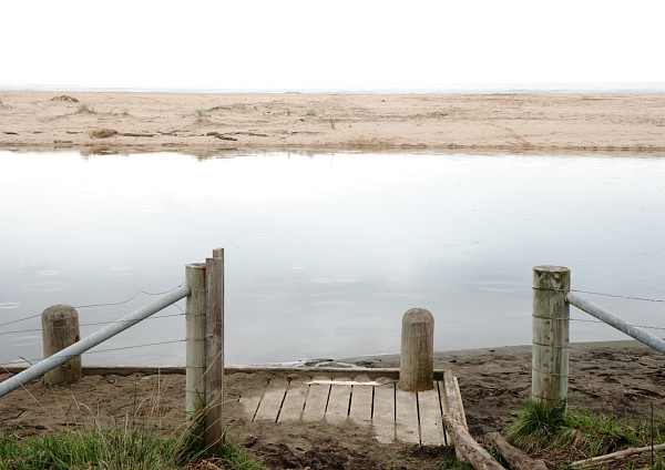
BmMC Barham River Observation Site
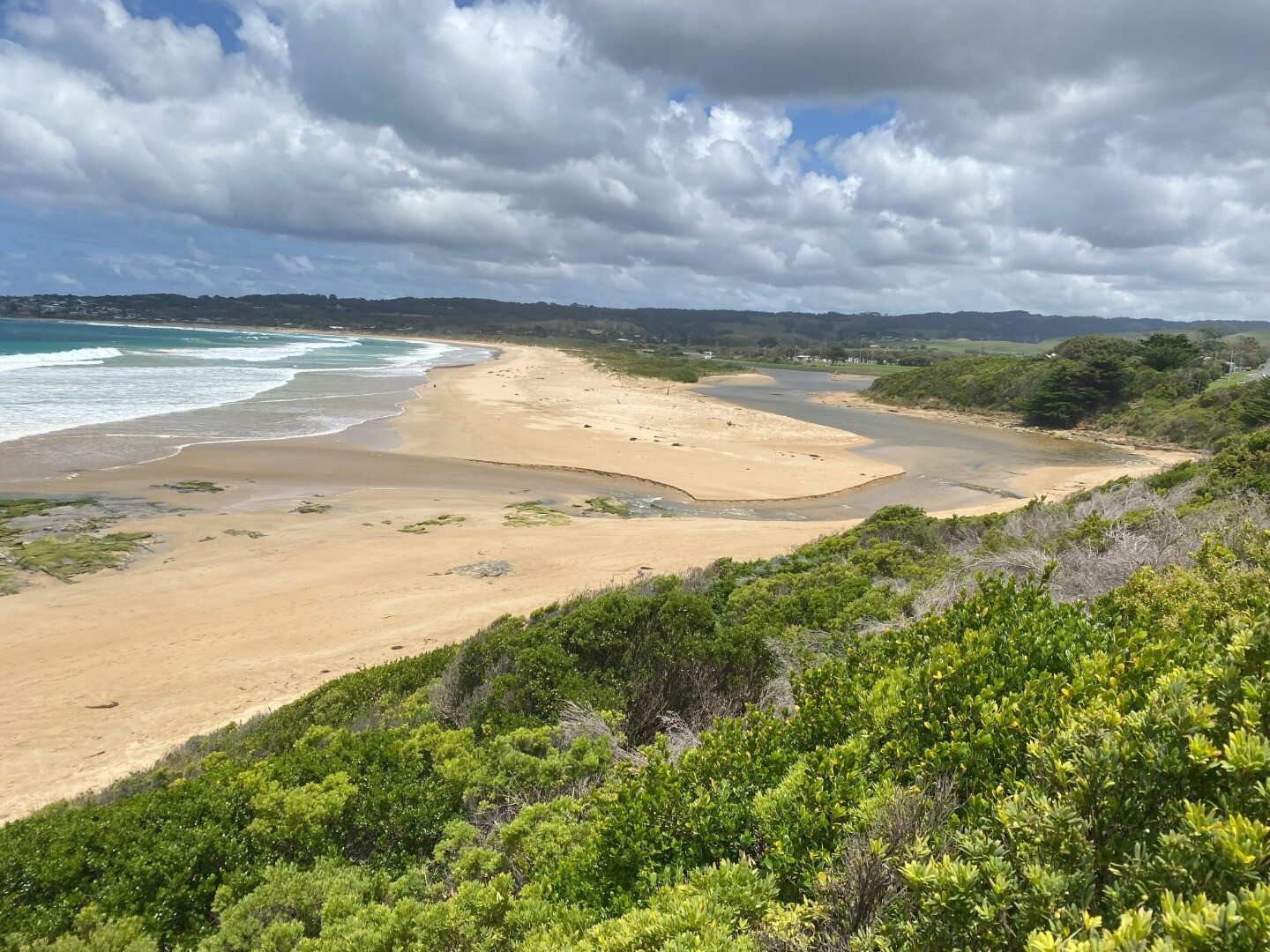
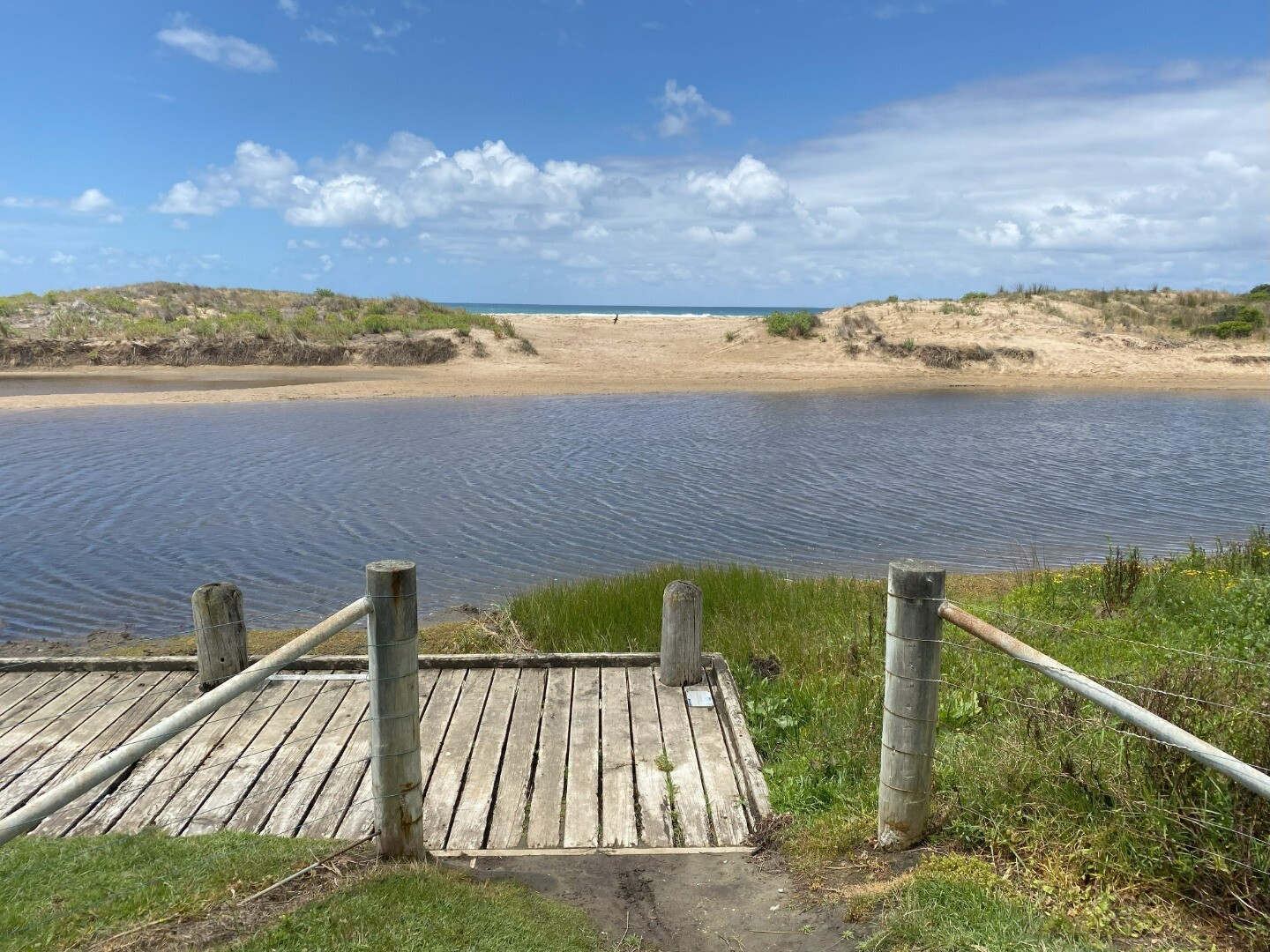
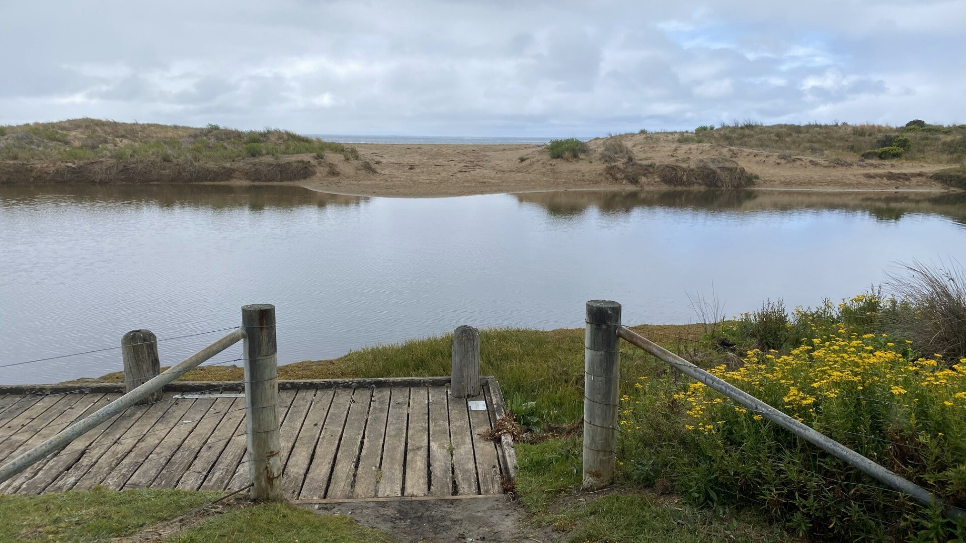
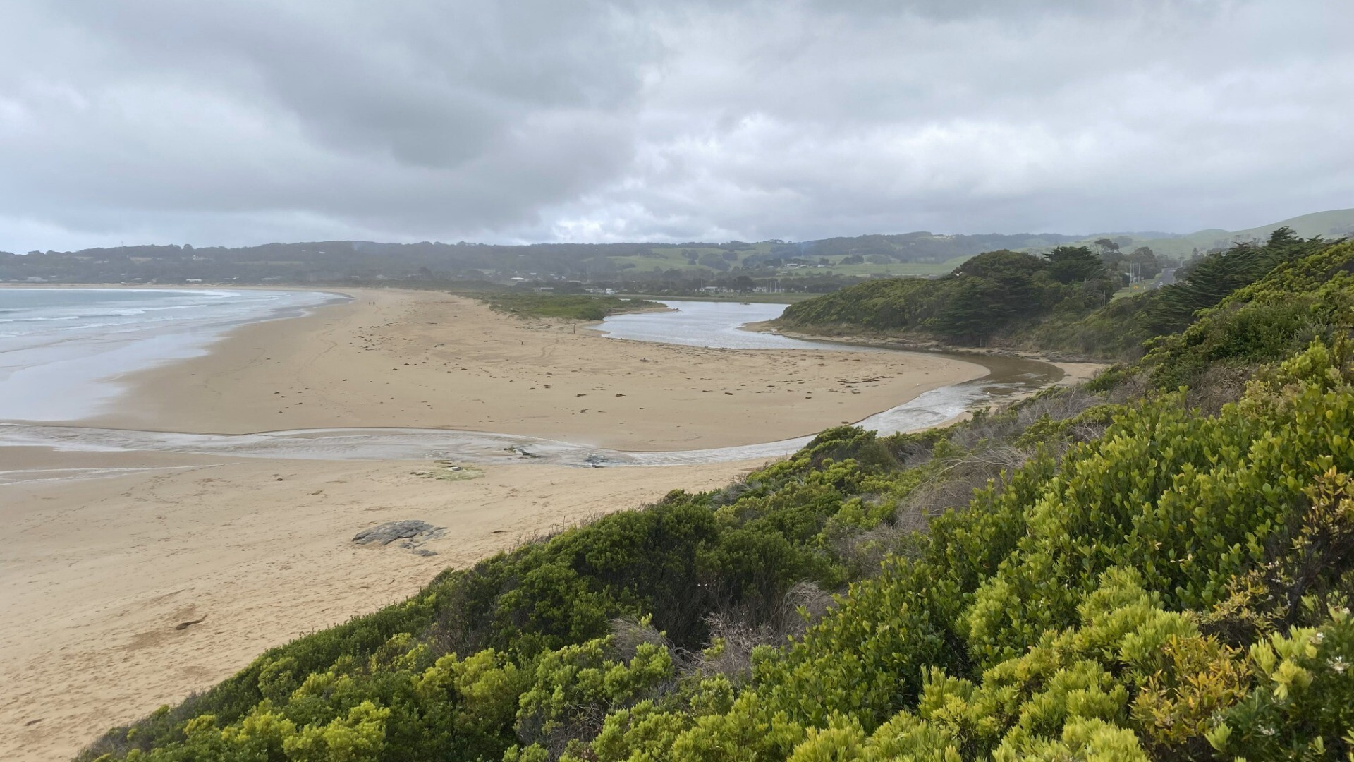
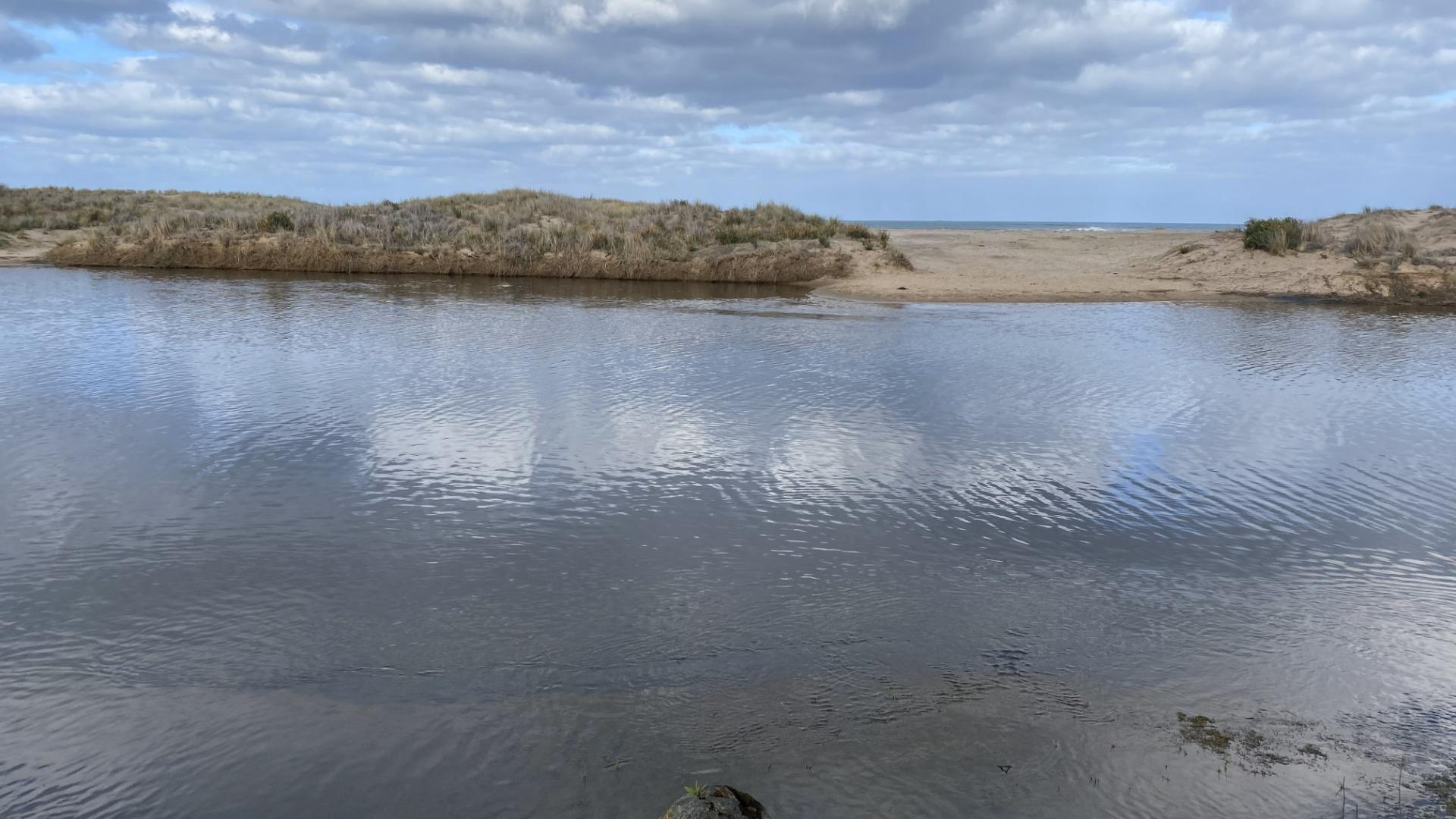
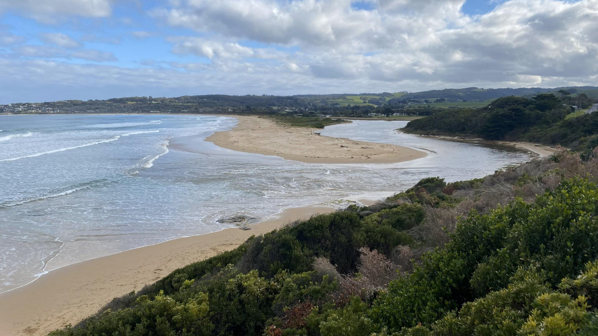
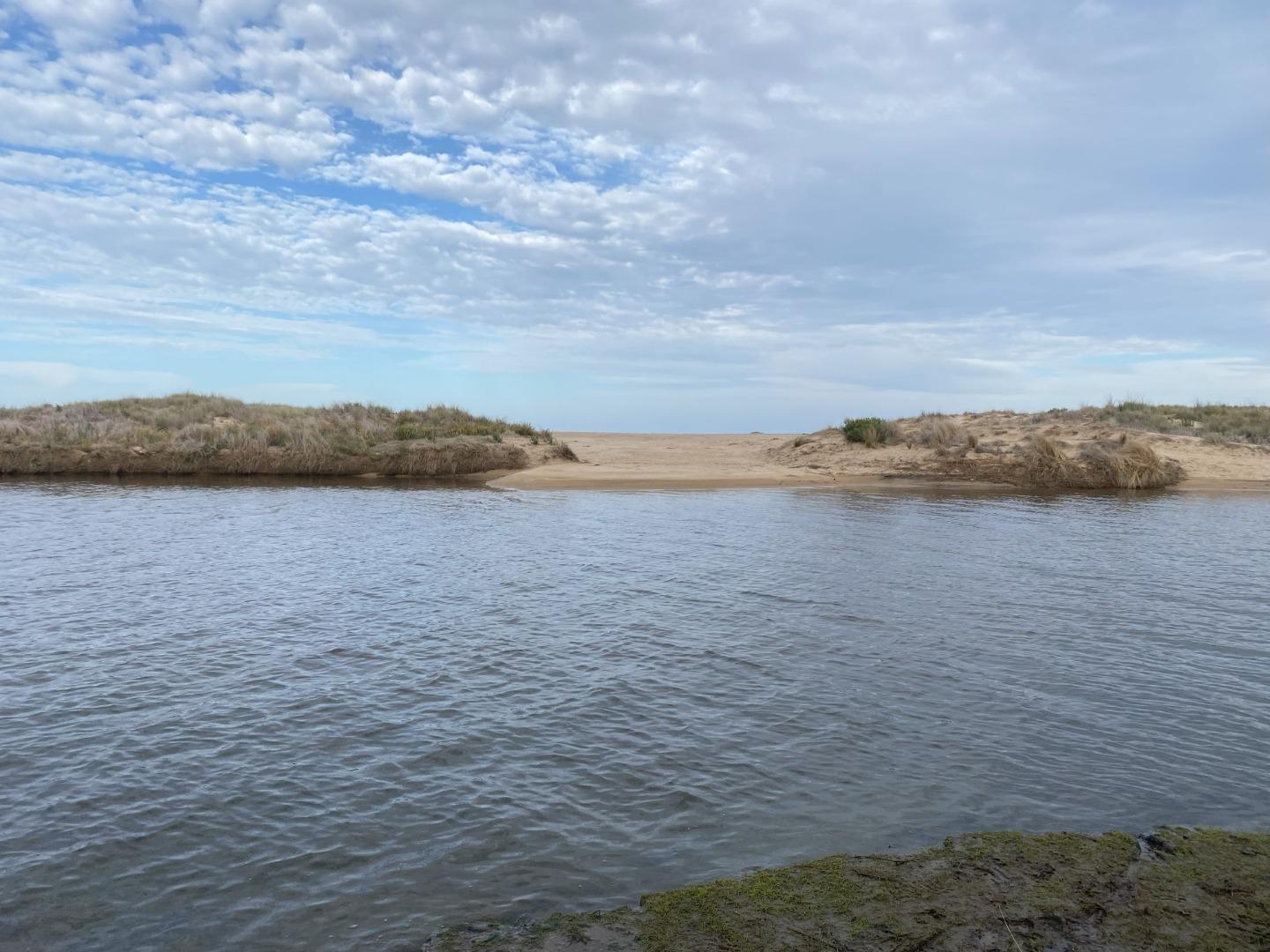
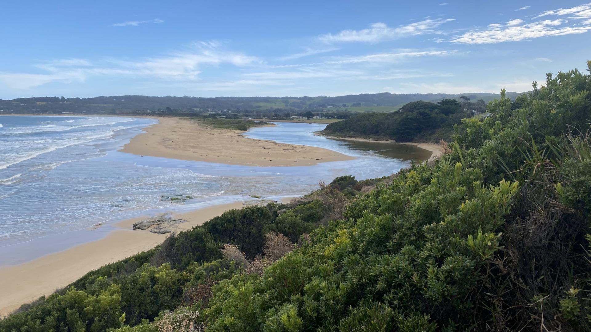
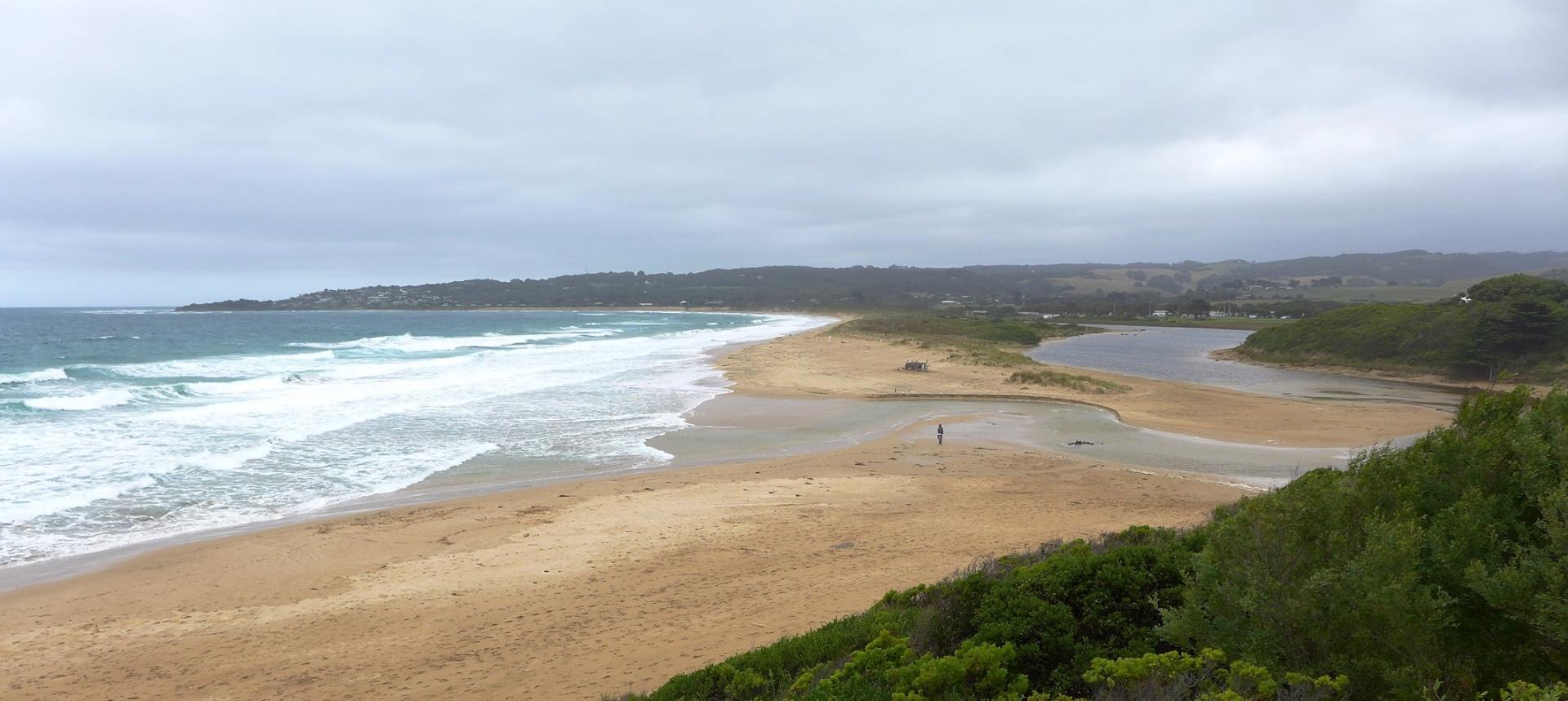
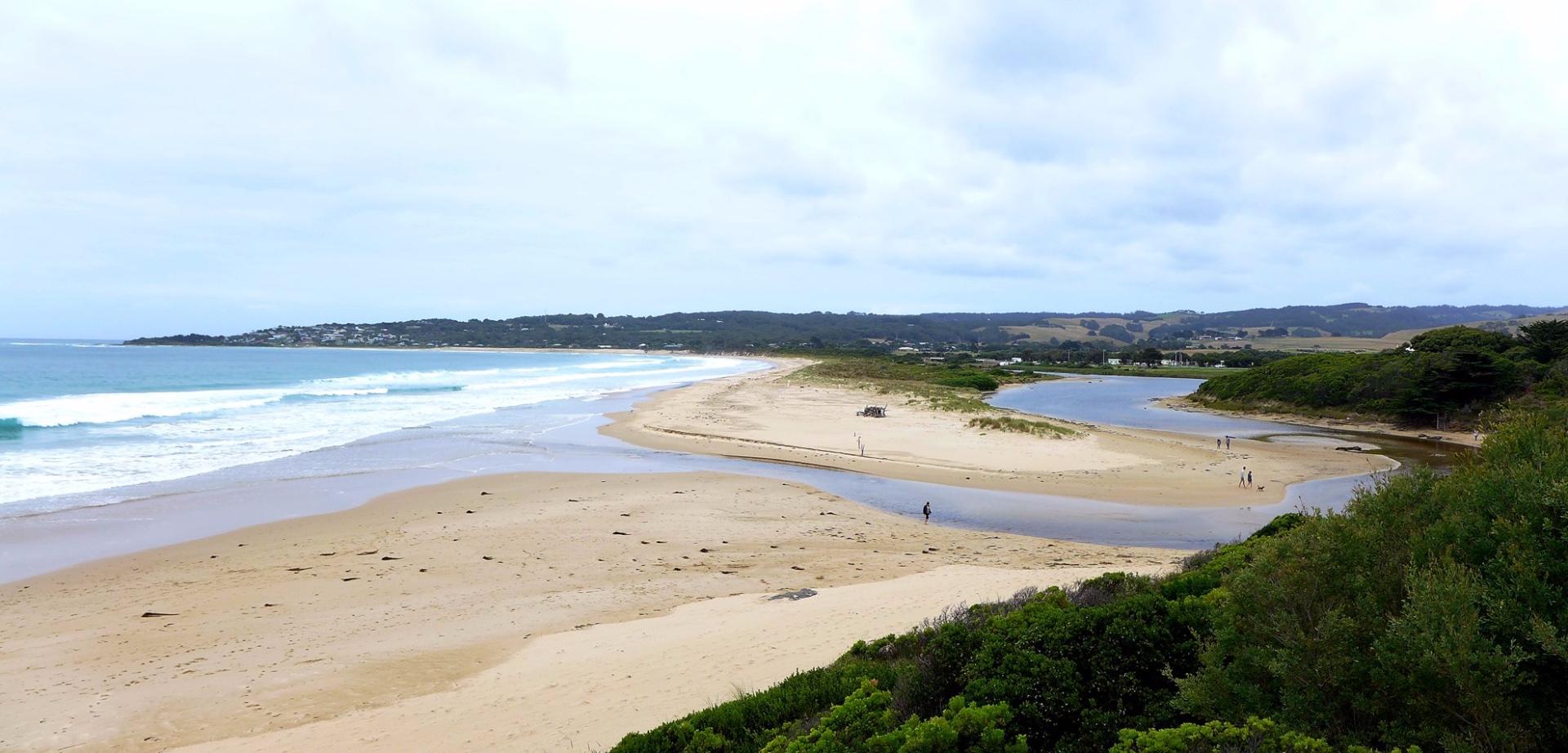
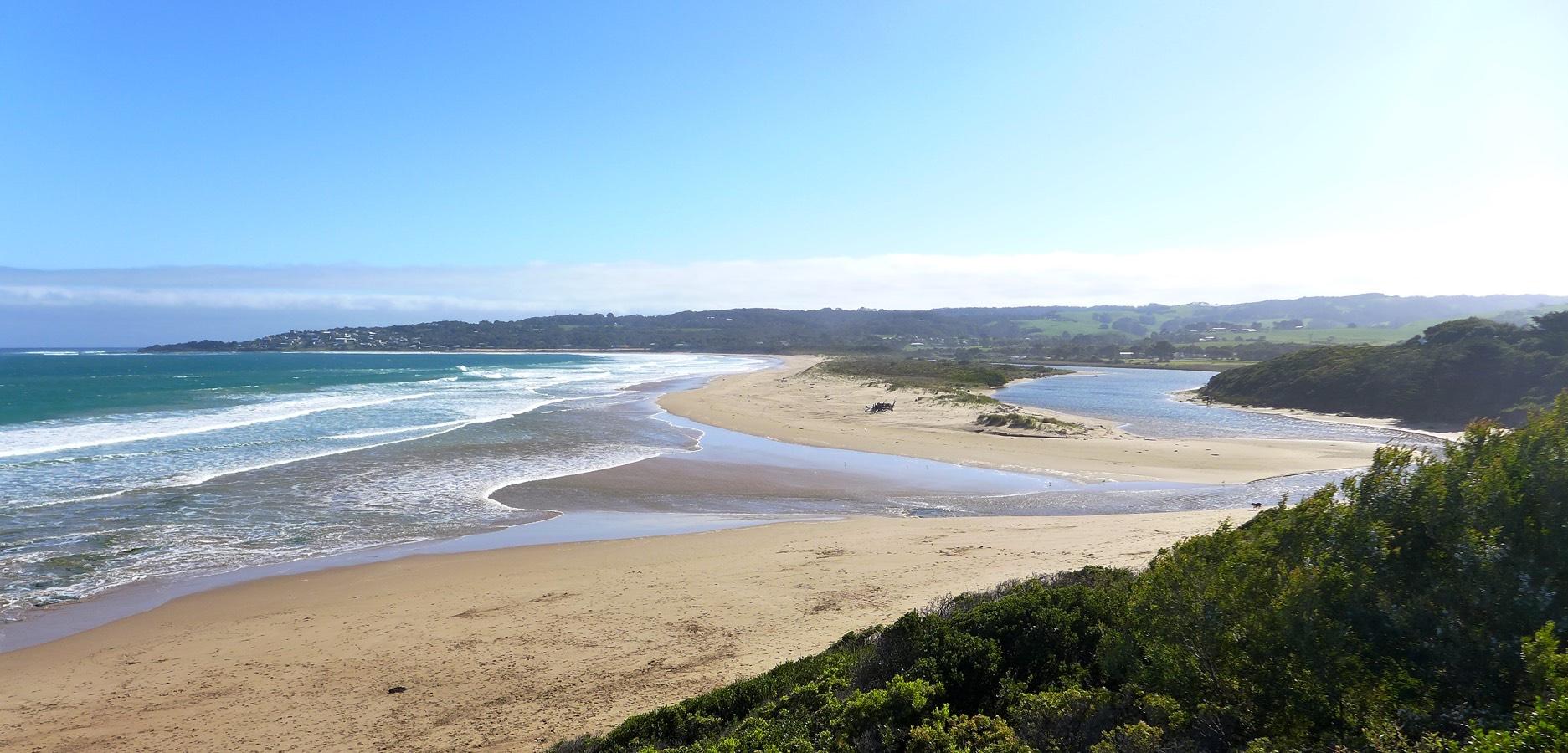
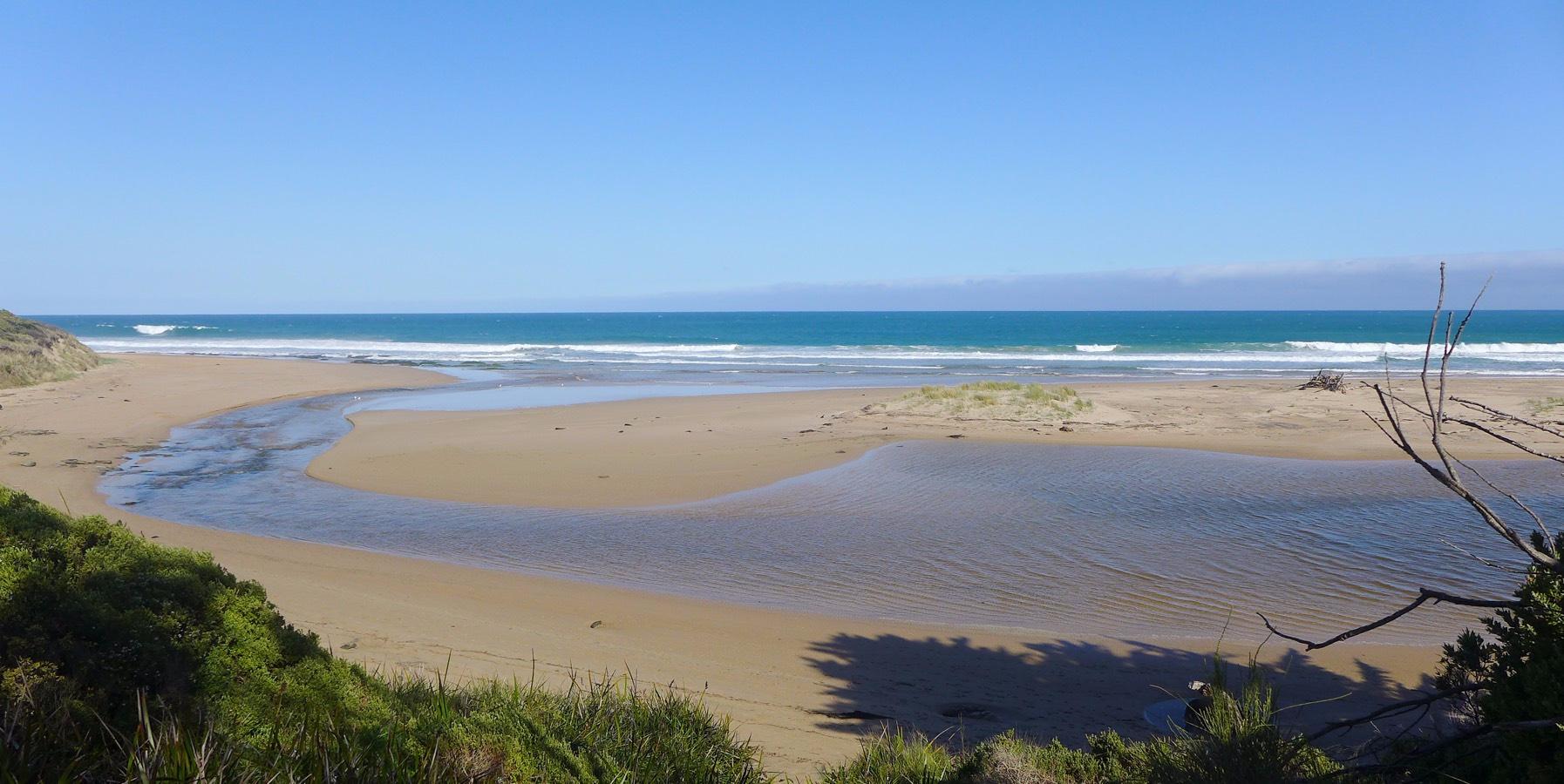
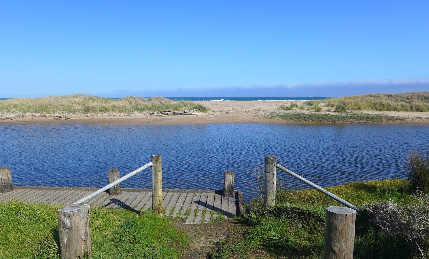
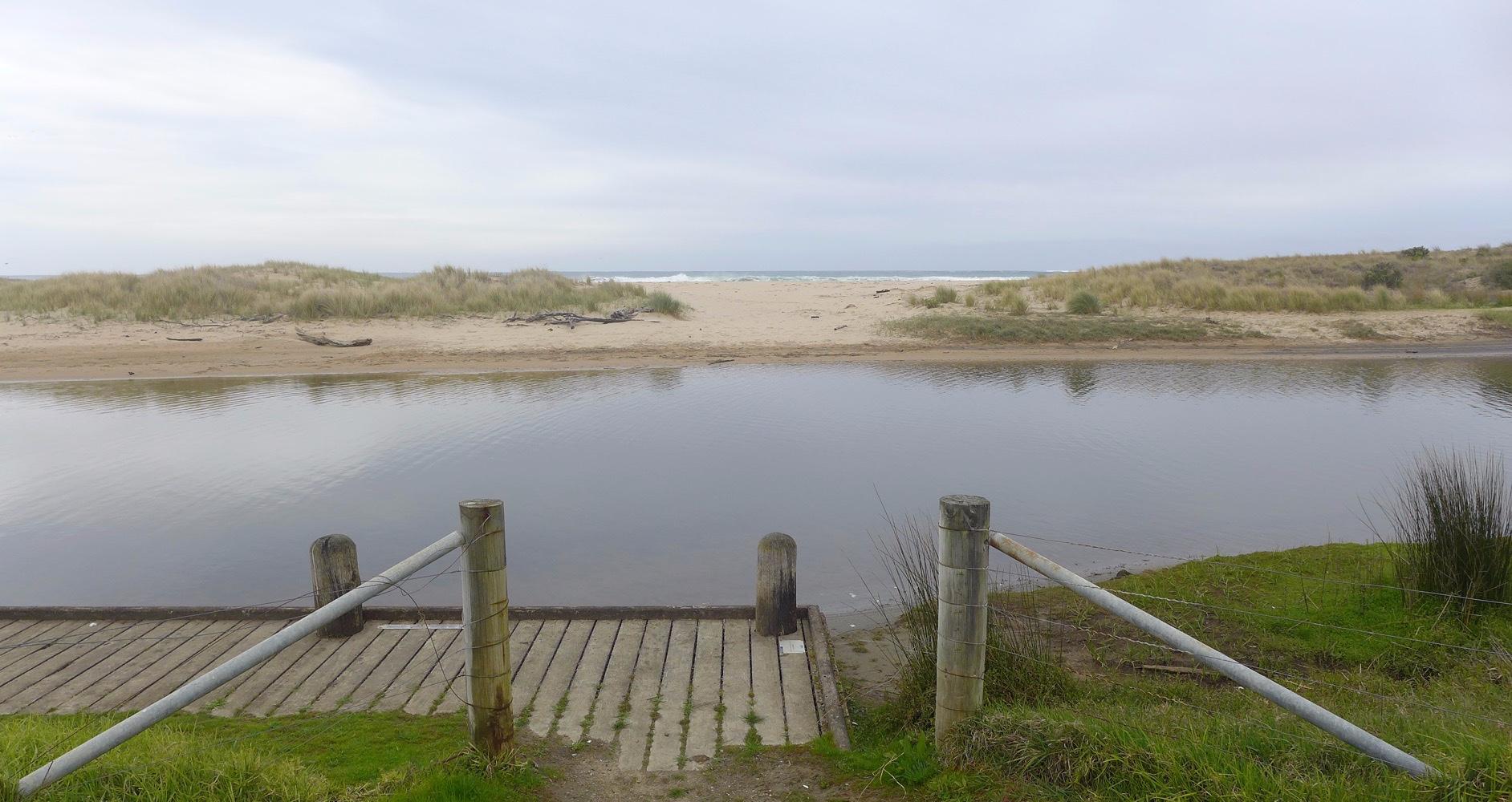
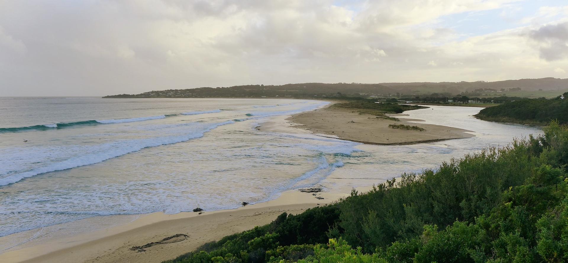
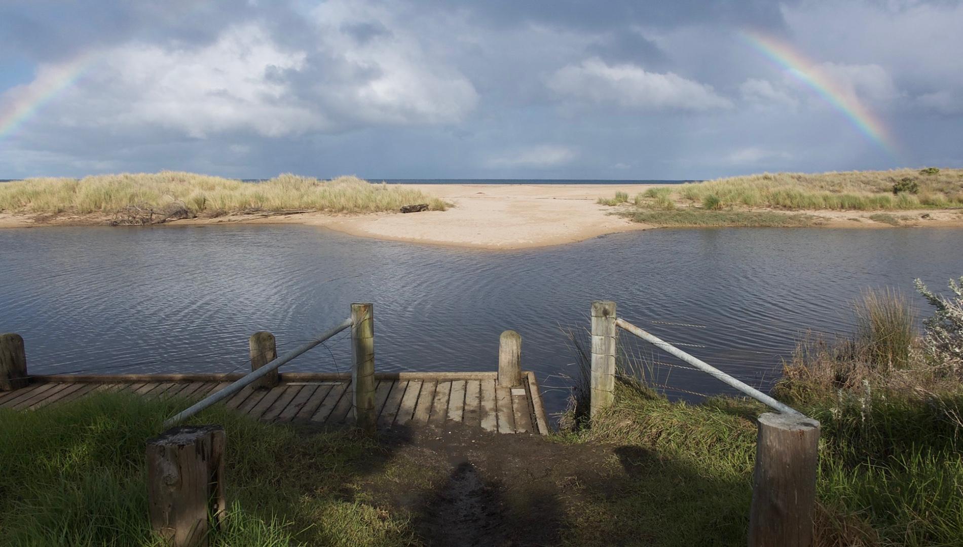
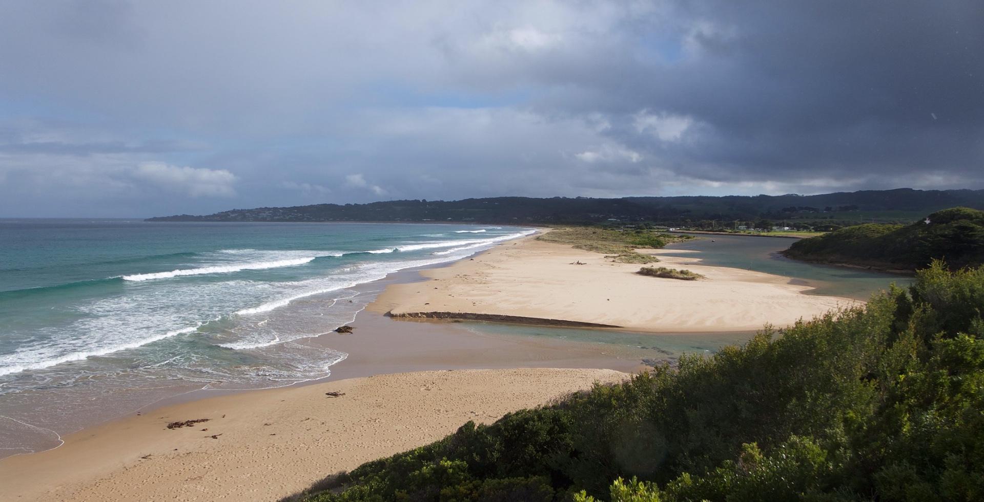
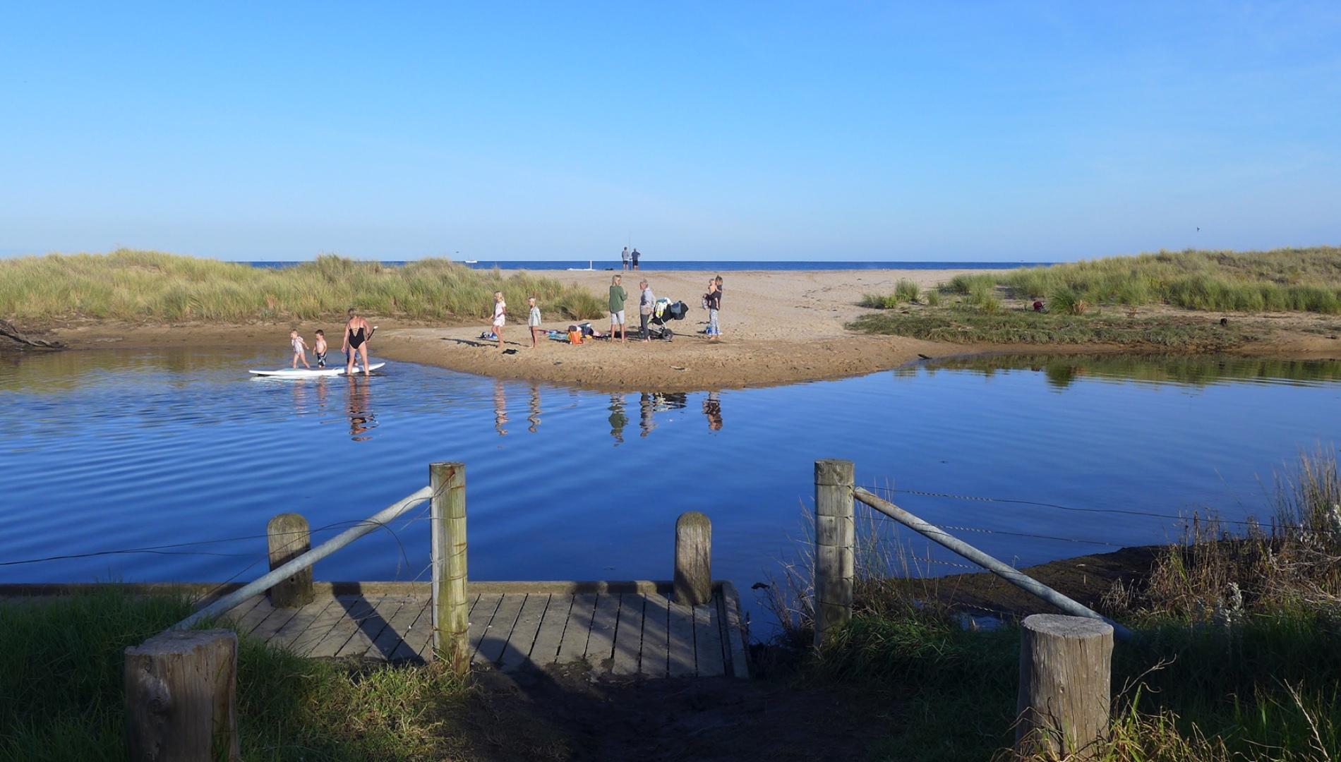
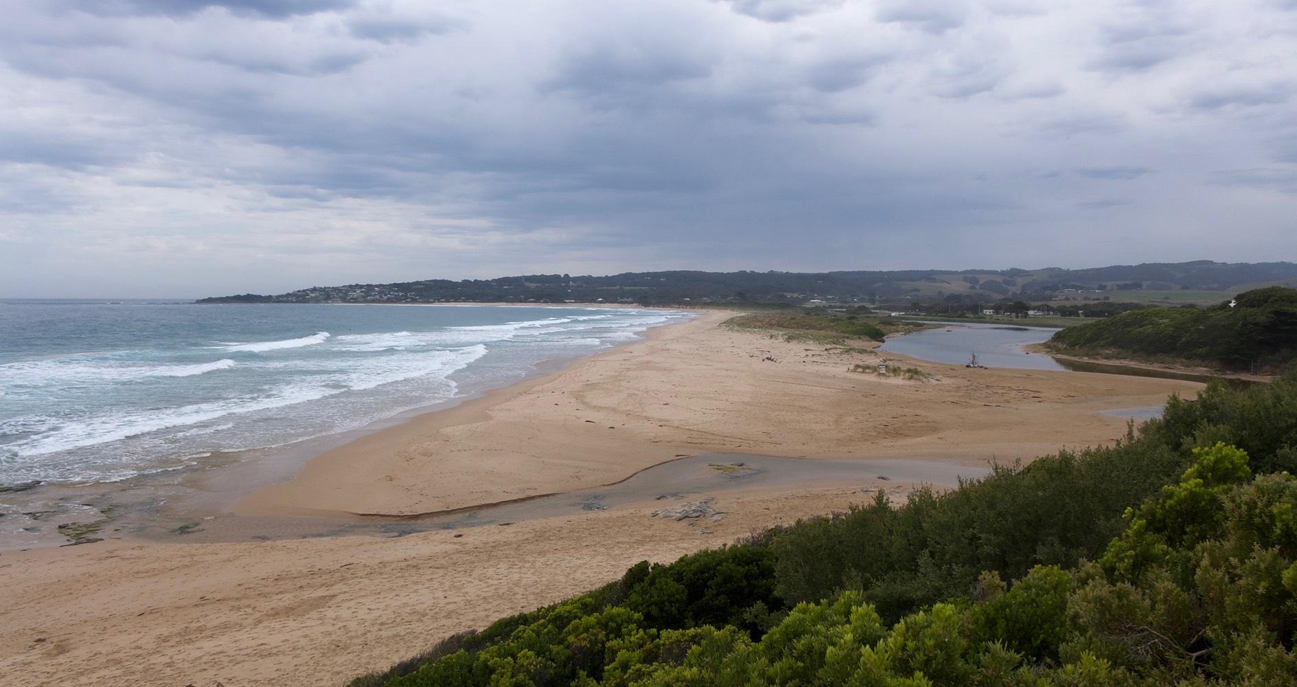
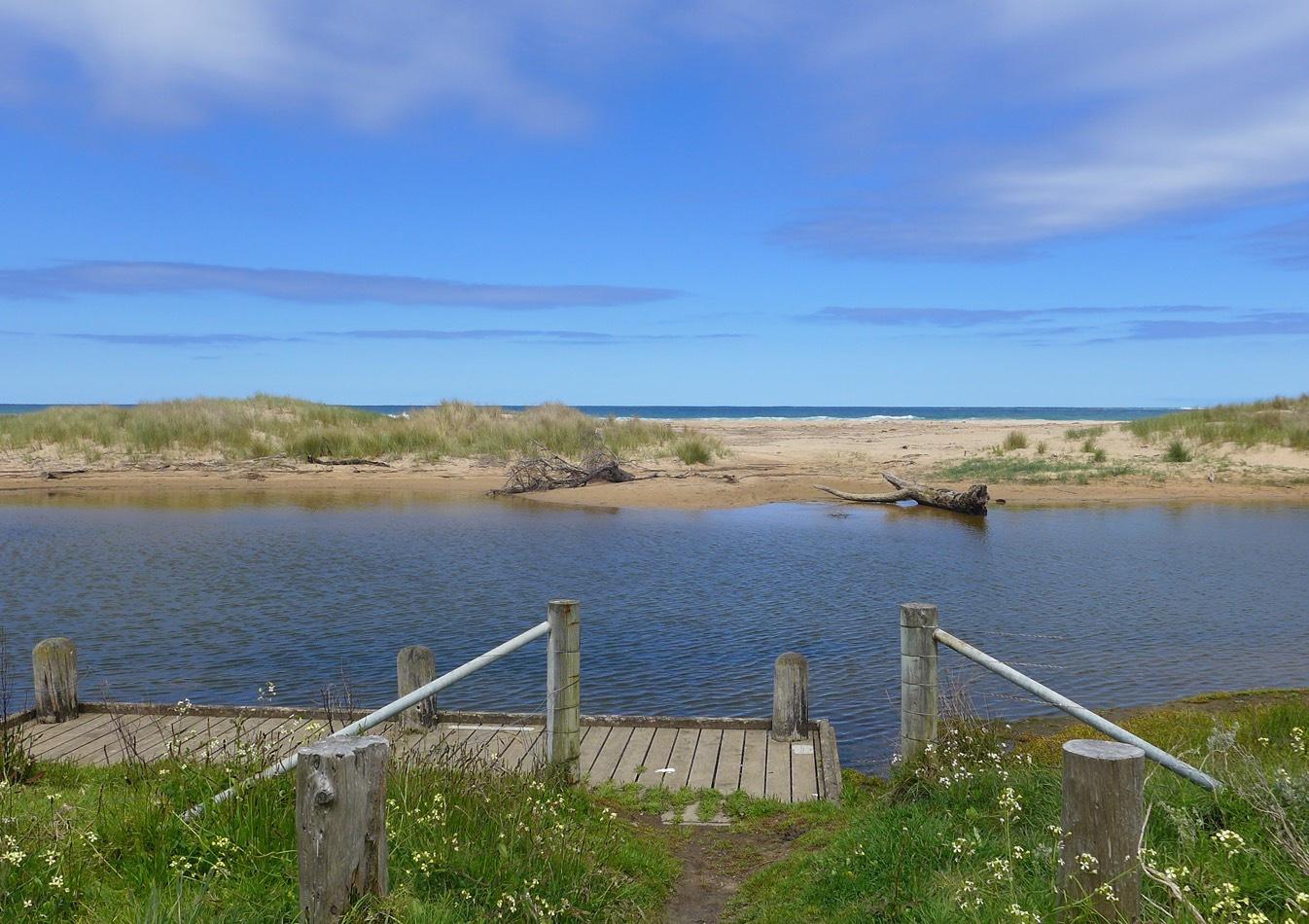
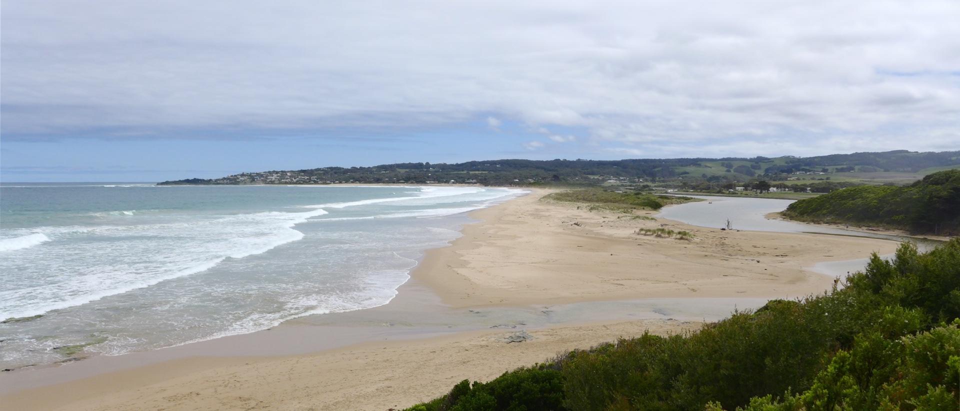
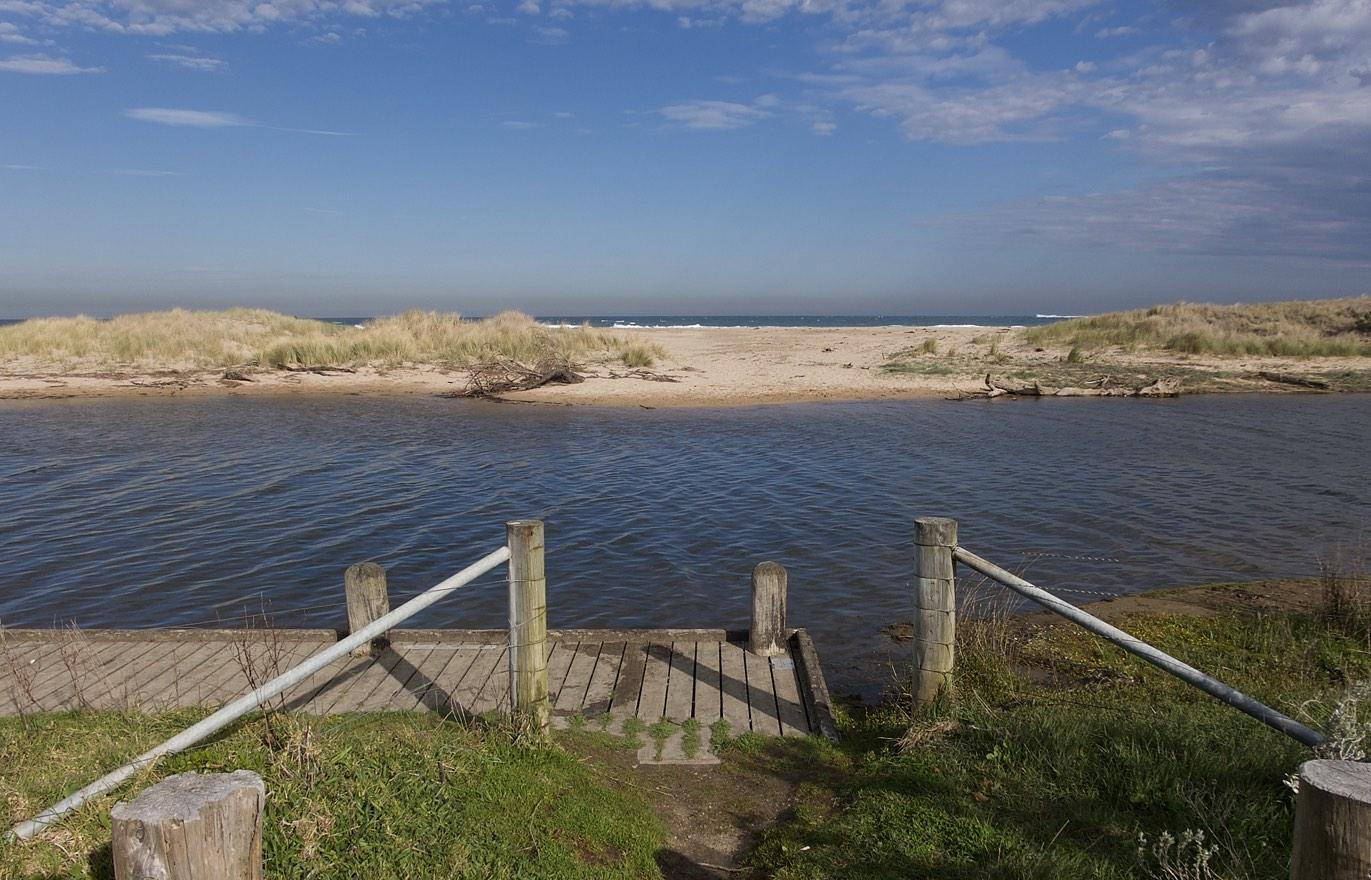
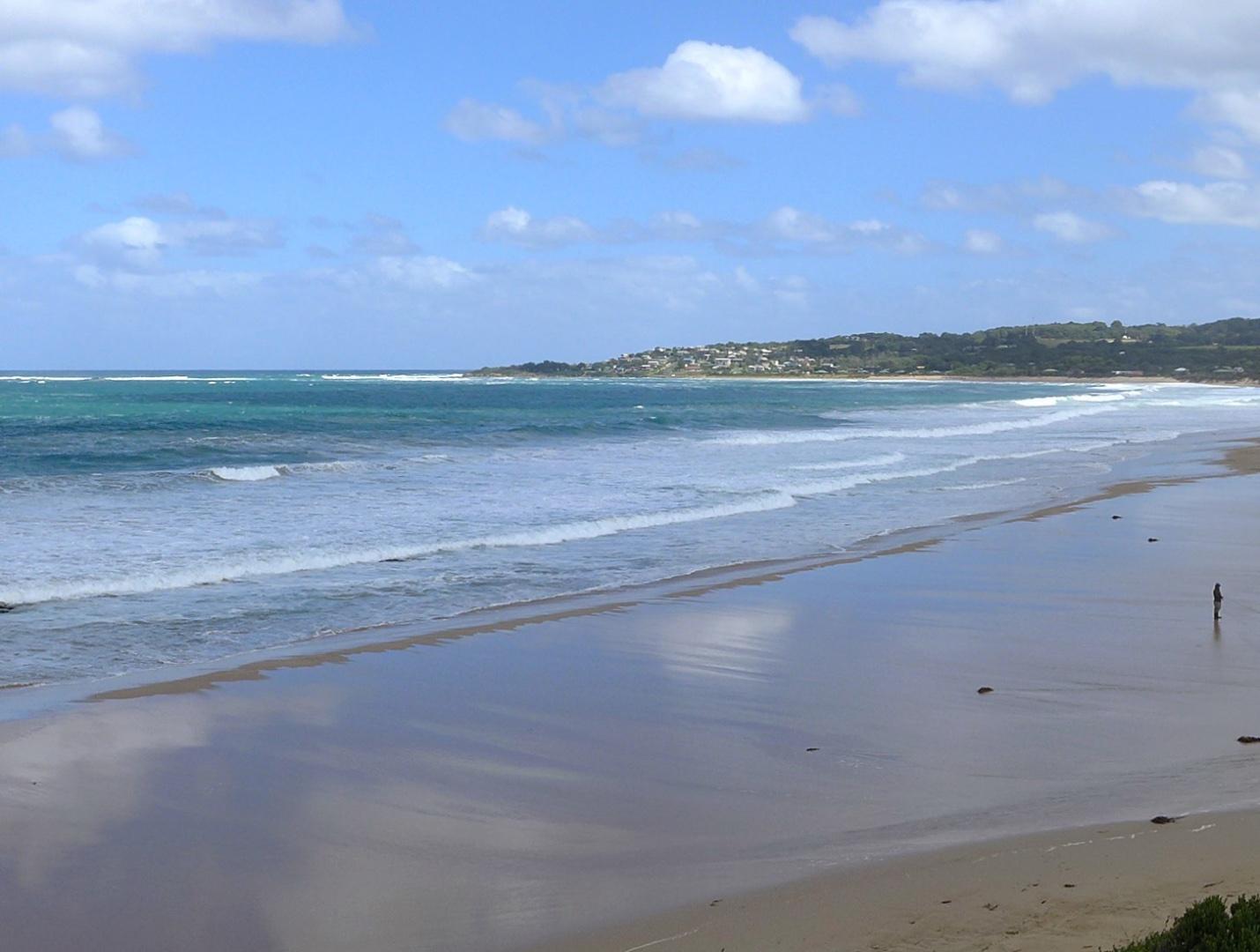
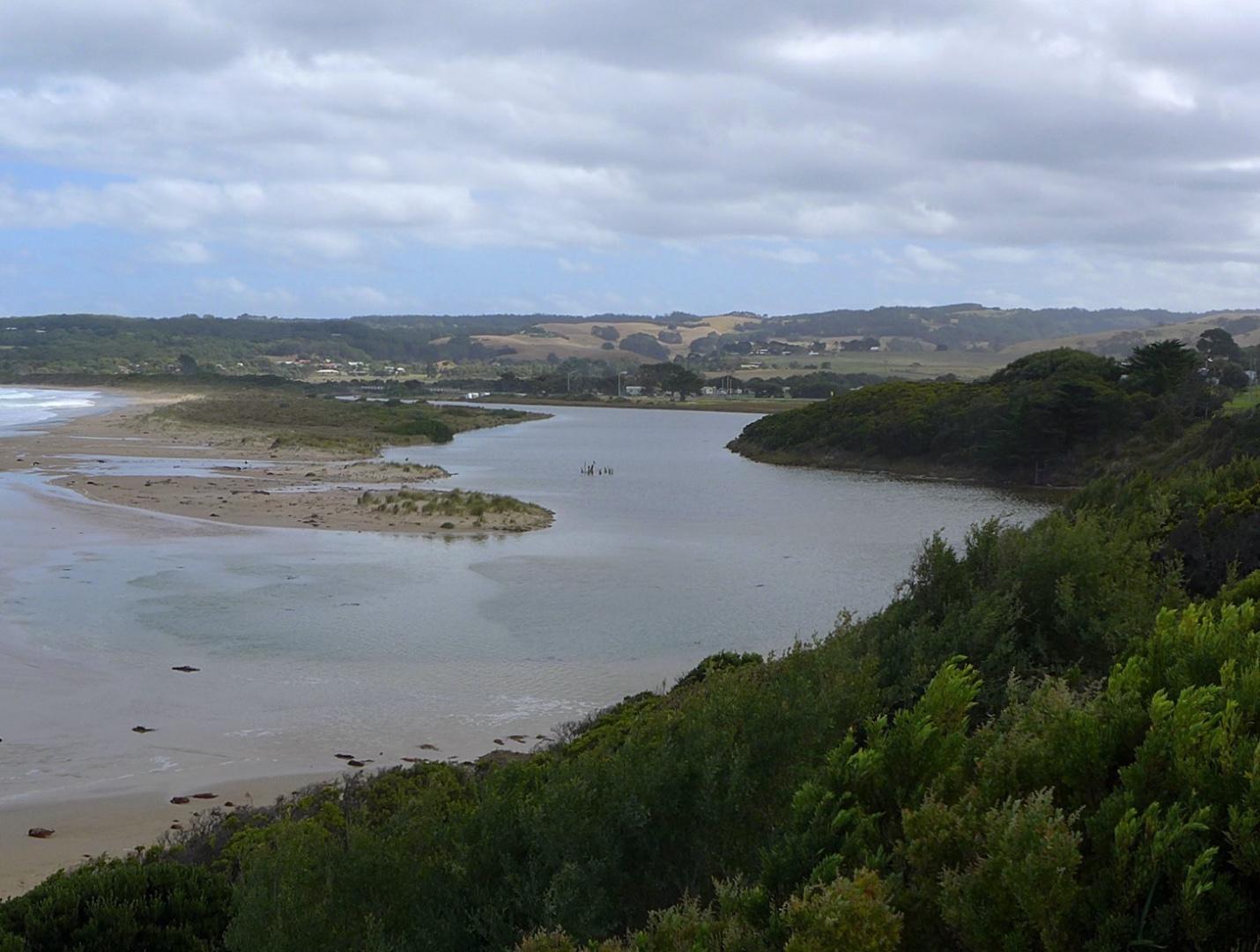
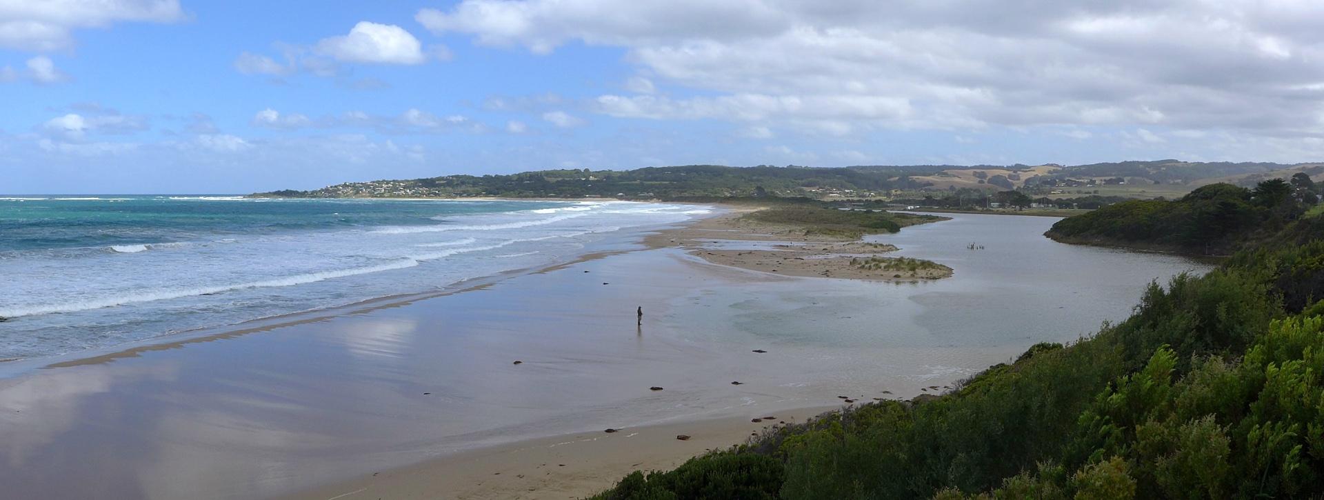
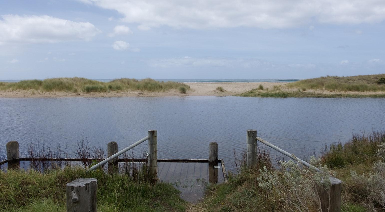
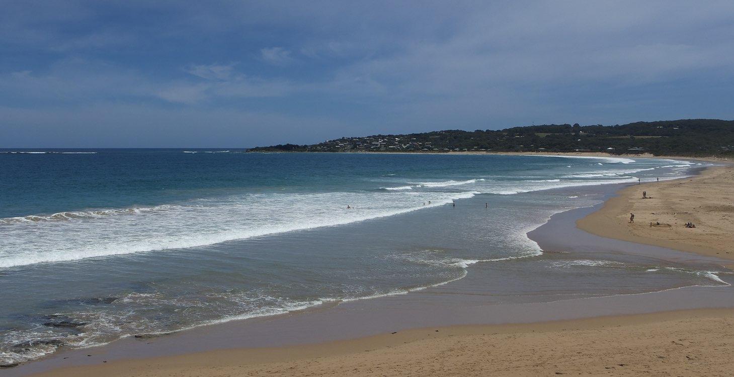
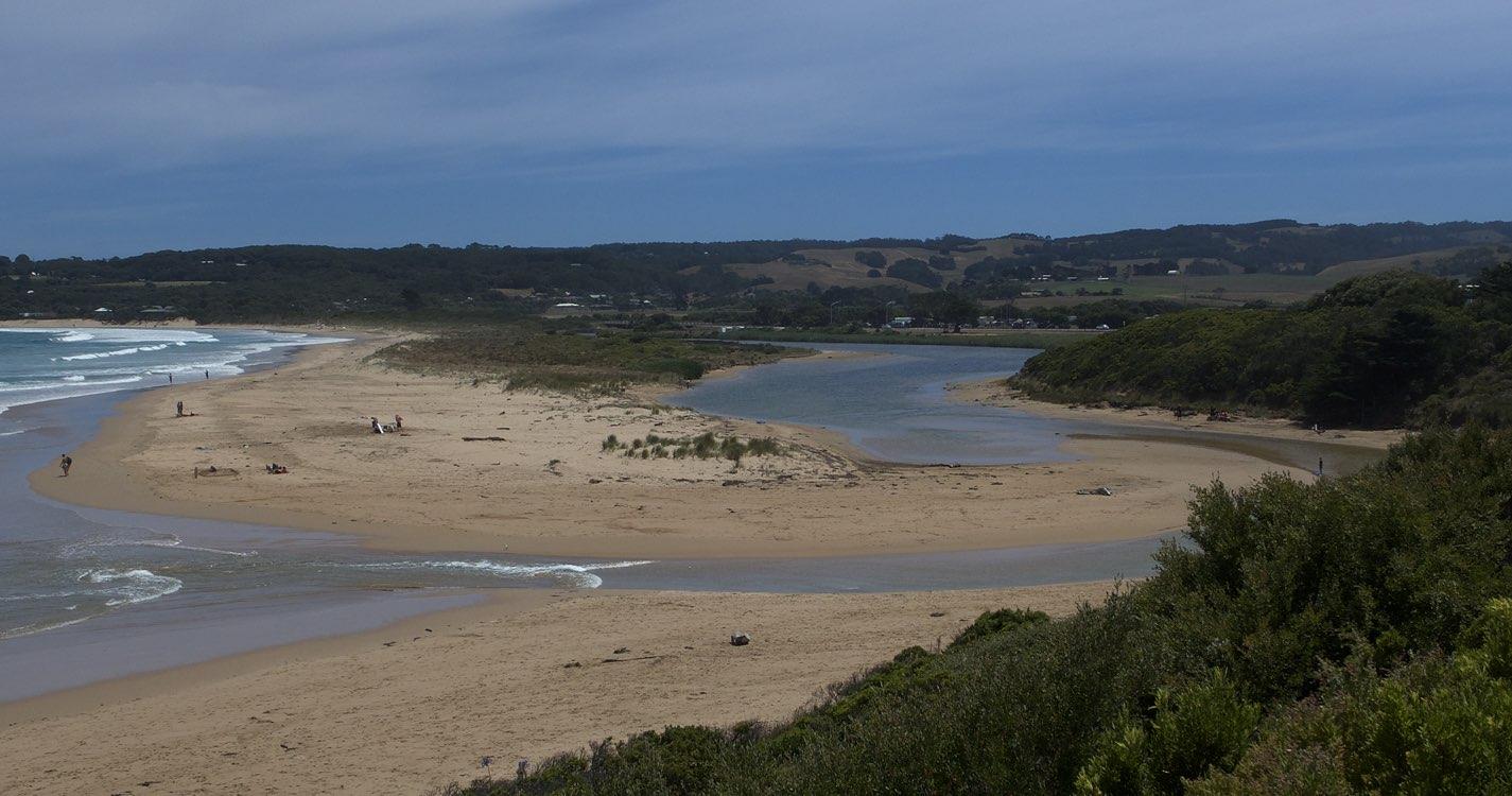
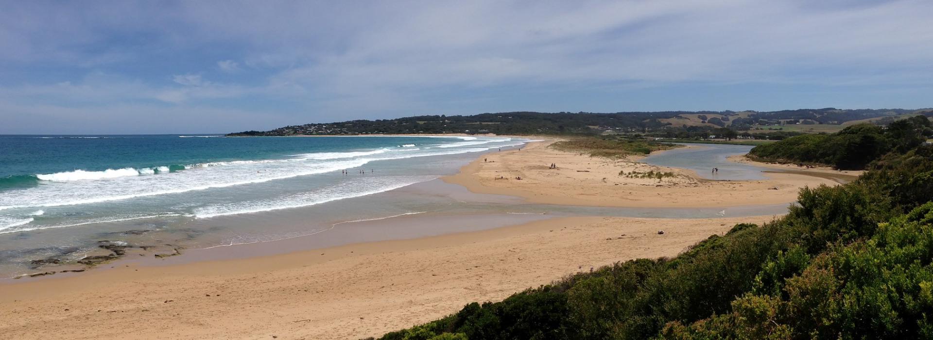
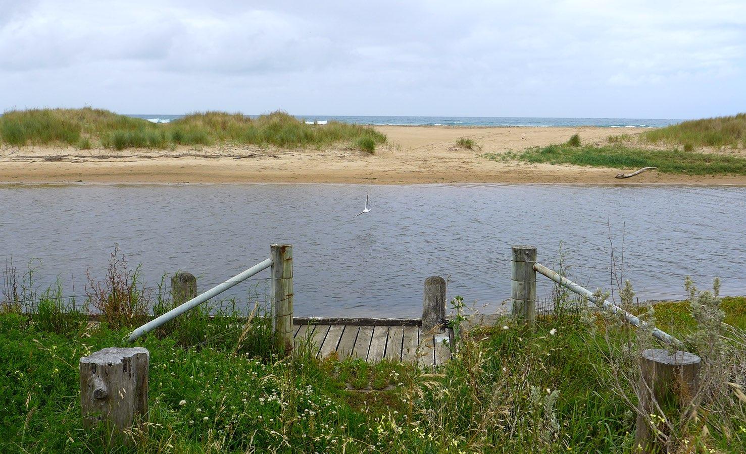
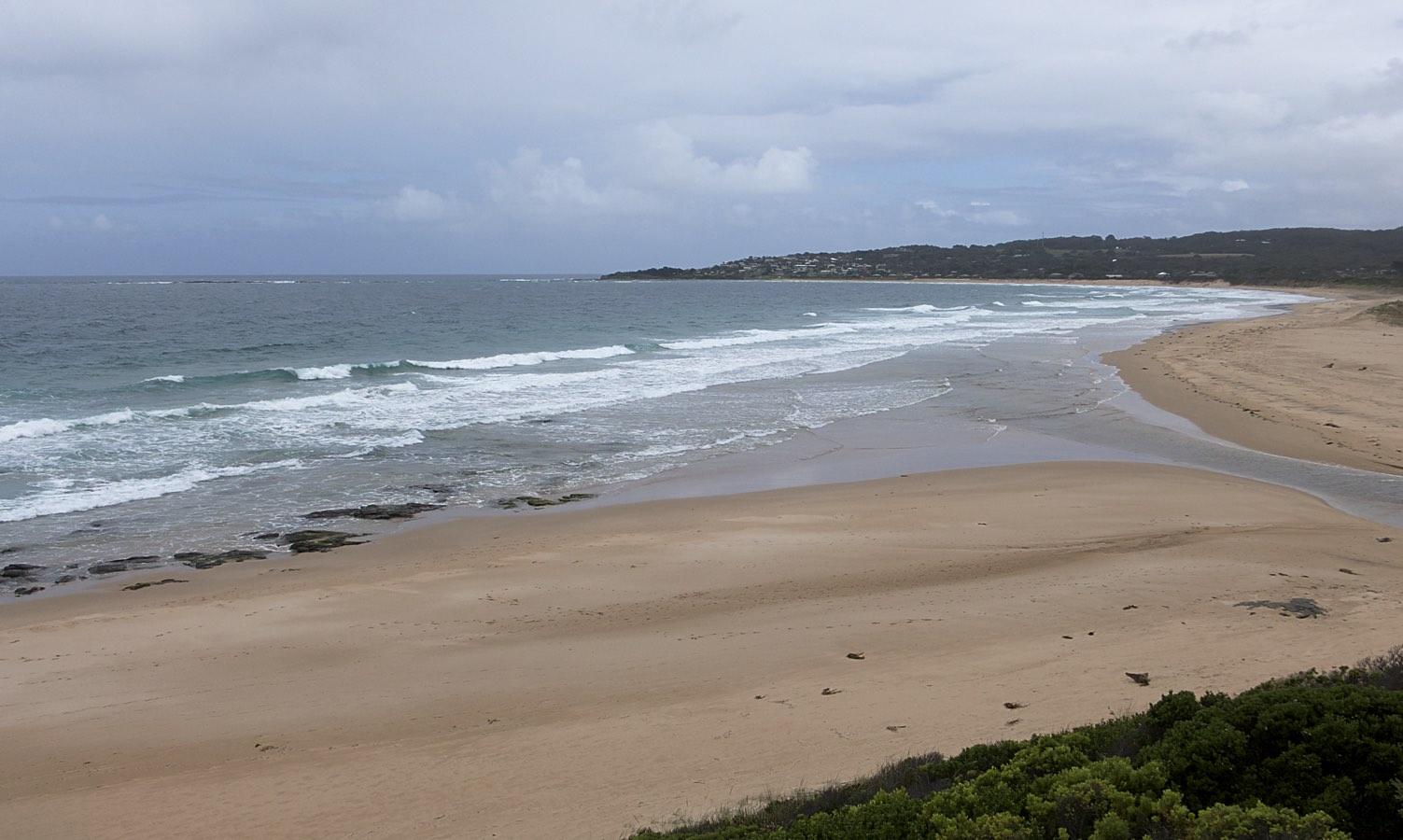
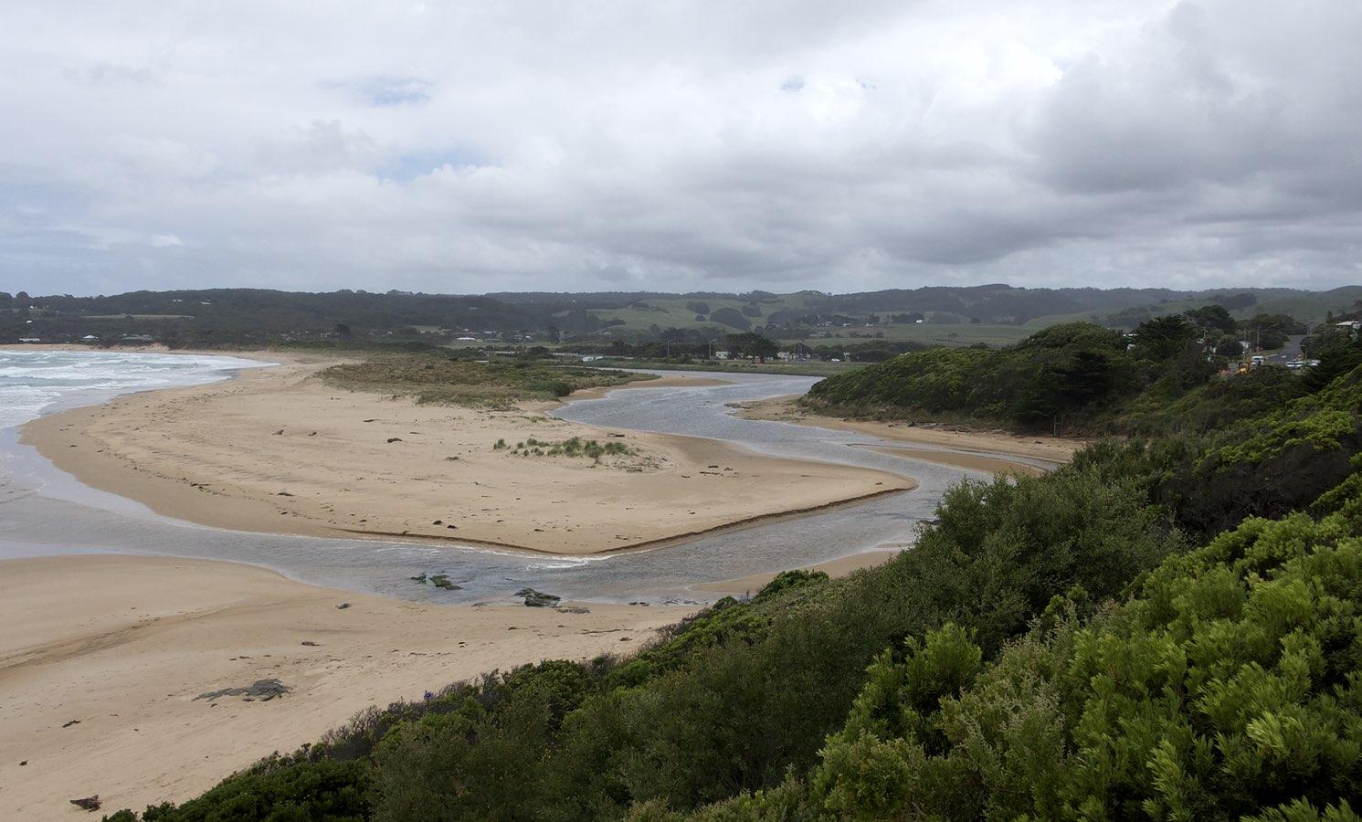
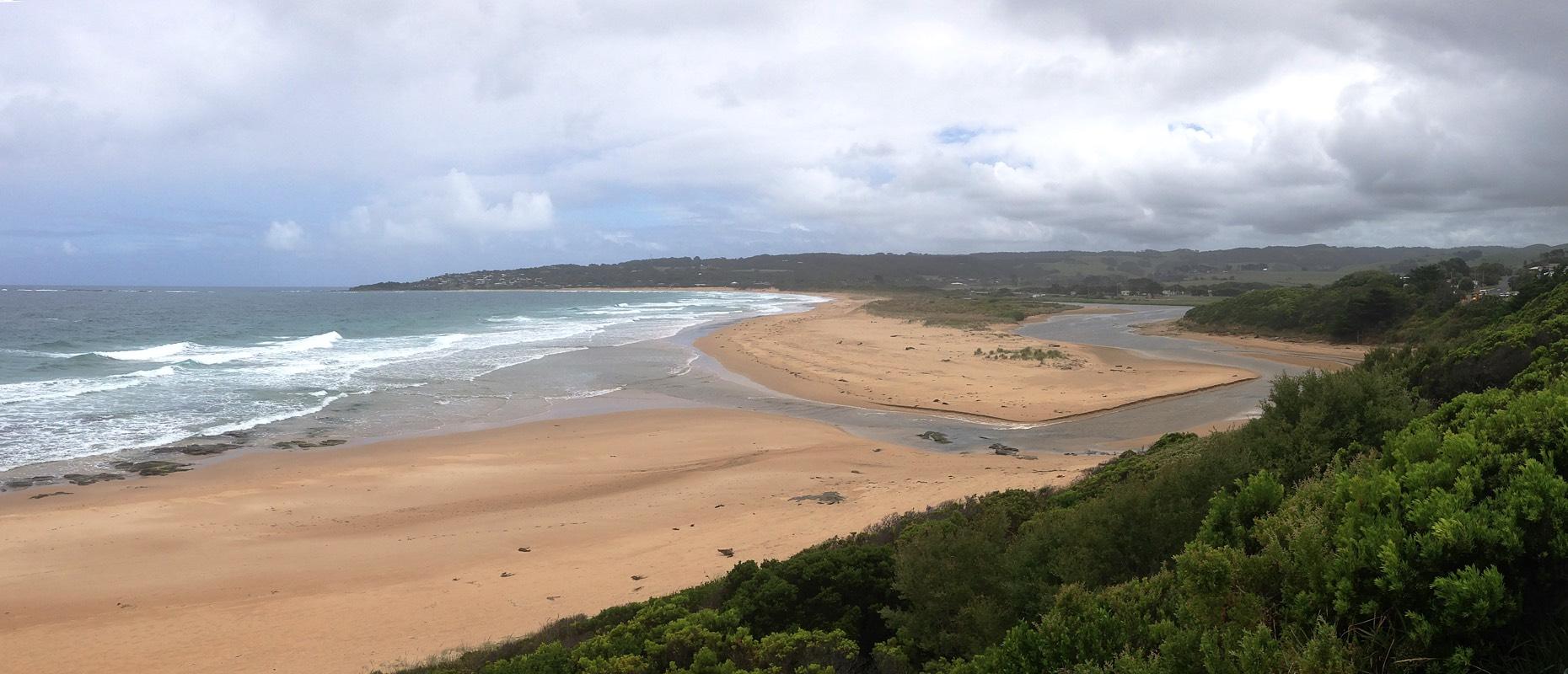
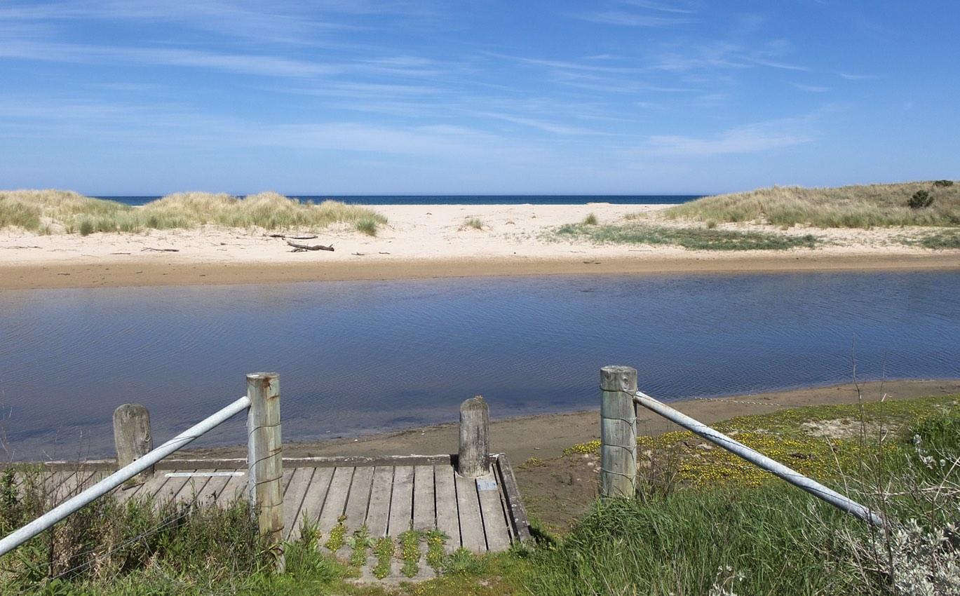
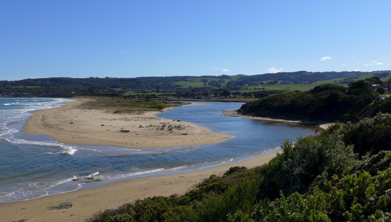
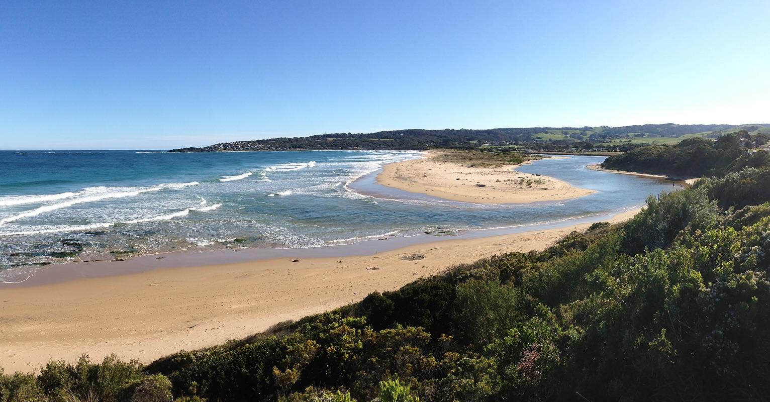
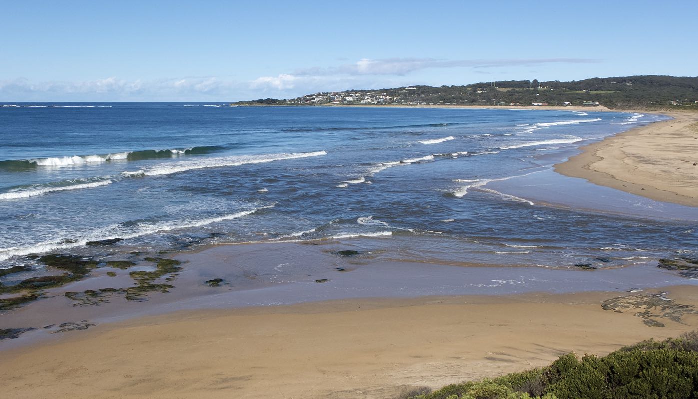
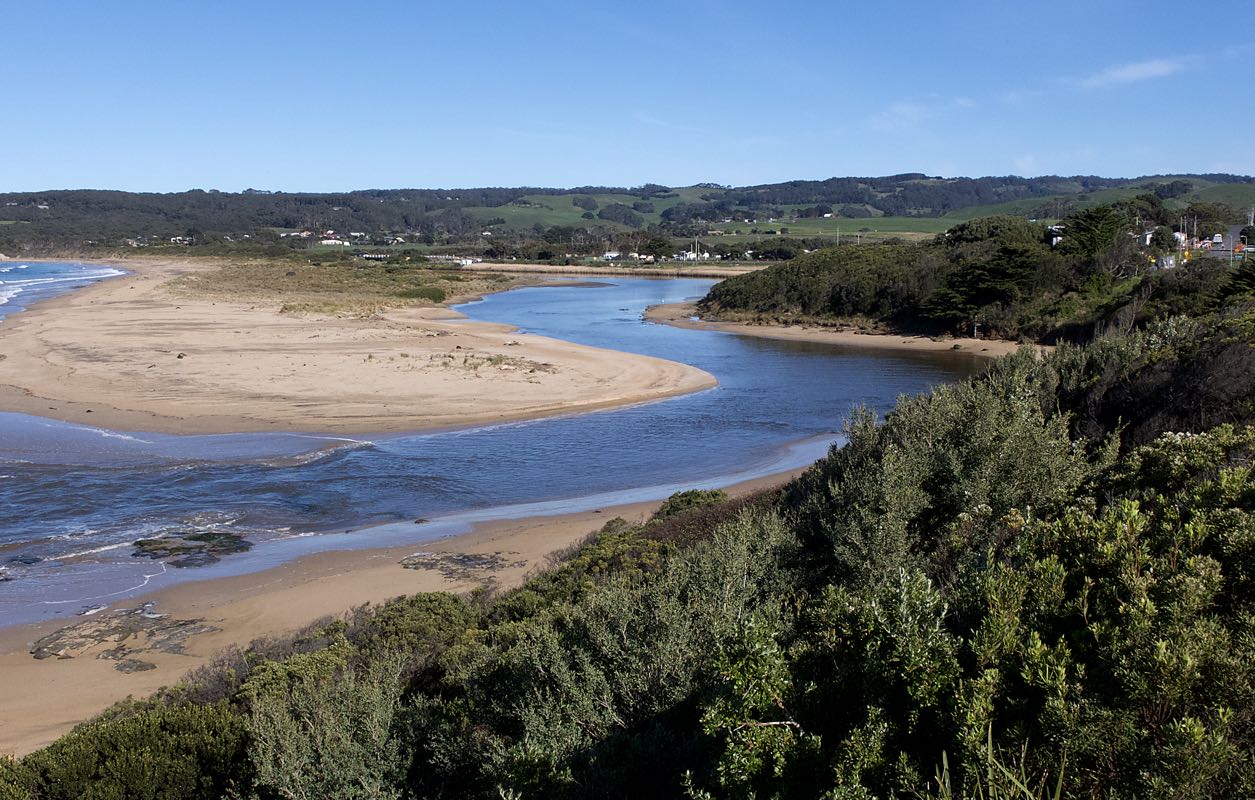
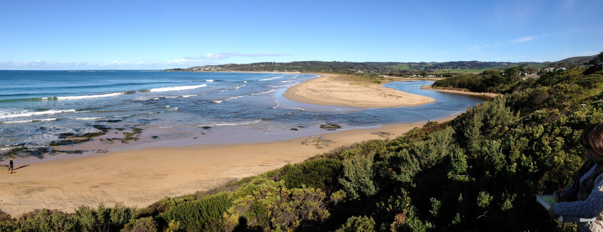
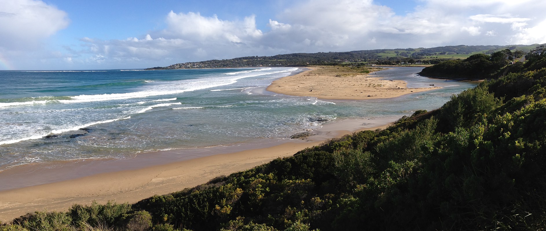
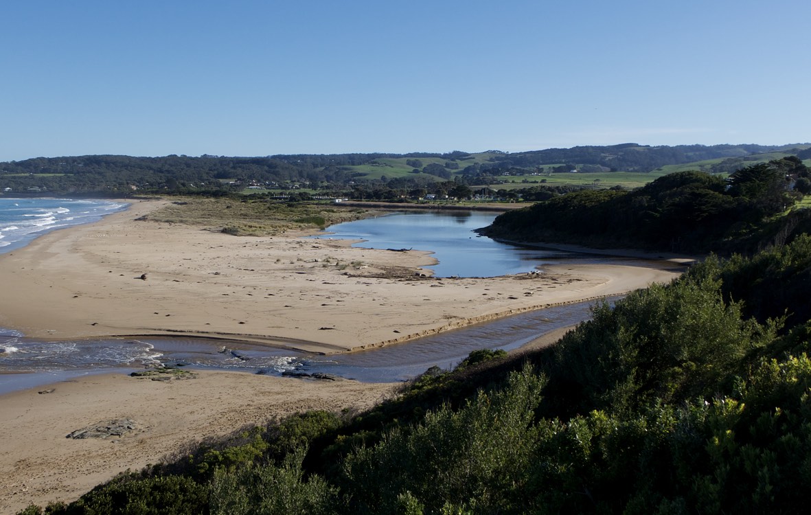
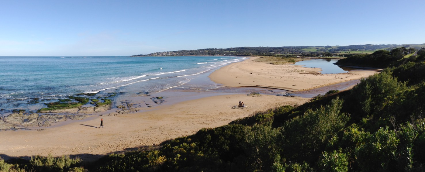
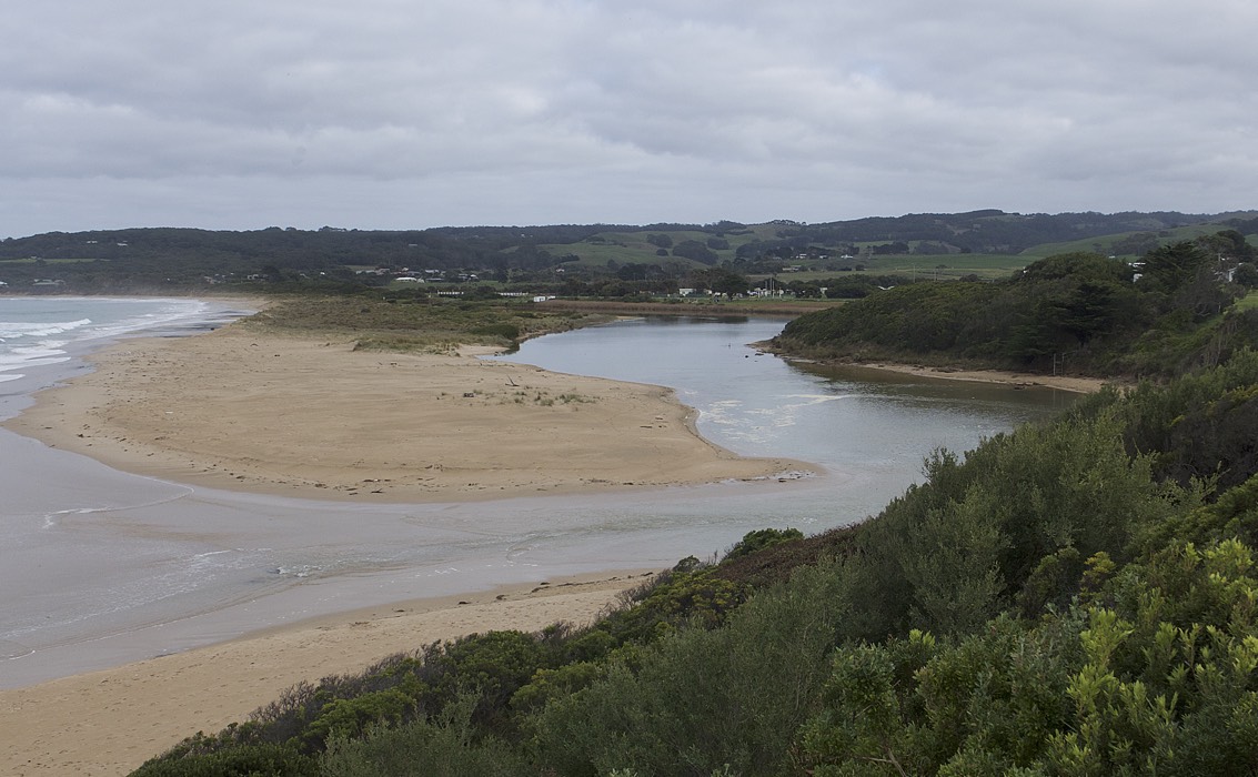
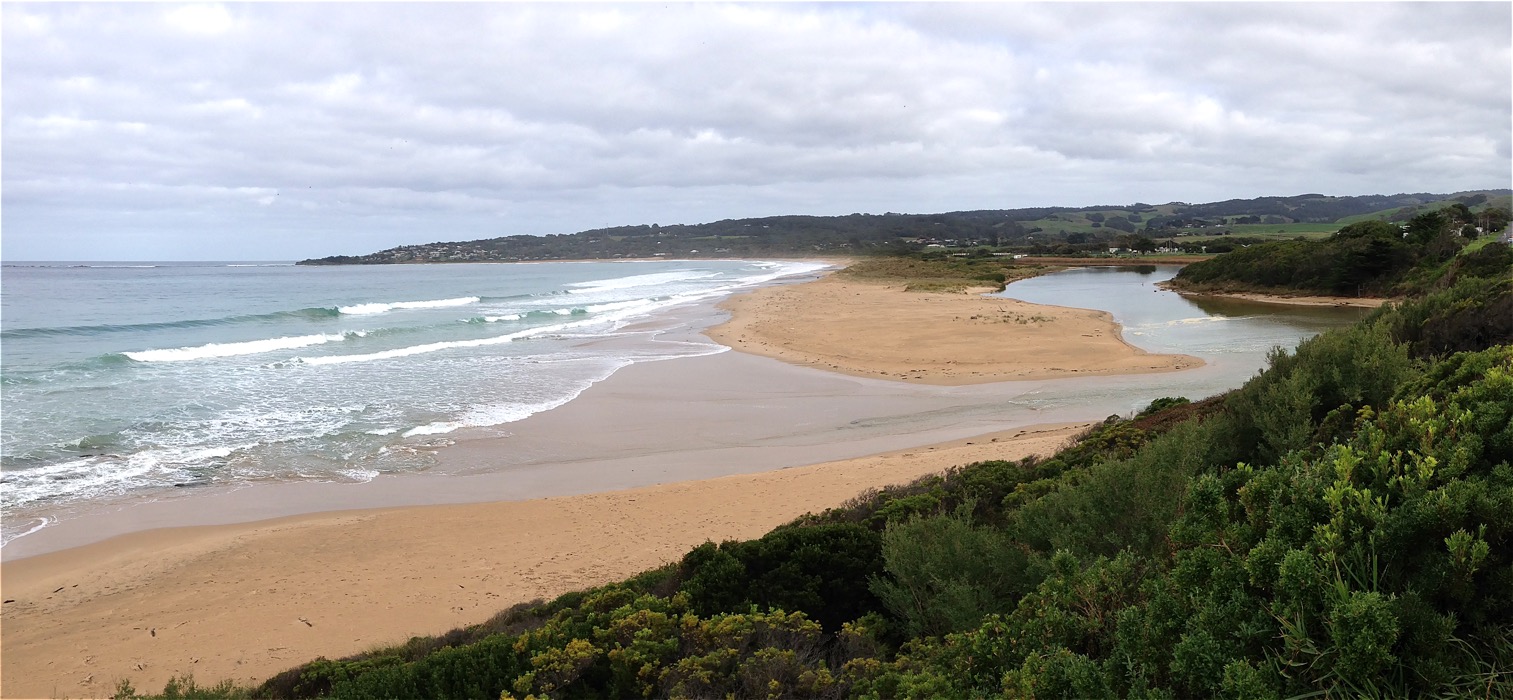
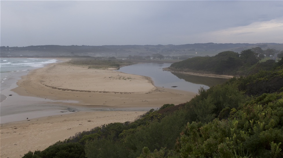
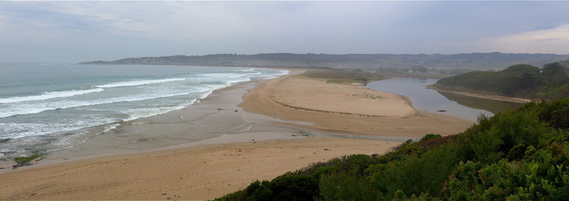
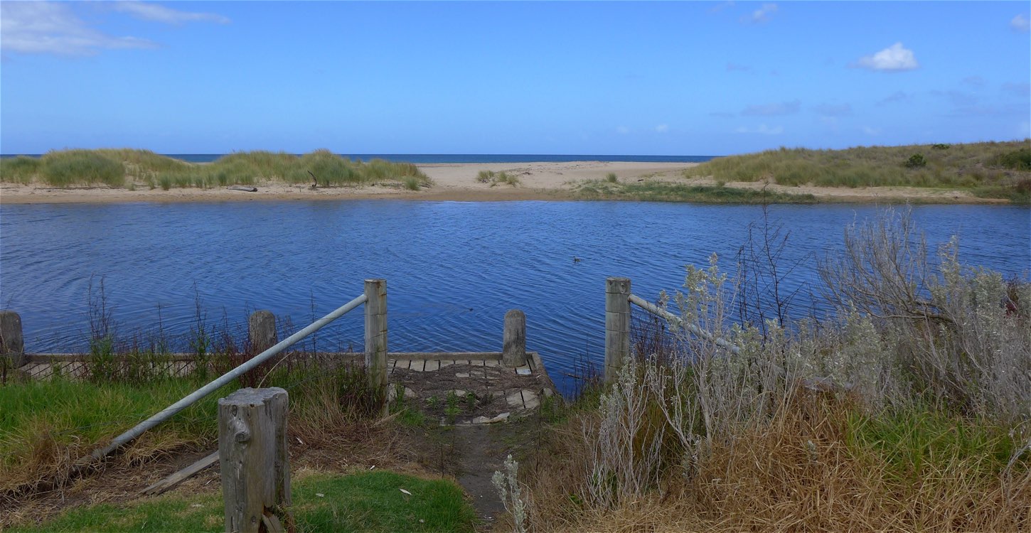
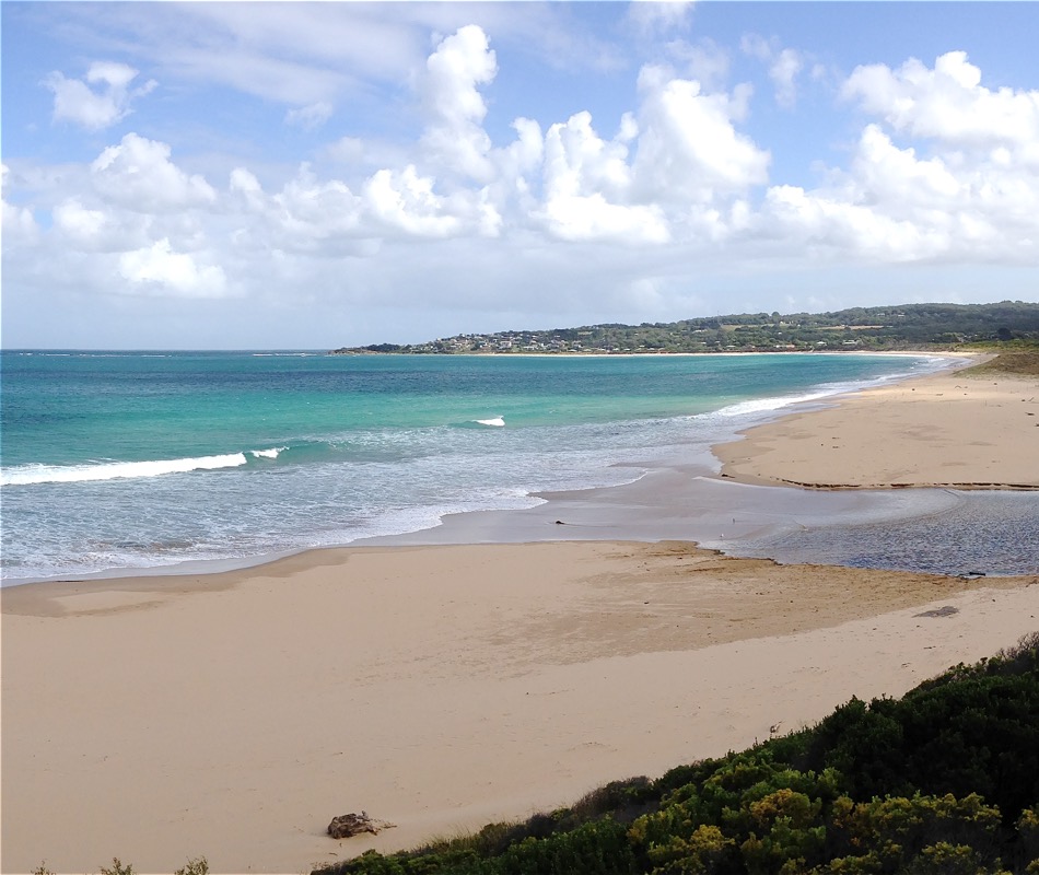
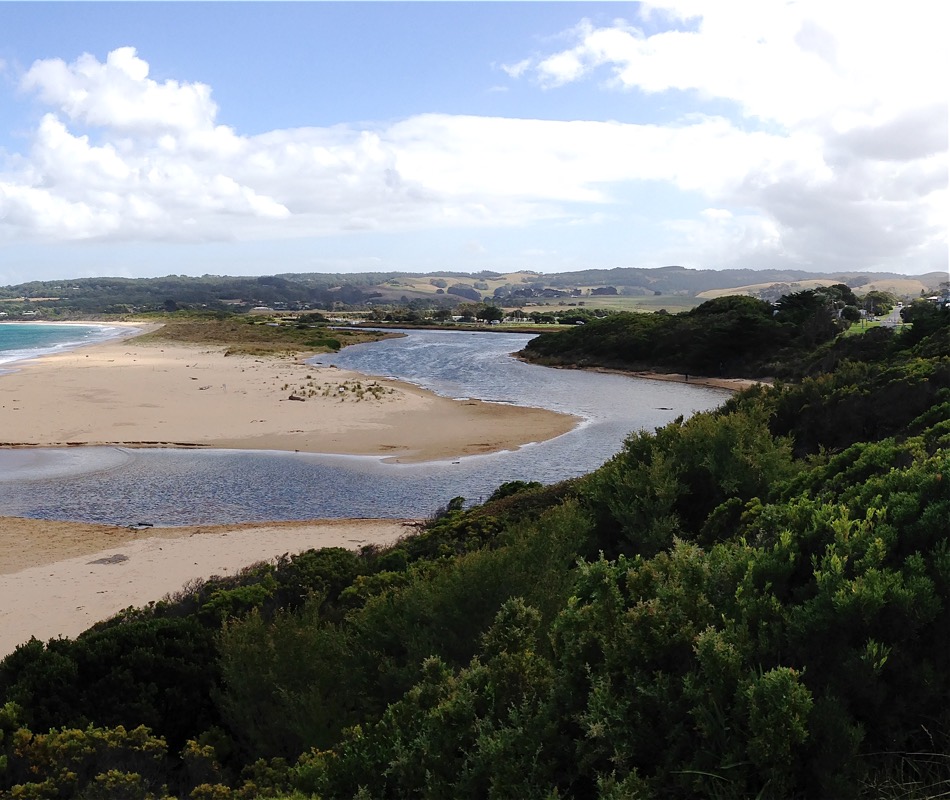
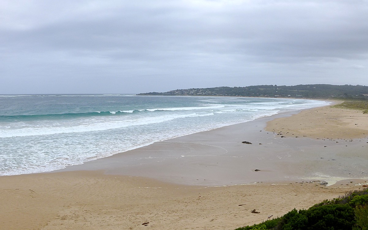
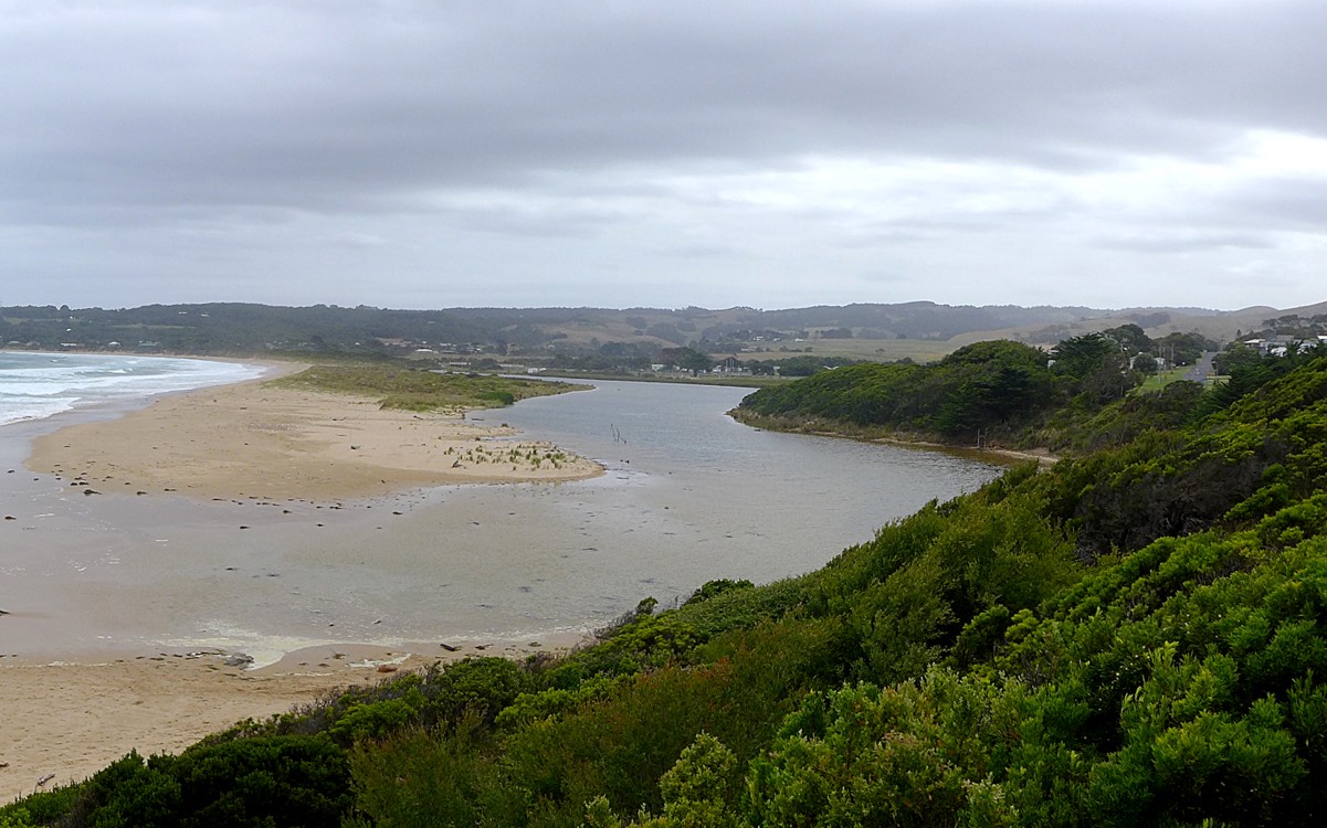
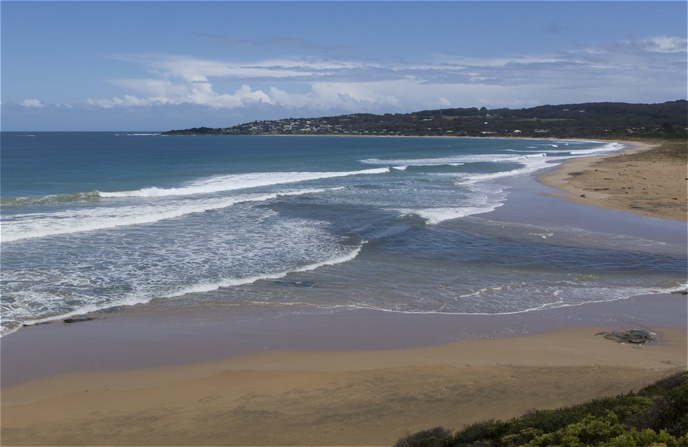
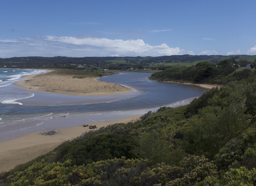
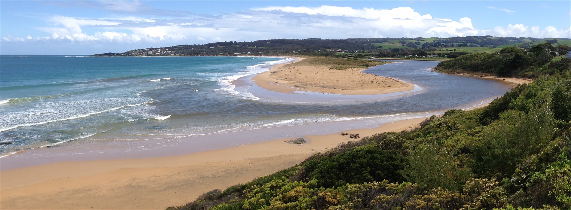
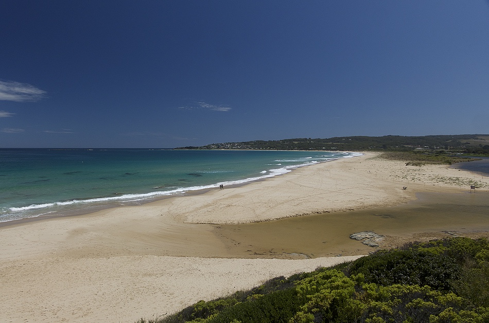
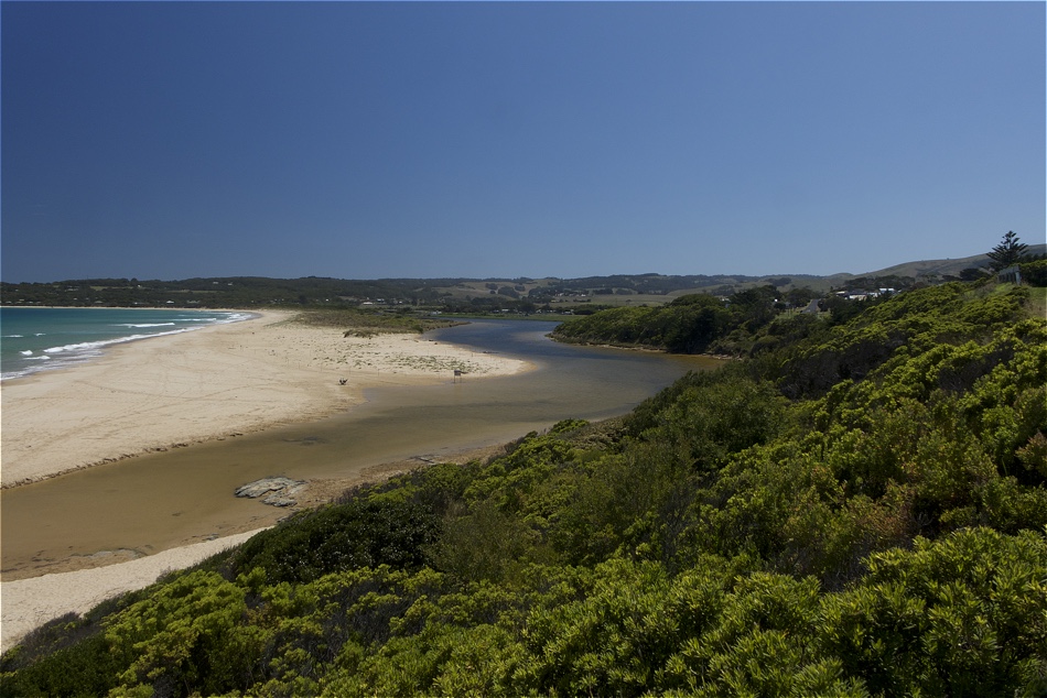
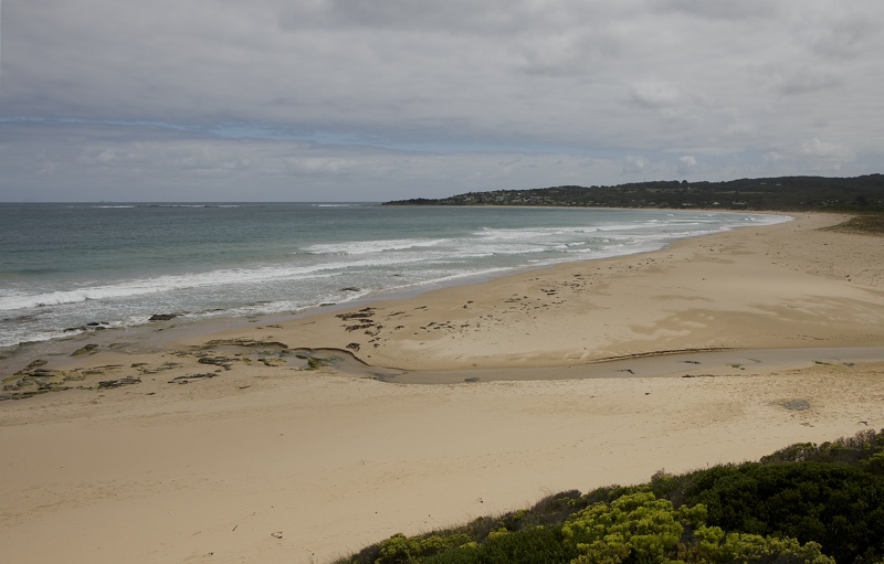
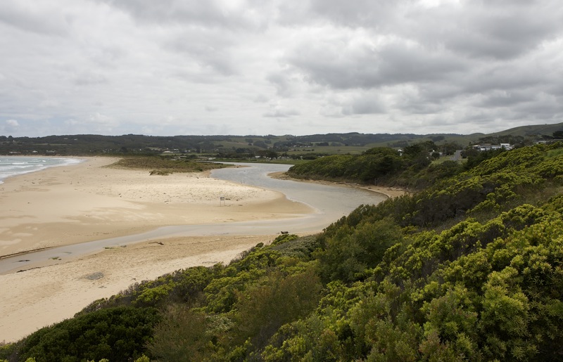
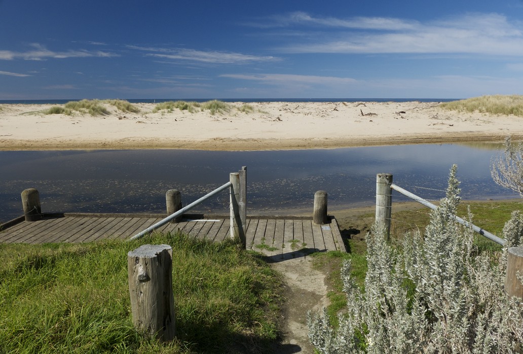
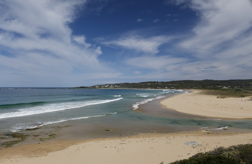
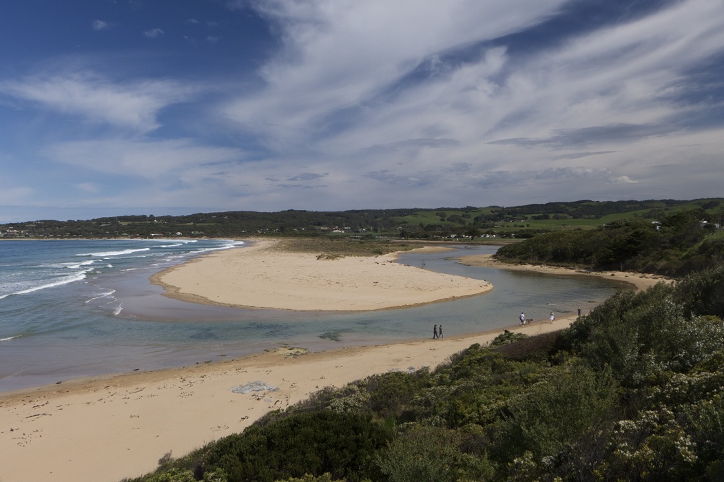
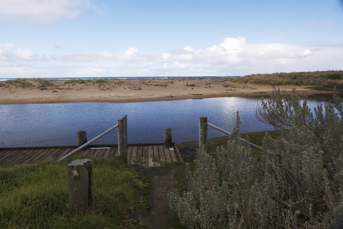
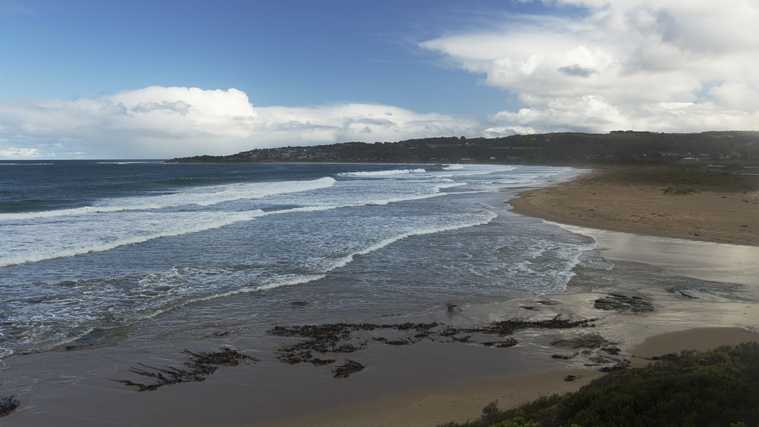
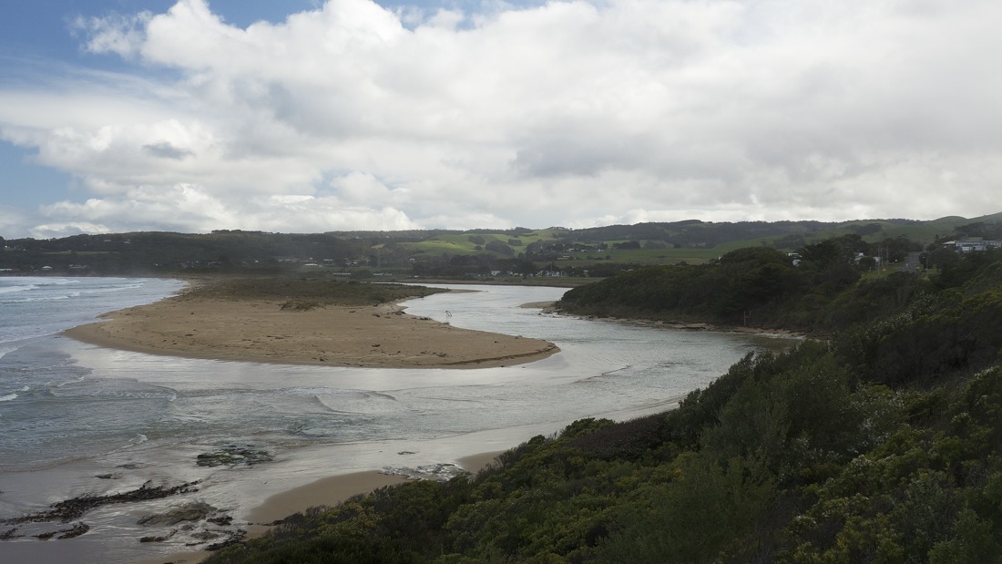
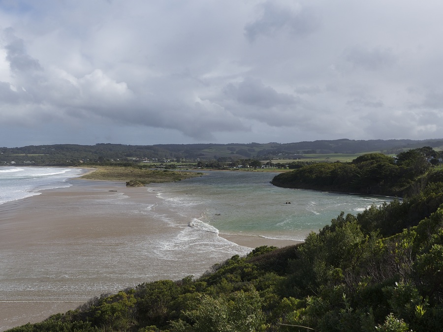
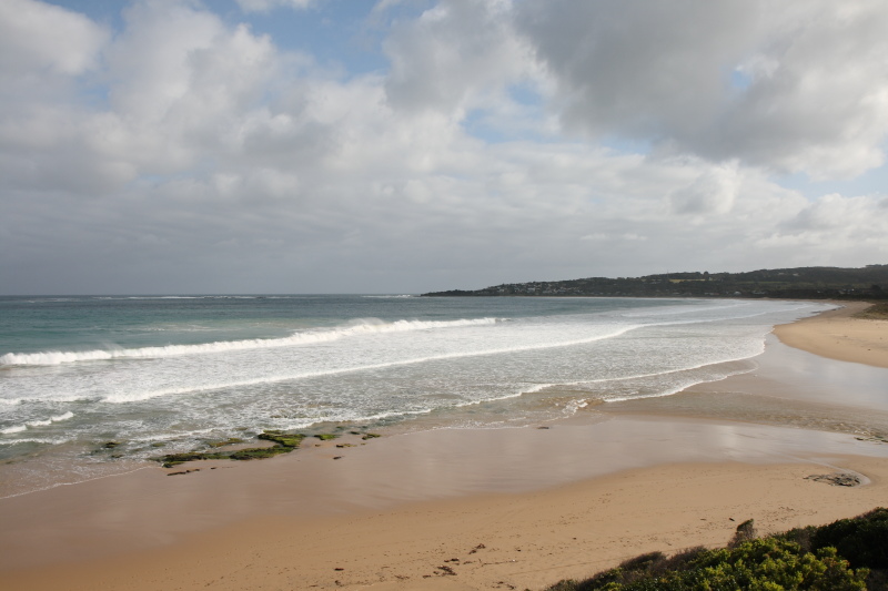
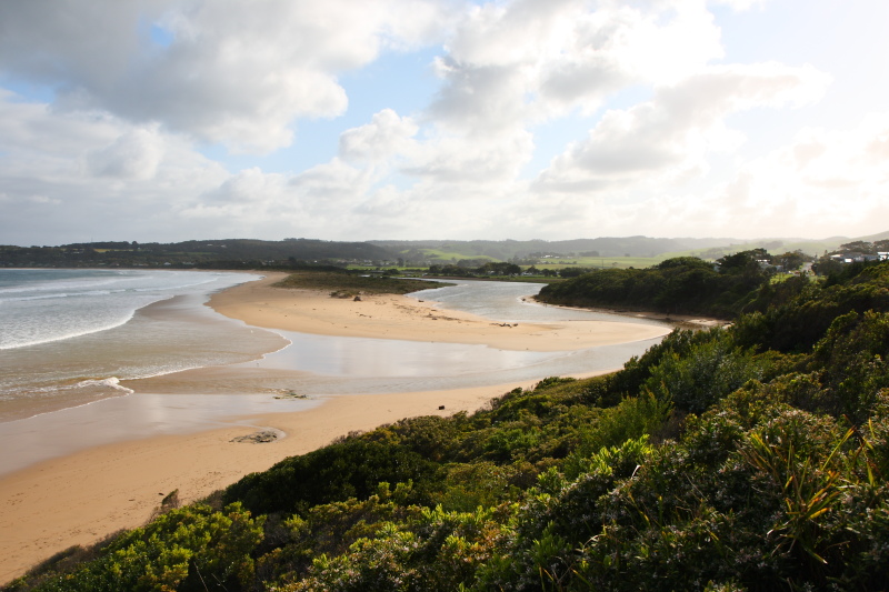
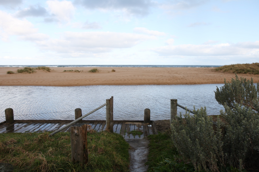
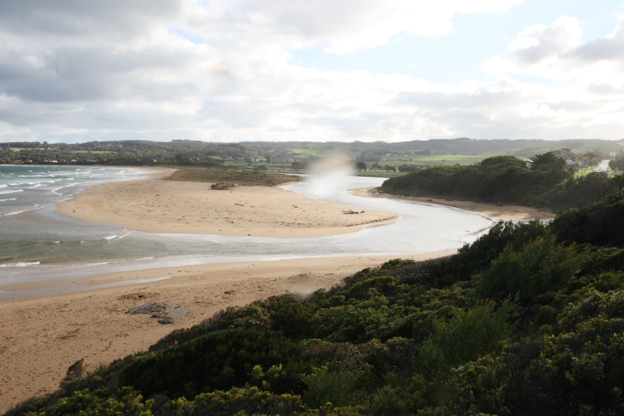
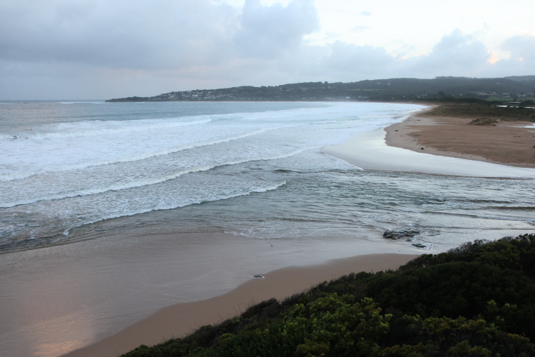
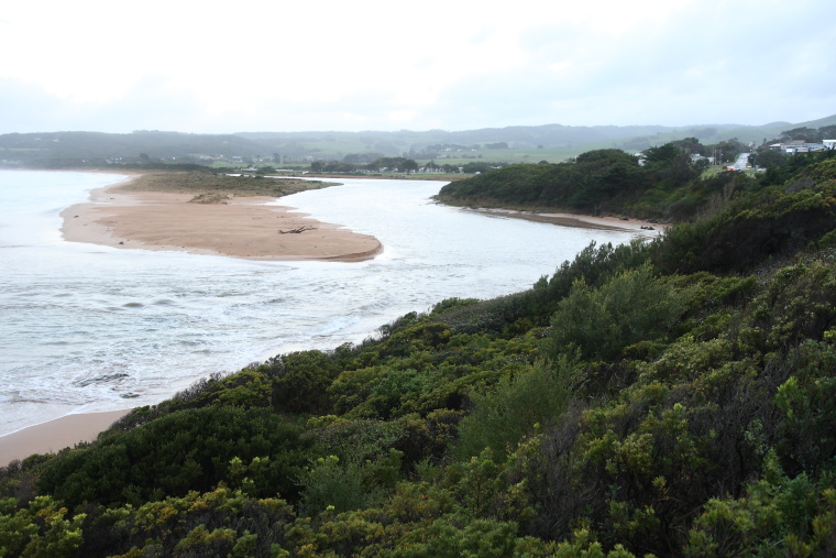
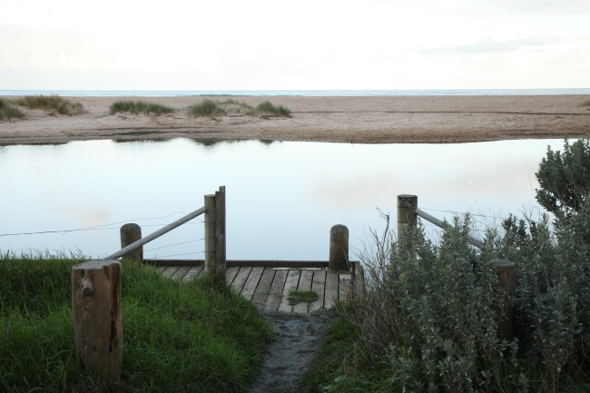
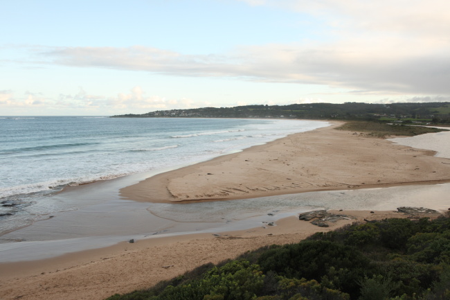
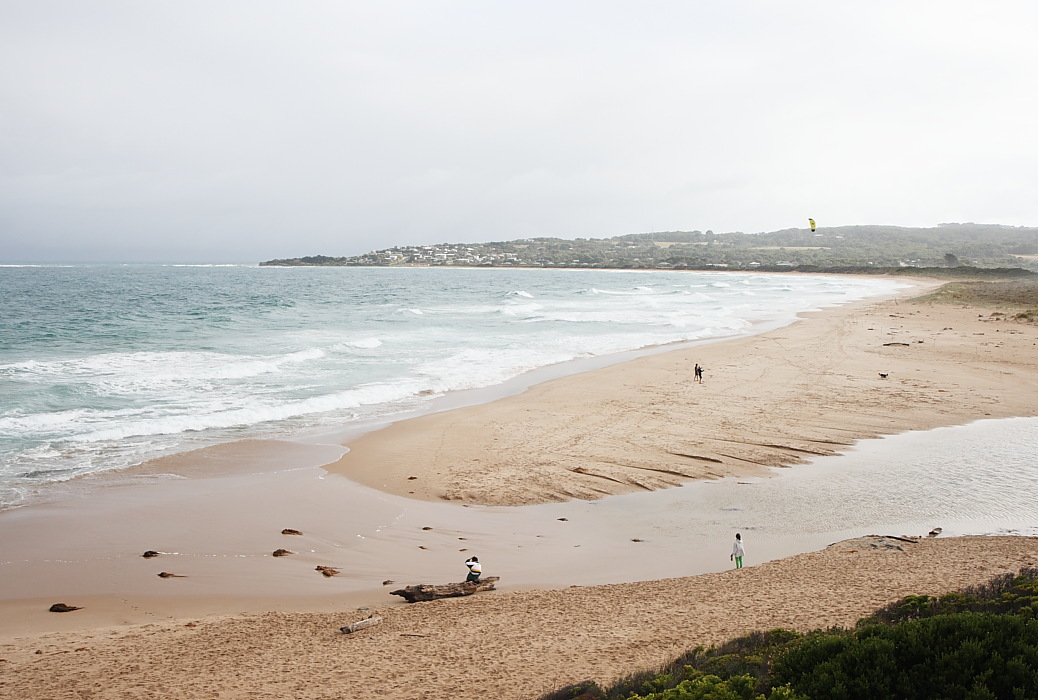
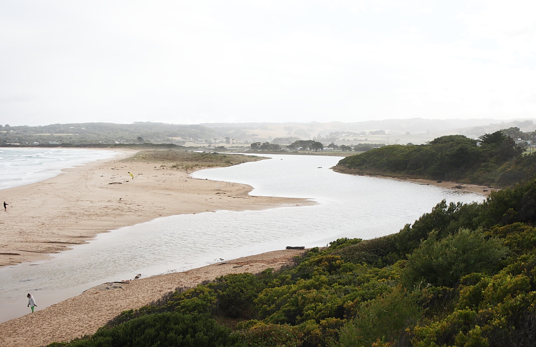
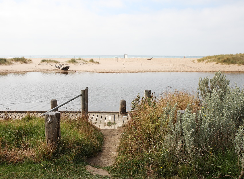
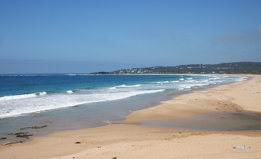
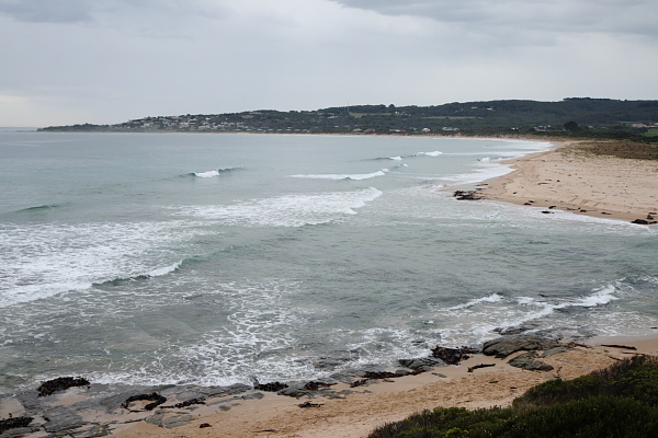
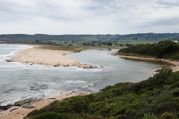
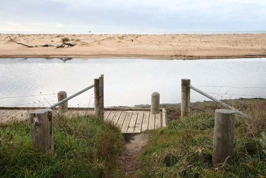
Active Mouth Condition 23-05-2008 - 19-04-2024Barham River Estuary
| ID | Date | Status | Details | |
|---|---|---|---|---|
| #16130 | 19 Apr 2024 | Pending |
Notes:
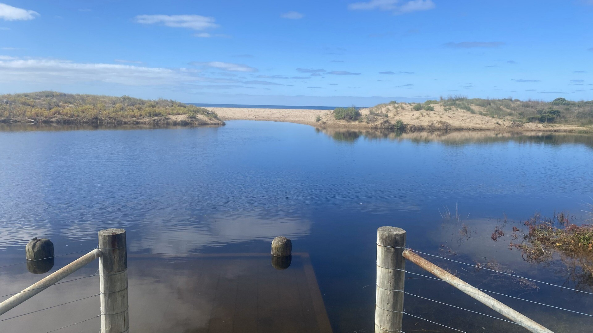
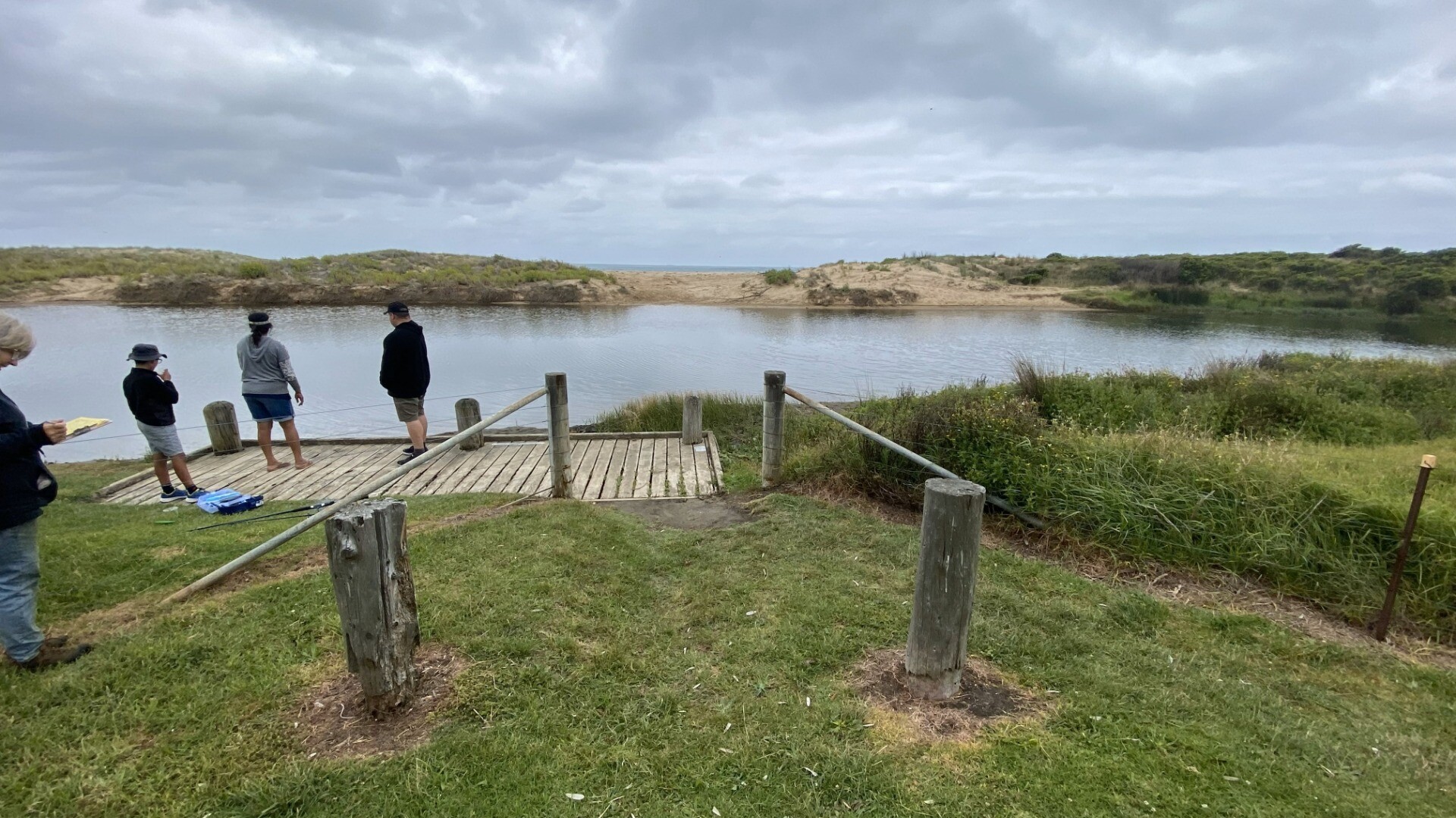
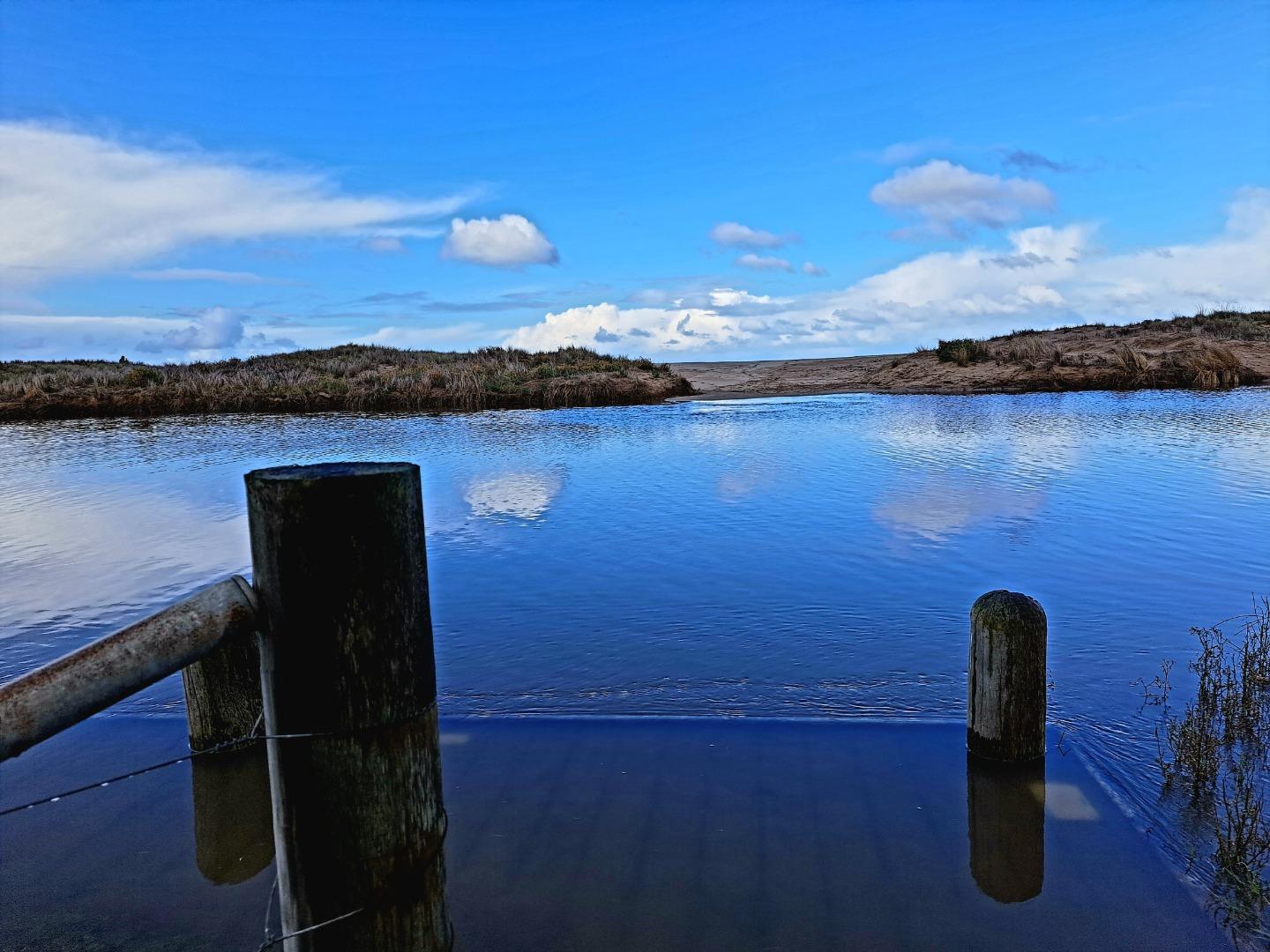
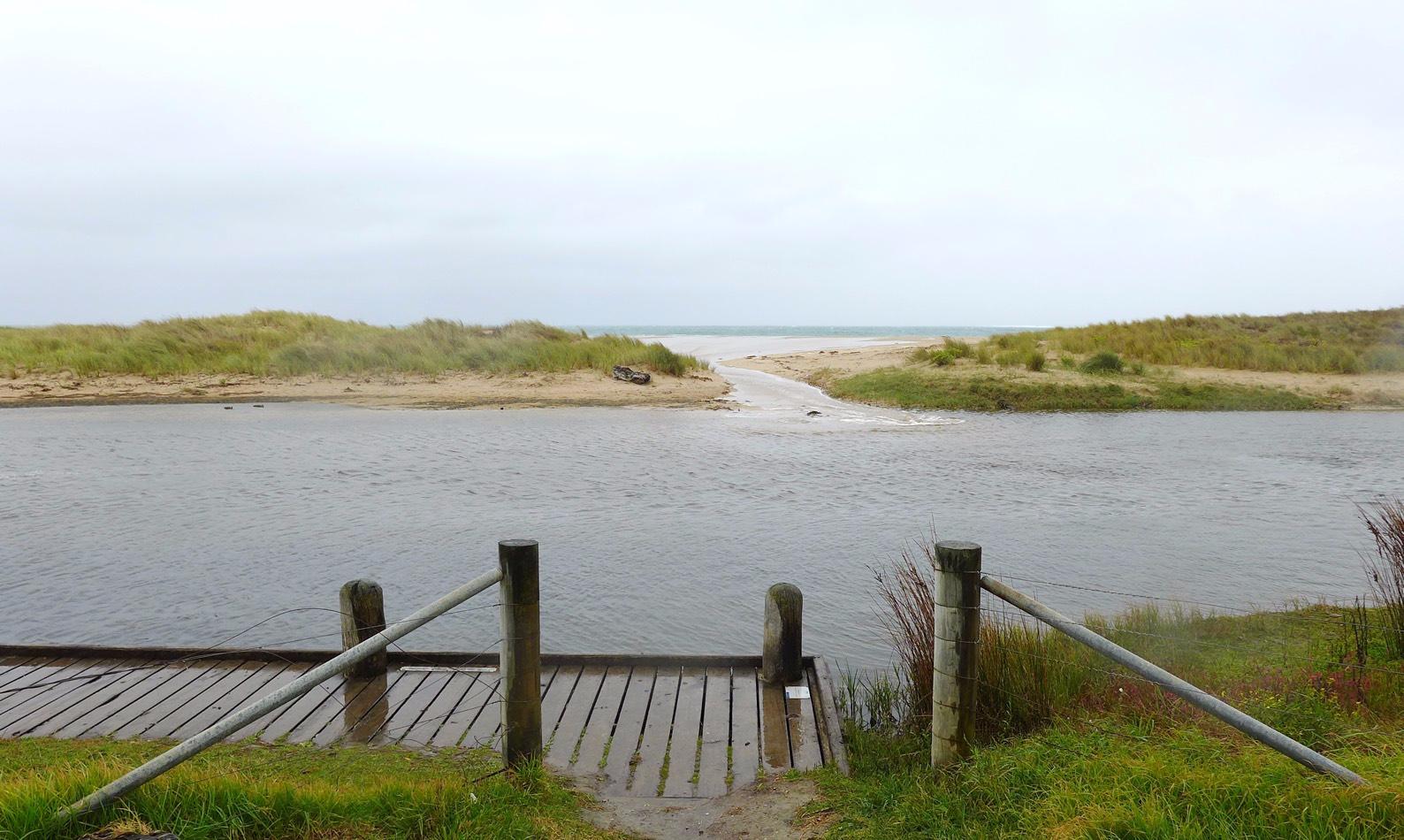
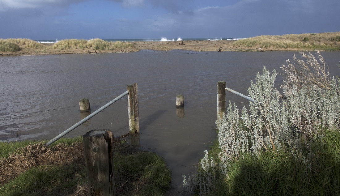
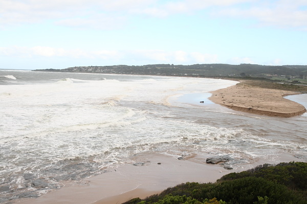
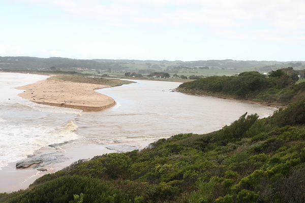
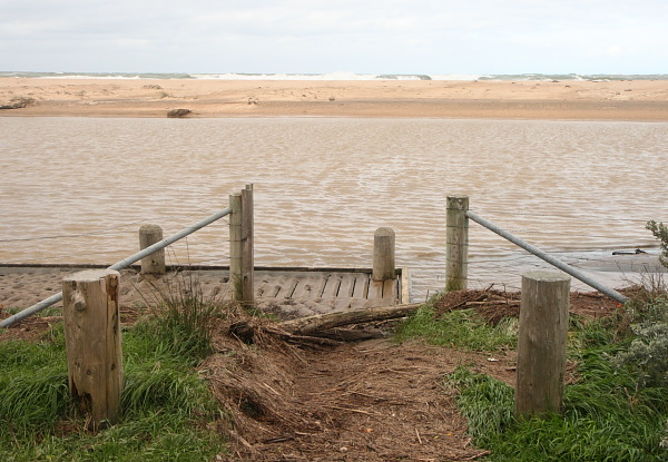
Sea state very variable over previous 2 weeks from flat calm to Rough Cannot measure water level due to lower gauge beng obscured by bushes River mouth was closed until previous day. River level quite high and overflowng banks prior to this.
|
|
| #16064 | 21 Mar 2024 | Pending |
Notes:
Lower water level marker is still completely obscured by overgrown bushes. Level we;ll below the bottom of higher marker (< 2m) though quite high and over banks in campground. Wind and sea state very variable over last 2 weeks - easterlies predominant varying from still to quite strong winds. Sea state from flat calm to very rough. Observed someone digging small channel to open berm (but they gave up before completing this). Following day, 22nd March, the river mouth had burst through the berm and was fully open agin. |
|
| #15987 | 19 Jan 2024 | Pending |
Notes:
Wind mode last 2 weeks - very variable in both direction and strength from strong eaterly to calm sw
Water level below all measurement markers
Apologies about no tidal data - forgot to complete on day and can't locate retrospectively from weather/tide apps |
|
| #15941 | 19 Dec 2023 | Pending |
Notes:
Water level below height markers |
|
| #15869 | 18 Nov 2023 | Pending |
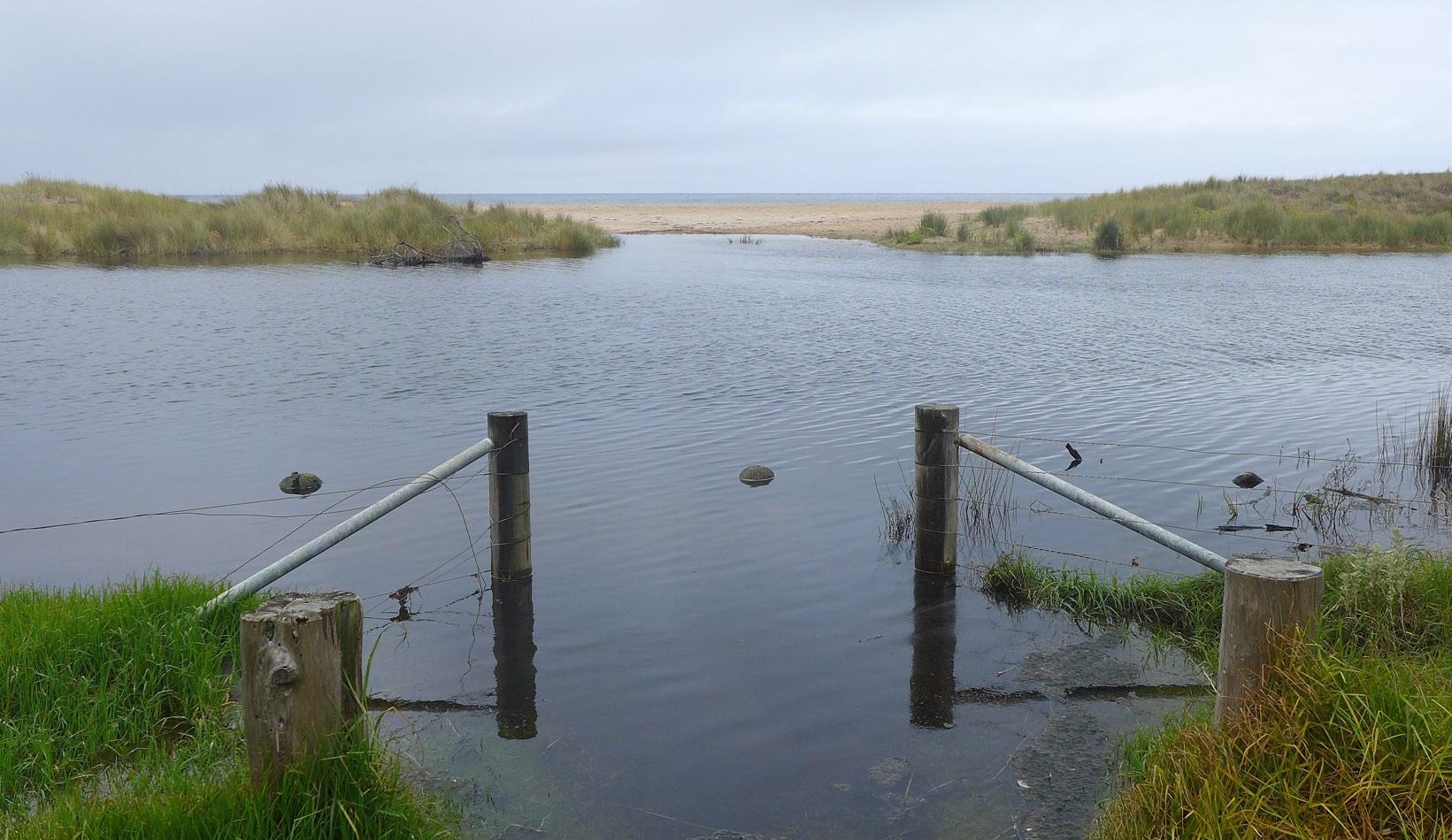
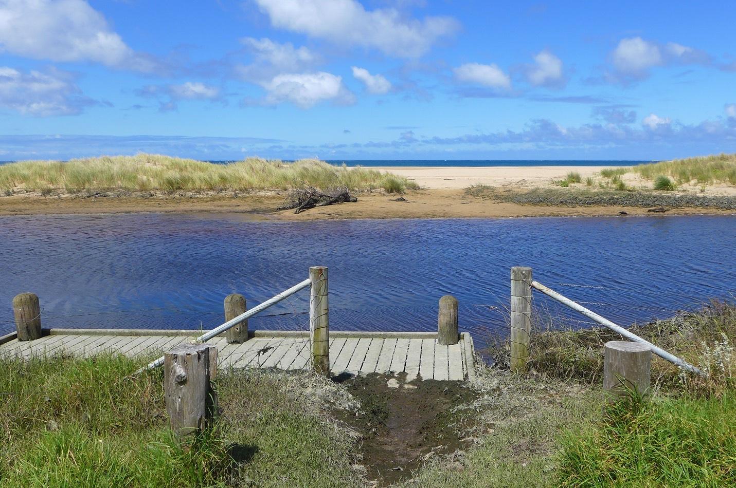
Notes:
Good to see that access to water level marker has been cleared - thank you Water level was well below the bottom of the marker today Sea state has been very variable over last 2 weeks |
|
| #15720 | 20 Aug 2023 | Pending |
Notes:
Unable to measure water levels due to overgrown tress on riverbank.
We will be away for next watch but will do an assessment around 21 October when we are back |
|
| #15669 | 19 Jul 2023 | Pending |
Notes:
Unable to access water level markers due to overgrown tree Unable to complete Mode for physical condition - very variable over last 2 weeks from completely still and calm to some days of very strong winds |
|
| #15665 | 19 Jul 2023 | Pending |
|
|
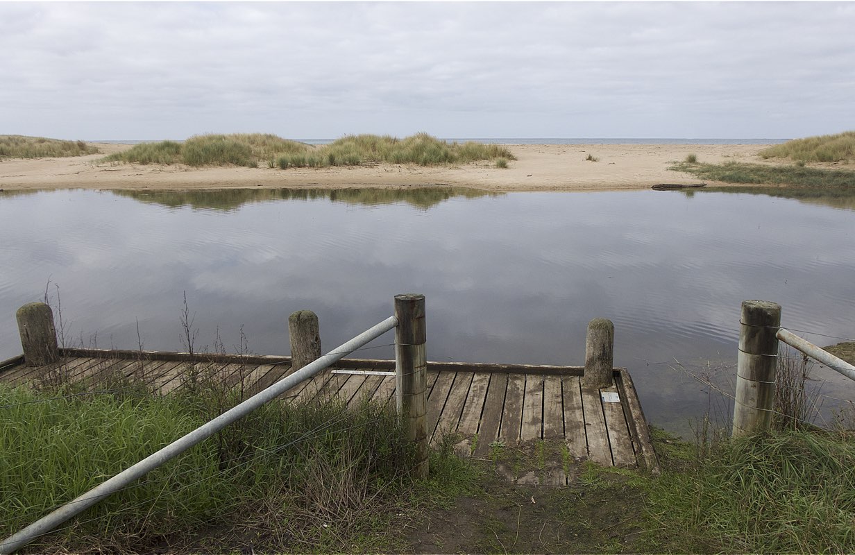
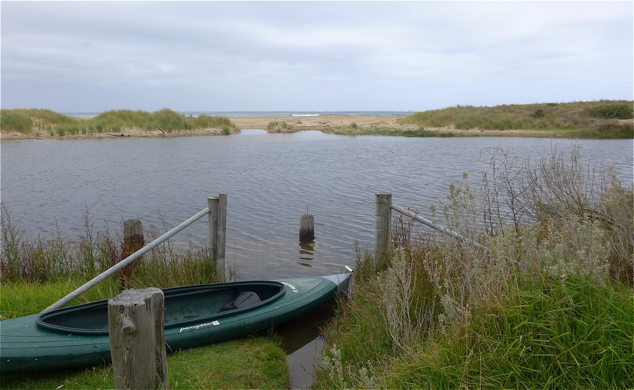
| #15591 | 19 Jun 2023 | Approved |
Notes:
At Bmp2 the platform was under water. Mode for wind and sea state was not assessed as conditions have been highly variable over the last 2 weeks. This was a training session.One wide angle 16:9 Bmp3 photo taken to replace two 4:3 images Water level assessment reading river height gauges could not be completed because of over-growing vegetation. |
|
| #13610 | 13 Mar 2020 | Approved |
Notes:
Rain last 48 hrs = 0 mm; Atmos. pressure = 1011 hPa. Rained continuously during monitoring period! Heavy wind and wave surges pushed water across the berm opposite the BmP2 observation site. These inflows temporarily raised the estuary water level by up to 2 cm. |
|
| #13574 | 15 Feb 2020 | Approved |
Notes:
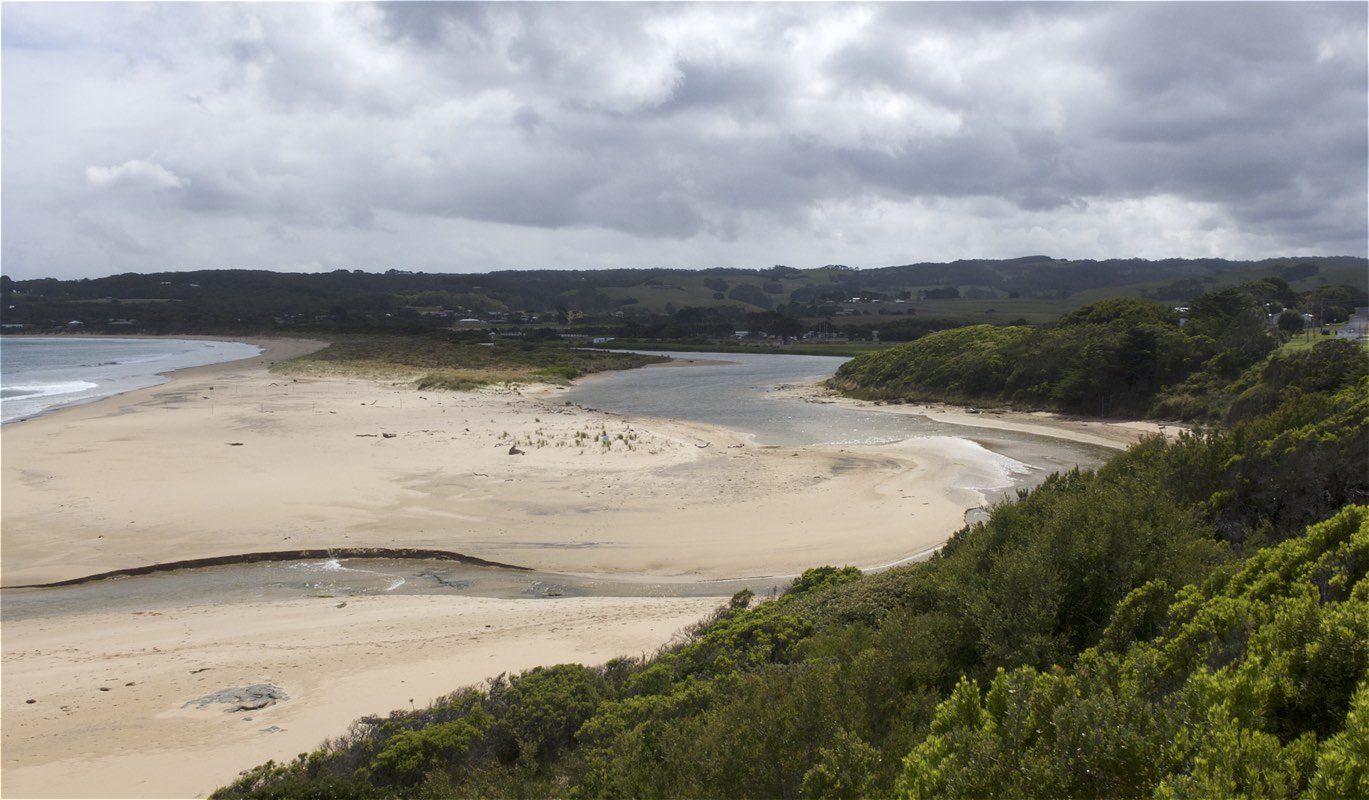
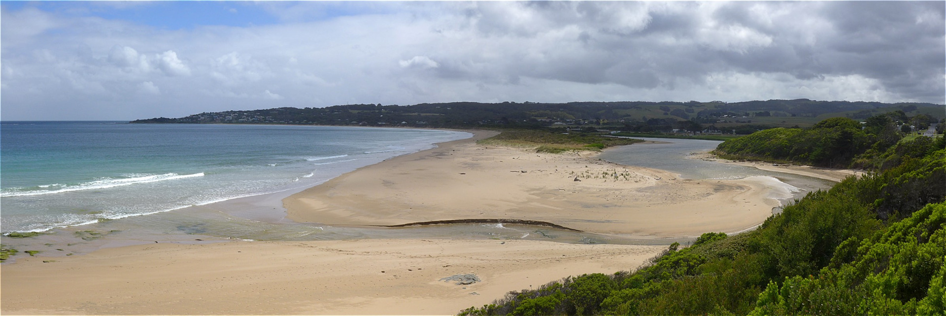
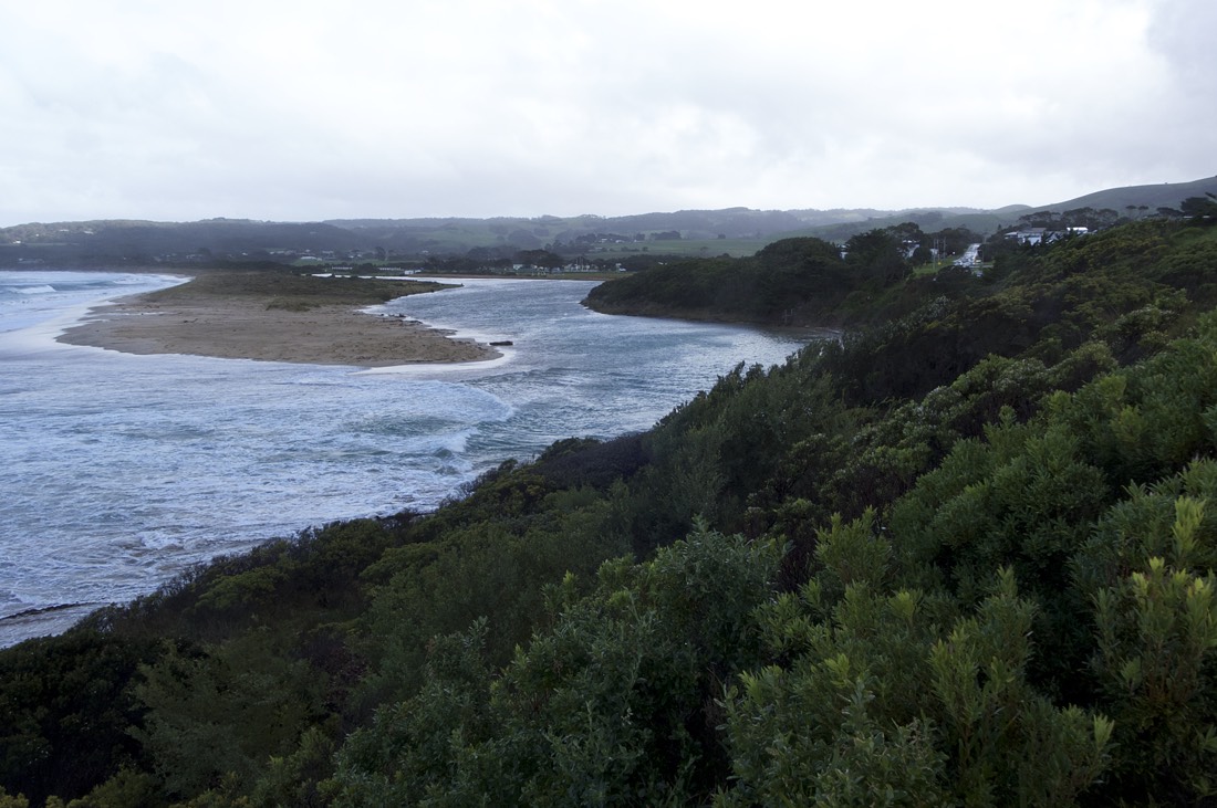
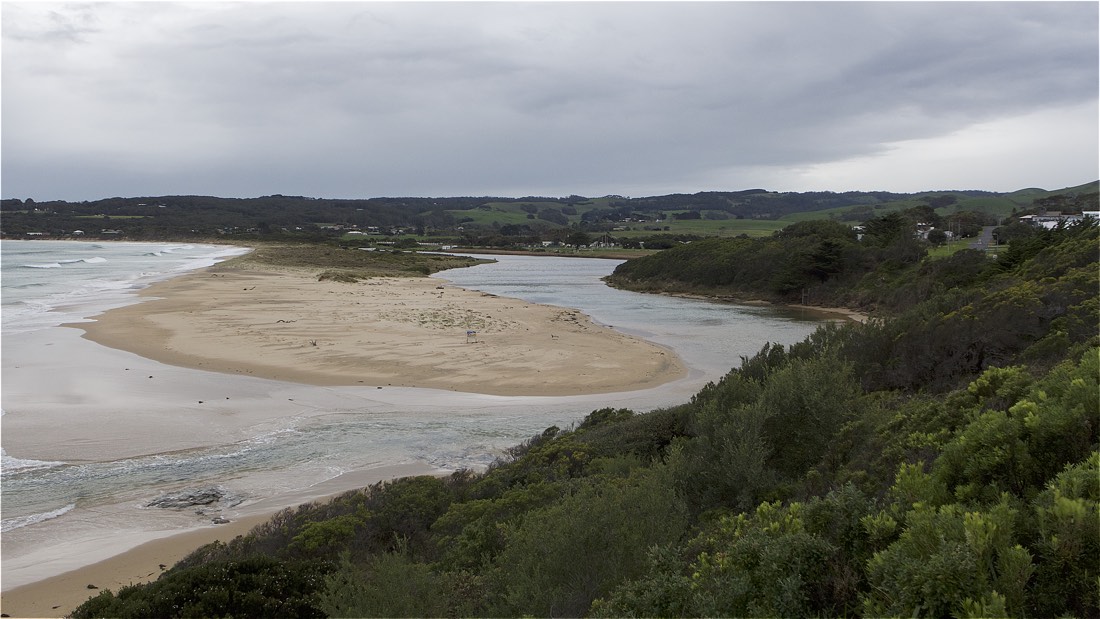
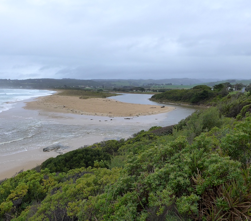
Rain past 48 hrs = 1.4 mm; Atm. Press. = 1012 hPa Mouth opening continues to shift south. |
|
| #13544 | 24 Jan 2020 | Approved |
Notes:
Rain past 48 hrs = 14.6 mm; Atm. Press = 1009 hPa. River mouth has moved Southwards. Although no tidal influence was observed, dark water stains on the estuary bank indicated that there was tidal intrusion during the 1.8 m high tide of the previous night. |
|
| #13469 | 22 Dec 2019 | Approved |
Notes:
No rain past 48 hrs; Atm press = 1024 hPa. |
|
| #13413 | 18 Nov 2019 | Approved |
Notes:
Rainfall past 48 hrs = 0.8 mm; Atm. Press = 1015 hPa Tidal influence would have been greater at 04:18 hrs when the predicted tide height was 2.03 m. |
|
| #13372 | 21 Oct 2019 | Approved |
Notes:
Rainfall past 48 hrs = 0.8 mm; Atm. press. = 1030 hPa. River level observed to be slowly dropping after recent rains. |
|
| #13312 | 13 Sep 2019 | Approved |
Notes:
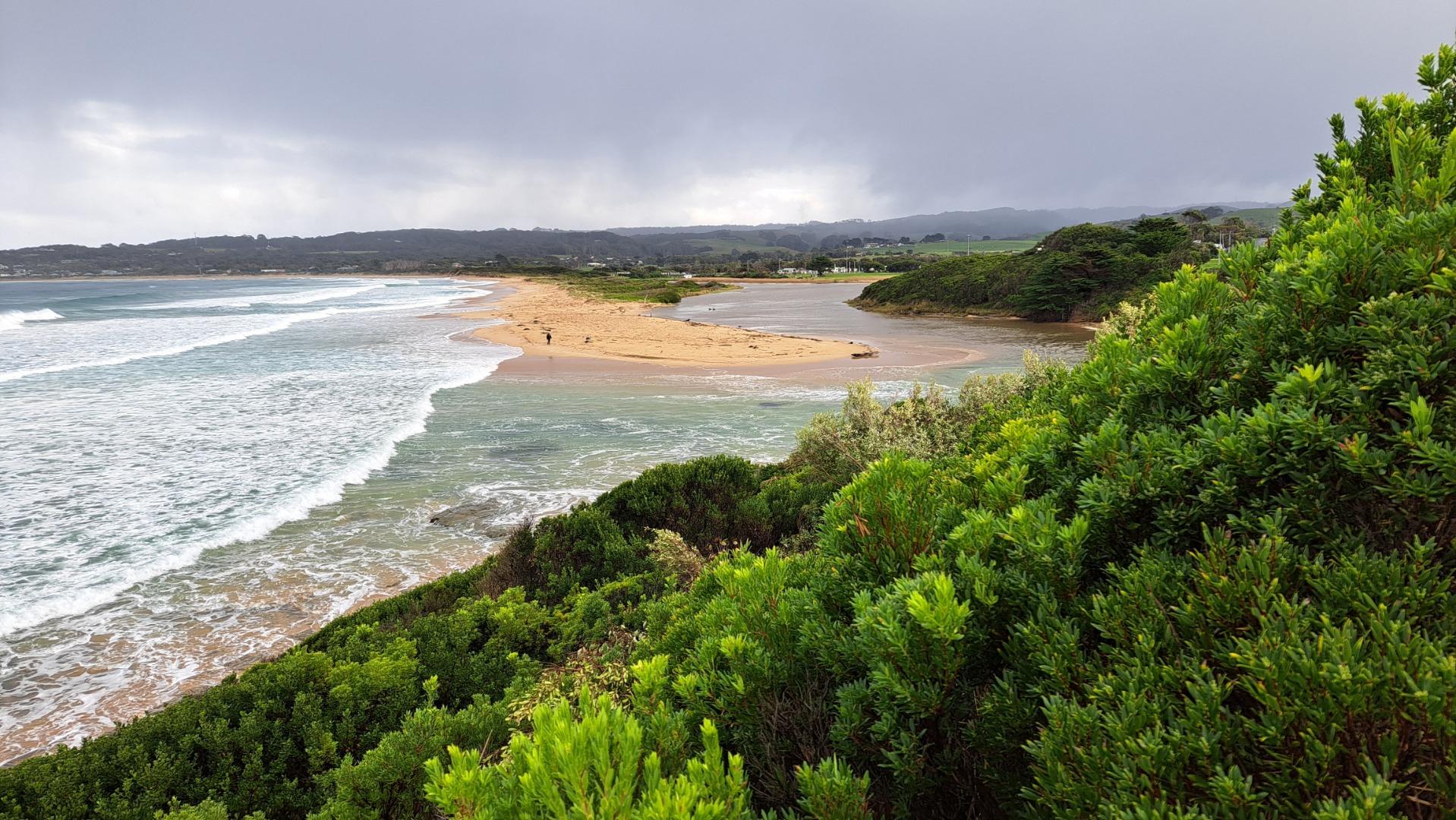
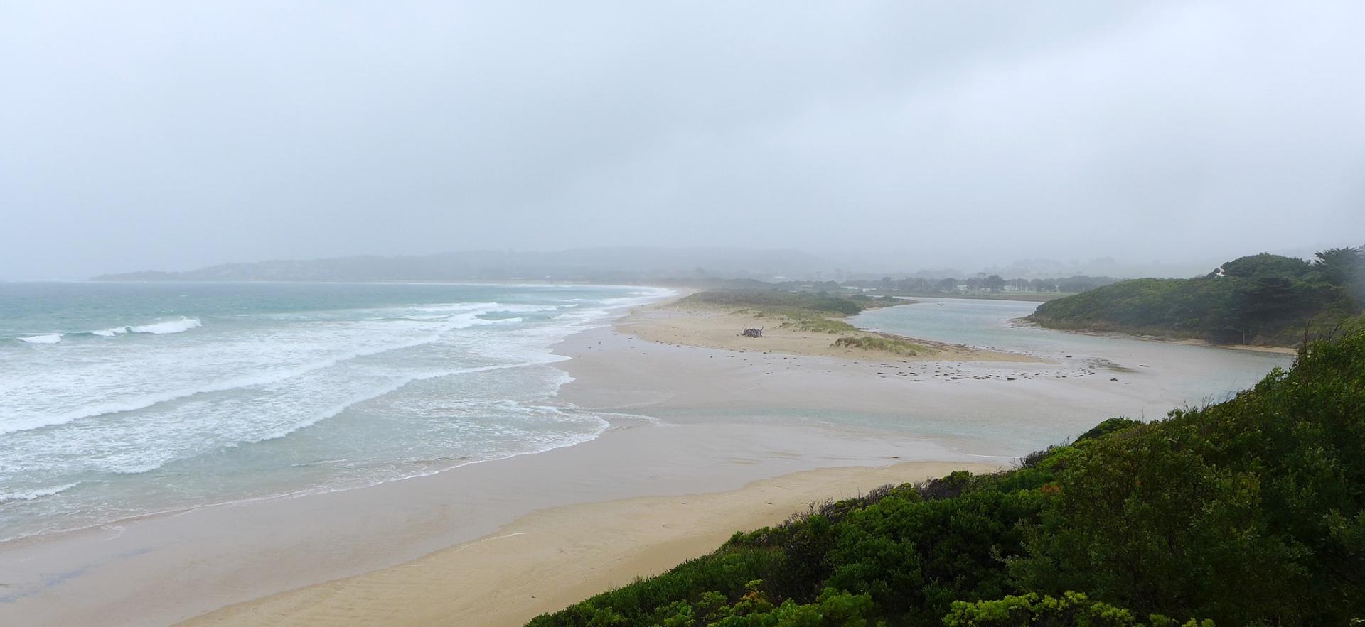
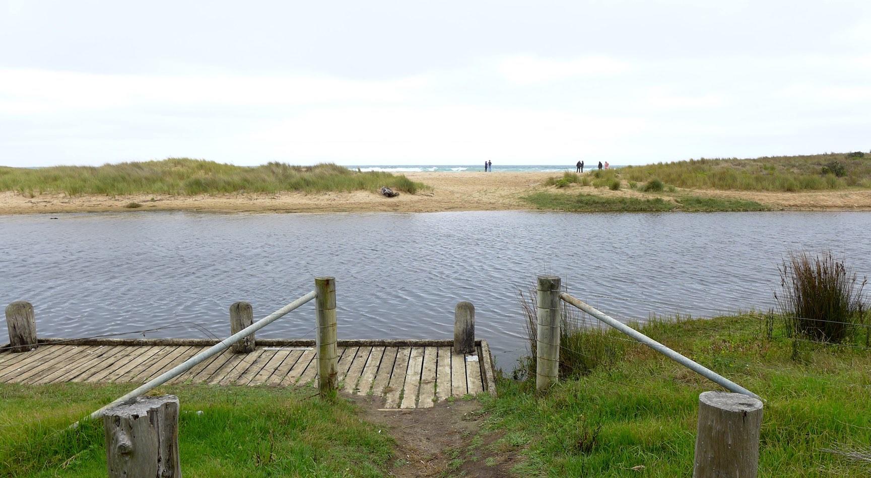
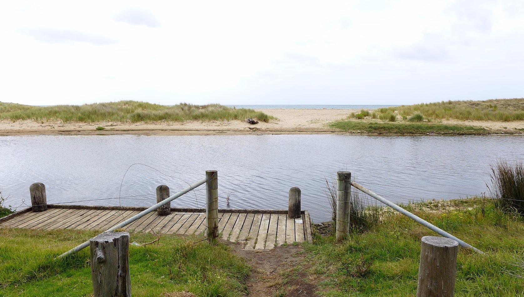
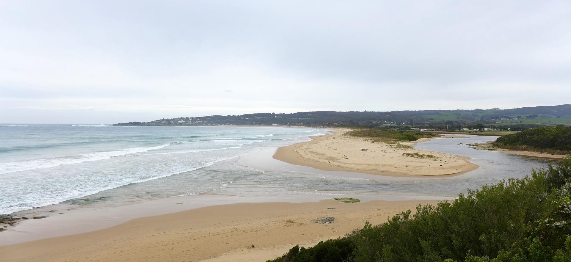
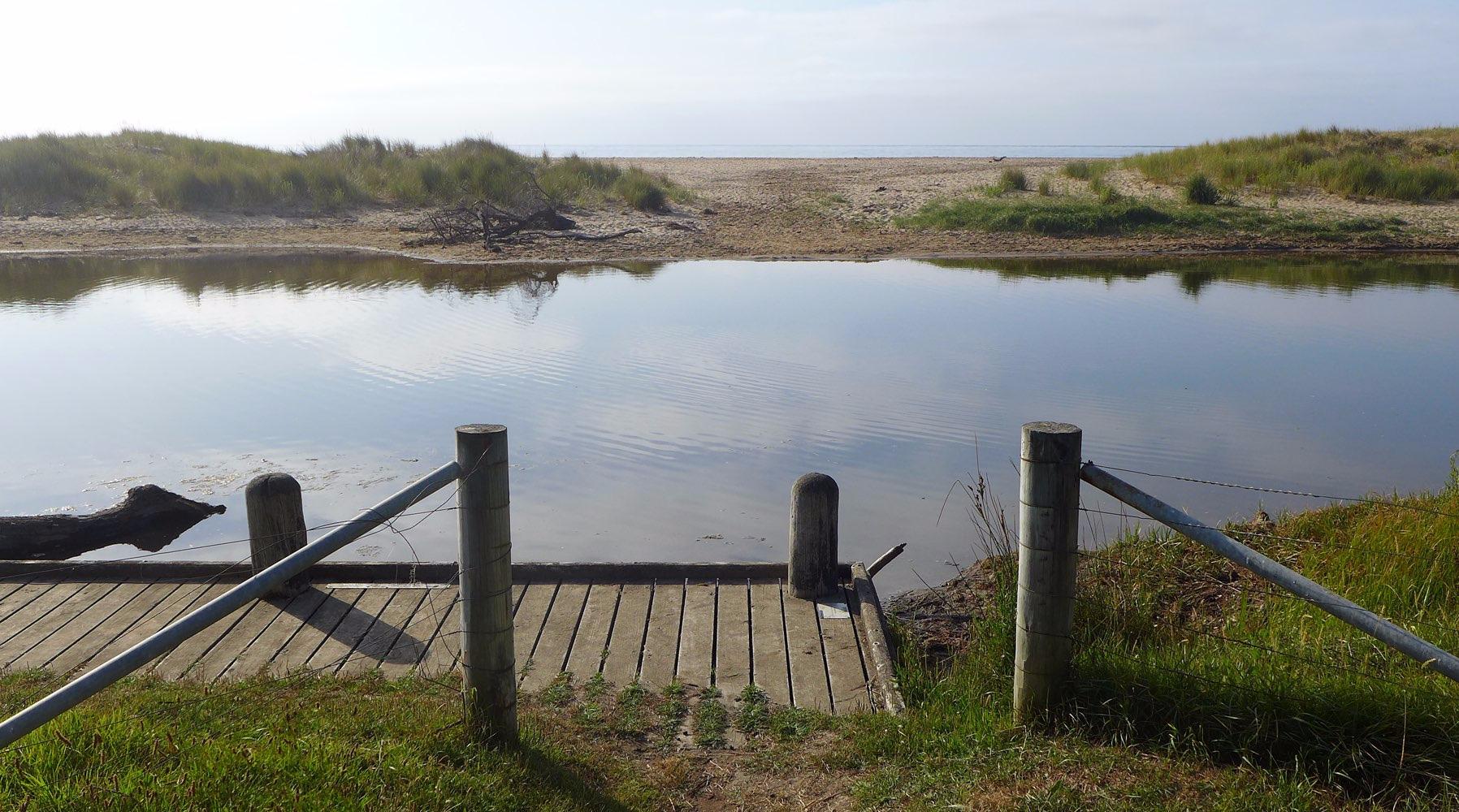
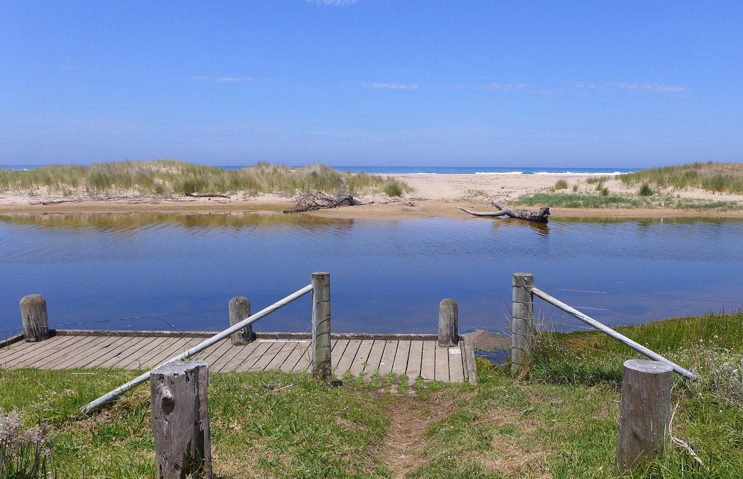
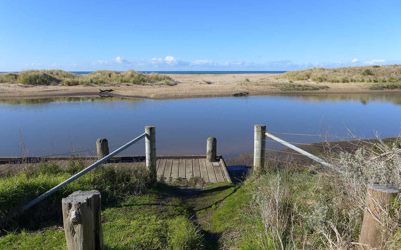
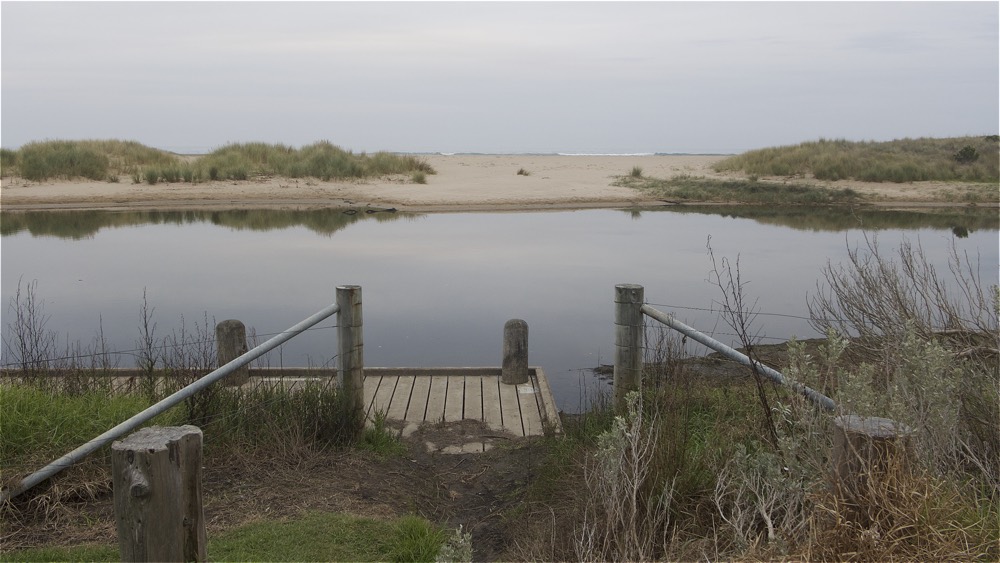
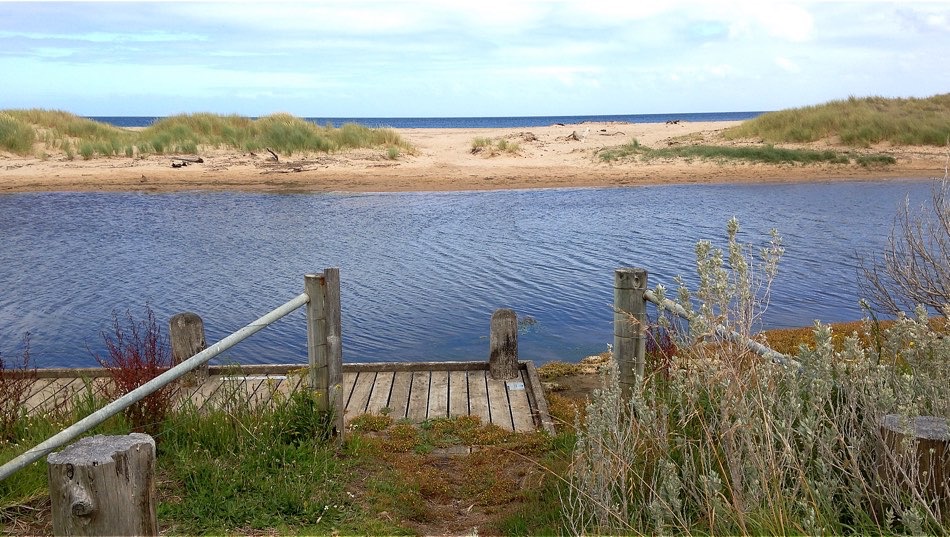
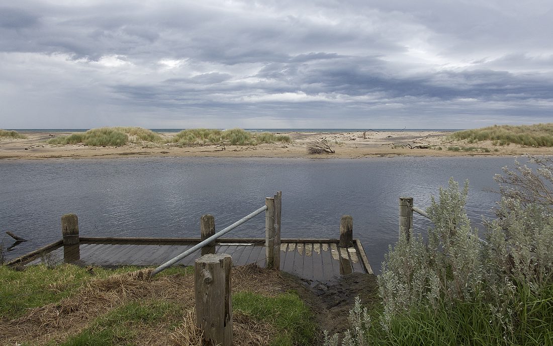
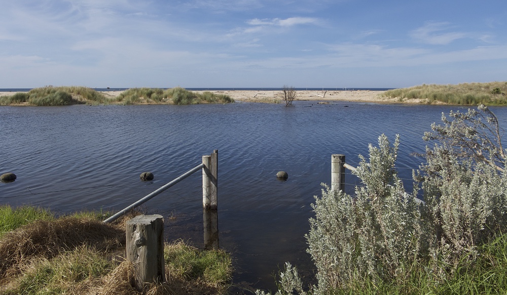
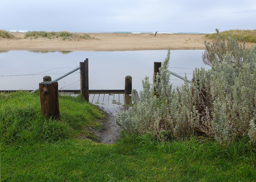
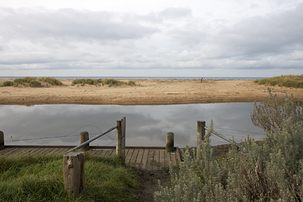
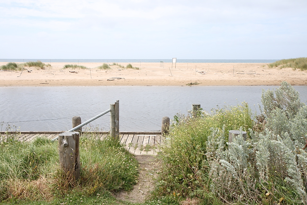
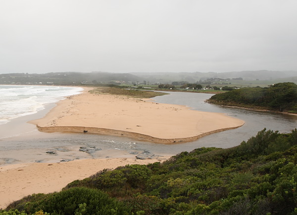
Rainfall past 48 hrs = 1.6 mm; Atm. press = 1023.5 hPa. There is an ongoing build-up of sediment and debris at the river gauge. (See photo.) River height readings may not be possible during dry months. Question for Estuarywatch co-ordinator: Vegetation growth has progressively obscured our vision of the river mouth from Photopoint BmP3. (See photo BmP3-3). Other viewpoints have advantages, and may deserve consideration. (See, for example, photo BmP2-5.) |
|
| #13245 | 14 Aug 2019 | Approved |
Notes:
1.8 mm rain past 48 hrs; atm. press. = 1027 hPa |
|
| #13187 | 8 Jul 2019 | Approved |
Notes:
Rain past 48 hrs = 8 mm; Atm. pressure = 1024 hPa School holidays: Visitors with dogs frequent estuary vicinity. |
|
| #13120 | 10 Jun 2019 | Approved |
Notes:
Rainfall past 48 hrs = 1 mm; Atm. press. = 1006.2 hPa Estuary water level high, accompanied by considerable width. Note the river levels observed at BmP2 were not steady, but showed short term fluctuations within the range 1.16 to 1.23 m, according to wave action at the river mouth. |
|
| #12910 | 8 May 2019 | Approved |
Notes:
19 mm rain during past 48 hrs; atmospheric pressure = 1019 hPa. At GOR bridge observation point BmP2, a developing sand berm was observed spreading across the river towards the fishing platform. |
|
| #12847 | 12 Apr 2019 | Approved |
Notes:
Rain past 48 hrs = 0 mm; Atm Press = 1024 hPa. Holiday makers enjoying perfect weather. |
|
| #12779 | 21 Mar 2019 | Approved |
Notes:
Rain past 48 hrs = 0.4 mm; Atm Press. = 1018.2 hPa Solid berm across mouth, which has been closed for 10 days. River has flooded above its banks. Recent rain in watershed today raised river height 3 cm from 12:15 to 15:00 hrs. |
|
| #12709 | 20 Feb 2019 | Approved |
Notes:
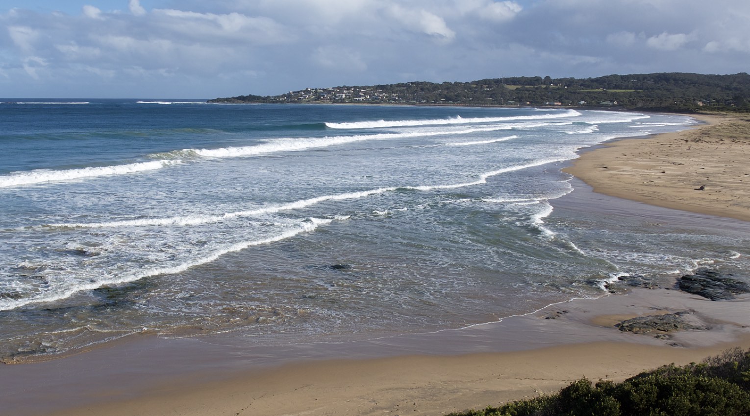
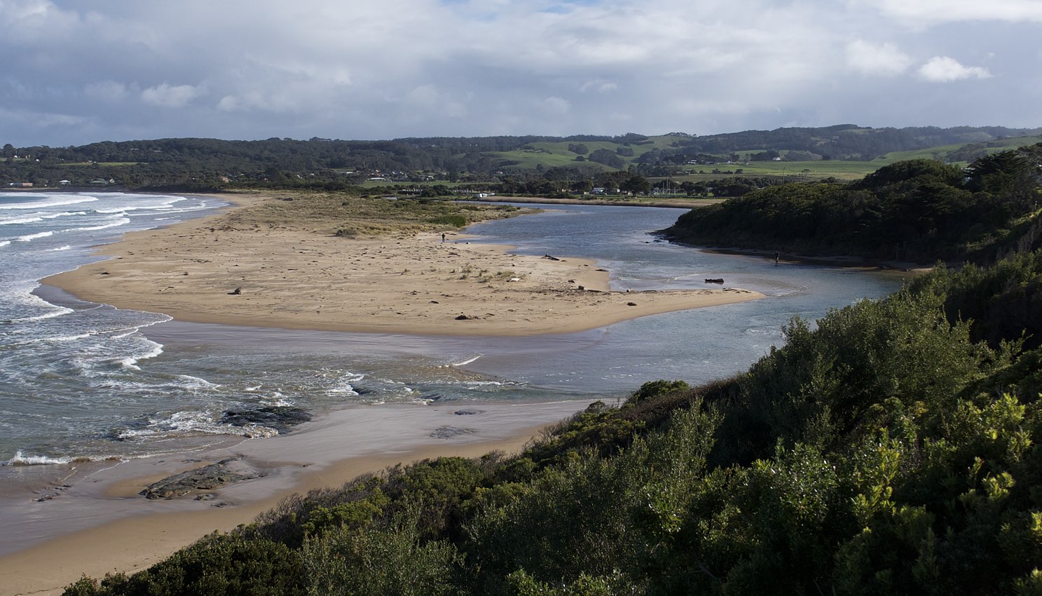
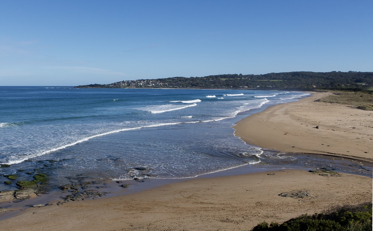
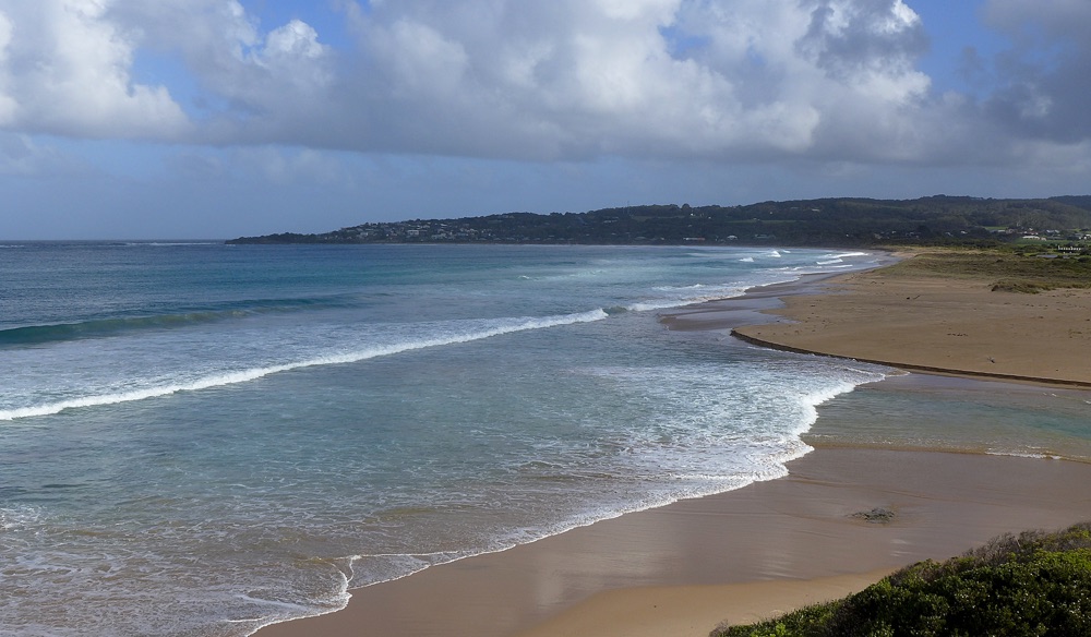
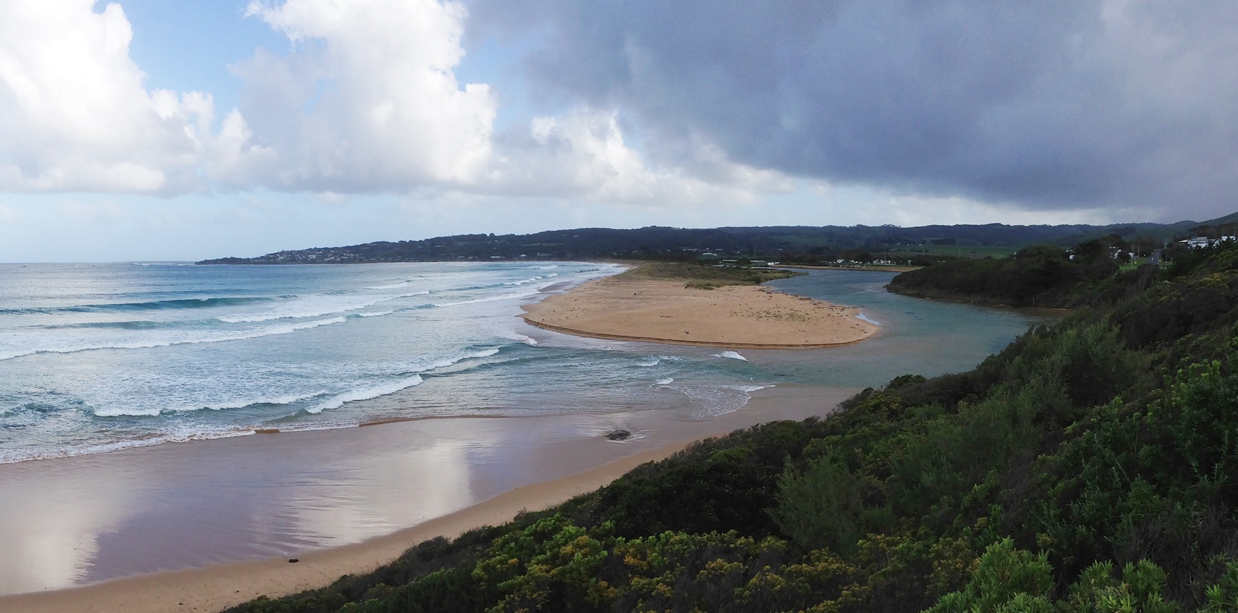
No rain during past 48 hrs; Atmos pressure = 1014 hPa. At mouth, river has cut through sand berm deposits. |
|
| #12643 | 16 Jan 2019 | Approved |
Notes:
0 mm rain during past 48 hrs; Atm press = 1010.1 hPa River mouth characterized by meandering channel; rocks exposed where river enters ocean. |
|
| #12589 | 12 Dec 2018 | Approved |
Notes:
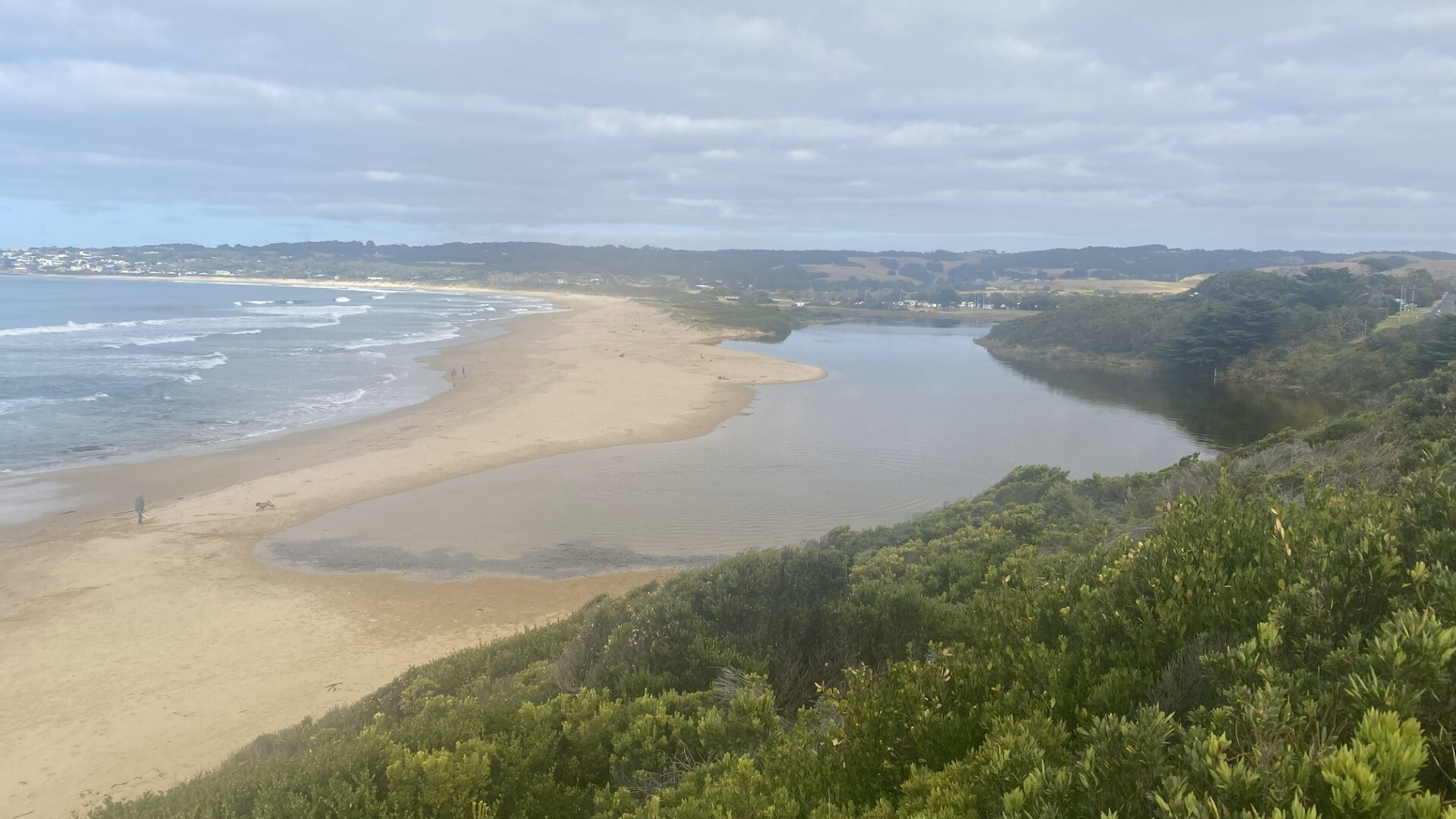
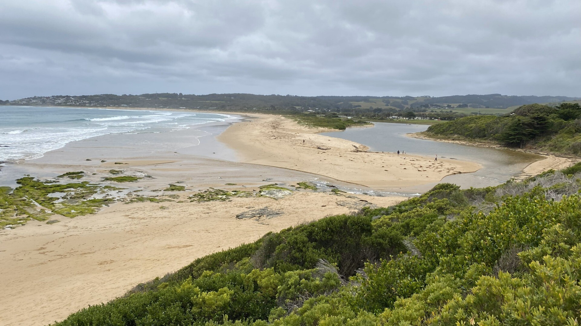
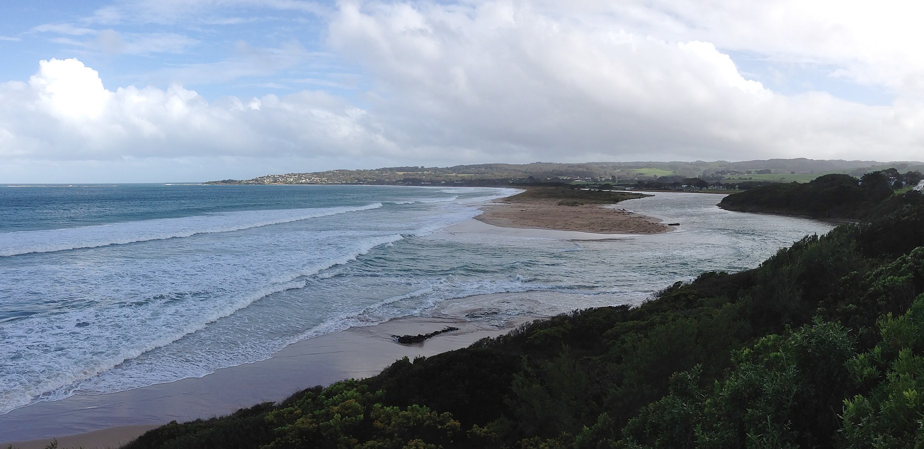
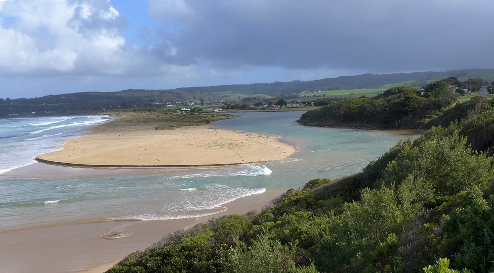
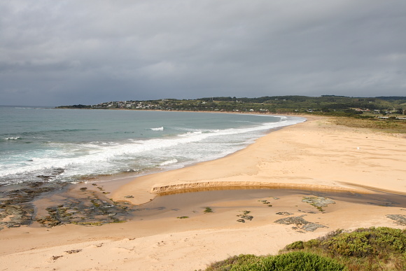
Rainfall past 48 hrs = 0; Atmospheric pressure = 1007.5 hPA. Wide build-up of sand at mouth narrows mouth and river passage. Observed decrease in water level between 14:00 & 17:15 is more likely due to drawdown of river after the mouth opening in the prior 24 hrs, rather than to tidal influence. No upstream influence was observed at high tide. Vegetation growth over the years on the bank below the BmP3 observation point is starting to obscure vision of the estuary on the inland side. (e.g., compare image BmP3-3 with past images from the same data point taken in Dec 2012.) |
|
| #12520 | 11 Nov 2018 | Approved |
Notes:
Rain past 48 hrs = 0 mm; Atm press = 1022 hPa Narrow opening at mouth, with large exposed expanse of sand, even at high tide. Rocks well-exposed on NE side of mouth.
|
|
| #12431 | 2 Oct 2018 | Approved |
Notes:
Rainfall last 48 hours 0.0mm, Air Pressure 1023.6 hPa |
|
| #12365 | 31 Aug 2018 | Approved |
Notes:
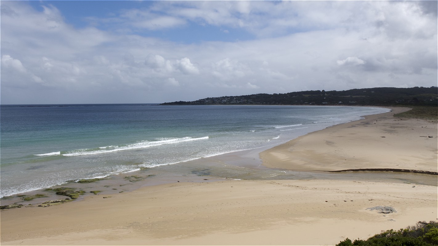
Rainfall past 48 hrs = 0.2 mm; Atmos pressure = 997.7 hPa. River mouth wide and relatively deep. Water level at gauge showed periodic fluctuations (within a range of 0.06 m), due to the surge and ebb of surf at the river mouth. |
|
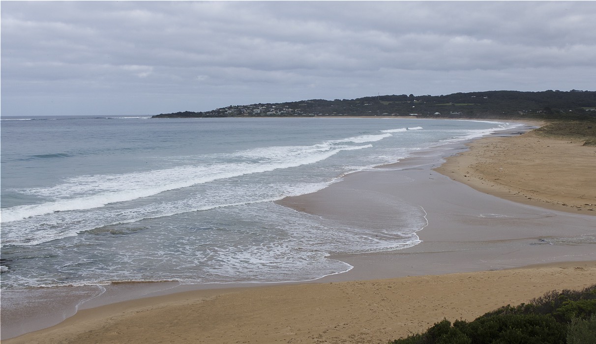
| #12301 | 1 Aug 2018 | Approved |
Notes:
Rainfall past 48 hrs = 10.8 mm Atm pressure = 1017.8 hPa Due to recent rains there is downriver flow, but this is opposed by the high tide, resulting in small net change of river height at the estuary during the time we were monitoring. |
|
| #12237 | 4 Jul 2018 | Approved |
Notes:
Rain past 48 hrs = 0; Atm pressure = 1014.6 hPa
|
|
| #12111 | 4 Jun 2018 | Approved |
Notes:
Rain past 48 hrs = 0.2 mm; Atm press = 1024 hPa |
|
| #12014 | 3 May 2018 | Approved |
Notes:
Rain past 24 hrs = 0; Atm press = 1008.6 hPa Car park at Barham bridge is now clear of roadworks materials. Flock of about 100 terns on berm south of mouth.
|
|
| #11904 | 20 Mar 2018 | Approved |
Notes:
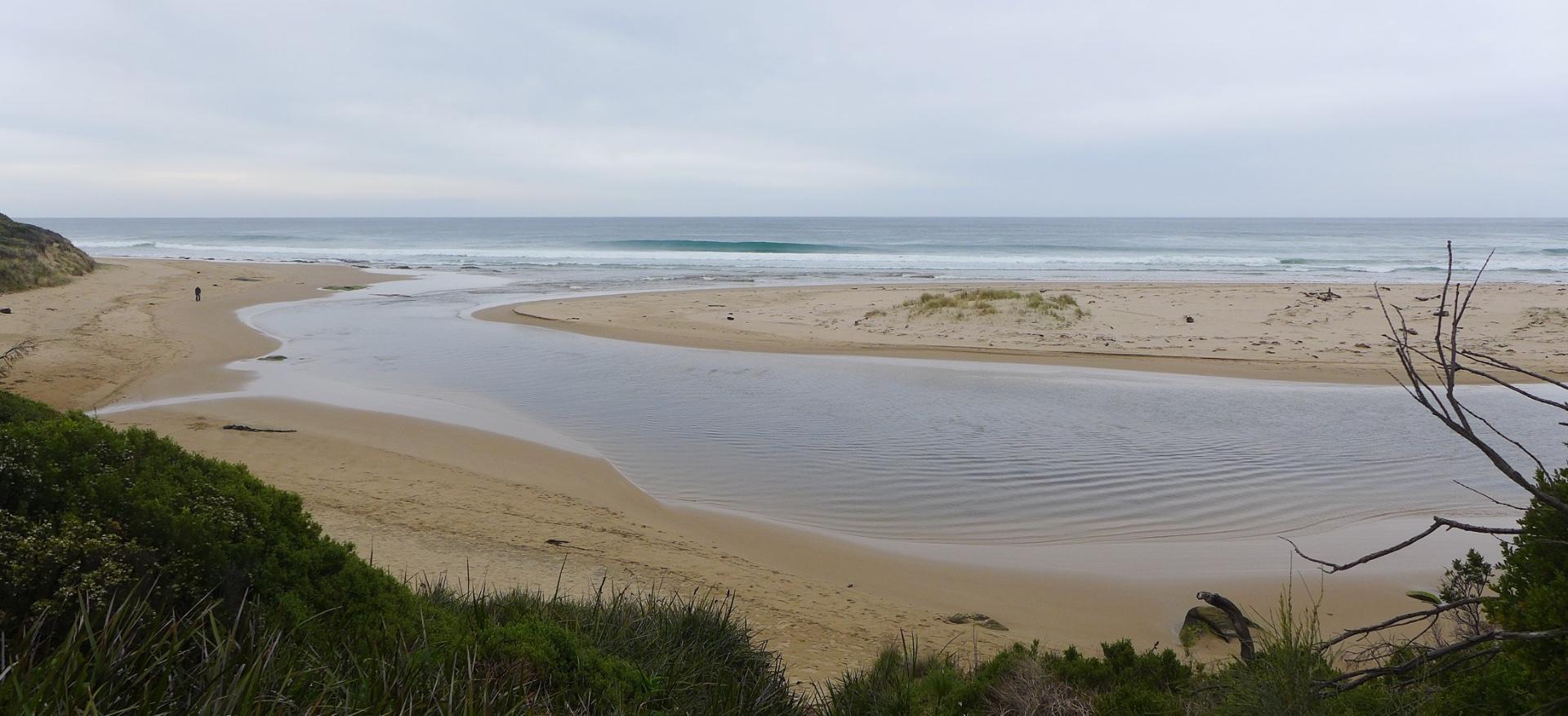
Rain past 48 hr = 2 mm; Atm. press = 1025.4 hPa River level high - banks flooded at bridge. At low tide mouth would be closed, but at full tide (14:30) storm surge waves breach over the berm at the river mouth and move up the river. Terns and gulls sheltering on land-ward side of dune build-up at mouth. Photo note: BmP3_1 & _BmP3_2 are simple crops of BmP3_pan, made using garden-variety photo app. |
|
| #11817 | 16 Feb 2018 | Approved |
Notes:
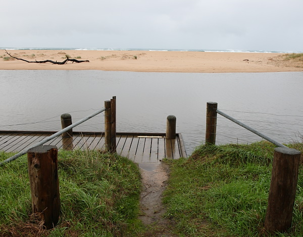
Rain past 48 hrs = 4.5 mm; Atmos Pressure = 1013.7 hPa As of 1/1/2018, car park has been cleared and graded with crushed rock. Sand deposited at mouth has produced high water levels in estuary, with the small berm just washed over at high tide. At other times, the mouth is closed. Starting with the next sampling, photographs BmP3-1 and BmP3-2 will not be uploaded. Panoramic photo BmP3-3 includes all information contained in BmP3-1 and BmP3-2, and moreover, is easier to interpret. |
|
| #11703 | 5 Jan 2018 | Approved |
Notes:
No rain previous 48 hrs; atm pressure = 1015 hPa. Roadworks adjacent to monitoring point BpM2 have been completed and parking area restored. |
|
| #11628 | 5 Dec 2017 | Approved |
Notes:
Rainfall past 48 hrs < 1 mm; Atmospheric pressure = 1015 hPa. Location and shape of mouth has altered considerably since last monitoring visit. |
|
| #11553 | 27 Oct 2017 | Approved |
Notes:
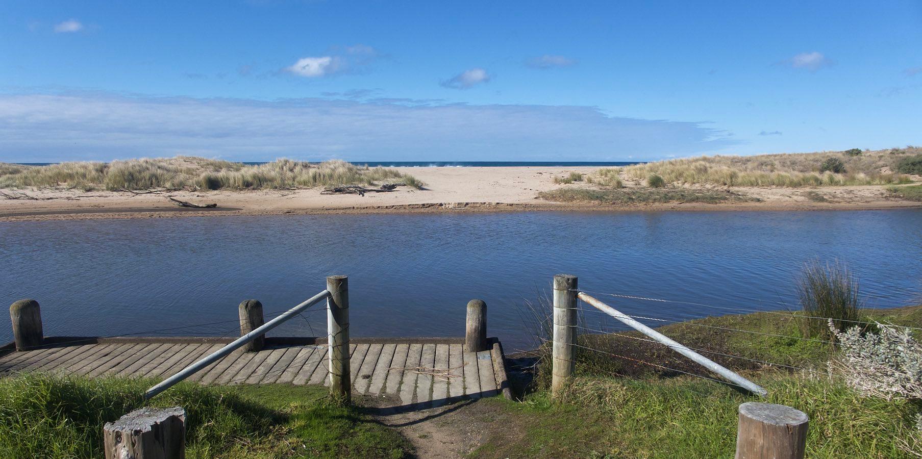
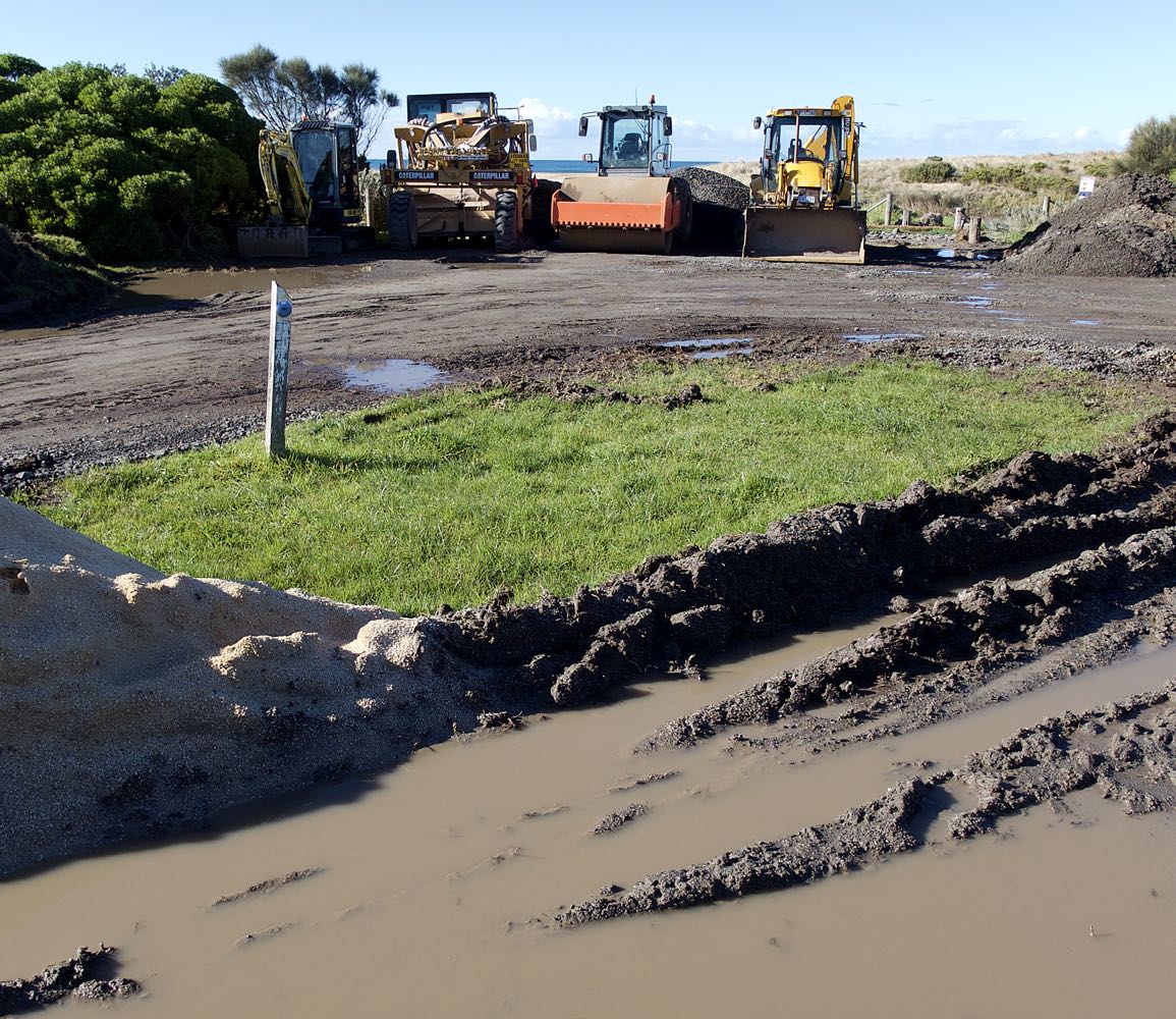
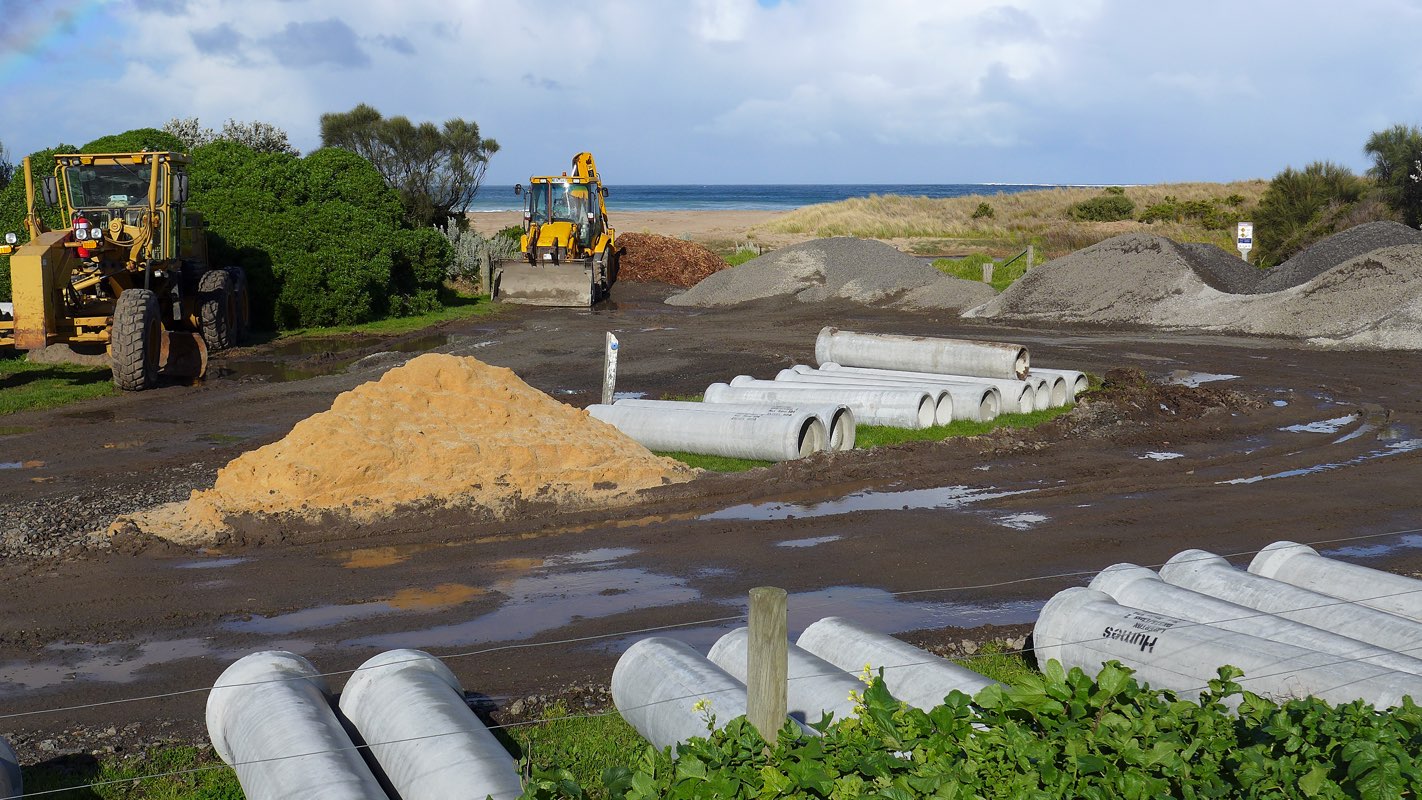
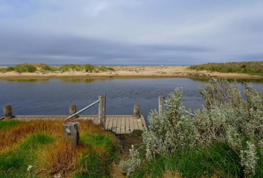
Rain past 48 hrs = 0; Atm. press. = 1008.9 hPa. Water level not readable on gauge due to mud bank deposits. Judged to be < 0.5 m. At finish of observations the level was still below 0.5 m, but was estimated to have risen by 1-2 cm. Observed wetting of sandbanks near the photopoint, presumed to be due to the previous high tide, supports the existence of tidal influence. Access to monitoring point BmP2 is considerably impeded by untended vegetation growth and by stockpiles for ongoing road construction. New season's growth also hinders access along the foot track leading to BmP3. |
|
| #11478 | 27 Sep 2017 | Approved |
Notes:
Rain during past 48 hrs = 0.4 mm; atm press = 1004.6 hPa Car park at Barham bridge closed to traffic owing to use by roadwork plants and for storage of roadwork materials. Significant roadworks still in progress. |
|
| #11397 | 20 Aug 2017 | Approved |
Notes:
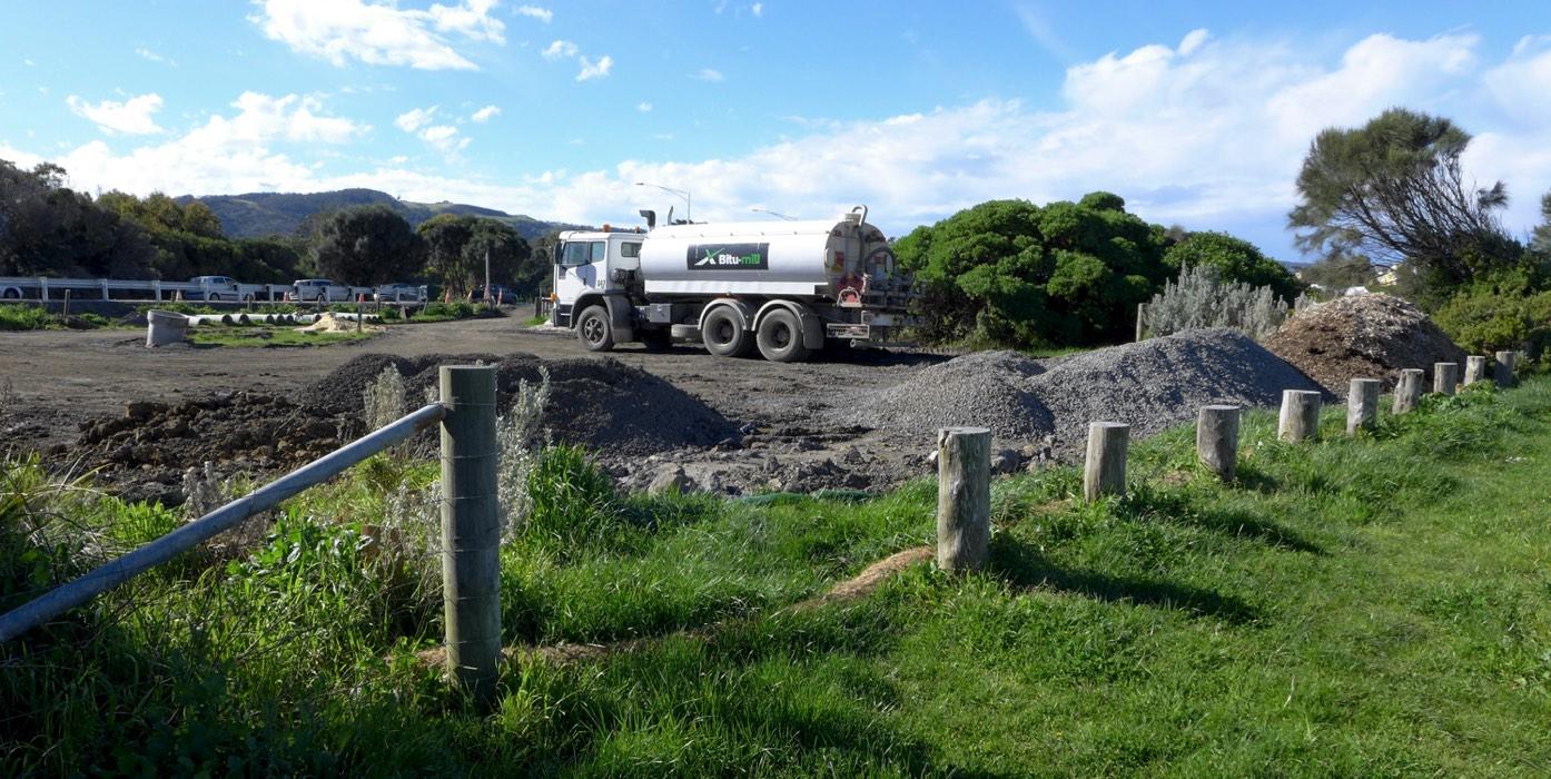
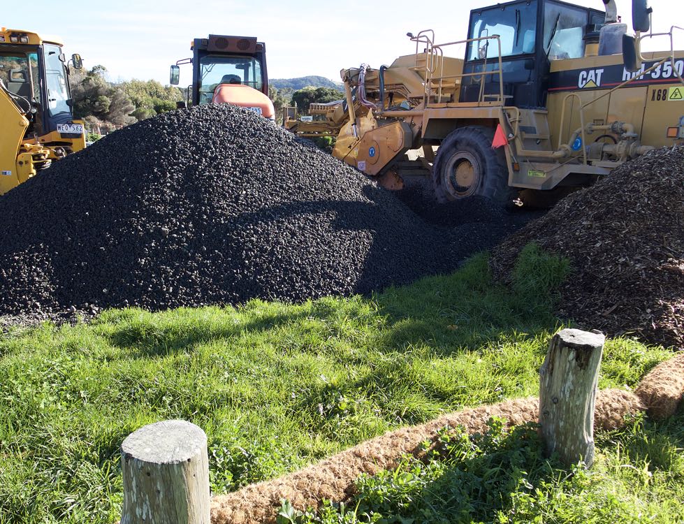
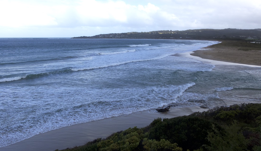
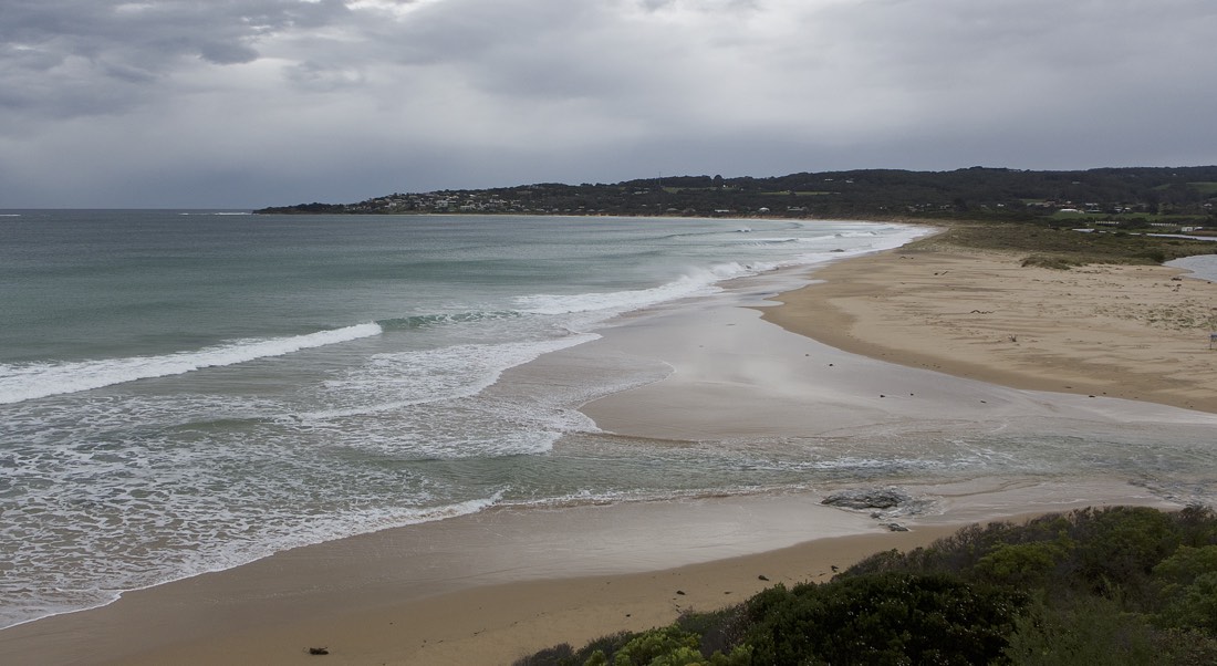
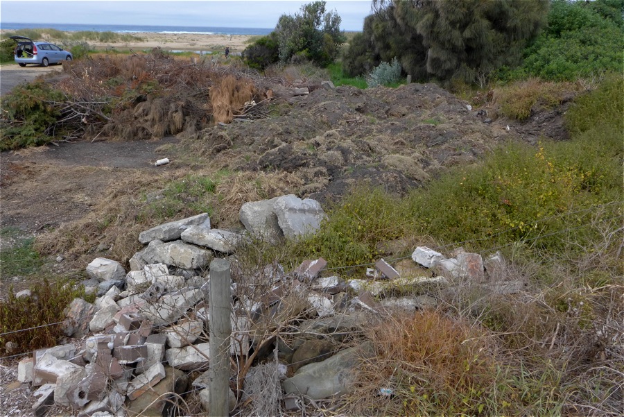
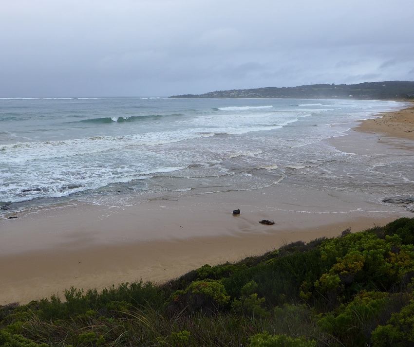
4.0 mm rain during past 48 hrs; Atm. press = 1026 hPa. Carpark at bridge continues to be used as base for ongoing drain and roadworks. Rolls of coir matting have been laid around the area to restrict run-off into the estuary. (See pix.) Due to heavy rain in catchment over the past week, river mouth is wide with consistent outflow. |
|
| #11365 | 30 Jul 2017 | Approved |
Notes:
Rainfall past 48 hrs = 1 mm; Atmospheric pressure = 1008.6 hPa Heavy winds previous day; large ocean swells. Carpark at bridge observation point BmP2 is being intensively used for the storage of excavator plant machinery and gravel for ongoing drainage and sewage works. It appears that this work will continue for some months. See added photo attached. |
|
| #11298 | 1 Jul 2017 | Approved |
Notes:
Rain past 48 hrs = 11.6 mm; rain past week > 20 mm. Air press. = 1029.4 hPa. Rain during past week has raised river level above normal. Strong outward flow at mouth. |
|
| #11213 | 26 May 2017 | Approved |
Notes:
Rainfall past 48 hrs = 2.6 mm; Atmos. press - 1022.2 hPa. High tide 11:45 Very still atmosphere. A stretch of mechanically-dumped sand was observed, placed to consolidate the beach of Mounts Bay in the vicinity of Marengo. The condition of the car park at the bridge opposite the campground is in poor condition. Added to previous debris-dumps from the campground, there now exists a large mulch pile to further restrict parking and public access. |
|
| #11094 | 20 Apr 2017 | Approved |
Notes:
Rainfall past 48 hrs = 4.2 mm; Atmos. pressure = 1024.5 hPa. Rain overnight has raised river level. Completely still atmosphere, overcast, grey, & smokey due to ongoing forestry controlled burn at Gellibrand. |
|
| #10911 | 16 Mar 2017 | Approved |
Notes:
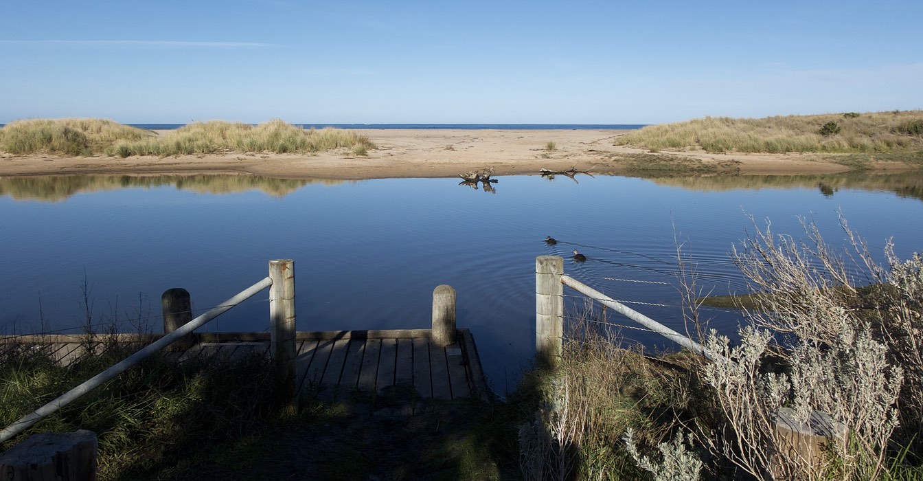
Rainfall past 48 hr = 1.4 mm; Atmos. Press = 1009.5 hPa. Otherwise closed, the mouth opens at peak high tides with small waves moving over the sand bar for a short distance upstream. No outward flow observed. Estuary is wide and relatively high due to the mouth closure when tide is not at peak. |
|
| #10813 | 16 Feb 2017 | Approved |
Notes:
Rainfall last 48 hours 0 mm; Atmospheric Pressure 1012.1hPa. River level higher than expected. Open mouth was wide and shallow. There would be an exposed sand bar at low tide. New vegetation growth 30 metres upstream of river mouth. Large flocks of gulls and terns resting on berm edge upstream of river mouth. |
|
| #10762 | 27 Jan 2017 | Approved |
Notes:
Rain last 48 hrs = 0 mm; atmos press = 1018 hPa. Moderate high tide and smooth ocean so little wave action at mouth; wide strand on beach. Estuary mouth narrow and shallow. Water stain along river bank suggests tidal influence during previous (midnight) higher tide. |
|
| #10638 | 20 Dec 2016 | Approved |
Notes:
Rain past 48 hrs = 6.8 mm; Atm press = 1007.9 hPa Following overnight rain, river height was observed to drop slightly during monitoring period. Sand bank at bridge fishing platform is well established and vegetated with grass |
|
| #10556 | 16 Nov 2016 | Approved |
Notes:
Rainfall past 48 hrs = 2.4 mm Atmos pressure = 1024.1 hPa Sand has accumulated and spread horizontally, widening the berm at the open river mouth. |
|
| #10555 | 18 Oct 2016 | Approved |
Notes:
Rainfall past 48 hrs = 27.6 mm; atmos pressure = 100.6.6 hPa. |
|
| #10554 | 23 Sep 2016 | Approved |
Notes:
Rainfall past 48 hrs < 2 mm. Air pressure = 1017.8 hPa. Large flock of terns on berm south of estuary mouth.
|
|
| #10552 | 16 Aug 2016 | Approved |
Notes:
Rainfall past 48 hrs = 3 mm; atmospheric pressure = 1022.2 hPa. |
|
| #10550 | 22 Jul 2016 | Approved |
Notes:
Air Pressure 993.9 hPa Rainfall last 48 hours 19.8 mm High Tide plus swell causing overflow banks at bridge (BmP2) fishing platforms flooded. Wide and deep mouth channel Brush pile at bridge car park has been burnt, but dumping continues. |
|
| #10389 | 22 Jun 2016 | Approved |
Notes:
Rainfall in last 48 hours 7.8 mm Atmospheric Pressure 1000.0 hPa. |
|
| #10333 | 25 May 2016 | Approved |
Notes:
Rain in last 48 hours 8.6 mm Atmospheric Pressure 1009.6 hPa Since last months monitoring high sea swells+ high tides + low Pressure produced several days of wave surge that appears to have moved much sand across the first berm and depositing it into the river. |
|
| #10257 | 20 Apr 2016 | Approved | Notes: Rainfall lst 48 hrs 0mm, Atmospheric Pressure 1020hPaWater level at rain gauge is high with fishing platforms under water. Wide berm across closed mouth has caused the river to widen considerably,flooding hood plover nesting area. Berm length was 38metres. | |
| #10196 | 11 Mar 2016 | Approved |
Notes:
Rainfall last 48 hours 7.2 mm. Atmos. Press. 1018.3 hPa Photo included of brush pile @fishing platforms car park - it continues to grow!!. Berm opposite fishing platform is quite high with colonizing vegetation well established. No evidence of wash over by waves. The Algae mat noted last month is now senescing. The river moouth opening, though wide, is shallow inhibiting water flow either in or out. Mouth would be CLOSED at low tide. We have enclosed a copy of a letter addressed to Otway Coast Committee regarding the brush dumping at the car park, for your information. |
|
| #10076 | 15 Jan 2016 | Approved | Notes: Rainfall last 48 hours 4.2mm. Atmospheric Prressure 1032.5 hPa. Water stain on sandbank sugests the river level rose with the higher tide of 1.67 @04.06am, with rough waves surmounting the the berm at the mouth. Berm along the beach front is spotted with pioneering plants, and has been fenced off for hooded plovers nesting. Berm length 65.5m. | |
| #10010 | 15 Dec 2015 | Approved |
Notes:
Rainfall last 48 hours 0mm, Atmospheric Pressure 1016 hPa Vegetation has established along the berm opposite the fishing platform and towards the mouth Water stain on river banks at the mouth suggests river level has been higher during the last 24 hours, suggesting the river level has been higher, possibly due to wave intrusion at high tide (1.66m ) at 03:05 |
|
| #9954 | 21 Nov 2015 | Approved | Notes: Rainfall last 48 hrs 4.8 mm. Atmospheric Pressure 1022 hPa | |
| #9839 | 13 Sep 2015 | Approved |
Notes:
Rainfall last 48 hours 0mm; Air Pressure 1022.5hPa A modest high tide and low rainfall resulted in low river level. Dunes well established. |
|
| #9791 | 18 Aug 2015 | Approved |
Notes:
Rainfall last 24 hours 12.6 mm, Atmospheric Pressure 1023.1. There is a large build up of sand opposite the fishing platform at BmP2. Mouth opening is wide, with tidal waves traveling upstream for approx. 100 m. Monitors were absent from the region on holiday, so that the Mode information is lacking |
|
| #9740 | 15 Jul 2015 | Approved |
Notes:
Rainfall last 48 hours 20.8 Atmospheric Pressure 1018 hPa High rainfall caused strong outward flow of river at mouth |
|
| #9666 | 15 Jun 2015 | Approved | Notes: Rainfall lat 48 hours 0mm, Atmospheric Pressure 1025.3 hPa, Tidal inflow extended about 30 metres upstream. Noticeable sand deposition on foredune along beach front. | |
| #9591 | 6 May 2015 | Approved | Notes: Rainfall last 48 hours 38 mm. Atmospheric Pressure 1008.3 hPa. Storm surge, high tide and high rainfall all contributed to exceptional water levels, overwashed berms and dramatic scenery. It is possible that at low tide the mouth would be closed - the water depth across the mouth was quite shallow at high tide. | |
| #9528 | 7 Apr 2015 | Approved | Notes: Rainfall last 48 hours 1.4mm. Air pressure 1013.5Kpa. Very stormy weather. | |
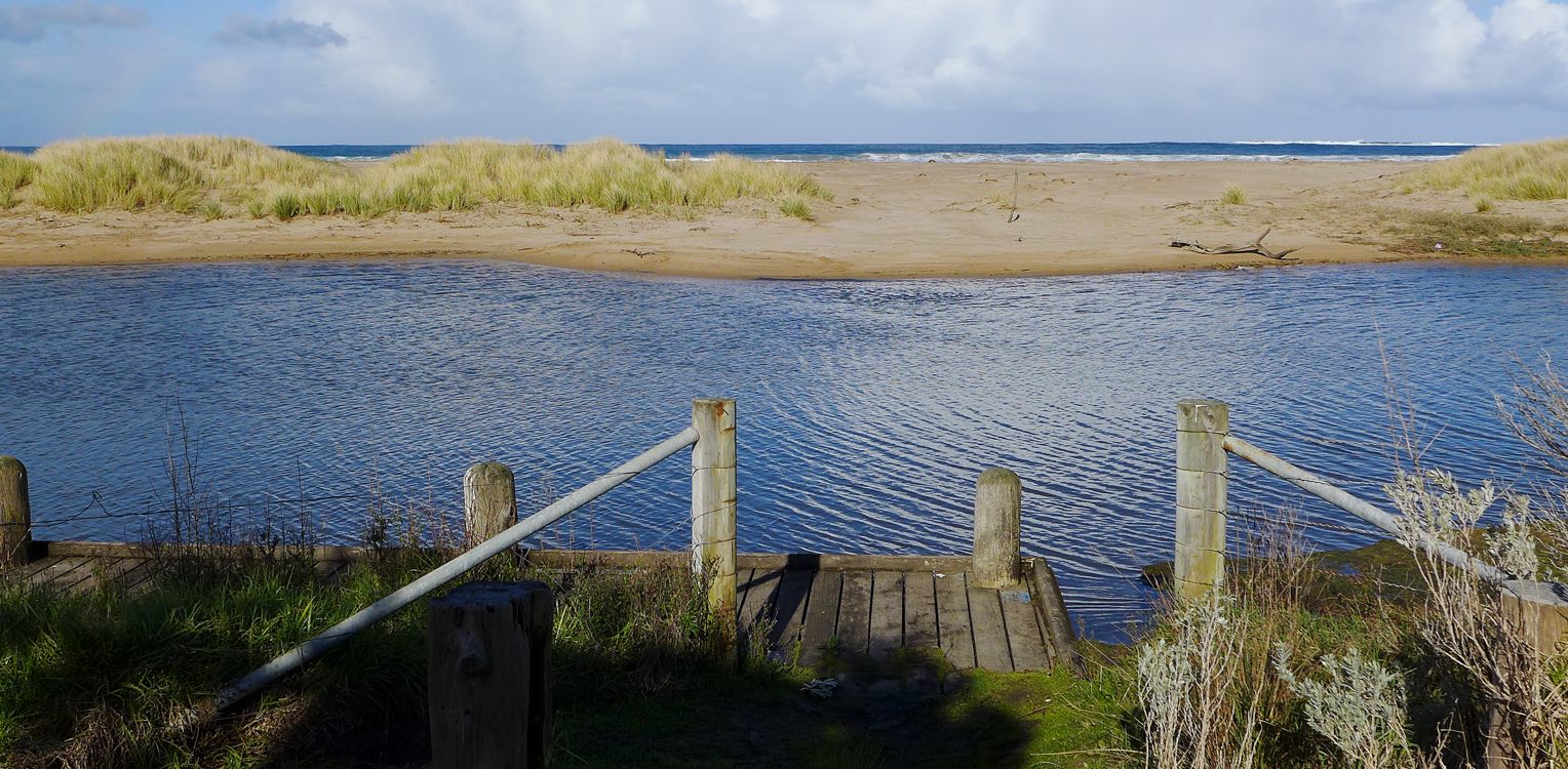
| #9433 | 3 Mar 2015 | Approved | Notes: Atmospheric Pressure 1017.3, rainfall last 48 hours 0 mm. River level is above banks, minor flooding in the riparian zone. Mouth berm is narrow, and a bigger high tide would wash over the berm blocking the river. There is a broad pondage of river water behind the berm. Tidal influence is questionable. The river level dropped marginally, probably due to river seepage underneath the berm. Berm length is 14 meters long. | |
| #9359 | 2 Feb 2015 | Approved | Notes: 0.6 mm rain during past 48 hrs. Atmospheric pressure = 1020.4 hPa. Mouth closed! River just flooding over banks into campground oval. | |
| #9288 | 4 Jan 2015 | Approved |
Notes:
Rainfall last 48 hours 6.00 mm. Atmosppheric Presssure 1018.1 hPa Mouth open with water flowing out through narrow winding channel. |
|
| #9226 | 25 Nov 2014 | Approved |
Notes:
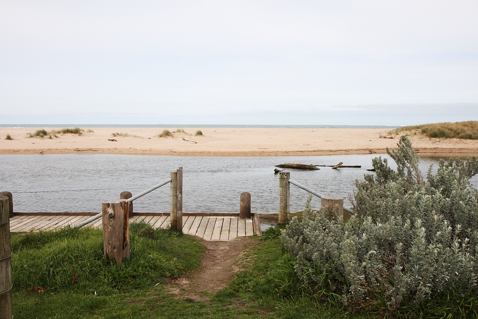
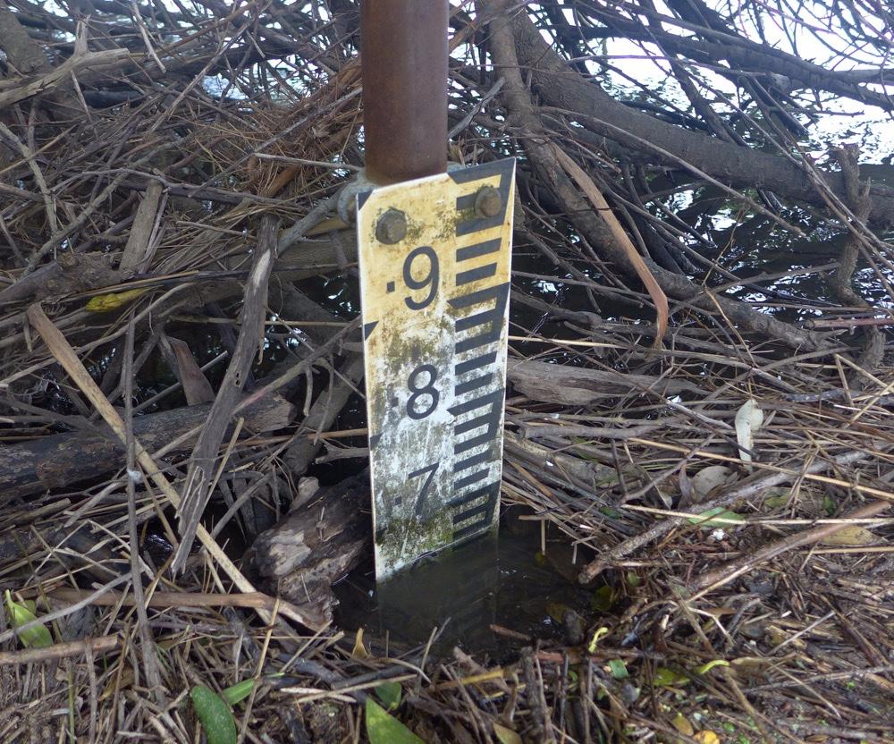
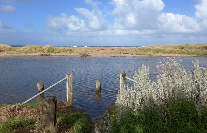
Rainfall last 48 hrs 8 mm. Atmospheric Pressure 1017.4 hPa. While there was no tidal influence at the time of monitoring, the high tide at 2 am did raise the river height considerably, leaving a tide water mark on river bank. Berm at the river mouth has been greatly reduced resulting in a flat beach. The River channel has been pushed against the mainland river bank. The flow through the mouth is shallow with a HT of 1.4m The shrubs previously obscuring the view of the river gauge have been trimmed back and gauges are now clear for reading. |
|
| #9178 | 29 Oct 2014 | Approved |
Notes:
Rainfall last 48 hours 12 mm Considerable sand deposiition near mouth of the river. River level relatively high, causing good outward flow. Shrub growth around the river gauge is obsscuring view of readings. We will take branch cutting tools next month. |
|
| #9148 | 1 Oct 2014 | Approved |
Notes:
Rainfall lst 48 hours 22 mm 24 hours previously gale force winds and heavy rain Currently weather much modified, sea relatively moderate, but breakers have steep fronts. Mouth outlet open but SHALLOW. Hooded plovers now on beach. |
|
| #9094 | 2 Sep 2014 | Approved |
Notes:
Rainfall last 48 hours 8 mm Atmospheric Pressure 1019.8 hPa |
|
| #9033 | 30 Jul 2014 | Approved | Notes: Rainfall during past 48 hrs was 23 mm in Otways. Atmospheric pressure = 1008.8 hPa. High-tide storm surge combined with recent rain produce elevated water levels in estuary. Berm breached in several places adjacent to river mouth. | |
| #8990 | 5 Jul 2014 | Approved |
Notes:
Rain in last 48 hours 13mm Atmospheric Pressure 1009 hPa. Stormy weather during sampling with breakers causing storm surge up the river mouth, while rainfall provided good downstream flow at the same time. |
|
| #8916 | 5 Jun 2014 | Approved | Notes: 5.6 mm rain in past 48 hr; atmospheric pressure = 1020.4 hPa | |
| #8852 | 7 May 2014 | Approved | Notes: In the 48 hrs before these observation, 1.2 mm of rain was received. Atmospheric pressure = 1029.3 hPa. Rain (43mm) during previous week has raised water level in river; level now dropping. | |
| #8813 | 3 Apr 2014 | Approved |
Notes:
Air pressure 1020.6 hPa; 0.4 mm rain previous 48 hr. At high tide waves overwash berm and push a storm surge upstream. At low tide there would be no surface flow. |
|
| #8772 | 7 Mar 2014 | Approved |
Notes:
Rain fall last 48 hours Air Pressure 1022.5 hPa |
|
| #8703 | 1 Feb 2014 | Approved |
Notes:
Rainfall last 48 hrs 0 mm, Atmospheric Pressure 1014 hPa January has been very dry, and has had a number of very hot days. Mouth opening is very narrow. At low tide the river flow would be blocked. |
|
| #8649 | 2 Jan 2014 | Approved |
Notes:
2.6 mm of rain in past 48 hr. Air pressure = 1008.8 hPa. Water levels given above are estimates only because silt deposits conceal gauge readings less than the 0.6 m mark. Tidal influence was inferred from water water stain on bank above the current water level. |
|
| #8609 | 2 Dec 2013 | Approved |
Notes:
Air Pressure 1016 hPa, Rainfall last 48 hours 0.00 m The river gauge was silted up to the 0.6 m mark, and Water Level entries are estimates only. Tidal influence was noted from the water stains left on the sand banks from an overnight high tide at 22:57 pm with a reading of 1.4m |
|
| #8545 | 2 Nov 2013 | Approved |
Notes:
No rain last 48 hrs; Atmospheric pressure = 1015.5 hPa *** Water levels are estimates only as at these low levels the river gauge is obscured by mud deposition. |
|
| #8511 | 4 Oct 2013 | Approved |
Notes:
Air pressure = 1021.0 hPa; 11.4 mm rain during past 48 hrs recorded at Cape Otway. Heavy rains and gale winds characterize preceding week. 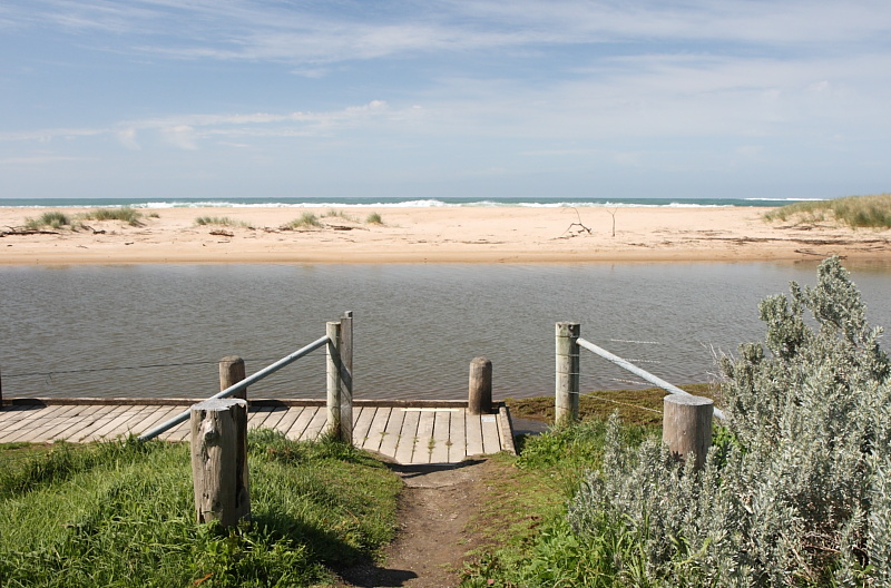  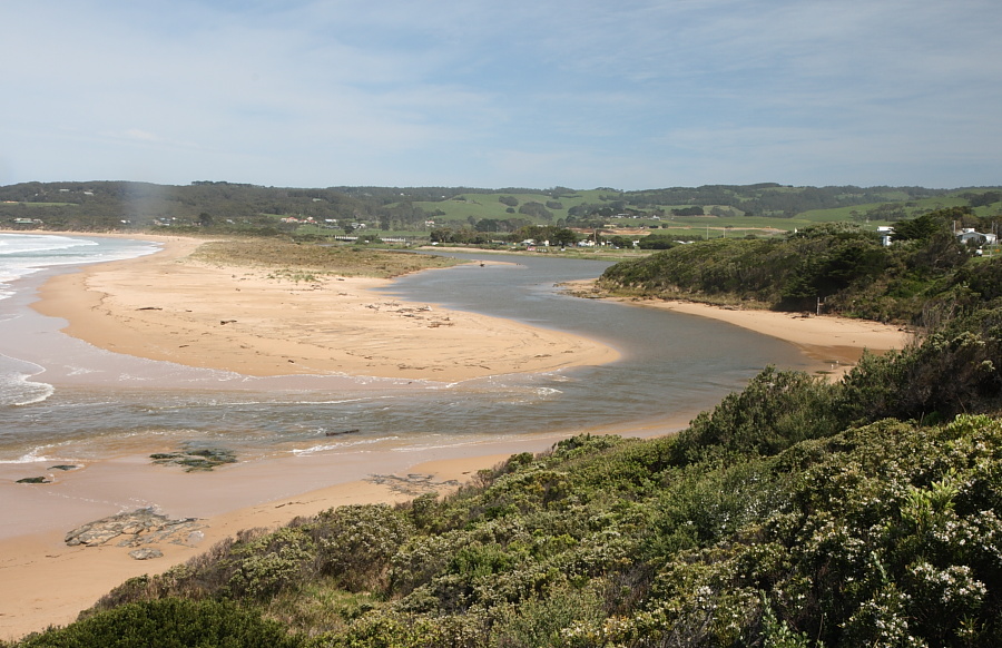 |
|
| #8476 | 8 Sep 2013 | Approved |
Notes:
Air pressure 1027 hPa.
   |
|
| #8451 | 14 Aug 2013 | Approved |
Notes:
Rainfall last 48 hours 31 mm, Air Pressure 999.2 hPa River level is high due to heavy rainfall in preceding week, and to the high tide hindering outward flow. Berm at river mouth has been been eroded to lower its height. Mouth opening has widened. |
|
| #8319 | 6 Jun 2013 | Approved |
Notes:
Rainfall last 48 hours 2.8 Air Pressure 1012.9 hPa Waves moving upstream at mouth of river |
|
| #8257 | 1 May 2013 | Approved |
Notes:
Rainfall last 48 hrs 11 mm. Air Pressure 1021.3 hPa The river level is above the banks, flooding the camp ground, and the horse paddock as well as rest of flood plain near the river edge. Additional rainfall will intensify flooding. The berm opposite the fishing platform at the bridge has risen in height. At the Golf Course observation post the high tide breakers did travel over the closed mouth, but there is no outward flow of river water . Berm across the mouth at high tide is shallow, but wide 35 meters on river side and 7 metres on seaward side. |
|
| #8199 | 28 Mar 2013 | Approved | Notes: Air Pressure 1013.9 hPa, Rainfall last 48 hrs 2.6 mm. Stormy conditions at time of sampling. River above banks and spreading to flats. Waves breaking over berms which have been reduced in height since last monitoring. At high tide waves were breaking over the shallow berm across mouth which would block outward flow at low tide. See photos. | |
| #8125 | 28 Feb 2013 | Approved |
Notes:
Air Pressure 1017.3 hPa, Rainfall last 48 hrs 14.0mm Water Level in the river high with flooded fishing platforms, and full banks. Level is due to the sand bar which is just underwater at high tide at estuary mouth. Mouth would be closed at low tide. See additional photo for BmP3 showing mouth. The location of the mouth has shifted north since last monitoring. Berm has been greatly reduced in height |
|
| #8048 | 31 Jan 2013 | Approved | Notes: Rainfall last 48 hrs 8.6, Air Pressure 1011.5 hPa. River level comparatively high. At HT the mouth was open with in flowing tide. However the depth at the mouth was very shallow, suggesting the mouth would be closed at low tide. This would help to account for the high river level. | |
| #7973 | 31 Dec 2012 | Approved |
Notes:
Rainfall last 48 hours 0mm Air Pressure 1018.9 Mouth entrance is quite narrow, <3 metres Vegetation has been cleared around the river gauge near the bridge so that the gauge can now be easily read |
|
| #7950 | 5 Dec 2012 | Approved |
Notes:
Atmospheric Pressure 1011.7 hPa Rainfall last 48 hours 7.4 mm Thick vegetation obscures the lower two river gauges, the reading above are a close estimation. WE shall take pruning tools on our next monitoring visit. |
|
| #7910 | 31 Oct 2012 | Approved |
Notes:
Rainfall last 48 hours 0mm Air Pressure 1010.0 hPa First Water Level height is an estimate as water was below the silt covering the gauge. Wind direction has been entered as E, however there was no wind, and therefore no direction. This is not an option on the program. |
|
| #7851 | 4 Oct 2012 | Approved |
Notes:
Rainfall over last 48 hours 0mm Atmospheric Pressure 1008.9 hPa |
|
| #7713 | 11 Sep 2012 | Approved | Notes: Air Pressure 1020.5 hPa, Rainfall over last 48 hours 0mm Preceeding weather has been marked by very high winds (mode W) responsible for deposition of sand on beaches and berms | |
| #7503 | 31 Jul 2012 | Approved |
Notes:
Rainfall over last 48 hrs 2mm Air Pressure 1029.7 hPa |
|
| #7401 | 9 Jul 2012 | Approved |
Notes:
Nil wind, no direction. Rainfall last 48 hrs 0mm, Air Press. 1022 hPa Mouth wide and deeper than usual Sighting of whales directly off shore of mouth, Mother and Babe? |
|
| #7204 | 5 Jun 2012 | Approved |
Notes:
Air Pressure 1018.6 hPa, rainfall last 48 hrs 47.8mm Intense storm on 04/06/12. Rack line shows river height at peak of flood greater than 1.28m. Large waves breaking over berm opposite fishing platform. Mouth is wide, storm waves battering edge of berm, greatly modifying its structure. Wave surge at HT is impeding the outward flow of flood waters. |
|
| #7108 | 4 May 2012 | Approved |
Notes:
Rainfall last 48 hours 12 mm Air Pressure 1019.5 hPa River full to height of bank top, high rainfall in upper catchment over last 3 days has produced strong river outflow through recently opened estuary mouth. Large flock of terns resting on river banks at fishing platform. |
|
| #6823 | 6 Mar 2012 | Approved | Notes: Atmospheric pressure 1024.1 hPa, Rainfall in last 48 hrs 2 mm. Note very strong winds over the previous week. The height and width of the dune between ocean and river has increased in height and width, with vegetation starting to colonize the dune opposite the fishing platform photosite. Although there was no tidal influence at the time of monitoring, the overnight high tide (1.5m) had pushed the level of the river higher, to leave wet stained sand along river bank. | |


All content, files, data and images provided by the EstuaryWatch Data Portal and Gallery are subject to a Creative Commons Attribution License
Content is made available to be used in any way, and should always attribute EstuaryWatch and www.estuarywatch.org.au