EstuaryWatch Data Portal
GMC Gellibrand River Estuary Mouth Observation Site
15 December 2017
Overview
| Estuary | Gellibrand River Estuary |
|---|---|
| Site | Gellibrand River Estuary Mouth Observation Site |
| Observation ID | #11662 |
| Date and Time | Friday 15th December 2017 11:07am |
| Approved | Approved |
Notes
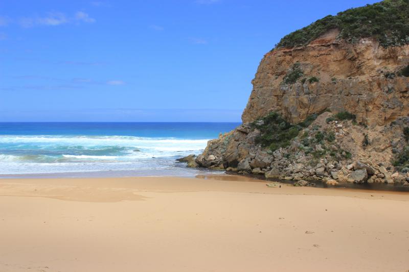
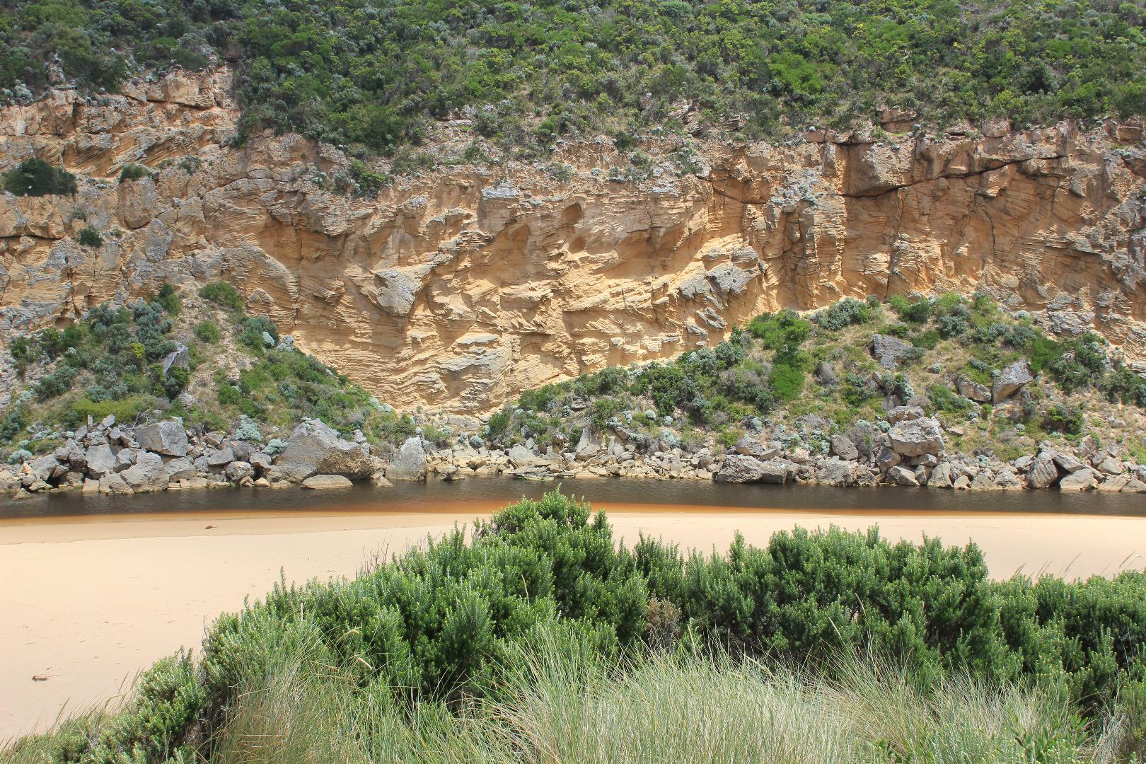
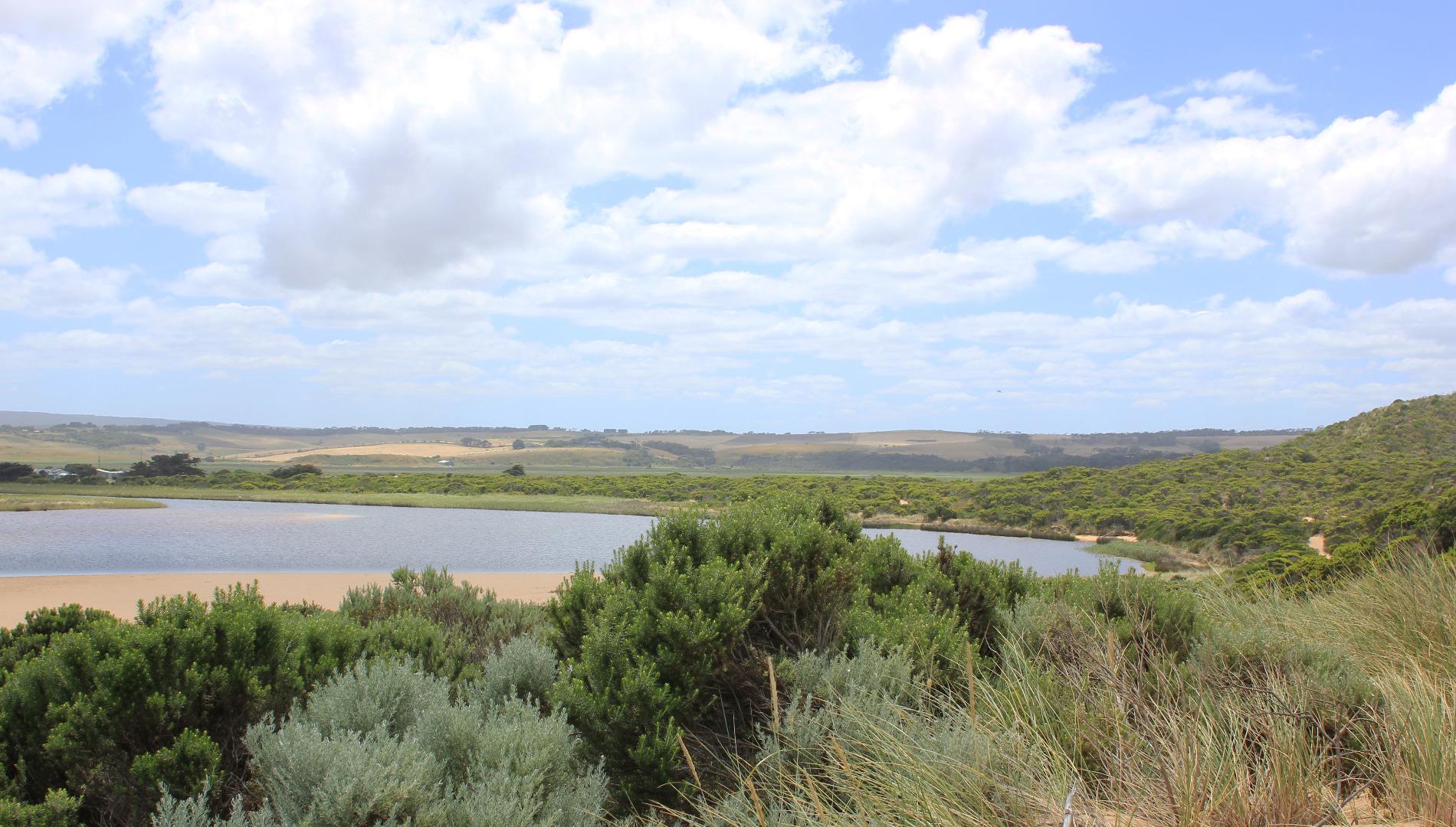
Very slight pale discharge going out to sea just east of entrance. Reducing flow despite observations being taken close to hi tide Only very narrow shallow channel flowing between last rock & cliff. Waves however are entering over wider area & going across from east side of rocks to cliff. Beach very flat with sand build up extending nearly across the entrance. Recent swash lines indicate waves going far up on beach. Backwash areas at mid beach are being scoured out into shallow N/S depressions. A lot of sand visible in breakers in that area & also directly out from mouth. Only part of sand bar visible
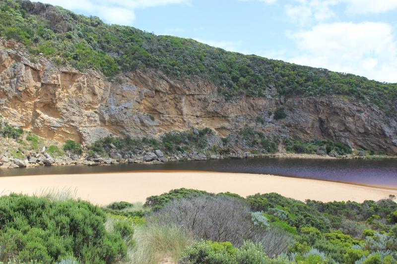
Algae in shallow water beside low track. Some in various stages of decomposition. Large no. small bubbles in one area. Moths wings also in these areas. In the shallow water along side low track there are large no. small very active fish. 6 White headed Herons actively feeding in these areas
Red silt/algae over dark black slimy deposit noted in shallow water of estuary at start of low track
Mouth Observation
| Mouth state | Open |
|---|---|
| Previous | O O O O O O O O O P O P C C O O O O O O O C O C C C O O O O O C O O O O O O O O O O O O O O O O O O O O O O O O |
| Flow Present? | Yes |
| Previous | Y Y Y Y Y Y Y Y Y Y Y Y N N Y Y Y N Y Y Y N N N N N Y Y Y Y Y N Y Y Y N Y Y Y Y Y Y Y Y Y Y Y Y Y Y Y Y Y Y Y Y |
| Flow Direction | Out |
| Previous | O O O O I I O O O I O I N N O O I N O O O N N N N N O O O O O N O O O N O O O O O O O O O O O O O O O O O O O O |
| Above Sea | Above Estuary | |
|---|---|---|
| Berm Height (m) | ||
| Berm Length (m) |
Physical Condition
| Current | Mode | |
|---|---|---|
| Wind Direction | South-West | |
| Beaufort Scale | Gentle breeze | |
| Sea State | Rough |


All content, files, data and images provided by the EstuaryWatch Data Portal and Gallery are subject to a Creative Commons Attribution License
Content is made available to be used in any way, and should always attribute EstuaryWatch and www.estuarywatch.org.au