EstuaryWatch Data Portal
GMC Gellibrand River Estuary Mouth Observation Site
22 June 2018
Overview
| Estuary | Gellibrand River Estuary |
|---|---|
| Site | Gellibrand River Estuary Mouth Observation Site |
| Observation ID | #12194 |
| Date and Time | Friday 22nd June 2018 10:48am |
| Approved | Approved |
Notes
AHD G2 0.56 @ 12:25 G6 AHD water covering AHD board
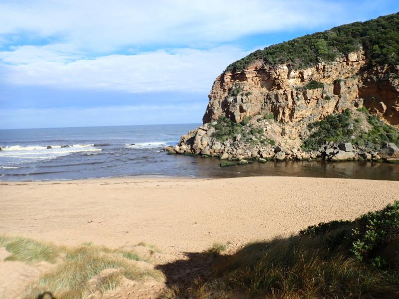
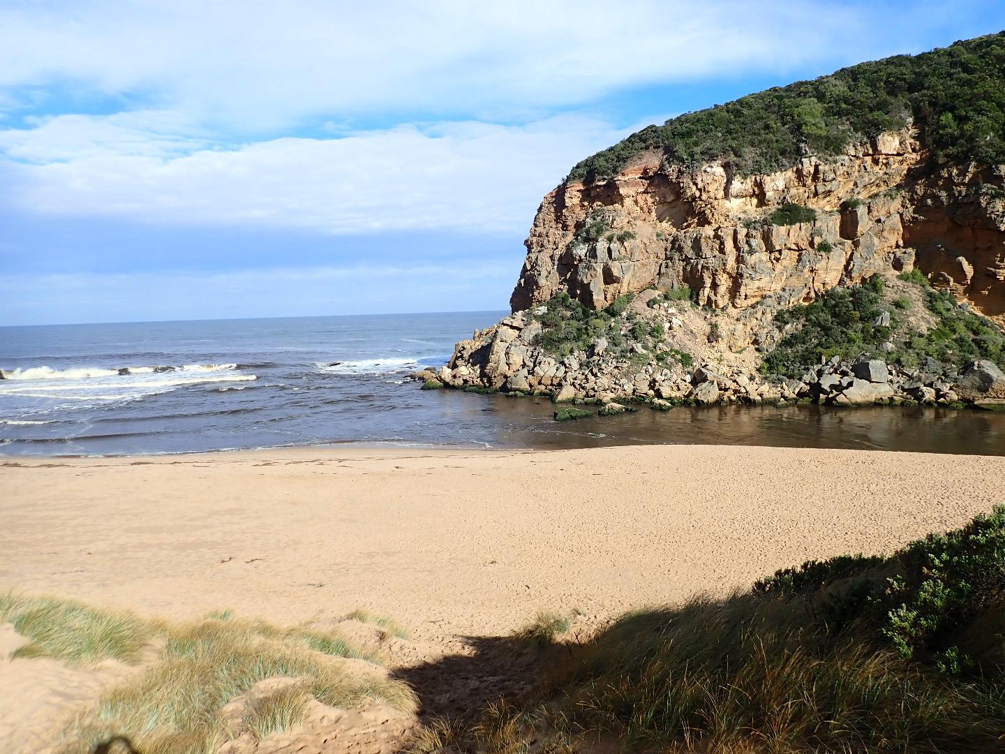
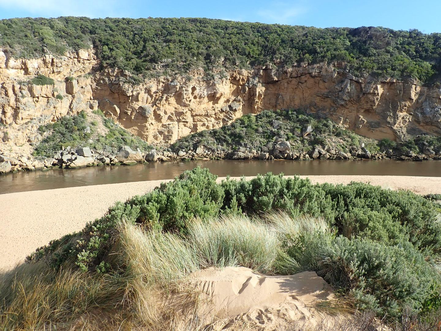
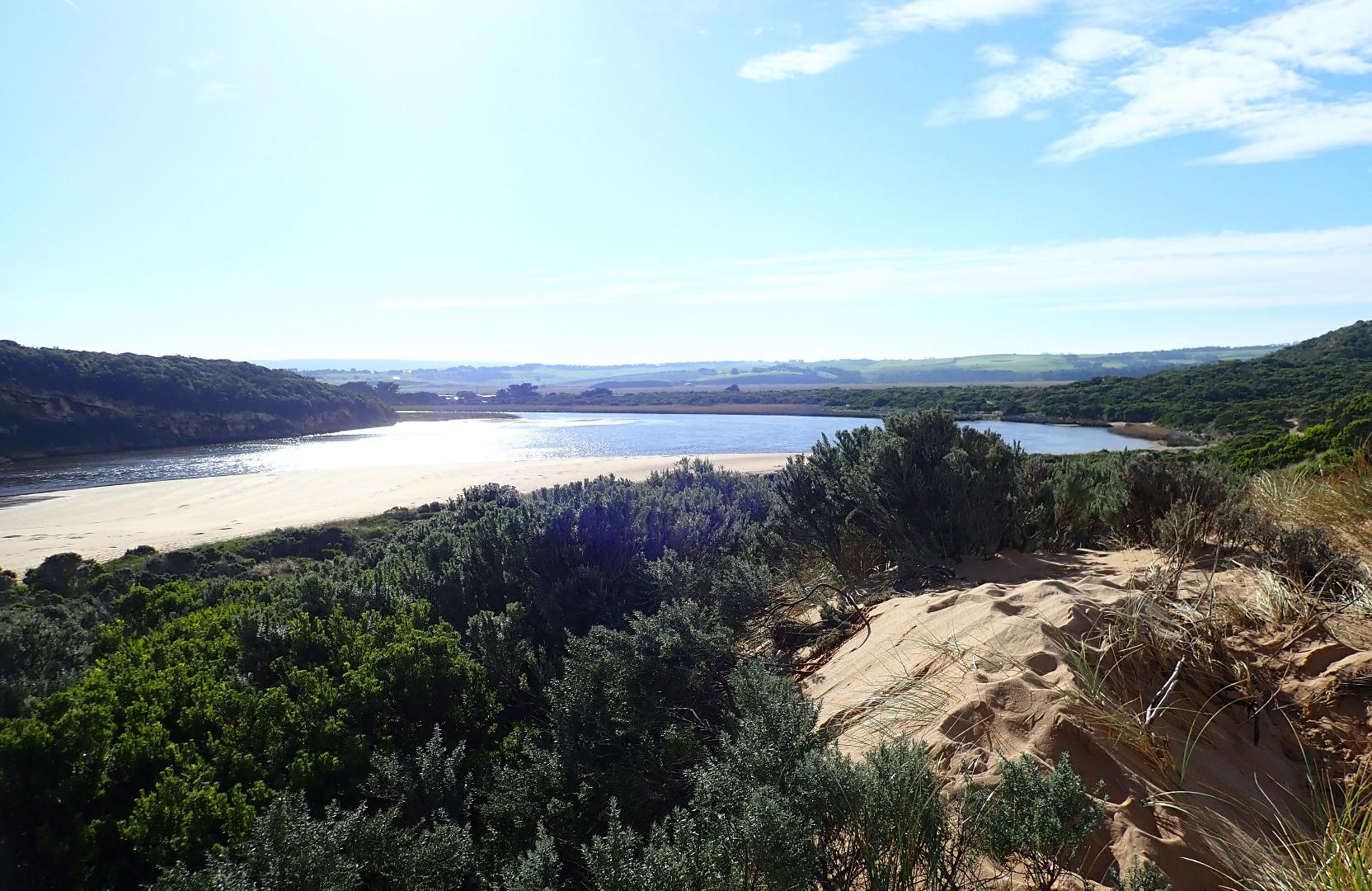
Dark discharge out around mouth & flowing strongly to east along beach front. Waves in all directions at entrance with small waves entering along channel, turning east along south side of exposed sand at south side of estuary, however strong outflow travelling fast was further west closer to cliff face
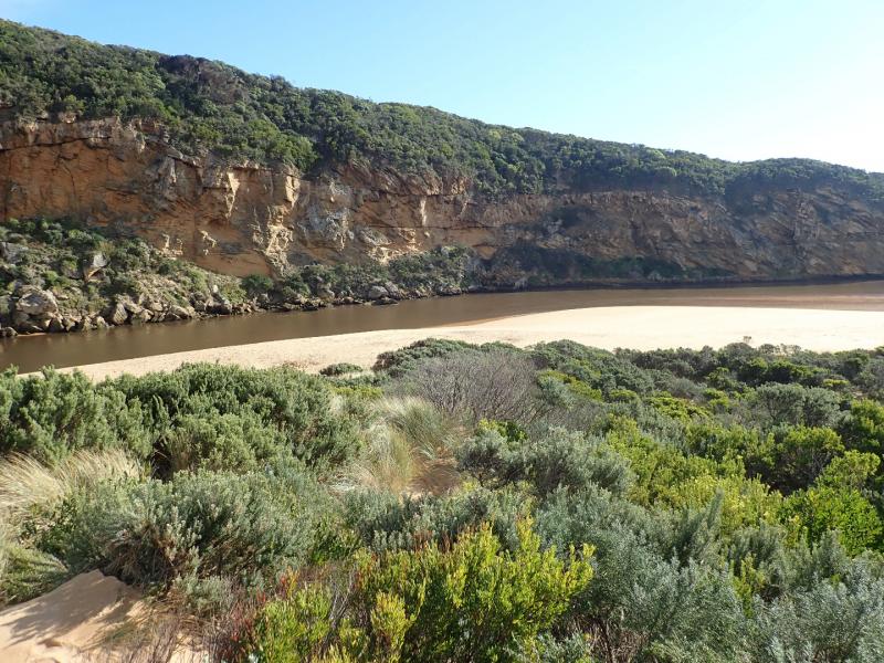
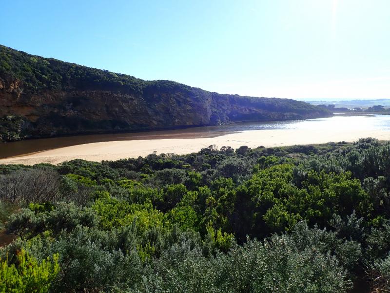
Large area of sand exposed at south side of estuary had a sheer face about 20-40 cm.above water level which reduced near turn into channel, then rose again up to 1.50m. near entrance. The sheer sides were gradually collapsing into fast outflow & incoming small entering waves. Low water level had sandbar in estuary well exposed
No roads or tracks had water over & only a small amount from runoff in very low areas of camp ground. No water over OOR at flood markers as flood water is being held back around G4 where water is flowing strongly over the bridge. Some flooding immediately downstream G4 which was draining back into the river channel but upstream all flats have deep extensive water cover & very fast flow from G4 to past G6. Flood water peaked at Burrupa on 20-06-18 late pm at 5.06m.
Mouth Observation
| Mouth state | Open |
|---|---|
| Previous | O O O O O O O O O O O O O O O O O O O O O O O P C C C C C C C O O O O C C C C C C C C C O O O O O C O O O O O O O |
| Flow Present? | Yes |
| Previous | Y Y Y Y Y Y Y Y Y Y Y Y Y Y Y Y Y Y Y Y Y Y Y N N N N N N N N Y Y Y Y N N N N N N N N N Y Y Y Y Y N Y Y Y Y Y Y Y |
| Flow Direction | Out |
| Previous | O O O O O O O O O O O O O O O O O O O O O O O N N N N N N N N O I O O N N N N N N N N N O O O O O N O I O O O I O |
| Above Sea | Above Estuary | |
|---|---|---|
| Berm Height (m) | ||
| Berm Length (m) |
Physical Condition
| Current | Mode | |
|---|---|---|
| Wind Direction | North | |
| Beaufort Scale | Gentle breeze | |
| Sea State | Moderate |


All content, files, data and images provided by the EstuaryWatch Data Portal and Gallery are subject to a Creative Commons Attribution License
Content is made available to be used in any way, and should always attribute EstuaryWatch and www.estuarywatch.org.au