EstuaryWatch Data Portal
GMC Gellibrand River Estuary Mouth Observation Site
23 November 2018
Observation details
Overview
| Estuary | Gellibrand River Estuary |
|---|---|
| Site | Gellibrand River Estuary Mouth Observation Site |
| Observation ID | #12552 |
| Date and Time | Friday 23rd November 2018 12:10pm |
| Approved | Approved |
Notes
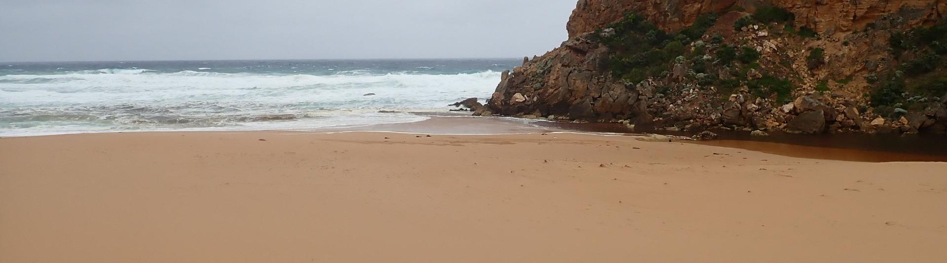
AHD G6 1.14 @ 14:03 Rainfall 30 ml. from 20 th -23 rd Nov
Pale discharge out & slightly to east. Some small waves entering channel over a high sand build up, longshore drift across entrance with waves in all directions. Very large amount of sand in breakers all along the beach
Strong SW swell of short time duration strongly impacting east end of beach leaving sheer face from 1-3 m high, longshore drift from there moving west to entrance. Wind from S at entrance & from SE along the beach where it is scouring the beach & dunes depositing sand in the channel
Mouth Observation
| Mouth state | Open |
|---|---|
| Previous | O O O O O O P C C C C C C C O O O O C C C C C C C C C O O O O O C O O O O O O O O O O O O O O O O O O O O O C O |
| Flow Present? | Yes |
| Previous | Y Y Y Y Y Y N N N N N N N N Y Y Y Y N N N N N N N N N Y Y Y Y Y N Y Y Y Y Y Y Y Y Y Y Y N Y Y Y Y Y Y Y Y Y N Y |
| Flow Direction | Out |
| Previous | O O O O O O N N N N N N N N O I O O N N N N N N N N N O O O O O N O I O O O I O O I O O N O I O O O O O O O N O |
| Above Sea | Above Estuary | |
|---|---|---|
| Berm Height (m) | ||
| Berm Length (m) |
Physical Condition
| Current | Mode | |
|---|---|---|
| Wind Direction | South | |
| Beaufort Scale | Strong breeze | |
| Sea State | Rough |


All content, files, data and images provided by the EstuaryWatch Data Portal and Gallery are subject to a Creative Commons Attribution License
Content is made available to be used in any way, and should always attribute EstuaryWatch and www.estuarywatch.org.au