EstuaryWatch Data Portal
GMC Gellibrand River Estuary Mouth Observation Site
4 April 2019
Overview
| Estuary | Gellibrand River Estuary |
|---|---|
| Site | Gellibrand River Estuary Mouth Observation Site |
| Observation ID | #12820 |
| Date and Time | Thursday 4th April 2019 12:55pm |
| Approved | Approved |
Notes
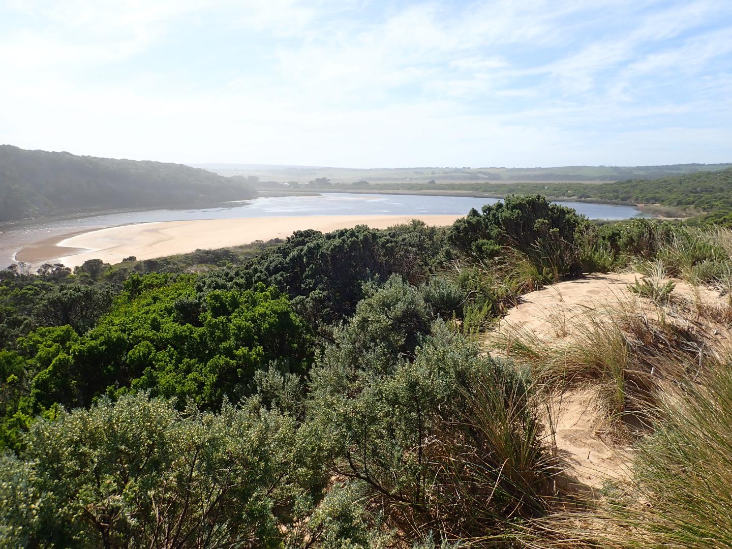
Estimated height @ G6 0.68 - board unreadable because of silt build up
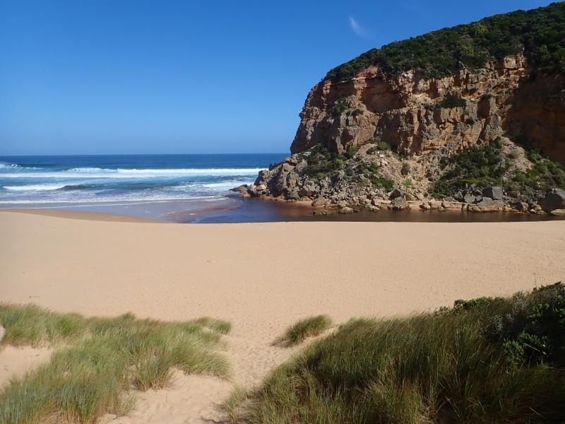
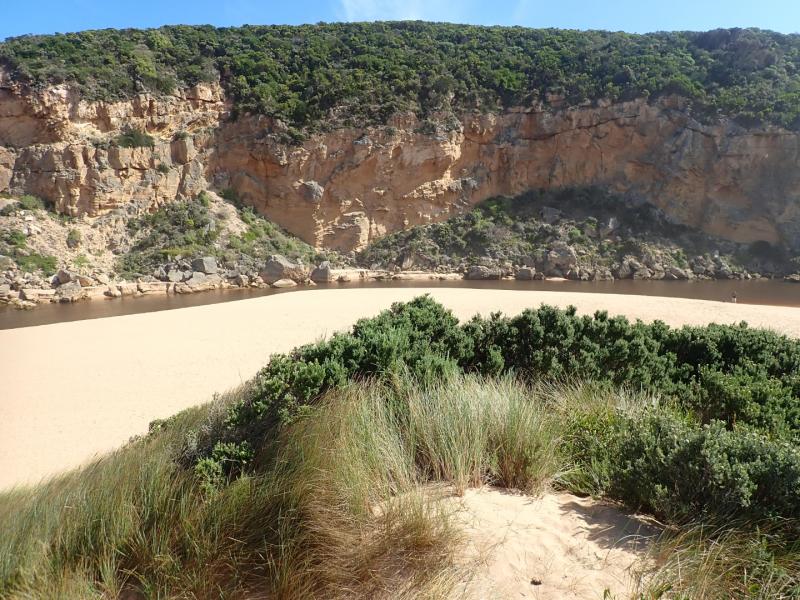
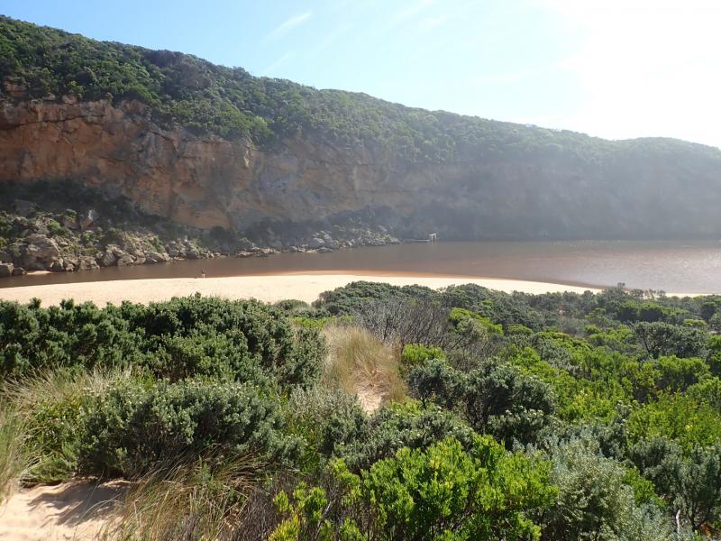
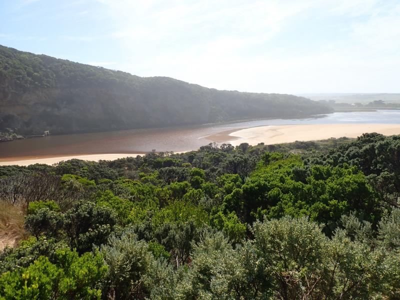
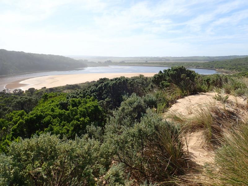
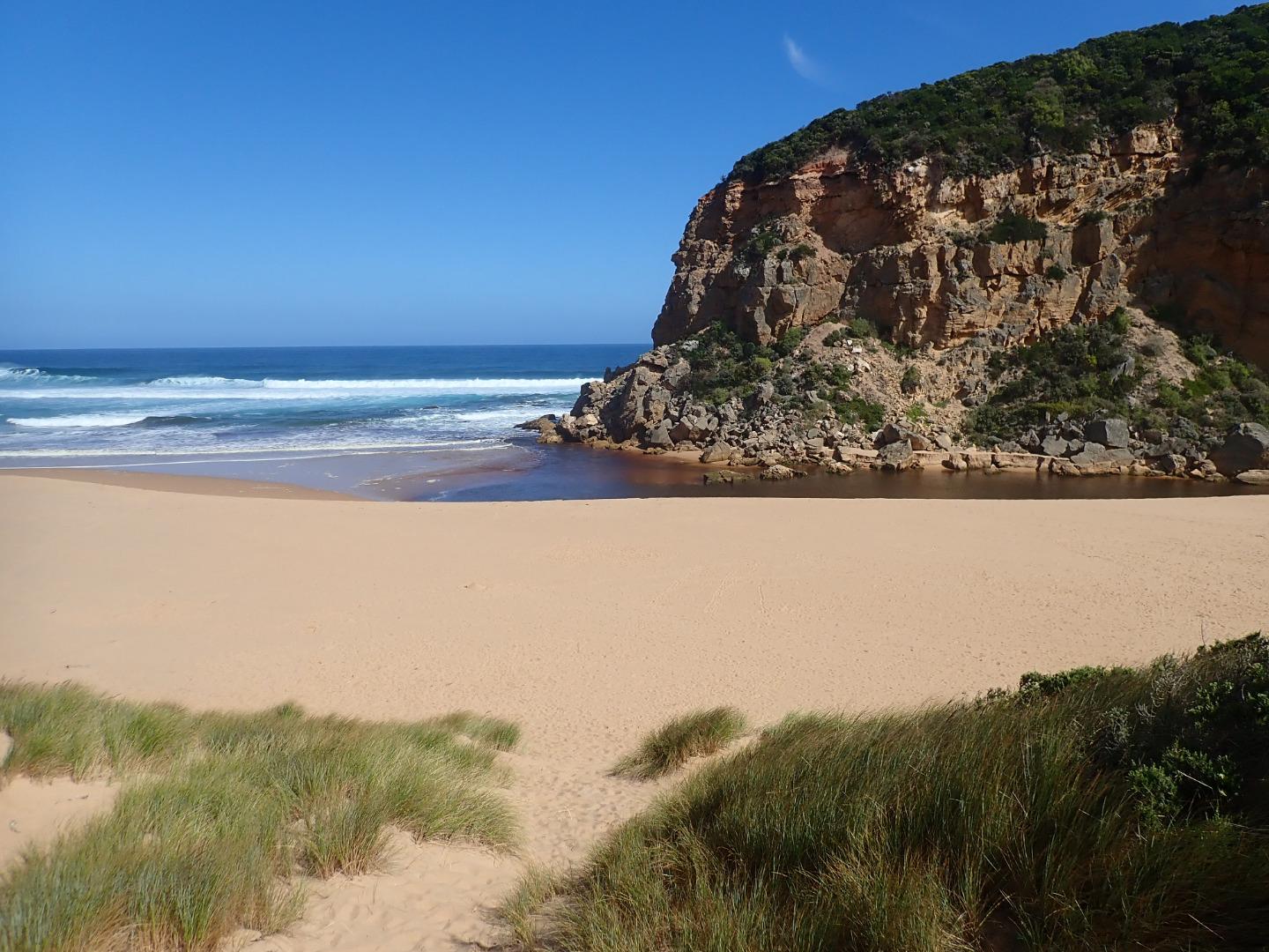
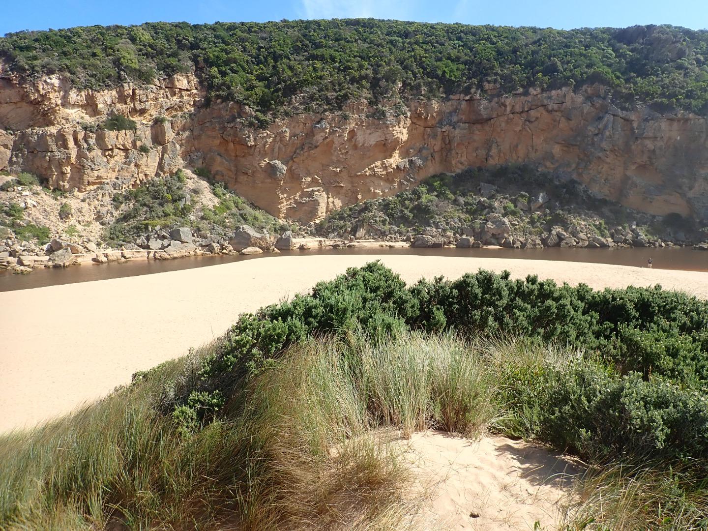
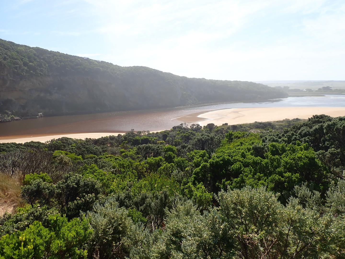
Dark discharge from reducing outflow around the mouth & to west, pale discharge continuing along foreshore to east. Entrance about 50m wide with sheer sides to channel from 1-2 m. high. Sand has built up on east side of channel -also directly downstream of rock. Longshore drift across mouth over sw swell with backwash return & some waves entering up the channel into the estuary. Waves are going high up on the beach at east end of beach which rises & falls creating some deep areas. Height of beach drops as it reaches the mouth
All tracks & roads are without water including low track where an extremely large number of small (1-3 cm) fish were actively swimming. Small fish were observed in all areas of estuary
D.O. levels @ G2 have greatly improved with flow going upstream while monitoring
Mouth Observation
| Mouth state | Open |
|---|---|
| Previous | C C C C C O O O O O C O O O O O O O O O O O O O O O O O O O O O C O O O O C O O O O O O C C C C C C C C O O O C C C C C O P C C C O O O |
| Flow Present? | Yes |
| Previous | N N N N N Y Y Y Y Y N Y Y Y Y Y Y Y Y Y Y Y N Y Y Y Y Y Y Y Y Y N Y Y Y Y N Y Y Y Y Y Y N N N N N N N N Y Y Y N N N N N Y N N N N Y Y Y |
| Flow Direction | Out |
| Previous | N N N N N O O O O O N O I O O O I O O I O O N O I O O O O O O O N O O O O N O O O O O I N N N N N N N N O O O N N N N N I N N N N O O O |
| Above Sea | Above Estuary | |
|---|---|---|
| Berm Height (m) | ||
| Berm Length (m) |
Physical Condition
| Current | Mode | |
|---|---|---|
| Wind Direction | South-West | |
| Beaufort Scale | Moderate breeze | |
| Sea State | Rough |


All content, files, data and images provided by the EstuaryWatch Data Portal and Gallery are subject to a Creative Commons Attribution License
Content is made available to be used in any way, and should always attribute EstuaryWatch and www.estuarywatch.org.au