EstuaryWatch Data Portal
GMC Gellibrand River Estuary Mouth Observation Site
24 March 2019
Overview
| Estuary | Gellibrand River Estuary |
|---|---|
| Site | Gellibrand River Estuary Mouth Observation Site |
| Observation ID | #12831 |
| Date and Time | Sunday 24th March 2019 09:14am |
| Approved | Approved |
Notes
AHD G2 1.57 @ 09:14 but between 1.57 & 1.58 @ 12:35 AHD G6 1.52 @ 08:40
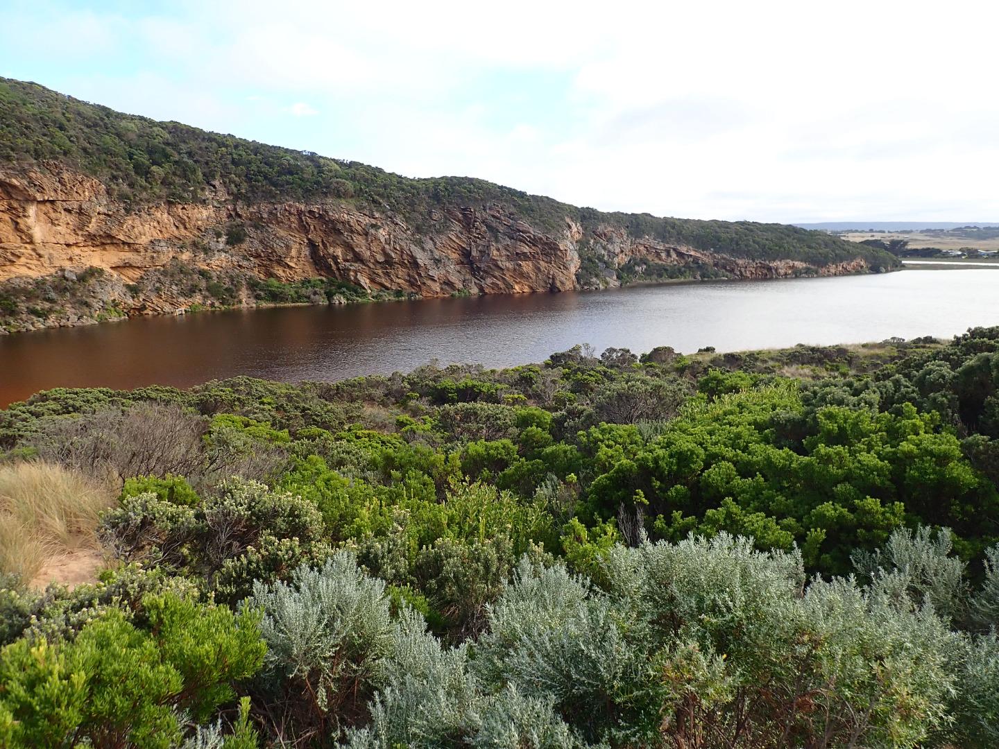
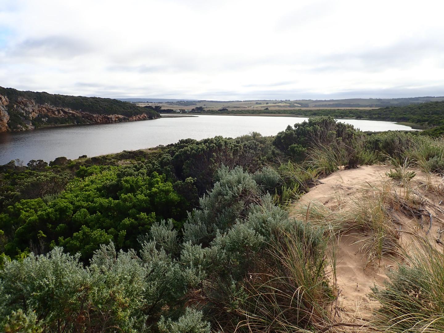
Observations made at low tide.
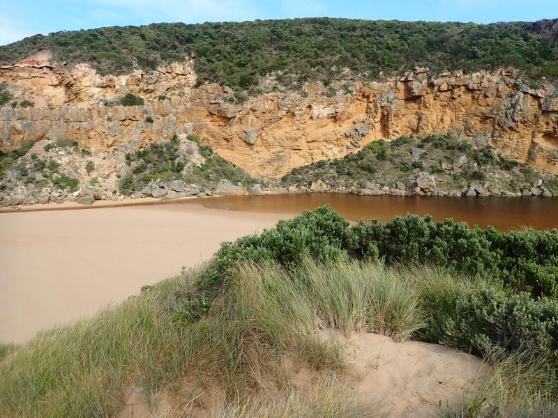
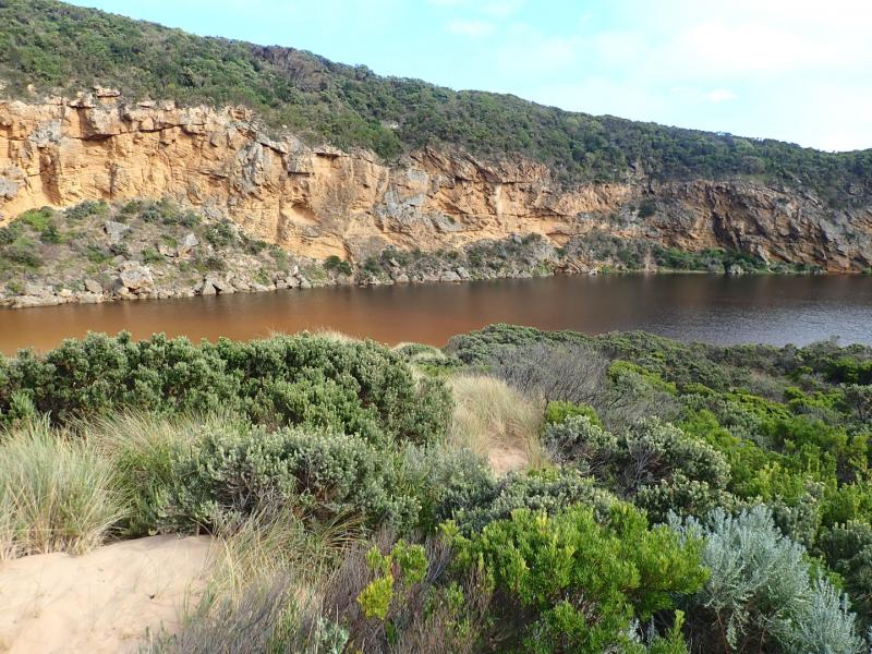
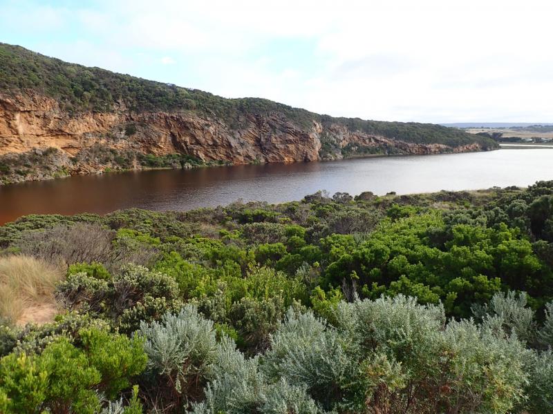
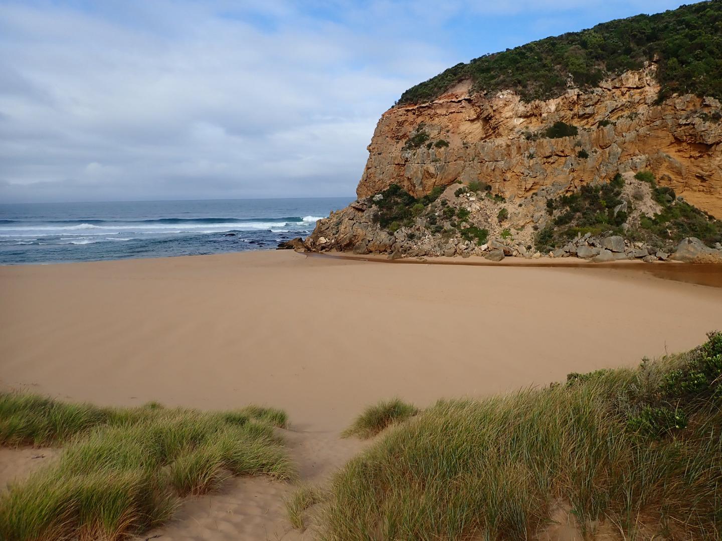
Mouth opened at low tide between rocks at base of cliff not through the berm sand build up which remained intact. Flow from estuary was coming down through a channel about 3-4 m across widening to 7m where it sharply curved west towards cliff - height of channel east side in that area 1m. Depth about .10-.20m . Waves had been overtopping the berm at last hi tide & running down west along the beach towards cliff along the sand behind the berm travelling down a previously formed depression. The beach rises & falls creating wide N-S depressions. High wave sets impacting on sandbar & going high up on beach = backwash & longshore drift.
Very large no. small fish in shallow water around estuary & in water at edge of roads. Peregrine falcon at entrance
Mouth Observation
| Mouth state | Open |
|---|---|
| Previous | C C C C C C O O O O O C O O O O O O O O O O O O O O O O O O O O O C O O O O C O O O O O O C C C C C C C C O O O C C C C C |
| Flow Present? | Yes |
| Previous | N N N N N N Y Y Y Y Y N Y Y Y Y Y Y Y Y Y Y Y N Y Y Y Y Y Y Y Y Y N Y Y Y Y N Y Y Y Y Y Y N N N N N N N N Y Y Y N N N N N |
| Flow Direction | In |
| Previous | N N N N N N O O O O O N O I O O O I O O I O O N O I O O O O O O O N O O O O N O O O O O I N N N N N N N N O O O N N N N N |
| Above Sea | Above Estuary | |
|---|---|---|
| Berm Height (m) | 1.1m | 0.1m |
| Berm Length (m) | 0.0m |
Physical Condition
| Current | Mode | |
|---|---|---|
| Wind Direction | North | |
| Beaufort Scale | Light Breeze | |
| Sea State | Moderate |


All content, files, data and images provided by the EstuaryWatch Data Portal and Gallery are subject to a Creative Commons Attribution License
Content is made available to be used in any way, and should always attribute EstuaryWatch and www.estuarywatch.org.au