EstuaryWatch Data Portal
GMC Gellibrand River Estuary Mouth Observation Site
26 April 2019
Overview
| Estuary | Gellibrand River Estuary |
|---|---|
| Site | Gellibrand River Estuary Mouth Observation Site |
| Observation ID | #12891 |
| Date and Time | Friday 26th April 2019 14:14pm |
| Approved | Approved |
Notes
AHD @ G6 about 0.96 @ 13:58 board covered with silt
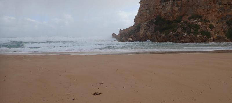
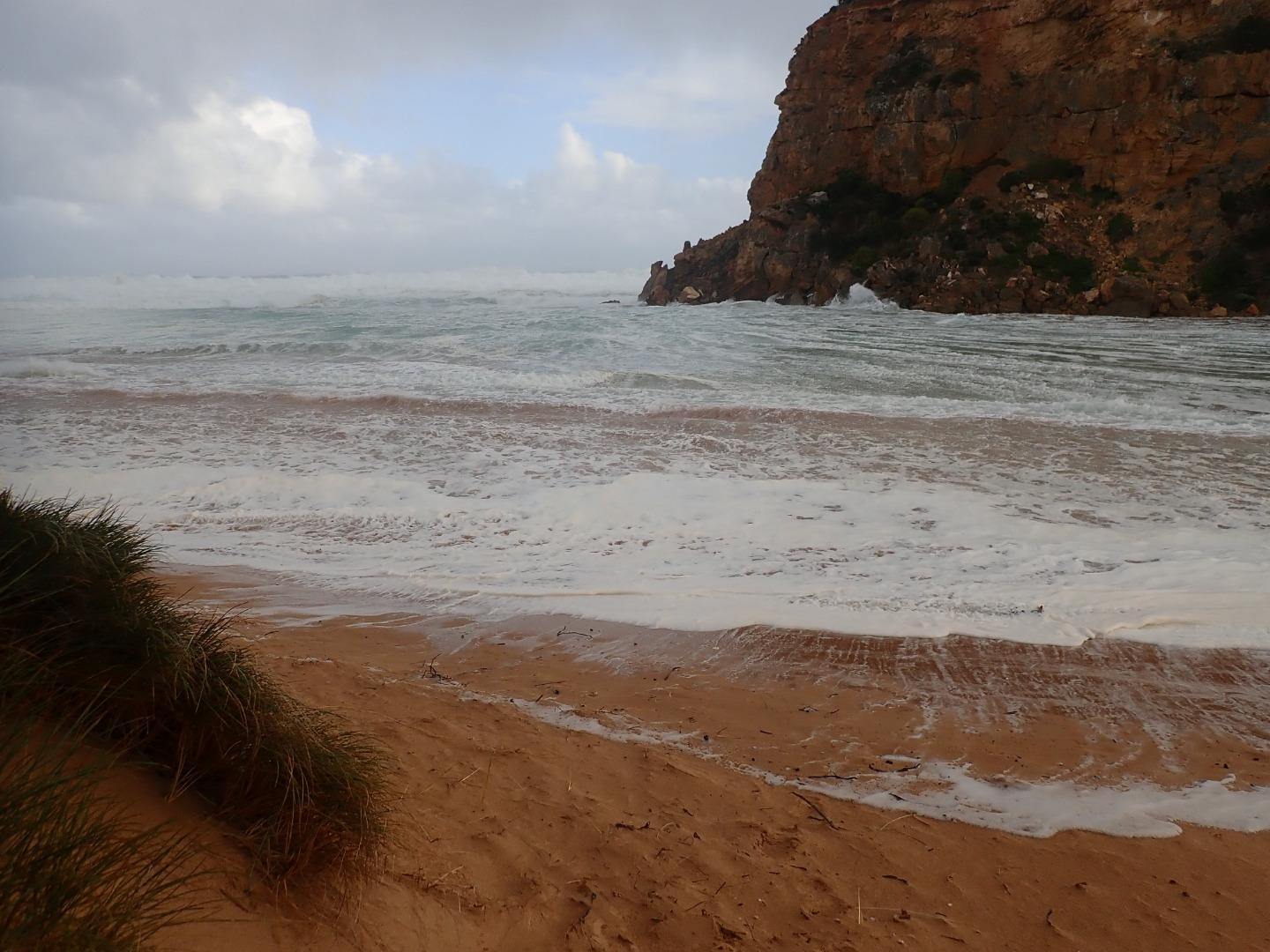
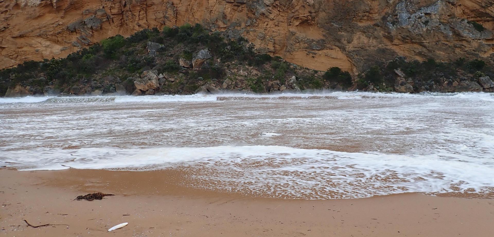
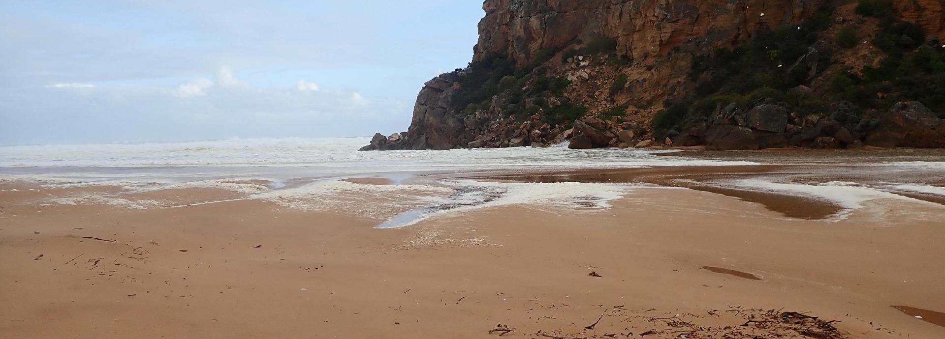
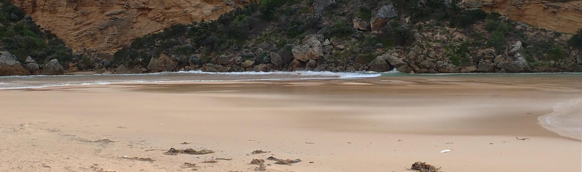
Observations made during hi tide & storm surge - wind from SE 8-9 along beach but even stronger turning down channel Not possible to use Gp1 site so taken from below.
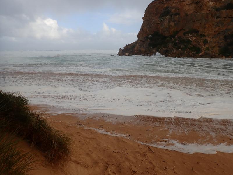
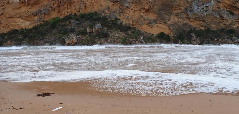
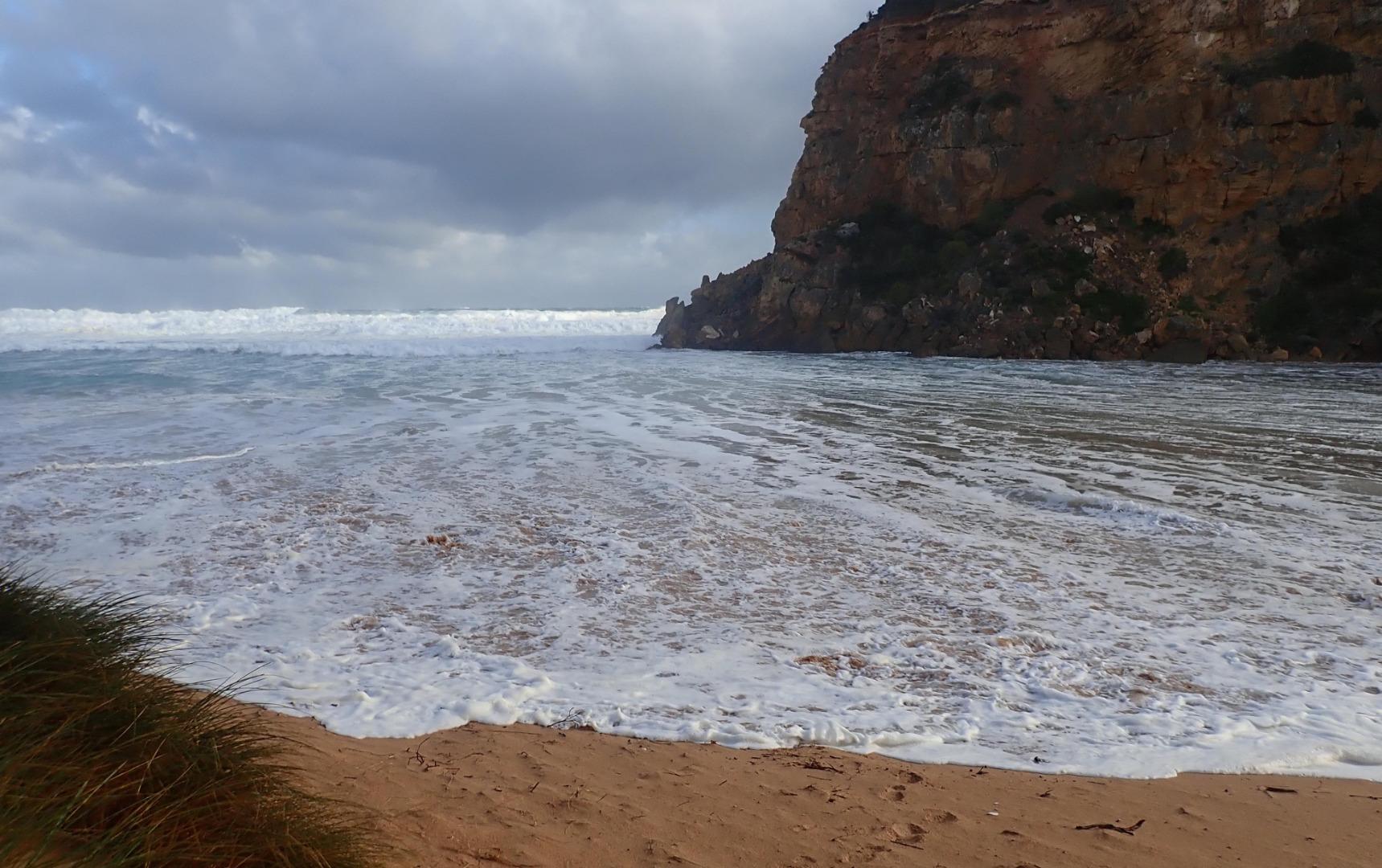
Waves entering from high sea combined with a very high tide. No fresh discharge only shallow salt return over high sand build up in channel. Waves going up to base of dunes all along beach & channel. Entering very wide at mouth & completely across channel. SW swell with over 8m waves strongly impacting east end of beach creating very strong longshore drift & backwash. Waves overtopping high part of beach about 50m from west cliff then turning west & around into the channel meeting incoming waves from SW swell also going down creating an extremely strong N-S backwash - also whirlpools at start of estuary, this action has left significant depressions in the sand . The wind action has also sent large amounts of sand from the beach down the channel & into the estuary
Mouth Observation
| Mouth state | Open |
|---|---|
| Previous | O C O O O O O O O O O O O O O O O O O O O O O C O O O O C O O O O O O C C C C C C C C O O O C C C C C O P C C C O O O O O O O O |
| Flow Present? | Yes |
| Previous | Y N Y Y Y Y Y Y Y Y Y Y Y N Y Y Y Y Y Y Y Y Y N Y Y Y Y N Y Y Y Y Y Y N N N N N N N N Y Y Y N N N N N Y N N N N Y Y Y Y Y Y Y Y |
| Flow Direction | In |
| Previous | O N O I O O O I O O I O O N O I O O O O O O O N O O O O N O O O O O I N N N N N N N N O O O N N N N N I N N N N O O O O I O I I |
| Above Sea | Above Estuary | |
|---|---|---|
| Berm Height (m) | ||
| Berm Length (m) |
Physical Condition
| Current | Mode | |
|---|---|---|
| Wind Direction | South-East | |
| Beaufort Scale | Gale, fresh gale | |
| Sea State | High |


All content, files, data and images provided by the EstuaryWatch Data Portal and Gallery are subject to a Creative Commons Attribution License
Content is made available to be used in any way, and should always attribute EstuaryWatch and www.estuarywatch.org.au