EstuaryWatch Data Portal
GMC Gellibrand River Estuary Mouth Observation Site
7 August 2019
Overview
| Estuary | Gellibrand River Estuary |
|---|---|
| Site | Gellibrand River Estuary Mouth Observation Site |
| Observation ID | #13242 |
| Date and Time | Wednesday 7th August 2019 10:15am |
| Approved | Approved |
Notes
AHD @ G6 1.93 @ 09:32
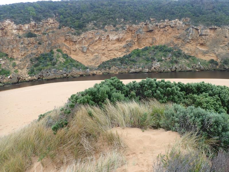
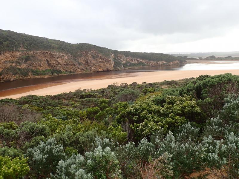
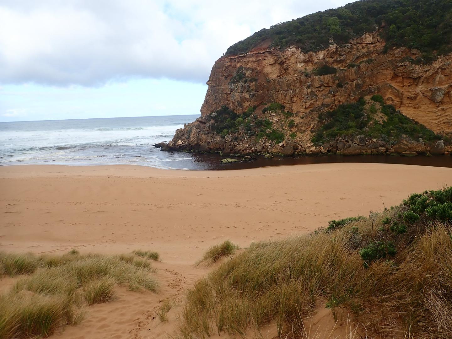
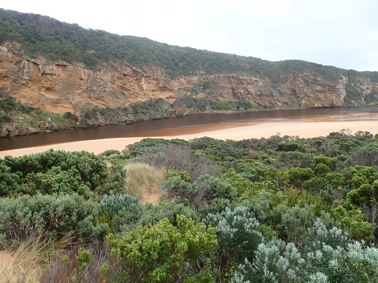
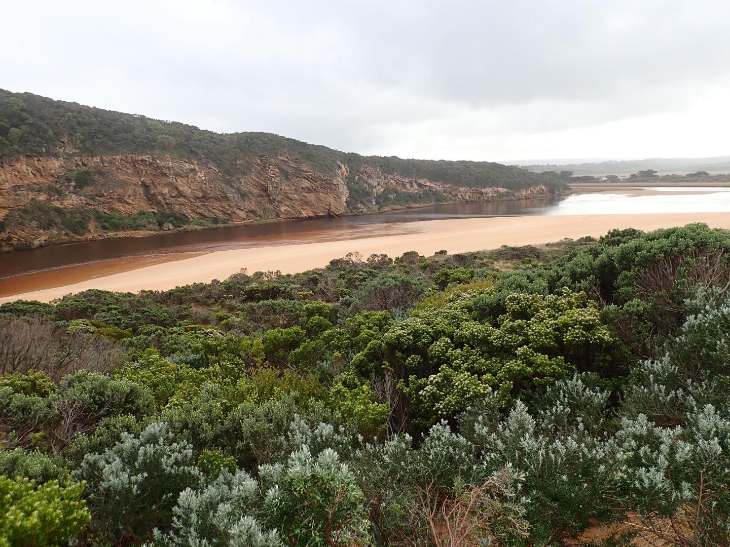
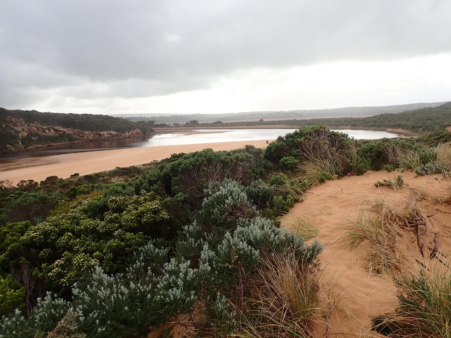
Dark discharge out along foreshore & continuing to east. Waves from last hi tide have been well up on beach where more sand has built up at mid beach with wide depression between there & east end. More sand has also built up along east side of entrance. Because of low water levels large areas of sand have become exposed in lagoon & inlet pipe on auto monitor at G2 is well above water level. Waves from longshore drift across entrance are crossing over outflow & combining with WSW/SW swell resulting in very small waves entering channel around rocks.
Erosion continues on S & SE face of Pt Ronald. Large build up of algae or duck weed? at west side of northern wetlands below township.
Mouth Observation
| Mouth state | Open |
|---|---|
| Previous | O O O O O O O C O O O O C O O O O O O C C C C C C C C O O O C C C C C O P C C C O O O O O O O O O C O O O O O O O O O |
| Flow Present? | Yes |
| Previous | Y Y Y Y Y Y Y N Y Y Y Y N Y Y Y Y Y Y N N N N N N N N Y Y Y N N N N N Y N N N N Y Y Y Y Y Y Y Y Y N Y Y Y Y Y Y Y Y Y |
| Flow Direction | Out |
| Previous | O O O O O O O N O O O O N O O O O O I N N N N N N N N O O O N N N N N I N N N N O O O O I O I I I N O I O O O O O I O |
| Above Sea | Above Estuary | |
|---|---|---|
| Berm Height (m) | ||
| Berm Length (m) |
Physical Condition
| Current | Mode | |
|---|---|---|
| Wind Direction | North-West | |
| Beaufort Scale | Gentle breeze | |
| Sea State | Rough |


All content, files, data and images provided by the EstuaryWatch Data Portal and Gallery are subject to a Creative Commons Attribution License
Content is made available to be used in any way, and should always attribute EstuaryWatch and www.estuarywatch.org.au