EstuaryWatch Data Portal
GMC Gellibrand River Estuary Mouth Observation Site
18 October 2019
Observation details
Overview
| Estuary | Gellibrand River Estuary |
|---|---|
| Site | Gellibrand River Estuary Mouth Observation Site |
| Observation ID | #13383 |
| Date and Time | Friday 18th October 2019 11:25am |
| Approved | Approved |
Notes
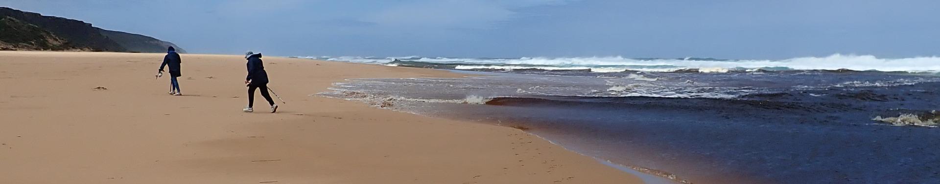
AHD G6 1.64 & 08:30
Some flow out but difficult to access Gp1 site because of near gale force gusty wind from NW. Wind coming in all directions depending on location - but mainly across lagoon to SE cr. Very strong down channel driving large amount of sand into sea. Very high & low tides during 18-10-19 with SW/WSW swell of between 12-13 secs. duration impacting mainly @ east end of beach creating longshore drift to mouth where backwash was rolling sand all along the edge of the channel
Only 1 photo because of conditions
Mouth Observation
| Mouth state | Open |
|---|---|
| Previous | O C O O O O C O O O O O O C C C C C C C C O O O C C C C C O P C C C O O O O O O O O O C O O O O O O O O O O O O O O O |
| Flow Present? | Yes |
| Previous | Y N Y Y Y Y N Y Y Y Y Y Y N N N N N N N N Y Y Y N N N N N Y N N N N Y Y Y Y Y Y Y Y Y N Y Y Y Y Y Y Y Y Y Y Y Y Y Y Y |
| Flow Direction | Out |
| Previous | O N O O O O N O O O O O I N N N N N N N N O O O N N N N N I N N N N O O O O I O I I I N O I O O O O O I O O O O O O O |
| Above Sea | Above Estuary | |
|---|---|---|
| Berm Height (m) | ||
| Berm Length (m) |
Physical Condition
| Current | Mode | |
|---|---|---|
| Wind Direction | North | |
| Beaufort Scale | High wind, moderate gale, near gale | |
| Sea State | Very Rough |


All content, files, data and images provided by the EstuaryWatch Data Portal and Gallery are subject to a Creative Commons Attribution License
Content is made available to be used in any way, and should always attribute EstuaryWatch and www.estuarywatch.org.au