EstuaryWatch Data Portal
GMC Gellibrand River Estuary Mouth Observation Site
10 November 2019
Overview
| Estuary | Gellibrand River Estuary |
|---|---|
| Site | Gellibrand River Estuary Mouth Observation Site |
| Observation ID | #13395 |
| Date and Time | Sunday 10th November 2019 14:49pm |
| Approved | Approved |
Notes
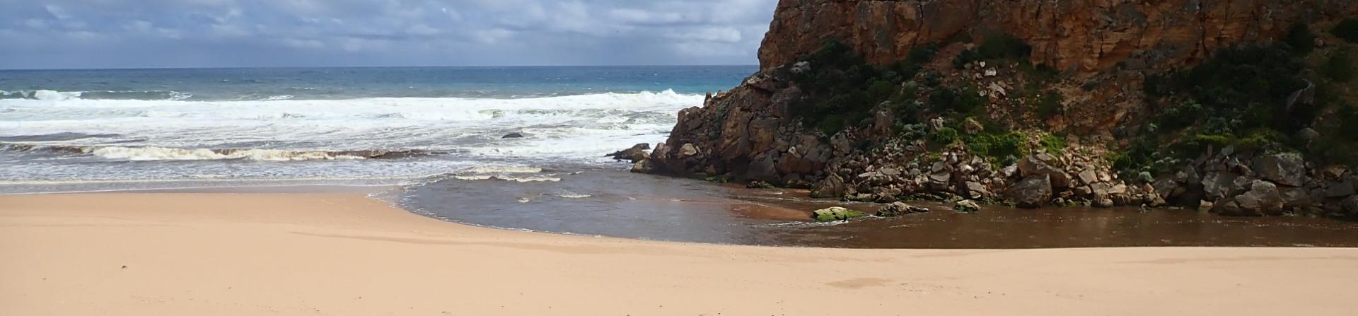
AHD G6 3.24 @ 14:28
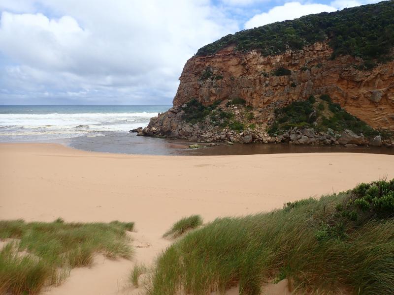
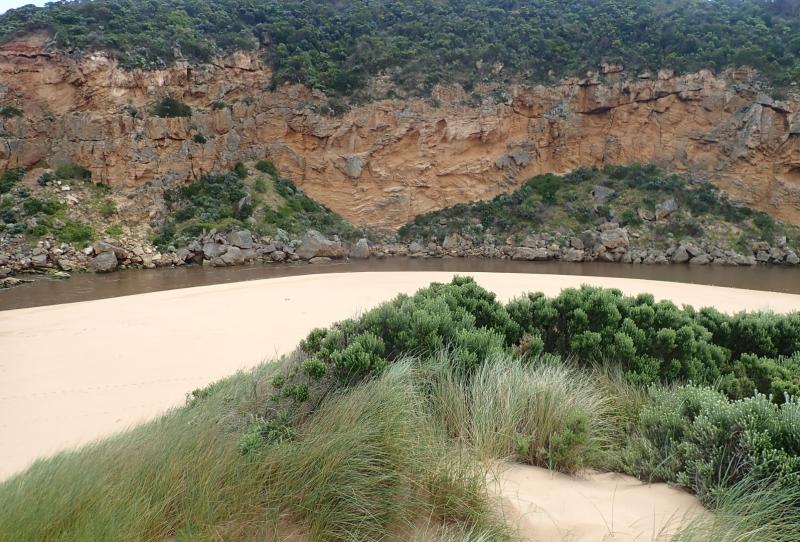
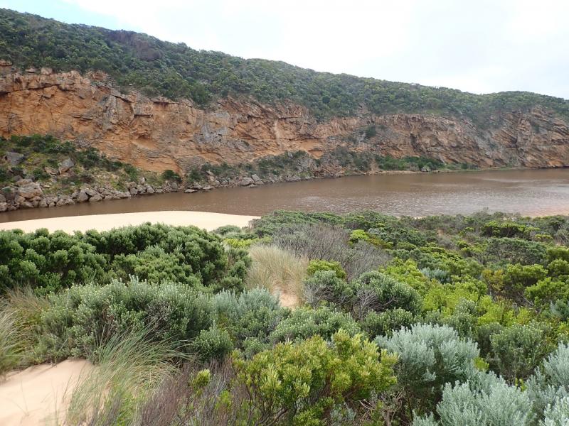
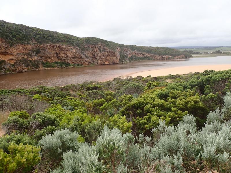
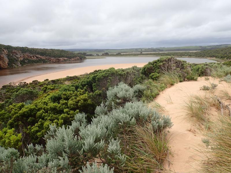
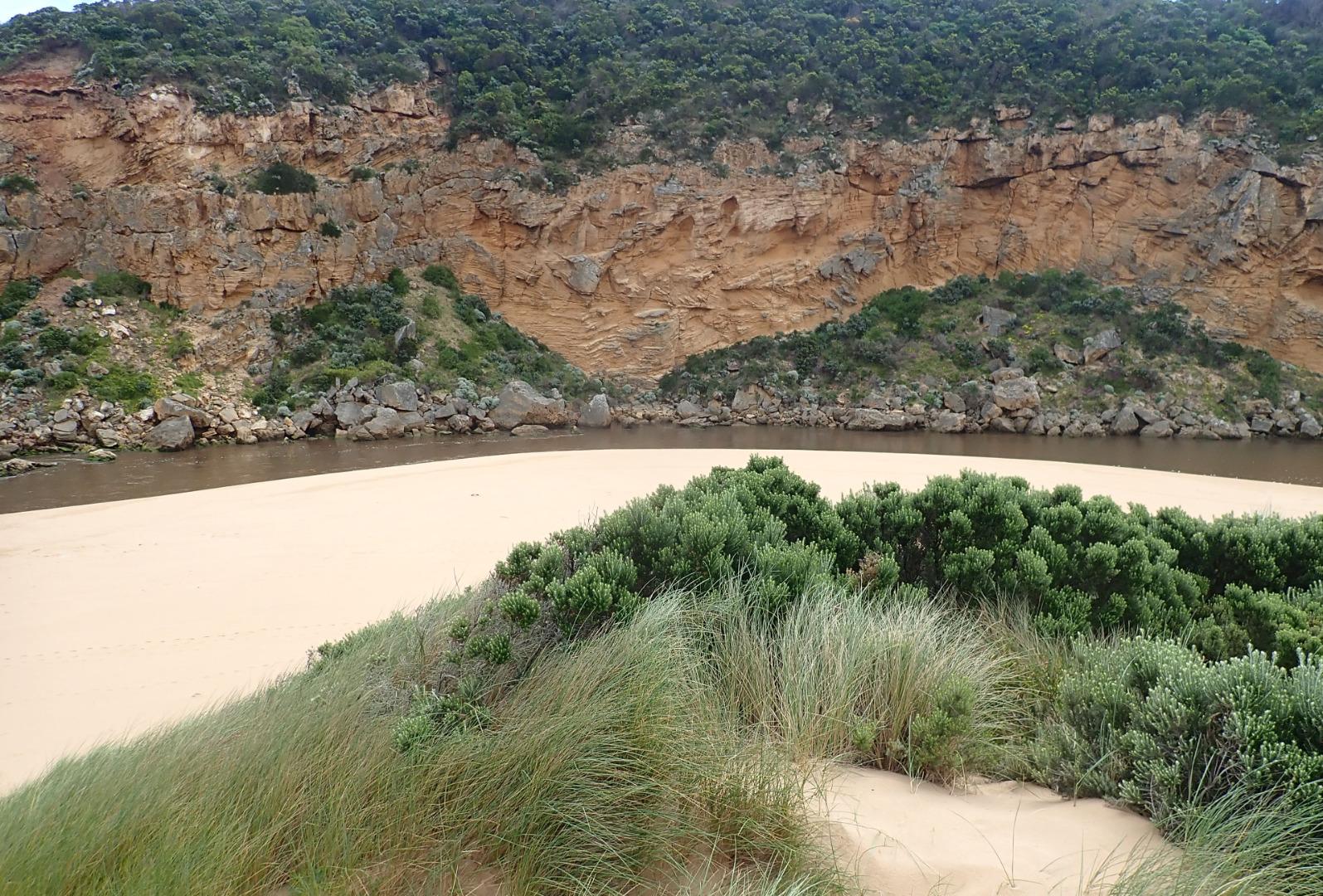
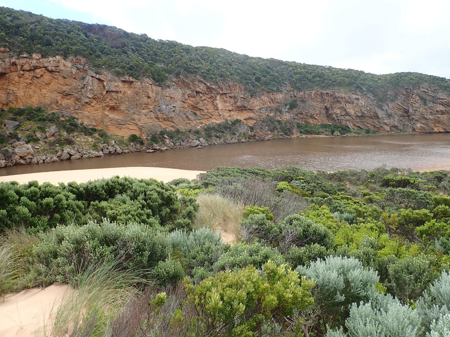
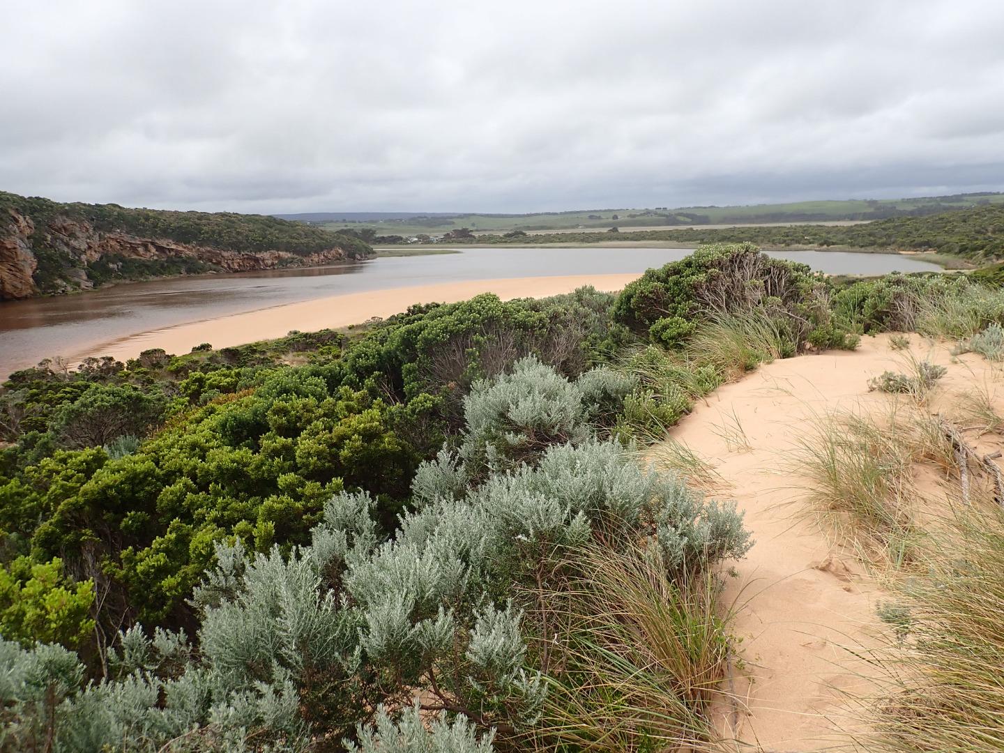
Very dark strong discharge out around the mouth for about 100 m. also continuing a long way to the east along the shoreline. Eastern end of beach covered with dark silt. The strong outflow has created sheer east side to channel about 1 m. high above water level (87 ml rain @ G6 over past 8 days). Beach is undulating & scouring areas especially at mid beach where backwash is taking out a lot of sand -waves in all directions at this area creating occasional longshore drift across mouth. Large amount of sand build up remains downstream of rocks but is being covered by outflow & entering waves. More erosion on east face of Pt. Ronald.
Large areas of deep flood water covering large areas from G4 & G5 (also some between G5 &G6) but very little downstream G4. OOR only had slight flow across near flood markers (run off only.
Mouth Observation
| Mouth state | Open |
|---|---|
| Previous | O O O O C O O O O O O C C C C C C C C O O O C C C C C O P C C C O O O O O O O O O C O O O O O O O O O O O O O O O O O |
| Flow Present? | Yes |
| Previous | Y Y Y Y N Y Y Y Y Y Y N N N N N N N N Y Y Y N N N N N Y N N N N Y Y Y Y Y Y Y Y Y N Y Y Y Y Y Y Y Y Y Y Y Y Y Y Y Y Y |
| Flow Direction | Out |
| Previous | O O O O N O O O O O I N N N N N N N N O O O N N N N N I N N N N O O O O I O I I I N O I O O O O O I O O O O O O O O O |
| Above Sea | Above Estuary | |
|---|---|---|
| Berm Height (m) | ||
| Berm Length (m) |
Physical Condition
| Current | Mode | |
|---|---|---|
| Wind Direction | South | |
| Beaufort Scale | Moderate breeze | |
| Sea State | Rough |


All content, files, data and images provided by the EstuaryWatch Data Portal and Gallery are subject to a Creative Commons Attribution License
Content is made available to be used in any way, and should always attribute EstuaryWatch and www.estuarywatch.org.au