EstuaryWatch Data Portal
GMC Gellibrand River Estuary Mouth Observation Site
22 November 2019
Overview
| Estuary | Gellibrand River Estuary |
|---|---|
| Site | Gellibrand River Estuary Mouth Observation Site |
| Observation ID | #13429 |
| Date and Time | Friday 22nd November 2019 11:45am |
| Approved | Approved |
Notes
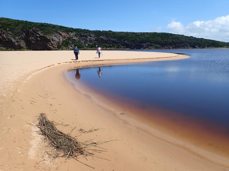
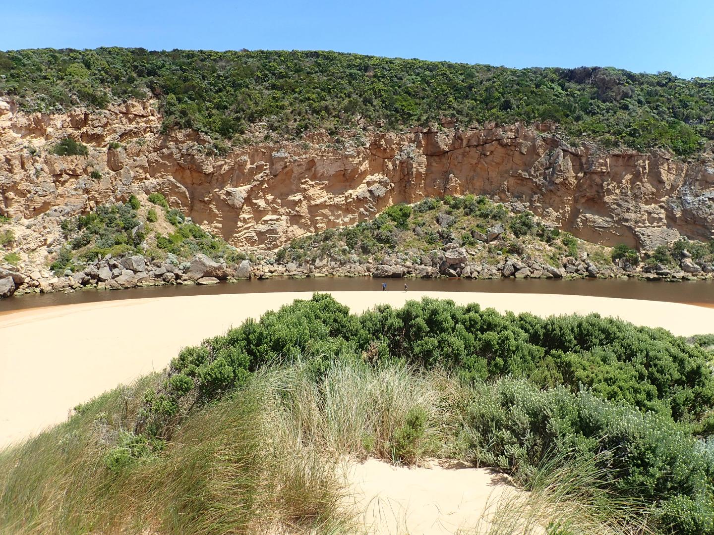
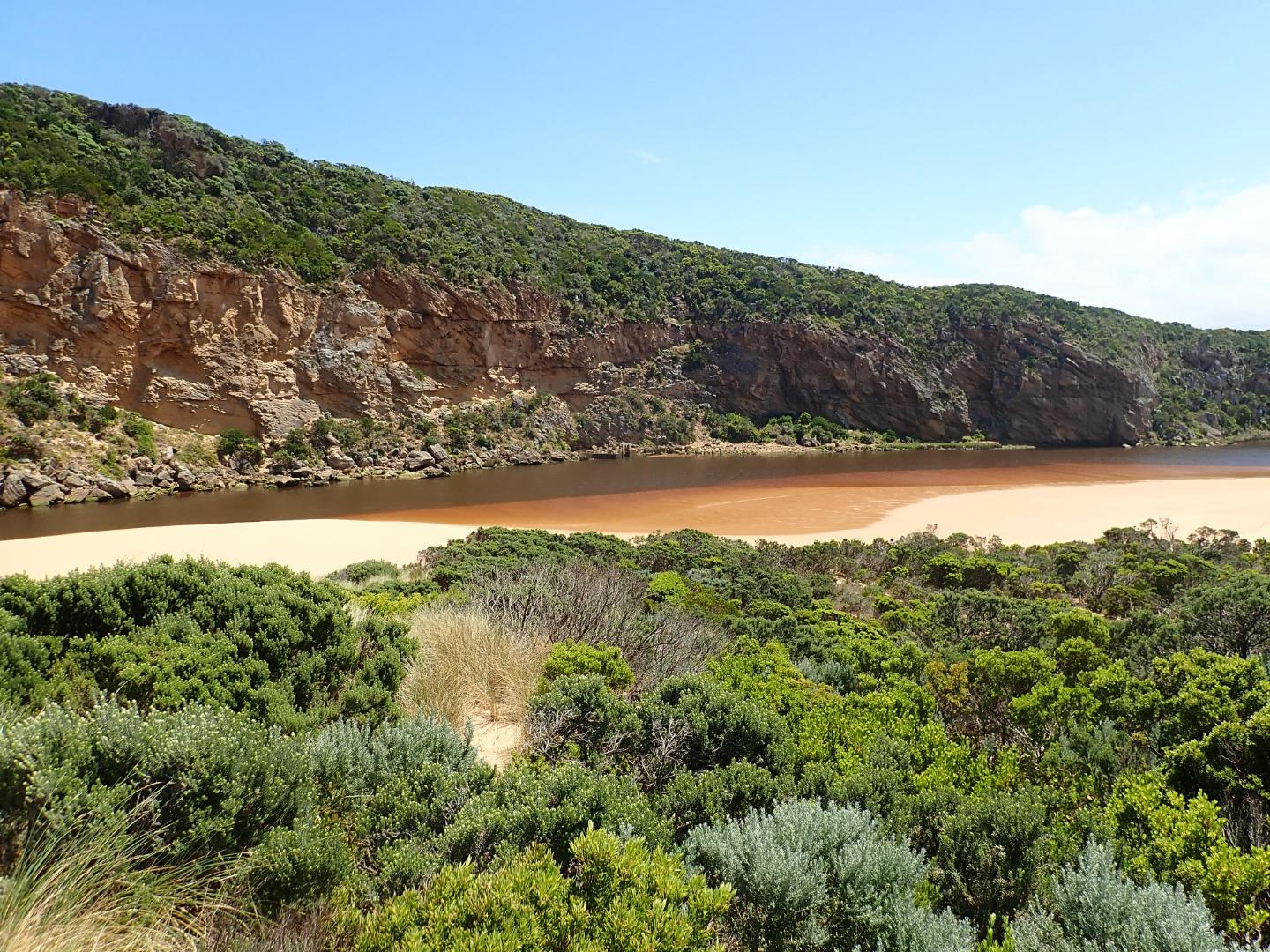
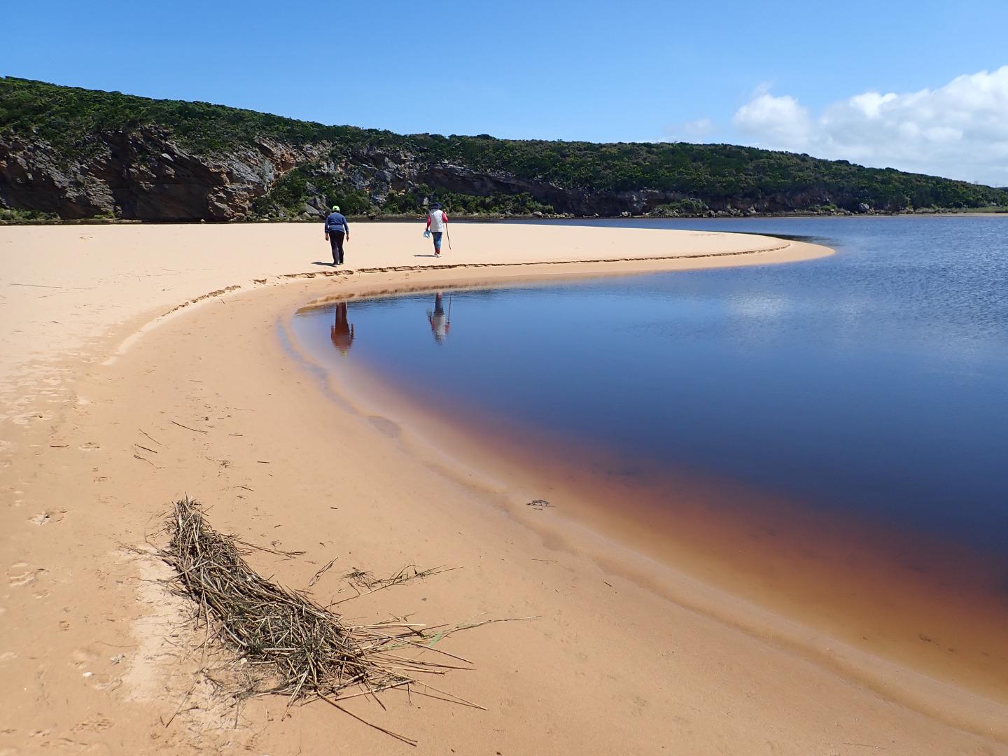
Dark discharge out mainly around the mouth -slight paler water along shoreline.
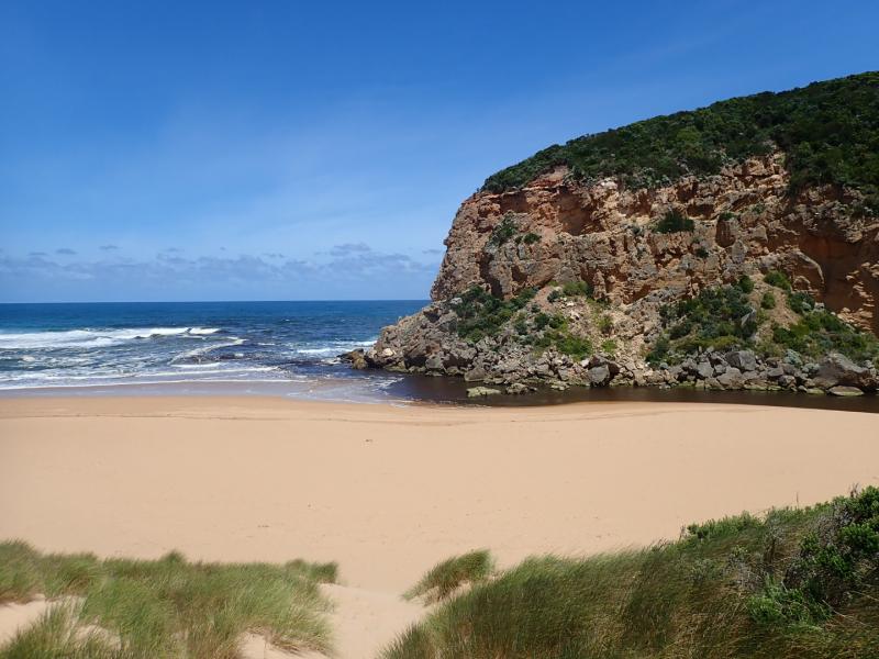
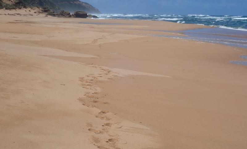
SW /WSW swell = occasional longshore drift to mouth creating small waves along east side of channel into the lagoon. Mid beach has 2 high areas of sand the most easterly one projecting out to sea. Waves going over this have created a small area of retained salt water further up the beach. Beach is undulating N/S with depressions allowing waves to go further up on beach & scour out sand with backwash
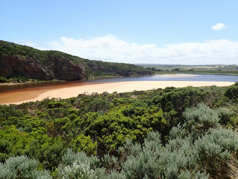
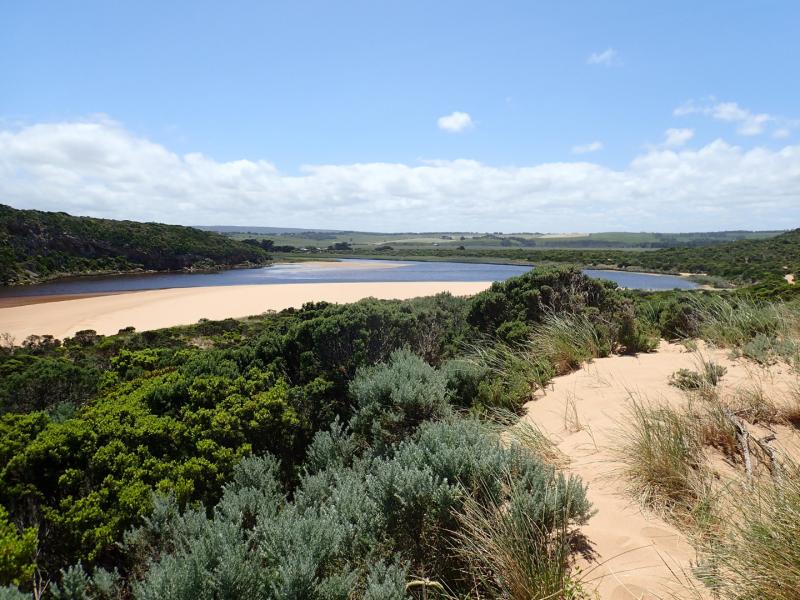
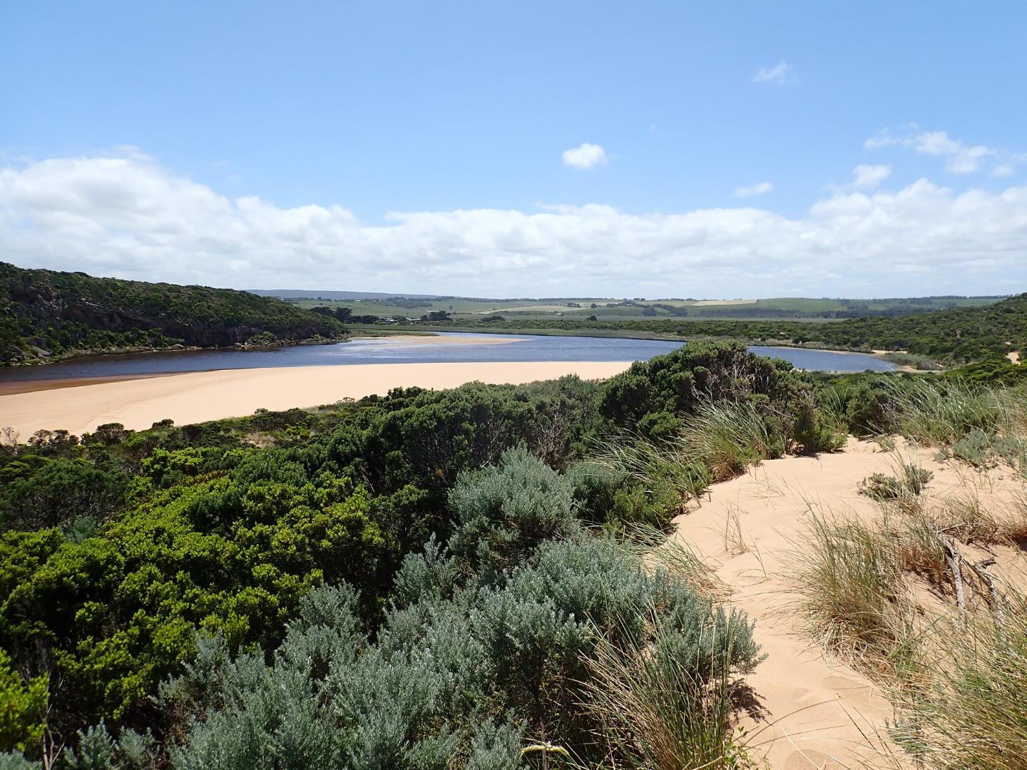
Sand on south side of lagoon well exposed extending far into lagoon. Separate sand bar closer to G2 is also exposed. The area on east side has a very large amount of green algae covering dying sea grass. Latrobe wetlands also has algae over most of the water
Mouth Observation
| Mouth state | Open |
|---|---|
| Previous | O O O C O O O O O O C C C C C C C C O O O C C C C C O P C C C O O O O O O O O O C O O O O O O O O O O O O O O O O O O O |
| Flow Present? | Yes |
| Previous | Y Y Y N Y Y Y Y Y Y N N N N N N N N Y Y Y N N N N N Y N N N N Y Y Y Y Y Y Y Y Y N Y Y Y Y Y Y Y Y Y Y Y Y Y Y Y Y Y Y Y |
| Flow Direction | In |
| Previous | O O O N O O O O O I N N N N N N N N O O O N N N N N I N N N N O O O O I O I I I N O I O O O O O I O O O O O O O O O O O |
| Above Sea | Above Estuary | |
|---|---|---|
| Berm Height (m) | ||
| Berm Length (m) |
Physical Condition
| Current | Mode | |
|---|---|---|
| Wind Direction | South | |
| Beaufort Scale | Moderate breeze | |
| Sea State | Moderate |


All content, files, data and images provided by the EstuaryWatch Data Portal and Gallery are subject to a Creative Commons Attribution License
Content is made available to be used in any way, and should always attribute EstuaryWatch and www.estuarywatch.org.au