EstuaryWatch Data Portal
GMC Gellibrand River Estuary Mouth Observation Site
19 December 2019
Overview
| Estuary | Gellibrand River Estuary |
|---|---|
| Site | Gellibrand River Estuary Mouth Observation Site |
| Observation ID | #13468 |
| Date and Time | Thursday 19th December 2019 11:10am |
| Approved | Approved |
Notes
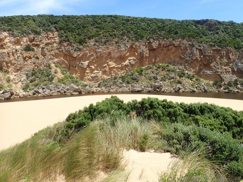
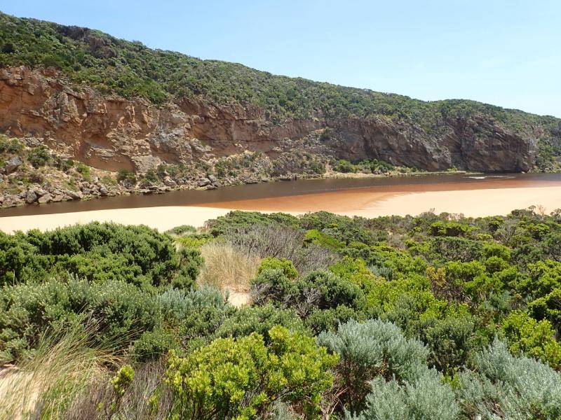
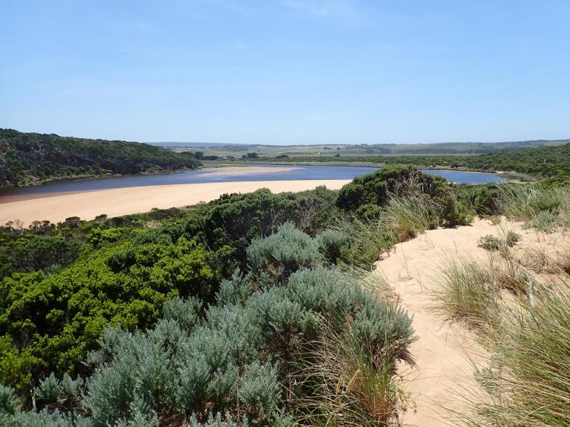
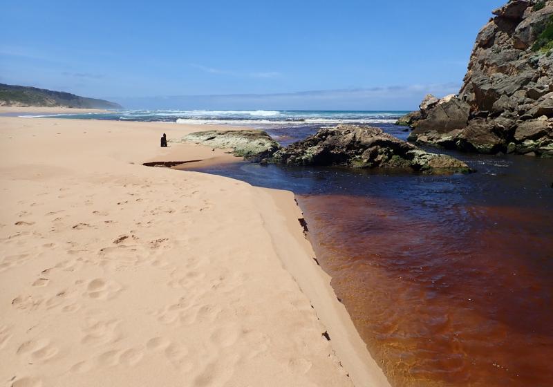
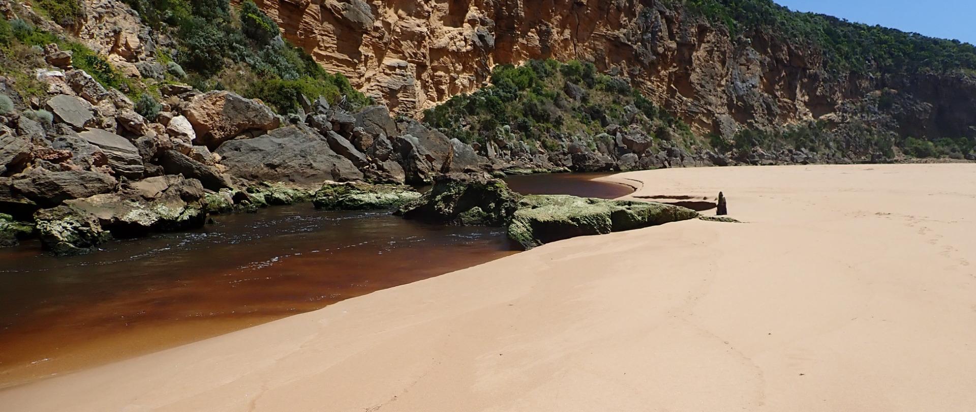
AHD board @ G6 covered with thick silt -Unreadable
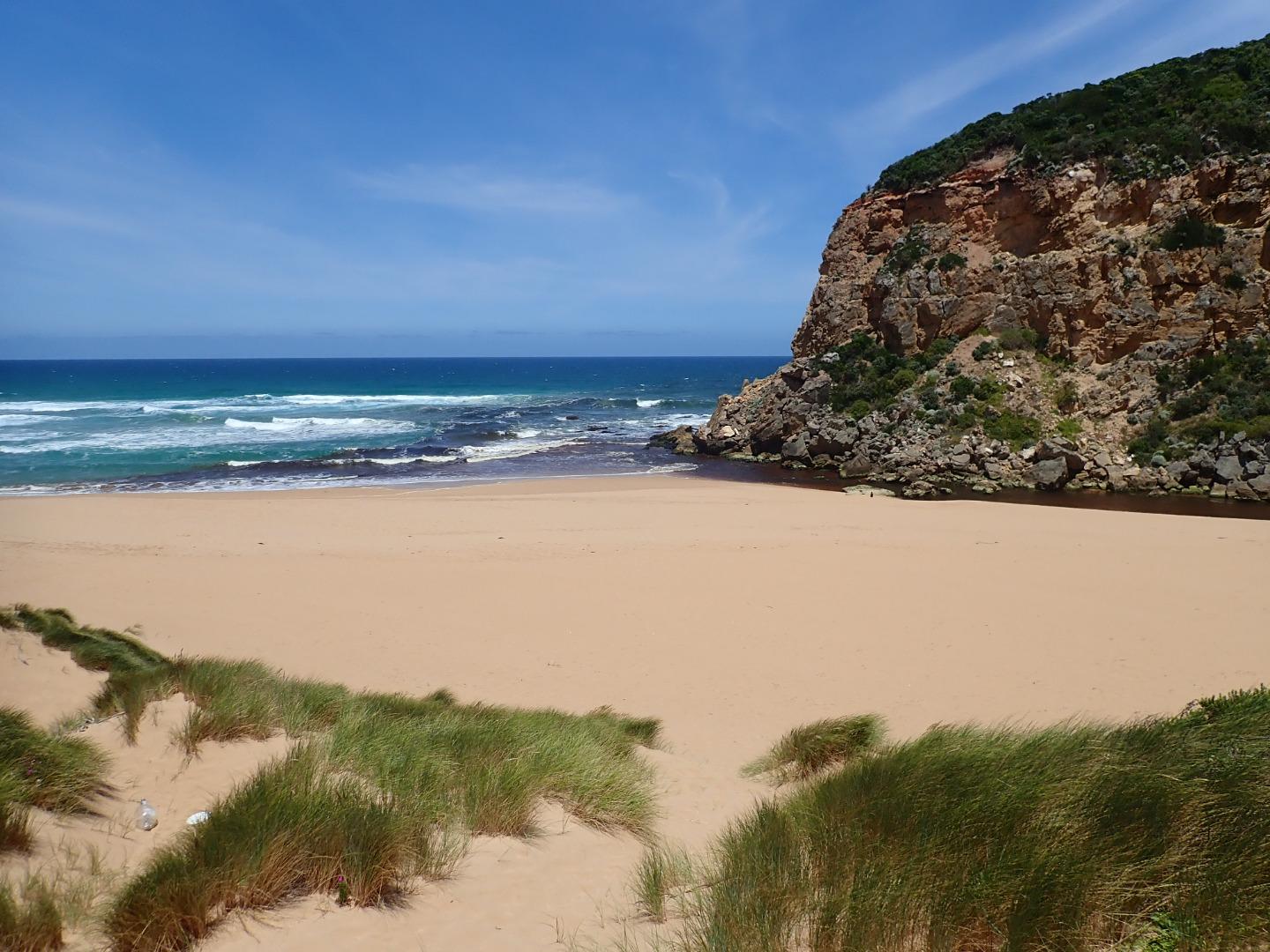
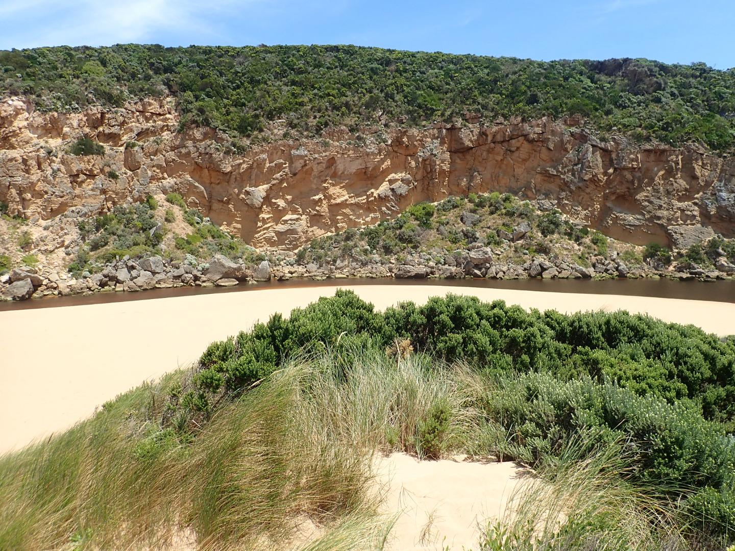
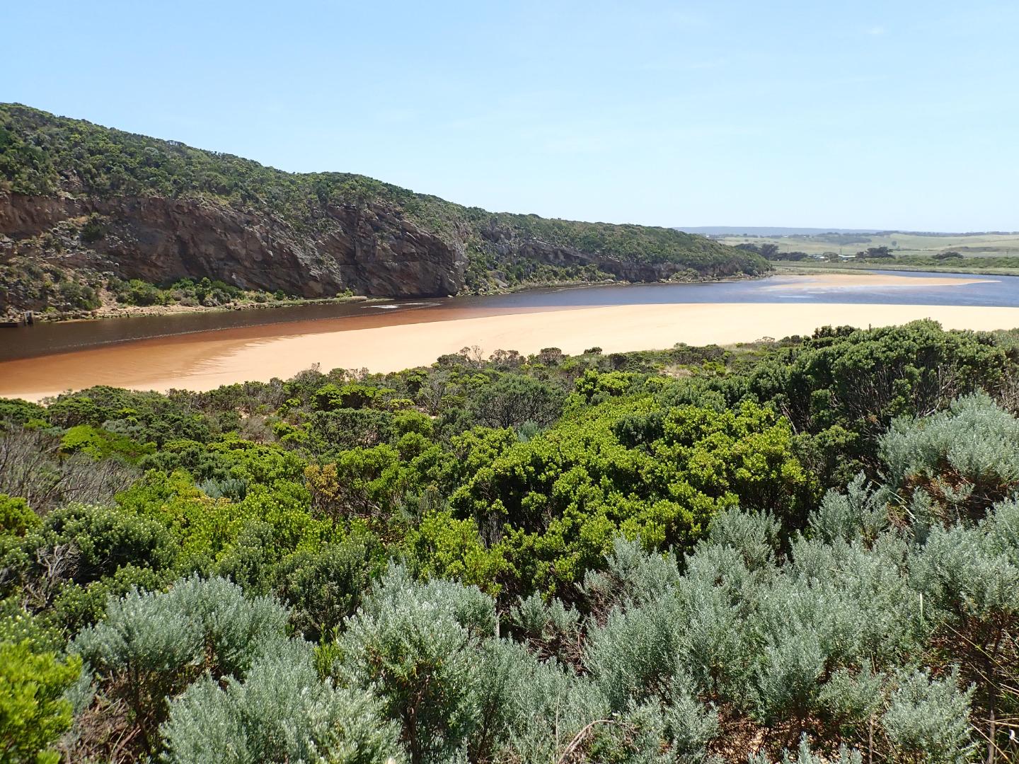
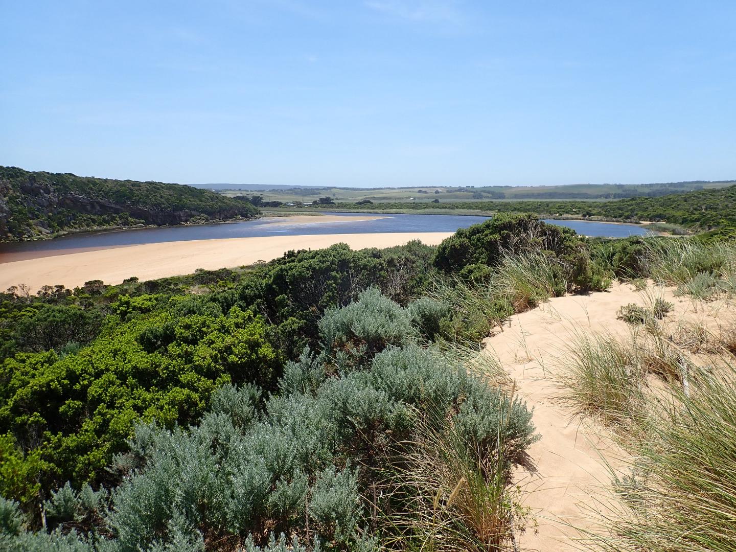
Dark discharge flowing out over an increased height of sand buildup around mouth & to south. SW swell impacting on west side of sand projection mid beach creating backwash & longshore drift which is mixing with incoming swell causing small waves up to rocks then low against east side of channel continuing around & across front of large sand projection to SE corner of lagoon. Area east of 1st rock has been filled with sand & water only flowing through narrow gap between !st & 2nd rock with a larger area of flow against cliff.
Very low tide has exposed large areas of sand on ocean beach & in lagoon where areas of algae occur along east side of lagoon. Algae is also covering areas of both west & north wetlands
Mouth Observation
| Mouth state | Open |
|---|---|
| Previous | O C O O O O O O C C C C C C C C O O O C C C C C O P C C C O O O O O O O O O C O O O O O O O O O O O O O O O O O O O O O |
| Flow Present? | Yes |
| Previous | Y N Y Y Y Y Y Y N N N N N N N N Y Y Y N N N N N Y N N N N Y Y Y Y Y Y Y Y Y N Y Y Y Y Y Y Y Y Y Y Y Y Y Y Y Y Y Y Y Y Y |
| Flow Direction | Out |
| Previous | O N O O O O O I N N N N N N N N O O O N N N N N I N N N N O O O O I O I I I N O I O O O O O I O O O O O O O O O O O I O |
| Above Sea | Above Estuary | |
|---|---|---|
| Berm Height (m) | ||
| Berm Length (m) |
Physical Condition
| Current | Mode | |
|---|---|---|
| Wind Direction | South-East | |
| Beaufort Scale | Fresh breeze | |
| Sea State | Moderate |


All content, files, data and images provided by the EstuaryWatch Data Portal and Gallery are subject to a Creative Commons Attribution License
Content is made available to be used in any way, and should always attribute EstuaryWatch and www.estuarywatch.org.au