EstuaryWatch Data Portal
Observation details
Overview
| Estuary | Wye River Estuary |
|---|---|
| Site | Wye River Mouth Condition |
| Observation ID | #13483 |
| Date and Time | Sunday 5th January 2020 10:05am |
| Approved | Approved |
Notes
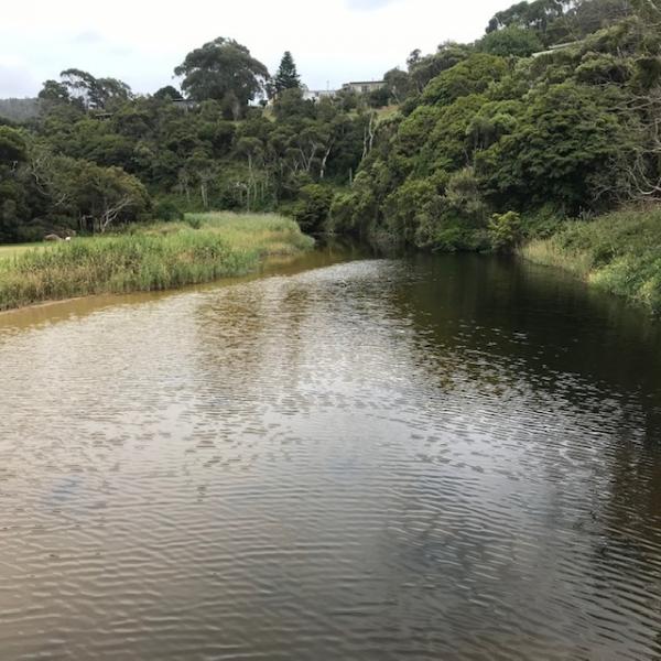
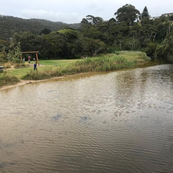
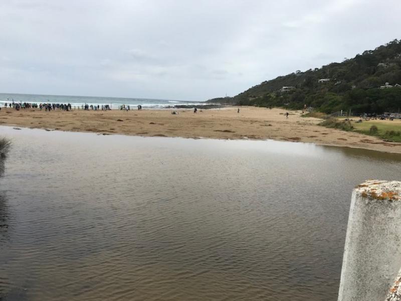
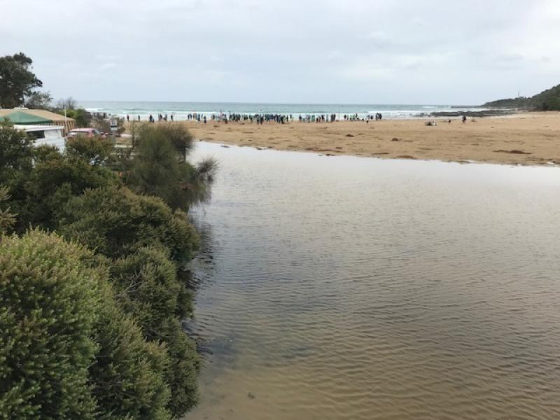
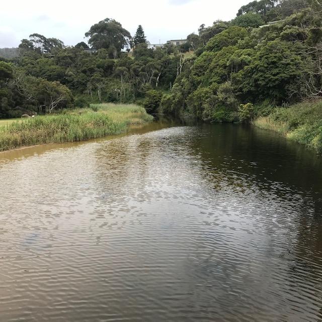
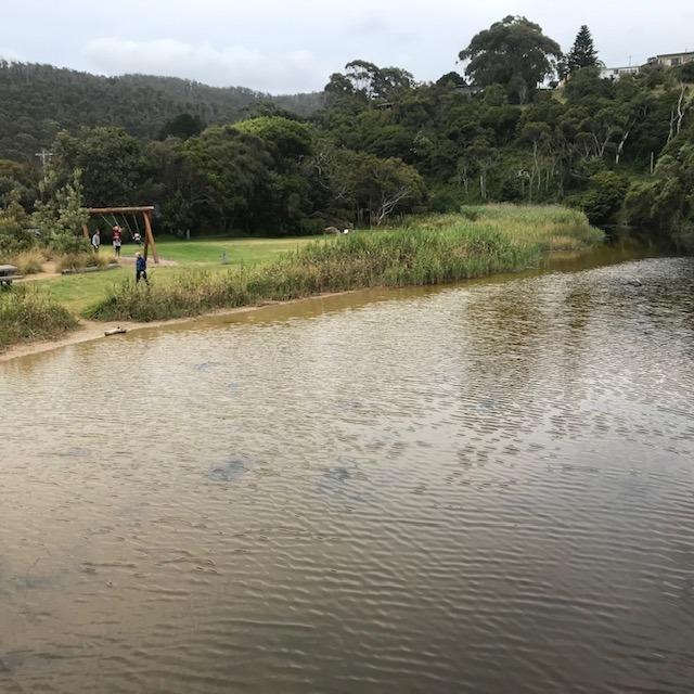
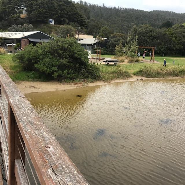
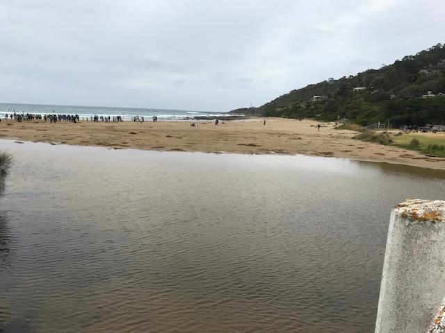
A change in the river above the footbridge, the wide beach that existed in previous months has disappeared with water covering this area. See photos attached. The river channel as it flows into the ocean has narrowed and there is not much water flowing into the sea. The channel is still undercutting the foreshore caravan park. If standing on the beach near the road bridge you can see the deposition of sand is quite high on the southern side of the river.
Mouth Observation
| Mouth state | Open |
|---|---|
| Previous | O O O O C O O O O O O O O O O O O O O O O O O O |
| Flow Present? | Yes |
| Previous | Y Y Y Y N Y Y Y Y Y Y Y Y Y Y Y Y Y Y Y Y Y Y Y |
| Flow Direction | Out |
| Previous | O O O O N O O O O O O O O O O O O O O O O O O O |
| Above Sea | Above Estuary | |
|---|---|---|
| Berm Height (m) | ||
| Berm Length (m) |
Physical Condition
| Current | Mode | |
|---|---|---|
| Wind Direction | South-East | |
| Beaufort Scale | Moderate breeze | |
| Sea State | Moderate |


All content, files, data and images provided by the EstuaryWatch Data Portal and Gallery are subject to a Creative Commons Attribution License
Content is made available to be used in any way, and should always attribute EstuaryWatch and www.estuarywatch.org.au