Overview

Estuary name Painkalac Creek Estuary
CMA Corangamite CMA
Description

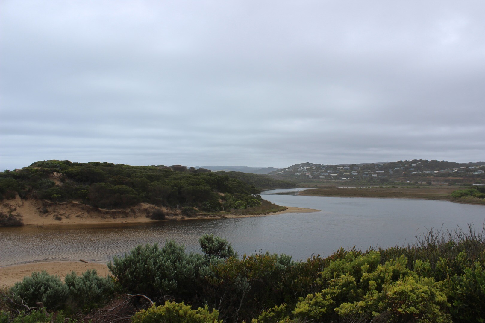
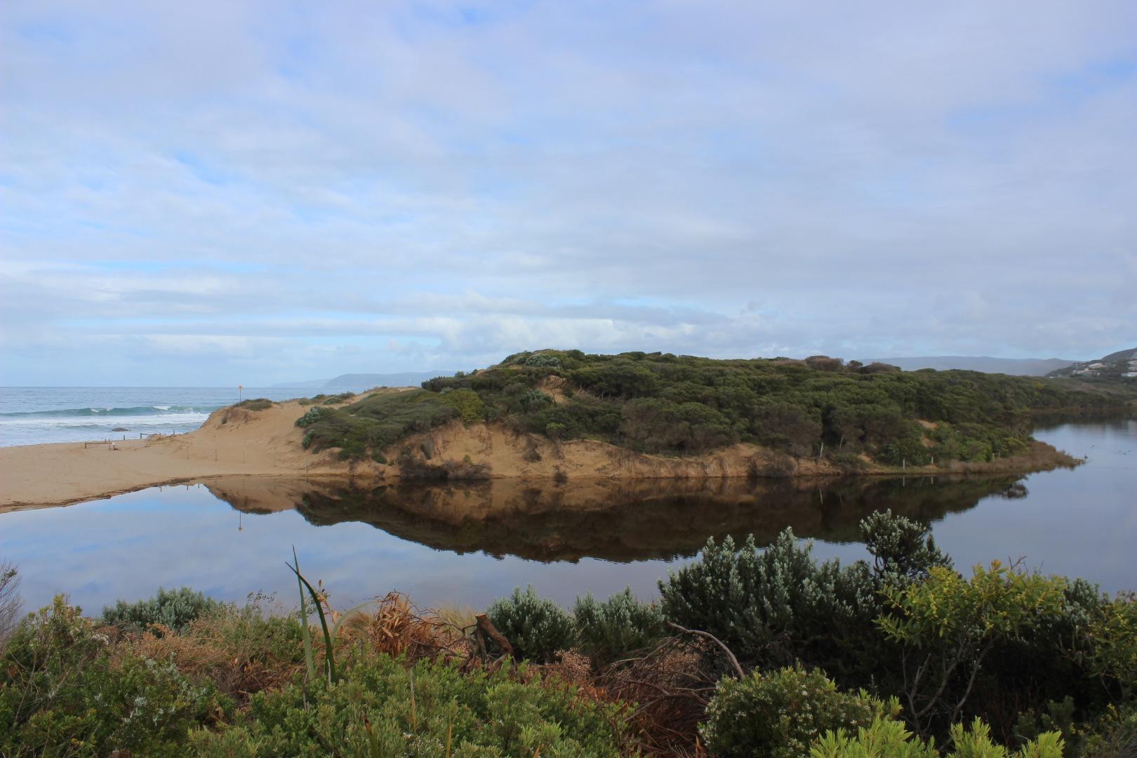
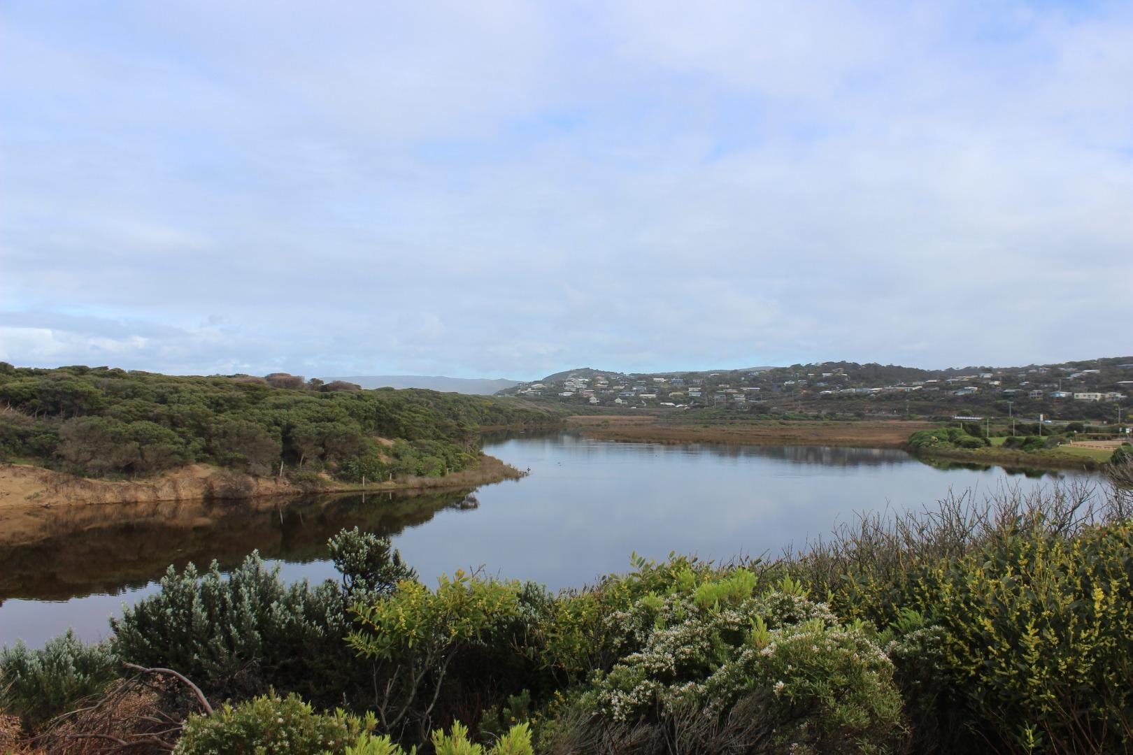
Painkalac Creek Estuary is approximately 3.5km in length and has a catchment area of 318.1Ha. It is a beautiful coastal lagoon system which attracts the spotted green frog and the eastern banjo frog (Pobblebonk).

Estuary Values
  • the Painkalac Creek estuary has been identified as an Important Bird Area
  • significant birds can be found on the Painkalac Creek estuary such as the Eastern Great Egret (Ardea modesta) Status: Vulnerable (Adv list), Nankeen Night Heron (Nycticorax caledonicus) Status: Near Threatened (Adv list), Royal Spoonbill (Platalea regia) Status: Vulnerable (Adv List)
  • Riparian Forest Ecological Vegetation Class (Vulnerable)
  • Swampy Riparian Woodland Ecological Vegetation Class (Endangered)
  • Riparian Scrub/Swampy Riparian Woodland Complex Ecological Vegetation Class (Depleted)
  • Sedgy Riparian Woodland Ecological Vegetation Class (Depleted)
  • canoeing, kayaking and stand up paddling
  • picnics and barbecues
  • recreational fishing
  • sightseeing
  • swimming
Estuary Threats
  • Degraded estuarine vegetation
  • Disturbance of Acid Sulphate Soils
  • Artificial estuary openings
  • Flow deviation
  • Stock access
  • Bed instability
Data Site observations
Status Active
Monitor group Painkalac Creek EstuaryWatchers
Document Painkalac_Estuary_Management_Plan.pdf
Document Painkalac Creek Estuary Fact Sheet

Map

Sites

Site details Options

P1 Estuary mouth area approximately 20m behind sand dune at estuary mouth

Retired Physico-Chemical 23-05-2007 - 23-05-2007

Estuary mouth area approximately 20m behind sand dune at estuary mouth

Observations 1

P2 Great Ocean Road Bridge at Aireys Inlet

Active Physico-Chemical 11-05-2007 - 12-03-2023

Great Ocean Road Bridge at Aireys Inlet - centre post

Observations 204

P3 Coastal Court Fishing Platform

Active Physico-Chemical 14-07-2007 - 12-03-2023
Fishing platform adjacent to Coastal Court
Observations 147

P4 The Bend

Active Physico-Chemical 19-10-2007 - 12-03-2023
Fishing platform at The Bend in the estuary
Observations 168

P5 Woods Property Fairhaven

Active Physico-Chemical 23-05-2007 - 12-02-2023
Fishing jetty at private property. Property owner consent required for access.
Observations 160

PGB Painkalac Creek Water Level Gauge Board

Active Gauge Board
The water level gauge board, used in the mouth condition monitoring process, is located under the Great Ocean bridge. It can be read from the western bank on the inland side of the bridge.
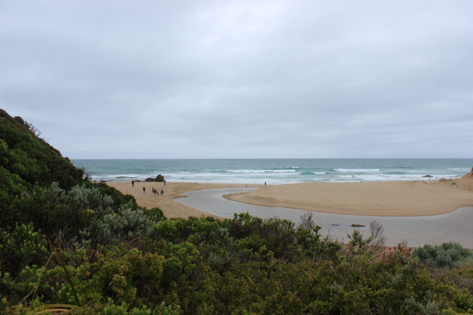
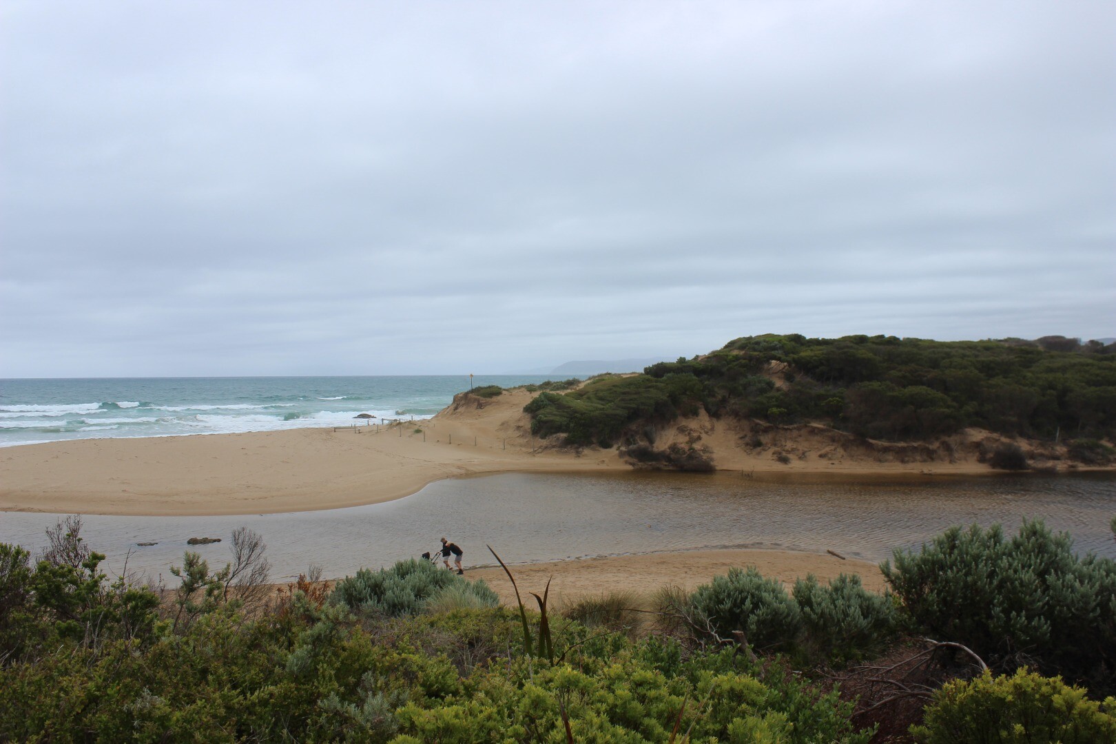
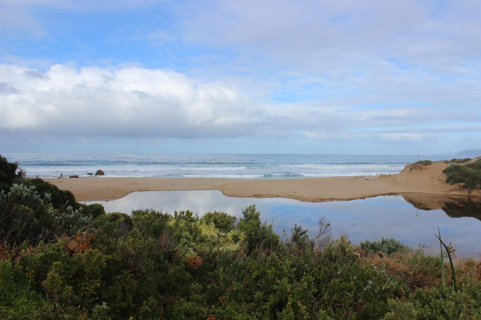
PMC Painkalac Creek Observation Site

Active Mouth Condition 23-05-2007 - 12-03-2023
Lookout platform on eastern side of estuary
Observations 260

Pp1 Painkalac Creek Photopoint

Active Photopoint 13-08-2010 - 13-03-2023
Lookout platform on eastern side of estuary
Photos 660

Recent Events

Event Details
25-07-2022 Estuary Entrance Opening

Dear Community members

With the recent partial opening on July 15th, Council has been monitoring Painkalac Creek water levels. With a saturated catchment any inflows over the past 2 weeks have resulted in water level rise. The weekends 7mm of rain in the catchment saw river levels rise to 1.9 metres which results in minor drain flooding along roadsides in specific low lying areas. The reservoir is currently full and is therefore not able to hold back any upstream inflows. The sand berm at the river mouth is blocking the river flows and is approximately 0.65metres above the estuary water levels.

With a further rainfall forecast of 20mm due and without removal of the sand berm, it is likely water levels will rise enough to cause flooding to houses. Council is therefore proposing to open the estuary mouth today with the support of CCMA, Barwon Water and DELWP.

Sharna Whitehead
Surf Coast Shire Council

PS from Rod Brooks: The estuary had naturally closed on 13 August but naturally reopened on 14 August following rainfall and then naturally closed on 11 September 2022

21-07-2022 EstuaryWatch Monitoring Group notices & meetings

Painkalac Creek fringing vegetation type maps from 2017

 These maps have been made by one of EstuaryWatch team Evy Gomm using open source data collected by Sinclair and Kohout 2018

The online data source is: https://discover.data.vic.gov.au/dataset/index-of-estuarine-condition-estuarine-fringing-vegetation

The report where the data collection methods are described is attached: Sinclair, S.J. and Kohout, M. (2018). Assessment of fringing vegetation for the index of estuary condition. Arthur Rylah Institute for Environmental Research Technical Report Series No. 290. Department of Environment, Land, Water and Planning, Heidelberg, Victoria.


15-07-2022 Estuary Entrance Opening

Dear Community members

With the recent wet weather, Council has been monitoring Painkalac Creek water levels. River levels have risen to 1.89 metres which results in minor drain flooding along roadsides in specific low lying areas. The reservoir is currently full and is therefore not able to hold back any upstream inflows. The sand berm at the river mouth is blocking the river flows and is approximately 0.65 metres above the estuary water levels.

With a further significant rainfall event due and without removal of the sand berm, it is likely water levels will rise enough to cause flooding to houses. Council is therefore proposing to open the estuary mouth today with the support of CCMA, Barwon Water and DELWP.

Sharna Whiteheasd
Coordinator Community Emergency Management
Surf Coast Shire Council

P.S. the opening was only partial and closed over in a few days.

17-06-2022 Estuary Entrance Opening

Council digger artificially opening estuary mouth

View all events

Estuary Snapshots

The EstuaryWatch snapshots provide a summary of estuary condition on a particular day. For all EstuaryWatch Snapshots, photopoint photos and a longitudinal water quality profile from the estuary mouth  to the inland extent is displayed. Read more

Full estuary snapshots below use dates where samples at every active monitoring site were recorded. View full and partial snapshots

Summer 2022


Spring 2022


Winter 2022


Autumn 2022


Creative Commons CC BY
All content, files, data and images provided by the EstuaryWatch Data Portal and Gallery are subject to a Creative Commons Attribution License

Content is made available to be used in any way, and should always attribute EstuaryWatch and www.estuarywatch.org.au