EstuaryWatch Data Portal
Cu2 Boggy Creek Road fishing jetty
3 January 2023
Observation details
Overview
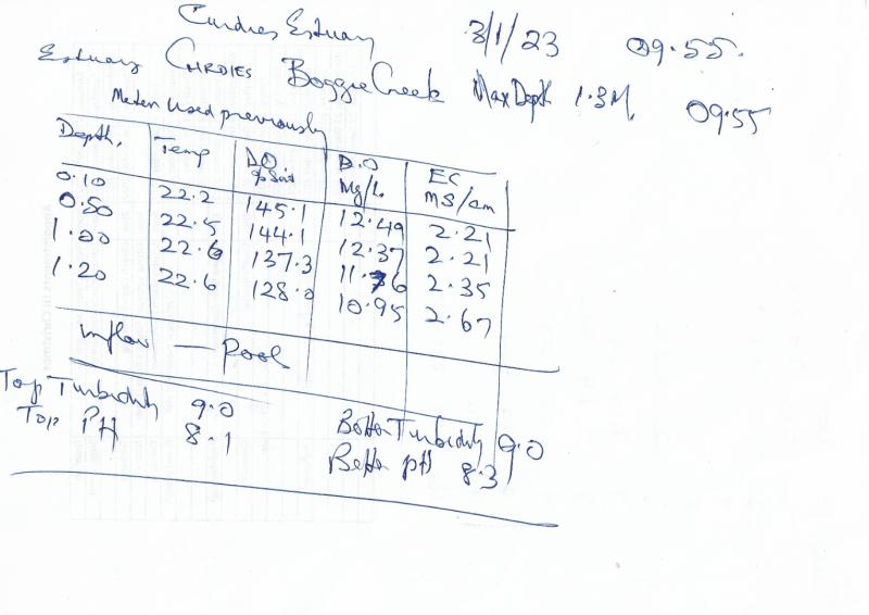
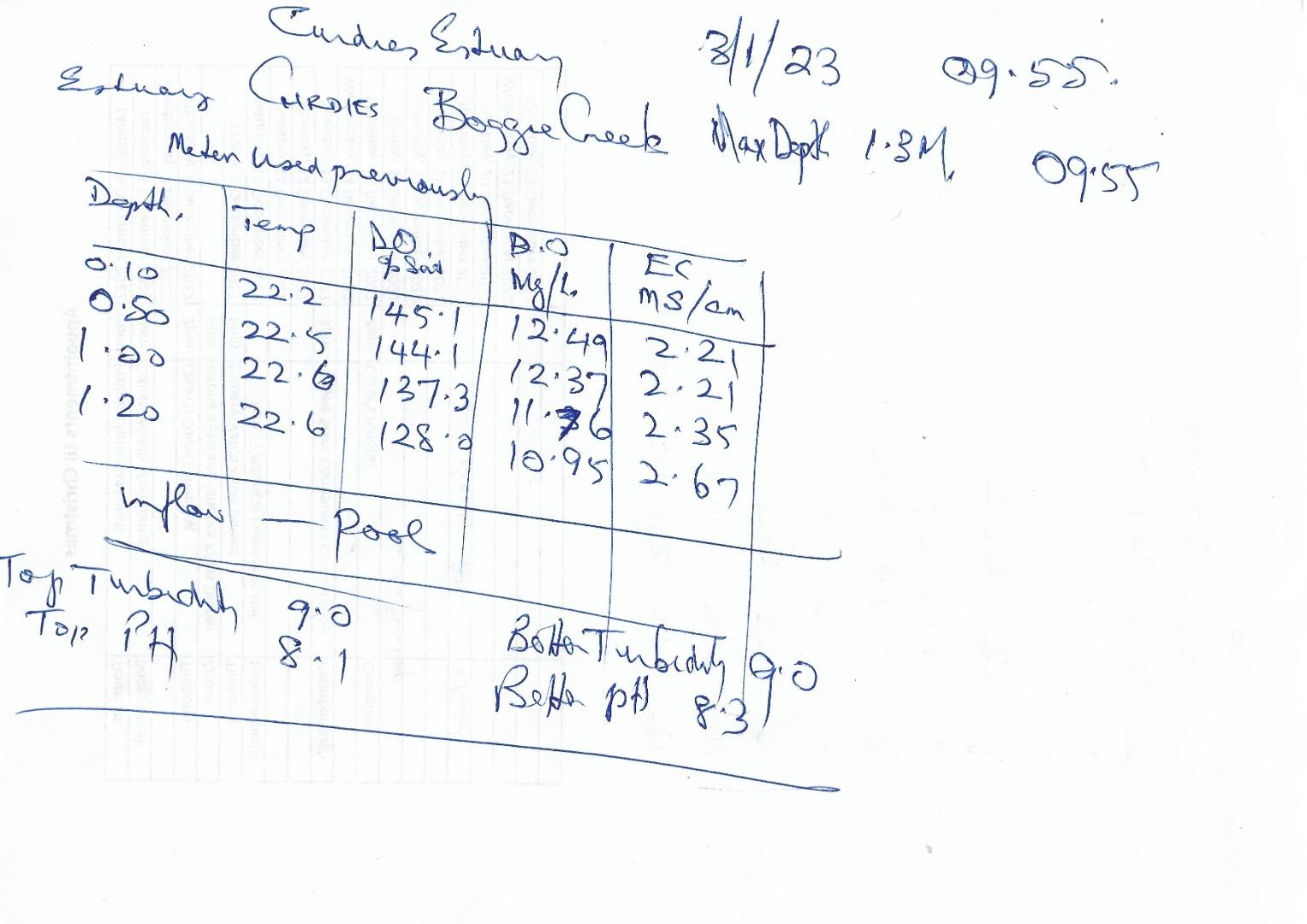
| Estuary | Curdies River Estuary |
|---|---|
| Site | Boggy Creek Road fishing jetty |
| Observation ID | #15207 |
| Date and Time | Tuesday 3rd January 2023 09:55am |
| Approved | Approved |
Notes
We ran out of Data Sheets, so we filled out the Data for Boggie Creek at the bottom of the Dorey Street sheet.
I have copied out the data for Boggie Creek onto a separate sheet for clarity, (I hope)
We need new green sheets before the next monitoring day.
Adam Nash monitored with me at Boggie Creek (Marg O'Toole had other duties to perform.) I could not include Adam on the Internet data.
Depth Profiling
| Depth m | Temperature °C | Salinity ppt | D.O. mg/L | D.O. % sat | EC mS/cm | Notes | |
|---|---|---|---|---|---|---|---|
| 0.1m | 22.20 | 12.49 | 145.1 | 2.21 | |||
| Previous | 19.2 | 6.9 | 75.0 | 1.3 | |||
| Median | 16.4 | 8.54 | 78.70 | 8.7 | |||
| 0.5m | 22.50 | 12.37 | 144.1 | 2.21 | |||
| Previous | 13.6 | 6.5 | 62.2 | 0.5 | |||
| Median | 16.2 | 8.54 | 78.70 | 8.7 | |||
| 1.0m | 22.60 | 11.76 | 137.3 | 2.35 | |||
| Previous | 19.1 | 6.7 | 73.0 | 1.4 | |||
| Median | 16.8 | 7.74 | 75.80 | 9.0 | |||
| 1.2m | 33.60 | 10.95 | 128.0 | 2.67 | |||
| Previous | 13.5 | 6.5 | 62.1 | 0.5 | |||
| Median | 16.1 | 7.74 | 75.80 | 9.0 |

All content, files, data and images provided by the EstuaryWatch Data Portal and Gallery are subject to a Creative Commons Attribution License
Content is made available to be used in any way, and should always attribute EstuaryWatch and www.estuarywatch.org.au