EstuaryWatch Data Portal
Estuary events Anglesea River Estuary
| Date | Details | |
|---|---|---|
| 29-03-2017 |
Estuary Entrance Closure Estuary closure. Water level was 1.153m AHD. rherben |
|
| 01-04-2017 |
Unusual/Extraordinary occurrence! On the 30th of March the estuary water level dropped to a low of 1.153m AHD after an artificial estuary opening on the 23rd of March. On the 30th of March the afternoon high tide was 1.61m. The afternoon high tide continued to rise until it peaked at 1.73m on Saturday the 1st of April. Over these three days the water level in the estuary increased with each high tide. The water level rose to 1.45m AHD on the 1st April. At high tide on the 1st of April, sea water was surging into the estuary and could be seen mixing with estuary water opposite the playground at the estuary mouth. rherben |
|
| 07-04-2017 |
Community Event pH has improved in the Anglesea River. Surf Coast Shire public health signage on the Anglesea River has been removed. Rose Herben |
|
| 11-04-2017 |
Estuary Entrance Opening Artificial estuary opening. 1.7m AHD. rherben |
|
| 02-05-2017 |
Tides High tide was 1.76m at 16:30. Photo shows seawater pushing into the estuary. Photo taken by Sam Munro. Rose Herben |
|
| 01-12-2017 |
Estuary Entrance Opening Permitted artificial estuary opening. Water level 1.4m AHD. Opening was conducted due to avoid localised flooding. Significant rain on the way for the next three days – 90-95% chance of up to 30 mm each of Friday through Sunday. Rose Herben |
|
| 11-12-2017 |
Fish Fish death reported on the Anglesea River. EstuaryWatchers visited the estuary and reported about 15 dead fish from the mouth of the estuary to 100m upstream of the Great Ocean Road Bridge. Most of the dead fish were within 100m of the Great Ocean Road Bridge. The largest fish was around 400mm. After talking to the tourism operaters and community members that regularly frequent the river it seems the fish death occurred 1-2 weeks before December 11. Many of the smaller fish that died had either decomposed or been eaten by birds. Rose Herben |
|
| 15-02-2018 |
Water level Transfer of 8Ml (@ 2Ml/day) commenced from the Alcoa storage basin. Brad Clingin |
|
| 26-02-2018 |
Water level Pumping start: Approx. 15:00 26/02/18 pH Basin: 4.2, Estuary: 4.3 Pumping rate 24 L/s Pumping start: Approx. 15:00 26/02/18 Pumping stop: 16/3/2018 (not constant during this time)
|
|
| 22-03-2018 |
Water level Pumping start: Approx. ? 22/03/18 pH Basin: 4.2, Estuary: 4.3 Basin level at start of transfer: 45Ml. Pumping rate 24 L/s Pumping stop: 23/3/2018 Brad Clingin |
|
| 04-04-2018 |
Water level Transfer commenced: 4/4/2018 (1.362m) Ceased transfer: 6/4/2018(1.373m) Brad Clingin |
|
| 09-04-2018 |
Water level Transfer commenced: 9/4/2018 10am (1.357m) Basin level at commencement of transfer: 36Ml. Ceased transfer: 12/4/2018(1.375m) Brad Clingin |
|
| 28-04-2018 |
Water level Pumping start: Approx. 28/03/18 pH Basin: Estuary: Pumping rate 24 L/s Pumping stop: 29/3/2018 Brad Clingin |
|
| 01-05-2018 |
Water level Pumping start: Approx. 1/05/18, ~10:00 Pumping rate 24 L/s Pumping stop: 2/5/2018 1/05/2018 Begin transfers to Anglesea River. Estuary level: 1.355m 2/05/2018 Ceased pumping. Estuary level 1.357m Brad Clingin |
|
| 21-05-2018 |
Unusual/Extraordinary occurrence! At high tide today (1.76m @16:27 pm) waves were overtopping berm introducing seawater to estuary. This is the last of a series of high tides which have probably done the same thing. The river level is exactly 1.5m AHD. Photo taken at 16:39hrs. Dick O'hanlon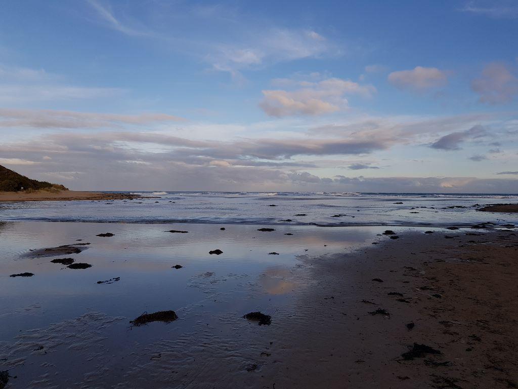 |
|
| 28-01-2020 |
Estuary Entrance Opening At 03:30hrs on 28/1/20 during a high spring tide waves overtopped the Berm at the river mouth and introduced a significant amount of seawater into the river. Although the flow was intermittent at the beach, further down the river a strong continuous inflow was observed. I have film of this. Note that the river level was 1.34m AHD and the berm was measured at 10am on 28/1/20 at .85m above the river level. This means that waves strongly overtopped a berm height of 1.34 + .85 = 2.19m AHD. Unfortunately I could not download the MP4 file of this event Dick O'hanlon |
|
| 12-04-2020 |
Estuary Entrance Opening Waves overtopped berm and caused an intermittent inflow of sea water around High Tide. Estuary level was 1.54m AHD
Note strong physical and anecdotal evidence that the same thing happened on 11/4/20. Dick O'hanlon |
|
| 01-05-2020 |
Estuary Entrance Opening Waves overtopped the Berm either side of High Tide at 17:37 hrs. The estuary height was 1.58m at the time. A small intermittent inflow of seawater occurred. The next day I measured the Berm Height at 1.97m AHD Dick O'hanlon |
|
| 01-10-2021 |
Extra pH monitoring along River Reserve Road Residents concerned that Frog chorusing, particularly for Pobblebonks, is delayed this Spring. Residents asked for pH monitoring of area west of dirt part of River Reserve Rd on the way into Coogoorah. A new Culvert was installed there in 2019. Some concern that chorusing delays were related to low estuary pH and increased connection to the river via the culvert. When river levels fall during an opening the swampy land on the west of RR road drains much more than it used to. 10 readings were carried out. The readings ranged from 3.5 to 5.0. The pH did appear to be lower nearer the culvert on the West side of the road. There was no visible flow through the culvert at time of testing although a flow was visible earlier that day around 10:00am. Dick O'hanlon |
|
| 28-01-2022 |
Estuary Entrance Opening Emergency opening due to recent rainfall Deirdre Murphy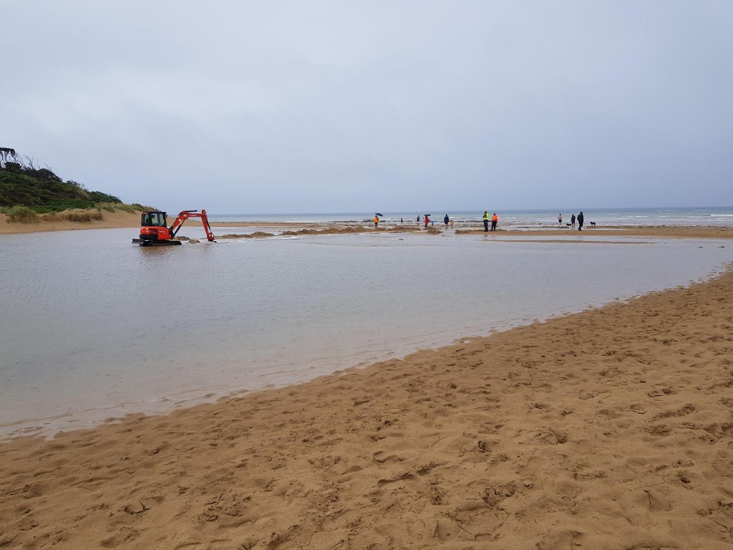 |
|

All content, files, data and images provided by the EstuaryWatch Data Portal and Gallery are subject to a Creative Commons Attribution License
Content is made available to be used in any way, and should always attribute EstuaryWatch and www.estuarywatch.org.au