EstuaryWatch Data Portal
GMC Gellibrand River Estuary Mouth Observation Site
25 May 2018
Overview
| Estuary | Gellibrand River Estuary |
|---|---|
| Site | Gellibrand River Estuary Mouth Observation Site |
| Observation ID | #12084 |
| Date and Time | Friday 25th May 2018 09:05am |
| Approved | Approved |
Notes
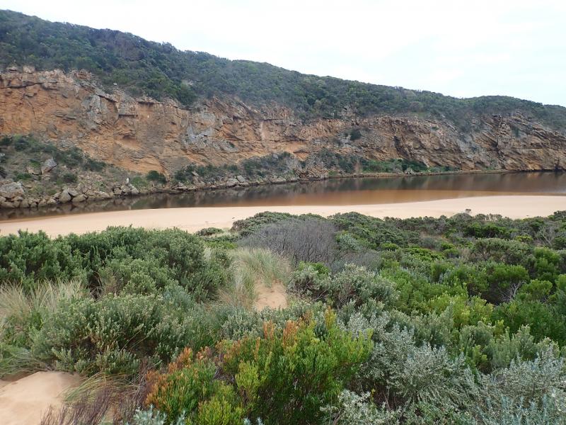
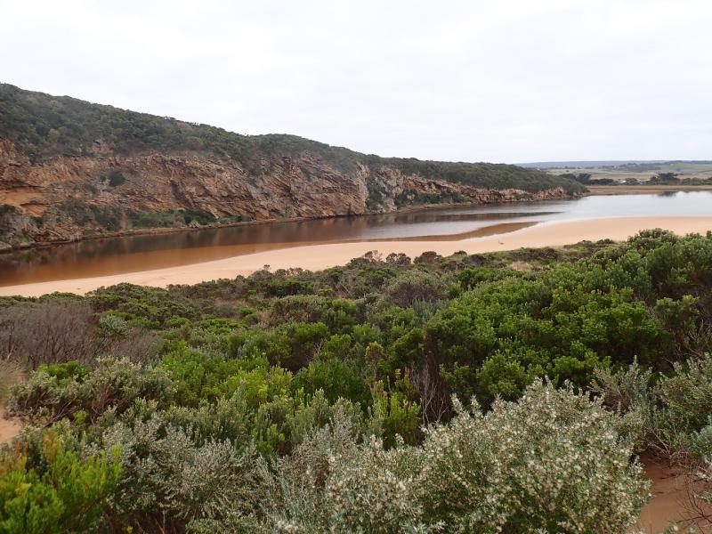
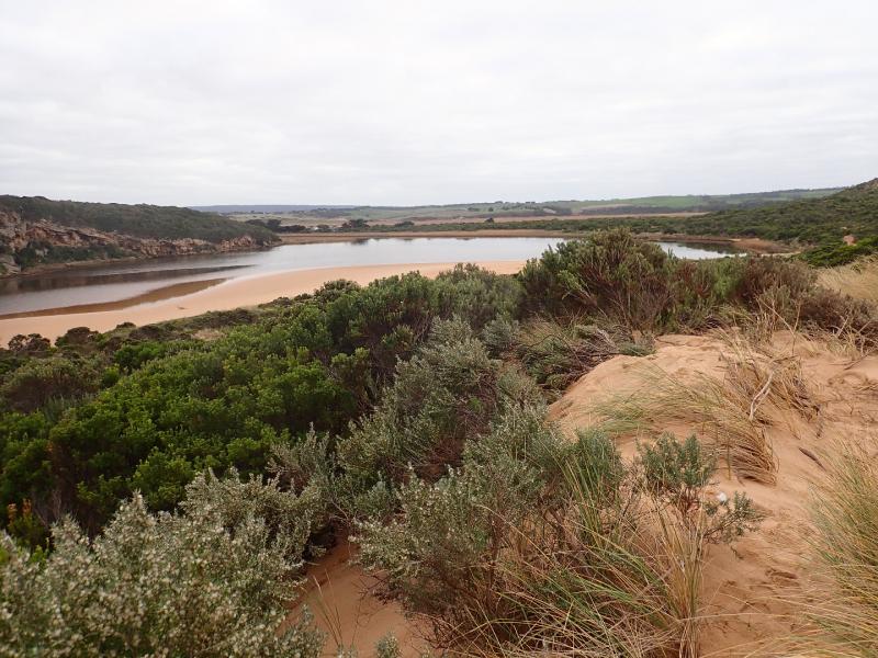
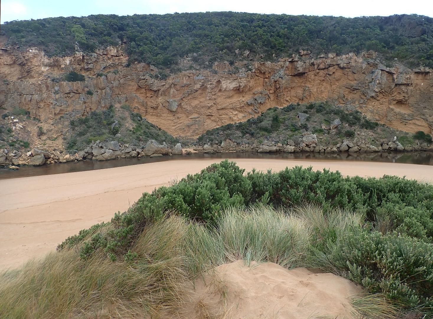
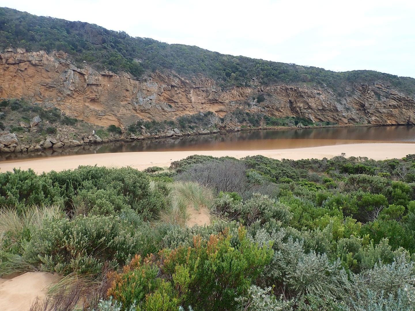
Dark discharge out diagonally across entrance with some to south west. SW swell limiting usual easterly direction of outflow along beach front & impacting strongly at easterly section of beach. Waves in all directions at this area. Waves also in all directions at entrance with some longshore drift across. Occasional small waves entering along channel into estuary
Reducing but still fast outflow going over sand build up at entrance & immediately downstream of rocks, large amount of sand visible in breakers. Sand spit has been reduced & now higher sand extends to east along the beach front A lower area where waves are going higher up on beach exists at mid beach. Highest area is still close to entrance
Erosion continues on south face of pt. Ronald
Mouth Observation
| Mouth state | Open |
|---|---|
| Previous | O O O O O O O O O O O O O O O O O O O O O O O O O O O P C C C C C C C O O O O C C C C C C C C C O O O O O C O O |
| Flow Present? | Yes |
| Previous | Y Y Y N Y Y Y Y Y Y Y Y Y Y Y Y Y Y Y Y Y Y Y Y Y Y Y N N N N N N N N Y Y Y Y N N N N N N N N N Y Y Y Y Y N Y Y |
| Flow Direction | Out |
| Previous | O O O N O O O O O O O O O O O O O O O O O O O O O O O N N N N N N N N O I O O N N N N N N N N N O O O O O N O I |
| Above Sea | Above Estuary | |
|---|---|---|
| Berm Height (m) | ||
| Berm Length (m) |
Physical Condition
| Current | Mode | |
|---|---|---|
| Wind Direction | North-East | |
| Beaufort Scale | Light Breeze | |
| Sea State | Rough |


All content, files, data and images provided by the EstuaryWatch Data Portal and Gallery are subject to a Creative Commons Attribution License
Content is made available to be used in any way, and should always attribute EstuaryWatch and www.estuarywatch.org.au