EstuaryWatch Data Portal
GMC Gellibrand River Estuary Mouth Observation Site
5 August 2018
Overview
| Estuary | Gellibrand River Estuary |
|---|---|
| Site | Gellibrand River Estuary Mouth Observation Site |
| Observation ID | #12317 |
| Date and Time | Sunday 5th August 2018 13:15pm |
| Approved | Approved |
Notes
AHD @ G6 3.40 @12:10
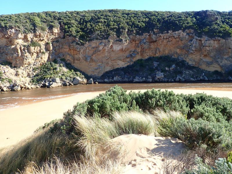
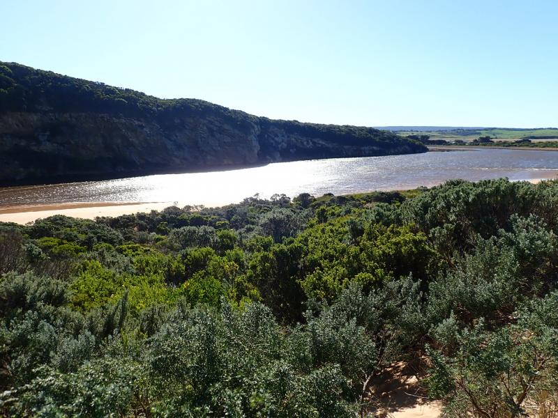
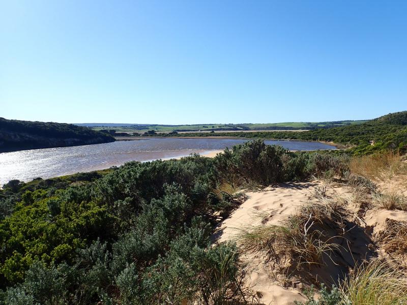
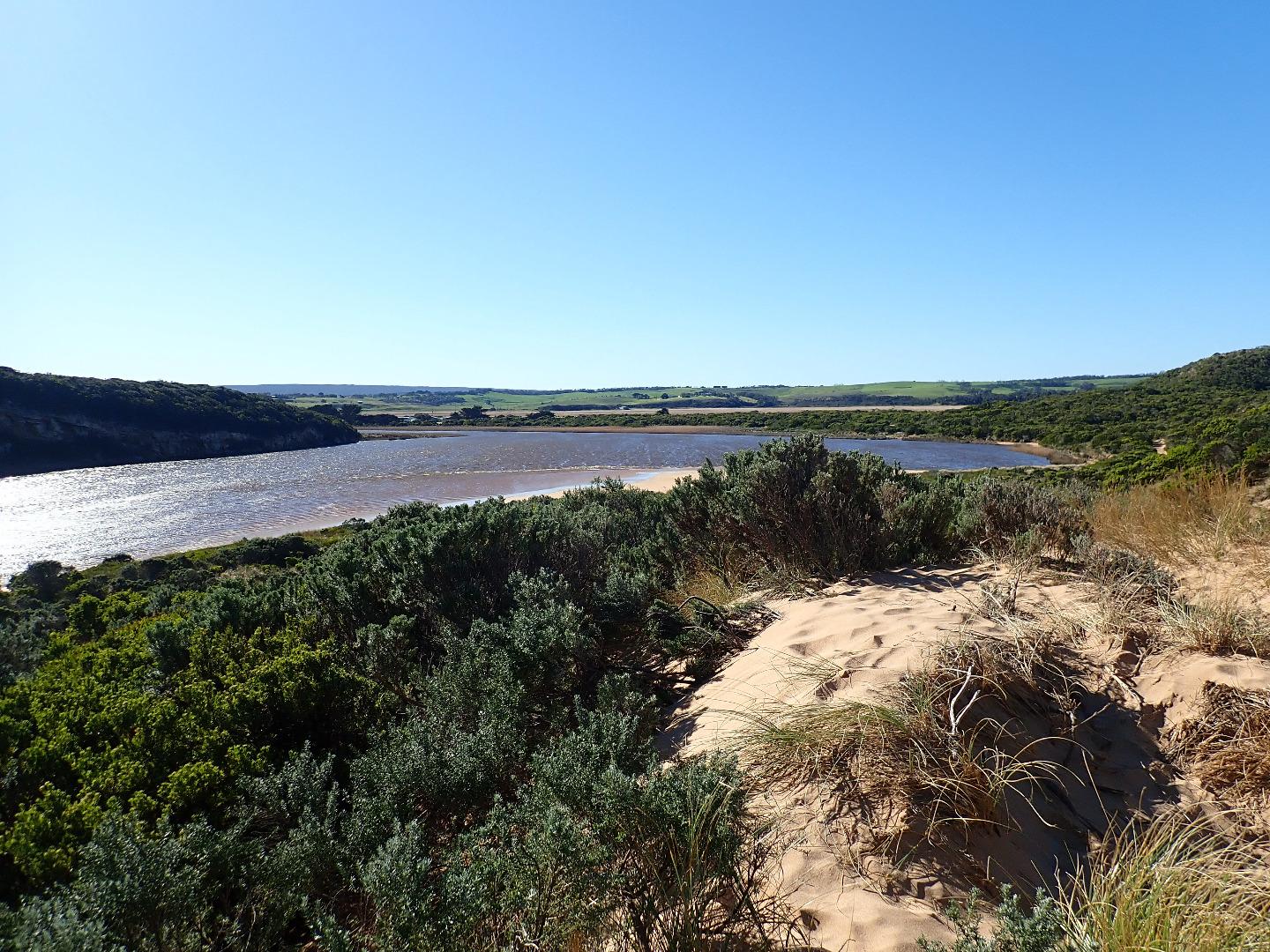
Estuary from G4 to G6 has been mainly been affected by tidal movement for many weeks despite deep extensive flooding upstream in all areas Area downstream G4 has not been flooded nor water over OOR despite heavy rain fall & large amount of runoff
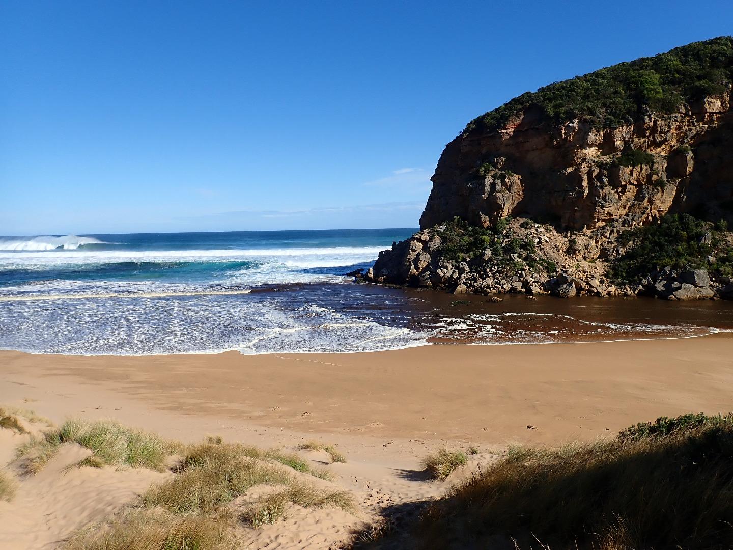
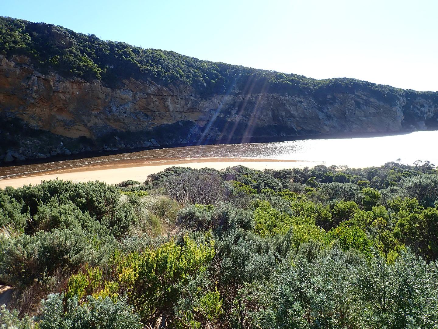
Dark discharge out along shore line to east but held back by rough sea. Waves entering very wide across the entrance, some travelling up the channel into the estuary where they are dispersed by strong north wind against sand projection & beach on south side of estuary. Large waves are being driven across the estuary by wind
Area directly below Gp1 site has been scoured out by wind & waves becoming much lower than the rest of the beach. More sand has been deposited on new areas of the dunes
Mouth Observation
| Mouth state | Open |
|---|---|
| Previous | O O O O O O O O O O O O O O O O O O P C C C C C C C O O O O C C C C C C C C C O O O O O C O O O O O O O O O O O O O |
| Flow Present? | Yes |
| Previous | Y Y Y Y Y Y Y Y Y Y Y Y Y Y Y Y Y Y N N N N N N N N Y Y Y Y N N N N N N N N N Y Y Y Y Y N Y Y Y Y Y Y Y Y Y Y Y N Y |
| Flow Direction | In |
| Previous | O O O O O O O O O O O O O O O O O O N N N N N N N N O I O O N N N N N N N N N O O O O O N O I O O O I O O I O O N O |
| Above Sea | Above Estuary | |
|---|---|---|
| Berm Height (m) | ||
| Berm Length (m) |
Physical Condition
| Current | Mode | |
|---|---|---|
| Wind Direction | North | |
| Beaufort Scale | Strong breeze | |
| Sea State | Very Rough |


All content, files, data and images provided by the EstuaryWatch Data Portal and Gallery are subject to a Creative Commons Attribution License
Content is made available to be used in any way, and should always attribute EstuaryWatch and www.estuarywatch.org.au