EstuaryWatch Data Portal
GMC Gellibrand River Estuary Mouth Observation Site
1 September 2018
Overview
| Estuary | Gellibrand River Estuary |
|---|---|
| Site | Gellibrand River Estuary Mouth Observation Site |
| Observation ID | #12368 |
| Date and Time | Saturday 1st September 2018 09:55am |
| Approved | Approved |
Notes
AHD board unreadable (estimate only) as covered with silt
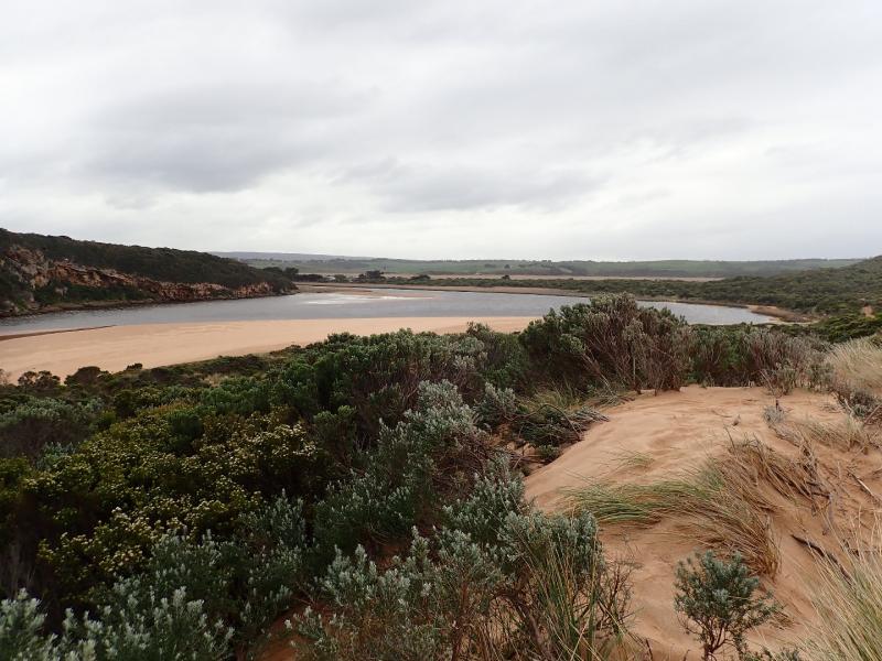
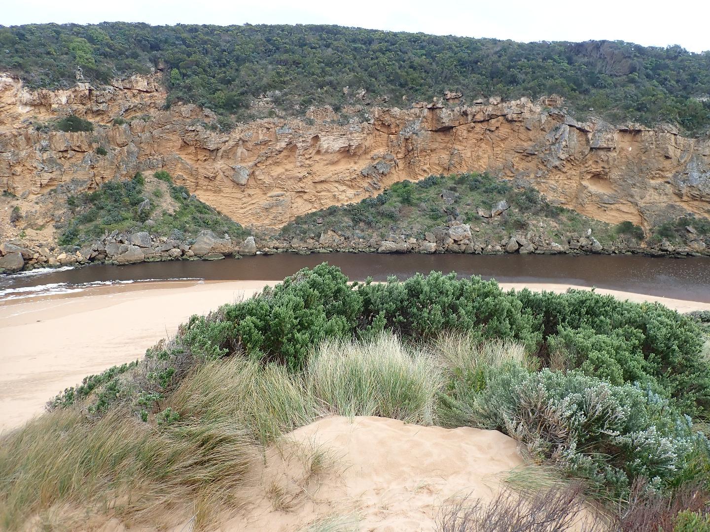
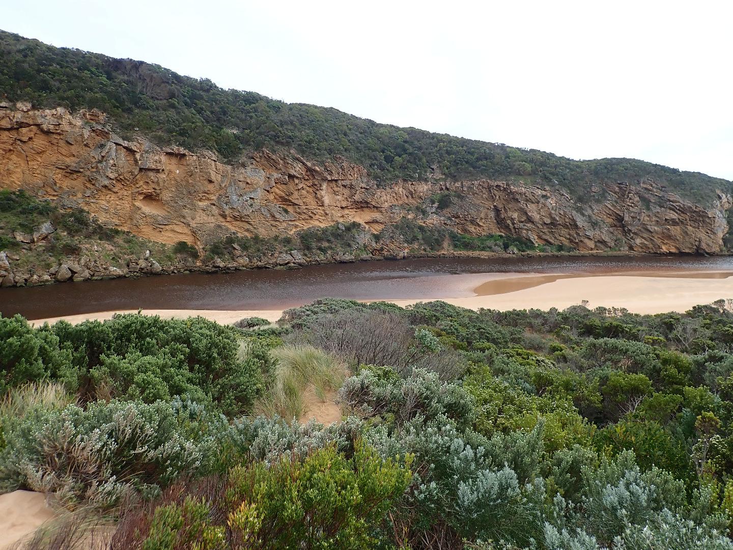
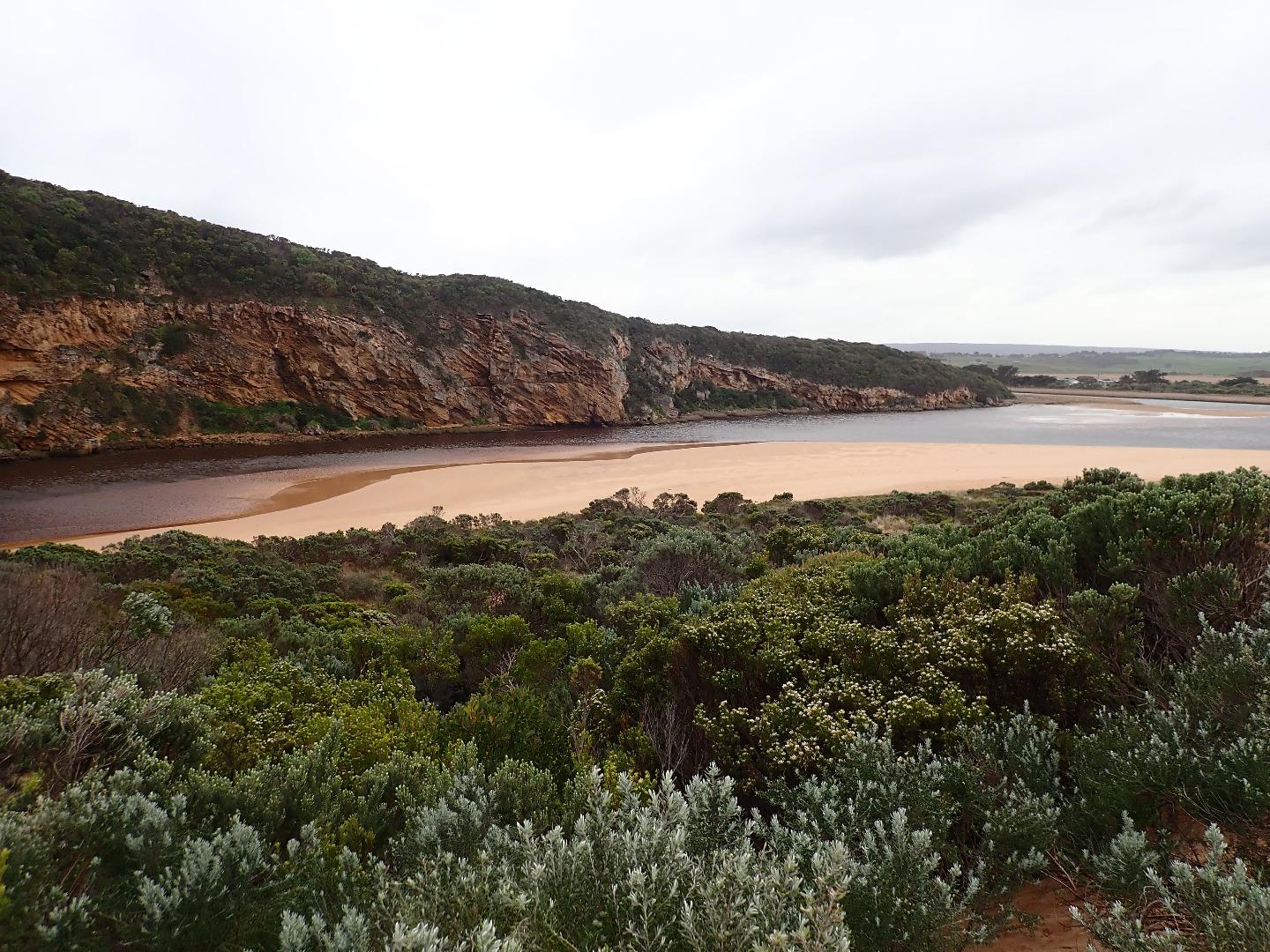
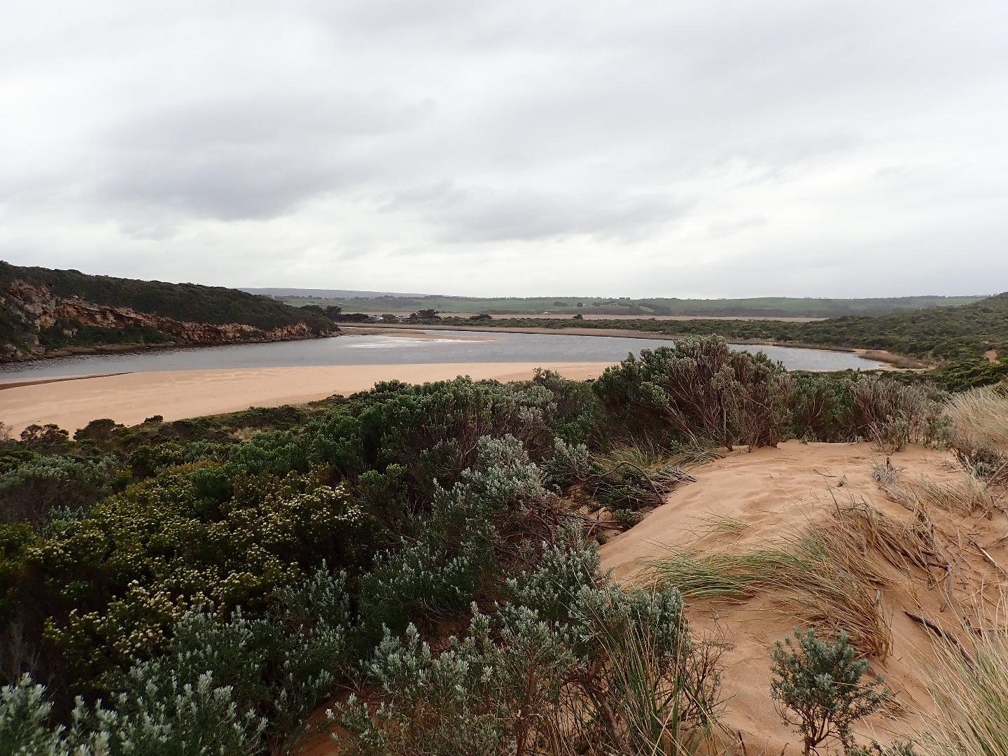
Dark discharge out around mouth & slightly to east.Very large amount of silt & foam along beach close to entrance, occasional longshore drift across entrance with small waves entering. Beach face at east end is increasing in height & steepness. Depression formed more deeply behind this area dropping down as it goes west
Very large amount of sand exposed on south side of estuary & sand bar partly visible
More extensive erosion on south face of Pt Ronald
Flood water upstream receding but large areas of shallow water remain around G5 where Aponogeton distachos is prolific & flowering
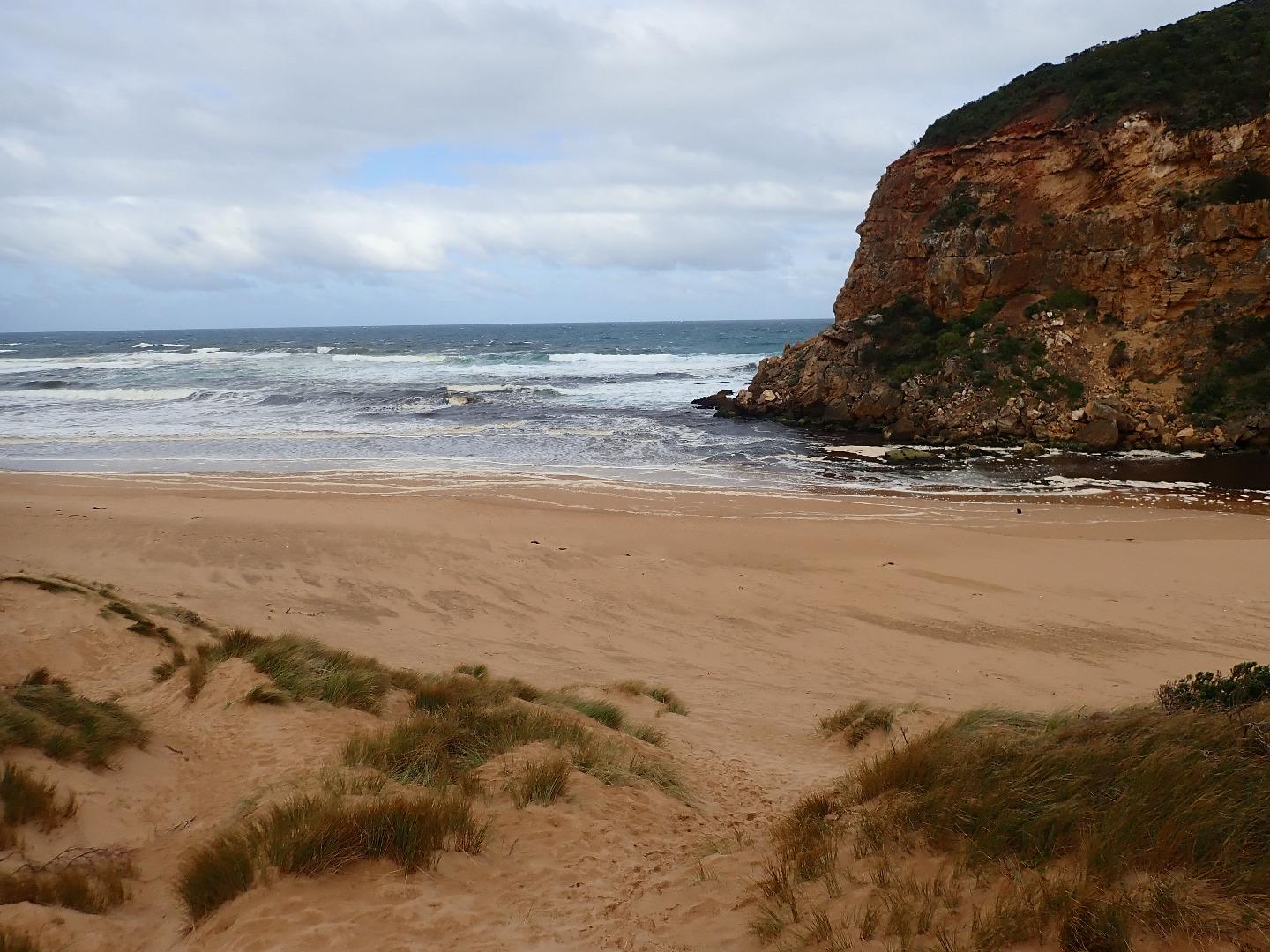
Mouth Observation
| Mouth state | Open |
|---|---|
| Previous | O O O O O O O O O O O O O O O P C C C C C C C O O O O C C C C C C C C C O O O O O C O O O O O O O O O O O O O O O O |
| Flow Present? | Yes |
| Previous | Y Y Y Y Y Y Y Y Y Y Y Y Y Y Y N N N N N N N N Y Y Y Y N N N N N N N N N Y Y Y Y Y N Y Y Y Y Y Y Y Y Y Y Y N Y Y Y Y |
| Flow Direction | Out |
| Previous | O O O O O O O O O O O O O O O N N N N N N N N O I O O N N N N N N N N N O O O O O N O I O O O I O O I O O N O I O O |
| Above Sea | Above Estuary | |
|---|---|---|
| Berm Height (m) | ||
| Berm Length (m) |
Physical Condition
| Current | Mode | |
|---|---|---|
| Wind Direction | South | |
| Beaufort Scale | Strong breeze | |
| Sea State | Rough |


All content, files, data and images provided by the EstuaryWatch Data Portal and Gallery are subject to a Creative Commons Attribution License
Content is made available to be used in any way, and should always attribute EstuaryWatch and www.estuarywatch.org.au