EstuaryWatch Data Portal
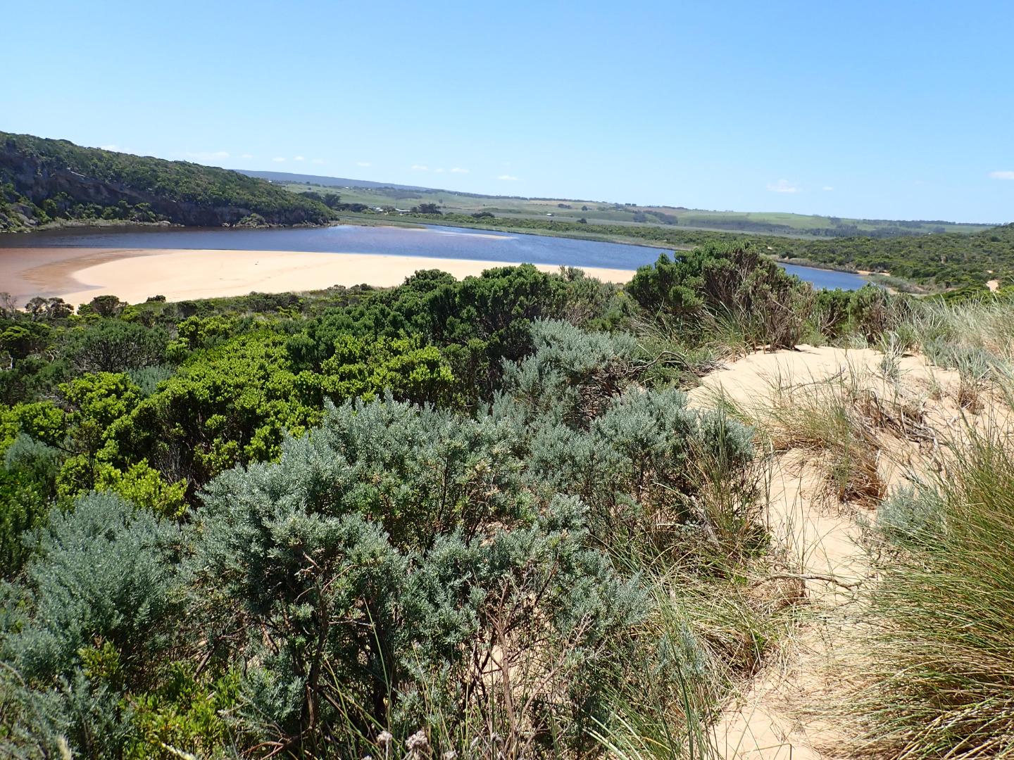
GMC Gellibrand River Estuary Mouth Observation Site
16 November 2018
Observation details
Overview
| Estuary | Gellibrand River Estuary |
|---|---|
| Site | Gellibrand River Estuary Mouth Observation Site |
| Observation ID | #12714 |
| Date and Time | Friday 16th November 2018 11:25am |
| Approved | Approved |
Notes
AHD G6 0.88 @ 08.40 estimate only as board is covered with silt
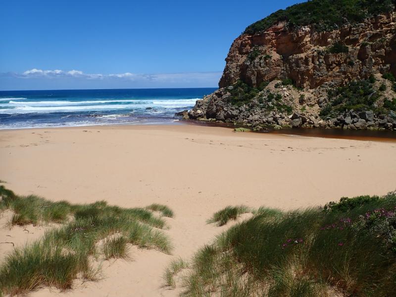
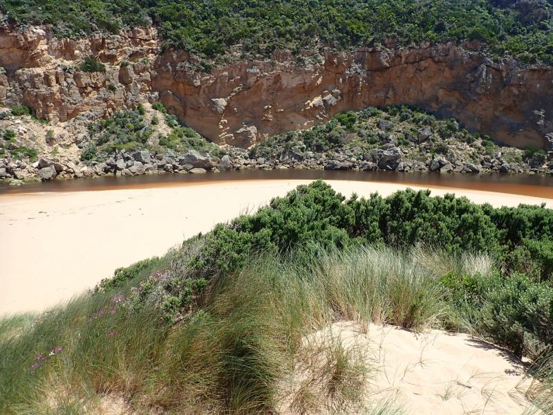
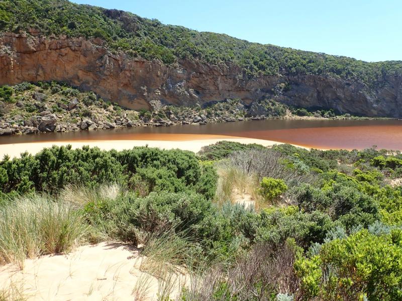
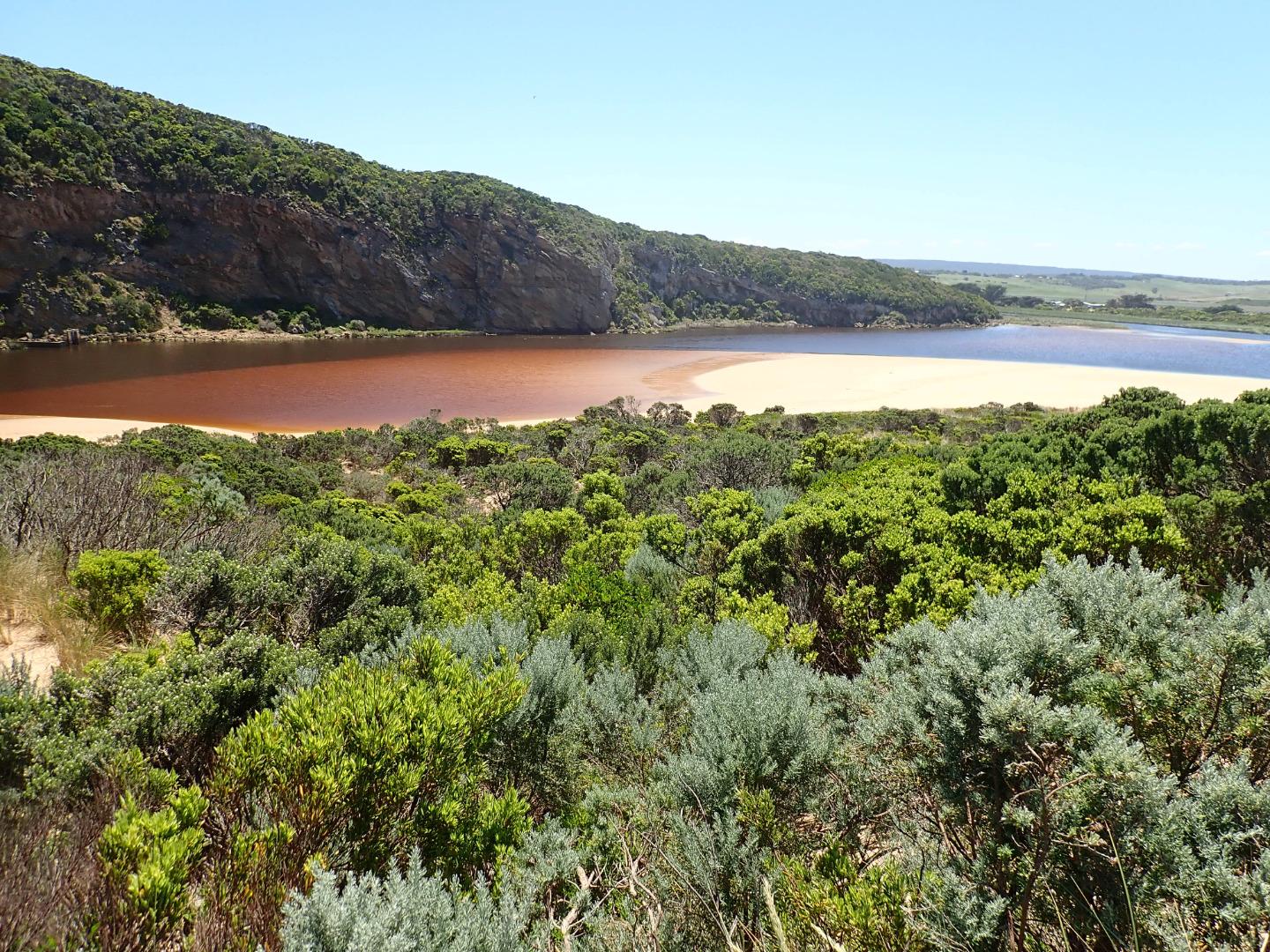
Dark discharge out over shallow opening going close to foreshore for about 40m to east. Longshore drift across entrance.
Sand is building up in channel more shallow & narrow. Large amount of sand in breakers all along beach. Sand is very high at east end of beach.
Sandbar is exposed in estuary
Bright blue damsel fly in area of low track
Mouth Observation
| Mouth state | Open |
|---|---|
| Previous | O O O O O O O P C C C C C C C O O O O C C C C C C C C C O O O O O C O O O O O O O O O O O O O O O O O O O O O C |
| Flow Present? | Yes |
| Previous | Y Y Y Y Y Y Y N N N N N N N N Y Y Y Y N N N N N N N N N Y Y Y Y Y N Y Y Y Y Y Y Y Y Y Y Y N Y Y Y Y Y Y Y Y Y N |
| Flow Direction | Out |
| Previous | O O O O O O O N N N N N N N N O I O O N N N N N N N N N O O O O O N O I O O O I O O I O O N O I O O O O O O O N |
| Above Sea | Above Estuary | |
|---|---|---|
| Berm Height (m) | ||
| Berm Length (m) |
Physical Condition
| Current | Mode | |
|---|---|---|
| Wind Direction | South-East | |
| Beaufort Scale | Moderate breeze | |
| Sea State | Rough |


All content, files, data and images provided by the EstuaryWatch Data Portal and Gallery are subject to a Creative Commons Attribution License
Content is made available to be used in any way, and should always attribute EstuaryWatch and www.estuarywatch.org.au