EstuaryWatch Data Portal
GMC Gellibrand River Estuary Mouth Observation Site
23 April 2019
Overview
| Estuary | Gellibrand River Estuary |
|---|---|
| Site | Gellibrand River Estuary Mouth Observation Site |
| Observation ID | #12889 |
| Date and Time | Tuesday 23rd April 2019 09:00am |
| Approved | Approved |
Notes
AHD G6 about 0.98 @ 08:40 AHD board still covered with silt
Observations made close to very low tide 0.1 @ 07:12
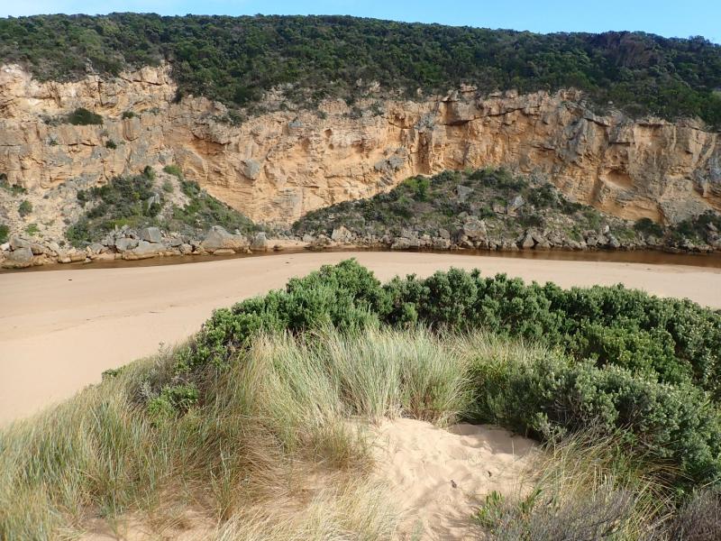
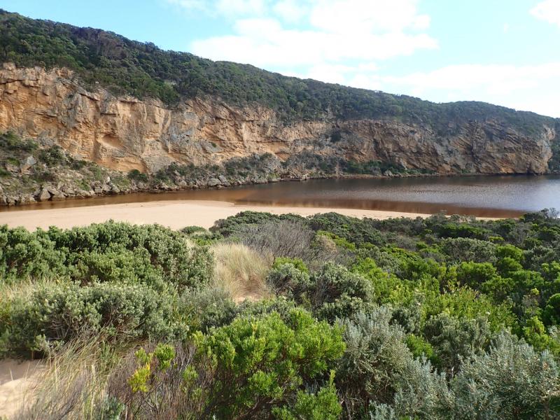
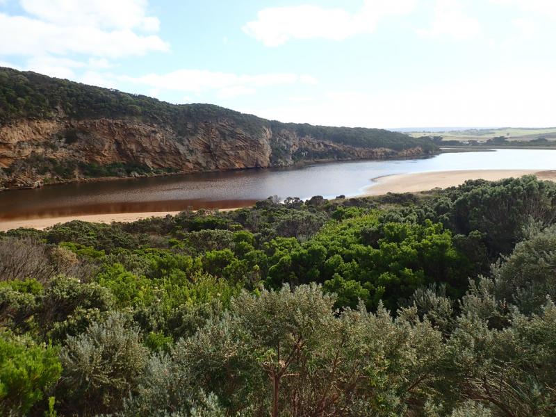
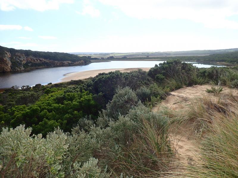
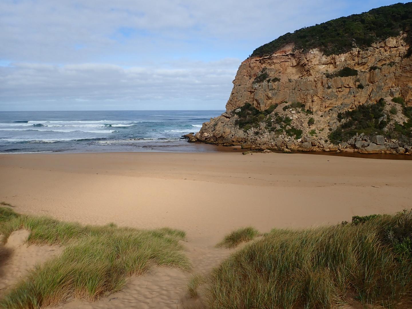
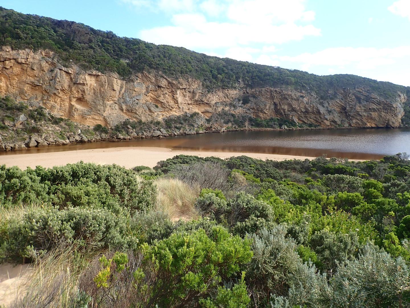
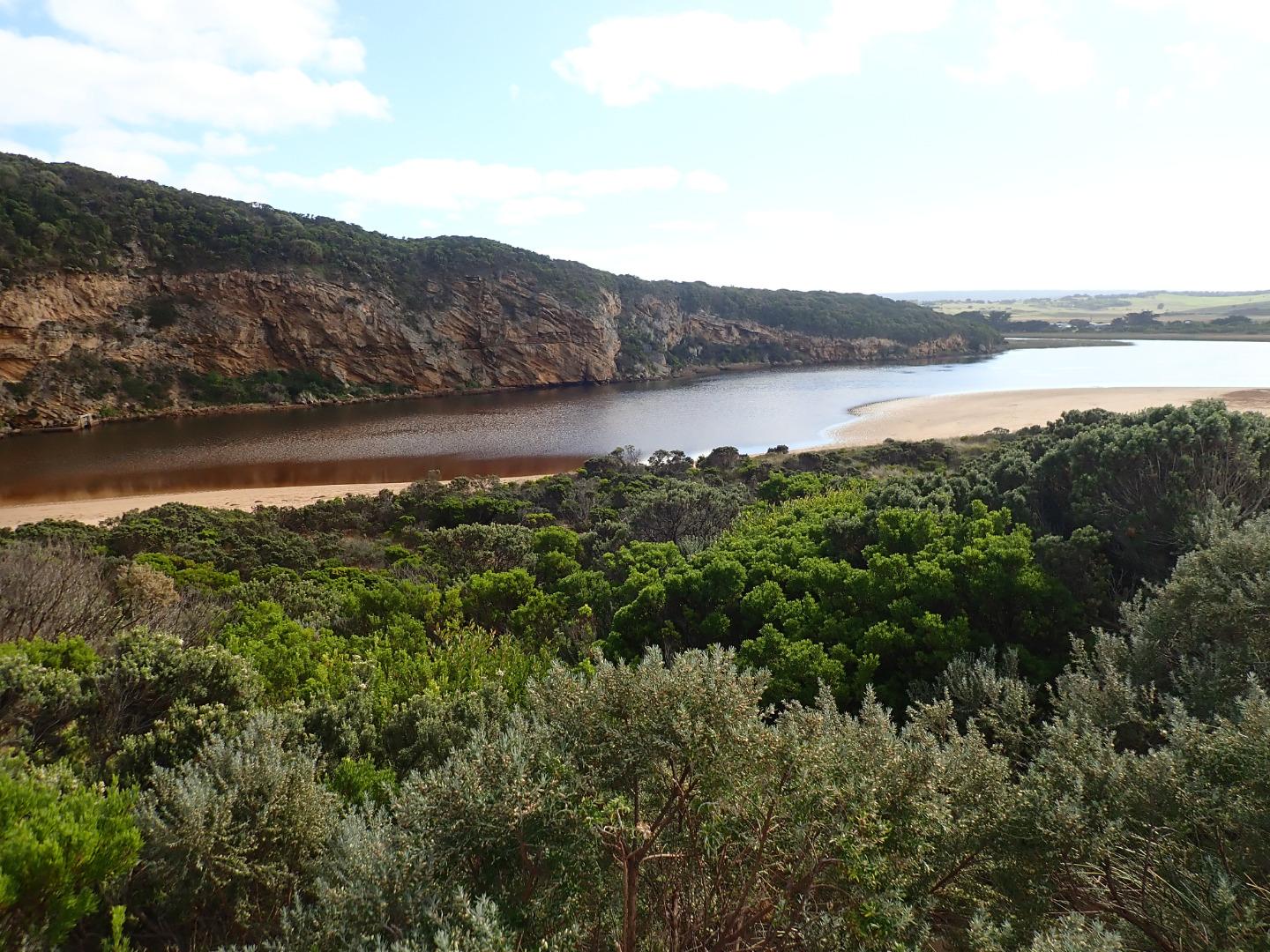
Very pale thin discharge out to sea & along to sand projection at mid beach. Out flow very shallow - channel about 20m wide .5 to .15 deep. at start of estuary. At mid channel it narrows to about 8m.then becomes more shallow & wider around rocks.Flow spreads very wide as waves enter at mouth. East side of channel has .20m sheer face as it approaches rocks.
Waves have been high up on beach at last hi tide. A large sand projection has formed at mid beach with area of beach behind scoured out. Strong longshore drift from east end travelling to spit where it meets incoming SW swell -large amount of sand visible in waves going out to sea. Only occasional longshore drift across mouth meeting small outflow & strong sw swell resulting in some waves going up the channel - large amount of sand visible in breakers around mouth. While sea is moderate there are higher wave sets are occurring
Mouth Observation
| Mouth state | Open |
|---|---|
| Previous | O O C O O O O O O O O O O O O O O O O O O O O O C O O O O C O O O O O O C C C C C C C C O O O C C C C C O P C C C O O O O O O |
| Flow Present? | Yes |
| Previous | Y Y N Y Y Y Y Y Y Y Y Y Y Y N Y Y Y Y Y Y Y Y Y N Y Y Y Y N Y Y Y Y Y Y N N N N N N N N Y Y Y N N N N N Y N N N N Y Y Y Y Y Y |
| Flow Direction | In |
| Previous | O O N O I O O O I O O I O O N O I O O O O O O O N O O O O N O O O O O I N N N N N N N N O O O N N N N N I N N N N O O O O I O |
| Above Sea | Above Estuary | |
|---|---|---|
| Berm Height (m) | ||
| Berm Length (m) |
Physical Condition
| Current | Mode | |
|---|---|---|
| Wind Direction | South-West | |
| Beaufort Scale | Light Breeze | |
| Sea State | Moderate |


All content, files, data and images provided by the EstuaryWatch Data Portal and Gallery are subject to a Creative Commons Attribution License
Content is made available to be used in any way, and should always attribute EstuaryWatch and www.estuarywatch.org.au