EstuaryWatch Data Portal
Estuary event details
| Estuary | Barwon River Estuary |
|---|---|
| Region | Corangamite CMA |
| Event type | Unusual/Extraordinary occurrence! |
| Date and time | 15 August 2013 13:41pm |
| Description |
The usual navigation channel under the bridges and identified with lateral marks implying safe water, a significant sand bar developed which didn¿t give the usual minimum clearance of water of about 1m depth. There hadn¿t been the water movement to scour the bar over the past two months, a permit was sought from DEPI for a trial sand excavation (dredging) which we gained. The long reach excavator was used, 18m arm reach. The excavation of sand and seaweed was approved to the pre-existing river bed, the harder surface was recognized by the excavator operator. Excavated material was moved up the beach by a 4ed backhoe and placed above the usual high tide line. The river conditions in the end of last week with some storm flow through the system scoured some sand from the channel though took sand off the east (OG)edge. That change of condition impacted the operation of the excavator as it could not place itself as near the navigation channel as desired especially at the pedestrian bridge. The excavator works could not reach in under the pedestrian bridge, a limit on the overall benefit. |
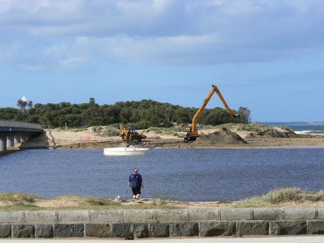
Barwon Dredging photo 1
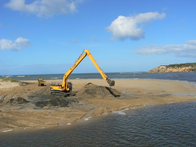
Barwon Dredging photo 2

All content, files, data and images provided by the EstuaryWatch Data Portal and Gallery are subject to a Creative Commons Attribution License
Content is made available to be used in any way, and should always attribute EstuaryWatch and www.estuarywatch.org.au