EstuaryWatch Data Portal
| Estuary | Painkalac Creek Estuary |
|---|---|
| Region | Corangamite CMA |
| Event type | EstuaryWatch Monitoring Group notices & meetings |
| Date and time | 21 July 2022 00:00am |
| Description |
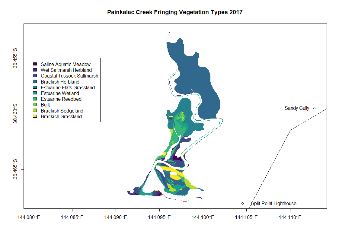
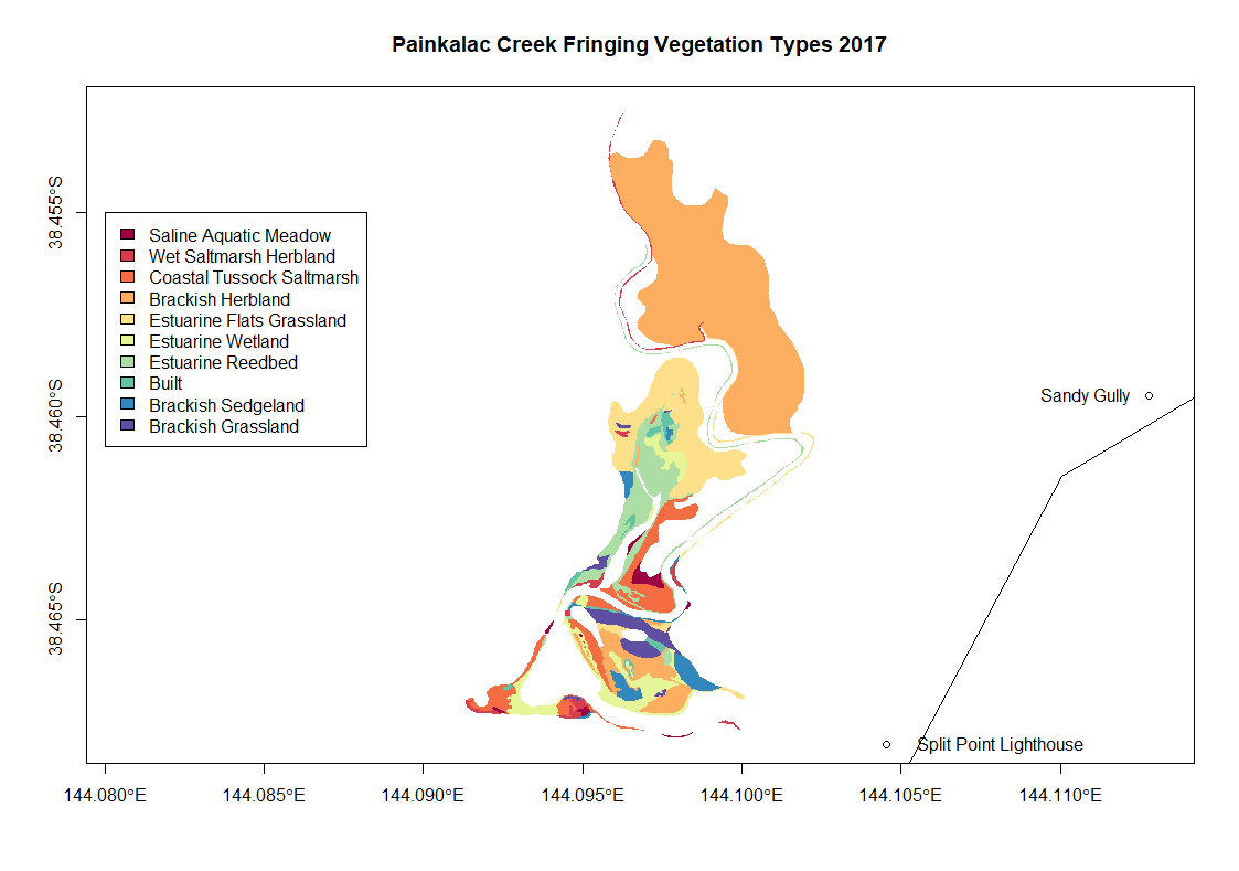
Painkalac Creek fringing vegetation type maps from 2017 These maps have been made by one of EstuaryWatch team Evy Gomm using open source data collected by Sinclair and Kohout 2018 The online data source is: https://discover.data.vic.gov.au/dataset/index-of-estuarine-condition-estuarine-fringing-vegetation The report where the data collection methods are described is attached: Sinclair, S.J. and Kohout, M. (2018). Assessment of fringing vegetation for the index of estuary condition. Arthur Rylah Institute for Environmental Research Technical Report Series No. 290. Department of Environment, Land, Water and Planning, Heidelberg, Victoria.
|

All content, files, data and images provided by the EstuaryWatch Data Portal and Gallery are subject to a Creative Commons Attribution License
Content is made available to be used in any way, and should always attribute EstuaryWatch and www.estuarywatch.org.au