EstuaryWatch Data Portal
Estuary event details
| Estuary | Barham River Estuary |
|---|---|
| Region | Corangamite CMA |
| Event type | Weather Event |
| Date and time | 13 December 2008 12:00pm |
| Description |
On the 13th Dec. there was a small flood on the Barham River. Photos 1 & 2 show the flood water meeting Medium to Large Swell at the River Mouth. The estuary water level is 1.6mAHD and the tide reading is 0.52mAHD Photo 3 is the fish platform with the floodwater peaking at 1.66mAHD. Photo 4 is the fish platform 3 days after the flood. The wooden platform is covered with river sediment. The estuary water level is 0.5mAHD. The river mouth has been scoured out by the flood down to the rock platform. Photo 5 is of the river mouth at 7pm on the 16/12/08. The lowest water level I have recorded for the Barham estuary is 0.363mAHD on the 23/12/08. Prior to the flood scouring out the river mouth: the river mouth was open, water out and the estuary water level at .843mAHD. |
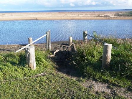
Fishing platform after flood
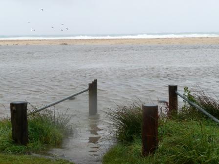
Fishing platform during flood
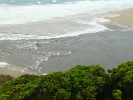
Floodwaters meeting ocean swell
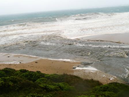
Floodwaters meeting ocean swell
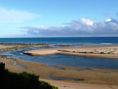
River Mouth after being scoured out to the rock platform by floodwaters.

All content, files, data and images provided by the EstuaryWatch Data Portal and Gallery are subject to a Creative Commons Attribution License
Content is made available to be used in any way, and should always attribute EstuaryWatch and www.estuarywatch.org.au