EstuaryWatch Data Portal
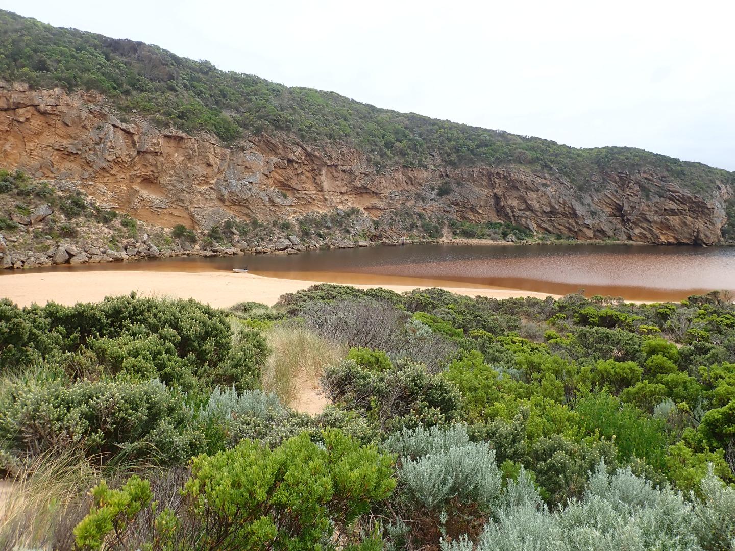
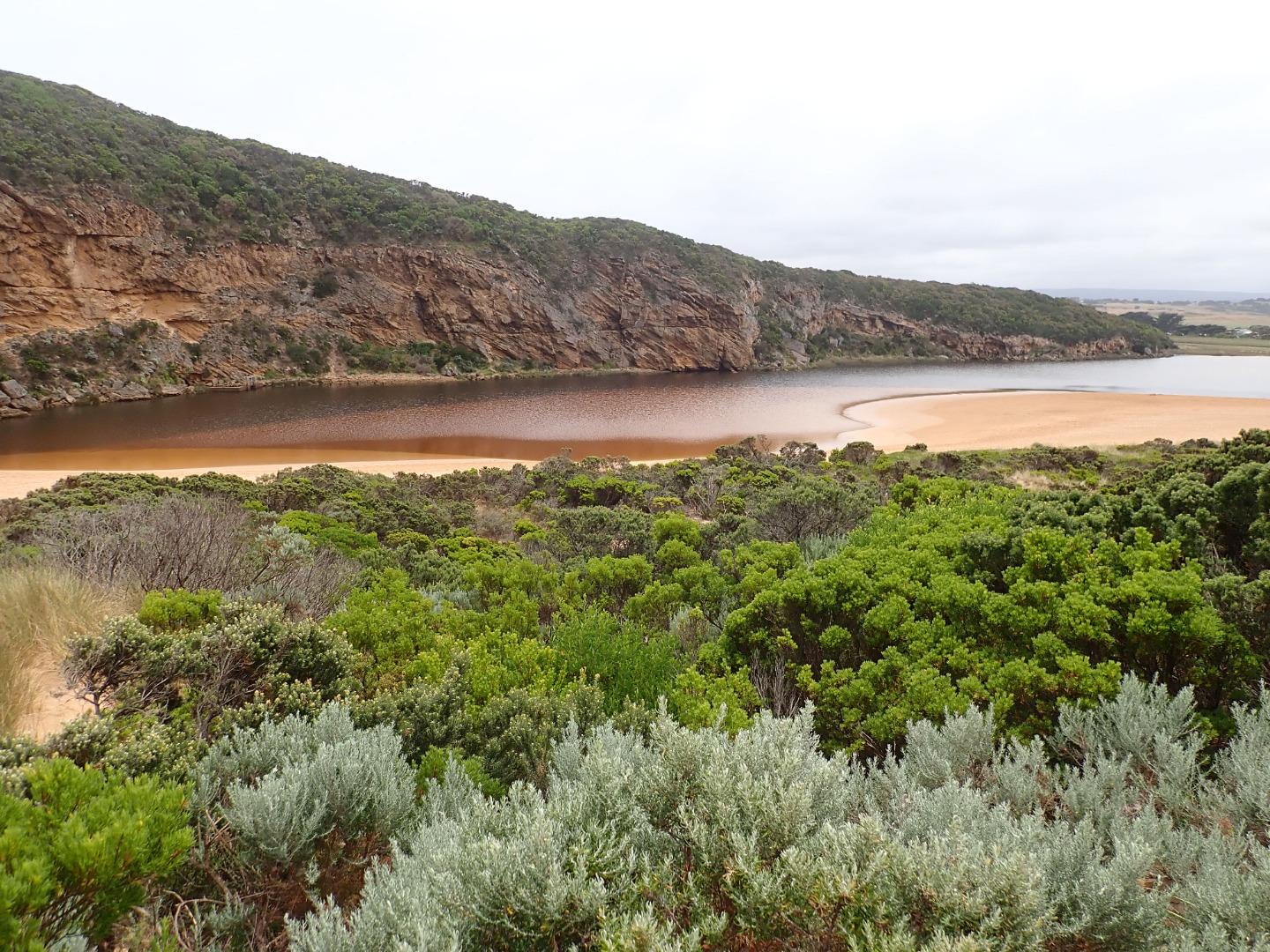
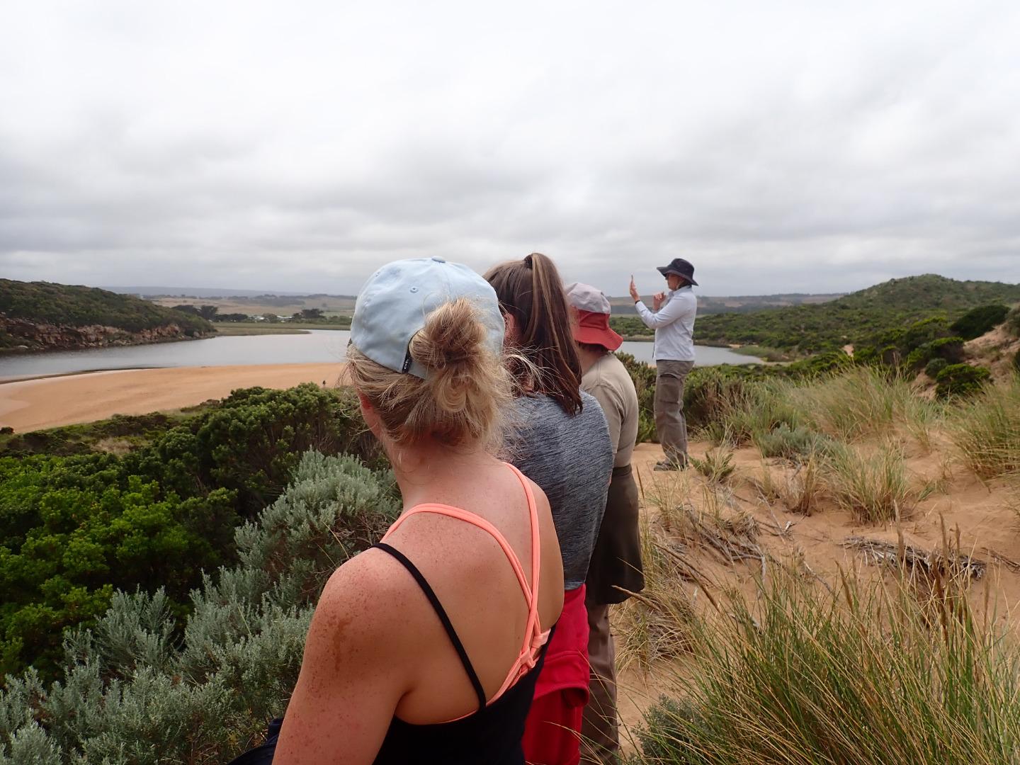
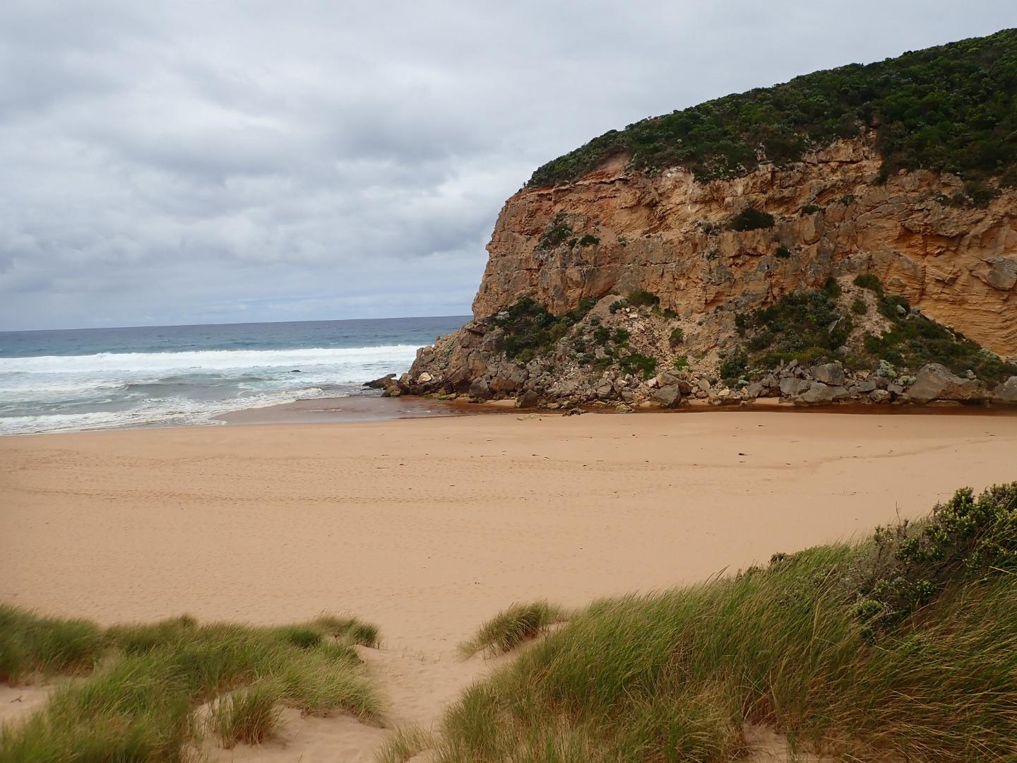
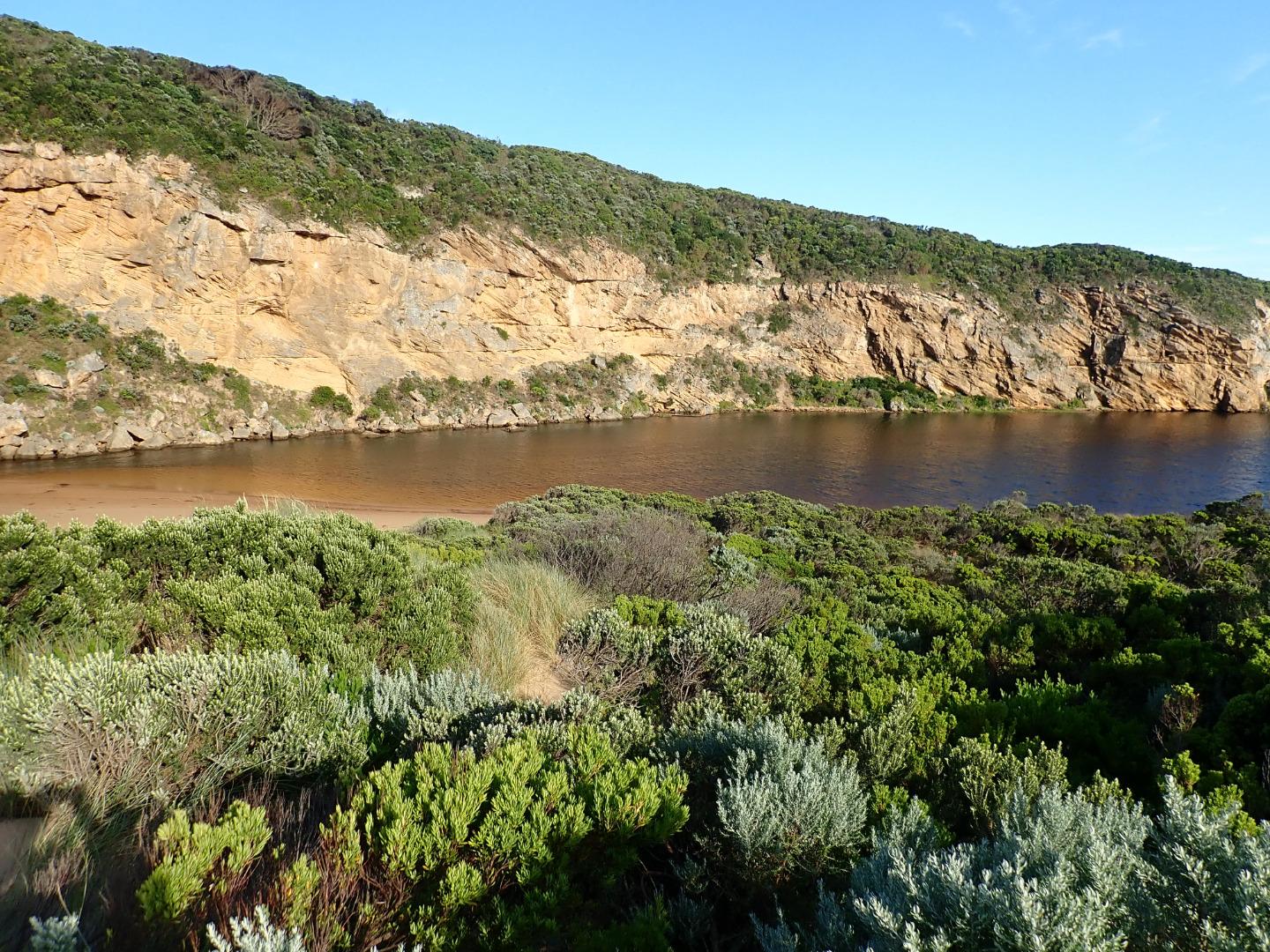
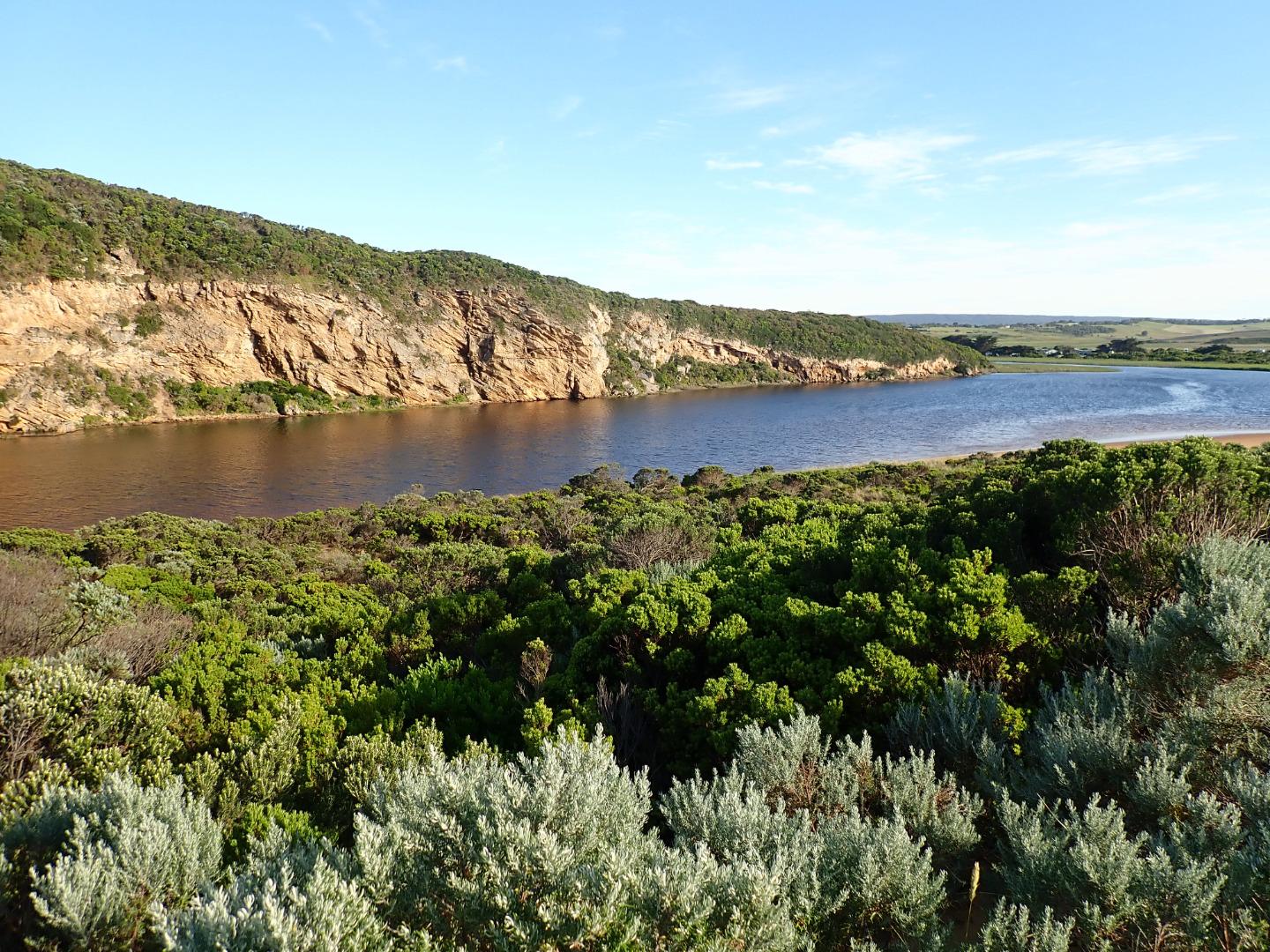
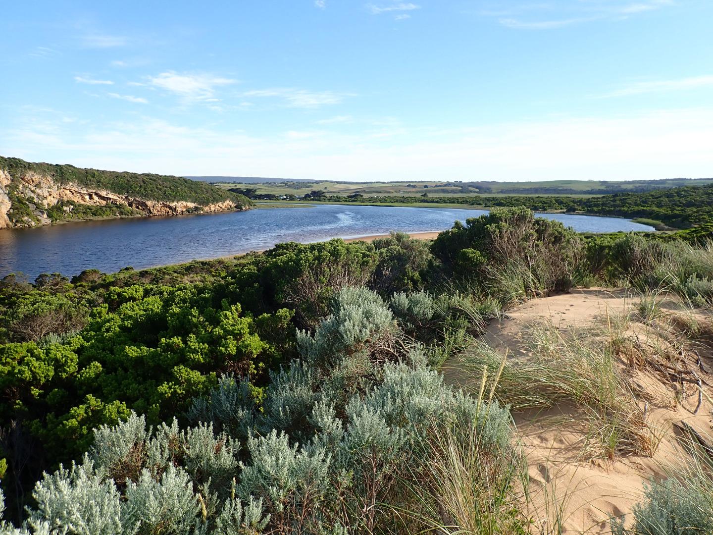
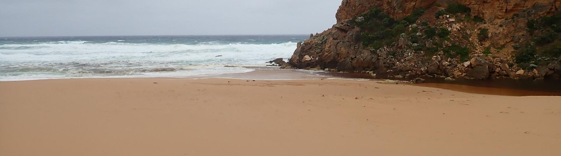
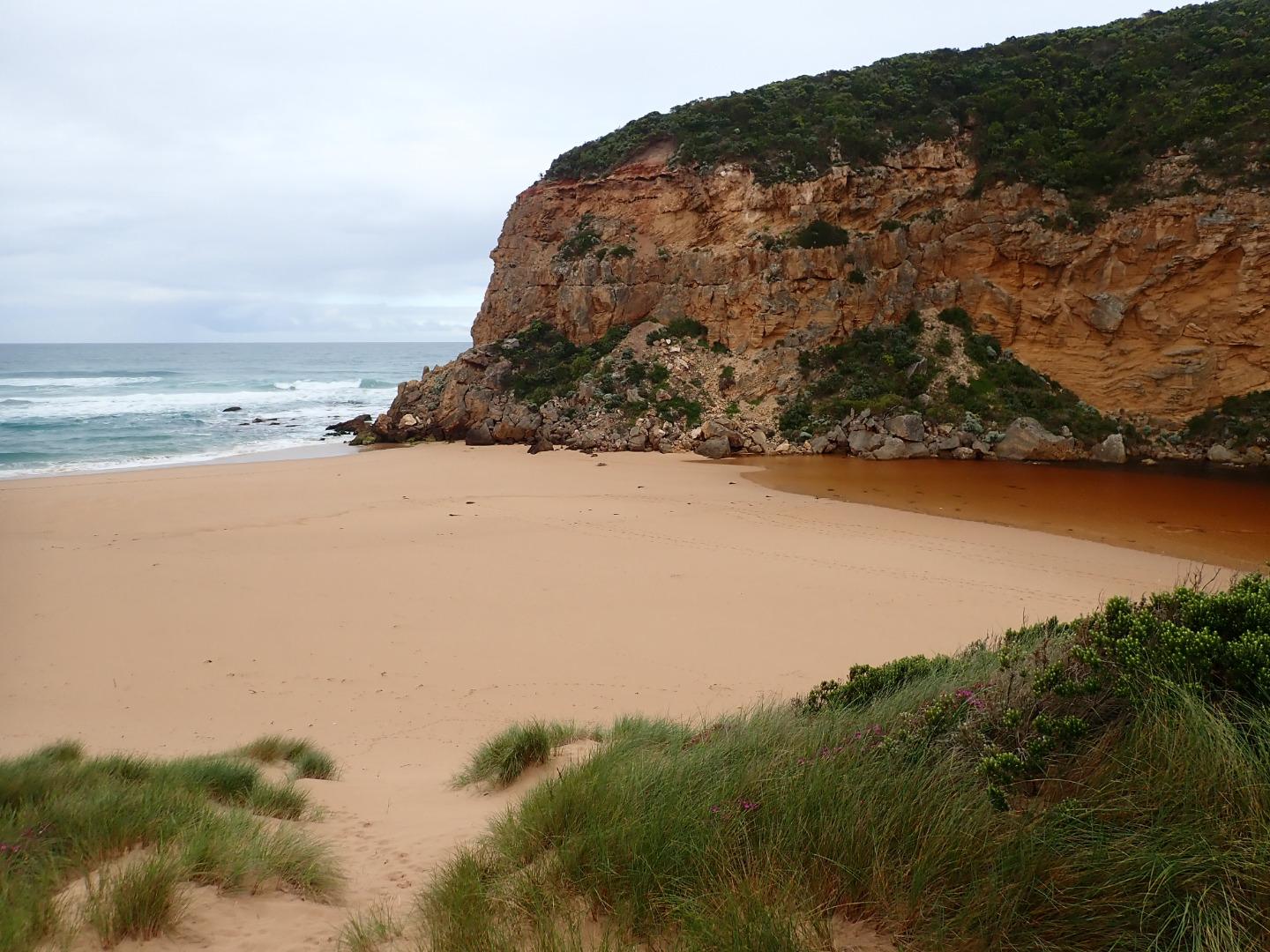
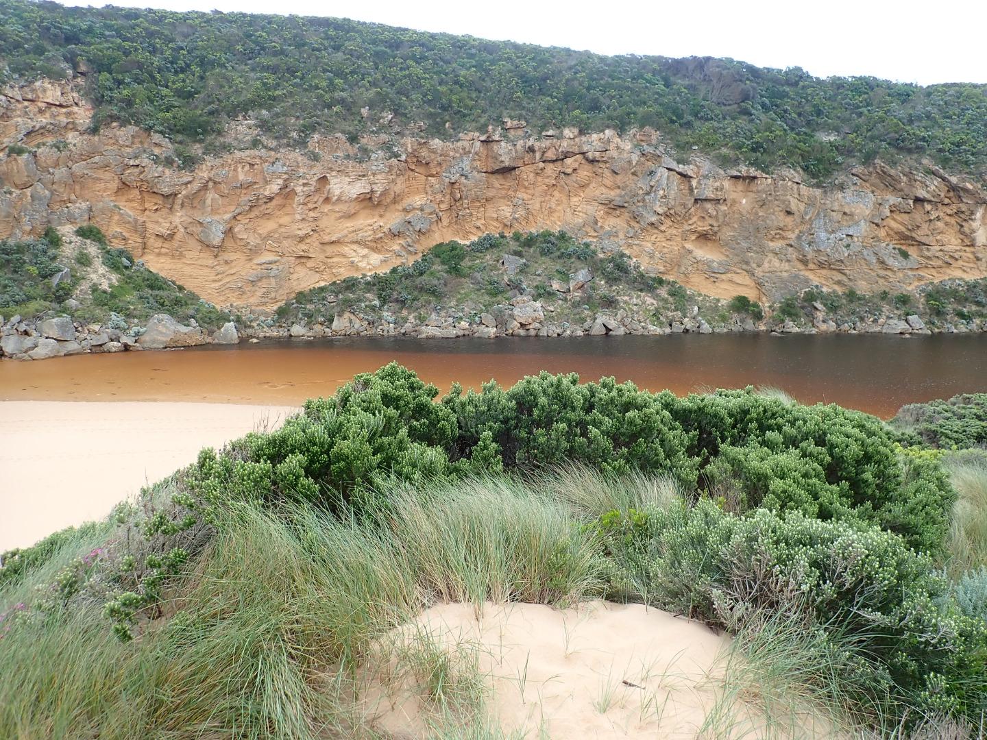
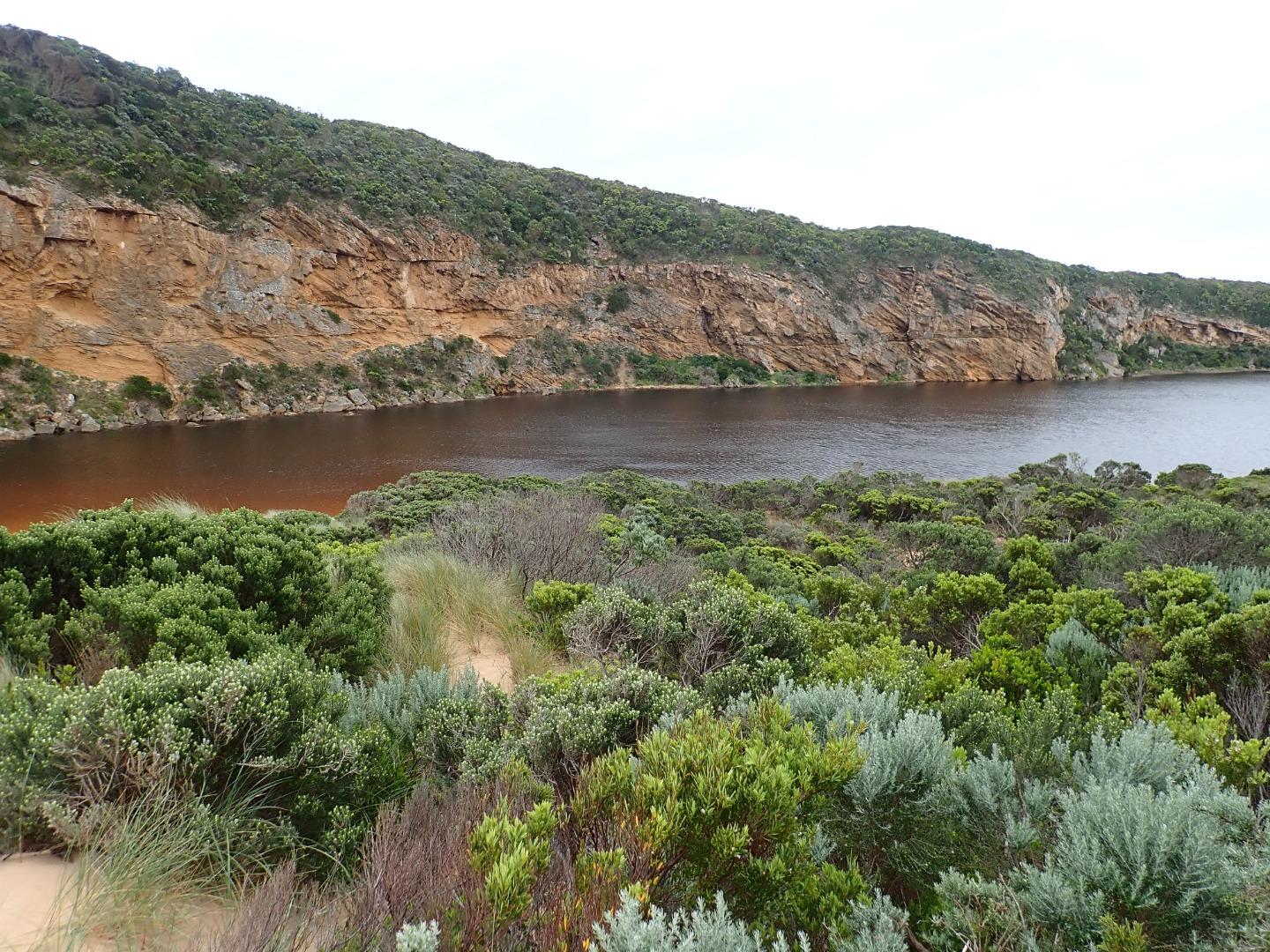
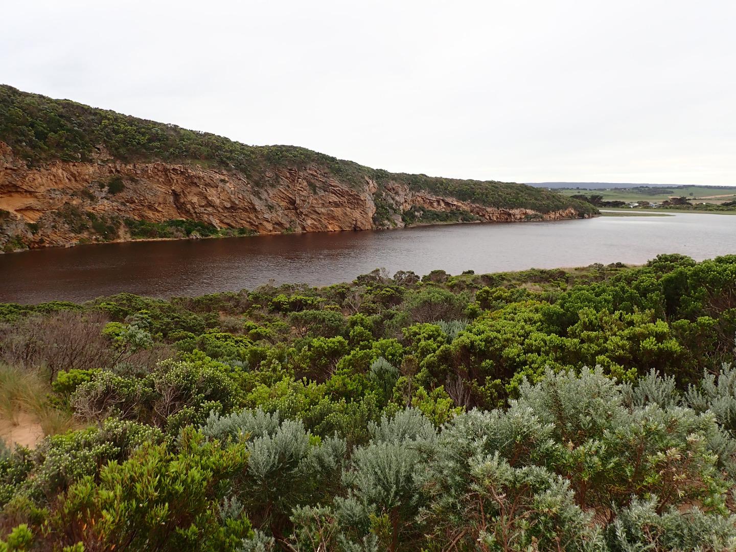
GMC Gellibrand River Estuary Mouth Observation Site
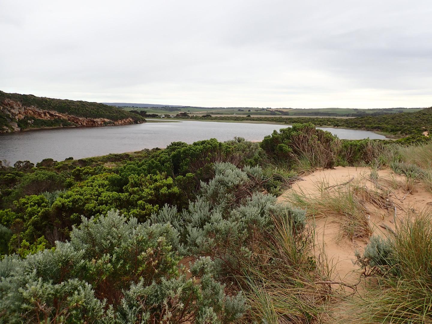
Active Mouth Condition 20-04-2007 - 19-04-2024Gellibrand River Estuary
| ID | Date | Status | Details | |
|---|---|---|---|---|
| #12655 | 18 Jan 2019 | Approved |
Notes:
AHD G6 estimated to be about 0.69 @ 09:03 (board still covered with silt) Only very slight pale discharge out around mouth flowing across an area of high sand build up both at entrance & along channel. Flow is restricted to 2 narrow channels through rocks. Sand is high at east end & mid beach up to about 50m. from entrance where it drops down gradually. The higher mid beach area projects out to sea. The 2 separate bays recently formed remain. WSW/sw swell impacting beach causing strong backwash & longshore drift at entrance, also some waves from swell curving around at entrance. Last high tide travelled high up on beach continuing into estuary |
|
| #12649 | 15 Jan 2019 | Approved |
Notes:
AHD G6 0.72 estimate only as board covered with silt Dense sea fog drifting down channel prevented observations from being taken from actual Gp1 site Weak pale shallow out flow over increased sand build up in channel, especially around rocks & downstream across a wide area at mouth. The beach is highest at mid beach where a wide area projects out to sea dividing beach & creating 2 separate bays. Highest area is only 50m from where it slopes down entrance. Swell & rough sea impacting on west side of projection creating longshore drift across the mouth, striking cliff & going over the top of rocks resulting in occasional small waves entering down channel |
|
| #12635 | 10 Jan 2019 | Approved |
Notes:
Very slight pale discharge flowing through shallow area in channel & over sand build up downstream of rocks, then turning east along beach front. Rough sea creating backwash & longshore drift across entrance over weak outflow -some small waves entering channel & travelling up into estuary. Waves in all directions at entrance. High sand at mid beach now extending further out to sea two distinct bays are starting to form along beach. Sand slopes down to entrance Very large no. small fish in shallows along E side of estuary Many campers, & walkers around. Also many large caravans across bridge @ G2 making monitoring difficult 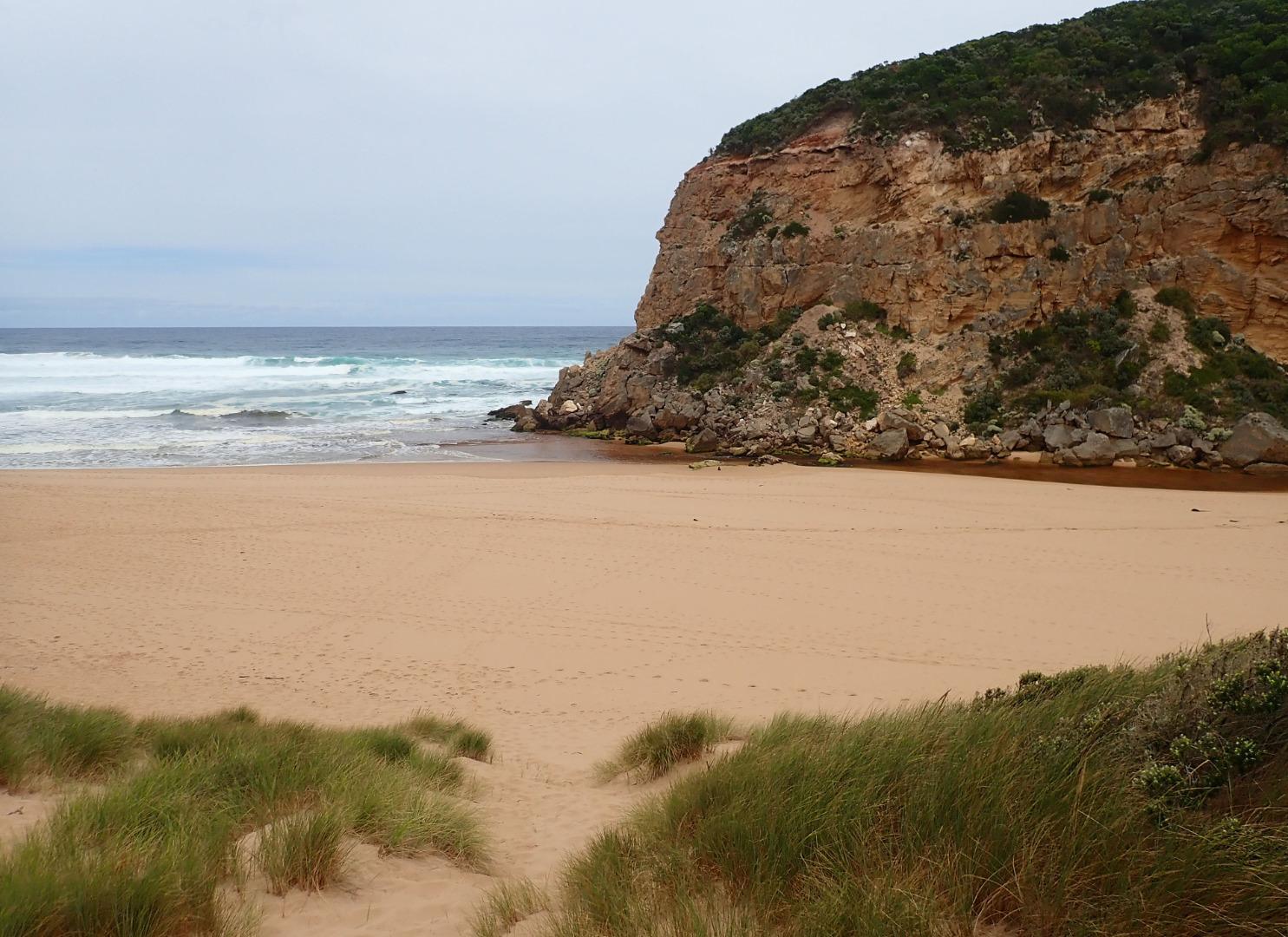 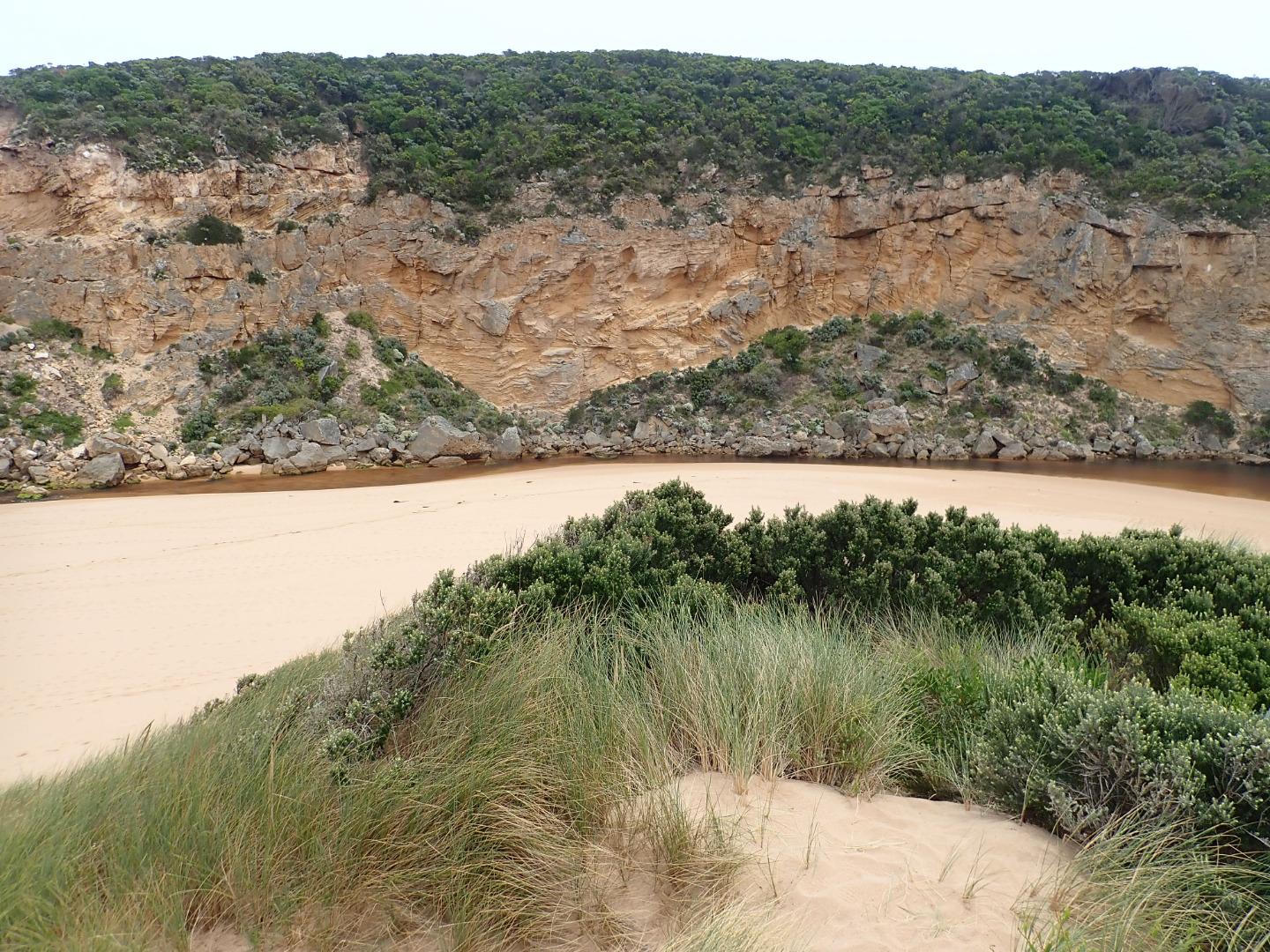 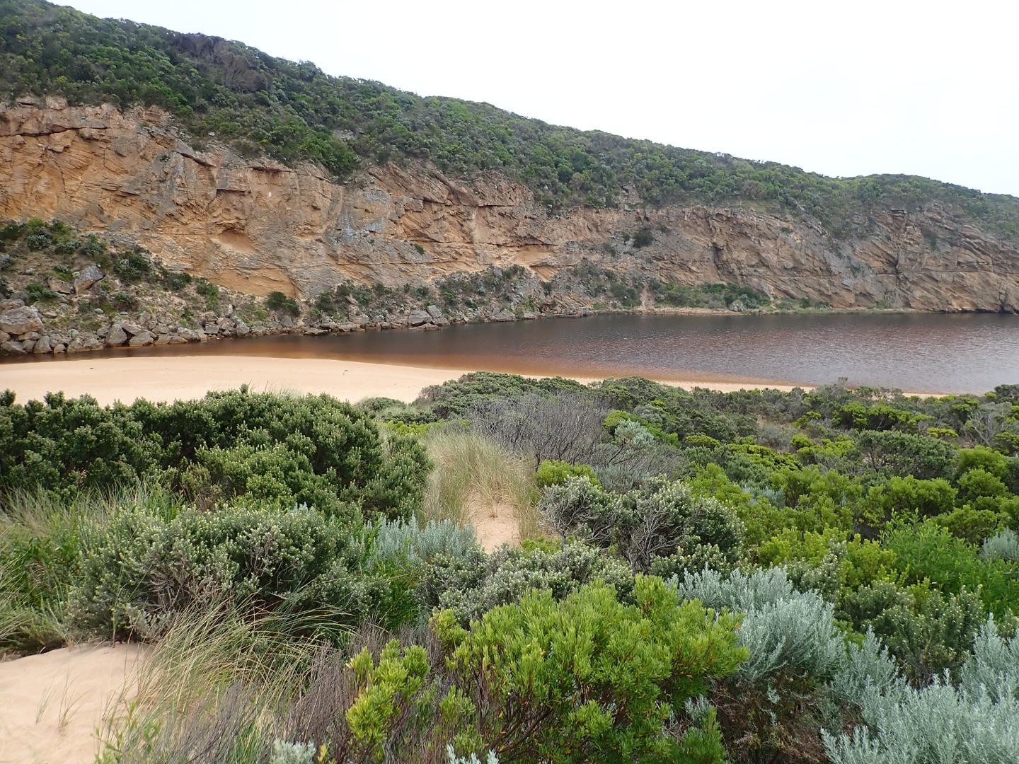 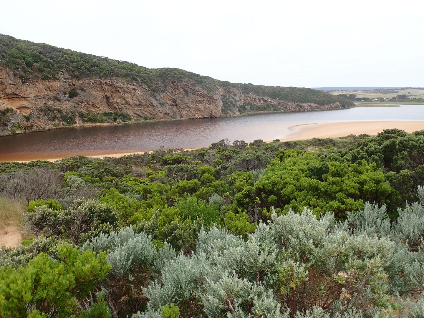 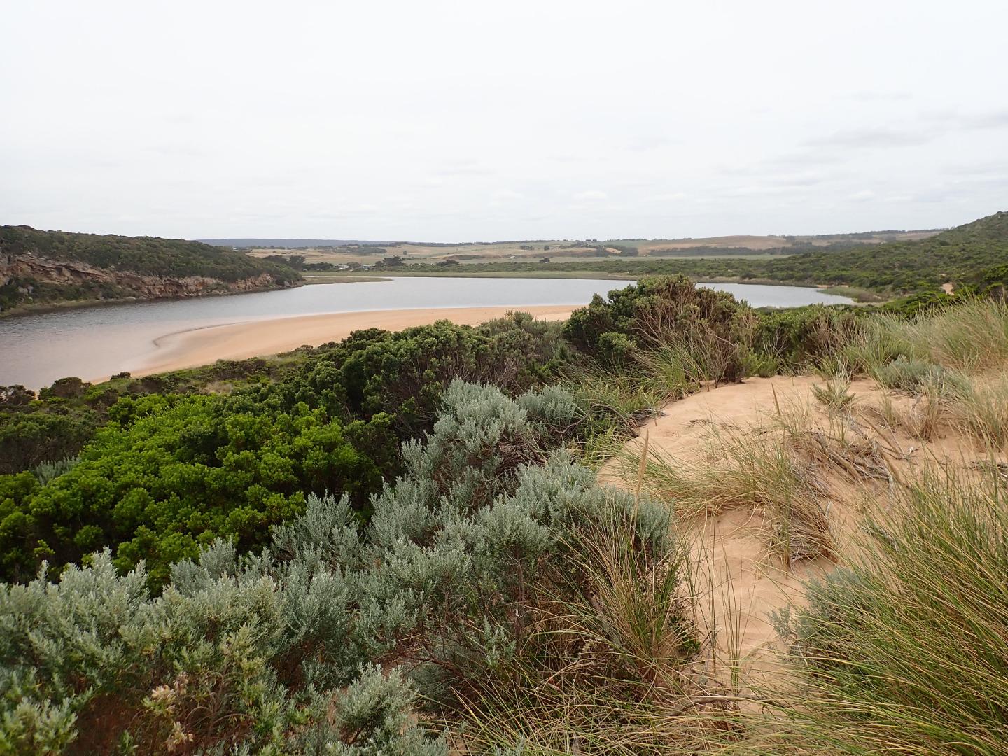 |
|
| #12625 | 6 Jan 2019 | Approved |
Notes:
AHD @ G6 1.02 @ 09:33 Mouth re opened sometime over 05 & 06-01-19. shallow narrow flow (area around rocks about 5-6 m.) Pale discharge out around mouth & paler along foreshore. Slight sheer edge to channel indicates a recent rapid flow. Longshore drift across mouth over outflow & curving incoming SW swell Rough sea & early hi tide (1.14) sent waves very far up on the beach which remains high from east end up to 46m. to entrance where it drops down |
|
| #12620 | 3 Jan 2019 | Approved |
Notes:
No discharge from river only salt water intermittently entering & returning from incoming rough sea. High sand build up at entrance & along channel. Longshore drift, backwash & incoming sw swell meeting returning salt water at entrance. Last hi tide well up on beach Flow reducing AHD @ G6 about 0.90 (board covered with silt) More sand has been removed from the east end of beach but area is still high from there to about 50m from entrance Large no. small fish in shallow water along S & SE side of estuary. Low track has only partial water cover & no water on top track
|
|
| #12612 | 21 Dec 2018 | Approved |
Notes:
Pale discharge out to east along foreshore, strong SW swell impacting east end of beach scouring out 1-3 m. high sheer sand cliffs. Increased sand build up at entrance & along channel, more sand being deposited in that area by very strong (7) SE wind along beach Erosion continues at S & SE face of Pt Ronald with more rock fall |
|
| #12578 | 6 Dec 2018 | Approved |
Notes:
Strong dark discharge through narrow channel cascading down to lower level through rocks & out over a wide shallow area around entrance travelling to east after a recent release after last hi tide.(High seas & gale force winds on 03-12-18 caused a high sand build up that closed the mouth). Tide mark on beach indicated extent of last hi tide. Sheer 10-50 cm sides to channel gradually collapsing into fast out flow. Waves from SW swell impacting mid beach & E end. Slight longshore drift across entrance. |
|
| #12552 | 23 Nov 2018 | Approved |
Notes:
AHD G6 1.14 @ 14:03 Rainfall 30 ml. from 20 th -23 rd Nov Pale discharge out & slightly to east. Some small waves entering channel over a high sand build up, longshore drift across entrance with waves in all directions. Very large amount of sand in breakers all along the beach Strong SW swell of short time duration strongly impacting east end of beach leaving sheer face from 1-3 m high, longshore drift from there moving west to entrance. Wind from S at entrance & from SE along the beach where it is scouring the beach & dunes depositing sand in the channel |
|
| #12714 | 16 Nov 2018 | Approved |
Notes:
AHD G6 0.88 @ 08.40 estimate only as board is covered with silt Dark discharge out over shallow opening going close to foreshore for about 40m to east. Longshore drift across entrance. Sand is building up in channel more shallow & narrow. Large amount of sand in breakers all along beach. Sand is very high at east end of beach. Sandbar is exposed in estuary Bright blue damsel fly in area of low track 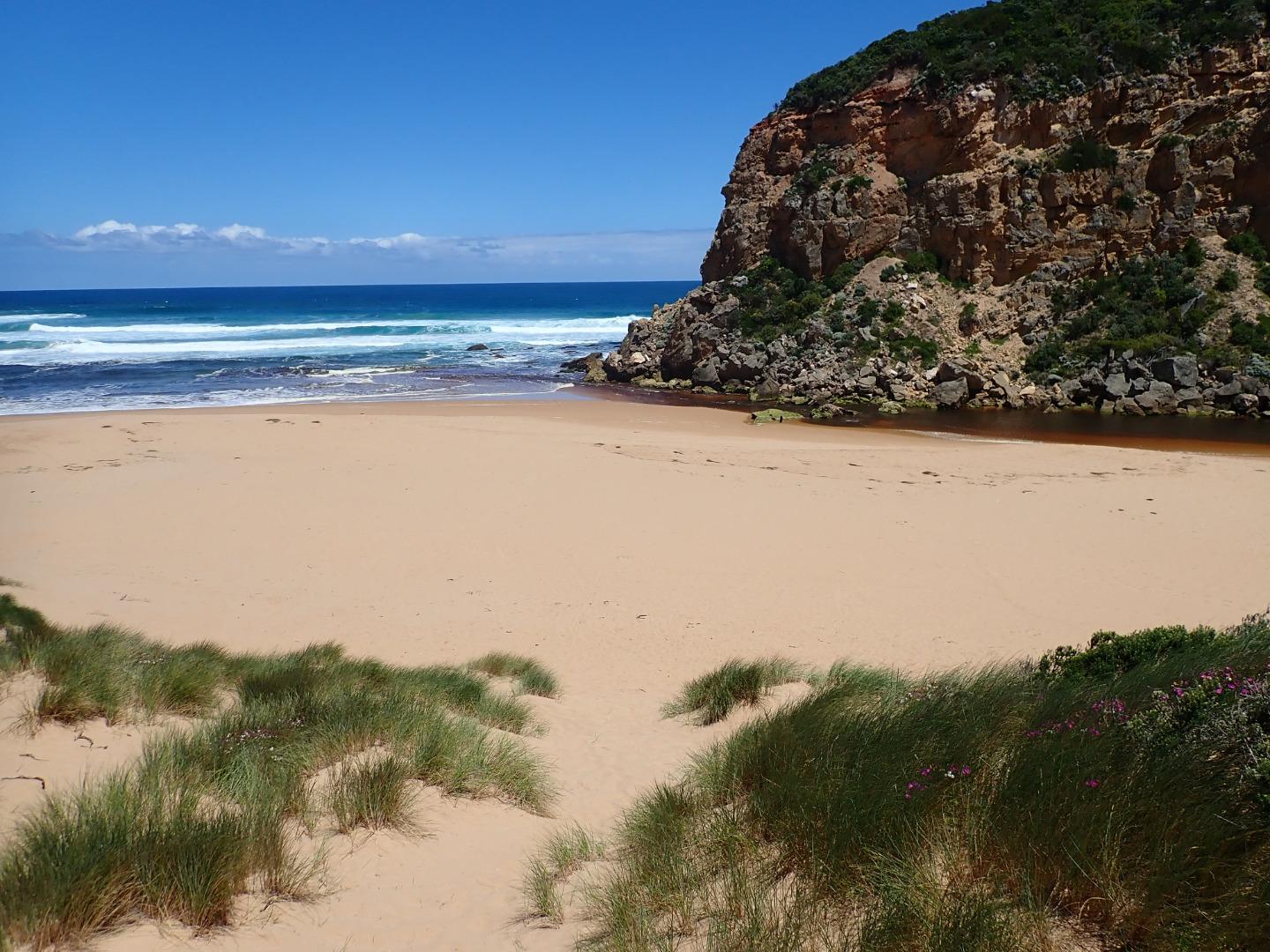 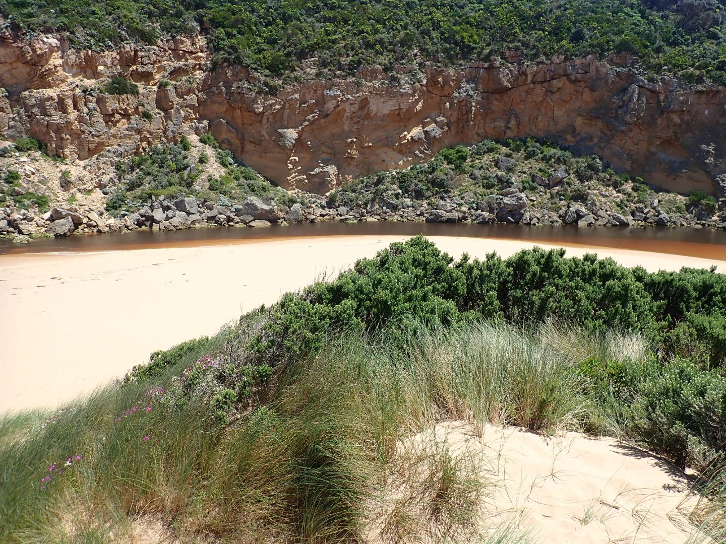 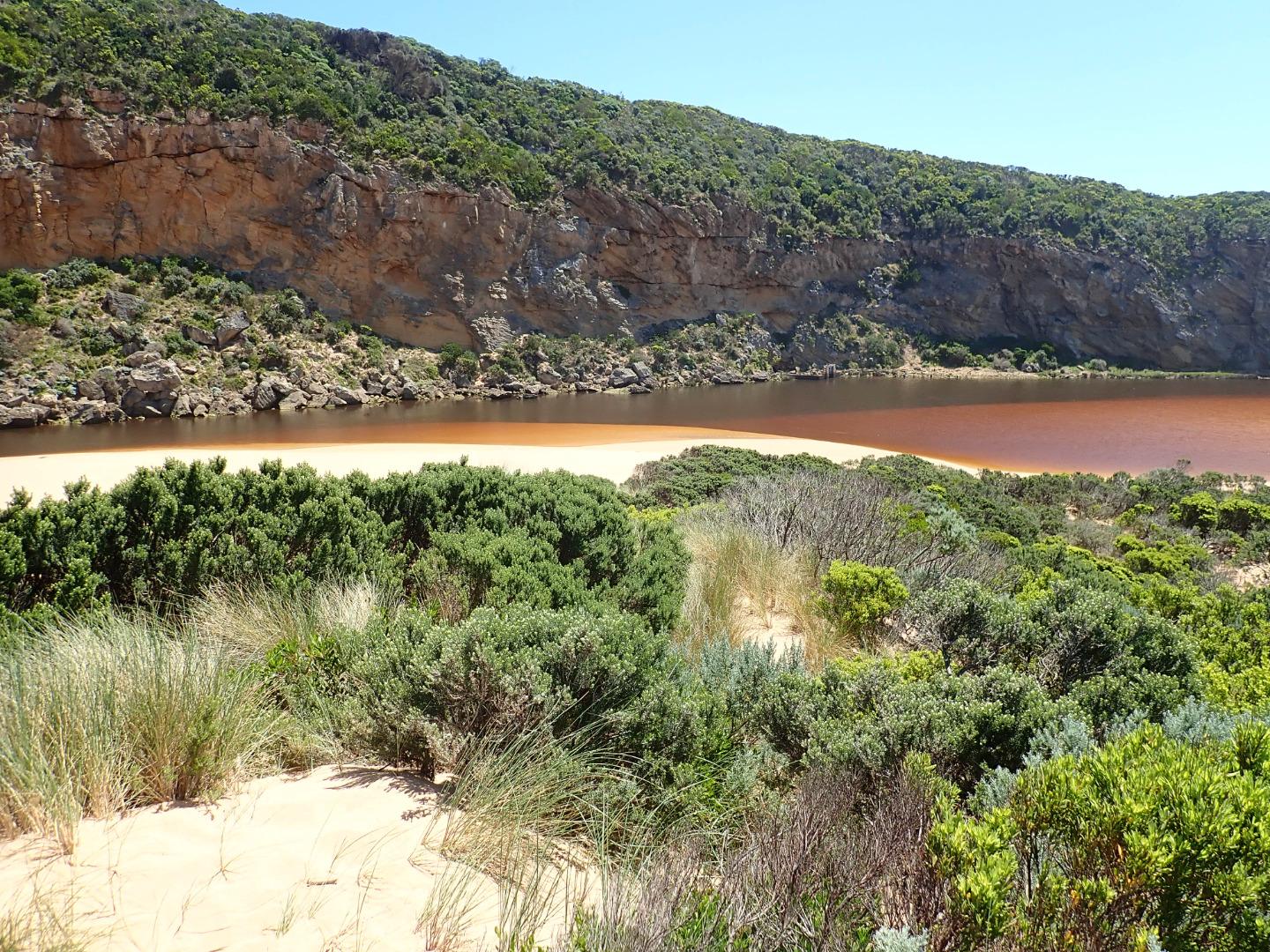   |
|
| #12514 | 9 Nov 2018 | Approved |
Notes:
Continuing rough seas & strong west winds over past days (6.3-6.1 swell height) on 03-11-18) have created a small low berm which was observed formed across mouth around 06-11-18 pm. The top of the middle rock was still uncovered. Waves had been over topping the berm at the last hi tide & entering the estuary - indicated by sand & swash line. Beach undulating with some very low areas. Sand very high at east end where sheer sided areas occur at the top of a steep decent to ocean - beach slopes down towards start of berm & entrance. Waves have been up to base of dunes in some areas - indicated by swash line which contained large dense areas of small shells, tiny crabs, shrimp, extremely small Janthina-janthina & larger 'By the wind sailors'. No water in camp ground or over any roads/tracks. Water up to the ocean car park along low track & up to the side of the recently raised OOR near flood markers (drains & sides of OOR are currently undergoing maintenance) Flood water occurs on both west & east flats @ Kangaroobie, G4 (Rivernook) flats are under water with wide flow through dip in causeway. US G4 water in drains only up to between G5&G4 . Upstream from there to G5 water covers large areas on both sides of channel. Water just starting to enter upstream of Coxon's track (G5) AHD @ G6 1.60 @ 07:15 rising to 1.61 @14:58 AHD @ G2 1.43 @ 07:15 rising to 1.46 @ 17:00 |
|

All content, files, data and images provided by the EstuaryWatch Data Portal and Gallery are subject to a Creative Commons Attribution License
Content is made available to be used in any way, and should always attribute EstuaryWatch and www.estuarywatch.org.au