EstuaryWatch Data Portal
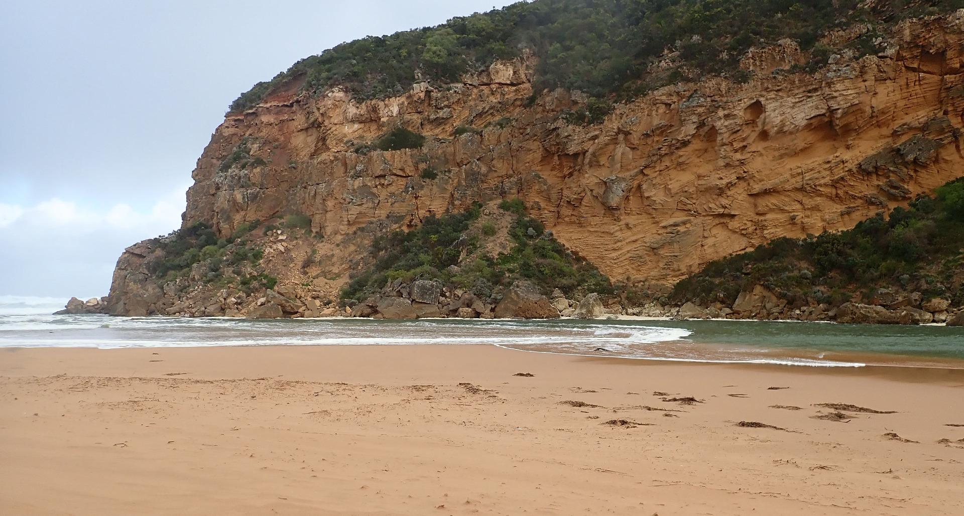
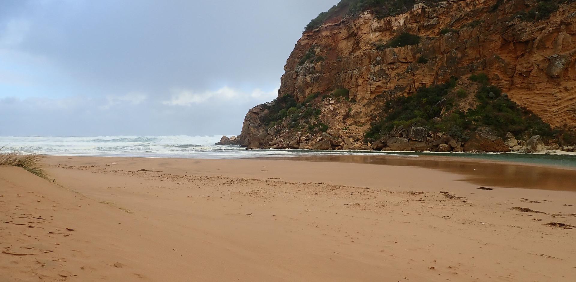
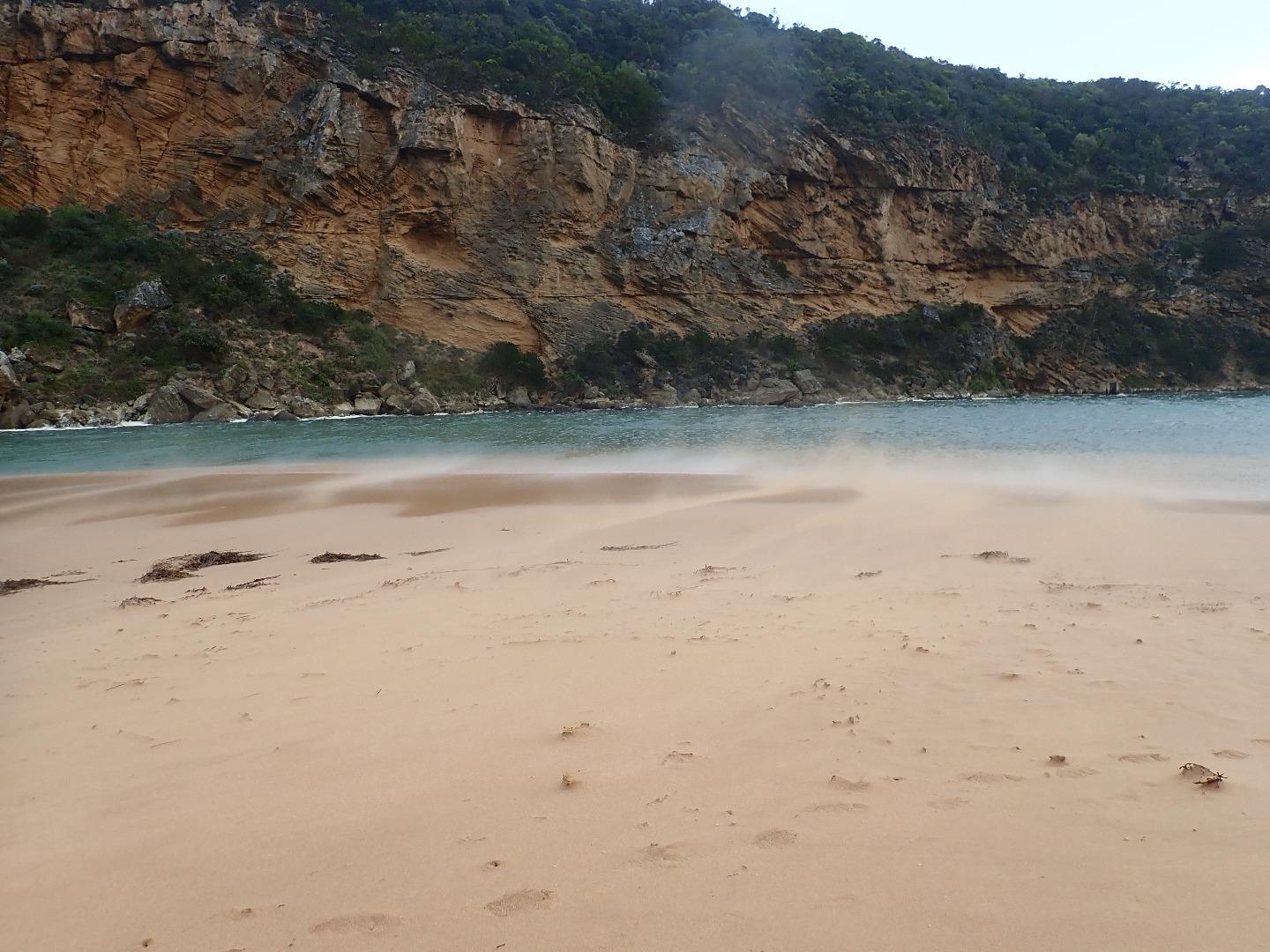
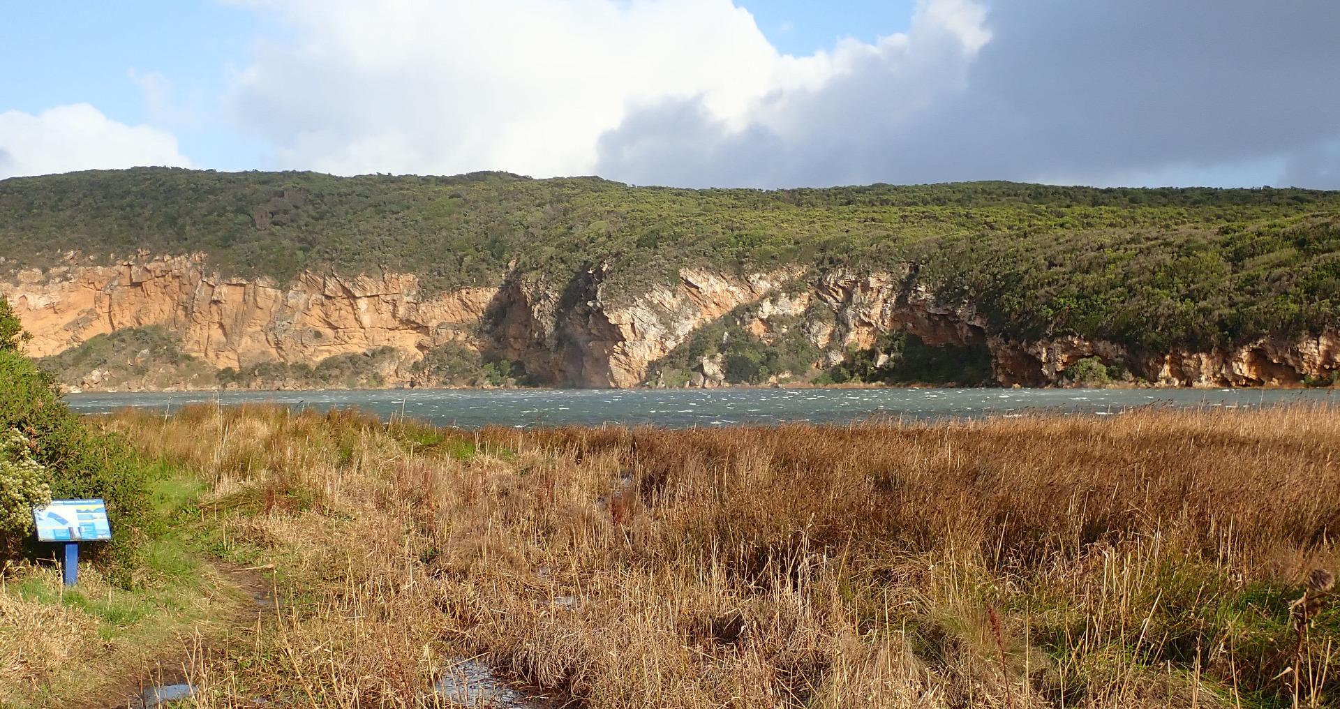
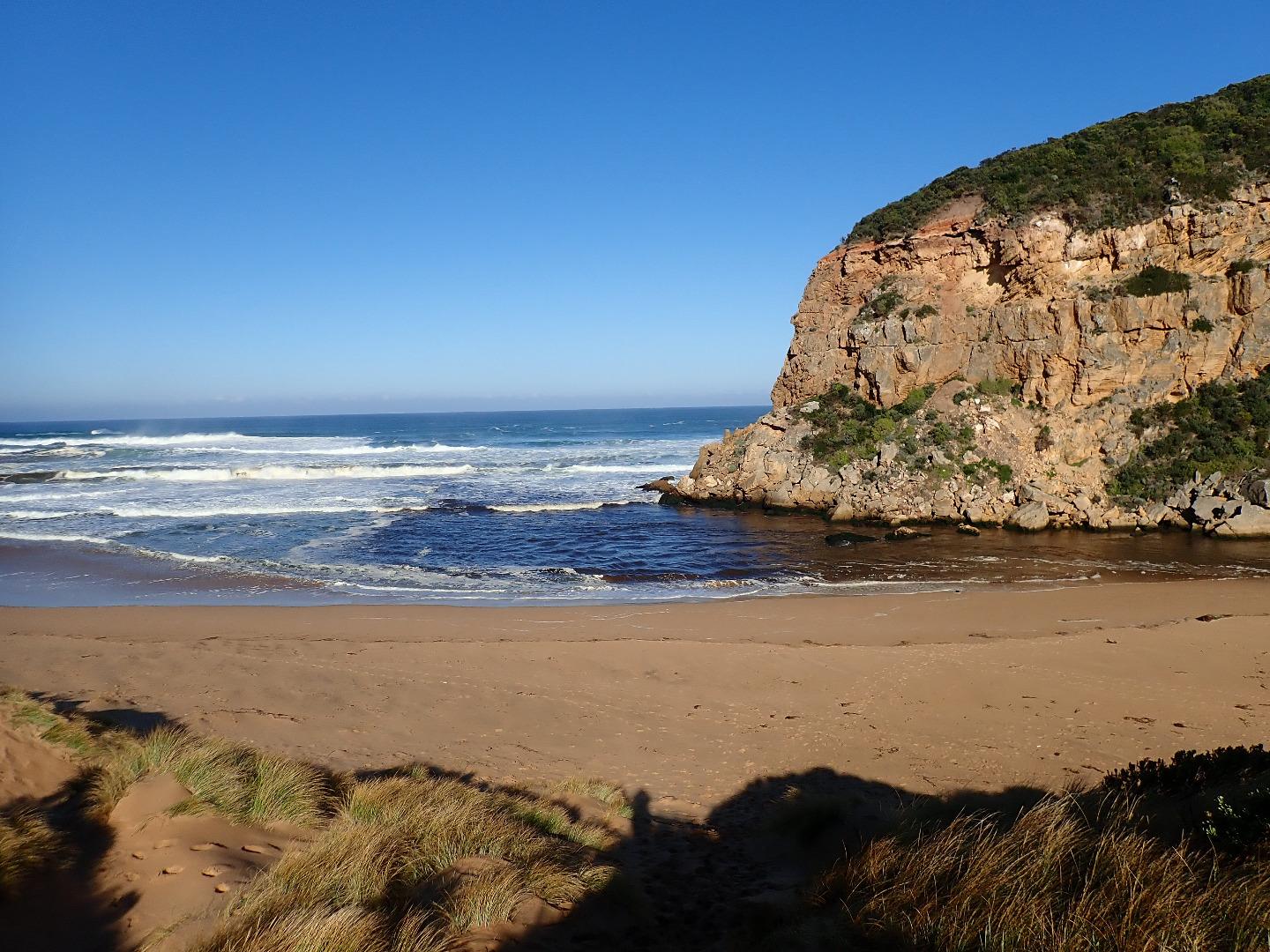
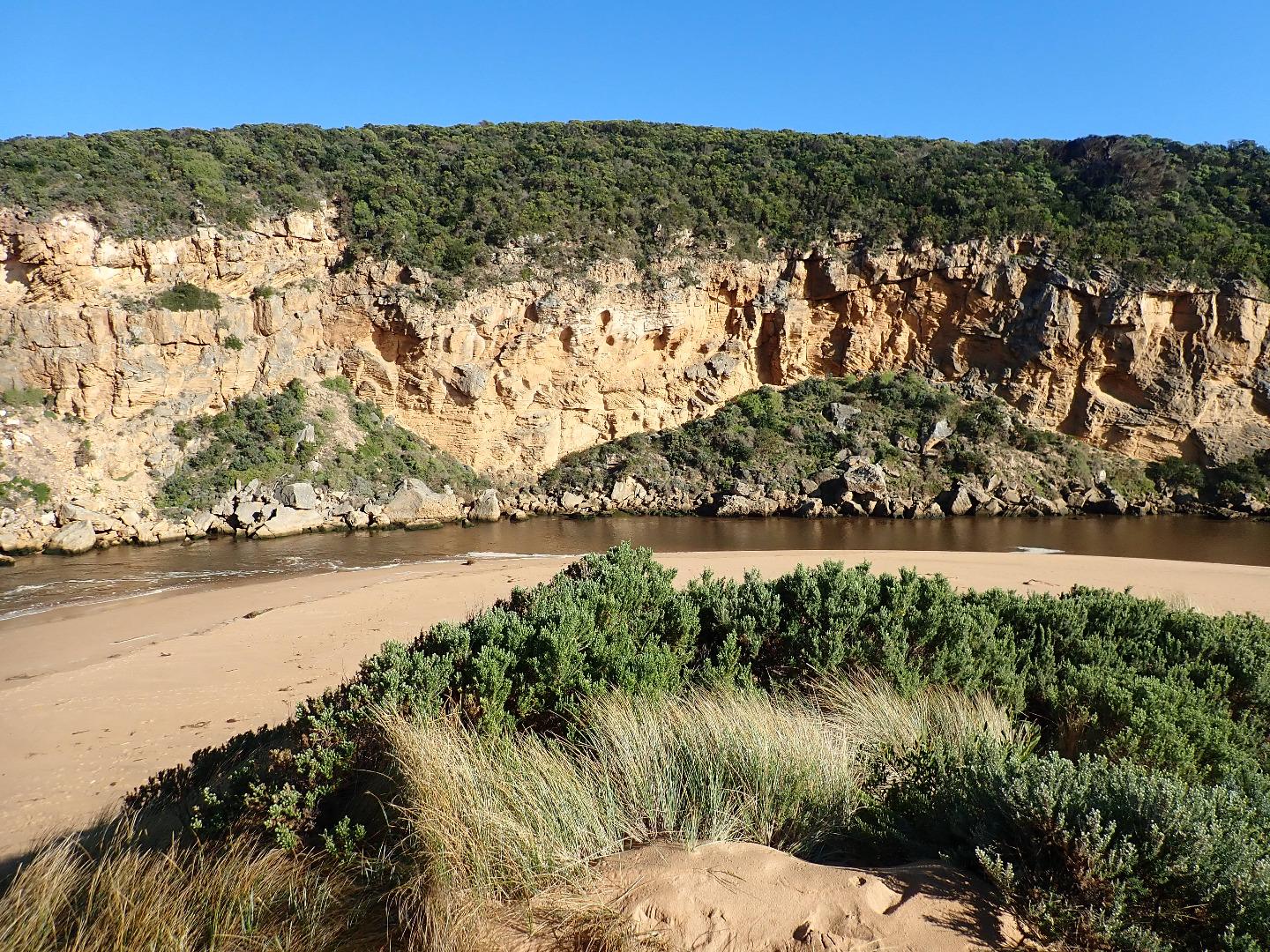
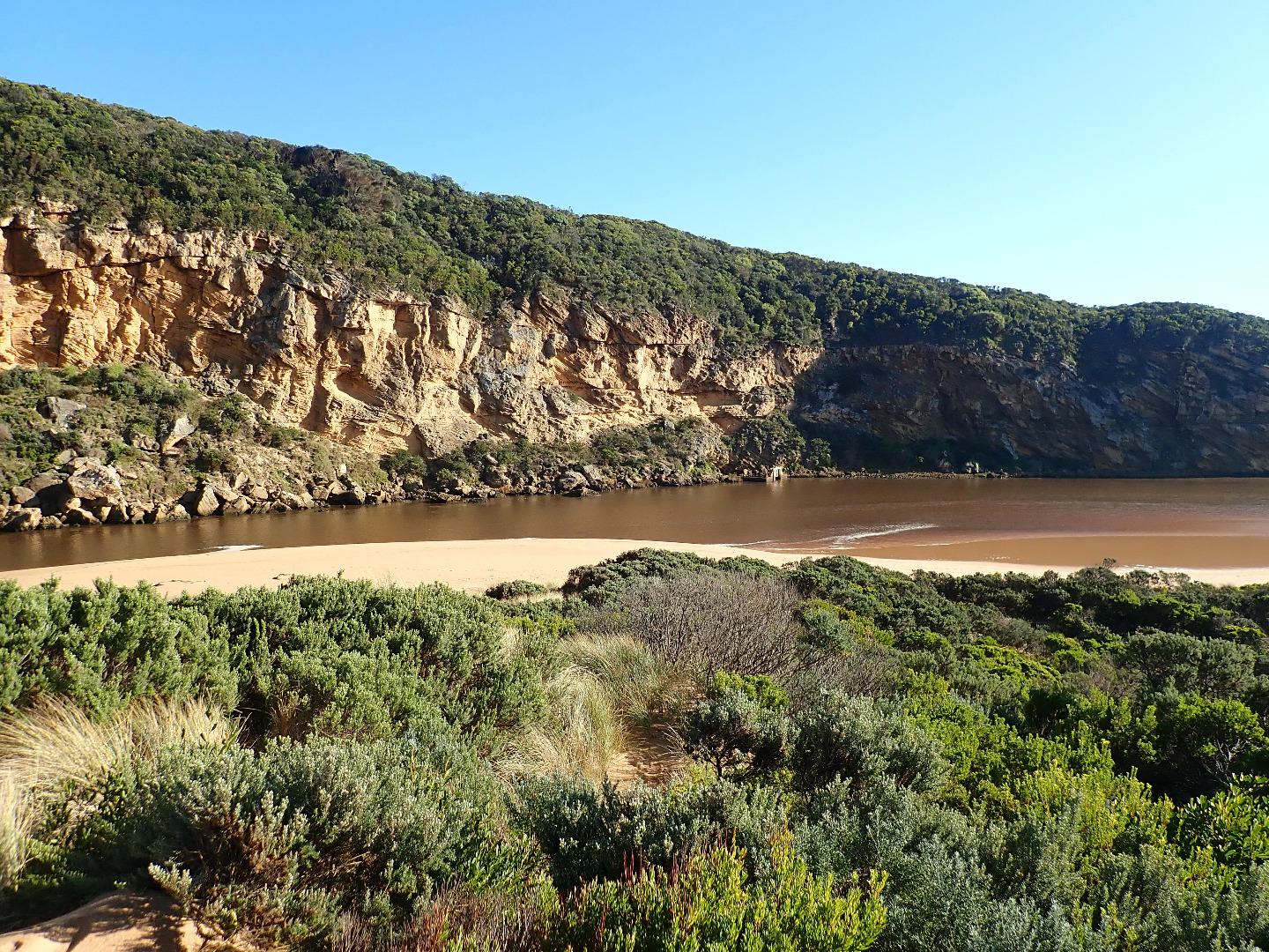
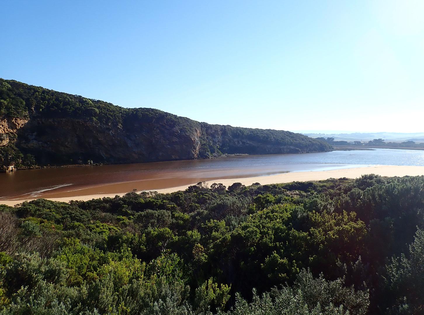
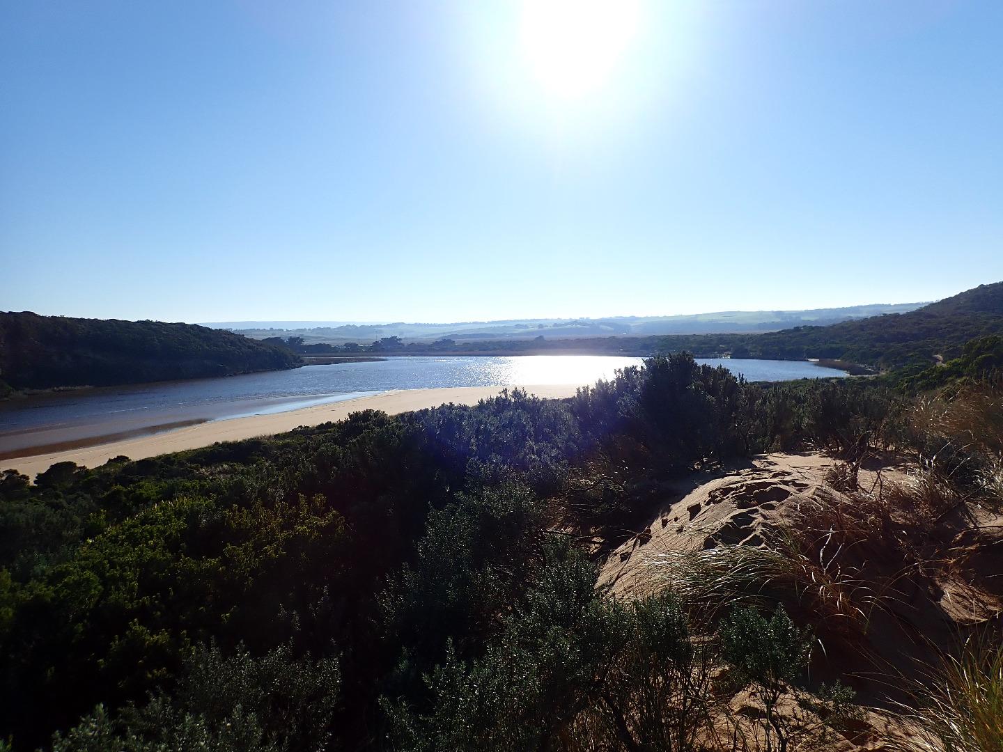
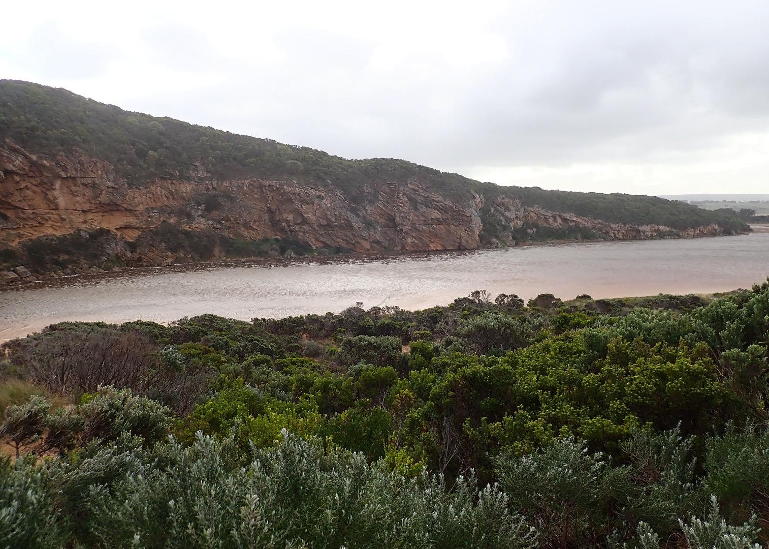
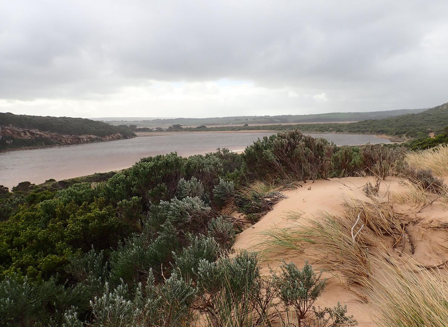
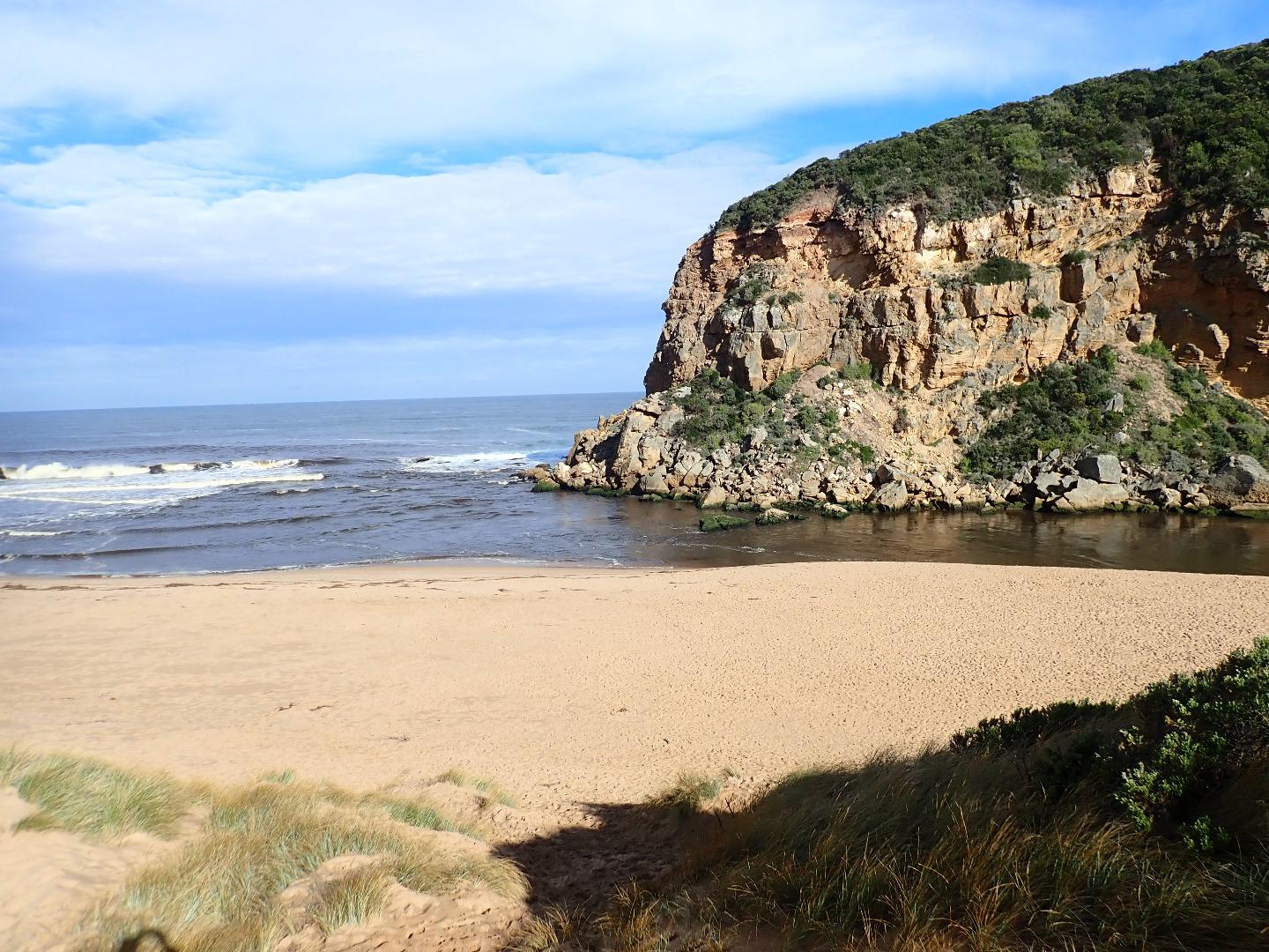
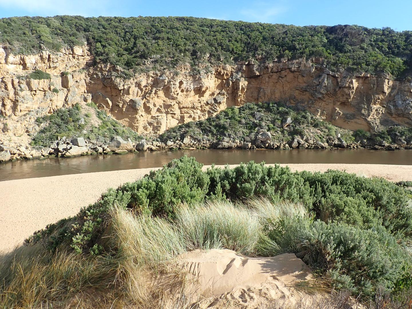
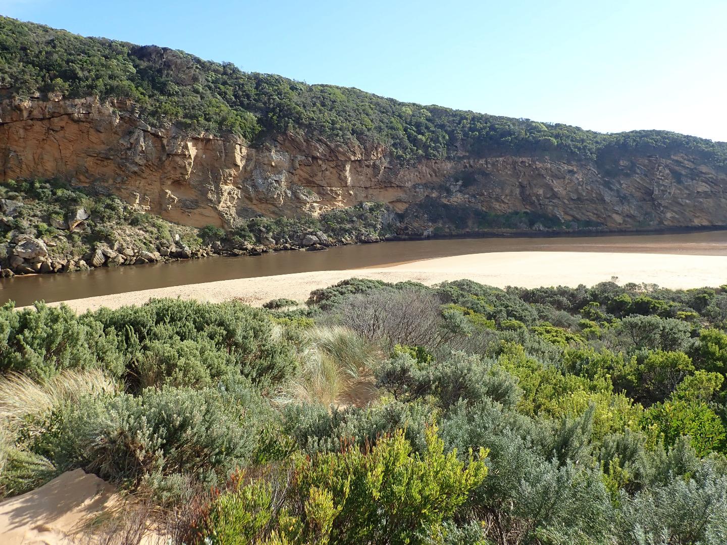
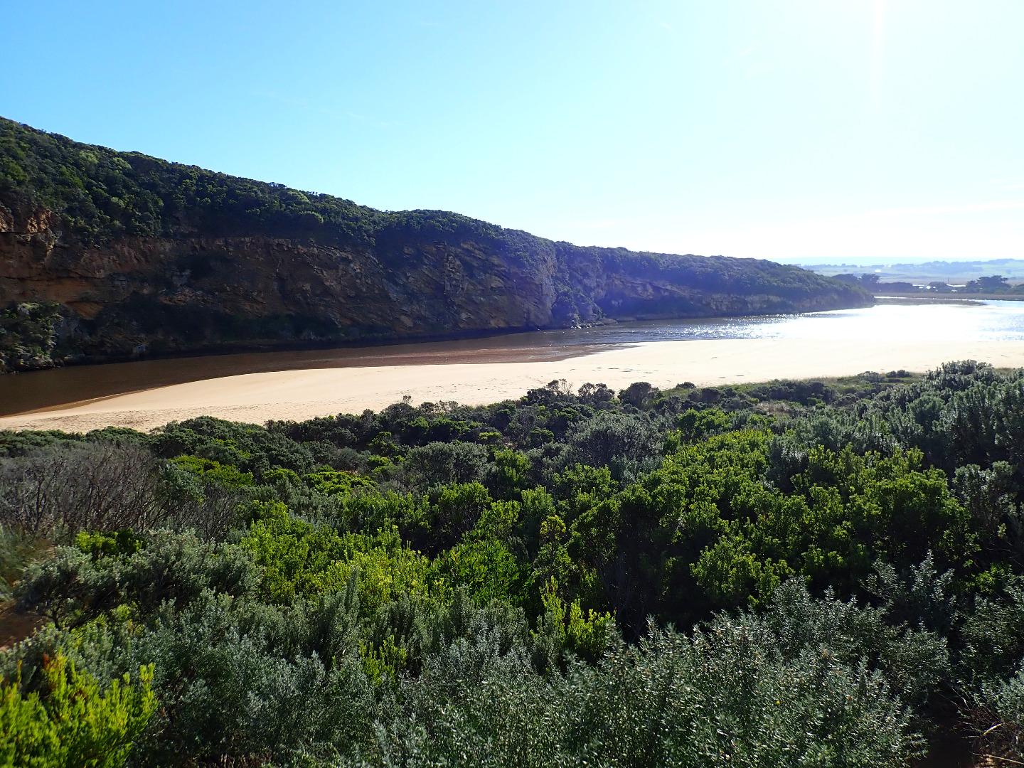
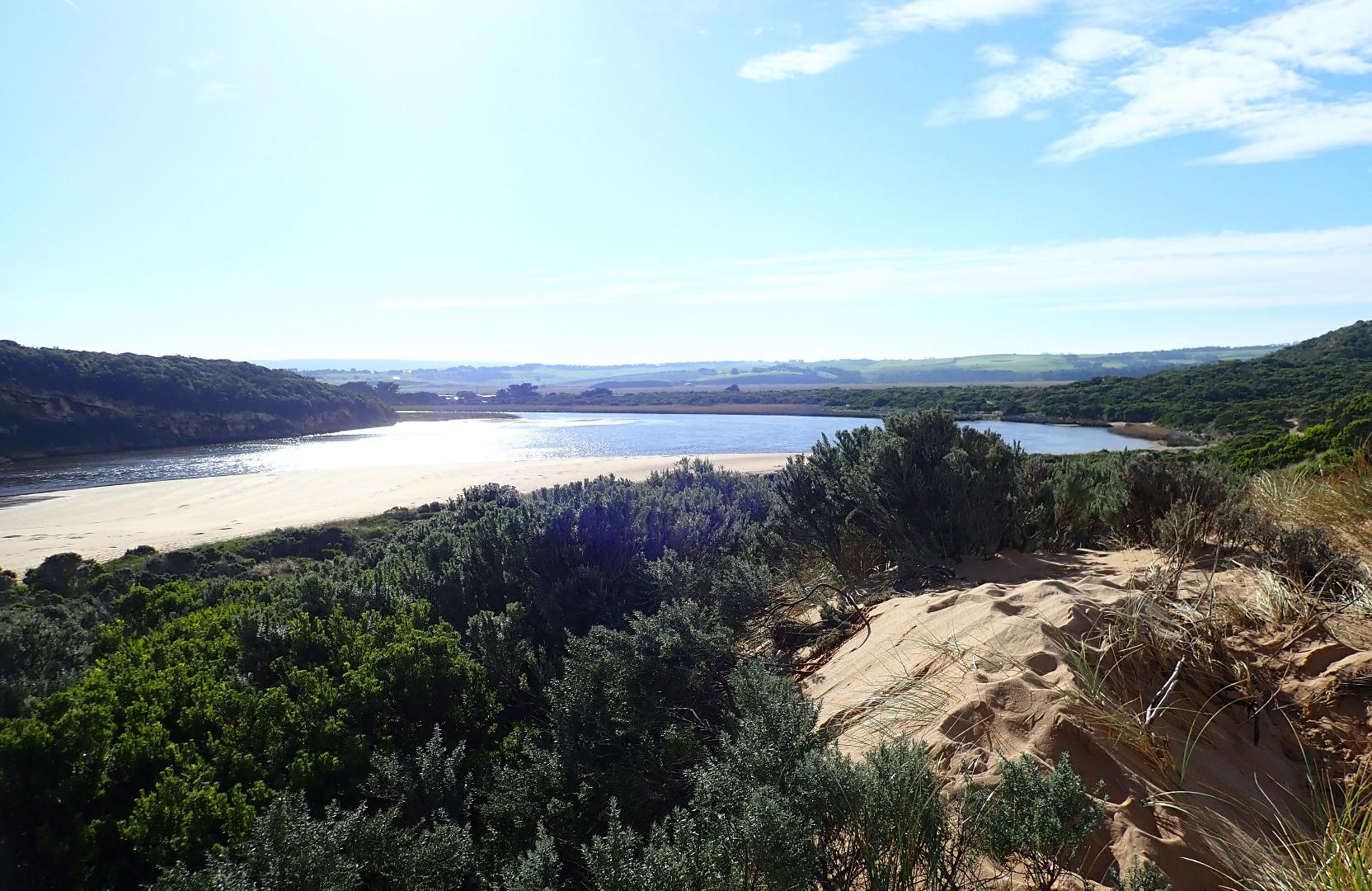
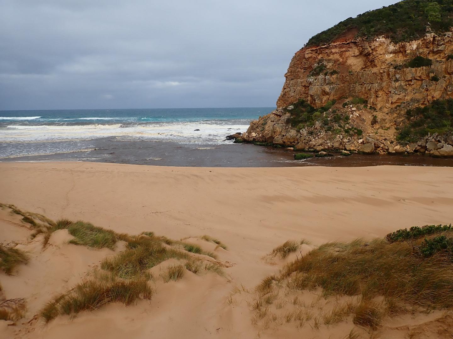
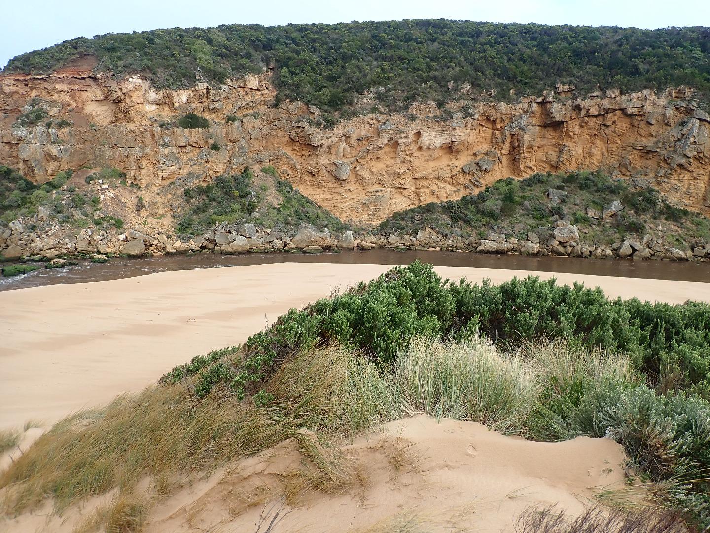
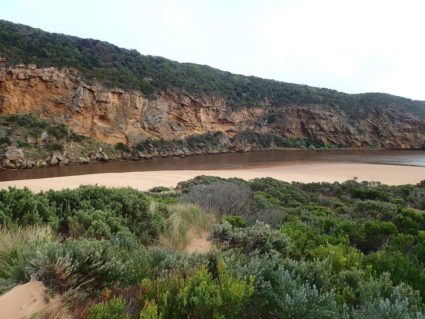
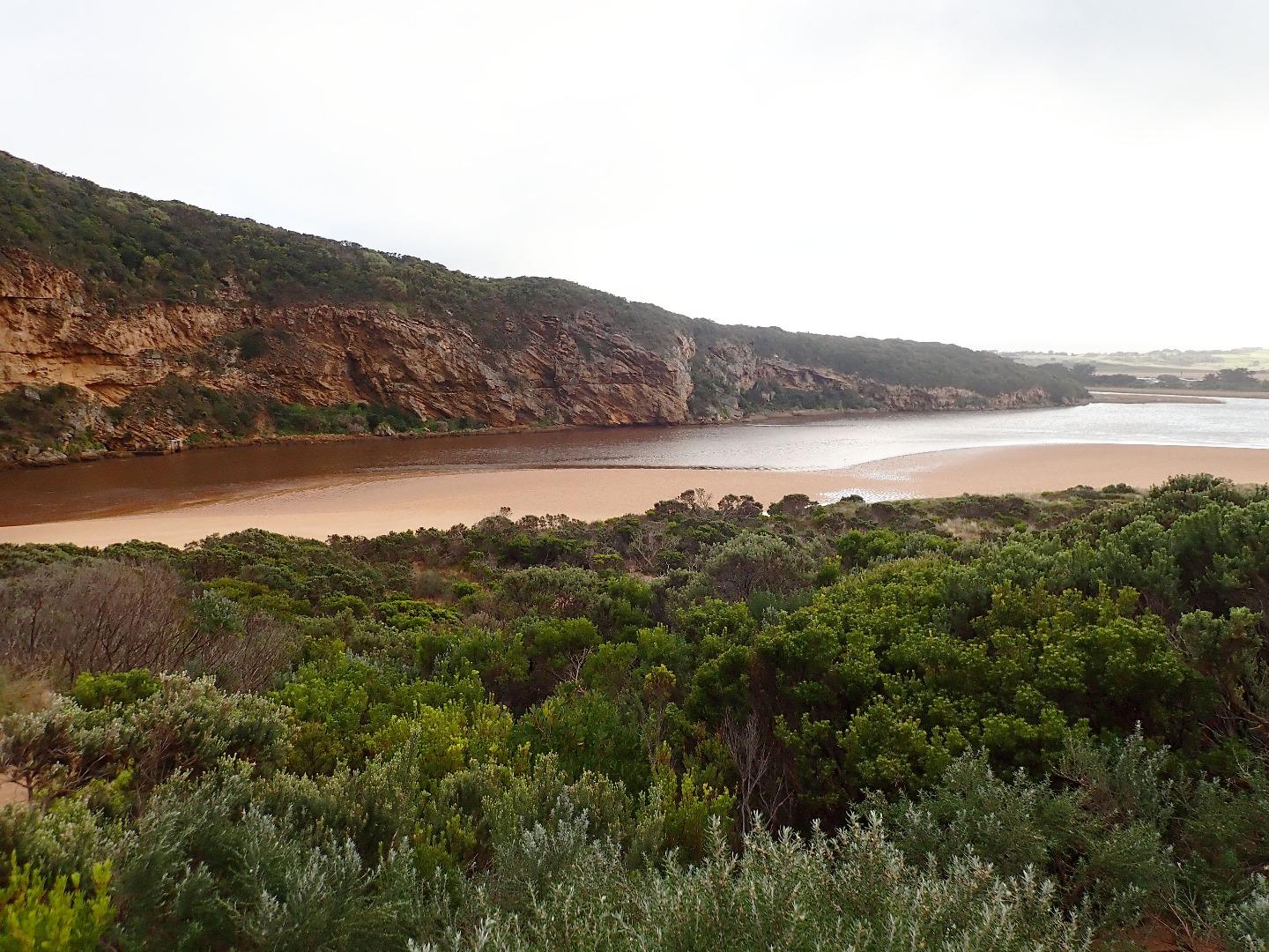
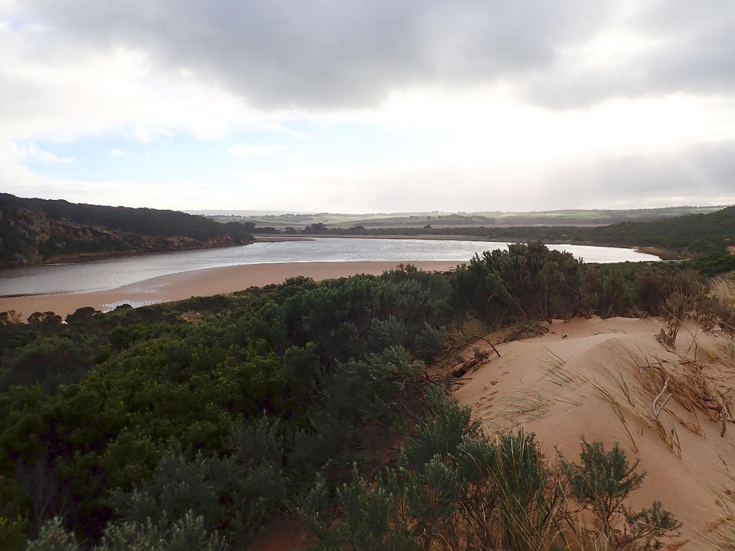
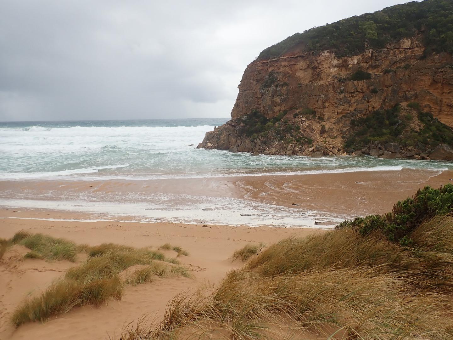
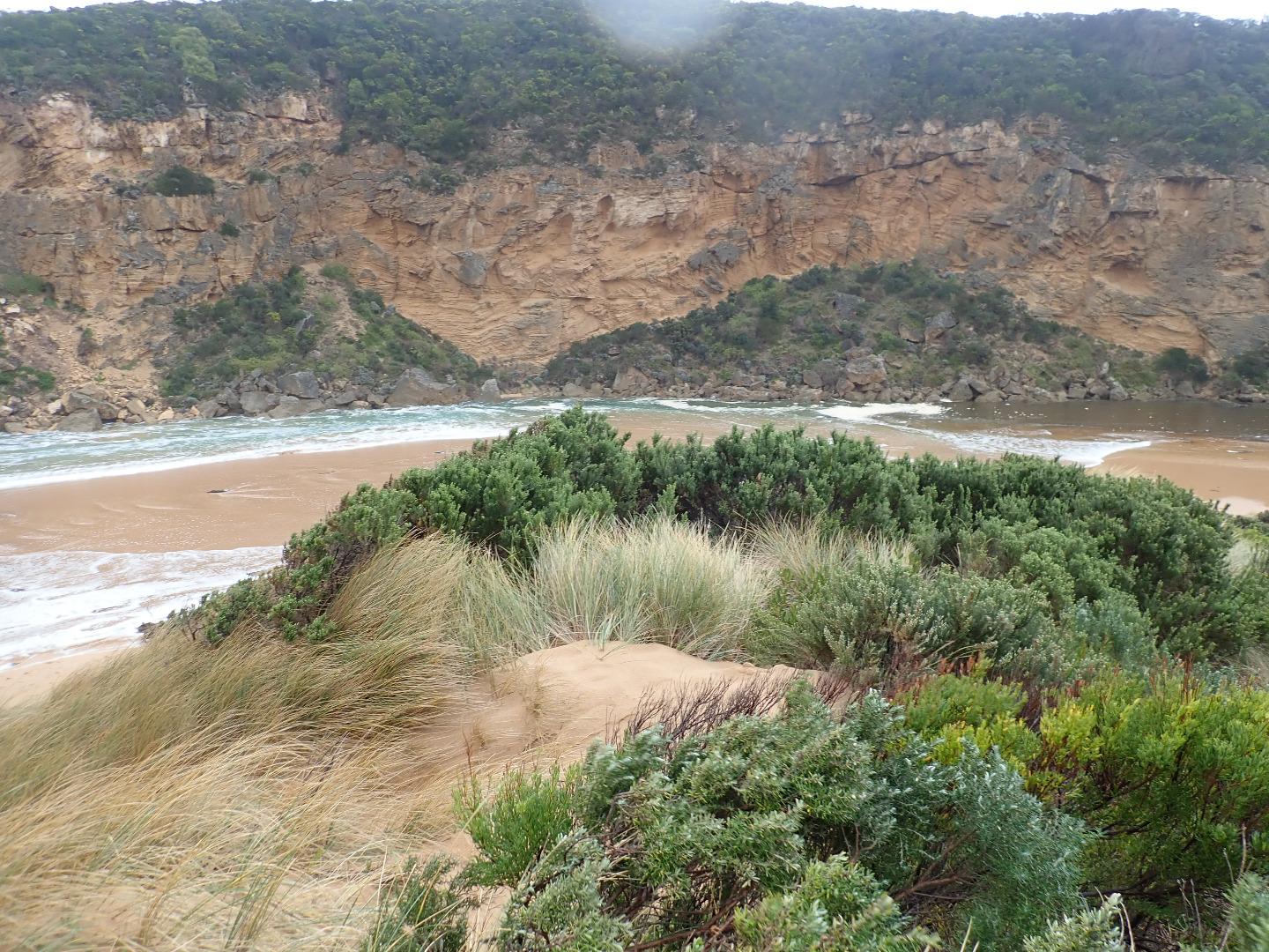
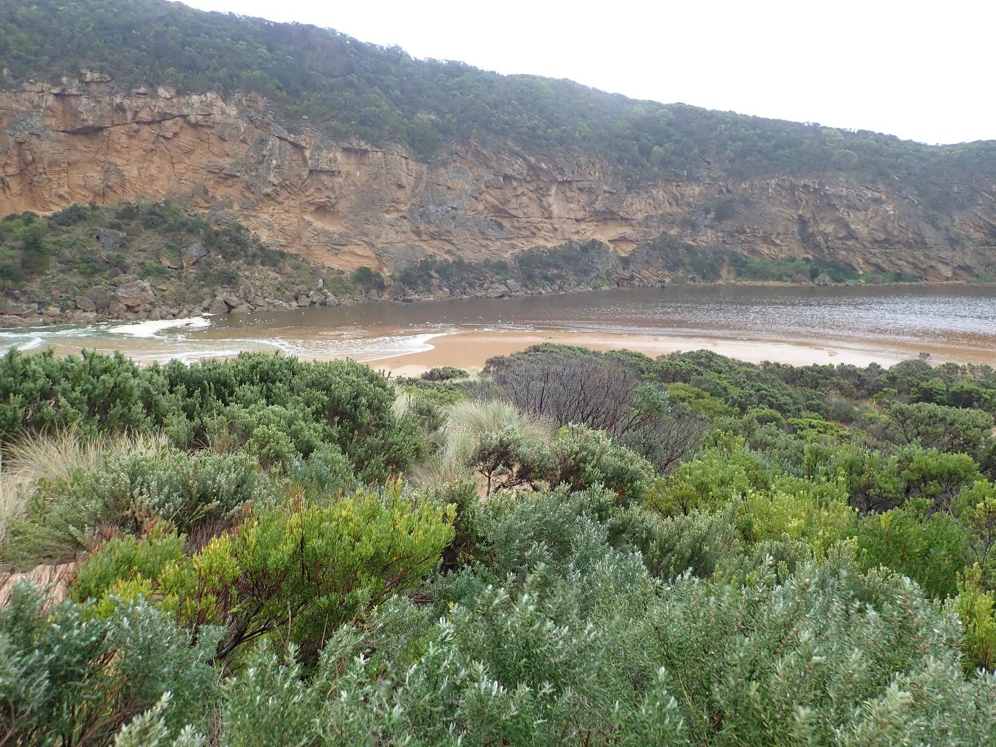
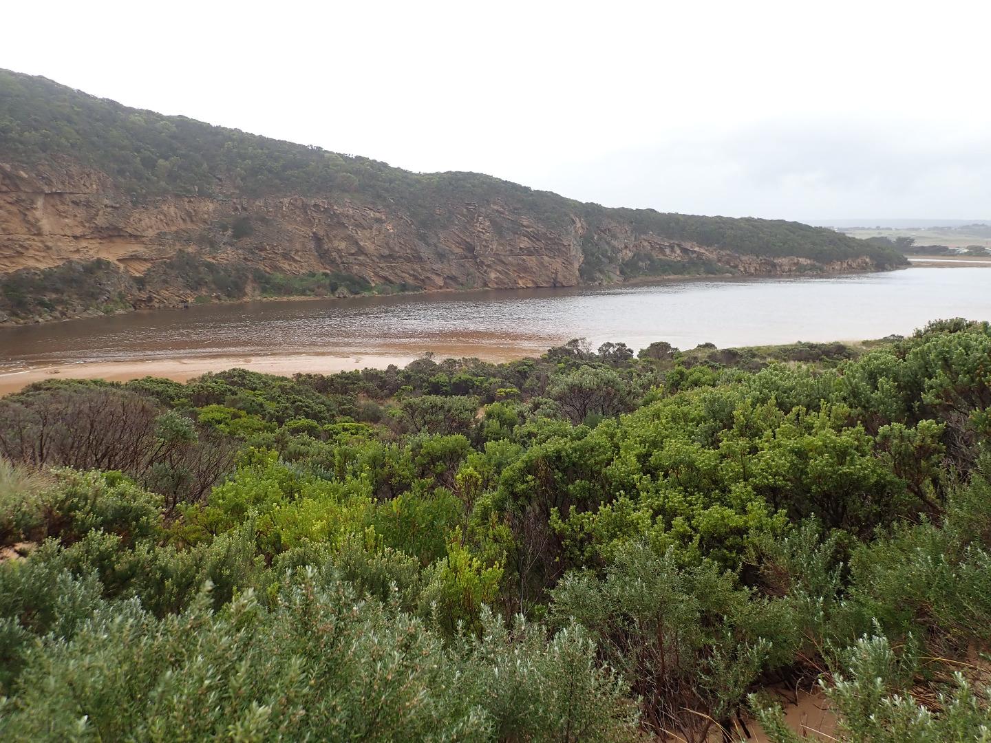
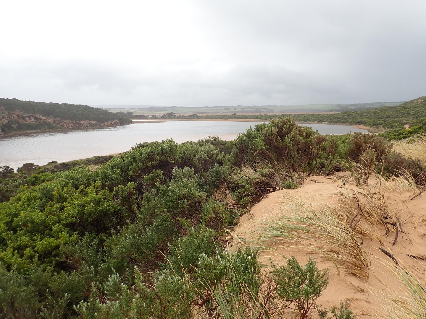
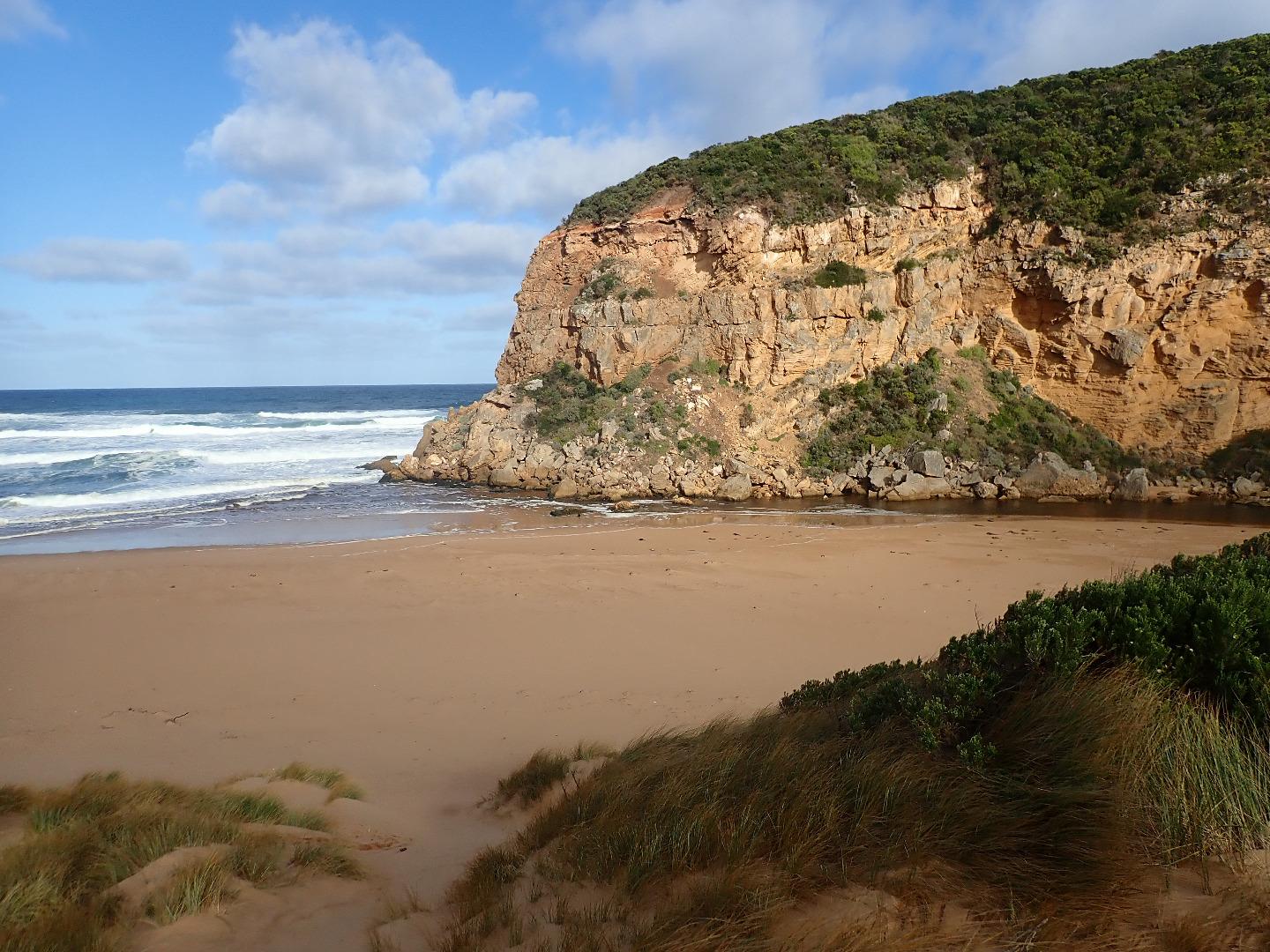
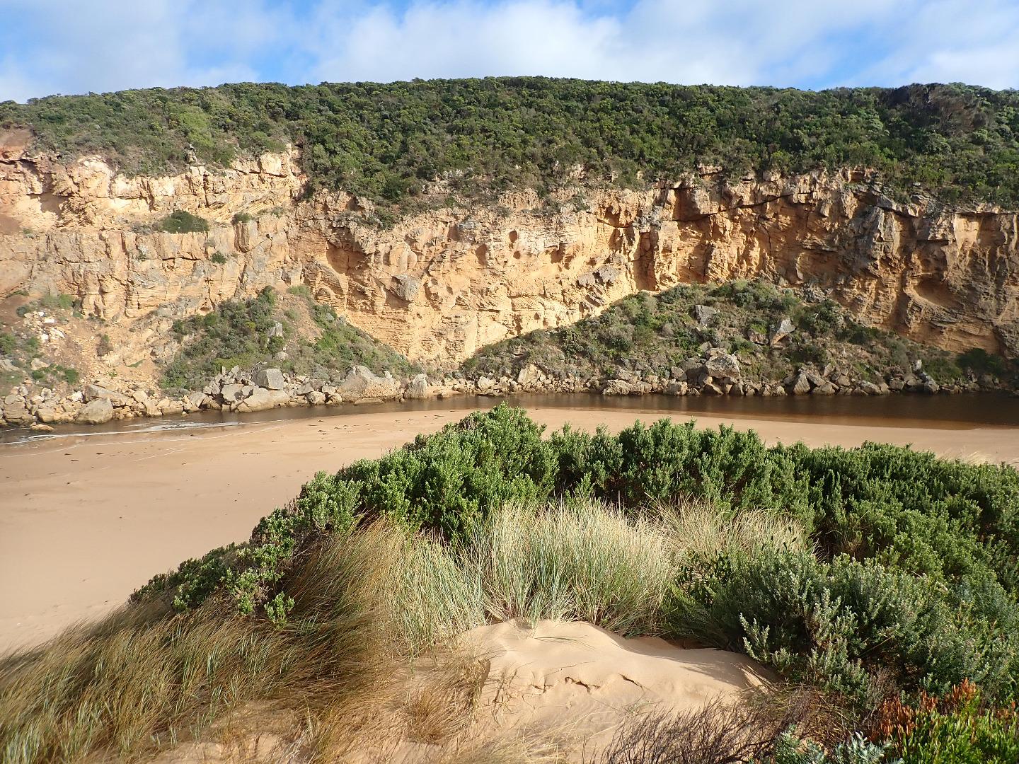
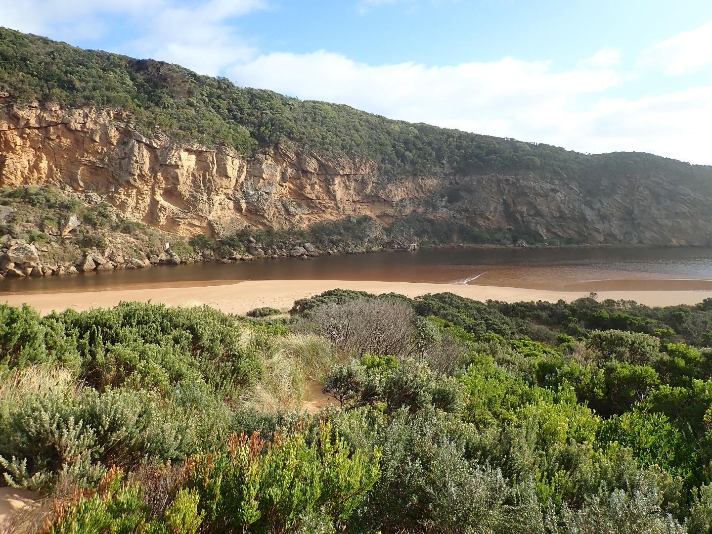
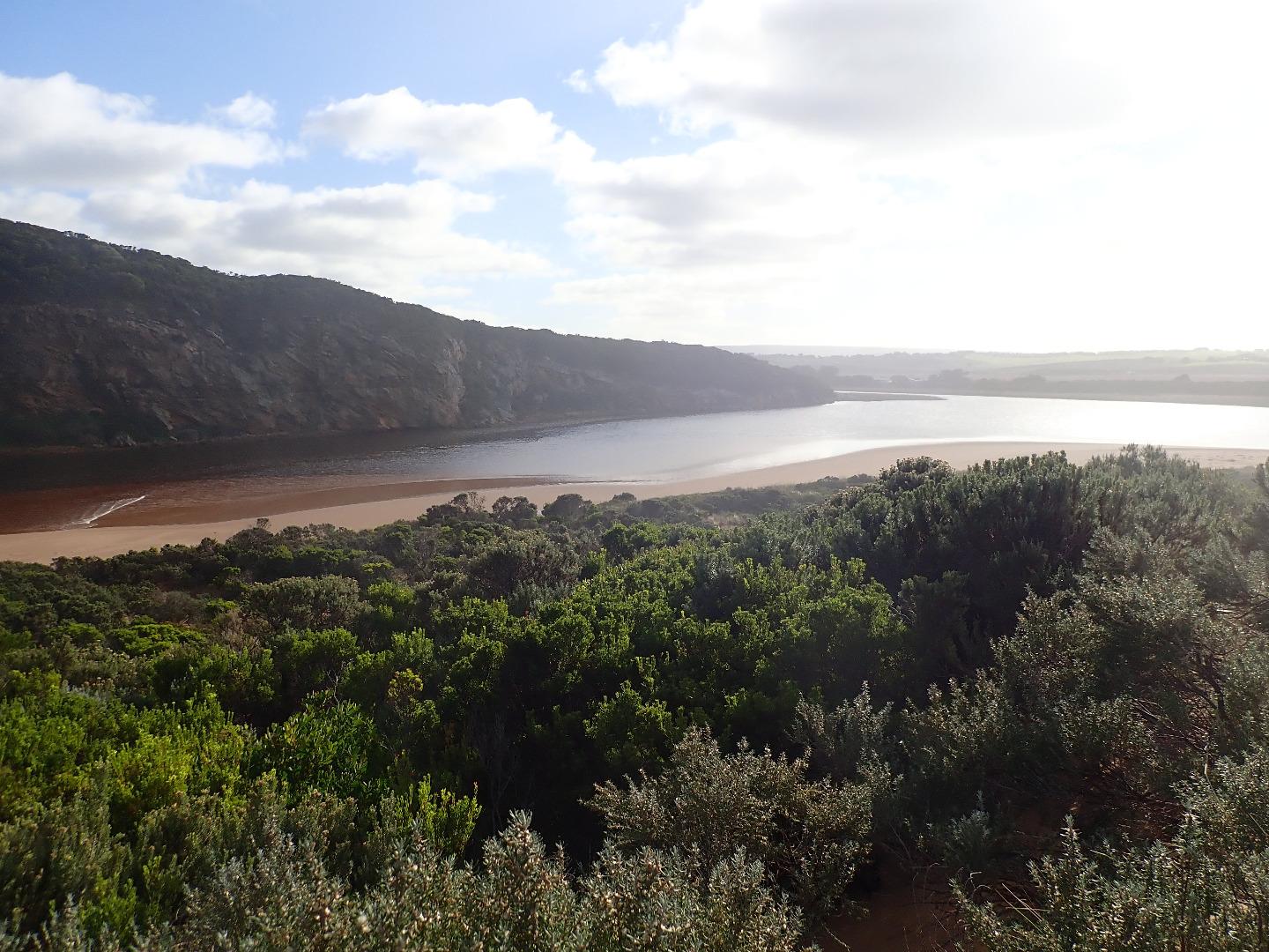
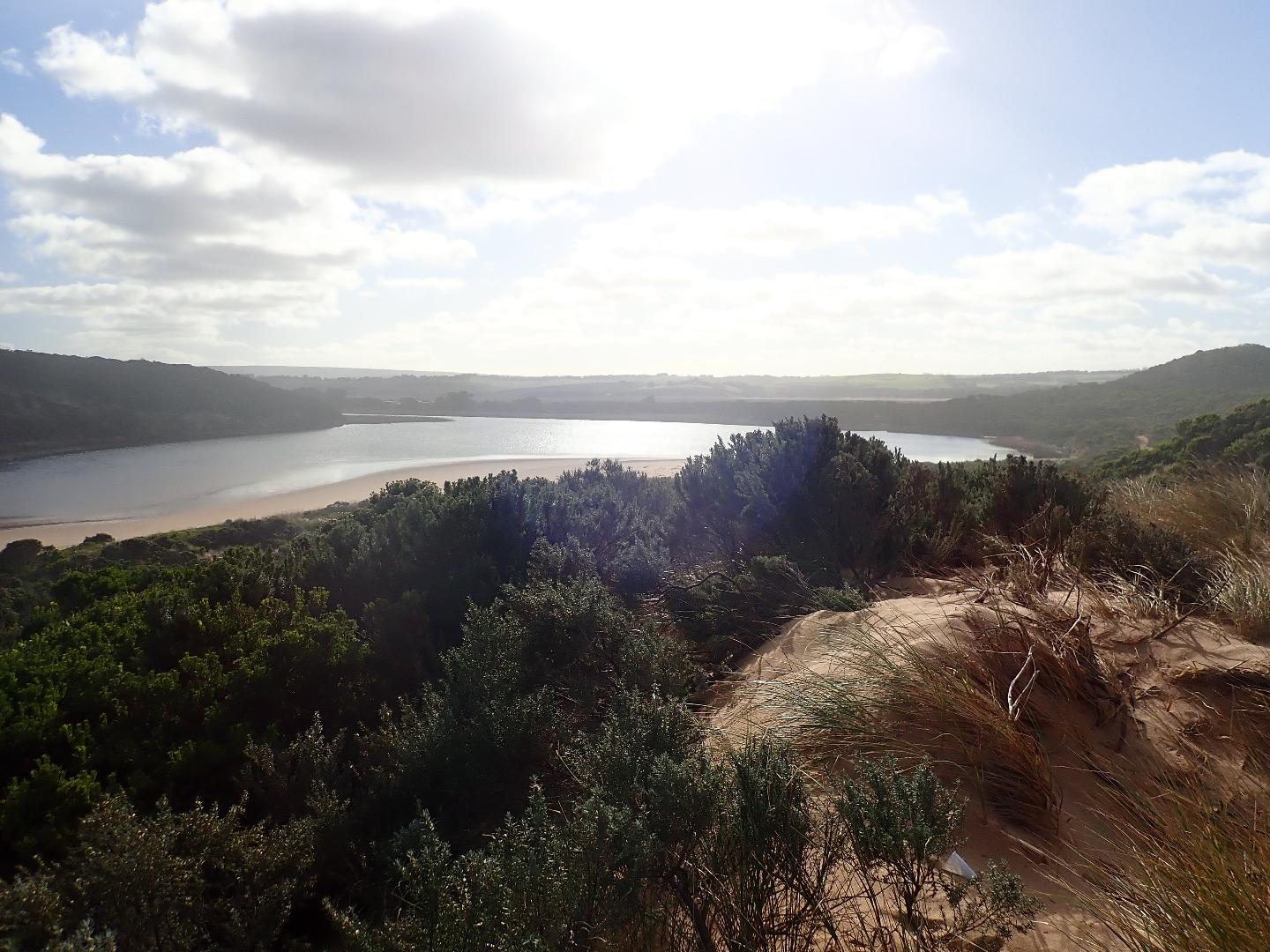
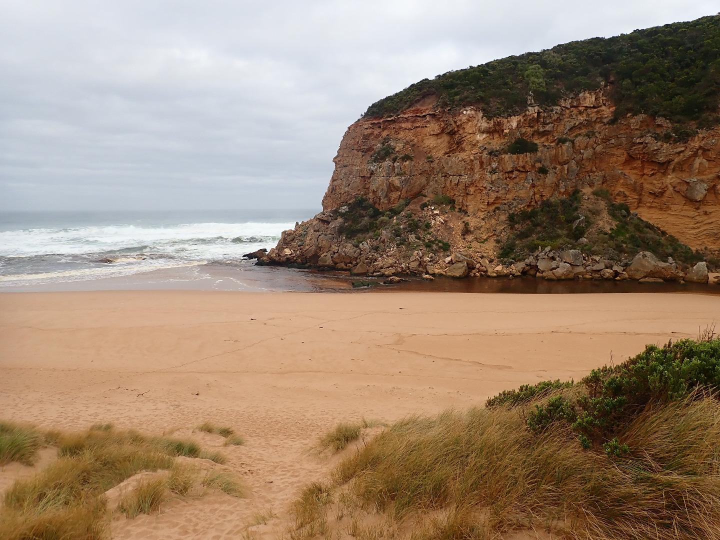
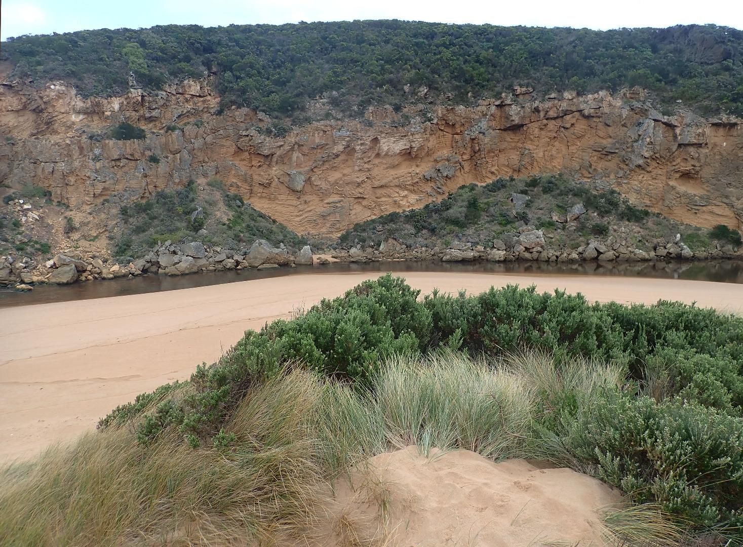
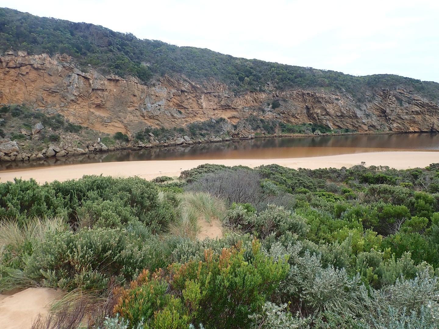
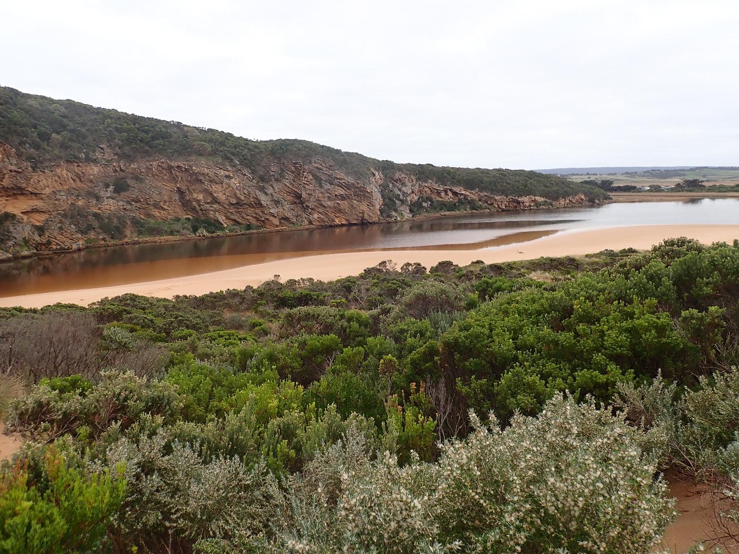
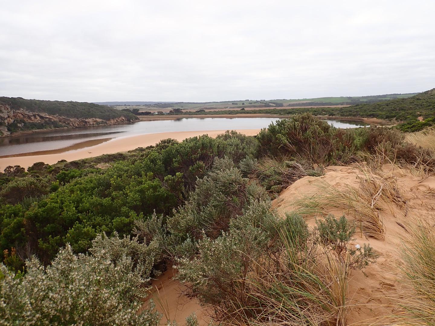
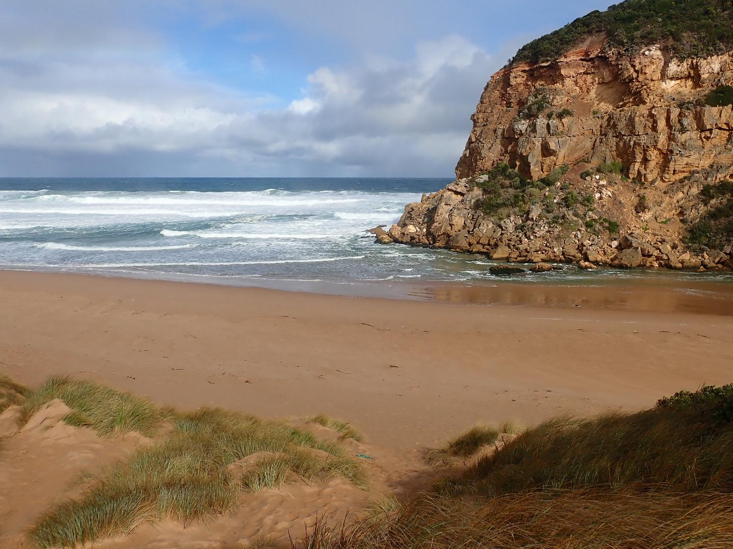
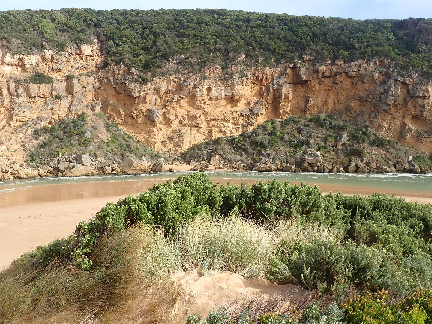
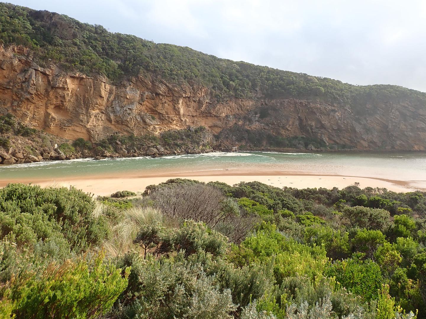
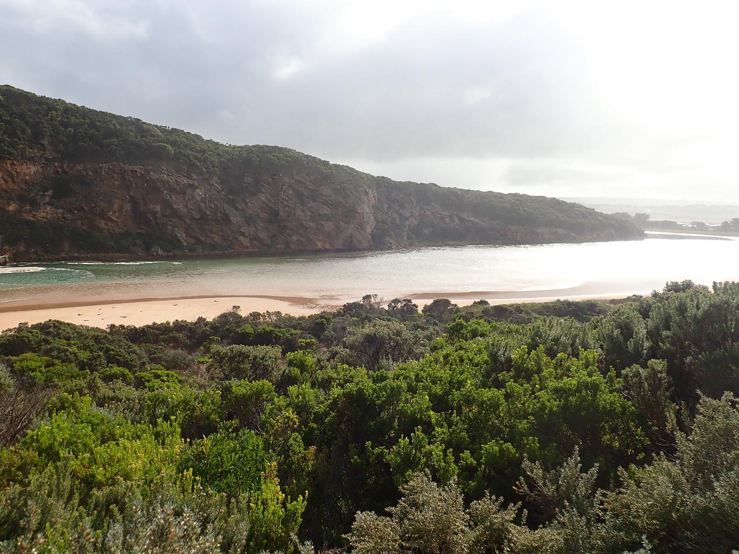
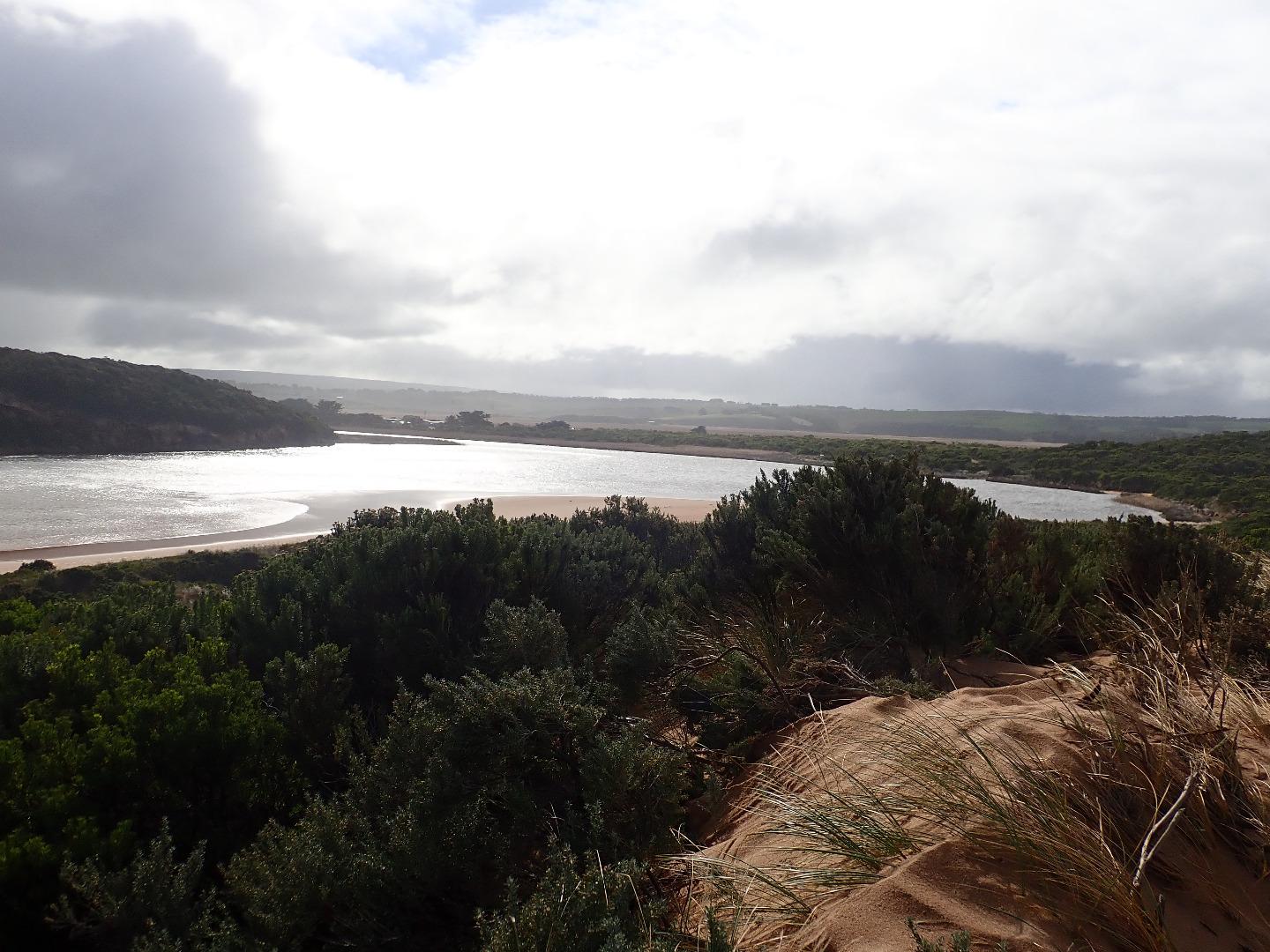
GMC Gellibrand River Estuary Mouth Observation Site
Active Mouth Condition 20-04-2007 - 19-04-2024Gellibrand River Estuary
| ID | Date | Status | Details | |
|---|---|---|---|---|
| #12257 | 14 Jul 2018 | Approved |
Notes:
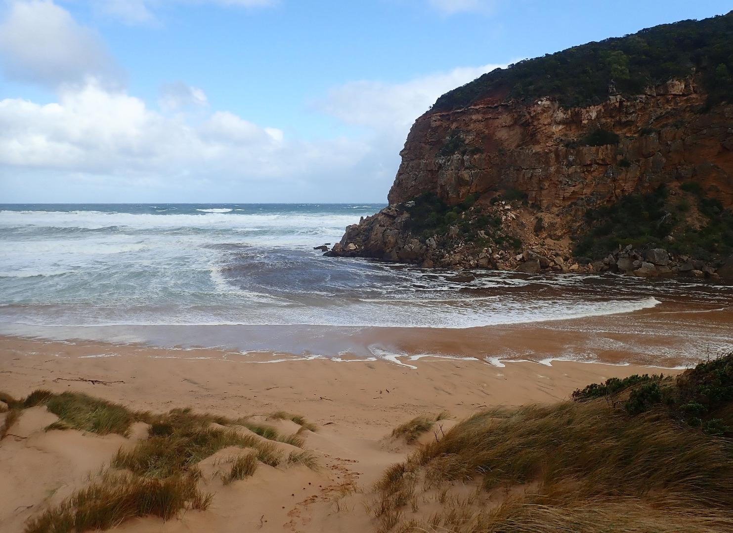
AHD G6 2.86 @ 09:22 Dark discharge out around mouth but becoming paler as it progresses south. Large amount of sand visible in breakers directly south of entrance Waves, some very high, are going in all directions along beach & 1st half of channel where some small waves are entering against a strong outflow & travelling down the east side of the channel. Because of low tide exposing large areas of sand the waves are unable to turn east but continue for a very short distance north where they disappear only to re emerge further north spreading wide as the sand bar is reached. Edge of sand on south side of estuary is about .60m above water level Last hi tide has gone high up on beach & where a gas bladder of a fish was found in the swash line at east end. (possibly from Spiny Puffer fish) |
|
| #12254 | 8 Jul 2018 | Approved |
Notes:
AHD G6 2.77@ 11:55 Dark discharge going straight out to sea against south gale force wind & high sea, waves entering over very wide area & progressing down channel into estuary over high sand build up. Channel deeper close to cliff. Waves turning east at start of estuary. Waves going in all directions along channel including whirlpool Wind has scoured out dunes especially just east of Gp1 site. A second smaller dune has been formed in front (south)of existing one on top of marram grass regrowth, then a steep slope occurs down to sea. Sand has been pushed up high against eastern dunes & extends further out to sea.Wind gusts still blowing sand into estuary |
|
| #12253 | 7 Jul 2018 | Approved |
Notes:
AHD G6 2.20 @ 09:30 2.38 @ 16:02 Heavy local rainfall 04-07-18 08-07-18 = 43 ml. causing flooding from run off but no water across any roads or tracks Storm surge from High 7m.seas (WSW swell 13-14 secs) & South Gale force winds, waves entering channel over a wide area & crossing over high sand build up then continuing down channel into estuary where they turn sharply east & travel along south side of estuary. Water green upstream to past G2. Wind raising small waves that travel all across the estuary to north Wind impacting/scouring sand dunes with stronger gusts carrying it along channel & into the estuary Rock falls have increased at South & east sides of Pt Ronald No photos from Gp1 site because of dangerous conditions
    |
|
| #12194 | 22 Jun 2018 | Approved |
Notes:
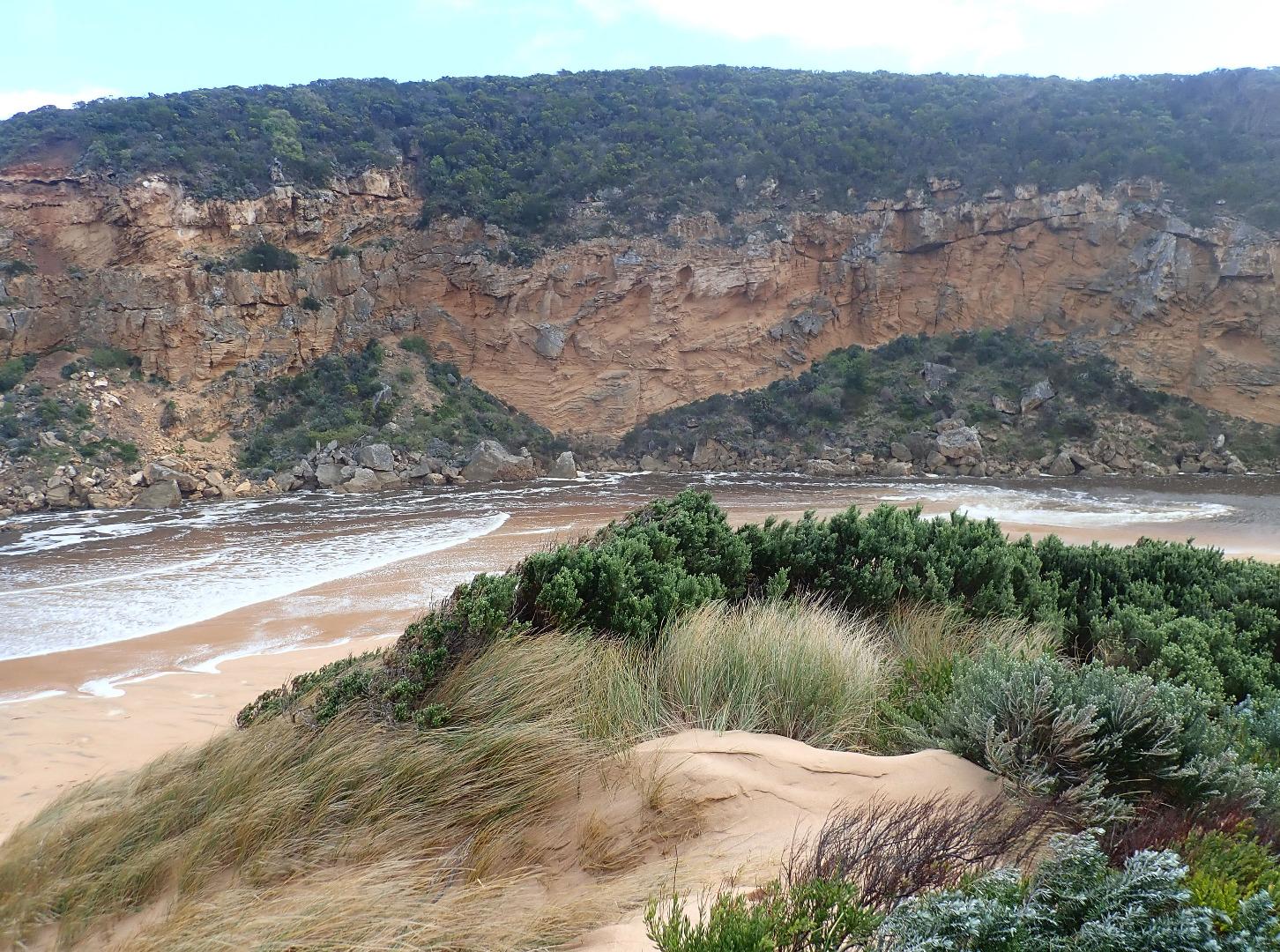
AHD G2 0.56 @ 12:25 G6 AHD water covering AHD board Dark discharge out around mouth & flowing strongly to east along beach front. Waves in all directions at entrance with small waves entering along channel, turning east along south side of exposed sand at south side of estuary, however strong outflow travelling fast was further west closer to cliff face Large area of sand exposed at south side of estuary had a sheer face about 20-40 cm.above water level which reduced near turn into channel, then rose again up to 1.50m. near entrance. The sheer sides were gradually collapsing into fast outflow & incoming small entering waves. Low water level had sandbar in estuary well exposed No roads or tracks had water over & only a small amount from runoff in very low areas of camp ground. No water over OOR at flood markers as flood water is being held back around G4 where water is flowing strongly over the bridge. Some flooding immediately downstream G4 which was draining back into the river channel but upstream all flats have deep extensive water cover & very fast flow from G4 to past G6. Flood water peaked at Burrupa on 20-06-18 late pm at 5.06m. |
|
| #12174 | 18 Jun 2018 | Approved |
Notes:
AHD G6 3.68 @ 08:45 Air pressure 1026.5 After yesterdays near gale force winds & extremely high & low tides a natural release occurred over night resulting in a very strong fast flowing dark discharge going out through a very wide entrance travelling both to east & west. The east side of the channel was sheer sided & about 1m.high, collapsing into the fast flow. Occasional longshore drift across the mouth being covered by incoming SSW swell. The wind had scoured the beach & channel area covering seaweed & again reshaping the dunes - Gp1 is now even higher. Lower water levels around G2 have drained area around flood markers on OOR with water flowing through previously scoured out areas from north to south, but levels upstream are still rising & water from the river flowing onto flats around G6 |
|
| #12161 | 16 Jun 2018 | Approved |
Notes:
AHD G6 2.30 @11:30 Air pressure 1009.5 101.5 ml rain in this event up to 08:00 17-06-18. River rising quickly but water from flooding is only across OOR in very deep scoured out areas from last flood event. No water over any other tracks or roads. Sea very rough with occasional strong longshore drift across entrance where waves are entering very wide & moving up the channel into the estuary where they turn sharply to east. Salt (green water) for about 40 - 50m. WSW/SW swell sending waves far up on beach - water is then travelling down a slight depression west along beach behind beach face. Swell waves are curving around at actual entrance. Sand visible in breakers far out to sea & a very large amount of seaweed has been deposited in area where channel meets estuary & along the SW area of exposed sand |
|
| #12136 | 10 Jun 2018 | Approved |
Notes:
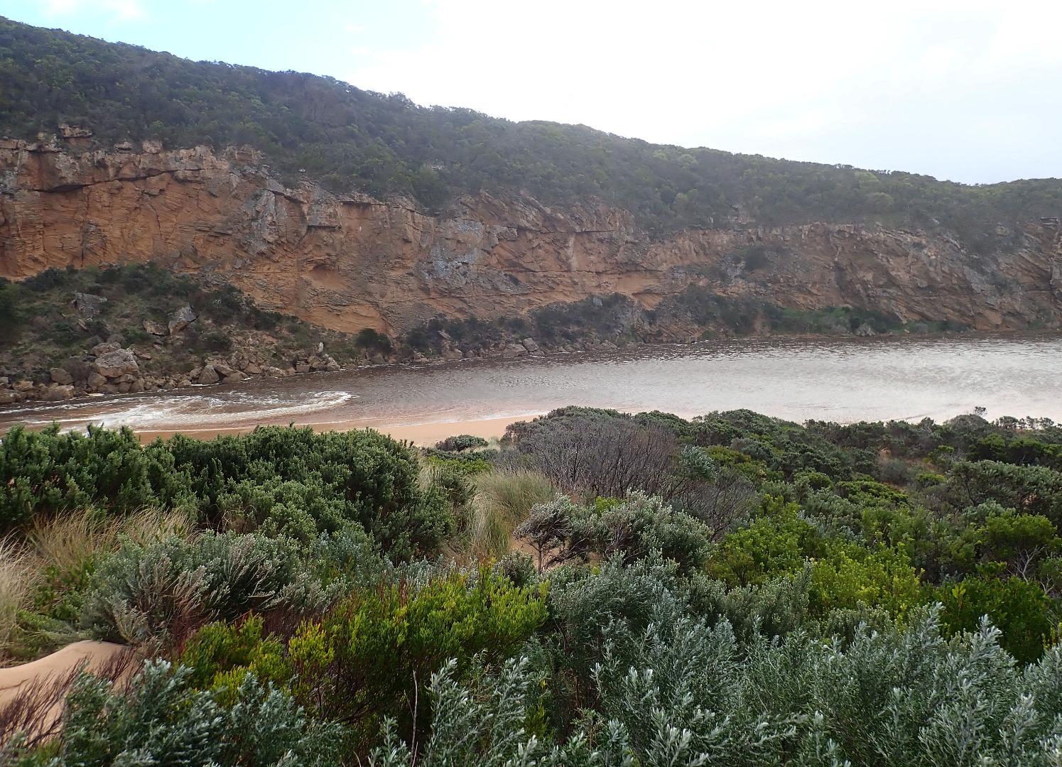
AHD G6 0.90 @ 09:03 Air pressure 1026.5 N wind very cold Observations taken from ground level not on top of dune (Gp1) Dark discharge out around mouth & slightly to east. Sea rough, WSW swell impacting mid & east end of beach. Longshore drift frequently across the mouth with small waves entering & travelling down channel into estuary Large expanse of sand exposed both on ocean beach & south side of estuary where broken off sea grass extends along the swash line in SW area . Sand high at mid beach with sheer face to top area of beach face Pair of Peregrine falcons active along cliff above the channel, large no. of Coots west side of estuary. Also small bird noted going into a low hole in the waterside bank at east side of estuary |
|
| #12102 | 31 May 2018 | Approved |
Notes:
AHD G6 1.37@ 09:44 Air pressure 1026. SW swell 12-13 sec. Rainfall over night 24 ml. Pale discharge out to about 50m east along shore line, flow reducing, going out over sand buildup at entrance - channel becoming more narrow. Small waves entering & travelling down channel into estuary. Slight longshore drift occasionally across mouth Sand on beach still high slightly east of entrance but rapidly increasing at east end Small penguin washed up alive but needed rescuing because of sinking deeply in soft sand. 2nd penguin found dead further along beach |
|
| #12084 | 25 May 2018 | Approved |
Notes:
Dark discharge out diagonally across entrance with some to south west. SW swell limiting usual easterly direction of outflow along beach front & impacting strongly at easterly section of beach. Waves in all directions at this area. Waves also in all directions at entrance with some longshore drift across. Occasional small waves entering along channel into estuary Reducing but still fast outflow going over sand build up at entrance & immediately downstream of rocks, large amount of sand visible in breakers. Sand spit has been reduced & now higher sand extends to east along the beach front A lower area where waves are going higher up on beach exists at mid beach. Highest area is still close to entrance Erosion continues on south face of pt. Ronald |
|
| #12072 | 18 May 2018 | Approved |
Notes:
Very rough sea entering across wide area, waves going up channel over a high sand build up from mid channel into estuary.(Wave action visible at G2). The sand build up extends into the estuary under shallow water cover. Only salt water entering, slightly darker water east of start of channel near tunnel entrance indicates some mixing taking place. Occasional waves going high up on beach. Waves in all directions along beach (sand spit remains) with longshore drift crossing mouth. Beach still highest just east of mouth Very high & low tides with waves 3.7- 4.6 high Swell duration 16-15 secs. |
|

All content, files, data and images provided by the EstuaryWatch Data Portal and Gallery are subject to a Creative Commons Attribution License
Content is made available to be used in any way, and should always attribute EstuaryWatch and www.estuarywatch.org.au