EstuaryWatch Data Portal
AMC Anglesea River Estuary Mouth Observation Site
13 September 2016
Observation details
Overview
| Estuary | Anglesea River Estuary |
|---|---|
| Site | Anglesea River Estuary Mouth Observation Site |
| Observation ID | #10432 |
| Date and Time | Tuesday 13th September 2016 00:00am |
| Approved | Approved |
Notes
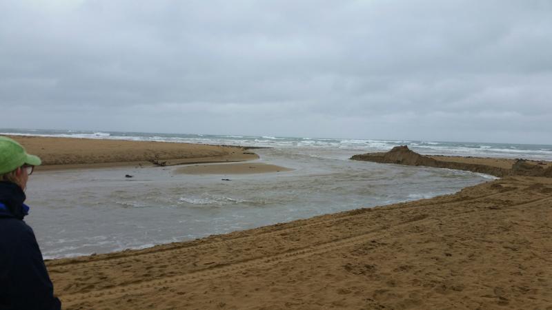
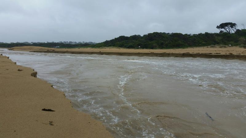
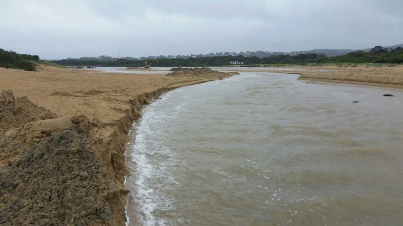
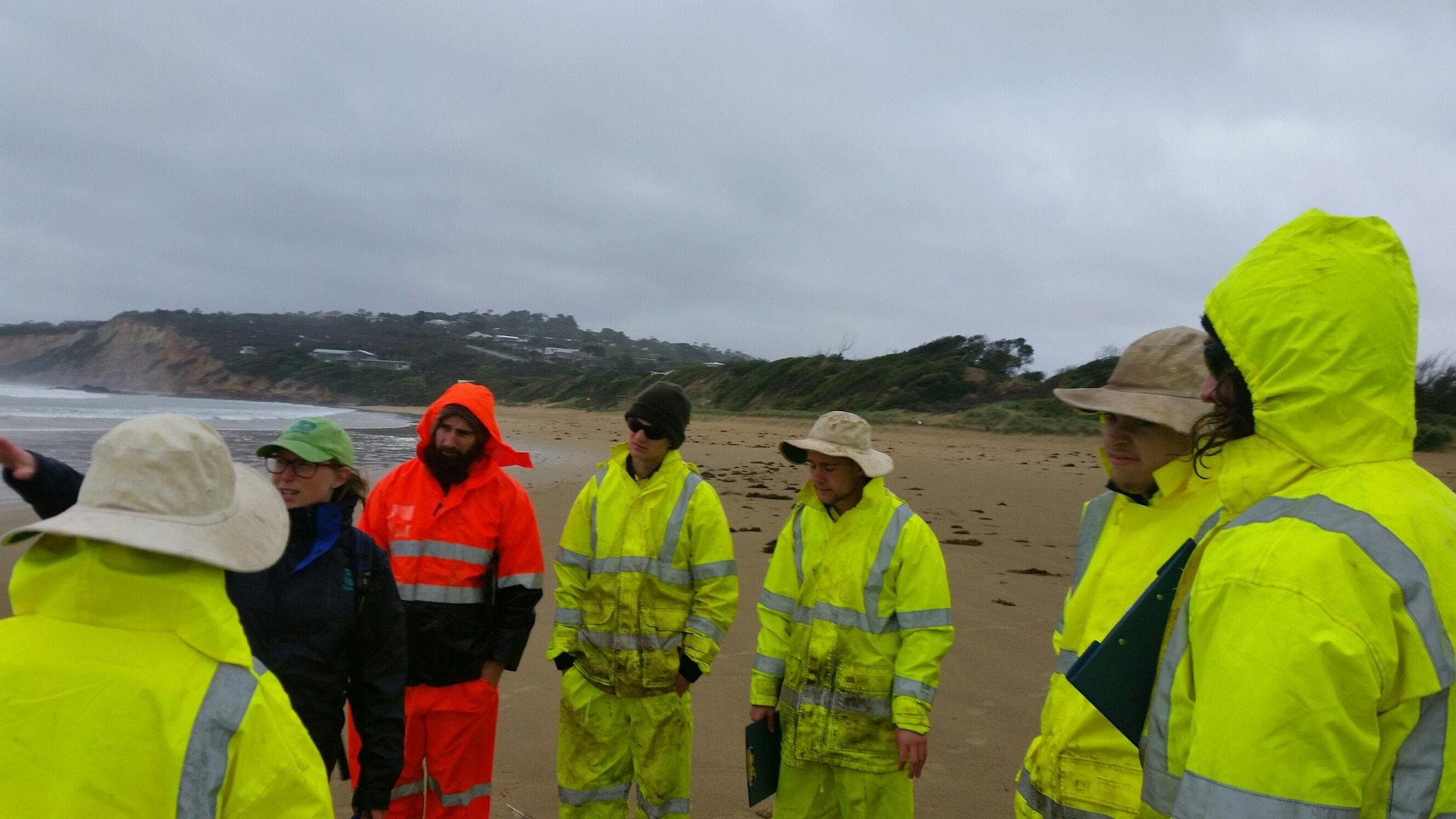
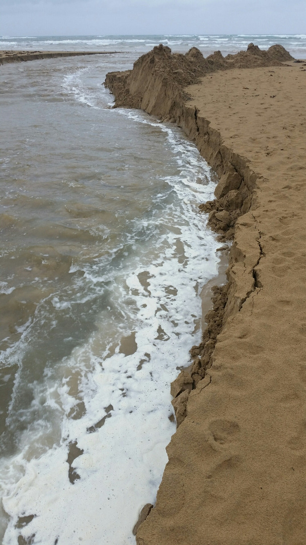
This datasheet was completed during a workshop with the Surf Coast Green Army team. The estuary was artificially opened earlier that day. The digger was still operating when we arrived at the estuary mouth at 9:30am. On this occoasion no photopoint photos were taken because it was unsafe to cross the estuary mouth. See photos.
Mouth Observation
| Mouth state | Open |
|---|---|
| Previous | O C O C C C C C C C C C O C C |
| Flow Present? | Yes |
| Previous | Y N Y N N N N N N N N N Y N N |
| Flow Direction | Out |
| Previous | O N O N N N N N N N N N O N N |
| Above Sea | Above Estuary | |
|---|---|---|
| Berm Height (m) | ||
| Berm Length (m) |
Physical Condition
| Current | Mode | |
|---|---|---|
| Wind Direction | East | |
| Beaufort Scale | Gentle breeze | |
| Sea State | Slight |


All content, files, data and images provided by the EstuaryWatch Data Portal and Gallery are subject to a Creative Commons Attribution License
Content is made available to be used in any way, and should always attribute EstuaryWatch and www.estuarywatch.org.au