EstuaryWatch Data Portal
GMC Gellibrand River Estuary Mouth Observation Site
12 November 2016
Overview
| Estuary | Gellibrand River Estuary |
|---|---|
| Site | Gellibrand River Estuary Mouth Observation Site |
| Observation ID | #10578 |
| Date and Time | Saturday 12th November 2016 10:48am |
| Approved | Approved |
Notes
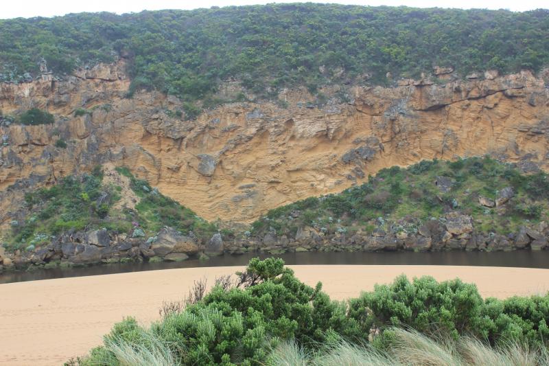
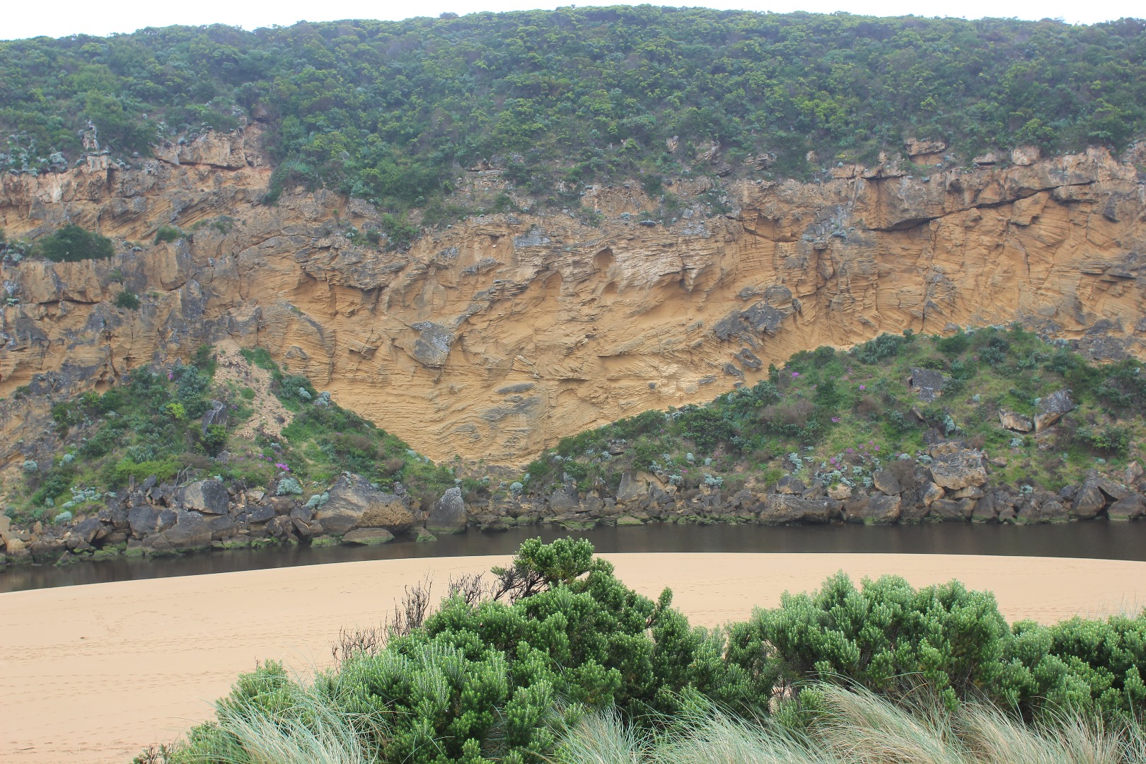
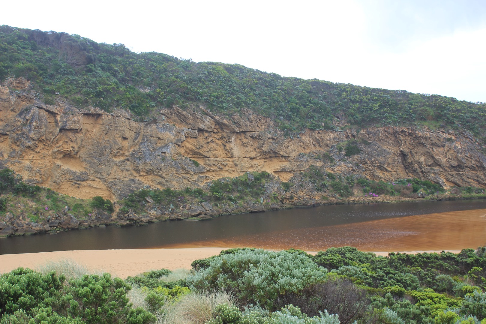
Dark discharge from draining flats up stream.( water drained from below G4 but is still draining upstream to G6. ( cape pond weed is flowering) Land slips along OOR between G5&G6
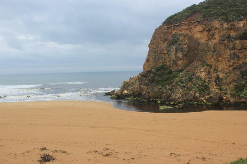
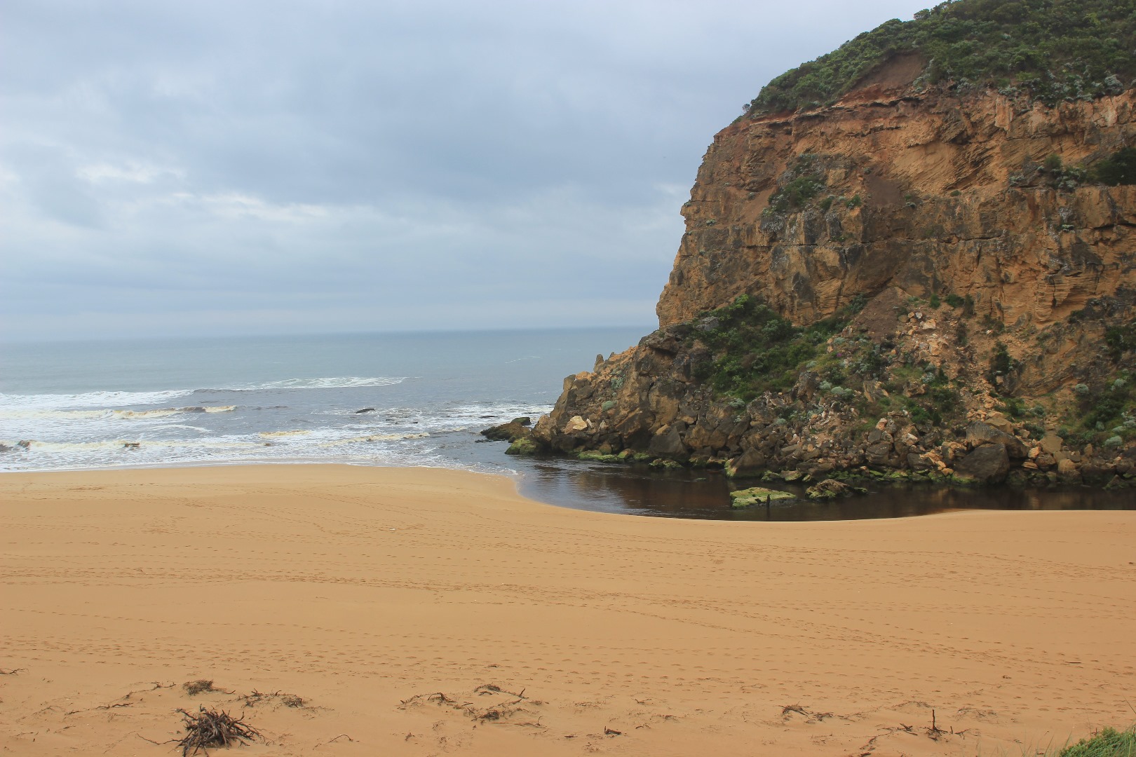
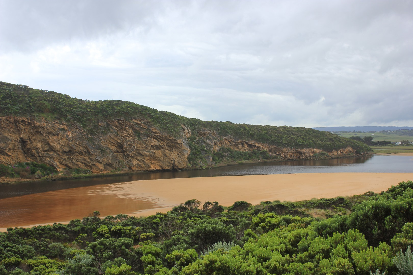
Flow out along foreshore to east
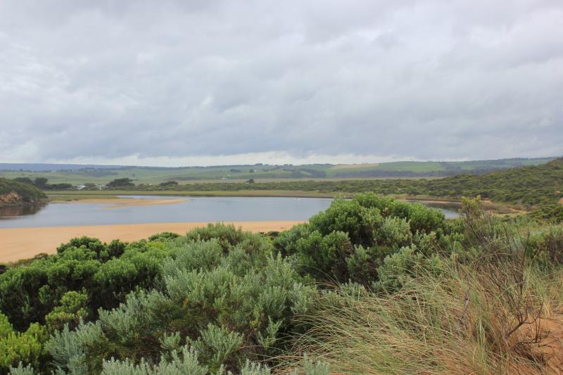
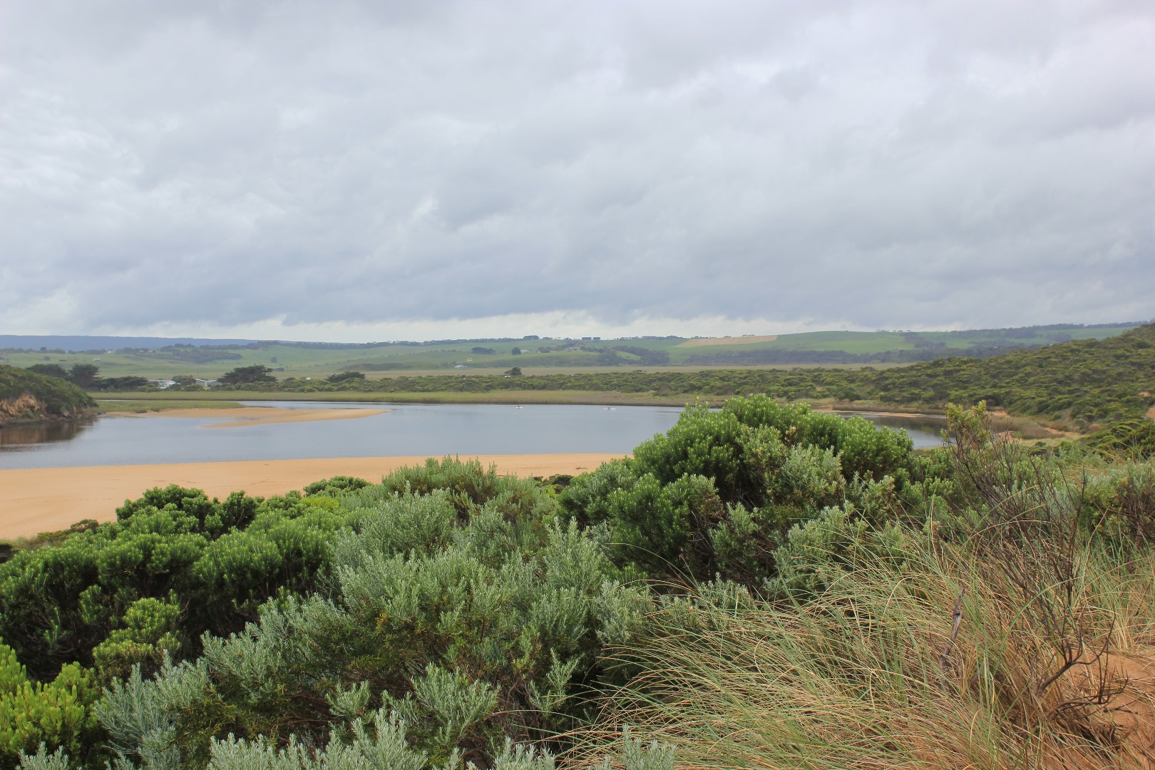
Foreshore is now undulating and beach very wide. Large areas of sand exposed in on south side of estuary. Sand extends north into estuary as well.The 'flow' of sand recently deposited by storm surge shows distinct levels (about .50m from present water level at edge) with about 30 - 40 cm. difference across area.Sand bar now has channel through middle.
Juvenile Nankeen Kestrel on debris near mouth
Sand has built up along parts of low track where new scour holes occur near previous two that currently contain small Flathead gudgeon & juvenile Tupong)
Mouth Observation
| Mouth state | Open |
|---|---|
| Previous | O O O C C C C C C O O O O O O C C O C C O C C C C C O O O O O C C C C C C C C C P C O O O O O O O O O O O O O O O O O O O O O O |
| Flow Present? | Yes |
| Previous | Y Y Y N N N N N N Y Y Y Y Y Y N N N N N N N N N N N Y Y Y Y Y N N N N N N N N N N N Y Y Y Y Y Y Y Y Y Y Y Y Y Y Y Y Y Y Y Y Y Y |
| Flow Direction | Out |
| Previous | O O O N N N N N N O O O O O O N N N N N N N N N N N O O O O O N N N N N N N N N N N O O O I I I O O O O I O O O I O O O O O O O |
| Above Sea | Above Estuary | |
|---|---|---|
| Berm Height (m) | ||
| Berm Length (m) |
Physical Condition
| Current | Mode | |
|---|---|---|
| Wind Direction | North | |
| Beaufort Scale | Light Breeze | |
| Sea State | Moderate |


All content, files, data and images provided by the EstuaryWatch Data Portal and Gallery are subject to a Creative Commons Attribution License
Content is made available to be used in any way, and should always attribute EstuaryWatch and www.estuarywatch.org.au