EstuaryWatch Data Portal
GMC Gellibrand River Estuary Mouth Observation Site
10 December 2016
Observation details
Overview
| Estuary | Gellibrand River Estuary |
|---|---|
| Site | Gellibrand River Estuary Mouth Observation Site |
| Observation ID | #10624 |
| Date and Time | Saturday 10th December 2016 09:37am |
| Approved | Approved |
Notes
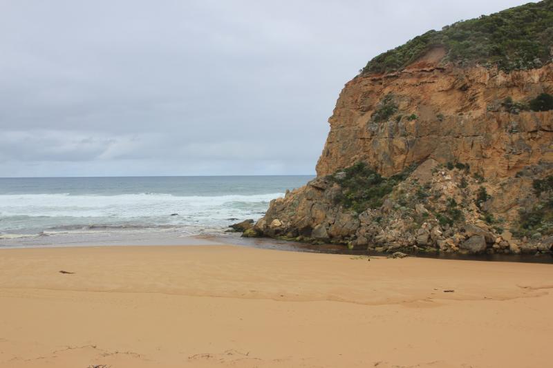
- Reduced outflow out shallow over large sand build up at mouth. Travelling east along foreshore. Long shore drift across mouth
- Swash line up high on beach with 1000's+ Velella at all stages of development
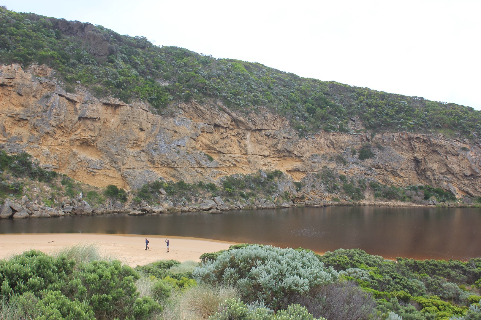
- Strong wind gusts (8) on 07/12/16 have reshaped the dunes especially next to Gp1 & E end of beach
- Steep rise from sea at E end of beach but rocky area has been scoured out (depth to sea about 5 - 8m)
- Steep rise in height of sand at E end beach then dips down at mid beach where waves impact then rises even higher close to mouth
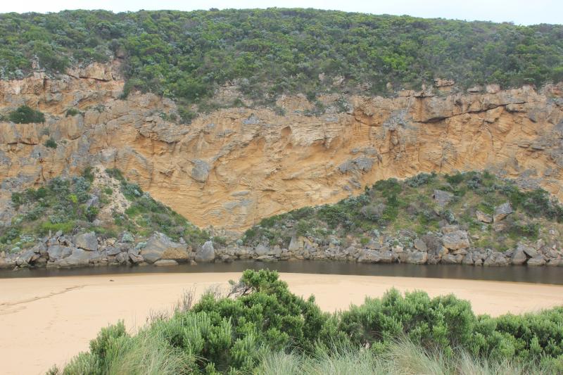
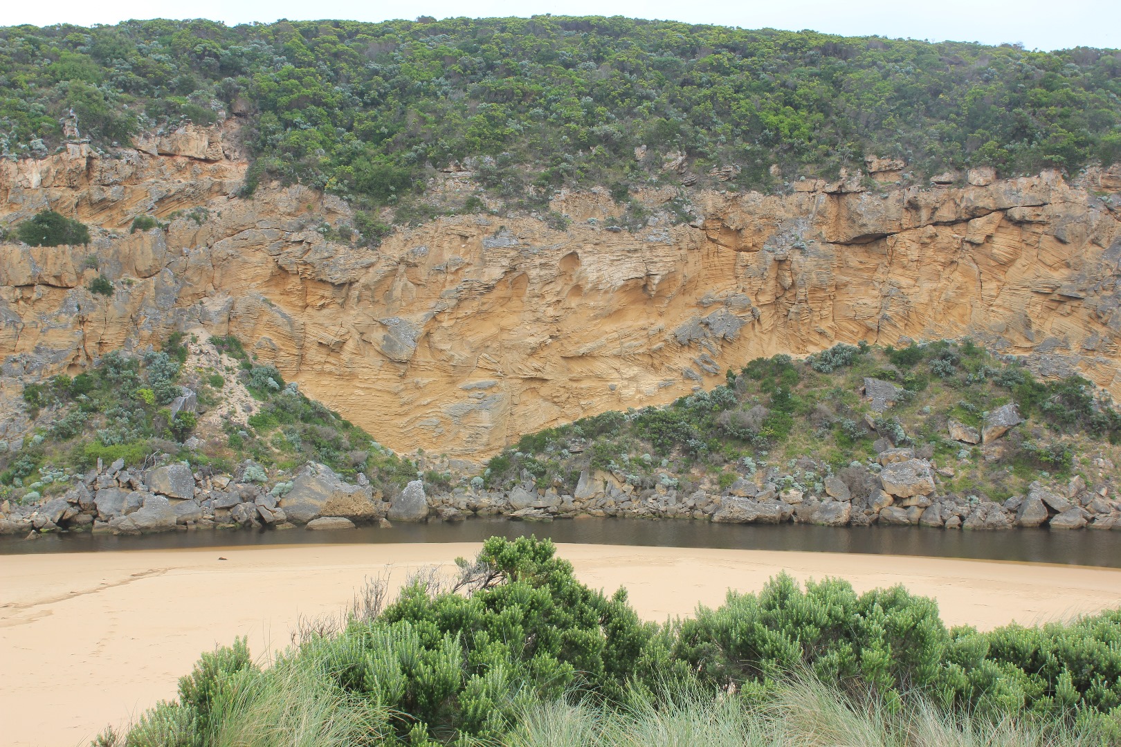
- More rock falls on west cliff face
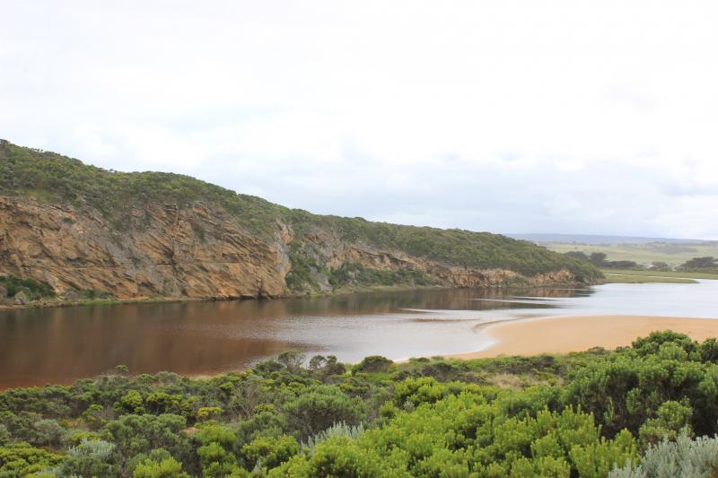
- Area where channel meets estuary has changed - much wider, large areas of black sand are have been deposited in this area
- Only mosquito lava seen in scour holes along low track, but closer to car park small fish were present in confined areas
- Pacific gull observed at E end of beach
Mouth Observation
| Mouth state | Open |
|---|---|
| Previous | C C C C O O O O O O C C O C C O C C C C C O O O O O C C C C C C C C C P C O O O O O O O O O O O O O O O O O O O O O O O O O |
| Flow Present? | Yes |
| Previous | N N N N Y Y Y Y Y Y N N N N N N N N N N N Y Y Y Y Y N N N N N N N N N N N Y Y Y Y Y Y Y Y Y Y Y Y Y Y Y Y Y Y Y Y Y Y Y Y Y |
| Flow Direction | Out |
| Previous | N N N N O O O O O O N N N N N N N N N N N O O O O O N N N N N N N N N N N O O O I I I O O O O I O O O I O O O O O O O O O O |
| Above Sea | Above Estuary | |
|---|---|---|
| Berm Height (m) | ||
| Berm Length (m) |
Physical Condition
| Current | Mode | |
|---|---|---|
| Wind Direction | South | |
| Beaufort Scale | Gentle breeze | |
| Sea State | Moderate |


All content, files, data and images provided by the EstuaryWatch Data Portal and Gallery are subject to a Creative Commons Attribution License
Content is made available to be used in any way, and should always attribute EstuaryWatch and www.estuarywatch.org.au