EstuaryWatch Data Portal
GMC Gellibrand River Estuary Mouth Observation Site
6 November 2017
Overview
| Estuary | Gellibrand River Estuary |
|---|---|
| Site | Gellibrand River Estuary Mouth Observation Site |
| Observation ID | #11573 |
| Date and Time | Monday 6th November 2017 09:59am |
| Approved | Approved |
Notes
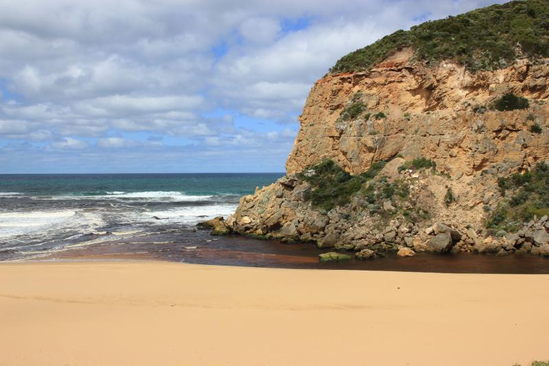
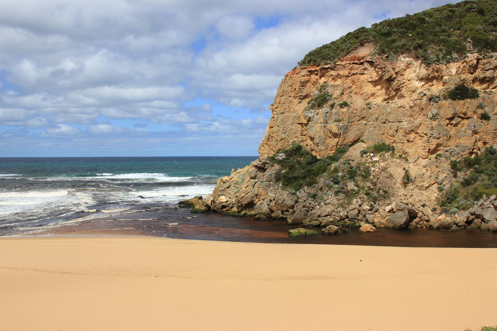
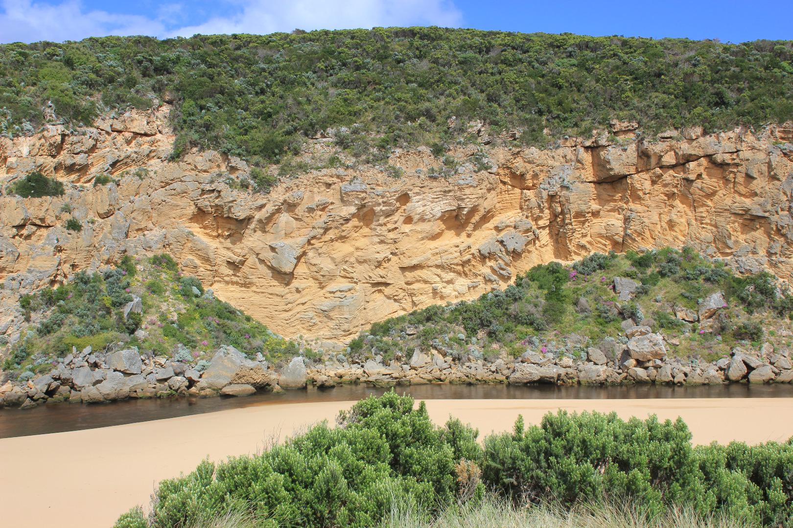
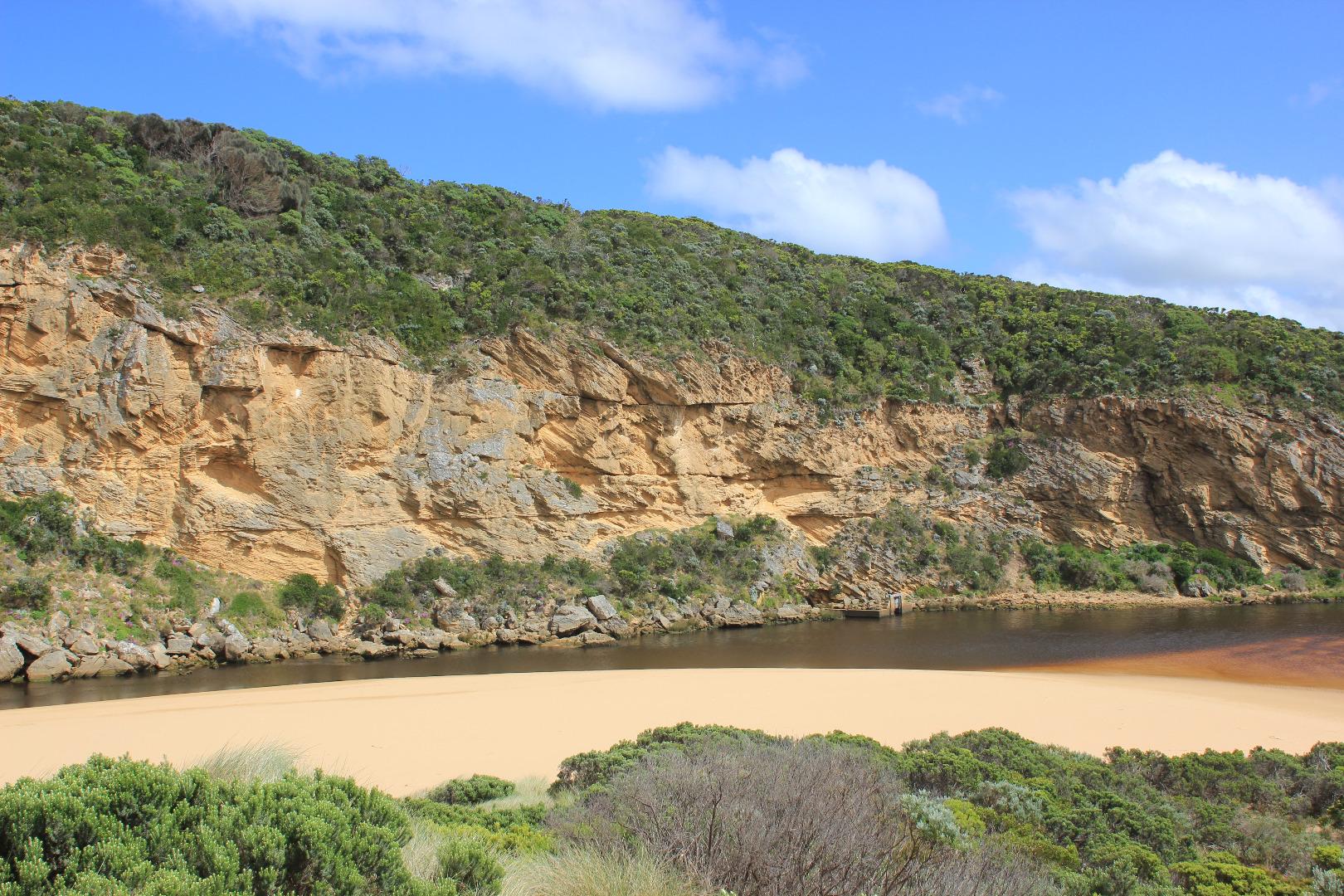
Dark discharge out & along beach front to east. Flow reducing less rainfall & less discharge from flats as nearly drained- except around G5 where Cape pond weed is prolific.
Large rock fall has occurred from directly above the existing 2 rocks across the channel & deposited a third one almost in line in the area of main flow closest to cliff face
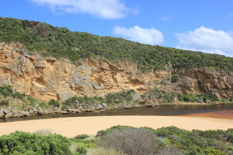
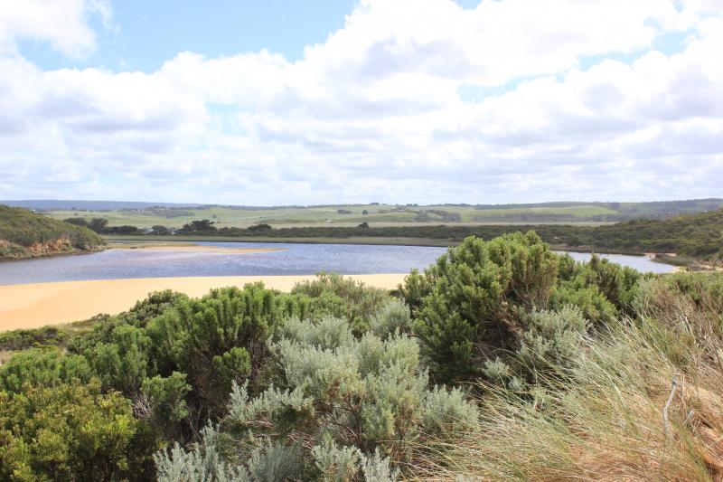
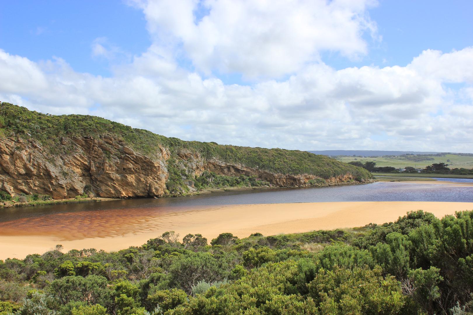
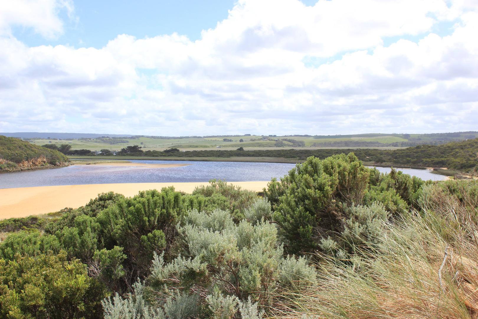
Recent storms & very rough / high seas have reshaped the beach & brought more sand to entrance & channel. Sand clearly seen under water D/S rocks & channel more narrow. Sand bar in estuary is visible & a large area of sand extends from south side of estuary north into the estuary. Large areas of debris from storm surge piled up along the south east side of the estuary. Green algae is covering some veg. alongside area of low track - also silt laden seagrass is uncovered
Mouth Observation
| Mouth state | Open |
|---|---|
| Previous | O O O O O O O O O O O O O P O P C C O O O O O O O C O C C C O O O O O C O O O O O O O O O O O O O O O O O O O |
| Flow Present? | Yes |
| Previous | Y Y Y Y Y Y Y Y Y Y Y Y Y Y Y Y N N Y Y Y N Y Y Y N N N N N Y Y Y Y Y N Y Y Y N Y Y Y Y Y Y Y Y Y Y Y Y Y Y Y |
| Flow Direction | Out |
| Previous | O O O O O O O O I I O O O I O I N N O O I N O O O N N N N N O O O O O N O O O N O O O O O O O O O O O O O O O |
| Above Sea | Above Estuary | |
|---|---|---|
| Berm Height (m) | ||
| Berm Length (m) |
Physical Condition
| Current | Mode | |
|---|---|---|
| Wind Direction | South | |
| Beaufort Scale | Fresh breeze | |
| Sea State | Moderate |


All content, files, data and images provided by the EstuaryWatch Data Portal and Gallery are subject to a Creative Commons Attribution License
Content is made available to be used in any way, and should always attribute EstuaryWatch and www.estuarywatch.org.au