EstuaryWatch Data Portal
GMC Gellibrand River Estuary Mouth Observation Site
30 April 2019
Overview
| Estuary | Gellibrand River Estuary |
|---|---|
| Site | Gellibrand River Estuary Mouth Observation Site |
| Observation ID | #12894 |
| Date and Time | Tuesday 30th April 2019 11:39am |
| Approved | Approved |
Notes
AHD G6 1.28 @ 11:45 = both G6 & G2 are the same
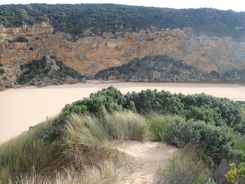
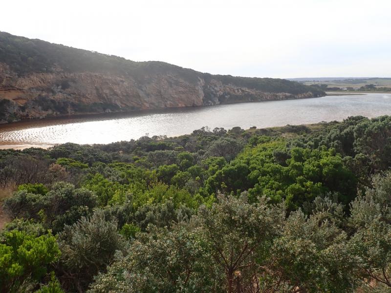
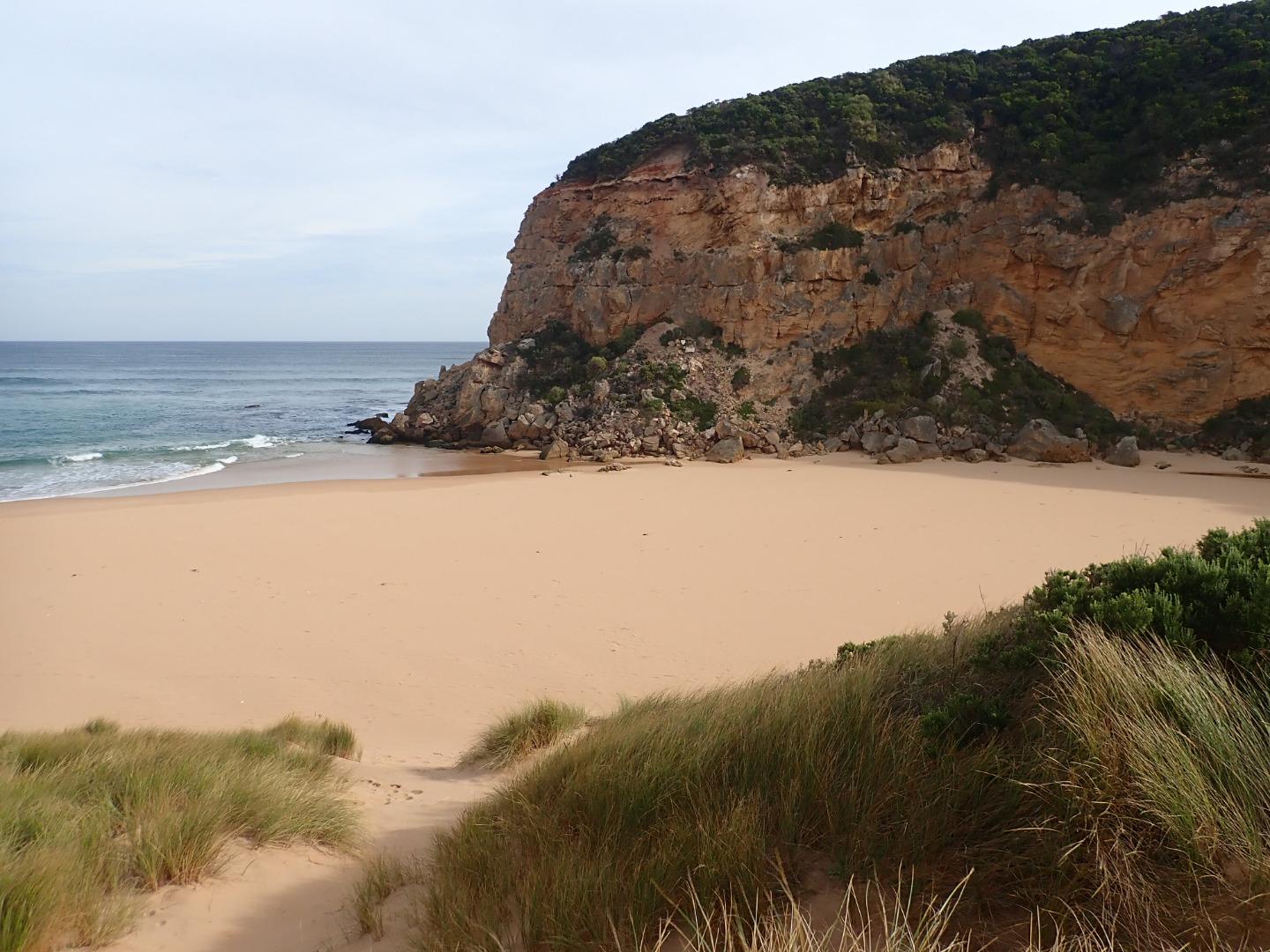
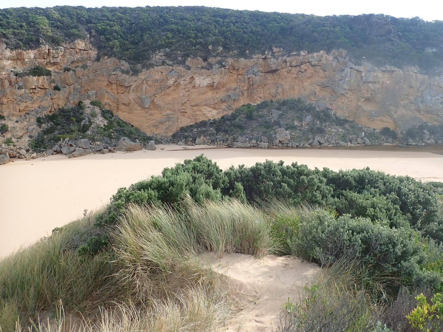
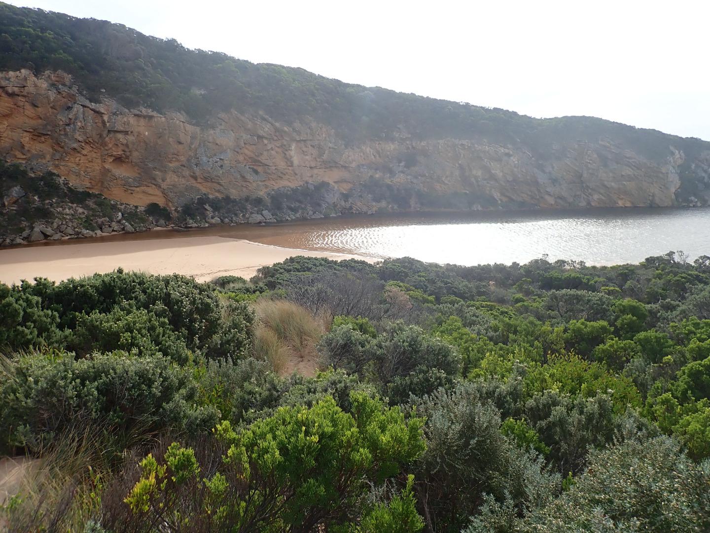
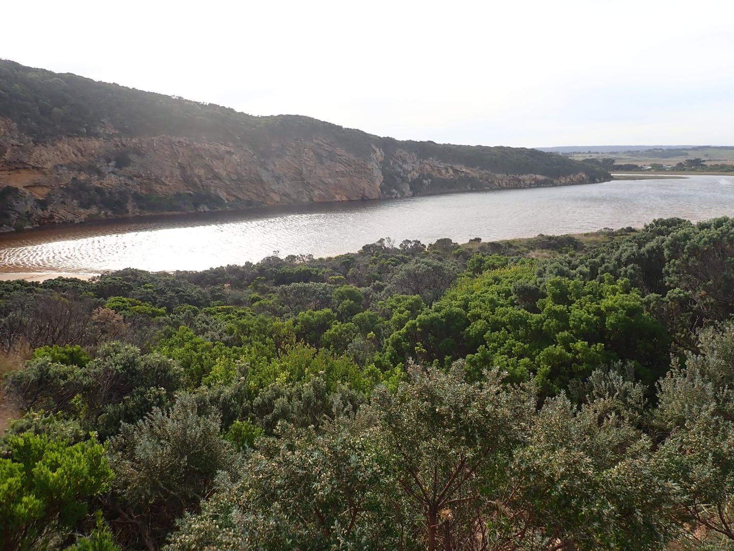
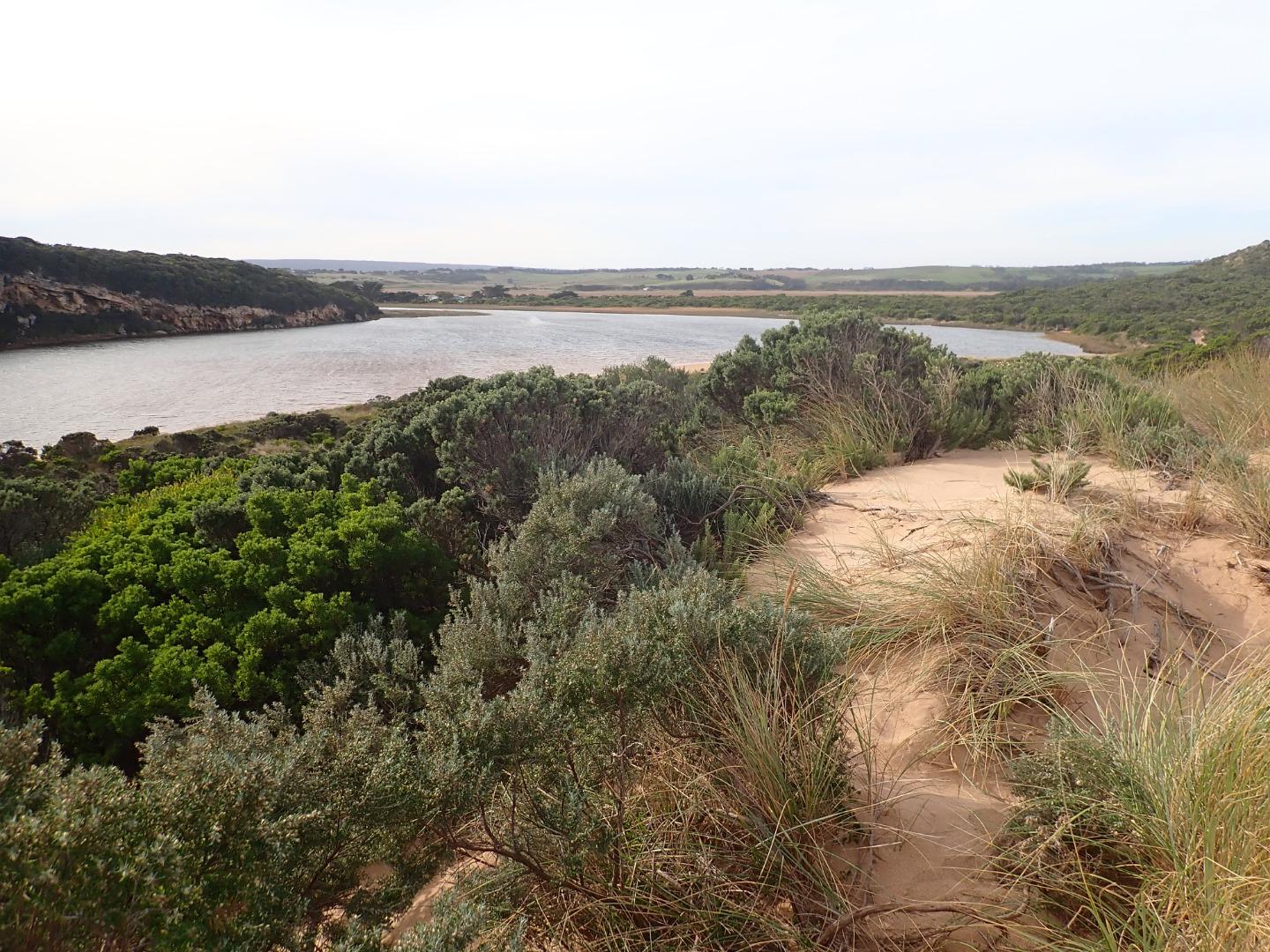
Mouth barred- the actual length of the berm without water is not great but only a very narrow very shallow projection is coming out of the estuary where an extensive sand build up is visible extending well into the estuary almost up to the tunnel entrance. Height of berm from estuary is .10 with gradual slope down to ocean. the recent storm has considerably lowered the beach around entrance & up to the sand spit at mid beach
No water over any roads but flats DS G4 have water cover.
G2 E.C. from 28.91 @ .10 from surface to 51.5 @ 4m down G4 E.C. 3.057 @ .10 then E.C. 48.88 @ 1.75 down & E.C. 52.3 @ 5.00
Bridge at G2 being repaired
Mouth Observation
| Mouth state | Closed |
|---|---|
| Previous | O C O O O O O O O O O O O O O O O O O O O O O C O O O O C O O O O O O C C C C C C C C O O O C C C C C O P C C C O O O O O O O O O |
| Flow Present? | No |
| Previous | Y N Y Y Y Y Y Y Y Y Y Y Y N Y Y Y Y Y Y Y Y Y N Y Y Y Y N Y Y Y Y Y Y N N N N N N N N Y Y Y N N N N N Y N N N N Y Y Y Y Y Y Y Y Y |
| Flow Direction | N/A |
| Previous | O N O I O O O I O O I O O N O I O O O O O O O N O O O O N O O O O O I N N N N N N N N O O O N N N N N I N N N N O O O O I O I I I |
| Above Sea | Above Estuary | |
|---|---|---|
| Berm Height (m) | 0.1m | |
| Berm Length (m) |
Physical Condition
| Current | Mode | |
|---|---|---|
| Wind Direction | North-West | |
| Beaufort Scale | Moderate breeze | |
| Sea State | Moderate |


All content, files, data and images provided by the EstuaryWatch Data Portal and Gallery are subject to a Creative Commons Attribution License
Content is made available to be used in any way, and should always attribute EstuaryWatch and www.estuarywatch.org.au