EstuaryWatch Data Portal
GMC Gellibrand River Estuary Mouth Observation Site
7 January 2020
Observation details
Overview
| Estuary | Gellibrand River Estuary |
|---|---|
| Site | Gellibrand River Estuary Mouth Observation Site |
| Observation ID | #13494 |
| Date and Time | Tuesday 7th January 2020 14:35pm |
| Approved | Approved |
Notes
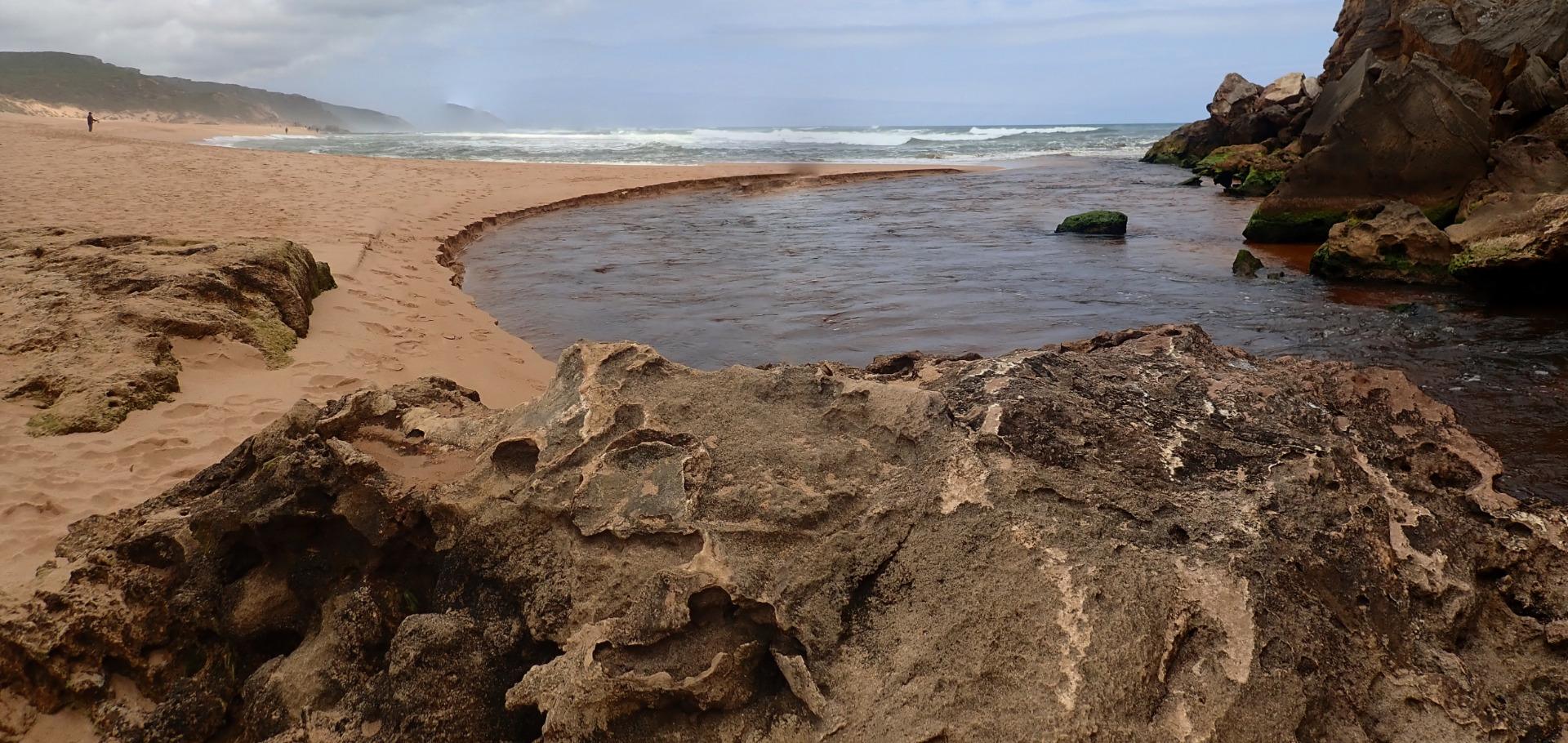
AHD board @ G6 covered with silt -unreadable
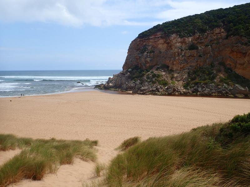
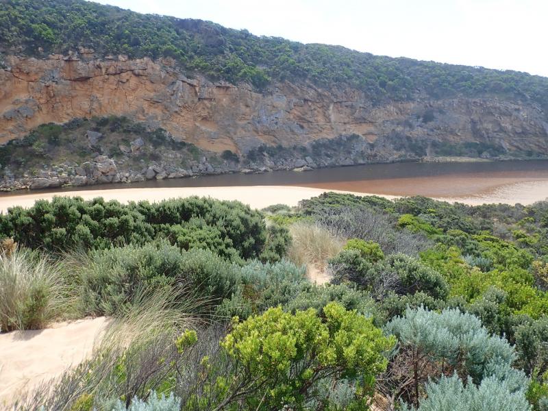
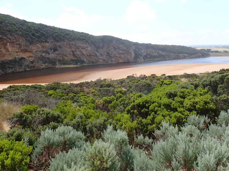
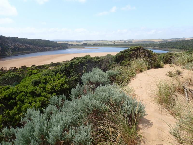
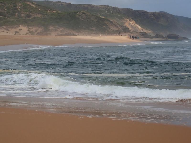
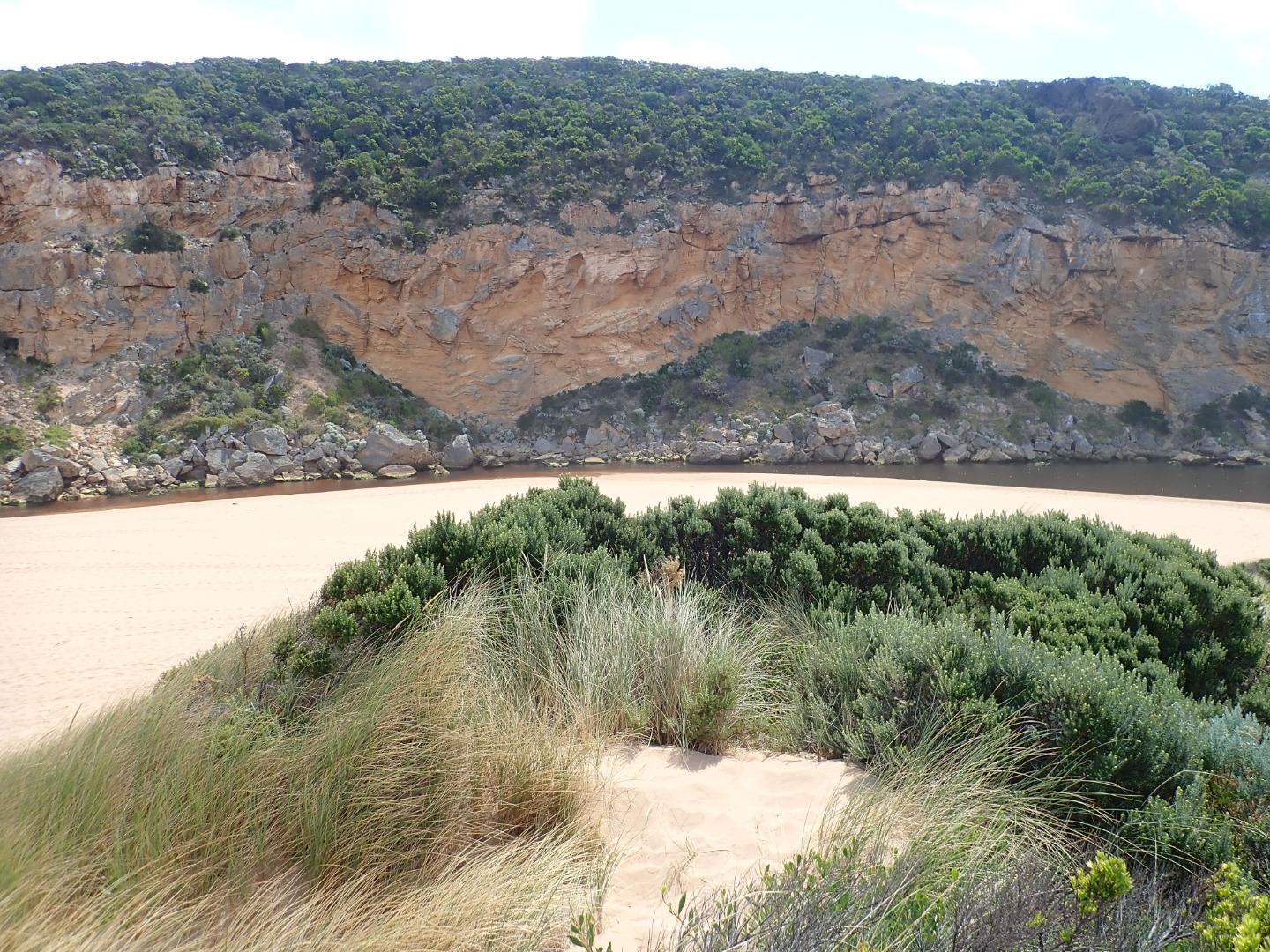
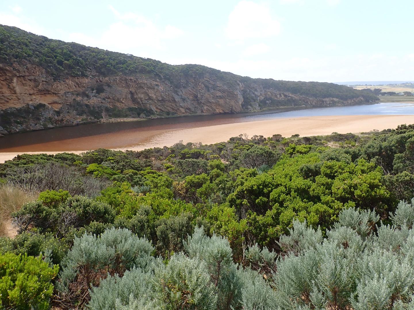
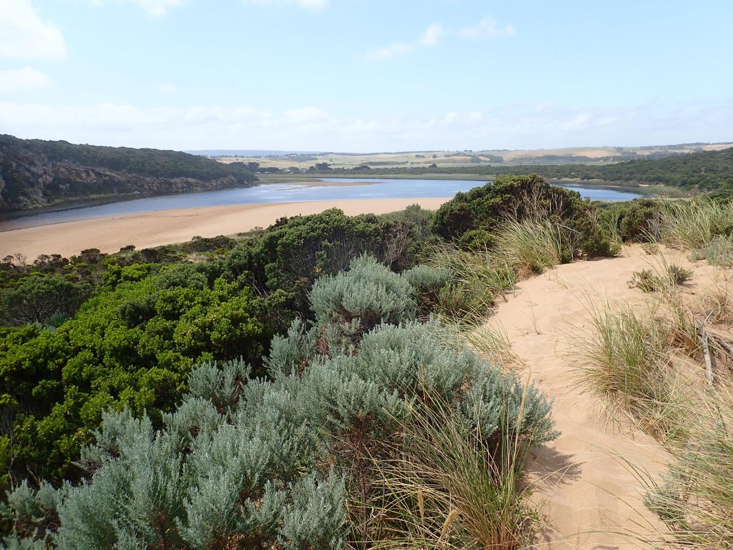
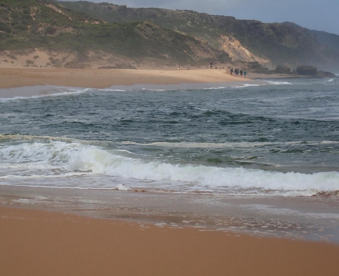
Very pale narrow, shallow outflow curving to east out over high sand build up. Waves & longshore drift impacting across entrance. Large amount of sand visible moving in flow down channel. Sand bar exposed also very large sand area projecting into lagoon south side of lagoon.
Edge of channel directly downstream of rocks has sheer east side
Sand high & projecting out to sea @ mid beach & continuing on to east end. Waves have overtopped beach front in this area & run down shallow channel in sand towards entrance
Mouth Observation
| Mouth state | Open |
|---|---|
| Previous | O O O O O C C C C C C C C O O O C C C C C O P C C C O O O O O O O O O C O O O O O O O O O O O O O O O O O O O O O O |
| Flow Present? | Yes |
| Previous | Y Y Y Y Y N N N N N N N N Y Y Y N N N N N Y N N N N Y Y Y Y Y Y Y Y Y N Y Y Y Y Y Y Y Y Y Y Y Y Y Y Y Y Y Y Y Y Y Y |
| Flow Direction | Out |
| Previous | O O O O I N N N N N N N N O O O N N N N N I N N N N O O O O I O I I I N O I O O O O O I O O O O O O O O O O O I O O |
| Above Sea | Above Estuary | |
|---|---|---|
| Berm Height (m) | ||
| Berm Length (m) |
Physical Condition
| Current | Mode | |
|---|---|---|
| Wind Direction | South | |
| Beaufort Scale | Gentle breeze | |
| Sea State | Moderate |


All content, files, data and images provided by the EstuaryWatch Data Portal and Gallery are subject to a Creative Commons Attribution License
Content is made available to be used in any way, and should always attribute EstuaryWatch and www.estuarywatch.org.au