EstuaryWatch Data Portal
GMC Gellibrand River Estuary Mouth Observation Site
14 November 2009
Observation details
Overview
| Estuary | Gellibrand River Estuary |
|---|---|
| Site | Gellibrand River Estuary Mouth Observation Site |
| Observation ID | #2804 |
| Date and Time | Saturday 14th November 2009 07:40am |
| Approved | Approved |
Notes
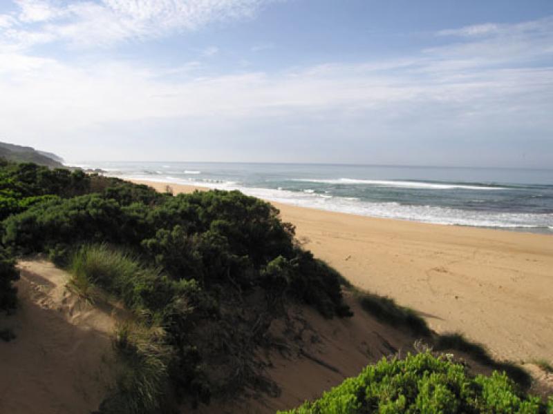
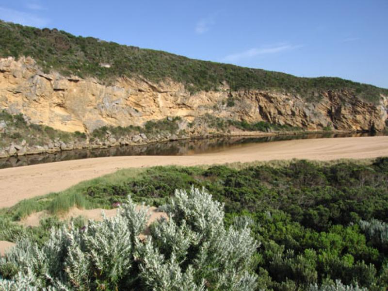
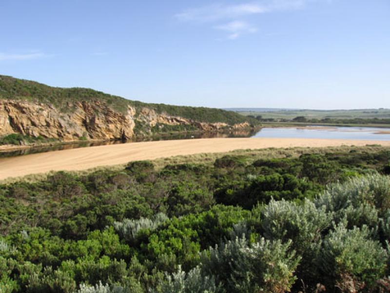
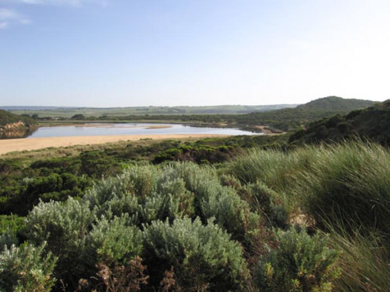
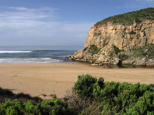
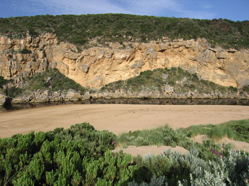
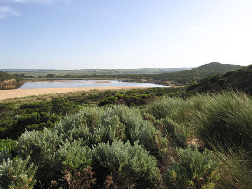
1.Low water levels, sandbars in estuary exposed. 6 shellduck on sand bars
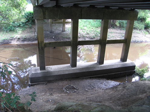
2.Channel reducing in size. Sand has built up near rocks, at times there is no flow on east side. Main flow is between rocks and cliff. Increase of sand in channel(long shore drift) between rocks and mouth
4.Reduced dark outflow, small area of discharge around mouth, none to east or west.
Mouth Observation
| Mouth state | Open |
|---|---|
| Previous | O O C C C C O O O O O O O O C C C C C C C C C O C O O O O O O P O O O O P P P C P P O O O O P P O O O O O O C O O O O O O O O O O O O O O O O O O O O O O O O O |
| Flow Present? | Yes |
| Previous | Y Y N N Y Y Y Y Y Y Y Y Y N N N N N N N N Y N Y Y Y Y Y Y Y Y Y Y Y Y Y Y N Y Y Y Y Y Y Y Y Y Y Y Y Y Y Y Y Y Y Y Y Y Y Y Y Y Y Y Y Y Y Y Y Y Y Y Y Y Y Y Y |
| Flow Direction | Out |
| Previous | O O N N I O O O O O O O I N N N N N N N N O N O O O O O O I O O O O O I N I I O O O I I O O O O I I O I O O O O O O O O O O O O O O O O O O O O O O O O |
| Above Sea | Above Estuary | |
|---|---|---|
| Berm Height (m) | ||
| Berm Length (m) |
Physical Condition
| Current | Mode | |
|---|---|---|
| Wind Direction | South-East | East |
| Beaufort Scale | Light Breeze | Gentle breeze |
| Sea State | Slight | Slight |


All content, files, data and images provided by the EstuaryWatch Data Portal and Gallery are subject to a Creative Commons Attribution License
Content is made available to be used in any way, and should always attribute EstuaryWatch and www.estuarywatch.org.au