EstuaryWatch Data Portal
GMC Gellibrand River Estuary Mouth Observation Site
7 May 2010
Observation details
Overview
| Estuary | Gellibrand River Estuary |
|---|---|
| Site | Gellibrand River Estuary Mouth Observation Site |
| Observation ID | #3521 |
| Date and Time | Friday 7th May 2010 10:15am |
| Approved | Approved |
Notes
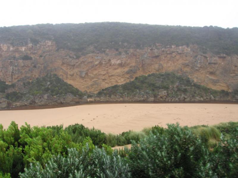
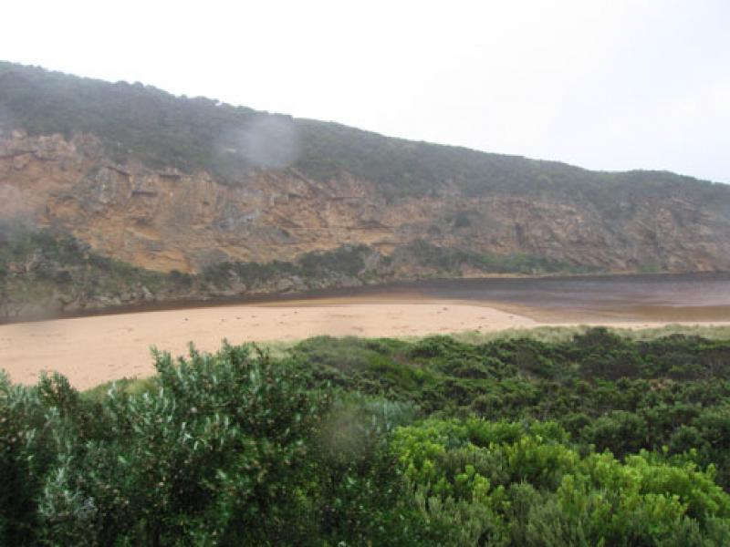
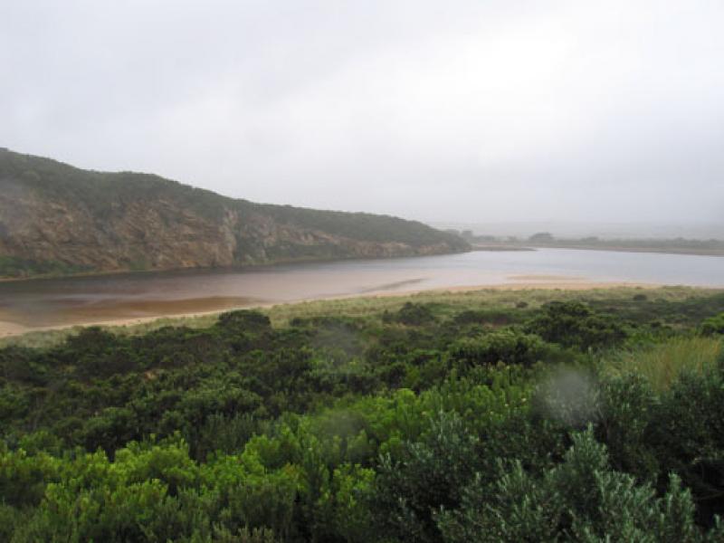
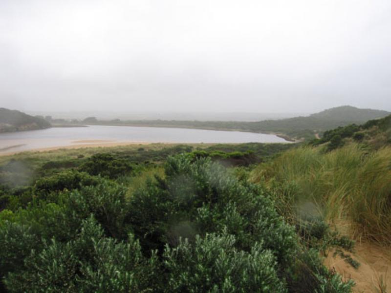
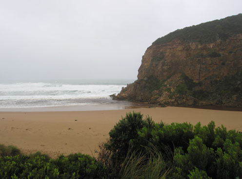
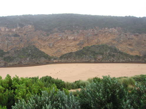
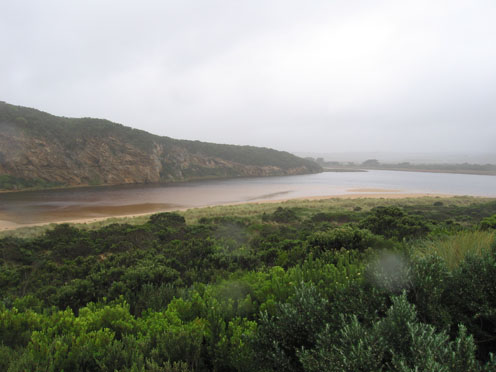
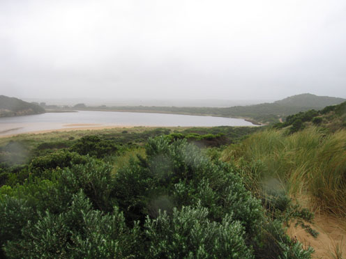
1.Flowing out over wide shallow area. Rough seas entering across a wide area, waves in all directions. Longshore drift bring sand back into the channel both infront of rocks and upstream
2.Beach front is a very gradual slope to sea
3.Wet and windy
4.Banded rail near car park. Swamp harrier near G2
Mouth Observation
| Mouth state | Open |
|---|---|
| Previous | O P P O O O O O O C O O O O O O O O O O O O O O O O O O O O O O O O O O O O O O O O O O O O O O P O O O O O O O O O O O O O O P O |
| Flow Present? | Yes |
| Previous | Y Y Y Y Y Y Y Y Y Y Y Y Y Y Y Y Y Y Y Y Y Y Y Y Y Y Y Y Y Y Y Y Y Y Y Y Y Y Y Y Y Y Y Y Y Y Y Y Y Y Y Y Y Y Y Y Y Y Y Y Y Y Y Y Y |
| Flow Direction | Out |
| Previous | I I O O O O I I O I O O O O O O O O O O O O O O O O O O O O O O O O O O O O O O O O O O O O O O O O O O O O O O I O O I O O I O |
| Above Sea | Above Estuary | |
|---|---|---|
| Berm Height (m) | ||
| Berm Length (m) |
Physical Condition
| Current | Mode | |
|---|---|---|
| Wind Direction | North | North-West |
| Beaufort Scale | Strong breeze | Fresh breeze |
| Sea State | Rough | Rough |


All content, files, data and images provided by the EstuaryWatch Data Portal and Gallery are subject to a Creative Commons Attribution License
Content is made available to be used in any way, and should always attribute EstuaryWatch and www.estuarywatch.org.au