EstuaryWatch Data Portal
GMC Gellibrand River Estuary Mouth Observation Site
18 June 2010
Observation details
Overview
| Estuary | Gellibrand River Estuary |
|---|---|
| Site | Gellibrand River Estuary Mouth Observation Site |
| Observation ID | #3741 |
| Date and Time | Friday 18th June 2010 10:00am |
| Approved | Approved |
Notes
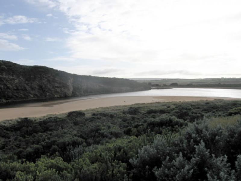
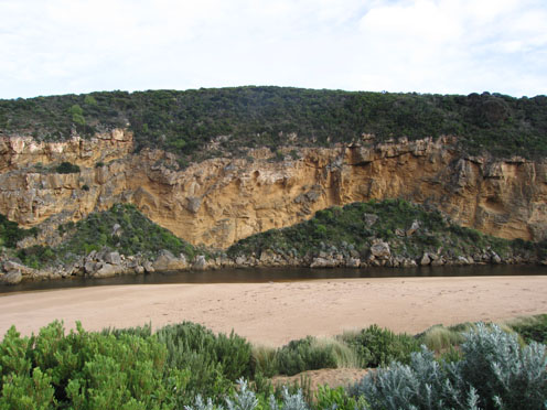
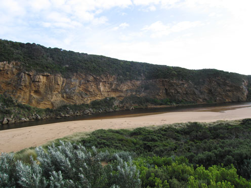
1.Out flow in narrow channel next to cliff at mouth. Waves covering a larger area over sand build up.
Some discharge can be seen around mouth and travelling along the foreshore to east.
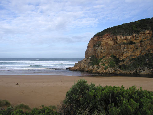
2.Small waves are entering the channel and travelling to the estuary.
Waves in all directions at mouth
Whirlpool around and infront of rocks. Longshoredrift is bringing back more sand.
Increased sand build up infront of rocks
3.Sand is visiable in breakers 50m.+ out to sea
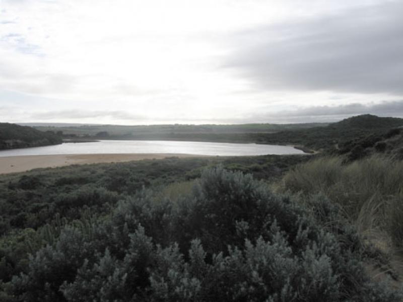
4.Beach is wide with gradual slope. Large amount of sand covering rocks at east end.
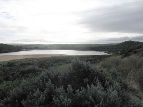
5.Last hi tide nearly reached dunes in estuary.
6.The river naturally opened a deep channel around 12th June. This resulted on steep banks to 3m. high along channel upstream of rocks which now have been reduced.
Mouth Observation
| Mouth state | Open |
|---|---|
| Previous | C O O O O O O O O O O O O O O O O O O O O O O O O O O O O O O O O O O O O O O P O O O O O O O O O O O O O O P O O O O O O P |
| Flow Present? | Yes |
| Previous | Y Y Y Y Y Y Y Y Y Y Y Y Y Y Y Y Y Y Y Y Y Y Y Y Y Y Y Y Y Y Y Y Y Y Y Y Y Y Y Y Y Y Y Y Y Y Y Y Y Y Y Y Y Y Y Y Y Y Y Y Y Y |
| Flow Direction | Out |
| Previous | I O O O O O O O O O O O O O O O O O O O O O O O O O O O O O O O O O O O O O O O O O O O O O O I O O I O O I O O O O I O I |
| Above Sea | Above Estuary | |
|---|---|---|
| Berm Height (m) | ||
| Berm Length (m) |
Physical Condition
| Current | Mode | |
|---|---|---|
| Wind Direction | North | West |
| Beaufort Scale | Strong breeze | Fresh breeze |
| Sea State | Rough | Moderate |


All content, files, data and images provided by the EstuaryWatch Data Portal and Gallery are subject to a Creative Commons Attribution License
Content is made available to be used in any way, and should always attribute EstuaryWatch and www.estuarywatch.org.au