EstuaryWatch Data Portal
GMC Gellibrand River Estuary Mouth Observation Site
31 August 2010
Observation details
Overview
| Estuary | Gellibrand River Estuary |
|---|---|
| Site | Gellibrand River Estuary Mouth Observation Site |
| Observation ID | #4323 |
| Date and Time | Tuesday 31st August 2010 10:20am |
| Approved | Approved |
Notes
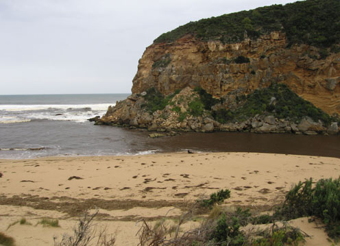
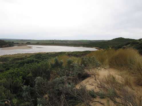
1. Very strong but reduced out flow. Dark discharge around mouth and both to east along beach and also to west
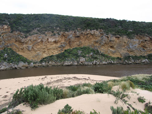
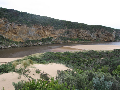
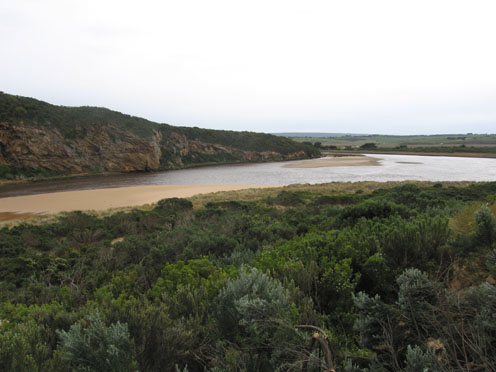
2. Fast flow has caused steep bank to 1.5m along east side of channel upstream of rocks
3. Sand has reappeared about 20m from tunnel. Sand bars in middle of estuary have changed shape and position
4.The whole s/e side of the estuary has been modified with sheer sides to dunes reaching up to
2-4m high
5. Large mass of Phragmities and rubbish around mouth and dark 'scum' up to base of dunes along ocean beach
6.Birds Silver gulls 8 - feeding at mouth, Hawks/ Harriers 6 - over wetlands
7.Valley still flooded
Mouth Observation
| Mouth state | Open |
|---|---|
| Previous | O O O O O O O O O O O O O O O O O O O O O O O P O O O O O O O O O O O O O O P O O O O O O P O O O O O O O O O O O O O O |
| Flow Present? | Yes |
| Previous | Y Y Y Y Y Y Y Y Y Y Y Y Y Y Y Y Y Y Y Y Y Y Y Y Y Y Y Y Y Y Y Y Y Y Y Y Y Y Y Y Y Y Y Y Y Y Y Y Y Y Y Y Y Y Y Y Y Y Y Y |
| Flow Direction | Out |
| Previous | O O O O O O O O O O O O O O O O O O O O O O O O O O O O O O O O I O O I O O I O O O O I O I O I O O I O O O O O O O O O |
| Above Sea | Above Estuary | |
|---|---|---|
| Berm Height (m) | ||
| Berm Length (m) |
Physical Condition
| Current | Mode | |
|---|---|---|
| Wind Direction | North | North-West |
| Beaufort Scale | High wind, moderate gale, near gale | Strong breeze |
| Sea State | Moderate | Rough |


All content, files, data and images provided by the EstuaryWatch Data Portal and Gallery are subject to a Creative Commons Attribution License
Content is made available to be used in any way, and should always attribute EstuaryWatch and www.estuarywatch.org.au