EstuaryWatch Data Portal
GMC Gellibrand River Estuary Mouth Observation Site
8 April 2011
Observation details
Overview
| Estuary | Gellibrand River Estuary |
|---|---|
| Site | Gellibrand River Estuary Mouth Observation Site |
| Observation ID | #5383 |
| Date and Time | Friday 8th April 2011 10:25am |
| Approved | Approved |
Notes
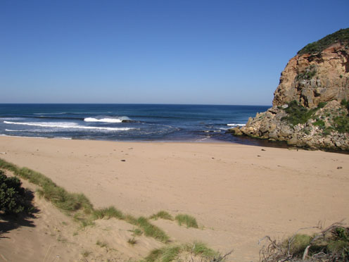
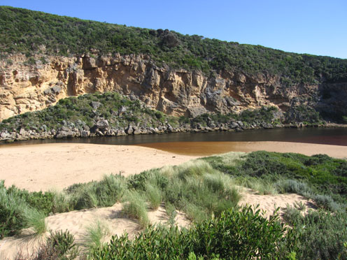
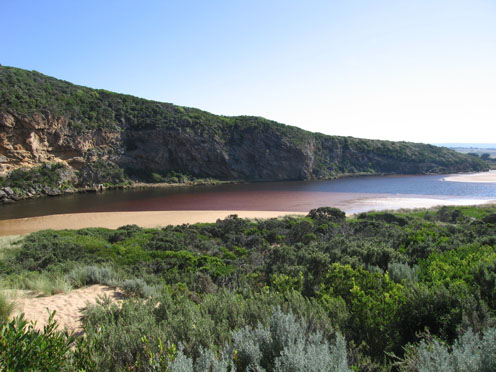
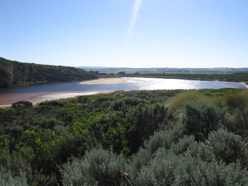
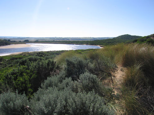
1. Slightly increased out flow, discharge visiable only around mouth
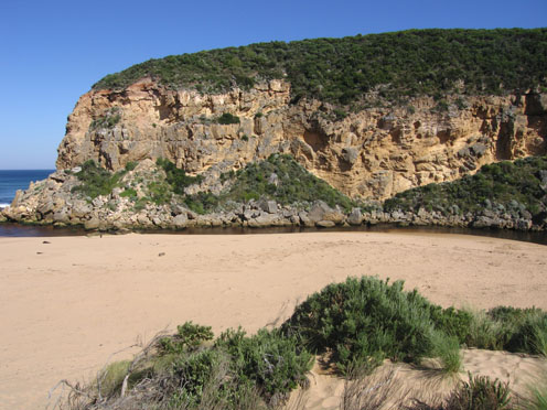
2.Steep sides (1m)to channel near mouth
3.Beach very wide & sloping, rocks exposed at east & west ends
4.waves circling at mouth
5.Large areas of sand exposed in estuary, seagrass on east side is showing signs of new growth.
6. Wanderer butterflies (3) on beach & near nouth
Mouth Observation
| Mouth state | Open |
|---|---|
| Previous | O O O P O O O O O O P O O O O O O O O O O O O O O O O O O O O O O O O O O O O O O O O O O O O O O O O O O O O O O O O O |
| Flow Present? | Yes |
| Previous | Y Y Y Y Y Y Y Y Y Y Y Y Y Y Y Y Y Y Y Y Y Y Y Y Y Y Y Y Y Y Y Y Y Y Y Y Y Y Y Y Y Y Y Y Y Y Y Y Y Y Y Y Y Y Y Y Y Y Y Y |
| Flow Direction | Out |
| Previous | I O O I O O O O I O I O I O O I O O O O O O O O O O O O O O O O O O O O O O O O O O O O O O O O O O O O O O O O O O O O |
| Above Sea | Above Estuary | |
|---|---|---|
| Berm Height (m) | ||
| Berm Length (m) |
Physical Condition
| Current | Mode | |
|---|---|---|
| Wind Direction | North | |
| Beaufort Scale | Fresh breeze | |
| Sea State | Slight |


All content, files, data and images provided by the EstuaryWatch Data Portal and Gallery are subject to a Creative Commons Attribution License
Content is made available to be used in any way, and should always attribute EstuaryWatch and www.estuarywatch.org.au