EstuaryWatch Data Portal
GMC Gellibrand River Estuary Mouth Observation Site
10 June 2011
Observation details
Overview
| Estuary | Gellibrand River Estuary |
|---|---|
| Site | Gellibrand River Estuary Mouth Observation Site |
| Observation ID | #5667 |
| Date and Time | Friday 10th June 2011 09:25am |
| Approved | Approved |
Notes
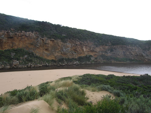
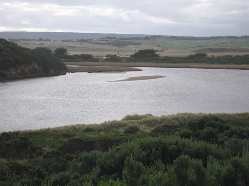
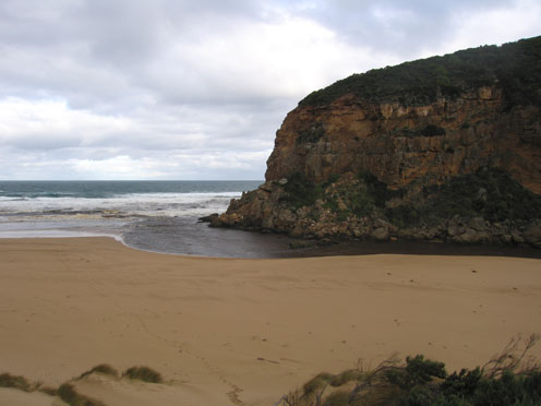
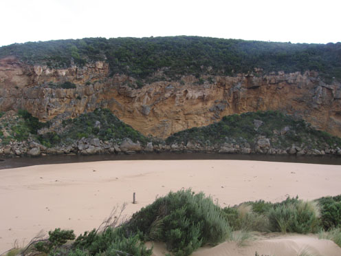
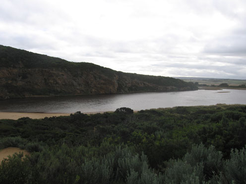
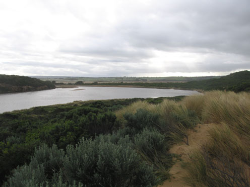
1.Strong out flow on both sides of rocks travelling through a much wider entrance and going to east along shoreline. Colour very dark
2.Recent heavy rain has increased flow. Channel between rocks & tunnel has steep east side (1-1.5m), channel in that area is about 15-20 m wide
3.Beach very wide with gradual slope
4.Recent rough seas & hi tides have cut into sand dunes on south side of estuary and impacted on east side. Debris is piled up along bank and sand has built up in reed area
5.Small area of sandbar is exposed
6. 2 dead penguins ( one without a head)
Mouth Observation
| Mouth state | Open |
|---|---|
| Previous | P O O O O O O O O O O O O O O O O O O O O O O O O O O O O O O O O O O O O O O O O O O O O O O O O O O O O O O O O O O |
| Flow Present? | Yes |
| Previous | Y Y Y Y Y Y Y Y Y Y Y Y Y Y Y Y Y Y Y Y Y Y Y Y Y Y Y Y Y Y Y Y Y Y Y Y Y Y Y Y Y Y Y Y Y Y Y Y Y Y Y Y Y Y Y Y Y Y Y |
| Flow Direction | Out |
| Previous | I O I O O I O O O O O O O O O O O O O O O O O O O O O O O O O O O O O O O O O O O O O O O O O O O O O O O O I O I O I |
| Above Sea | Above Estuary | |
|---|---|---|
| Berm Height (m) | ||
| Berm Length (m) |
Physical Condition
| Current | Mode | |
|---|---|---|
| Wind Direction | South | |
| Beaufort Scale | Strong breeze | |
| Sea State | Moderate |


All content, files, data and images provided by the EstuaryWatch Data Portal and Gallery are subject to a Creative Commons Attribution License
Content is made available to be used in any way, and should always attribute EstuaryWatch and www.estuarywatch.org.au