EstuaryWatch Data Portal
GMC Gellibrand River Estuary Mouth Observation Site
4 November 2011
Observation details
Overview
| Estuary | Gellibrand River Estuary |
|---|---|
| Site | Gellibrand River Estuary Mouth Observation Site |
| Observation ID | #6321 |
| Date and Time | Friday 4th November 2011 09:02am |
| Approved | Approved |
Notes
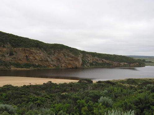
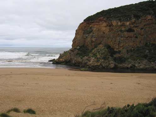
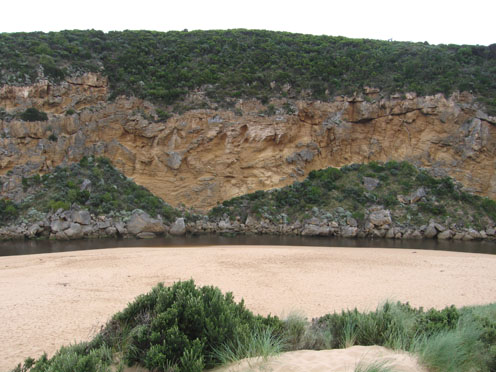
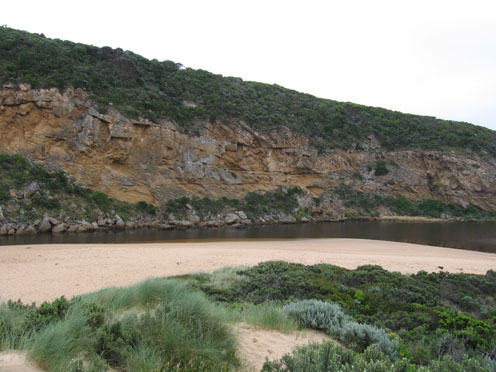
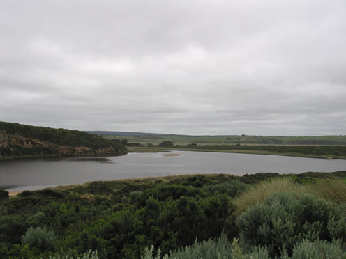
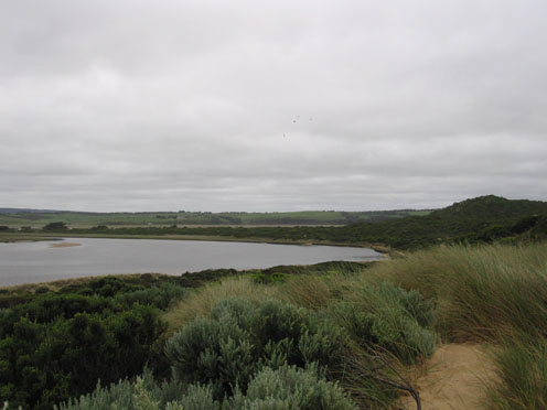
1.Water flowing both sides of rocks but increased sand build up at mouth
2.Sea has eroded eastern end of ocean beach leaving 3m high face to sand
3.Continuing erosion on east & south side of estuary
4.Hooded Plover tracks on beach but no sighting of birds
5 Birds
Increaced no of Coots & Swamphens
Hardhead ducks, Swans, Ibis, White egrets,W/h herons, W/n Herons, Comorants,Wood duck, Teal, Grebes, Swamp harriers3, large mob of masked Plover 10 at G4
Mouth Observation
| Mouth state | Open |
|---|---|
| Previous | O O O O O O O O O O O O O O O O O O O O O O O O O O O O O O O O O O O O O O O O O O O O O O O O O O O O O O O O |
| Flow Present? | Yes |
| Previous | Y Y Y Y Y Y Y Y Y Y Y Y Y Y Y Y Y Y Y Y Y Y Y Y Y Y Y Y Y Y Y Y Y Y Y Y Y Y Y Y Y Y Y Y Y Y Y Y Y Y Y Y Y Y Y Y |
| Flow Direction | Out |
| Previous | O O O O O O O O O O O O O O O O O O O O O O O O O O O O O I O I O I O I O O O O O O O O O O O O O O O O O O O |
| Above Sea | Above Estuary | |
|---|---|---|
| Berm Height (m) | ||
| Berm Length (m) |
Physical Condition
| Current | Mode | |
|---|---|---|
| Wind Direction | North | |
| Beaufort Scale | Calm | |
| Sea State | Moderate |


All content, files, data and images provided by the EstuaryWatch Data Portal and Gallery are subject to a Creative Commons Attribution License
Content is made available to be used in any way, and should always attribute EstuaryWatch and www.estuarywatch.org.au