EstuaryWatch Data Portal
GMC Gellibrand River Estuary Mouth Observation Site
27 October 2012
Observation details
Overview
| Estuary | Gellibrand River Estuary |
|---|---|
| Site | Gellibrand River Estuary Mouth Observation Site |
| Observation ID | #7902 |
| Date and Time | Saturday 27th October 2012 08:18am |
| Approved | Approved |
Notes
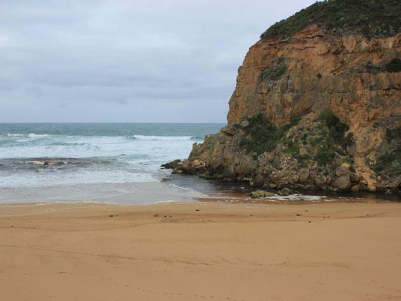
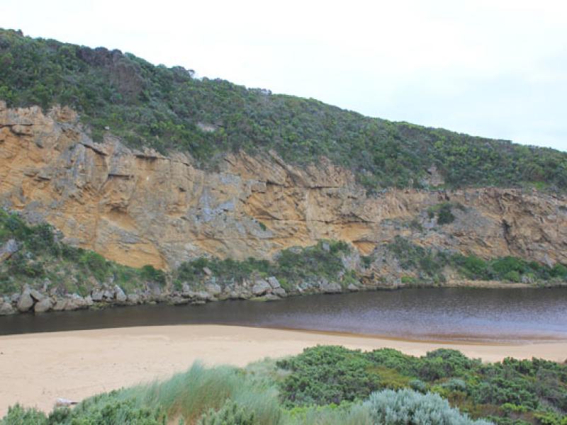
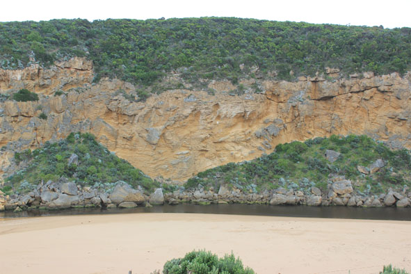
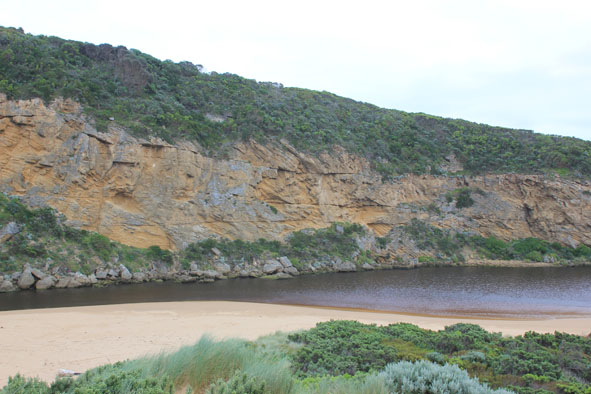
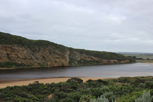
1. Dark discharge out around mouth & to east along foreshore
2.Waves impacting mid beach then a longshore drift moving west brings more sand to entrance
3.Out flow only between rocks & cliff, channel reduced upstream of rocks (about 5m.)
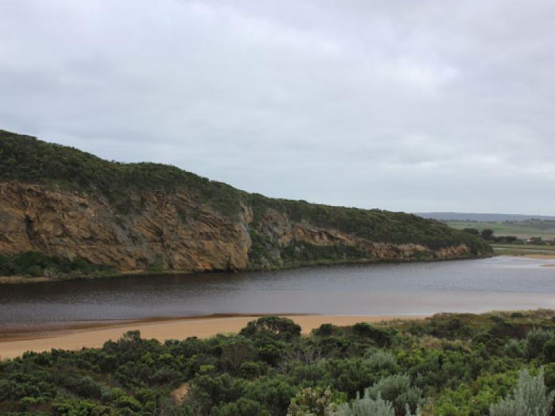
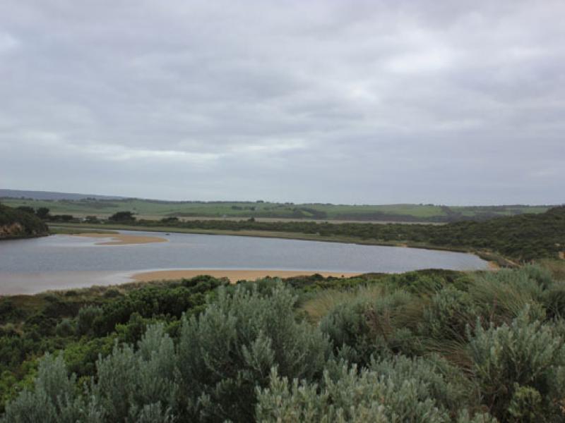
4.Dark swash line along beach (flats upstream have drained since 19/10/12)
5.Sandbar & south side of estuary have large areas of sand exposed
6.Senecio elegans flowering everywhere but in some areas Euphorbia paralais is taking over
Mouth Observation
| Mouth state | Open |
|---|---|
| Previous | O O O O O O O O O O O C O O O C O O O O O P P P C O P O O O P O O O O O O O O O O O O O O O O O O O |
| Flow Present? | Yes |
| Previous | Y Y Y Y Y Y Y Y Y Y Y N Y Y Y N Y Y Y Y Y Y N N N Y N Y Y Y Y Y Y Y Y Y Y Y Y Y Y Y Y Y Y Y Y Y Y Y |
| Flow Direction | Out |
| Previous | O O O O O O O O O O N O O O N O O O O O I N N N I N I I O I O O O O O O O O O O O O O O O O O O O |
| Above Sea | Above Estuary | |
|---|---|---|
| Berm Height (m) | ||
| Berm Length (m) |
Physical Condition
| Current | Mode | |
|---|---|---|
| Wind Direction | South | |
| Beaufort Scale | Moderate breeze | |
| Sea State | Rough |


All content, files, data and images provided by the EstuaryWatch Data Portal and Gallery are subject to a Creative Commons Attribution License
Content is made available to be used in any way, and should always attribute EstuaryWatch and www.estuarywatch.org.au