EstuaryWatch Data Portal
GMC Gellibrand River Estuary Mouth Observation Site
3 January 2013
Observation details
Overview
| Estuary | Gellibrand River Estuary |
|---|---|
| Site | Gellibrand River Estuary Mouth Observation Site |
| Observation ID | #7996 |
| Date and Time | Thursday 3rd January 2013 07:58am |
| Approved | Approved |
Notes
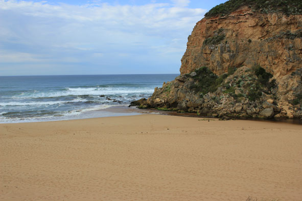
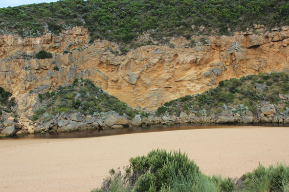
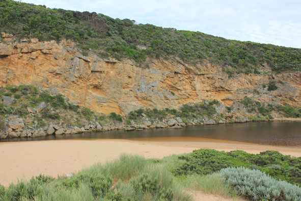
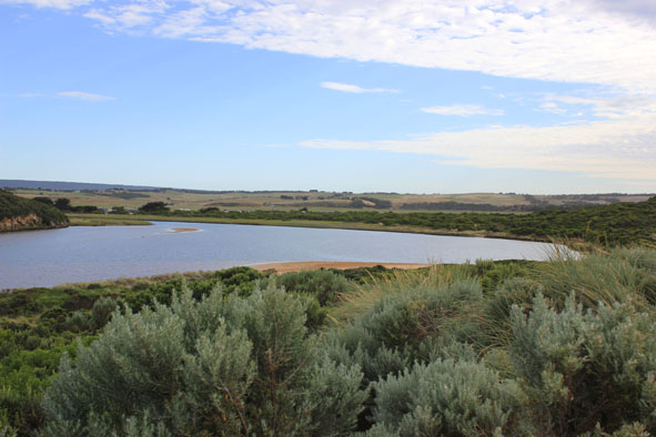
1.Strong outflow only between rocks & cliff - out over wide shallow area (no sign of dark discharge) Large ripples/waves ( 30cm +) created. in flow despite being impacted by long shore drift
2.Large sand build up around mouth
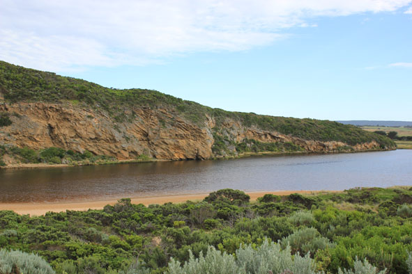
3. Last hi tide almost up to dunes then flowing back west (to mouth) & entering channel around rocks and upstream
4.Dead penguin on side of channel up stream rocks
Mouth Observation
| Mouth state | Open |
|---|---|
| Previous | O C O O O C O O O O O P P P C O P O O O P O O O O O O O O O O O O O O O O O O O O O O O O O O O O O |
| Flow Present? | Yes |
| Previous | Y N Y Y Y N Y Y Y Y Y Y N N N Y N Y Y Y Y Y Y Y Y Y Y Y Y Y Y Y Y Y Y Y Y Y Y Y Y Y Y Y Y Y Y Y Y Y |
| Flow Direction | Out |
| Previous | O N O O O N O O O O O I N N N I N I I O I O O O O O O O O O O O O O O O O O O O O O O O O O O O O O |
| Above Sea | Above Estuary | |
|---|---|---|
| Berm Height (m) | ||
| Berm Length (m) |
Physical Condition
| Current | Mode | |
|---|---|---|
| Wind Direction | North-East | |
| Beaufort Scale | Light Breeze | |
| Sea State | Slight |


All content, files, data and images provided by the EstuaryWatch Data Portal and Gallery are subject to a Creative Commons Attribution License
Content is made available to be used in any way, and should always attribute EstuaryWatch and www.estuarywatch.org.au