EstuaryWatch Data Portal
GMC Gellibrand River Estuary Mouth Observation Site
2 March 2013
Observation details
Overview
| Estuary | Gellibrand River Estuary |
|---|---|
| Site | Gellibrand River Estuary Mouth Observation Site |
| Observation ID | #8137 |
| Date and Time | Saturday 2nd March 2013 08:55am |
| Approved | Approved |
Notes
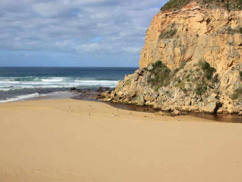
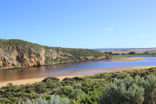
- Dark discharge out east along foreshore then to the south, seems to be following current of beach which is horseshoe shaped, with a gradual slope and every windswept.
- Wave mid way up at last high tide.
- longshore drift over sand building at mouth into channel which is wider and deeper.
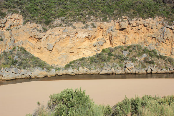
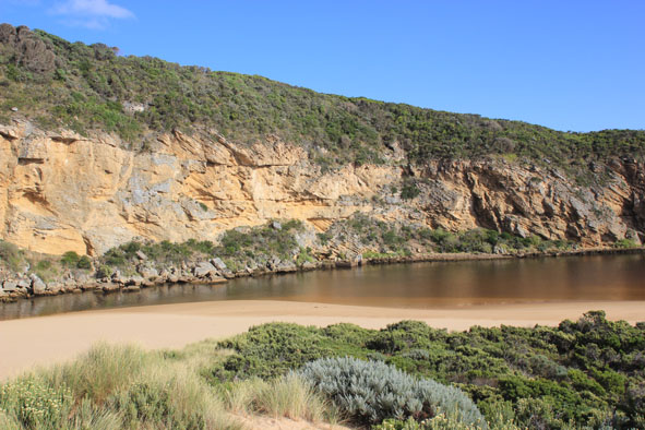
- High sand cliffs (1.20m) remain about 20m east of channel.
- Channel outflow downstream of rocks is very close to cliffs and works its way through rocks below end of cliff.
- No. of birds similar to 01/03/13 but now 12 "fat" cormorants and more ibis.
Mouth Observation
| Mouth state | Open |
|---|---|
| Previous | O O O P P P C O P O O O P O O O O O O O O O O O O O O O O O O O O O O O O O O O O O O C C C C C C C C C C C O O O O O |
| Flow Present? | Yes |
| Previous | Y Y Y Y N N N Y N Y Y Y Y Y Y Y Y Y Y Y Y Y Y Y Y Y Y Y Y Y Y Y Y Y Y Y Y Y Y Y Y Y Y N N N N N N N N Y N N Y Y Y Y Y |
| Flow Direction | Out |
| Previous | O O O I N N N I N I I O I O O O O O O O O O O O O O O O O O O O O O O O O O O O O O O N N N N N N N N N N O O I O |
| Above Sea | Above Estuary | |
|---|---|---|
| Berm Height (m) | ||
| Berm Length (m) |
Physical Condition
| Current | Mode | |
|---|---|---|
| Wind Direction | East | |
| Beaufort Scale | Gentle breeze | |
| Sea State | Moderate |


All content, files, data and images provided by the EstuaryWatch Data Portal and Gallery are subject to a Creative Commons Attribution License
Content is made available to be used in any way, and should always attribute EstuaryWatch and www.estuarywatch.org.au