EstuaryWatch Data Portal
GMC Gellibrand River Estuary Mouth Observation Site
2 May 2013
Observation details
Overview
| Estuary | Gellibrand River Estuary |
|---|---|
| Site | Gellibrand River Estuary Mouth Observation Site |
| Observation ID | #8258 |
| Date and Time | Thursday 2nd May 2013 10:42am |
| Approved | Approved |
Notes
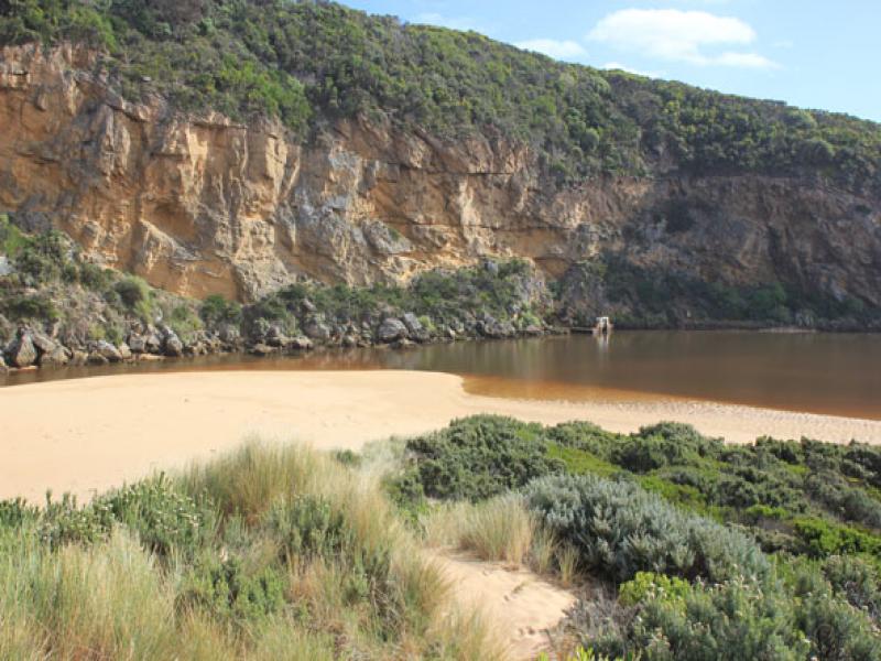
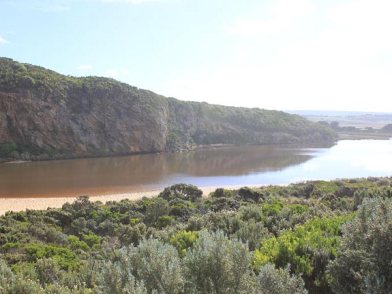
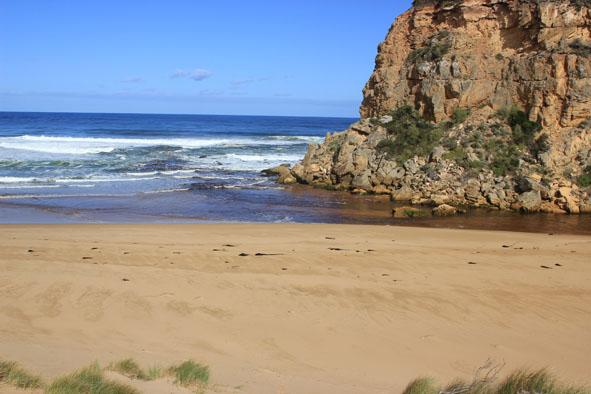
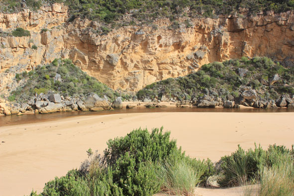
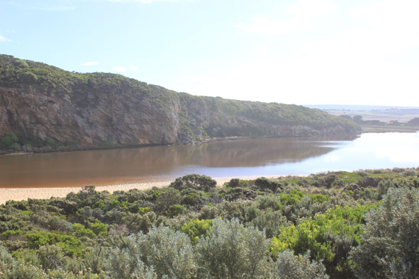
- Natural opening (possibly last night) dark discharge out to south & west with a lessor flow to east along foreshore, longshore drift active in this area
- Channel wide & shallow, but narrow infront of rocks where the sand build up is visiable
- Channel flowing along base of cliff
- Beach(Ocean) is wide & slopping -sand build up east mouth has been leveled out
- No sign of any fish (dead or alive) in estuary, also birds seen.
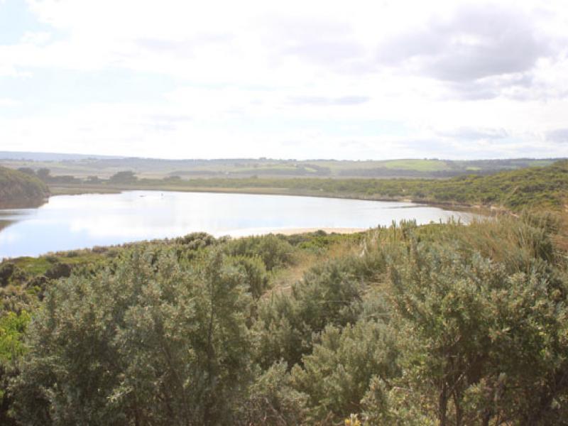
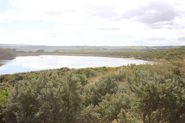
- Water still visiable in very low areas & drains on flats between Princetown & upstream G5. Extensive waterlogging around G4
- AHD at G6 0.81 @ 10:15
Mouth Observation
| Mouth state | Open |
|---|---|
| Previous | O O O P O O O O O O O O O O O O O O O O O O O O O O O O O O O O O O C C C C C C C C C C C O O O O O O C C C C O C C C C C C C O O O O P |
| Flow Present? | Yes |
| Previous | Y Y Y Y Y Y Y Y Y Y Y Y Y Y Y Y Y Y Y Y Y Y Y Y Y Y Y Y Y Y Y Y Y Y N N N N N N N N Y N N Y Y Y Y Y Y N N N N Y N N N N N N Y Y Y Y Y |
| Flow Direction | Out |
| Previous | I I O I O O O O O O O O O O O O O O O O O O O O O O O O O O O O O O N N N N N N N N N N O O I O O N N N N I N N N N N N O O O I I |
| Above Sea | Above Estuary | |
|---|---|---|
| Berm Height (m) | ||
| Berm Length (m) |
Physical Condition
| Current | Mode | |
|---|---|---|
| Wind Direction | South | |
| Beaufort Scale | Light Breeze | |
| Sea State | Moderate |


All content, files, data and images provided by the EstuaryWatch Data Portal and Gallery are subject to a Creative Commons Attribution License
Content is made available to be used in any way, and should always attribute EstuaryWatch and www.estuarywatch.org.au