EstuaryWatch Data Portal
Observation details
Overview
| Estuary | Barham River Estuary |
|---|---|
| Site | Barham River Observation Site |
| Observation ID | #11904 |
| Date and Time | Tuesday 20th March 2018 14:22pm |
| Approved | Approved |
Notes
Rain past 48 hr = 2 mm; Atm. press = 1025.4 hPa
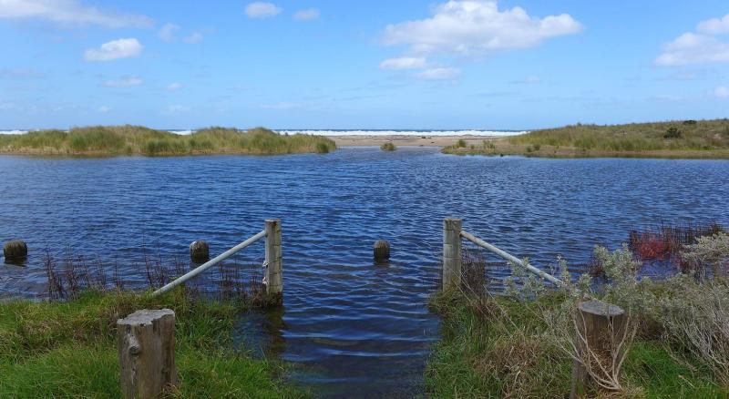
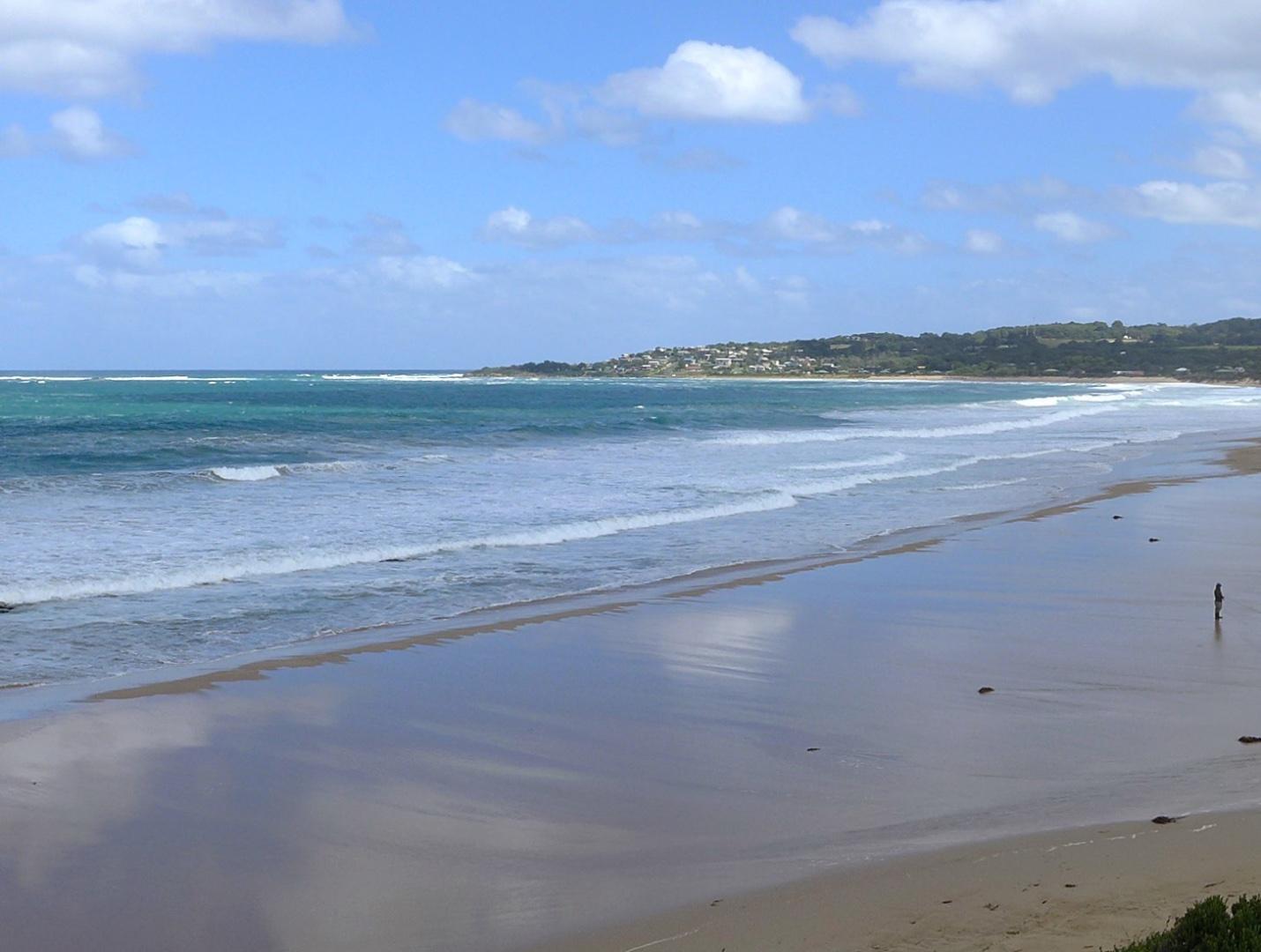
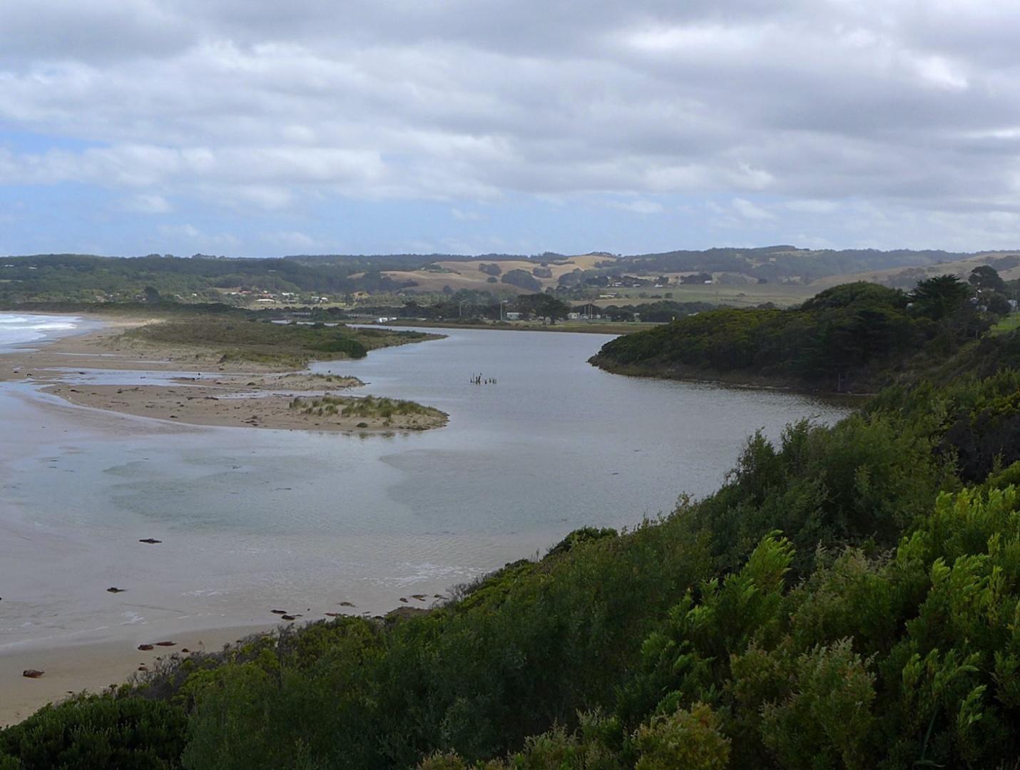
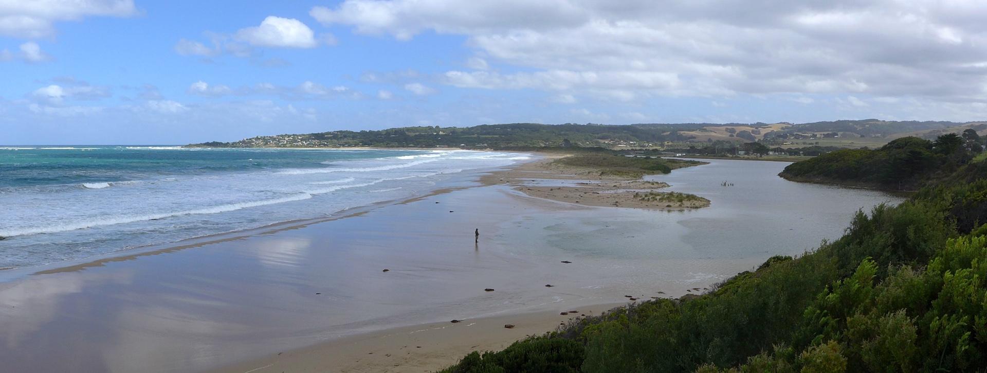
River level high - banks flooded at bridge. At low tide mouth would be closed, but at full tide (14:30) storm surge waves breach over the berm at the river mouth and move up the river.
Terns and gulls sheltering on land-ward side of dune build-up at mouth.
Photo note: BmP3_1 & _BmP3_2 are simple crops of BmP3_pan, made using garden-variety photo app.
Mouth Observation
| Mouth state | Open |
|---|---|
| Previous | O O O O O O O O O O |
| Flow Present? | Yes |
| Previous | Y Y Y Y Y Y Y Y Y N |
| Flow Direction | In |
| Previous | O I O I O O I O S N |
| Above Sea | Above Estuary | |
|---|---|---|
| Berm Height (m) | ||
| Berm Length (m) |
Physical Condition
| Current | Mode | |
|---|---|---|
| Wind Direction | South | South-West |
| Beaufort Scale | Moderate breeze | Gentle breeze |
| Sea State | High |


All content, files, data and images provided by the EstuaryWatch Data Portal and Gallery are subject to a Creative Commons Attribution License
Content is made available to be used in any way, and should always attribute EstuaryWatch and www.estuarywatch.org.au