EstuaryWatch Data Portal
Observation details
Overview
| Estuary | Wye River Estuary |
|---|---|
| Site | Wye River Mouth Condition |
| Observation ID | #13303 |
| Date and Time | Sunday 1st September 2019 10:00am |
| Approved | Approved |
Notes
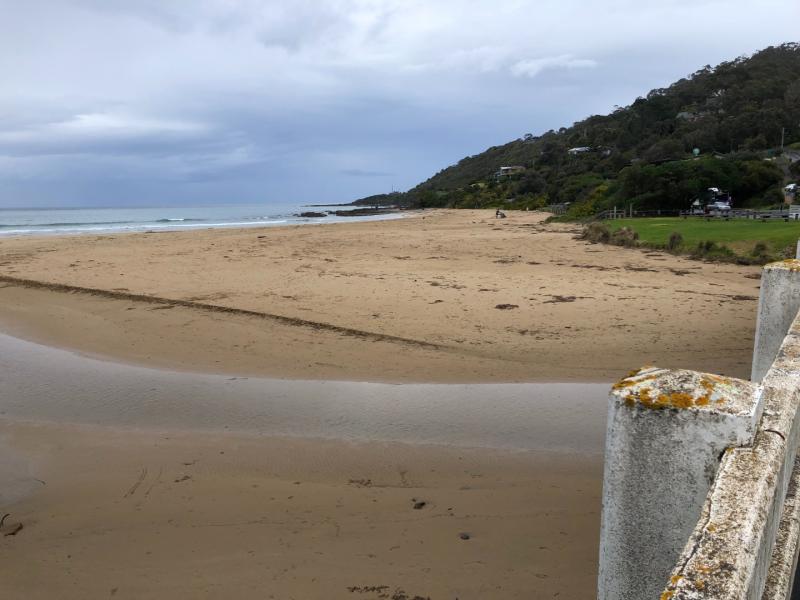
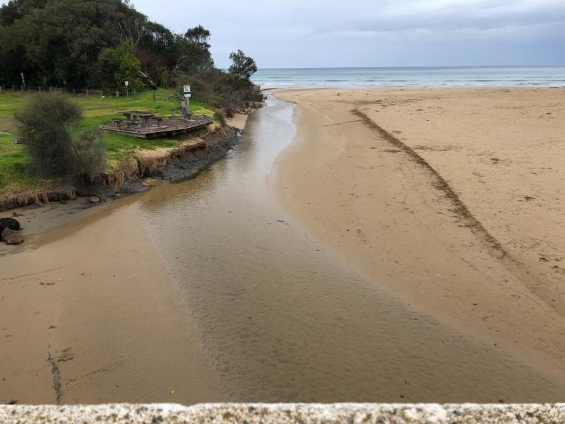
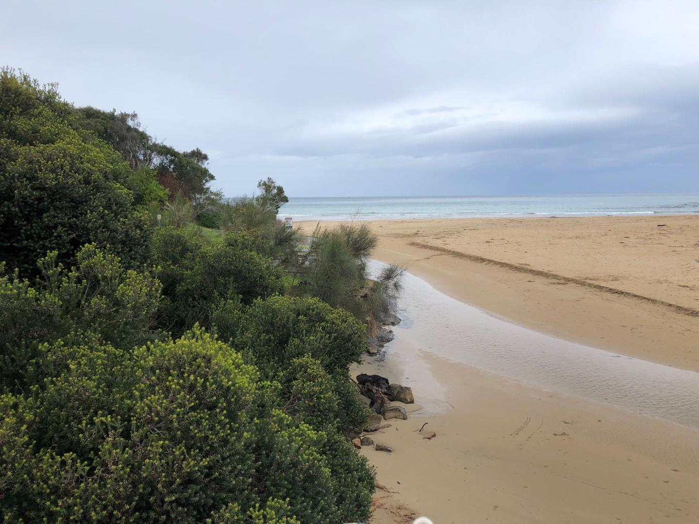
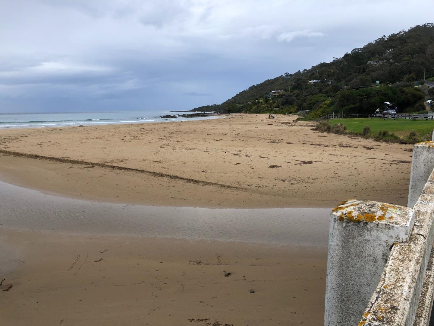
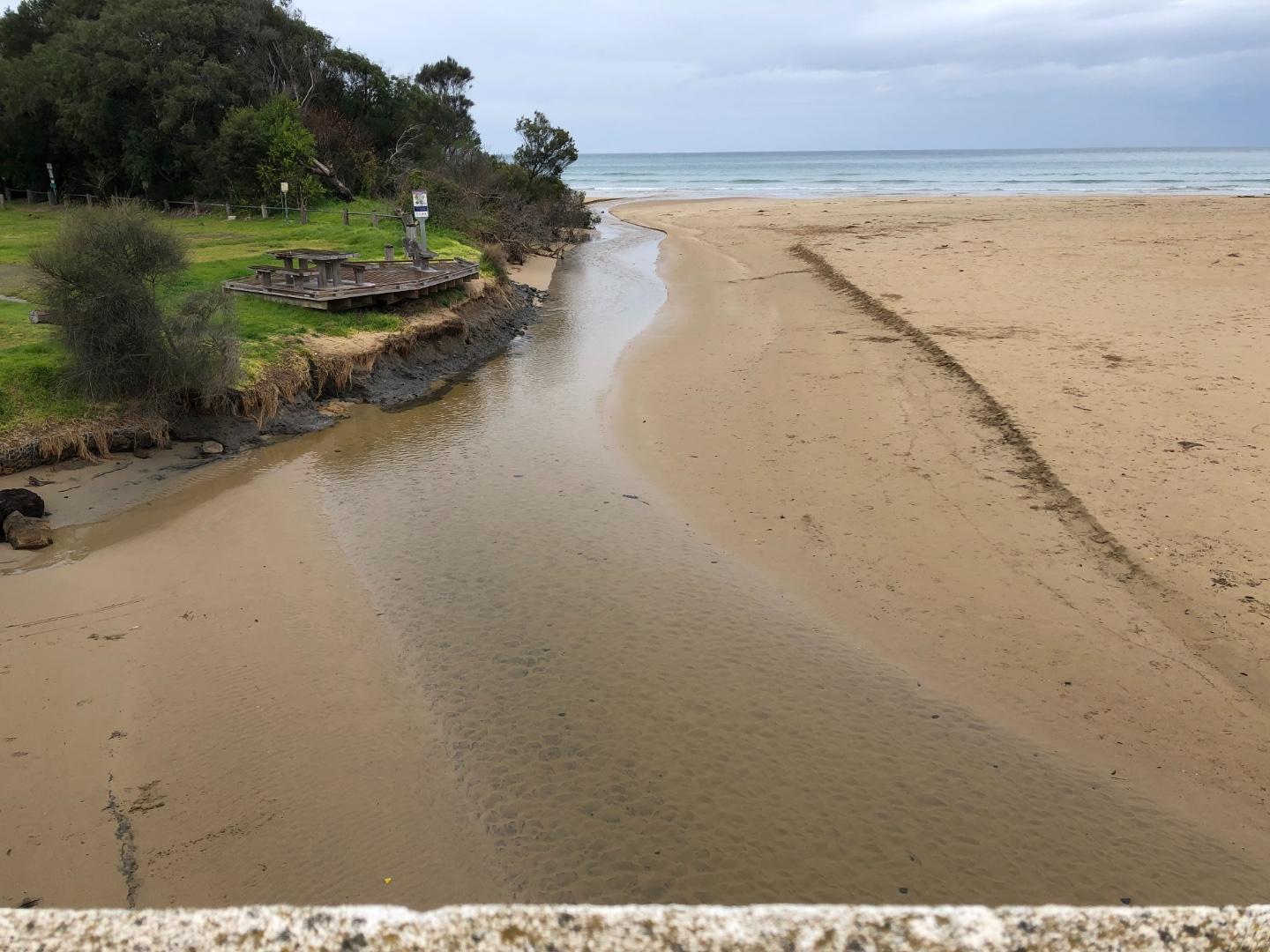
Photo 1 and 2 are the regular photo points
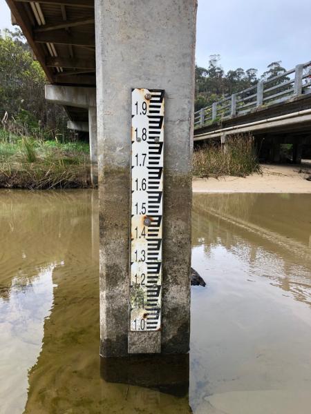
The water level was below the scale on the height measuring board in the river - so we made an estimate see photo 3
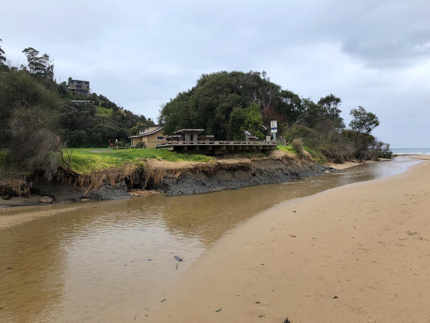
Undercutting along the river bank next to the foreshore caravan - see photos 4 and 5
There was a bird - like a quail spotted on the riverbank
Mouth Observation
| Mouth state | Open |
|---|---|
| Previous | O O O O O O O O O O O O C O O O O O O O O O O O |
| Flow Present? | Yes |
| Previous | Y Y Y Y Y Y Y Y Y Y Y Y N Y Y Y Y Y Y Y Y Y Y Y |
| Flow Direction | Out |
| Previous | O O O O O O O O O O O O N O O O O O O O O O O O |
| Above Sea | Above Estuary | |
|---|---|---|
| Berm Height (m) | ||
| Berm Length (m) |
Physical Condition
| Current | Mode | |
|---|---|---|
| Wind Direction | West | |
| Beaufort Scale | Light Air | |
| Sea State | Smooth |


All content, files, data and images provided by the EstuaryWatch Data Portal and Gallery are subject to a Creative Commons Attribution License
Content is made available to be used in any way, and should always attribute EstuaryWatch and www.estuarywatch.org.au