EstuaryWatch Data Portal
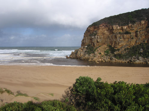
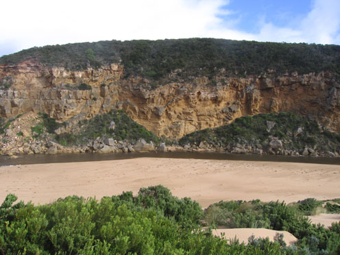
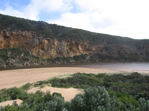
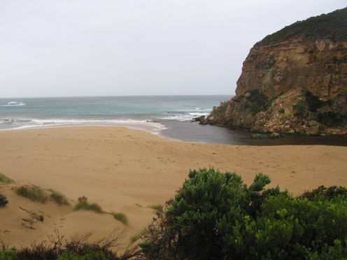
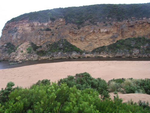
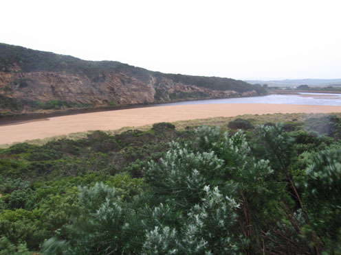
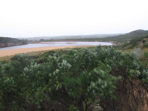
GMC Gellibrand River Estuary Mouth Observation Site
Active Mouth Condition 20-04-2007 - 19-04-2024Gellibrand River Estuary
770 results found (Displaying 111 - 120)
| ID | Date | Status | Details | |
|---|---|---|---|---|
| #2148 | 23 May 2009 | Approved |
Notes:
Changed formation of beach: sand build-up reforming, but still a return channel before estuary. Very large increase of berm into estuary. Discharge to east along beach, some to the west. Some slight flow inwards along eastside (wave surge). Sand built up east of the entrance forcing channel closer to cliffs and rocks.
|
|
| #2183 | 30 May 2009 | Approved |
Notes:
Flow is very slow at the estuary mouth. Berm is extending into the estuary. Sand cliffs are reforming mid-beach (1m high). Longshore drift is moving sand back into the estuary mouth at the entrance. Channel is shallow at the entrance (2m wide) against cliffs, not much sign of any discharge to the ocean, but there is a lot of 'sand stir'. Sea grass exposed in the estuary, some rotting with algae attatched on the east side of estuary on the waters edge.
|
|
| #2189 | 2 Jun 2009 | Approved |
Notes:
|
|
| #2185 | 5 Jun 2009 | Approved |
Notes:
Beach is carved out in the middle- high sand cliffs. Sea is going over and travelling down to mouth. There is more sand around the rocks with waves going over the rocks. Channel is shallow until past the tunnel.
|
|
| #2190 | 8 Jun 2009 | Approved |
Notes:
The channel is quite shallow with more sand built up in front of and upstream of rocks. A lot of dead and green seagrass on the south and east side of the estuary. Waves are going over the 'sand cliffs' mid-beach and travelling wets along the beachand into the channel around the rocks. Water is flowing in both directions at6 estuary mouth. Small (40cm) waves are coming into the estuary.
|
|
| #2188 | 13 Jun 2009 | Approved |
Notes:
There is a strong outward flow. Water is a very dark colour, with dark discharge around the mouth and east along the shoreline. Flood waters have carved a much larger and wider channel. Channel is about 12m wide halfway between rocks and tunnel. Evidence of longshore drift behind high sand on the front of the beach. There is a sand bar forming on the east of the mouth. 'Sand cliffs' between rocks and tunnel reach over 1m in height. Gulls feeding at river mouth, white egret in estuary.
|
|
| #2023 | 20 Jun 2009 | Approved |
Notes:
1.discharge contained around entrance.Nothing east of sand deposit on east side of entrance 2. more sand-east side of rocks 3.sand 'cliffs' along channel in two stages up to 1m. 4.waves in all directions around entrance 5.off shore wind flatening waves |
|
| #2064 | 27 Jun 2009 | Approved |
Notes:
1.Reduced flow,discharge only around mouth and tending south for about 40m. 2.More sand at eastern end of beach,highest point about 50m+ east of entrance with gradual slope down to river 3.Depth at rocks 1m. with reducing sand cliffs upstream 4.Scum and rotting veg. on east side of estuary 5.6 fishermen, 9 surfers 6.1 egret, 1 grey heron,, 3 pied comorants. Lots of fox prints |
|
| #2083 | 4 Jul 2009 | Approved |
Notes:
1.Sea grass -large amount along east side of estuary 2.Strong discharge flow out to left along shoreline 3.Wind gusting to about 8 4.Waves in all directions with whirlpool near rocks at entrance. Rocks about 2/3rds covered by waves. Sand building up infront of rocks 5.Width of channel has increased 6.Wind blowing sand into estuary 7.Sand build up at eastern end of beach,rocks covered 8.Hooded plover-male sighted on beach 050709 |
|
| #2120 | 11 Jul 2009 | Approved |
Notes:
1. AHD reading taken at G2. 0.19 9:30am. 28:00 10:40. Very wet and windy 2.Sand bars in estuary well exposed. 3.High sand cliffs along channel 1-2m. Rocks at entrance well exposed, water curving around to east. Distance from sand to tunnel about 10-15m. 4.Strong discharge along shoreline to east. Width of actual channel at entrance -15m. 5.Sand bar on left of entrance projecting south into sea about 30m from ridge running east to west along beach 6. Sand build up at eastern end of beach 7. 1.white heron, 1.whiteheaded heron |
|


All content, files, data and images provided by the EstuaryWatch Data Portal and Gallery are subject to a Creative Commons Attribution License
Content is made available to be used in any way, and should always attribute EstuaryWatch and www.estuarywatch.org.au