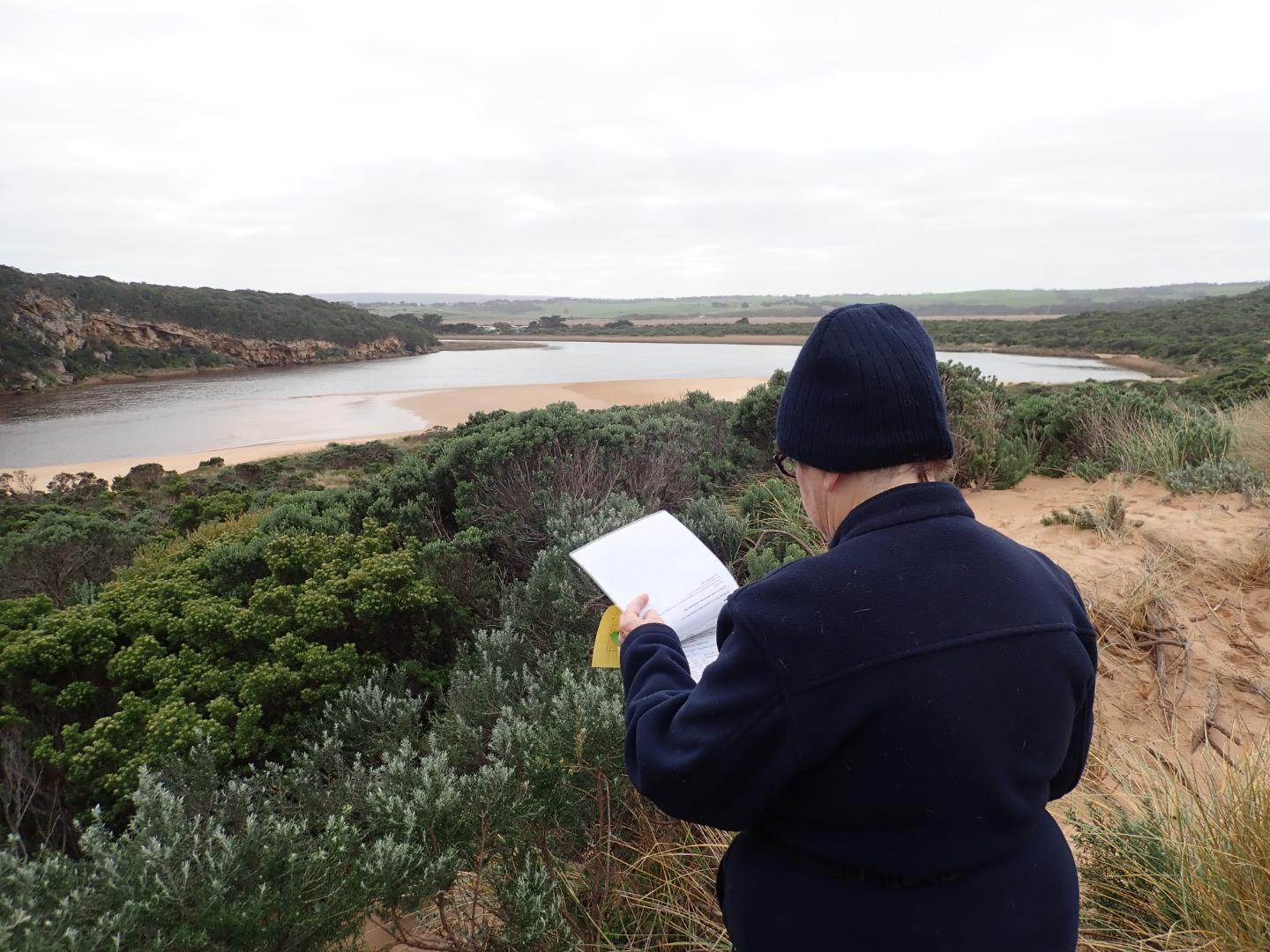
EstuaryWatch Data Portal
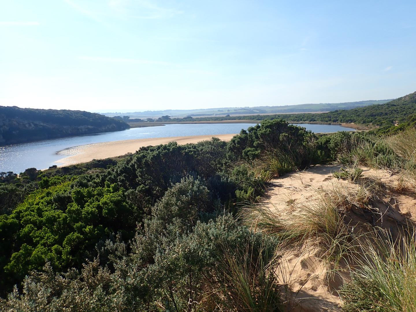
GMC Gellibrand River Estuary Mouth Observation Site
Active Mouth Condition 20-04-2007 - 19-04-2024Gellibrand River Estuary
| ID | Date | Status | Details | |
|---|---|---|---|---|
| #13208 | 19 Jul 2019 | Approved |
Notes:
Very strong dark discharge out around mouth & to east, increased flow caused by very low tide 0.17 @ 06:31 - large amount of foam over exposed rocks & beach at east end of beach. Despite strong outflow waves are entering & travelling down sheer east side of a 25-30m. wide channel (.50-1.00m high) which is collapsing into the flow. At the start of the lagoon waves turn sharply east travelling over the increased sand build up resulting from recent very rough seas. Waves in all directions at entrance & large amount of sand moving in the flow along the channel. Area directly around mouth has been lowered & more of the old breakwater post has been exposed |
|
| #13210 | 30 Jun 2019 | Approved |
Notes:
G6 AHD 2.24 @ 10:38 Slight pale discharge around mouth & only a short distance to east but very rough sea going high up on beach & entering wide across mouth. Impact of W/WSW swell causing strong longshore drift across mouth. Wind from north @ Gp1 site but in many directions around lagoon & beach. North wind over 6 blowing sand along channel into sea 36 ml. rain on 29-06-19 but no water over any roads or tracks except low track. |
|
| #13209 | 27 Jun 2019 | Approved |
Notes:
AHD estimate only as board is covered with algae & silt Pale reducing flow out around mouth & slightly to east. Very low water level with large areas of sand exposed in the lagoon. Previous sand projection & sand bar uncovered |
|
| #13165 | 21 Jun 2019 | Approved |
Notes:
Low water level because of tide & reducing flow, dark discharge around mouth with small waves entering & going upstream across the lagoon on G2. East side of channel is sheer sided (up to about .40 high at start of channel) Remains of the previous sand projection going north into the estuary was visible because of lower water levels No water over any tracks & flood water has drained from flats around G4, but remains from midway between G5&G4 up to G6       |
|
| #13135 | 14 Jun 2019 | Approved |
Notes:
Strong dark outflow from lagoon along wide channel out around mouth & to east. Rough sea sending waves high up on beach resulting in strong longshore drift which continues to scour sand from beach area around mouth which is now lower. Both ends of channel are very wide - most of previous sand projection into the lagoon has been removed but an area remains further to the east. Despite heavy rainfall the flats downstream G4 are draining but extensive flooding occurs upstream to G6. No water over roads or tracks apart from low track which has water only in very low areas |
|
| #13077 | 17 May 2019 | Approved |
Notes:
Mouth open with rocks well exposed, sea moderate but higher waves breaking on sand bar, active longshore drift across with some waves entering up channel into estuary scouring out sand at east side. Large tongues of sand projecting into lagoon -exposed areas in new formation in front of tunnel |
|
| #12901 | 3 May 2019 | Approved |
Notes:
AHD G6 1.42 @ 08:40 Shallow outflow opening wide over sand build up at entrance - very large amount of sand visible under water in estuary extending past tunnel entrance. sea moderate but some high sets breaking on sandbar about 50m. out & going very high up on beach. Occasional small waves from longshore drift & incoming sw swell going part way up channel to where it narrows down to about 2m.wide. Waves are going over top of high sand build up at mid beach (formerly a narrow projection but now extending towards east end of beach) where water then runs east along an area on top of high sand to slightly lower area where abruptly turning towards ocean it scours out narrow N/S channel - very large amount of sand visible in outflow & back wash in ocean at that area Water level in downstream of G2 is high, water over top track & nearly up to ocean car park. No water on any roads but at side of OOR between flood markers & GOR. Flats south side of G4 & downstream have visible water cover - further upstream water from runoff (about 30 ml. on 01-05-19) is only in very low areas & drains      |
|
| #12894 | 30 Apr 2019 | Approved |
Notes:
AHD G6 1.28 @ 11:45 = both G6 & G2 are the same Mouth barred- the actual length of the berm without water is not great but only a very narrow very shallow projection is coming out of the estuary where an extensive sand build up is visible extending well into the estuary almost up to the tunnel entrance. Height of berm from estuary is .10 with gradual slope down to ocean. the recent storm has considerably lowered the beach around entrance & up to the sand spit at mid beach No water over any roads but flats DS G4 have water cover. G2 E.C. from 28.91 @ .10 from surface to 51.5 @ 4m down G4 E.C. 3.057 @ .10 then E.C. 48.88 @ 1.75 down & E.C. 52.3 @ 5.00 Bridge at G2 being repaired |
|
| #12891 | 26 Apr 2019 | Approved |
Notes:
AHD @ G6 about 0.96 @ 13:58 board covered with silt Observations made during hi tide & storm surge - wind from SE 8-9 along beach but even stronger turning down channel Not possible to use Gp1 site so taken from below. Waves entering from high sea combined with a very high tide. No fresh discharge only shallow salt return over high sand build up in channel. Waves going up to base of dunes all along beach & channel. Entering very wide at mouth & completely across channel. SW swell with over 8m waves strongly impacting east end of beach creating very strong longshore drift & backwash. Waves overtopping high part of beach about 50m from west cliff then turning west & around into the channel meeting incoming waves from SW swell also going down creating an extremely strong N-S backwash - also whirlpools at start of estuary, this action has left significant depressions in the sand . The wind action has also sent large amounts of sand from the beach down the channel & into the estuary       |
|
| #12890 | 25 Apr 2019 | Approved |
Notes:
AHD G6 about 0.78 - board still covered with silt Waves entering across a wide area & travelling down channel into estuary -large amount of green water is visible almost to tunnel entrance & can be seen mixing with darker fresh throughout the estuary. Only salt return occurring over high sand build up in channel. Outflow is very narrow & shallow - often no flow at all. Waves going very high up all along beach & entering very wide at mouth. At 15:50 a very strong longshore drift was visible going across entrance -impacting on west cliff & sending strong waves up channel 1 dead Gannet on beach near entrance & about 10 others feeding in area around the ocean sandbar. 2 dark grey Pacific gulls feeding in estuary |
|
| #12889 | 23 Apr 2019 | Approved |
Notes:
AHD G6 about 0.98 @ 08:40 AHD board still covered with silt Observations made close to very low tide 0.1 @ 07:12 Very pale thin discharge out to sea & along to sand projection at mid beach. Out flow very shallow - channel about 20m wide .5 to .15 deep. at start of estuary. At mid channel it narrows to about 8m.then becomes more shallow & wider around rocks.Flow spreads very wide as waves enter at mouth. East side of channel has .20m sheer face as it approaches rocks. Waves have been high up on beach at last hi tide. A large sand projection has formed at mid beach with area of beach behind scoured out. Strong longshore drift from east end travelling to spit where it meets incoming SW swell -large amount of sand visible in waves going out to sea. Only occasional longshore drift across mouth meeting small outflow & strong sw swell resulting in some waves going up the channel - large amount of sand visible in breakers around mouth. While sea is moderate there are higher wave sets are occurring      |
|
| #12860 | 19 Apr 2019 | Approved |
Notes:
Very pale discharge out (mainly salt water return). Outflow very shallow around rocks & entrance. It is wider but also shallow at start of channel from estuary, the previous high sheer east side of channel has been reduced but sand is a lot higher around rocks. Some waves entering & continuing upstream. Beach rises & falls with deep depressions (N -S direction) -2 bays have formed with a projection out to sea at mid beach. Area at east end has had full impact of previous WSW swell & rough seas extending well back towards dunes. Low water level has exposed large areas of sand on beach but sand bar in estuary is under water. Many very small fish observed in shallow water beside low track.      |
|
| #12842 | 9 Apr 2019 | Approved |
Notes:
AHD G6 1.18 @12:20 (estimate only as board is covered with silt) Mouth is open but high seas & SW swell (waves over 6m.) are entering completely across entrance & channel & travelling into estuary as well as going up to base of dunes all along the beach. Waves are up to base of dune at Gp1 site. Only salt water is entering & returning - green water extends into the estuary & well upstream of G2. Waves (some over 2m high) going down channel then turn east at start of estuary but an occasional wave proceeds north alongside of cliff face. Wind about 6 SE along beach but from S along channel gusts are stronger (7). Large amount of sand blowing into estuary as well as being carried in large waves down the channel . In between waves a large amount of sand is visible in channel with only a very slight flow of salt water return down below the side of cliff |
|
| #12820 | 4 Apr 2019 | Approved |
Notes:
Estimated height @ G6 0.68 - board unreadable because of silt build up Dark discharge from reducing outflow around the mouth & to west, pale discharge continuing along foreshore to east. Entrance about 50m wide with sheer sides to channel from 1-2 m. high. Sand has built up on east side of channel -also directly downstream of rock. Longshore drift across mouth over sw swell with backwash return & some waves entering up the channel into the estuary. Waves are going high up on the beach at east end of beach which rises & falls creating some deep areas. Height of beach drops as it reaches the mouth All tracks & roads are without water including low track where an extremely large number of small (1-3 cm) fish were actively swimming. Small fish were observed in all areas of estuary D.O. levels @ G2 have greatly improved with flow going upstream while monitoring |
|
| #12821 | 1 Apr 2019 | Approved |
Notes:
AHD G2 1.47 @ 09:00 1.33 @ 13:20 1.22 @ 15:50 AHD G6 1.52 @13:00 1.42 @ 17:42 On 02-04-19 AHD @ G2 was 0.54 @ 14:00 G6 0.88 @13:43 (estimate for G6 only as board was covered with silt & unreadable) Very wide strong & dark discharge @ entrance, out along foreshore to east then turning south at east end of beach -visible a long way out to sea. Water in the estuary very dark -almost black Channel from estuary over 20 m wide & about 40 m wide @ entrance. Strong & frequent longshore drift across entrance over Sw swell & very strong outflow. Waves entering & continuing along eastside of channel meeting outflow midway creating a whirlpool with a very large amount of sand visible & also building up against edge. Sand was visible in outflow travelling down whole length of channel |
|
| #12822 | 31 Mar 2019 | Approved |
Notes:
AHD G2 1.68 @ 11:45 G6 1.68 @ 11:00 Pale discharge out to east along foreshore - also south out to sea, some going west along front of cliff. East side of channel .50 -1m high, width about 15-20 m wide Very large amount of sand visible being carried out in flow. Strong wind from south blowing sand off beach down channel into estuary Some water on side of GOR & across OOR at flood markers but only at side of OCR |
|
| #12823 | 30 Mar 2019 | Approved |
Notes:
AHD G2 1.69 @ 13:17 G6 1.67 @ 13:05 Strong outflow down channel with pale discharge visible slightly to east. Rough sea = SW swell impacting E end of beach, large amount of backwash occurring at mid beach & longshore drift across entrance over outflow, small waves are going up channel into the estuary. Small areas of east side of channel are sheer sided ( above lower exposed area). These sides are currently sliding down into water as wave action in channel increases. Channel sides about .10 - .20 m.high & about .20m deep. About 8m wide Wind much stronger gusts from south down channel Water at side of GOR & OCR but across OOR at flood markers. Only at side of OOR closer to GOR |
|
| #12824 | 28 Mar 2019 | Approved |
Notes:
AHD G2 1.66 @ 09:00 1.66 @ 17:18 G6 1.64 @ 09:50 Day of Artificial Opening. Completed @ 16:50 At completion of artificial opening outflow was moving fast down channel with large outflow waves nearer entrance SSW swell sending waves far up all along beach. 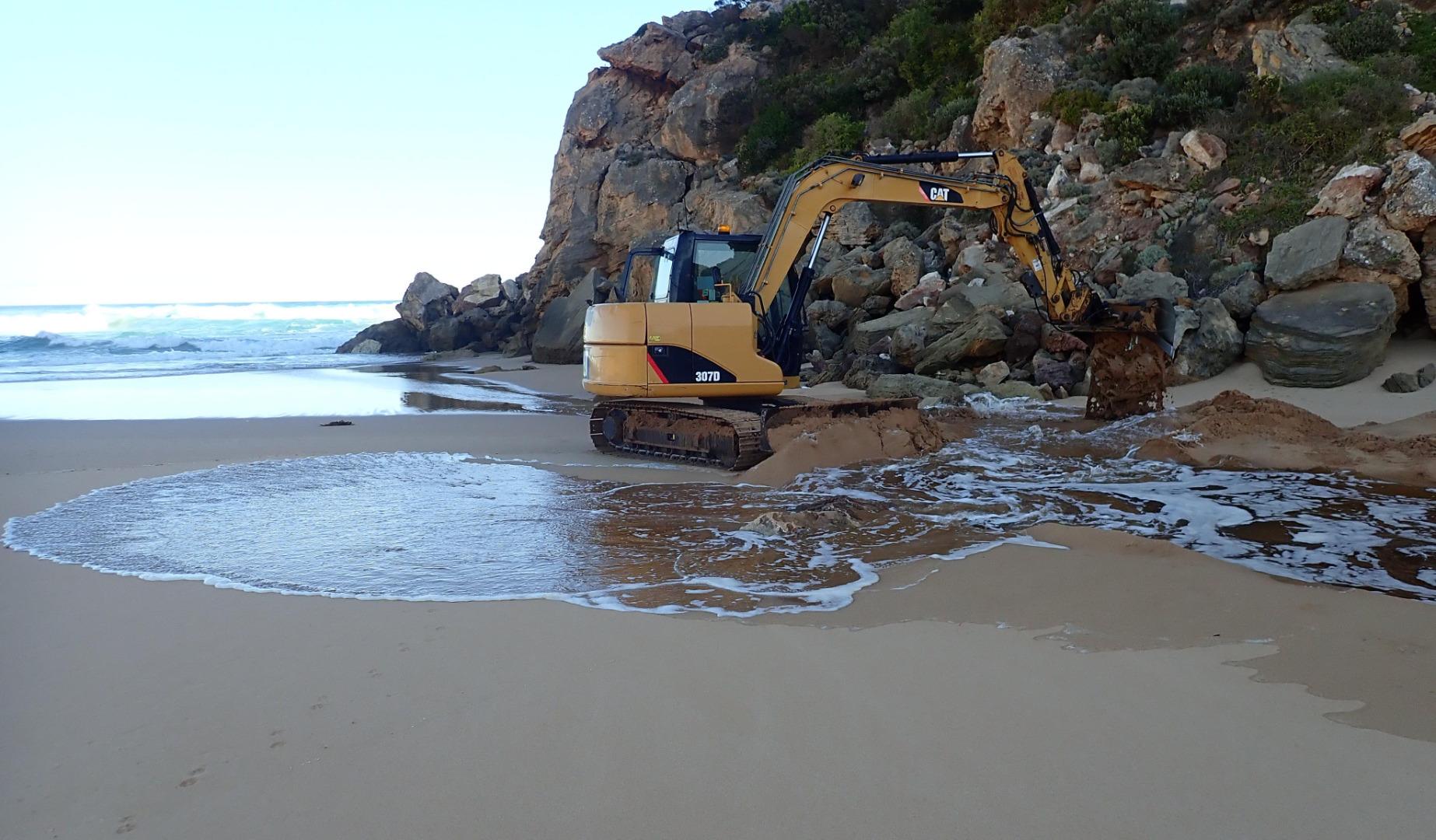 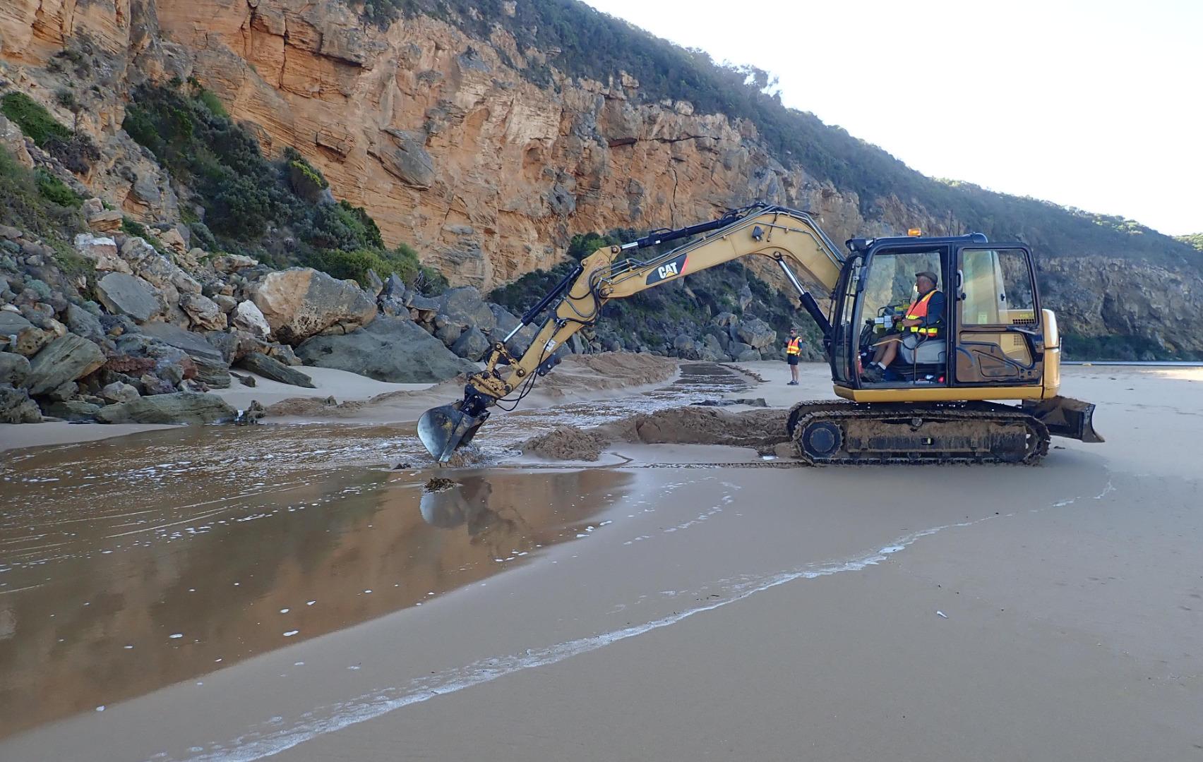  |
|
| #12825 | 27 Mar 2019 | Approved |
Notes:
AHD G2 1.65 G6 1.65 @10:35 Mouth closed but waves have been over berm & up into the estuary @ last hi tide -7 dead eels were stranded trying to cross over to sea. Strong sw/ssw swell impacting at mid beach creating strong backwash with occasional longshore drift. Wide area of beach near cliff is much lower than that towards east where sand is very high Water is up to the sides of OCR west of camp ground (which has increased water cover). Areas of OCR south & further east along return track have deep holes scoured out by vehicle traffic. Water has started to cover small area of GOR between Latrobe creek bridge & start of OCR. Water at side & over OOR at Flood markers. Water across flats DS G4 but not US G4. Flats around G5 have significant water cover that is not completely visible because of high vegetation |
|
| #12826 | 26 Mar 2019 | Approved |
Notes:
AHD G2 1.63 @ 09:32 - @11:20 between 1.63 & 1.64. G6 1.63 @ 09:13 Both G2 & G6 are level Observations taken @ low tide. Mouth closed but a few waves entering up to estuary -mostly a large expanse of sand between ocean & estuary. SW swell impacting beach - strong backwash @ mid beach carrying large amount of sand then longshore drift to west to cliff. Yesterday's high seas have lowered about 1/3rd of beach east of cliff Wind in many directions -SE along beach but turning S with much stronger gusts down channel blowing a lot of sand into estuary Increased water at side of roads & camp ground but water only just coming over OOR at flood markers. Small pool at side of GOR   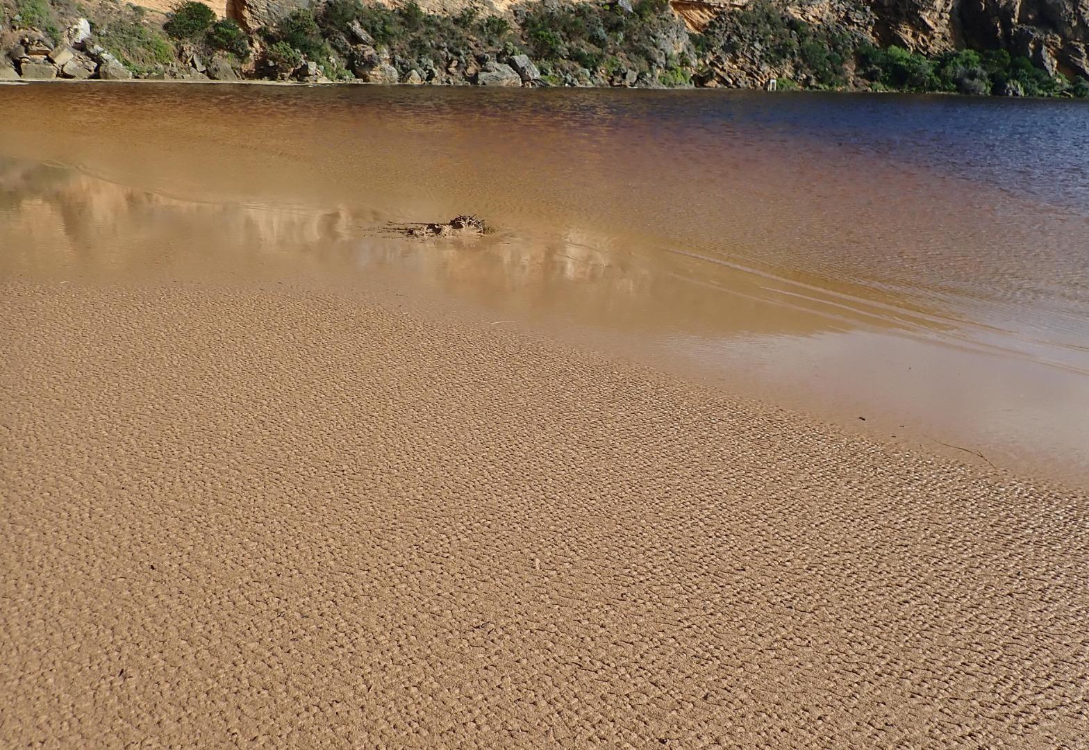 |
|
| #12830 | 25 Mar 2019 | Approved |
Notes:
AHD G6 1.56 @ 09:37 1.59 @ 16:10 Mouth perched, flow both in & out. High seas & WSW swell (8-15 secs.) = waves over 6m. impacting beach sending waves all along up to the dunes & completely across the entrance & down the channel. Hi tide about 15:00 combined with strong longshore drift sent waves into the estuary - green water was visible at start of channel from estuary. Incoming waves were going over top of water returning across a wide front. A whirlpool occurred at start of estuary. Near gale force winds from many directions around estuary, channel & beach Increasing water cover at edge of roads,& on flats DS G4. Small area of water starting to cross OOR at flood markers. Fishing platform structure completely under water by 15:55      |
|
| #12831 | 24 Mar 2019 | Approved |
Notes:
AHD G2 1.57 @ 09:14 but between 1.57 & 1.58 @ 12:35 AHD G6 1.52 @ 08:40 Observations made at low tide. Mouth opened at low tide between rocks at base of cliff not through the berm sand build up which remained intact. Flow from estuary was coming down through a channel about 3-4 m across widening to 7m where it sharply curved west towards cliff - height of channel east side in that area 1m. Depth about .10-.20m . Waves had been overtopping the berm at last hi tide & running down west along the beach towards cliff along the sand behind the berm travelling down a previously formed depression. The beach rises & falls creating wide N-S depressions. High wave sets impacting on sandbar & going high up on beach = backwash & longshore drift. Very large no. small fish in shallow water around estuary & in water at edge of roads. Peregrine falcon at entrance |
|
| #12832 | 22 Mar 2019 | Approved |
Notes:
AHD @ G6 1.52 @ 08:40 Mouth was closed but a narrow very shallow flow close to cliff reached to about .30 m. from top of berm where a unsuccessful manual attempt to illegally open the mouth was being made ( small channel .10 - .15m.) Waves were occasionally overtopping berm but had been up to estuary during last hi tide        |
|
| #12833 | 19 Mar 2019 | Approved |
Notes:
AHD @ G6 1.48 Mouth closed but waves over topping berm at last hi tide. A higher 2nd. berm has risen closer to sea with a depression formed between it & the previous highest part of the original berm formation. Waves have been over berm & high up all along the beach. S wind blowing sand down channel into estuary, more sand over rock   |
|
| #12836 | 16 Mar 2019 | Approved |
Notes:
AHD G6 1.46 @ 10:18 Observations taken at low tide. Mouth closed but waves have been up to the estuary at last hi tide. Sand high all along the beach. Water is across all of low track |
|


All content, files, data and images provided by the EstuaryWatch Data Portal and Gallery are subject to a Creative Commons Attribution License
Content is made available to be used in any way, and should always attribute EstuaryWatch and www.estuarywatch.org.au