EstuaryWatch Data Portal
GMC Gellibrand River Estuary Mouth Observation Site
7 May 2016
Observation details
Overview
| Estuary | Gellibrand River Estuary |
|---|---|
| Site | Gellibrand River Estuary Mouth Observation Site |
| Observation ID | #10354 |
| Date and Time | Saturday 7th May 2016 12:05pm |
| Approved | Approved |
Notes
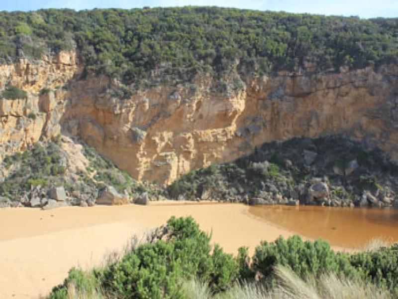
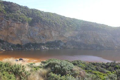
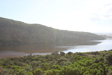
- Mouth barred, estuary almost straight across from cliff to dune (below Gp1 site). Waves going over but not reaching estuary
- Erosion occurring at southern end of cliff - small rock falls
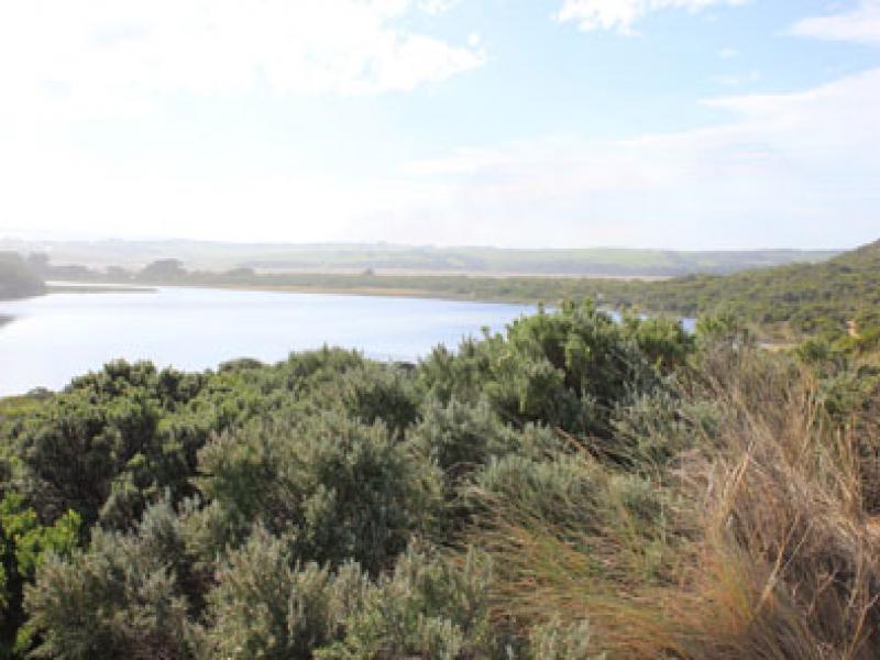
- Flood levels increasing upstream & in wetlands. Many waterbirds in flooded areas also small fish
- OCR- water at sides of road but not across, west end of campground & adjoining property entrance under water. Picnic area & boardwalk wetland area flooded
- GOR -water about 1/3 across
- OOR -increased flood level at flood markers & water at sides of road further west toward GOR
Mouth Observation
| Mouth state | Closed |
|---|---|
| Previous | O P O O O O O O O O O O O O O O O O O O O O O O O O O O O O O O C C C C C C O O O O O O C C O C C O C C C C C O O O O O C C C C C C |
| Flow Present? | No |
| Previous | Y N Y Y Y Y Y Y Y Y Y Y Y Y Y Y Y Y Y Y Y Y Y Y Y Y Y Y Y Y Y N N N N N N Y Y Y Y Y Y N N N N N N N N N N N Y Y Y Y Y N N N N N N |
| Flow Direction | N/A |
| Previous | O N O O O O O O I O I O O I O O O O O O O O O O O O O O O N N N N N N O O O O O O N N N N N N N N N N N O O O O O N N N N N N |
| Above Sea | Above Estuary | |
|---|---|---|
| Berm Height (m) | ||
| Berm Length (m) |
Physical Condition
| Current | Mode | |
|---|---|---|
| Wind Direction | South | |
| Beaufort Scale | Light Breeze | |
| Sea State | Rough |


All content, files, data and images provided by the EstuaryWatch Data Portal and Gallery are subject to a Creative Commons Attribution License
Content is made available to be used in any way, and should always attribute EstuaryWatch and www.estuarywatch.org.au